

List of colonial buildings and structures in Jakarta
Encyclopedia
Colonial buildings and structures in Jakarta
include those that were constructed during the Dutch colonial period
of Indonesia
. The period (and the subsequent style) succeeded the earlier period when Jakarta (known then as Jayakarta/Jacatra), governed by the Sultanate of Banten
, were completely eradicated and replaced with a walled city of Batavia. The dominant styles of the colonial period can be divided into three periods: the Dutch Golden Age
(17th to late 18th century), the transitional style period (late 18th century – 19th century), and Dutch modernism (20th century). Dutch colonial architecture in Jakarta is apparent in buildings such as houses or villas, churches, civic buildings, and offices, mostly concentrated in the administrative city of Central Jakarta
and West Jakarta
.
Below is a list of colonial buildings and structures found in Jakarta. The list is sorted alphabetically according to its official (local) name. The list can also be sorted to each category.
Buildings which undertook complete renovation which resulted in different form are listed separately to distinguish the different architectural form.
Some notable Chinese-style buildings and Islamic mosques that were built during these period are included in the list for comparison.
was commissioned to design a plan for the future settlement based on his concept of the 'ideal city'. His response was a rectangular, walled town, bisected by the river Ciliwung which was to be channeled into a straight canal (later known as also known as Grote Rivier or Kali Besar or "Big River" in this area). This new city is called Batavia (now Jakarta
). In accordance to Stevin's model, the fortress of Batavia was the most prominent building in the city, symbolizing the center of power, while townhall, markets, and other public buildings were distributed. This layout of Jakarta can still be clearly recognized today in Jakarta Old Town
through the layout of the streets and canals, although most of the original 17th structures had been destroyed or replaced with newer early 20th century structures.
The architecture style of this period were the tropical counterparts of 17th century Dutch architecture. Typical features include the typically Dutch high sash windows with split shutters, gable roofs, and white-coral painted wall (as opposed to exposed brick architecture in the Netherlands). This earlier period of Jakarta had many of the buildings solidly built with relatively enclosed structures, a structure that is not very friendly to tropical climate as compared to the architecture of the next period in Jakarta. Best example of these buildings were located along the Tygersgracht (now Jalan Muka Timur), all had been demolished. Best surviving example is Toko Merah.
Several Portuguese colonial architecture also exist, usually outside the walled city of Batavia. Tugu Church and Sion Church
, with its plain facade and domed windows, are some surviving examples.
In 1808, Daendels officially moved the city center to south because of the deteriorating condition of the inner town as well as the malaria outbreak. As a result, many buildings and structures from this period were left to deteriorated. Because of financial issues, many buildings were demolished in 19th century and the debris were used to construct newer structure in the south (such as the Palace of Governor-General Daendels (now the Financial Department of Indonesia) from the debris of Batavia Castle, and Batavia Theater (now Gedung Kesenian Jakarta
) from the debris of the Spinhuis.
Later, these empty lots in Jakarta Old Town were filled with newer 20th century structures. Surviving 17th–18th structures were later converted as Jakarta's cultural heritage, e.g. Toko Merah, Gereja Sion
and Jakarta History Museum
.
Other dominant architecture style from these period were the Chinese merchant houses, many were built during the 18th century. Many of these structures show eclectic mix of Dutch and Chinese influences.
As the Dutch become more securely established in the region, towns grew up beyond the walls of the fort. Batavia
, together with Semarang
and Ujung Pandang, were the most important urban centers. During this time, Batavia became congested and wealthier merchants and other powerful men began to build their residences on the outskirts of town and in the surrounding countryside.
The period shows a gradual adaptation to the tropical climate form on the part of the Dutch colonial architecture. These new form of architecture is called the Indies. Typical style during this period include large roof overhang, high roof and ceiling, and front and rear verandahs that opened on to gardens. Indies style can be described as a mix of Indonesian, Chinese, and European influence. Very often the local Javanese style limasan roof was employed, but with addition of 19th century European architectural elements such as Tuscan columns, doors, windows, and a flight of three to four steps leading up to a verandah running the full width of the house.
Neoclassicism
was a popular style for buildings in Jakarta during this period, which is considered to be the best representation of the greatness of the empire.
. These private companies owned or managed plantations, oil fields, and mines. Railway stations were designed during this period, with characteristic style of this period.
Architecturally, neoclassicism fell out of favor to be replaced by Neogothic and Dutch Rationalism
. Apparent architectural style were Nieuwe Kunst (e.g. Bank Tabungan Negara), Art Deco
or De Stijl
, and Amsterdam School
. This architecture styles were also the tropical counterpart of the original style, resulting in a style called the Indies.
Two dominant architectural bureaus during this period were AIA Bureau (Ghijsels) and AA Fermont and Cuypers Bureau (Eduard Cuypers
).
Colonnades are required during this period to provide protection against monsoon rains and tropical sun, which in turns transformed the appearance of buildings in the city centers.
Colonial style in Jakarta lingered some years after the Japanese occupation of Indonesia in 1942, and further after the independence of Indonesia in 1945.
Jakarta
Jakarta is the capital and largest city of Indonesia. Officially known as the Special Capital Territory of Jakarta, it is located on the northwest coast of Java, has an area of , and a population of 9,580,000. Jakarta is the country's economic, cultural and political centre...
include those that were constructed during the Dutch colonial period
Dutch East Indies
The Dutch East Indies was a Dutch colony that became modern Indonesia following World War II. It was formed from the nationalised colonies of the Dutch East India Company, which came under the administration of the Netherlands government in 1800....
of Indonesia
Indonesia
Indonesia , officially the Republic of Indonesia , is a country in Southeast Asia and Oceania. Indonesia is an archipelago comprising approximately 13,000 islands. It has 33 provinces with over 238 million people, and is the world's fourth most populous country. Indonesia is a republic, with an...
. The period (and the subsequent style) succeeded the earlier period when Jakarta (known then as Jayakarta/Jacatra), governed by the Sultanate of Banten
Sultanate of Banten
The Sultanate of Banten was founded in the 16th century and centered in Banten, a port city on the northwest coast of Java; the contemporary English spelling of both was Bantam...
, were completely eradicated and replaced with a walled city of Batavia. The dominant styles of the colonial period can be divided into three periods: the Dutch Golden Age
Dutch Golden Age
The Golden Age was a period in Dutch history, roughly spanning the 17th century, in which Dutch trade, science, military and art were among the most acclaimed in the world. The first half is characterised by the Eighty Years' War till 1648...
(17th to late 18th century), the transitional style period (late 18th century – 19th century), and Dutch modernism (20th century). Dutch colonial architecture in Jakarta is apparent in buildings such as houses or villas, churches, civic buildings, and offices, mostly concentrated in the administrative city of Central Jakarta
Central Jakarta
Central Jakarta is one of the five cities which form Jakarta, Indonesia. It had 898,883 inhabitants at the 2010 Census.Central Jakarta is the smallest in area and population of the five cities of Jakarta. It is the administrative and political center of Jakarta and Indonesia...
and West Jakarta
West Jakarta
West Jakarta is a city within Jakarta Special District, Indonesia. It had a p[opulation of 2,278,825 at the 2010 Census; the administrative centre is at Puri Kembangan....
.
Below is a list of colonial buildings and structures found in Jakarta. The list is sorted alphabetically according to its official (local) name. The list can also be sorted to each category.
Buildings which undertook complete renovation which resulted in different form are listed separately to distinguish the different architectural form.
Some notable Chinese-style buildings and Islamic mosques that were built during these period are included in the list for comparison.
Dutch East India Company period – 17th to late 18th century
The first type of colonial architecture grew from the early Dutch settlements in the 17th century, when settlements were generally within walled defences to protect them from attack by other European trade rivals and native revolt. Following the siege of Jayakarta (previously known as Sunda Kelapa) and its demolition by the Dutch in 1619, it was decided to build the headquarters of the Dutch East India Company on the site. Simon StevinSimon Stevin
Simon Stevin was a Flemish mathematician and military engineer. He was active in a great many areas of science and engineering, both theoretical and practical...
was commissioned to design a plan for the future settlement based on his concept of the 'ideal city'. His response was a rectangular, walled town, bisected by the river Ciliwung which was to be channeled into a straight canal (later known as also known as Grote Rivier or Kali Besar or "Big River" in this area). This new city is called Batavia (now Jakarta
Jakarta
Jakarta is the capital and largest city of Indonesia. Officially known as the Special Capital Territory of Jakarta, it is located on the northwest coast of Java, has an area of , and a population of 9,580,000. Jakarta is the country's economic, cultural and political centre...
). In accordance to Stevin's model, the fortress of Batavia was the most prominent building in the city, symbolizing the center of power, while townhall, markets, and other public buildings were distributed. This layout of Jakarta can still be clearly recognized today in Jakarta Old Town
Jakarta Old Town
Kota , is a small area in Jakarta, Indonesia. It is also known as Old Jakarta, and Old Batavia . It spans 1.3 square kilometres of North Jakarta and West Jakarta...
through the layout of the streets and canals, although most of the original 17th structures had been destroyed or replaced with newer early 20th century structures.
The architecture style of this period were the tropical counterparts of 17th century Dutch architecture. Typical features include the typically Dutch high sash windows with split shutters, gable roofs, and white-coral painted wall (as opposed to exposed brick architecture in the Netherlands). This earlier period of Jakarta had many of the buildings solidly built with relatively enclosed structures, a structure that is not very friendly to tropical climate as compared to the architecture of the next period in Jakarta. Best example of these buildings were located along the Tygersgracht (now Jalan Muka Timur), all had been demolished. Best surviving example is Toko Merah.
Several Portuguese colonial architecture also exist, usually outside the walled city of Batavia. Tugu Church and Sion Church
Gereja Sion
Gereja Sion is a historic church located in Pinangsia Administrative District, Taman Sari, Jakarta, Indonesia...
, with its plain facade and domed windows, are some surviving examples.
In 1808, Daendels officially moved the city center to south because of the deteriorating condition of the inner town as well as the malaria outbreak. As a result, many buildings and structures from this period were left to deteriorated. Because of financial issues, many buildings were demolished in 19th century and the debris were used to construct newer structure in the south (such as the Palace of Governor-General Daendels (now the Financial Department of Indonesia) from the debris of Batavia Castle, and Batavia Theater (now Gedung Kesenian Jakarta
Gedung Kesenian Jakarta
Gedung Kesenian Jakarta , historically known as Schouwburg Weltevreden, is a concert hall in Jakarta, Indonesia, built during the Dutch colonial period.-History:...
) from the debris of the Spinhuis.
Later, these empty lots in Jakarta Old Town were filled with newer 20th century structures. Surviving 17th–18th structures were later converted as Jakarta's cultural heritage, e.g. Toko Merah, Gereja Sion
Gereja Sion
Gereja Sion is a historic church located in Pinangsia Administrative District, Taman Sari, Jakarta, Indonesia...
and Jakarta History Museum
Jakarta History Museum
The Jakarta History Museum , also known as Fatahillah Museum or Batavia Museum, is located in the Old Town of Jakarta, Indonesia. The building was built in 1710 as the Stadhuis of Batavia...
.
Other dominant architecture style from these period were the Chinese merchant houses, many were built during the 18th century. Many of these structures show eclectic mix of Dutch and Chinese influences.
| Last official name | Former names | Year | Architect | Location | Latest image | Oldest image |
|---|---|---|---|---|---|---|
| 18th century Dutch mansion at Kali Besar Barat | 18th century Dutch mansion at Kali Besar Barat | 18th century | 6.136367°N 106.811372°W | |||
| Baijen’s Country House and the Outer Hospital (demolished, replaced by Citadel Prins Frederik) | Baijen’s Country House and the Outer Hospital | before 1669, later a hospital, from 1743 until 1820. | 6.170386°N 106.830742°W | |||
| Bastion Amsterdam (demolished) | Amsterdam | 1632-1635 | anonymous | 6.129527°N 106.815078°W | ||
| Bastion Buren (demolished) | Buren | before 1650 | anonymous | 6.128014°N 106.807904°W | ||
| Bastion Cuylenburg (demolished, on its site stands Menara Syahbandar) | Bastion Cuylenburg, Bastion Cullenburch, | before 1650 | anonymous | 6.127527°N 106.809071°W | ||
| Bastion Diest (demolished) | Diest | 1632-1635 | anonymous | 6.136733°N 106.811704°W | ||
| Bastion Enkhuizen(demolished) | Enkhuizen | 1627-1632 | anonymous | 6.134680°N 106.816474°W | ||
| Bastion Friesland (demolished) | Friesland | 1632-1635 | anonymous | 6.131831°N 106.806058°W | ||
| Bastion Gelderland (demolished) | Punt Gelderland | 1627-1632 | anonymous | 6.137472°N 106.816785°W | ||
| Bastion Grimbergen (demolished) | Grimbergen | 1635-1650 | anonymous | |||
| Bastion Groningen (demolished) | Groningen | 1632-1635 (replacing the older Buren fortification) | anonymous | 6.126864°N 106.804796°W | ||
| Bastion Hollandia (demolished) | Hollandia | 1627-1632 | anonymous | 6.138544°N 106.812822°W | ||
| Bastion Middelburg (demolished) | Middelburg | 1627-1632 | anonymous | 6.130719°N 106.815397°W | ||
| Bastion Nassau (demolished) | Nassau | 1632-1635 | anonymous | |||
| Bastion Oranje (demolished) | Oranje | 1627-1632 | anonymous | 6.137377°N 106.814514°W | ||
| Bastion Overrijsel (demolished) | Overrijsel | 1632-1635 | anonymous | 6.129746°N 106.805465°W | ||
| Bastion Rotterdam (demolished) | Rotterdam | 1627-1632 | anonymous | 6.132779°N 106.815928°W | ||
| Bastion Utrecht and portal(demolished) | Utrecht Poort | 1635-1650 | anonymous | 6.135285°N 106.806872°W | ||
| Bastion Vierkant (demolished) | Vierkant | 1627-1632 | anonymous | 6.126775°N 106.807857°W | ||
| Bastion Zeeburch (demolished) | Zeeburch poort | 1632-1635 | anonymous | 6.126119°N 106.807639°W | ||
| Bastion Zeeland (demolished) | Zeeland poort | 1627-1632 | anonymous | 6.137890°N 106.807708°W | ||
| Batavia City Hall (1st) and church (demolished between 1622 and 1627.) | Kerk en Stadhuis | 1619-1622 | anonymous | 6.132411°N 106.811770°W | ||
| Batavia City Hall (2nd) (replaced with Batavia City Hall (3rd)) | Batavia Stadhuis | 1627 | 6.135348°N 106.813372°W | |||
| Binnen Hospital, "Inner Hospital" (demolished) | Binnen Hospital | 1635-1650 | 6.137185°N 106.812856°W | |||
| De Middelpunt, "the middle point" | De Middelpunt | 1650-1667 | anonymous | 6.134163°N 106.811096°W | ||
| De Portugese Stadskerk (burned down in 1808) | De Portugese Stadskerk | 1650-1667 | 6.133806°N 106.810358°W | |||
| Fort Ancol (demolished) | Fort Ancol, Fort Ansjol | anonymous | 6.126605°N 106.845150°W | |||
| Fort Angke(demolished) | Fort Angke | 1657 | anonymous | |||
| Fort Batavia (dismantled in 1890–1910) | Kasteel Batavia | 1619 (project started) | anonymous | 6.127854°N 106.811338°W | 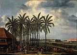 |
|
| Fort Jacatra (Nassau and Mauritius) (dismantled between 1627–1632) | Fort Jacatra | before 1619 | 6.128640°N 106.809979°W | |||
| Fort Jacarta Buiten Batavia (demolished) | Fort Jacarta Buiten Batavia | anonymous | 6.145389°N 106.830442°W | |||
| Fort Noordwijk (demolished in 1808) | Fort Noordwijk | 1658 | anonymous | 6.167773°N 106.830801°W | ||
| Fort Zevenhoek (demolished) | Fort Zevenhoek | 1657 | anonymous | |||
| Fort Rijswijk (demolished) | Fort Rijswijk | anonymous | ||||
| Fort Zouteland (demolished) | Fort Zouteland | 1656 | anonymous | Ancol Ancol right|thumbnail|Ancol Carnival BeachAncol is an Administrative Village in Pademangan Subdistrict, North Jakarta, Jakarta. It is located in the coastal lowland of Jakarta. Ancol is bounded by Jakarta Bay to the north, Sunda Kelapa harbor to the west, and Kali Japat canal to the east. Ancol has the... |
||
| Galangan VOC Restaurant and Ta San Yen | Carpenter's shop of the Dutch East Indies | 1627-1632 or before 1650 or 1727 | anonymous | 6.128344°N 106.808937°W | ||
| Gedung Candranaya (1957) | Landhuis Kroet / Landhuis Van Majoor der Chinezen Khouw Kim An or "residence of Chinese Mayor Khouw Kim An" | 18th century | Khouw Tjoen (first resident) | 6.147337°N 106.815284°W | ||
| Gerbang Amsterdam Amsterdam Gate, Jakarta The Amsterdam Gate is a former gate in Jakarta, Indonesia. It was part the Castle of Batavia built between 1619-1627. It survived the dismantling of the castle between 1890–1910, however it was demolished in the 1950s. In 2007 it was proposed to rebuild a replica as part of heritage conservation... or "Amsterdam Gate" (demolished in 1950s) |
Amsterdamsepoort, Pinangpoort, Kasteelpoort | 1622-1627 | 6.130834°N 106.812062°W | |||
| Gereja Sion Gereja Sion Gereja Sion is a historic church located in Pinangsia Administrative District, Taman Sari, Jakarta, Indonesia... |
De Portugese Buitenkerk | 1695 | E. Ewout Verhagen | 6.138009°N 106.817920°W | ||
| Gereja Tugu | Portuguese Church | 1676–1678, rebuilt in 1737–1738 | Melchior Leidecker, later rebuilt by Julius Vinck | 6.123844°N 106.924070°W | ||
| Government House or a 'Play House' (demolished) | Huis van de Generaal/Speelhuis | 1632-1650 | 6.141976°N 106.815156°W | |||
| Great Palace of Weltevreden (demolished in 1820, now Rumah Sakit Pusat AD Gatot Subroto or Army Main Hospital) | Great Palace of Weltevreden / Landhuis Weltevreden | 1761 | for Jacob Mossel Jacob Mossel Jacob Mossel went from being a common sailor to become Governor-General of the Dutch East Indies from 1750 to 1761.... |
6.176726°N 106.836608°W | ||
| Jembatan Gantung Kota Intan | Engelse Brug / Het Middelpuntbrug / Grote Boom or "Large Tree Bridge" / Djembatan Hoenderpasser Kali Besar or Hoenderpasserbrug or "Chicken Market Bridge" (1900s) / Ophalsbrug Juliana (1938) | 1655 (after the demolition of earlier English Bridge, located 100 meter to the south), 1937 (renovated) | 6.131259°N 106.810579°W | |||
| Mesjid Luar Batang, Luar Batang Mosque | Mesjid Luar Batang | 1739 (established) | Sayid Husein bin Abubakar Alaydrus (founder) | 6.123765°N 106.806533°W | ||
| Mohr Observatory Johan Maurits Mohr thumbnail|right|Mohr observatory in [[Jakarta|Batavia]] .Johan Maurits Mohr was a Dutch-German pastor who studied at Groningen University from 1733 and settled in Batavia in 1737... (demolished in 1812) |
Mohr Observatory | 1765 | Johan Maurits Mohr Johan Maurits Mohr thumbnail|right|Mohr observatory in [[Jakarta|Batavia]] .Johan Maurits Mohr was a Dutch-German pastor who studied at Groningen University from 1733 and settled in Batavia in 1737... |
6.143863°N 106.812911°W | ||
| Museum Bahari Maritime Museum (Indonesia) The Maritime Museum is located in the old Sunda Kelapa harbor area in Penjaringan Administrative Village, Penjaringan Subdistrict, Jakarta, Indonesia. The museum was inaugurated inside the former Dutch East India Company warehouses... |
Warehouse | 1652–1771 | 6.126753°N 106.808279°W | |||
| Museum Sejarah Jakarta Jakarta History Museum The Jakarta History Museum , also known as Fatahillah Museum or Batavia Museum, is located in the Old Town of Jakarta, Indonesia. The building was built in 1710 as the Stadhuis of Batavia... |
Batavia City Hall (3rd) | 1710 | W.J. van der Velde | 6.135348°N 106.813372°W | ||
| Nieuwe Hollandse Kerk, "New Church of Holland" (destroyed by earthquake in 1808, Wayang Museum Wayang Museum The Wayang Museum is a museum dedicated to Javanese wayang puppetry. The museum is located in Jakarta, Indonesia.- History :The building occupies the site of a church which was built in 1640 under the name of the Old Dutch Church . In 1732, the church was renovated and the name was changed into... is now on its site) |
Nieuwe Hollandse Kerk, Groote Hollandse Kerk | 1736 | 6.134882°N 106.812603°W | |||
| Nieuwe Poort, "New Gate" (demolished) | Nieuwe Poort | 1627-1632 | anonymous | 6.138424°N 106.813777°W | ||
| Old Gelderland defence works (demolished after 1667) | Oud Gelderland | 1622-1627 | 6.135031°N 106.815689°W | |||
| Oude Hollandse Kerk, "Old Holland Church" (demolished in 1732, bottom part still viewable) | Oude Hollandse Kerk / Kruiskerk, "Cross Church" | 1640 | 6.134882°N 106.812603°W | 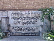 |
||
| Oude Utrechtse Poort, "Old Utrecht Gate" (demolished) | Oude Utrechtse Poort | 1632-1650 | anonymous | 6.136034°N 106.807207°W | ||
| Pasar Ikan, "Fish Market" | Vismarkt | anonymous | ||||
| Raja Kuring Restaurant | Carpenter's shop of the Chinese | 1632-1635 | 6.130012°N 106.809692°W | |||
| Sinees Sieken Huys, Chinese hospital and home for the aged (demolished) | Sinees Sieken Huys | 1646 | 6.134812°N 106.807577°W | |||
| Spinhuis, "spinning-house for single women" (demolished) | Spinhuis, Spinhuys | 1635-1650 | 6.134435°N 106.807492°W | |||
| The Latin and Greek School (demolished) | The Latin and Greek School | 1622-1627 | anonymous | 6.131917°N 106.813228°W | ||
| Toko Merah Tambora, Jakarta Tambora is a subdistrict of West Jakarta, Jakarta, Indonesia. Tambora Subdistrict is bounded by a railway to the west and to the north, Kali Krukut - Kali Besar canal to the east, and Duri Selatan Road to the south.... , "Red Shop" |
Residence of Gustaaf Willem, Baron van Imhoff / Residence of other Governor General of Batavia, Jacob Mossel (1750–1761), Petrus Albertus van der Parra (1761–1775), Reinier de Klerk (1777–1780), Nicolaas Hartingh, Baron van Hohendorf / Academie de Marine (1734) / Kantoor van de Bank voor Indië / Hotel / Shop of Oey Liauw Kong (1851) | 1730According to a plaque in front of Toko Merah. | for Gustaaf Willem van Imhoff | 6.135955°N 106.811285°W | ||
| Vihara Dharma Bhakti | Jin De Yuan Klenteng | 1650, 1755 (restored) | 6.143973°N 106.812736°W | |||
| Vismarkt, "Fish Market" (earlier structure) (demolished) | Vismarkt, Vischmarkt | 1632-1635 | anonymous | 6.130653°N 106.80995°W | ||
| Waterkasteel (demolished) | Waterkasteel / "Hornwerk" | 1741, 1750 | anonymous | 6.116205°N 106.806601°W |
Colonialism – late 18th century to 1870
After the VOC was formally dissolved in 1800 the Batavian Republic expanded all the VOC's territorial claims into a fully fledged colony named the Dutch East Indies. From the company's regional headquarters Batavia now evolved into the capital of the colony. In 1808 Daendels moved the old town center to higher ground to the south and urbanized the area known as Weltevreden. During the British interregnum Daendels was replaced by Raffles who governed until 1816.As the Dutch become more securely established in the region, towns grew up beyond the walls of the fort. Batavia
Jakarta
Jakarta is the capital and largest city of Indonesia. Officially known as the Special Capital Territory of Jakarta, it is located on the northwest coast of Java, has an area of , and a population of 9,580,000. Jakarta is the country's economic, cultural and political centre...
, together with Semarang
Semarang
- Economy :The western part of the city is home to many industrial parks and factories. The port of Semarang is located on the north coast and it is the main shipping port for the province of Central Java. Many small manufacturers are located in Semarang, producing goods such as textiles,...
and Ujung Pandang, were the most important urban centers. During this time, Batavia became congested and wealthier merchants and other powerful men began to build their residences on the outskirts of town and in the surrounding countryside.
The period shows a gradual adaptation to the tropical climate form on the part of the Dutch colonial architecture. These new form of architecture is called the Indies. Typical style during this period include large roof overhang, high roof and ceiling, and front and rear verandahs that opened on to gardens. Indies style can be described as a mix of Indonesian, Chinese, and European influence. Very often the local Javanese style limasan roof was employed, but with addition of 19th century European architectural elements such as Tuscan columns, doors, windows, and a flight of three to four steps leading up to a verandah running the full width of the house.
Neoclassicism
Neoclassicism
Neoclassicism is the name given to Western movements in the decorative and visual arts, literature, theatre, music, and architecture that draw inspiration from the "classical" art and culture of Ancient Greece or Ancient Rome...
was a popular style for buildings in Jakarta during this period, which is considered to be the best representation of the greatness of the empire.
| Last official name | Former names | Year | Architect | Location | Latest image | Oldest image |
|---|---|---|---|---|---|---|
| Aley Cramerus Residence | ||||||
| C. Schultze Residence | ||||||
| H. Vaupel Residence | ||||||
| J.J. Kunst Residence | ||||||
| M.C. Westerman Residence | ||||||
| W.C. van Benthem Jutting Residence | Kebon Sirih, Weltevreden | |||||
| Arsip Nasional National Archives of Indonesia The National Archives of Indonesia is the non-departmental government institution of Indonesia responsible for maintaining a central archive. It holds the largest archive collection related to the Dutch East India Company... |
Reiner de Klerk house | 1760 | Reiner de Klerk | 6.153761°N 106.817036°W | ||
| Asrama Polisi Sektor Pal Merah | Landhuis Kebayoran Lama / Gedung Tinggi or "tall building" / Rumah Grogol or "Grogol house" / Residence of Andreas Hartink | 18th century | W.J. Van de Velde | Jl. Pal Merah Barat , Kel. Pal Merah, Kec. Palmerah Palmerah Palmerah is a Subdistrict of West Jakarta, Indonesia. The Subdistrict is roughly bounded by Jakarta-Merak Tollway to the north, Batusari - Rawa Belong Road to the west, Palmerah Barat - Palmerah Utara Road to the south, and Aipda K. Sasuit Tubun Road - Western Flood Canal to the east.Let Jend S... , Jakarta Barat |
||
| Balai Kota or City Hall | Burgemeesterswoning / Jakarta Tokubetsusi (1942–1945) | 19th century | ||||
| Biara Santa Ursula, Kapel, dan Sekolah Santa Ursula; St Ursula cloister, chapel, and school | Ursulinen Klooster, "Kleine Klooster" | 1859 (cloister), 1888 (chapel), 1912 (school) | 6.168618°N 106.834143°W | |||
| BP7 | Volksraad or Council of the Indies Building or Raad van Indië (1918) / Dokuritsu Zyunbi Tyoosakai or Badan Penyidik Usaha-Usaha Persiapan Kemerdekaan | 1830 | J. Tromp | 6.175200°N 106.833073°W | ||
| Citadel Prins Frederik (demolished, on its site stands the Istiqlal Mosque Istiqlal Mosque Istiqlal Mosque, or Masjid Istiqlal, in Jakarta, Indonesia is the largest mosque in Southeast Asia in terms of capacity to accommodate people and building structure. This national mosque of Indonesia was built to commemorate Indonesian independence, as nation's gratitude for Islam's blessings; the... ) |
Citadel Prins Frederik | 1831 | 6.170386°N 106.830742°W | |||
| De Club Burger Societeit (demolished) | Residence ((1815, 1819) / Hotel Marine (1833) | 1815 | 6.167613°N 106.820352°W | |||
| Departemen Keuangan | Palace of Governor-General Daendels / Het Groote Huis / Het Witte Huis | March 7, 1809 | J.C. Schultze, completed by J. Tromp (1828) | 6.169257°N 106.837096°W | ||
| Dewan Kerajinan Nasional (February 24, 1992) | Residence / Office of Hamengkubuwono IX (1945) | 1860–1870 | Jl. Prapatan No. 42 Kel. Senen, Kec. Senen, Jakarta 10410 | |||
| Freemasonry buildings in Weltevreden | Vrijmetselarij in Weltevreden | |||||
| Gedung Kesenian Jakarta Gedung Kesenian Jakarta Gedung Kesenian Jakarta , historically known as Schouwburg Weltevreden, is a concert hall in Jakarta, Indonesia, built during the Dutch colonial period.-History:... |
Stadtsschouwburg / Bataviasch Schouwburg / "Gedung Komidi" / Sin'tsu Cekizyoo | 1821 | J.C. Schultze | 6.166540°N 106.834417°W | ||
| Gedung Pancasila, Pancasila Building / Gedung Departemen Luar Negeri or Building of the Ministry of Foreign Affairs | Residence of Hertog Bernhard (original) / residence of Dutch Royal Army Commander / Volksraad or Council of the Indies Building or Raad van Indië (1918) / Dokuritsu Zyunbi Tyoosakai or Badan Penyidik Usaha-Usaha Persiapan Kemerdekaan | 1830 | J. Tromp | 6.174350°N 106.833632°W | ||
| Gereja Immanuel or Emmanuel Church | Willemskerk or "Williams Church" | 1835–1839 | J.H. Horst | 6.176703°N 106.832081°W | ||
| Grand Hôtel Java (Demolished in the 1950s and replaced with Markas besar TNI Angkatan Darat (headquarters of the National Indonesian Army Land Forces)) | Private residence (original) / Grand Hôtel Java (1834) | early 19th century | 6.168221°N 106.828216°W | |||
| Hotel der Nederlanden (demolished and replaced with Bina Graha Presidential Office in 1969) | Pieter Tenzy residence (original) / W.H. van Eijsseldijk residence / Thomas Stamford Raffles residence (1811) / Hotel Palace Royale (1840) / Hotel der Nederlanden (1846) / Hotel Dharma Nirmala (1950s) / Markas Cakrabirawa (1950s) | 1794 | 6.167956°N 106.824918°W | |||
| Hotel des Indes Hotel des Indes (Batavia) Hotel des Indes was one of the oldest and most prestigious hotels in Asia. Located in Batavia , in the Dutch East Indies . The hotel had accommodated countless famous patrons throughout its existence from 1829 to 1971... 1st form (renovated in 1930) |
a residential / Hotel Chaulan (1828) / Hotel de Provence (1835) / Hotel Rotterdamsch (1854) / Hotel des Indes (1 May 1856) | 1930 | 6.165495°N 106.819806°W | |||
| Hotel Sriwijaya (1950) | Hotel Cavadino (1863) / Hotel Lion d’Or (1899) / Park Hotel (1941) | 1863 | for Conrad Alexander Willem Cavadino | 6.168918°N 106.829860°W | ||
| Hotel Wisse (1890, replaced with Hotel des Galeries in 1920) | Residence of GG Petrus Albertus van der Parra / Hotel Ernst (1860) | around 1750 | for GG Petrus Albertus van der Parra | 6.166930°N 106.821007°W | ||
| Istana Merdeka | Governor General's Palace or Paleis van de Gouverneur-Generaal, "Gambir Palace" | 1873 | Drossares | 6.170170°N 106.824177°W | ||
| Istana Negara Istana Negara Istana Negara is the official residence of His Majesty, the Yang di-Pertuan Agong of Malaysia. It stands on a 13 acre site, located at a commanding position on the slope of a hill of Bukit Petaling overlooking the Klang River, along Jalan Syed Putra.Another royal residence of the Yang di-Pertuan... (1949) |
Residence of Jacob Andries van Braam (original); Schonburg Building; Paleis Z. E. Gouverneur Generaal te Rijswijk | 1796–1804, 1848 (renovated after an earthquake) | 6.168084°N 106.823956°W | |||
| Jean Belle Residence (demolished, replaced with Nederlandsche Handels Maatschappij te Weltevreden in 1910) | Jean Belle Residence | |||||
| J.P. Coen Statue (demolished in March 7, 1943 during Japanese occupation) | J.P. Coen Statue | 1869 | 6.169353°N 106.836808°W | |||
| Kimia Farma (1958) | Volksapotheek te Rijswijk | 1857; 1913 (renovated) | unknown; Eduard Cuypers Eduard Cuypers Eduard Cuypers was a Dutch architect.Cuypers was trained in the architectural practice of his uncle P.J.H. Cuypers and in 1881 set up his own office in Amsterdam. His good contacts with businessmen earned him commissions for offices, shops and houses... (renovation) |
6.168194°N 106.826802°W | ||
| Kleedingmagazijn M. De Koning in Noordwijk (Demolished in 1950s, now Grand Brilliant Palace Restaurant) | Kleedingmagazijn M. De Koning in Noordwijk | 6.167146°N 106.827491°W | ||||
| Magazijn Onderlinge Hulp in Noordwijk (demolished, replaced with Kantor Departemen Keuangan RI bagian KPPN (Kantor Pelayanan Perbendaharaan Negara) | Magazijn Onderlinge Hulp in Noordwijk | 6.167054°N 106.827050°W | ||||
| Mahkamah Agung or "Indonesia Supreme Court Building" | Hoogerechshaf | 1828 | J.C. Schultze, completed by J. Tromp (1828) | 6.168203°N 106.836664°W | ||
| Menara Syahbandar Maritime Museum (Indonesia) The Maritime Museum is located in the old Sunda Kelapa harbor area in Penjaringan Administrative Village, Penjaringan Subdistrict, Jakarta, Indonesia. The museum was inaugurated inside the former Dutch East India Company warehouses... |
De Uitkijk | 1839 | 6.127527°N 106.809071°W | 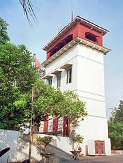 |
||
| Mercu Suar Sunda Kelapa or "Sunda Kelapa lighthouse" | Vuurtoren Batavia | 1862 | 6.105129°N 106.805397°W | |||
| Mesjid Jami Kebon Jeruk or "Kebon Jeruk Mosque" | 1786 | for Tuan Tschoa (Kapten Tamien Dosol Seeng) | 6.155555°N 106.818506°W | |||
| Military Society Concordia (demolished in 1960s, now occupied by Gedung A.A. Maramis II Departemen Keuangan) | Military Society Concordia / Kantor Pusar DPR | 21 September 1833 (inauguration); 1836, 1874, 1990 (building extension) | 6.170186°N 106.837689°W | |||
| Museum Nasional National Museum of Indonesia The National Museum of Indonesia , is an archeological, historical, ethnological, and geographical museum located in Jakarta. Popularly known as Elephant Building after the elephant statue in its forecourt. Its broad and fascinating collections covers all of Indonesia's territory and almost all of... , "Museum Gajah" |
Bataviaasch Genootschap van Kunsten en Watenschappen, "The Batavian Society of Arts and Science Building" | 1862 | 6.176434°N 106.822115°W | |||
| Museum Seni Rupa dan Keramik Fine Art and Ceramic Museum - History :The building of the Fine Art and Ceramic Museum was completed on January 12, 1870, and was used as the Court of Justice . The building was known as Paleis van Justitie. During the Japanese occupation, the building was used by KNIL and later after the independence of Indonesia, was used... |
Palais van Justitie ("Justice Palace") | 1870 | 6.134310°N 106.814212°W | |||
| Museum Sumpah Pemuda | Customs inspection office / Hotel Hersia (until 1951) / Residence (1937–1951) / Sie Kok Liong's Dormitory for students from outside Java (before 1928) | before 1925 | ||||
| Museum Tekstil Textile Museum (Jakarta) The Textile Museum houses a collection of textiles from various islands in Indonesia. The museum is located in Jakarta, Indonesia.- History :... (1978) |
Residence; Headquarter of Barisan Keamanan Rakyat ("Front of People Safety"); Institution for aged people (1947) | 19th century | 6.188019°N 106.809620°W | |||
| Oger Frères (demolished, replaced with Singer Building in the 1930s) | Oger Frères | 1823 (store opened) | 6.168118°N 106.820704°W | |||
| Passer Baroe, Pasar Baru | Passer Baroe | 1821 | 6.165375°N 106.834602°W | |||
| Photographisch Atelier Walter Woodbury Walter B. Woodbury Walter Bentley Woodbury was an inventor and pioneering English photographer. He was one of the earliest photographers in Australia and the Dutch East Indies... (demolished, replaced by Gedung Bina Graha) |
Residence of Van Dorp (original) / Photographisch Atelier Walter Woodbury Walter B. Woodbury Walter Bentley Woodbury was an inventor and pioneering English photographer. He was one of the earliest photographers in Australia and the Dutch East Indies... (1861–1908) |
6.167701°N 106.825144°W | ||||
| Post- en Telegraafkantoor te Weltevreden | Post- en Telegraafkantoor te Weltevreden | (before 1885) | ||||
| Postkantoor Weltevreden (demolished and replaced with a new building in 1913) | Postkantoor Weltevreden | 1853 | ||||
| Rumah Sakit Cikini or "Cikini hospital" | Raden Saleh Raden Saleh Raden Saleh Sjarif Boestaman is one of the best known painters from Indonesia and a pioneer of modern Indonesian art.... Residence (original); Hospital and a Nurse Academy (1898) |
1852 | Raden Saleh Raden Saleh Raden Saleh Sjarif Boestaman is one of the best known painters from Indonesia and a pioneer of modern Indonesian art.... |
Jalan Raden Saleh 40, Menteng-Cikini, Jakarta Pusat 10330 | ||
| SMK Santa Maria | Groote Klooster / Mater Dei (1920) | 1856 | ||||
| Societeit Harmonie or "Harmony Society" (demolished for road widening and parking area in 1985) | Societeit Harmonie or "Harmony Society" (original) | 18 January 1815 | J.C. Schultze | 6.167927°N 106.821246°W | ||
| Topografische Dienst te Weltevreden | Topografische Dienst te Weltevreden |
Post Cultuurstelsel abolition – 1870 to mid 20th century
The abolition of the Cultuurstelsel in 1870 made way for the rapid development of private enterprises in the Dutch Indies. Numerous trading companies and financial institutions established themselves in Java, most of them settled in Batavia. Jakarta Old Town's deteriorating structures were replaced with offices, typically along the Kali BesarCiliwung River
Ciliwung is a river that passes through Jakarta, Indonesia. The river flows from its source near Puncak on the highlands of West Java to the Jakarta Bay....
. These private companies owned or managed plantations, oil fields, and mines. Railway stations were designed during this period, with characteristic style of this period.
Architecturally, neoclassicism fell out of favor to be replaced by Neogothic and Dutch Rationalism
New Objectivity
The New Objectivity is a term used to characterize the attitude of public life in Weimar Germany as well as the art, literature, music, and architecture created to adapt to it...
. Apparent architectural style were Nieuwe Kunst (e.g. Bank Tabungan Negara), Art Deco
Art Deco
Art deco , or deco, is an eclectic artistic and design style that began in Paris in the 1920s and flourished internationally throughout the 1930s, into the World War II era. The style influenced all areas of design, including architecture and interior design, industrial design, fashion and...
or De Stijl
De Stijl
De Stijl , propagating the group's theories. Next to van Doesburg, the group's principal members were the painters Piet Mondrian , Vilmos Huszár , and Bart van der Leck , and the architects Gerrit Rietveld , Robert van 't Hoff , and J.J.P. Oud...
, and Amsterdam School
Amsterdam School
The Amsterdam School is a style of architecture that arose from 1910 through about 1930 in The Netherlands...
. This architecture styles were also the tropical counterpart of the original style, resulting in a style called the Indies.
Two dominant architectural bureaus during this period were AIA Bureau (Ghijsels) and AA Fermont and Cuypers Bureau (Eduard Cuypers
Eduard Cuypers
Eduard Cuypers was a Dutch architect.Cuypers was trained in the architectural practice of his uncle P.J.H. Cuypers and in 1881 set up his own office in Amsterdam. His good contacts with businessmen earned him commissions for offices, shops and houses...
).
Colonnades are required during this period to provide protection against monsoon rains and tropical sun, which in turns transformed the appearance of buildings in the city centers.
Colonial style in Jakarta lingered some years after the Japanese occupation of Indonesia in 1942, and further after the independence of Indonesia in 1945.
| Last official name | Former names | Year | Architect | Location | Latest image | Oldest image |
|---|---|---|---|---|---|---|
| Bioscoop Manggarai or "Manggarai Cinema" | ||||||
| Binnacle (Schakelhuis) | ||||||
| Chinese Christian Church | ||||||
| Office | 6.167141°N 106.831749°W | |||||
| Frans Consulaat Koningsplein | ||||||
| Electrification of the State Railway Company at Meester Cornelis (Electrificatie van de Staatsspoor- en Tramwegen (SS en T) bij het spoorwegstation te Meester Cornelis) | ||||||
| Kantoor van de Nederlandsch Indische Escompto Maatschappij te Weltevreden | ||||||
| Laboratory for Pasar Ikan Marine Research | ||||||
| Mayestik Bioscoop | ||||||
| Modernist villas of Westerpark | 1920-1930s | |||||
| Oranje Beer Brewery | ||||||
| Van Arcken and Co. Shop | ||||||
| Artesian well at Batoe Toelis (demolished) | Artesian well at Batoe Toelis | |||||
| Artesian well at Koningsplein (demolished) | Artesian well at Koningsplein | 6.171693°N 106.825636°W | ||||
| Artesian well at Meester Cornelis (demolished) | Artesian well at Meester Cornelis | 1881 | Meester Cornelis | |||
| Artesian well at Postweg (demolished) | Artesian well at Postweg | |||||
| Artesian well at Salemba (Demolished) | Artesian well at Salemba | 6.193574°N 106.849935°W | ||||
| Asuransi Jasa Indonesia Asuransi Jasindo Asuransi Jasindo, the marketing brand for PT Asuransi Jasa Indonesia is the second largest general insurance company in Indonesia and is wholly owned by the Government of Republic of Indonesia, administrated under the Ministry of State-Owned Enterprises... (deteriorated and gradually demolished) |
1912 | 6.134176°N 106.812882°W | ||||
| Asuransi Jiwasraya (1957, front facade demolished for road widening) | Nillmij (Nederlandsch-Indische Levensverzekerings en Lijfrente Maatschappij) | 1909–1910 | P.A.J.Moojen dan S. Snuyft | 6.166923°N 106.823224°W | ||
| Asuransi Wahana Tata, Wahana Tata Insurance | Office | 19th century | unknown | 6.134973°N 106.811088°W | ||
| Athena Diskotik | Het Nieuws van den Dag | 1925–1927 | Ir. W. Selle | 6.135152°N 106.811078°W | ||
| Badan Pengawas Tenaga Nuklir (BAPETEN) | Gebouw van Burgerlijke Openbare Werken | 6.163912°N 106.819607°W | ||||
| Bank Indonesia Bank Indonesia Bank Indonesia is the central bank of The Republic of Indonesia. Bank Indonesia is currently governed by Darmin Nasution, former interim governor. The last governor before the interim phase, Boediono, resigned due to his vice presidential candidacy in the Indonesian presidential election... |
De Javasche Bank | 1909 | Eduard Cuypers Eduard Cuypers Eduard Cuypers was a Dutch architect.Cuypers was trained in the architectural practice of his uncle P.J.H. Cuypers and in 1881 set up his own office in Amsterdam. His good contacts with businessmen earned him commissions for offices, shops and houses... and Hulswit |
6.137185°N 106.812856°W | ||
| Bank Mandiri | Kantoor van de Nederlandsch Indische Escompto Maatschappij / Bank Dagang Negara / Bank Mandiri | 1920 | Eduard Cuypers Eduard Cuypers Eduard Cuypers was a Dutch architect.Cuypers was trained in the architectural practice of his uncle P.J.H. Cuypers and in 1881 set up his own office in Amsterdam. His good contacts with businessmen earned him commissions for offices, shops and houses... |
6.136417°N 106.812845°W | ||
| Bank Mandiri - Jakarta-Kota branch | Bank Export Import / Bank Bumi Daya (1960) | 1920s | Ir. J.F.L. Blankenberg dan Wolff Schoemaker, Ir. Fermont – Eduard Cuypers Eduard Cuypers Eduard Cuypers was a Dutch architect.Cuypers was trained in the architectural practice of his uncle P.J.H. Cuypers and in 1881 set up his own office in Amsterdam. His good contacts with businessmen earned him commissions for offices, shops and houses... |
6.137011°N 106.813704°W | ||
| Bank Mandiri | Standard Chartered Bank Office of India, Australia, and China / Bank Umum Negara (1965) / Bank Bumi Daya (1968) | February 27, 1921 | Eduard Cuypers Eduard Cuypers Eduard Cuypers was a Dutch architect.Cuypers was trained in the architectural practice of his uncle P.J.H. Cuypers and in 1881 set up his own office in Amsterdam. His good contacts with businessmen earned him commissions for offices, shops and houses... |
6.136532°N 106.811417°W | ||
| Bank Sinarmas | NV. Handelsvereniging / NV. Reiss & Co | 19th century? | 6.135787°N 106.811279°W | |||
| Bank Tabungan Negara Office (1968) | Kantoor van de Postspaarbank (1920) / Tyokin Kyoku (1942) / Bank Tabungan Pos (1945) | 1920, 1936 (renovated to current form) | RLA Schoenmaker (1920), J. van Gendt (1936) | 6.167185°N 106.820338°W | ||
| Banteng Building - Kantor Advokat dan Pengacara | Office | 19th century | ? | 6.136108°N 106.811337°W | ||
| Bappenas or "Board of National Planning and Development" | Freemason Lodge | Ir Frans Johan Lauwrens Ghijsels | 6.200663°N 106.832426°W | |||
| Bengkel Praktek Kerja Pendidikan Teknik (1974) | Nederlandsch Indie Gas Maatschappij | 1924 | Jl. Budi Utomo No. 3 Kel. Pasar Baru Kec. Sawah Besar Jakarta 10710 | |||
| Bhanda Graha Reksa | Offices | 19th century | 6.136135°N 106.812264°W | |||
| Bioscoop Menteng (demolished in 1988, on its site stands Menteng Plaza) | Bioscoop Menteng | 1949 | Johanens Martinus Han Groenewegen (Selle, De Bruyn, Reyerse & de Vries) | 6.183443°N 106.834165°W | ||
| Buddha Bar | Bataviasche Kunstkring (original); Immigration office of Central Jakarta | 1913 | 6.188898°N 106.833497°W | |||
| Building at Jl. Kunir no. 2 | Geo. Wehry & Co Office building | 1927 | Ir. FJL Ghijsels (AIA Bureau) | 6.132514°N 106.814826°W | ||
| Cafe Batavia | Residence / Warehouse / Office / Coffeeshop / Gallery | between 1805–1850 | 6.134410°N 106.812740°W | |||
| Canisius College | Canisius College HBS | 1929 | a group of Jesuit pastors (established) | 6.185809°N 106.834284°W | 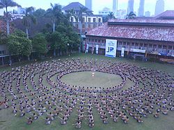 |
|
| Departemen Energi dan Sumber Daya Mineral, Department of Energy and Mineral Resources | Batavia Police Headquarter | 1925 (approximate) | 6.181321°N 106.823529°W | |||
| Departement Keuangan | Ika-Daigaku Dormitory | 1942 | Jl. Prapatan No. 10, Kel. Senen, Kec. Senen, Jakarta 10410 | |||
| Departemen Pertahanan dan Keamanan, Department of Defense and Security (1964) | Rechts Hoge School | 1924 | J.F. van Hoytema | 6.177091°N 106.821867°W | ||
| Direktorat Jenderal Perhubungan Laut, National Committee on Sea Transportation Safety, Ministry of Transportation. Research and Development, Human Development of Transportation Ministry | Koninklijke Paketvaart Maatschappij (original) / Japanese Marine Department (1942) | 1916–1918 | F.J.L. Ghijsels, Heins von Essen, and Stoltz (AIA Bureau) | |||
| Djakarta Lloyd Office (abandoned) | Asurantie Kantoor van Ongevallen verzekering mij FATUM en Onderlinge elvensverzekering van EIGEN HULP / Honda (2004) | 1890 | 6.134077°N 106.812596°W | |||
| Fakultas Kedokteran Universitas Indonesia, "Medical Faculty of the University of Indonesia University of Indonesia The Universitas Indonesia, is a state, comprehensive world class university located in Depok, West Java and Salemba, Jakarta, Indonesia. Universitas Indonesia is the oldest tertiary-level educational institution in Indonesia... " |
de Geneeskundige Hoogeschool, "Medical College" | 1919-1926 | 6.194962°N 106.848907°W | |||
| Filateli Jakarta | Main Post and Telegraph Office | 1913 | J van Hoytema | 6.167137°N 106.833818°W | ||
| Former office of Nederlandsch Indische Handelsbank (NIHB) | First office of Nederlandsch Indische Handelsbank (NIHB) | 6.133186°N 106.810616°W | ||||
| Gebouw van de Koninklijke Paketvaart Maatschappij (KPM) bij de Sluisbrug (Demolished for road widening) | Gebouw van de Koninklijke Paketvaart Maatschappij (KPM) bij de Sluisbrug | 1888 | 6.167754°N 106.831296°W | |||
| Gereja Katedral Jakarta Jakarta Cathedral Jakarta Cathedral is a Roman Catholic Cathedral in Jakarta, Indonesia, which is also the seat of the Roman Catholic Archbishop of Jakarta, currently Archbishop Ignatius Suharyo Hardjoatmodjo... (final form) |
Batavia Cathedral | 1901 | 6.169013°N 106.833114°W | |||
| Gereja Koinonia | GPIB Bethel Jemaat Djatinegara (1961) / Bethelkerk (original) | March 28, 1889 | 6.213764°N 106.861818°W | |||
| Gereja Pniel (1953) | "Gereja Ayam" ("Chicken Church") / Haantjes Kerk | 1913-1915 (replacing earlier church built in 1850) | N.A. Hulswit (Cuypers en Hulswit) | 6.160909°N 106.834265°W | ||
| Gereja St Paulus, St. Paul Church (October 31, 1948) | Nassaukerk / Gereja Menteng (1942-October 31, 1948) | 1936 | F.J.L. Ghijsels (AIA Bureau) | 6.200499°N 106.831460°W | ||
| Gereja St Yoseph Matraman | St. Joseph Church Matraman | 1906 – June 22, 1909 | Ir Frans Johan Lauwrens Ghijsels (AIA Bureau); Ir Erawan Kartawidjaja (renovation in 2001) | 6.208243°N 106.859596°W | ||
| Gereja St Theresia, St Theresia Church | Theresiakerk | 1934 | Fermont-Cuypers Burean, Arsitek Th. van Oyen | 6.188929°N 106.825490°W | ||
| Gunung Sahari Lock Bridge (demolished) | Gunung Sahari Lock Bridge | |||||
| Hotel Duta Indonesia Hotel des Indes (Batavia) Hotel des Indes was one of the oldest and most prestigious hotels in Asia. Located in Batavia , in the Dutch East Indies . The hotel had accommodated countless famous patrons throughout its existence from 1829 to 1971... (demolished in 1972, replaced with Duta Merlin Plaza) |
Hotel des Indes | 1930 | Burhoven Jaspers | 6.165495°N 106.819806°W | ||
| Hotel Melati | Hotel des Galeries | 1914 | 6.166930°N 106.821007°W | |||
| Jasa Raharja | Zee en Brand Verzekerings Maatschapij Sluyters & Co / Lloyd Insurance (1950) | 6.135694°N 106.812086°W | ||||
| Kantor Pelayanan Pajak Jakarta Tambora or "Tambora Tax Office" | HSBC HSBC HSBC Holdings plc is a global banking and financial services company headquartered in Canary Wharf, London, United Kingdom. it is the world's second-largest banking and financial services group and second-largest public company according to a composite measure by Forbes magazine... |
19th century | 6.135680°N 106.811241°W | |||
| Kantor Pos Cikini, "Cikini Post Office" | Tjikini post kantoor | Before 1920s | 6.187273°N 106.836711°W | |||
| Kantor Pos Kota, "Kota Post Office" | Post- en telegraaf kantoor aan het Stadhuisplein | 6.134022°N 106.813279°W | ||||
| Kerta Niaga (1966) | Geo Wehry Office? | before 1910? | 6.135830°N 106.812145°W | |||
| Koninklijke Bataviasche Jacht Club (demolished) | Koninklijke Bataviasche Jacht Club | 6.098545°N 106.898009°W | ||||
| Landsdrukkerij, "City Press Factory" | Landsdrukkerij | Weltevreden | ||||
| Lembaga Biologi Molekul Eijkman, Eijkman Institute of Molecular Biology | Eijkman Instituut | 1914 (built), 1916 (inauguration) | H von Essen | 6.198011°N 106.846399°W | ||
| Lembaga Pendidikan Jurnalistik Antara | LKBN Antara (1961) / Apotheek Van Gorkom / AIgemeen Niews en Telegraaf Aneta / Algemeen Niews en Telegraaf Agentschaap (original) | 6.165816°N 106.833924°W | ||||
| Mesjid Angke or "Angke Mosque" | Angke Mosque | Jakarta Utara | ||||
| Mesjid Cut Mutiah Cut Mutiah Mosque Cut Mutiah Mosque is a mosque located at Jalan Cut Mutiah No. 1, Jakarta Pusat, DKI Jakarta, Indonesia. The mosque is named after the well-known Indonesian heroine Cut Nyak Meutia who took part in the struggle against Dutch colonialism in Aceh.... (1987) |
N.V. de Bouwploeg (original) / post office, Train Company (1942–1945) / office of Home and Religion (1964–1970). | 1922 | Pieter Adriaan Jacobus Moojen | 6.187285°N 106.833358°W | ||
| Metropole | Bioscoop Metropol / Megaria | 1932 | Liauw Goan Sing | 6.200059°N 106.843688°W | ||
| Michiels Monument (demolished between 1942–1945) | Michiels Monument | mid 19th century | 6.171074°N 106.833451°W | |||
| Monument voor de Slag bij Waterloo (demolished) | Monument voor de Slag bij Waterloo | |||||
| Monument for J.B. van Heutsz (demolished in 1960) | Monument for J.B. van Heutsz | 1927-1932 | 6.186994°N 106.834119°W | |||
| Museum Joang '45 (1975) | Hotel Schomper / Ganseikanbu Sendenbu (1942–1945) | 1920s | 6.186098°N 106.836601°W | |||
| Museum Kebangkitan Nasional, "Museum of the History of National Awakening" | STOVIA | 1899-1902 | 6.178718°N 106.838034°W | |||
| Museum Mandiri | Nederlandsche Handel-Maatschappij Office Building; or Factorij der Batavia / Bank Koperasi Tani dan Nelayan (1960) / Bank Export Import (Bank Exim) (1968) / Bank Exim bersama Bank Dagang Negara / Bank Bumi Daya / Bank Pembangunan Indonesia / Bank Mandiri (1999) | 1917 | Ir. J. de Bruyn, Ir. A.P. Smiths dan C. Van de Linde | 6.138170°N 106.813085°W | ||
| Museum Sasmita Loka Ahmad Yani | residence of Ahmad Yani Ahmad Yani General Ahmad Yani was the commander of the Indonesian Army, and was killed by members of the 30 September Movement during an attempt to kidnap him from his house.-Early life:... / residence |
1930 | 6.204564°N 106.836524°W | |||
| Museum Taman Prasasti Taman Prasasti Museum Taman Prasasti Museum or Museum of Memorial Stone Park is a museum located in Jakarta, Indonesia. The museum was formerly a cemetery, built by the Dutch colonial government in 1795 as a final resting place for noble Dutchmen... |
Europese Kerkhof | 6.172196°N 106.818946°W | ||||
| Museum Wayang Wayang Museum The Wayang Museum is a museum dedicated to Javanese wayang puppetry. The museum is located in Jakarta, Indonesia.- History :The building occupies the site of a church which was built in 1640 under the name of the Old Dutch Church . In 1732, the church was renovated and the name was changed into... |
Museum of Old Batavia (1939) / Geo Wehry & Co Warehouse | 1912 | 6.134882°N 106.812603°W | |||
| Nederlandsche Handels Maatschappij te 22 Noordwijk (Demolished in 1984, replaced with Kantor Departemen Keuangan RI bagian KPPN (Kantor Pelayanan Perbendaharaan Negara) | Nederlandsche Handels Maatschappij te 22 Noordwijk / "Factorij" | 1910 | Eduard Cuypers Eduard Cuypers Eduard Cuypers was a Dutch architect.Cuypers was trained in the architectural practice of his uncle P.J.H. Cuypers and in 1881 set up his own office in Amsterdam. His good contacts with businessmen earned him commissions for offices, shops and houses... |
6.167017°N 106.827407°W | ||
| Office (abandoned) | G.J. Kolff & Co Bookstore Kolff Kolff is a Dutch family originating from the provinces of Holland, Gelderland, and Noord Brabant in the Netherlands.-History:... |
6.134228°N 106.811806°W | ||||
| Office building at Jl. Taman Fatahillah no. 2 | Gebouw West Java (WEVA) | 1920 | Eduard Cuypers Eduard Cuypers Eduard Cuypers was a Dutch architect.Cuypers was trained in the architectural practice of his uncle P.J.H. Cuypers and in 1881 set up his own office in Amsterdam. His good contacts with businessmen earned him commissions for offices, shops and houses... and Hulswit |
Jl. Taman Fatahillah No. 2 Kel. Penjaringan, Kec. Taman Sari Jakarta Barat | ||
| Pasar Gambir Market Structures/Pavilions (demolished) | Pasar Gambir Market Structures/Pavilions | 6.178931°N 106.825833°W | ||||
| Pelayaran Bahtera Adhiguna | The Ships Agency Ltd Office | 19th century | 6.135544°N 106.812098°W | |||
| Perpustakaan Nasional Jakarta or "National Library" (March 11, 1989) | Koning Willem III School (original) | |||||
| Pertamina Pertamina Pertamina is an Indonesian government-owned corporation which extracts and refines the country's oil and gas reserves. It was created in August 1968 by the merger of Pertamin and Permina... headquarter (1957), front section is rented to Bank Mandiri. |
Batavia Petroleum Maatschappij (original) / Japanese Military Headquarter / General Staff of the Army (before 1950) | 1937 | Jalan Medan Merdeka Timur No.1 or Jalan Perwira No.2 | |||
| Rathkamp and Co. Pharmacy (demolished after 1948) | Rathkamp and Co. Pharmacy | 6.168837°N 106.821009°W | ||||
| Rumah Sakit PELNI, "PELNI Hospital" | KPM Hospital | 1914–1915, 1920 (extension) | F.J.L. Ghijsels | 6.193155°N 106.803531°W | ||
| Rumah Sakit Umum Dr. Cipto Mangunkusumo, Cipto Mangunkusumo General Hospital | Medicinal warehouse for the Ministry of Health of the Dutch Colonial Government / Teaching Hospital (1919) / Het Centrale Burgerlijke Hospitaal (CBZ) or "Central Civil Hospital of Batavia" / Ika Dai Gakku Byoin (1942–1945) | 1919–1926 | 6.197111°N 106.847549°W | |||
| Samudera Indonesia Commercial Fleet Division (Breakbulk & NVOCC) office building | Maintz & Co Office | 1920s | F.J.L. Ghijsels | 6.132948°N 106.810554°W | ||
| Singer Building | Singer Building | 1930 | F.W. Brinkman | 6.168118°N 106.820704°W | ||
| SMA 7 or "State Primary School No. 1" | Carpentier Alting Stichting School / Sekolah Menengah Atas 7 or "Senior High School no. 7" | 1902 | Koningsplein Oost 14 (now Jalan Medan Merdeka Timur) | |||
| SMK Santa Maria | Koningin Emma School | 20th century | ||||
| St. Aloysius Broederschool (demolished, on its site stands carpark of Pertamina Headquarter) | St. Aloysius Broederschool | 6.173346°N 106.830867°W | ||||
| Stasiun Jatinegara Jatinegara Station thumb|right|The front facade of the Jatinegara Station.Jatinegara Station is a railway station in Jakarta. The station is the main entrance to Jakarta from cities east of Jakarta. The station is located at Bekasi Barat Raya street at Jatinegara, East Jakarta. Jatinegara station is operated by the PT... |
Station Meester Cornelis | 1910 | S. Snuyff | 6.215183°N 106.870276°W | ||
| Stasiun Gambir Gambir Station Gambir Station is a mainline railway station in Gambir, Central Jakarta, Indonesia. It is located on eastern side of Merdeka Square. It was built by the colonial Dutch before World War II but renovated in the 1990s... 2nd form (post-independence) |
Station Weltevreden (1884) / Station Batavia Koningsplein (1937) | 1927 | 6.176660°N 106.830617°W |  |
||
| Stasiun Kota Jakarta Kota Station Jakarta Kota Station is a terminal train station, located in the old city core of Jakarta. The station was appointed as a historical and cultural landmark in 1993.... |
Station BEOS | 1926 | F.J.L. Ghijsels | 6.137672°N 106.814421°W | ||
| Stasiun Manggarai, "Manggarai Station" | Station Manggarai | 1910s | 6.210055°N 106.850247°W | |||
| Stasiun Pasar Senen, "Pasar Senen Station" | Station Pasar Senen | 1916, March 19, 1925 (inauguration) | J. Van Gendt, for Staats Spoorwegen (SS) | 6.174223°N 106.844469°W | ||
| Stasiun Tanjung Priok, "Tanjung Priok Station" | State Railway Company's Railway Station | 1914 | C.W. Koch | 6.110642°N 106.881511°W | ||
| Station Batavia Koninsplein Gambir Station Gambir Station is a mainline railway station in Gambir, Central Jakarta, Indonesia. It is located on eastern side of Merdeka Square. It was built by the colonial Dutch before World War II but renovated in the 1990s... 1st form (renovated into current form in 1927) |
Station Weltevreden (1884) | 1884 | 6.176660°N 106.830617°W | |||
| Station Batavia Zuid (demolished) | Station Batavia Zuid | |||||
| Station Tandjong Priok (demolished in 1917) | Station Tandjong Priok | 1885 | 6.111039°N 106.880963°W | |||
| Taman Kehormatan Belanda Menteng Pulo or "Menteng Pulo Netherlands Field of Honour" | Ereveld Menteng Poelo | 1947; Simultaankerk, columbarium in 1950 | H. van Oerle from Royal Netherlands Engineers | 6.222654°N 106.839678°W | ||
| Tjipta Niaga | Zee en Brand Assurantie / Gebouw van de Internationale Credit en Handelsvereeniging Rotterdam | 25 May 1912 | Eduard Cuypers Eduard Cuypers Eduard Cuypers was a Dutch architect.Cuypers was trained in the architectural practice of his uncle P.J.H. Cuypers and in 1881 set up his own office in Amsterdam. His good contacts with businessmen earned him commissions for offices, shops and houses... , Hulswit |
6.134519°N 106.811900°W | ||
| Topografisch Bureau (abandoned and destroyed) | Topografisch Bureau | 1868, 1907 (older building demolished and replaced) | ||||
| Telefoonkantoor aan het Koningsplein or "Telephone office at the Koningsplein" (demolished) | Telefoonkantoor aan het Koningsplein | 6.131250°N 106.810594°W | ||||
| Eigen Hulp aan de Molenvliet West (replaced with Postspaarbank office in 1920) | Eigen Hulp aan de Molenvliet West | 1897 | 6.167185°N 106.820338°W | |||
| Toshiba Office | John Peet & Co Office | around 1920 | Ir. FJL Ghijsels | 6.133426°N 106.810650°W | ||
| Unie Gebouw (demolished) | Unie Gebouw | 6.163179°N 106.820677°W | ||||
| Vereniging Toeristenverkeer – Official Tourist Bureau (demolished) | Vereniging Toeristenverkeer te Rijswijk – Official Tourist Bureau | 1910 | 6.167891°N 106.822847°W | |||
| Warehouse (abandoned, deteriorating) | Dasaad Musin Concern / Residence of the Director of NV. Pabrik Tenoen Kantjil Mas, Bangil, Djawa Timoer | 1920 | 6.133967°N 106.812800°W | |||
| Wilhelmina Park Atjeh Monument (demolished in 1950s, on its site stand the Istiqlal Mosque Istiqlal Mosque Istiqlal Mosque, or Masjid Istiqlal, in Jakarta, Indonesia is the largest mosque in Southeast Asia in terms of capacity to accommodate people and building structure. This national mosque of Indonesia was built to commemorate Indonesian independence, as nation's gratitude for Islam's blessings; the... ) |
Wilhelmina Park Atjeh Monument | 1880-1882 | Bart van Hove, Pierre Cuypers | 6.168333°N 106.830884°W | ||
| Wilhelmina Pavilion (demolished) | Wilhelmina Pavilion | Concordia Societeit | ||||
| Zoological and Plant Society Building (demolished) | Zoological and Plant Society Building |