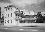
List of National Historic Landmarks in South Carolina
Encyclopedia
This is a List of National Historic Landmarks in South Carolina, United States, and other landmarks of equivalent landmark status in the state. The United States' National Historic Landmark
(NHL) program is operated under the auspices of the National Park Service
, and recognizes structures, districts, objects, and similar resources according to a list of criteria of national significance. There are 76 NHLs in South Carolina
and 3 additional National Park Service-administered areas of primarily historic importance.
Architects whose work is recognized by two or more separate NHLs in the state are:
These tallies does not include any buildings that are contributing properties
within historic districts
unless they are also individually designated as NHLs.
There are five places listed for their association with artists and writers.
There are four World War II-era museum ships; all are located at Patriot's Point
in Charleston Harbor.
.
(also known as Snee Farm) and Ninety Six National Historic Site
are also NHLs and are listed above. The remaining three are:
was moved to Virginia
. Piedmont Number One
, a historic textile mill
, burned in 1983.
National Historic Landmark
A National Historic Landmark is a building, site, structure, object, or district, that is officially recognized by the United States government for its historical significance...
(NHL) program is operated under the auspices of the National Park Service
National Park Service
The National Park Service is the U.S. federal agency that manages all national parks, many national monuments, and other conservation and historical properties with various title designations...
, and recognizes structures, districts, objects, and similar resources according to a list of criteria of national significance. There are 76 NHLs in South Carolina
South Carolina
South Carolina is a state in the Deep South of the United States that borders Georgia to the south, North Carolina to the north, and the Atlantic Ocean to the east. Originally part of the Province of Carolina, the Province of South Carolina was one of the 13 colonies that declared independence...
and 3 additional National Park Service-administered areas of primarily historic importance.
Architects whose work is recognized by two or more separate NHLs in the state are:
- Robert MillsRobert Mills (architect)Robert Mills , most famously known for designing the Washington Monument, is sometimes called the first native born American to become a professional architect, though Charles Bulfinch perhaps has a clearer claim to this honor...
(8 sites), - Edward Brickell WhiteEdward Brickell WhiteEdward Brickell White , also known as E. B. White, was an American architect. He was known for his Gothic Revival architecture and his use of Roman and Greek designs.-Life:...
(5 sites), - Gabriel ManigaultGabriel ManigaultGabriel Manigault was an American architect. He was born in Charleston, South Carolina, went to study in Geneva, Switzerland, and London, and came back to Charleston after the American Revolutionary War. He died in Philadelphia, Pennsylvania...
(3 sites), and - William Wallace AndersonWilliam Wallace AndersonWilliam Wallace Anderson was a medical doctor and was involved in architecture of rammed earth construction in South Carolina. He was the father of Confederate General Richard H. Anderson...
(2 sites).,
These tallies does not include any buildings that are contributing properties
Contributing property
In the law regulating historic districts in the United States, a contributing resource or contributing property is any building, structure, or object which adds to the historical integrity or architectural qualities that make the historic district, listed locally or federally, significant...
within historic districts
Historic district (United States)
In the United States, a historic district is a group of buildings, properties, or sites that have been designated by one of several entities on different levels as historically or architecturally significant. Buildings, structures, objects and sites within a historic district are normally divided...
unless they are also individually designated as NHLs.
There are five places listed for their association with artists and writers.
There are four World War II-era museum ships; all are located at Patriot's Point
Patriot's Point
Patriots Point Naval & Maritime Museum is located in Mount Pleasant, South Carolina, at the mouth of the Cooper River on the Charleston Harbor, across from Charleston.-Museum ships and exhibits:...
in Charleston Harbor.
Current NHLs in South Carolina
The 76 NHLs in South Carolina are distributed across 16 of the 46 counties in the state; 42 of the 76 are located in Charleston CountyCharleston County, South Carolina
Charleston County is a county located in the U.S. state of South Carolina. According to a 2005 U.S. Census Bureau estimate, its population was 330,368. Its county seat is Charleston. It is the third-most populous county in the state . Charleston County was created in 1901 by an act of the South...
.
| Landmark name | Image | Year listed | Locality | County | Description | |
|---|---|---|---|---|---|---|
| William Aiken House and Associated Railroad Structures William Aiken House and Associated Railroad Structures William Aiken House and Associated Railroad Structures is a historic district in Charleston, South Carolina, that contains structures of South Carolina Canal and Rail Road Company and the home of the company's founder, William Aiken... |
.jpg) |
Charleston Charleston, South Carolina Charleston is the second largest city in the U.S. state of South Carolina. It was made the county seat of Charleston County in 1901 when Charleston County was founded. The city's original name was Charles Towne in 1670, and it moved to its present location from a location on the west bank of the... |
Charleston Charleston County, South Carolina Charleston County is a county located in the U.S. state of South Carolina. According to a 2005 U.S. Census Bureau estimate, its population was 330,368. Its county seat is Charleston. It is the third-most populous county in the state . Charleston County was created in 1901 by an act of the South... |
Structures of South Carolina Canal and Railroad Company, the longest operating railroad in the world in 1833, and home of founder William Aiken William Aiken William Aiken, Jr. was the 61st Governor of South Carolina. He served from 1844 to 1846.He was the son of William Aiken, the first president of the pioneering South Carolina Canal and Rail Road Company. Unfortunately, William Sr. was killed in a Charleston carriage accident and never saw his... |
||
| Atalaya and Brookgreen Gardens Atalaya and Brookgreen Gardens Atalaya and Brookgreen Gardens is a historical site including the Atalaya Castle and a portion of Brookgreen Gardens, in South Carolina, United States... |
 |
Murrells Inlet Murrells Inlet, South Carolina Murrells Inlet is a small fishing village in Horry County, South Carolina, United States that is considered to be the "Seafood Capital of South Carolina". The population was 5,519 at the 2000 census. It was once primarily a fishing village, but has grown substantially in modern time, along with the... |
Georgetown | Landmark combining Atalaya and portions of Brookgreen Gardens Brookgreen Gardens Brookgreen Gardens is a sculpture garden and wildlife preserve, located just south of Murrells Inlet, in South Carolina. The property includes several themed gardens with American figurative sculptures placed in them, the Lowcountry Zoo, and trails through several ecosystems in nature reserves on... associated with artist Anna Hyatt Huntington Anna Hyatt Huntington Anna Vaughn Hyatt Huntington was an American sculptor.-Life and career:Huntington was born in Cambridge, Massachusetts. Her father, Alpheus Hyatt, was a professor of paleontology and zoology at Harvard University and MIT, and served as a contributing factor to her early interest in animals and... |
||
| Beaufort Historic District | .jpg) |
Beaufort Beaufort, South Carolina Beaufort is a city in and the county seat of Beaufort County, South Carolina, United States. Chartered in 1711, it is the second-oldest city in South Carolina, behind Charleston. The city's population was 12,361 in the 2010 census. It is located in the Hilton Head Island-Beaufort Micropolitan... |
Beaufort Beaufort County, South Carolina -National protected areas:*Ernest F. Hollings ACE Basin National Wildlife Refuge *Pinckney Island National Wildlife Refuge-Demographics:As of the census of 2000, there were 155,215 people, 45,532 households, and 33,056 families residing in the county. The population density was 206 people per... |
Historic district Historic district A historic district or heritage district is a section of a city which contains older buildings considered valuable for historical or architectural reasons. In some countries, historic districts receive legal protection from development.... |
||
| Bethesda Presbyterian Church Bethesda Presbyterian Church (Camden, South Carolina) Bethesda Presbyterian Church, in Camden, South Carolina, was built in 1822 and is one of few surviving churches designed by Robert Mills.It was declared a National Historic Landmark in 1985.... |
.jpg) |
Camden Camden, South Carolina Camden is the fourth oldest city in the U.S. state of South Carolina and is also the county seat of Kershaw County, South Carolina, United States. The population was an estimated 7,103 in 2009... 34.246589°N 80.605213°W |
Kershaw | Church designed by Robert Mills Robert Mills (architect) Robert Mills , most famously known for designing the Washington Monument, is sometimes called the first native born American to become a professional architect, though Charles Bulfinch perhaps has a clearer claim to this honor... |
||
| William Blacklock House William Blacklock House The William Blacklock House, built in 1800, is one of the United States' most important Adamesque houses. The house is two stories of brick on a high brick basement. The facade features a large lunette in the pediment, openings in blind arches, delicate tracery, and a double flight of iron-railed... |
.jpg) |
Charleston Charleston, South Carolina Charleston is the second largest city in the U.S. state of South Carolina. It was made the county seat of Charleston County in 1901 when Charleston County was founded. The city's original name was Charles Towne in 1670, and it moved to its present location from a location on the west bank of the... 32.782927°N 79.939353°W |
Charleston Charleston County, South Carolina Charleston County is a county located in the U.S. state of South Carolina. According to a 2005 U.S. Census Bureau estimate, its population was 330,368. Its county seat is Charleston. It is the third-most populous county in the state . Charleston County was created in 1901 by an act of the South... |
Adamesque house, possibly designed by Gabriel Manigault Gabriel Manigault Gabriel Manigault was an American architect. He was born in Charleston, South Carolina, went to study in Geneva, Switzerland, and London, and came back to Charleston after the American Revolutionary War. He died in Philadelphia, Pennsylvania... |
||
| Borough House Borough House Plantation Borough House Plantation, also known as Borough House, Hillcrest Plantation and Anderson Place, is an historic place in Stateburg, in the High Hills of Santee near Sumter, South Carolina.... |
.jpg) |
Stateburg Stateburg, South Carolina Stateburg is a census-designated place in the High Hills of Santee in Sumter County, South Carolina, United States. The population was 1,264 at the 2000 census. It is included in the Sumter, South Carolina Metropolitan Statistical Area... |
Sumter | "The oldest and largest collection of 'high style' pise de terre (rammed earth Rammed earth Rammed earth, also known as taipa , tapial , and pisé , is a technique for building walls using the raw materials of earth, chalk, lime and gravel. It is an ancient building method that has seen a revival in recent years as people seek more sustainable building materials and natural building methods... ) buildings in the United States". Across the road from Church of the Holy Cross Church of the Holy Cross (Stateburg, South Carolina) Church of the Holy Cross, also known as the Holy Cross Episcopal Church, is an historic church in Stateburg, in the High Hills of Santee near Sumter, South Carolina. It is located on land donated earlier by General Thomas Sumter, a resident of Stateburg, and its walls were constructed of rammed... |
||
| Miles Brewton House Miles Brewton House The Miles Brewton House is located at 27 King St., Charleston, South Carolina, USA. It is one of the finest examples of a double house in Charleston. Its extensive collection of dependencies makes it one of the most complete Georgian townhouse complexes in America. The house was built ca. 1769... |
.jpg) |
Charleston Charleston, South Carolina Charleston is the second largest city in the U.S. state of South Carolina. It was made the county seat of Charleston County in 1901 when Charleston County was founded. The city's original name was Charles Towne in 1670, and it moved to its present location from a location on the west bank of the... 32.772131°N 79.932201°W |
Charleston Charleston County, South Carolina Charleston County is a county located in the U.S. state of South Carolina. According to a 2005 U.S. Census Bureau estimate, its population was 330,368. Its county seat is Charleston. It is the third-most populous county in the state . Charleston County was created in 1901 by an act of the South... |
Fine examples of a "double house" (having four main rooms per floor) in Charleston | ||
| Robert Brewton House Robert Brewton House Robert Brewton House, built in 1730, is the oldest dated "single" house in Charleston, South Carolina. A single house is one room wide, with the narrow end towards the street, the better to catch cool breezes.... |
 |
Charleston Charleston, South Carolina Charleston is the second largest city in the U.S. state of South Carolina. It was made the county seat of Charleston County in 1901 when Charleston County was founded. The city's original name was Charles Towne in 1670, and it moved to its present location from a location on the west bank of the... 32.774388°N 79.929041°W |
Charleston Charleston County, South Carolina Charleston County is a county located in the U.S. state of South Carolina. According to a 2005 U.S. Census Bureau estimate, its population was 330,368. Its county seat is Charleston. It is the third-most populous county in the state . Charleston County was created in 1901 by an act of the South... |
Charleston's oldest dated "single" house (one room wide, with the narrow end towards the street, the better to catch cool breezes) | ||
| Brick House Ruins Brick House Ruins The Paul Hamilton House, commonly referred to as the Brick House Ruins, is the ruin of a 1725 plantation house on Edisto Island, South Carolina, that burned in 1929.-Construction:... |
.jpg) |
Edisto Island Edisto Island, South Carolina Edisto Island is one of South Carolina's Sea Islands, the larger part of which lies in Charleston County, with its southern tip in Colleton County. The Charleston County part is a census-designated place. The population was 2,301 at the 2000 census... 32.5997736201°N 80.3254204452°W |
Charleston Charleston County, South Carolina Charleston County is a county located in the U.S. state of South Carolina. According to a 2005 U.S. Census Bureau estimate, its population was 330,368. Its county seat is Charleston. It is the third-most populous county in the state . Charleston County was created in 1901 by an act of the South... |
Ruins of a plantation house that burned in 1929 | ||
| Burt-Stark Mansion Burt-Stark Mansion The Burt-Stark Mansion, also known as Armistead Burt House, in Abbeville, South Carolina was the site of the last Council of War of cabinet members of the Confederate government... |
.jpg) |
Abbeville Abbeville, South Carolina For other communities of the same name, see Abbeville .Abbeville is a city in Abbeville County, South Carolina, United States, 86 miles west of Columbia. Its population was 5,237 at the 2010 census. It is the county seat of Abbeville County... 34.180317°N 82.382023°W |
Abbeville Abbeville County, South Carolina Abbeville County is a county located in the U.S. state of South Carolina. In 2010, its population was 25,147. Its county seat is Abbeville. It is the first county in the United States alphabetically.-History:... |
Where the American Civil War American Civil War The American Civil War was a civil war fought in the United States of America. In response to the election of Abraham Lincoln as President of the United States, 11 southern slave states declared their secession from the United States and formed the Confederate States of America ; the other 25... ended. |
||
| Camden Battlefield Camden Battlefield Camden Battlefield is the site of the Battle of Camden on 16 August 1780, a British victory over a mixed force of American regulars and militia led by Horatio Gates.It was declared a National Historic Landmark in 1961.... |
Camden Camden, South Carolina Camden is the fourth oldest city in the U.S. state of South Carolina and is also the county seat of Kershaw County, South Carolina, United States. The population was an estimated 7,103 in 2009... |
Kershaw | Site of Battle of Camden Battle of Camden The Battle of Camden was a major victory for the British in the Southern theater of the American Revolutionary War... , British victory in 1780 |
|||
| Chapelle Administration Building Chappelle Administration Building The Chappelle Administration Building, on the campus of Allen University in Columbia, South Carolina, was designed by John Anderson Lankford, known as the “dean of black architects.” The building name has been spelled Chapelle Administration Building in HABS and NPS reports.It was declared a... |
.jpg) |
Columbia Columbia, South Carolina Columbia is the state capital and largest city in the U.S. state of South Carolina. The population was 129,272 according to the 2010 census. Columbia is the county seat of Richland County, but a portion of the city extends into neighboring Lexington County. The city is the center of a metropolitan... 34.010263°N 81.020966°W |
Richland Richland County, South Carolina Richland County is a county located in the U.S. state of South Carolina. The 2000 U.S. census recorded its population to be 320,677. In 2010, the U.S. Census Bureau recorded that its population had reached 384,504. It is the second most populous county in South Carolina, behind only Greenville... |
Allen University Allen University -External links:* -- Official web site... building designed by John A. Lankford John A. Lankford John A. Lankford was an American architect. He was the first professionally licensed African-American architect in Virginia in 1922 and in the District of Columbia in 1924. He has been regarded as the "dean of black architecture".... , "dean of black architecture" |
||
| Charlesfort-Santa Elena Site Charlesfort-Santa Elena Site Charlesfort-Santa Elena Site is an archeological site on Parris Island, South Carolina, which is also known as Ribaut Monument, San Marcos, San Felipe, or 38BU51 and 38BU162... |
Parris Island Parris Island, South Carolina Parris Island is a former census-designated place , currently a portion of Port Royal in Beaufort County, South Carolina, United States. The population was 4,841 at the 2000 census. As defined by the U.S. Census Bureau, Parris Island is included within the Beaufort Urban Cluster and the larger... |
Beaufort Beaufort County, South Carolina -National protected areas:*Ernest F. Hollings ACE Basin National Wildlife Refuge *Pinckney Island National Wildlife Refuge-Demographics:As of the census of 2000, there were 155,215 people, 45,532 households, and 33,056 families residing in the county. The population density was 206 people per... |
Archeological site of French fort built in 1562 and Spanish forts built in 1566 and after. | |||
| Charleston Historic District Charleston Historic District The Charleston Historic District, also known as Charleston Old and Historic District, is a historic district in Charleston, South Carolina. It was declared a National Historic Landmark in 1960.... |
.jpg) |
Charleston Charleston, South Carolina Charleston is the second largest city in the U.S. state of South Carolina. It was made the county seat of Charleston County in 1901 when Charleston County was founded. The city's original name was Charles Towne in 1670, and it moved to its present location from a location on the west bank of the... |
Charleston Charleston County, South Carolina Charleston County is a county located in the U.S. state of South Carolina. According to a 2005 U.S. Census Bureau estimate, its population was 330,368. Its county seat is Charleston. It is the third-most populous county in the state . Charleston County was created in 1901 by an act of the South... |
Historic district including 81 contributing properties and 700 others. | ||
| Church of the Holy Cross Church of the Holy Cross (Stateburg, South Carolina) Church of the Holy Cross, also known as the Holy Cross Episcopal Church, is an historic church in Stateburg, in the High Hills of Santee near Sumter, South Carolina. It is located on land donated earlier by General Thomas Sumter, a resident of Stateburg, and its walls were constructed of rammed... |
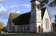 |
Stateburg Stateburg, South Carolina Stateburg is a census-designated place in the High Hills of Santee in Sumter County, South Carolina, United States. The population was 1,264 at the 2000 census. It is included in the Sumter, South Carolina Metropolitan Statistical Area... 33.9607436711°N 80.531944136°W |
Sumter | Gothic Revival Church constructed of rammed earth in 1852. Across the road from Borough House Borough House Plantation Borough House Plantation, also known as Borough House, Hillcrest Plantation and Anderson Place, is an historic place in Stateburg, in the High Hills of Santee near Sumter, South Carolina.... |
||
| USS CLAMAGORE (Submarine) USS Clamagore (SS-343) USS Clamagore was a Balao-class submarine of the United States Navy, built in 1945 and still in training when World War II ended. It was named for the clamagore or blue parrotfish Scarus coeruleus found in the West Indies and along the Atlantic coast as far north as Maryland.Clamagore was built... |
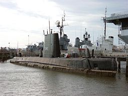 |
Mount Pleasant Mount Pleasant, South Carolina Mount Pleasant is a large affluent suburban town in Charleston County, South Carolina, United States. It is a member of the Charleston–North Charleston–Summerville Metropolitan Statistical Area, for statistical purpose only, as designated by the U.S. Office of Management and Budget.... 32.7878828892°N 79.9077444154°W |
Charleston Charleston County, South Carolina Charleston County is a county located in the U.S. state of South Carolina. According to a 2005 U.S. Census Bureau estimate, its population was 330,368. Its county seat is Charleston. It is the third-most populous county in the state . Charleston County was created in 1901 by an act of the South... |
A submarine Submarine A submarine is a watercraft capable of independent operation below the surface of the water. It differs from a submersible, which has more limited underwater capability... that was in training when World War II World War II World War II, or the Second World War , was a global conflict lasting from 1939 to 1945, involving most of the world's nations—including all of the great powers—eventually forming two opposing military alliances: the Allies and the Axis... ended |
||
| Coker Experimental Farms Coker Experimental Farms Coker Experimental Farms, also known as Coker Pedigreed Seed Company, is a National Historic Landmark site in South Carolina.It was declared to be a National Historic Landmark in 1964... |
Hartsville Hartsville, South Carolina Hartsville is a small city in Darlington County, South Carolina, United States. The population was 7,764 at the 2010 census.-Geography:Hartsville is located at .... |
Darlington | Site of crop-improvement experiments that "played a great role in the agricultural revolution of the South" | |||
| College of Charleston College of Charleston The College of Charleston is a public, sea-grant and space-grant university located in historic downtown Charleston, South Carolina, United States... |
 |
Charleston Charleston, South Carolina Charleston is the second largest city in the U.S. state of South Carolina. It was made the county seat of Charleston County in 1901 when Charleston County was founded. The city's original name was Charles Towne in 1670, and it moved to its present location from a location on the west bank of the... |
Charleston Charleston County, South Carolina Charleston County is a county located in the U.S. state of South Carolina. According to a 2005 U.S. Census Bureau estimate, its population was 330,368. Its county seat is Charleston. It is the third-most populous county in the state . Charleston County was created in 1901 by an act of the South... |
Historic and attractive campus center; Main Building, the Library, and Gate Lodge completed by 1856, designed by William Strickland William Strickland (architect) William Strickland , was a noted architect in nineteenth-century Philadelphia, Pennsylvania and Nashville, Tennessee.-Life and career:... , Edward Brickell White Edward Brickell White Edward Brickell White , also known as E. B. White, was an American architect. He was known for his Gothic Revival architecture and his use of Roman and Greek designs.-Life:... , and George E. Walker |
||
| Drayton Hall Drayton Hall Drayton Hall, in the South Carolina "Lowcountry" and about 15 miles northwest of Charleston, South Carolina and directly across the Ashley River from North Charleston, South Carolina, is one of the most handsome examples of Palladian architecture in North America.The house was built for John... |
 |
Charleston Charleston, South Carolina Charleston is the second largest city in the U.S. state of South Carolina. It was made the county seat of Charleston County in 1901 when Charleston County was founded. The city's original name was Charles Towne in 1670, and it moved to its present location from a location on the west bank of the... |
Charleston Charleston County, South Carolina Charleston County is a county located in the U.S. state of South Carolina. According to a 2005 U.S. Census Bureau estimate, its population was 330,368. Its county seat is Charleston. It is the third-most populous county in the state . Charleston County was created in 1901 by an act of the South... |
Plantation house built in 1742 of Palladian architectural style Palladian architecture Palladian architecture is a European style of architecture derived from the designs of the Venetian architect Andrea Palladio . The term "Palladian" normally refers to buildings in a style inspired by Palladio's own work; that which is recognised as Palladian architecture today is an evolution of... |
||
| Exchange and Provost Exchange and Provost Exchange and Provost, also known as the Old Exchange & Provost Dungeon, Custom House and Half-Moon Battery, and The Exchange, was built in 1767.... |
.jpg) |
Charleston Charleston, South Carolina Charleston is the second largest city in the U.S. state of South Carolina. It was made the county seat of Charleston County in 1901 when Charleston County was founded. The city's original name was Charles Towne in 1670, and it moved to its present location from a location on the west bank of the... 32.776842°N 79.927009°W |
Charleston Charleston County, South Carolina Charleston County is a county located in the U.S. state of South Carolina. According to a 2005 U.S. Census Bureau estimate, its population was 330,368. Its county seat is Charleston. It is the third-most populous county in the state . Charleston County was created in 1901 by an act of the South... |
Variously a customhouse, mercantile exchange, military prison and barracks, post office, and meeting place of the 1790 State Legislature | ||
| Farmers' and Exchange Bank Farmers' and Exchange Bank Farmers' and Exchange Bank is a Moorish Revival-style bank building built in 1854 in Charleston, South Carolina. It was rehabilitated in 1970 and again in 1990.... |
.jpg) |
Charleston Charleston, South Carolina Charleston is the second largest city in the U.S. state of South Carolina. It was made the county seat of Charleston County in 1901 when Charleston County was founded. The city's original name was Charles Towne in 1670, and it moved to its present location from a location on the west bank of the... 32.777435°N 79.926964°W |
Charleston Charleston County, South Carolina Charleston County is a county located in the U.S. state of South Carolina. According to a 2005 U.S. Census Bureau estimate, its population was 330,368. Its county seat is Charleston. It is the third-most populous county in the state . Charleston County was created in 1901 by an act of the South... |
A unique Moorish-style bank building built in 1854 | ||
| Fig Island Fig island Fig Island, also known as 38CH42, is an archaeological site on the Atlantic Coast of South Carolina, consisting of three shell rings. Shell rings are curved shell middens wholly or partially surrounding a clear central area or plaza... |
image pending | Charleston Charleston, South Carolina Charleston is the second largest city in the U.S. state of South Carolina. It was made the county seat of Charleston County in 1901 when Charleston County was founded. The city's original name was Charles Towne in 1670, and it moved to its present location from a location on the west bank of the... |
Charleston Charleston County, South Carolina Charleston County is a county located in the U.S. state of South Carolina. According to a 2005 U.S. Census Bureau estimate, its population was 330,368. Its county seat is Charleston. It is the third-most populous county in the state . Charleston County was created in 1901 by an act of the South... |
Archaeological site Archaeological site An archaeological site is a place in which evidence of past activity is preserved , and which has been, or may be, investigated using the discipline of archaeology and represents a part of the archaeological record.Beyond this, the definition and geographical extent of a 'site' can vary widely,... that is "one of the most complex shell-ring sites" in the United States |
||
| Fireproof Building Fireproof Building The Fireproof Building, also known as County Records Building, is located at 100 Meeting St., Charleston, South Carolina. It was designed by Robert Mills and constructed by John G. Spindle. It was completed by 1827. At that time, it was the most completely fireproof building in America and it is... |
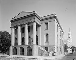 |
Charleston Charleston, South Carolina Charleston is the second largest city in the U.S. state of South Carolina. It was made the county seat of Charleston County in 1901 when Charleston County was founded. The city's original name was Charles Towne in 1670, and it moved to its present location from a location on the west bank of the... 32.776923°N 79.931052°W |
Charleston Charleston County, South Carolina Charleston County is a county located in the U.S. state of South Carolina. According to a 2005 U.S. Census Bureau estimate, its population was 330,368. Its county seat is Charleston. It is the third-most populous county in the state . Charleston County was created in 1901 by an act of the South... |
Designed by Robert Mills Robert Mills (architect) Robert Mills , most famously known for designing the Washington Monument, is sometimes called the first native born American to become a professional architect, though Charles Bulfinch perhaps has a clearer claim to this honor... to be the most fireproof Fireproof -Track List for Original 2002 Release:# "Fireproof" – 3:46# "Just 2 Get By" – 4:17# "Echelon" – 3:25# "Stay Up" – 3:40# "Behind Closed Doors" – 2:55# "Epidemic" – 3:14# "Hindsight" – 2:57# "Light at My Feet" – 3:28# "A Shame" – 3:17... building in America |
||
| First Baptist Church (Columbia) First Baptist Church (Columbia, South Carolina) The First Baptist Church in Columbia, South Carolina is a Greek Revival building built in 1856. A convention met here on December 17, 1860 which voted unanimously for South Carolina to secede from the United States, leading to the American Civil War.... |
Columbia Columbia, South Carolina Columbia is the state capital and largest city in the U.S. state of South Carolina. The population was 129,272 according to the 2010 census. Columbia is the county seat of Richland County, but a portion of the city extends into neighboring Lexington County. The city is the center of a metropolitan... 34.005864°N 81.033450°W |
Richland Richland County, South Carolina Richland County is a county located in the U.S. state of South Carolina. The 2000 U.S. census recorded its population to be 320,677. In 2010, the U.S. Census Bureau recorded that its population had reached 384,504. It is the second most populous county in South Carolina, behind only Greenville... |
Where the American Civil War American Civil War The American Civil War was a civil war fought in the United States of America. In response to the election of Abraham Lincoln as President of the United States, 11 southern slave states declared their secession from the United States and formed the Confederate States of America ; the other 25... started, with the secession of South Carolina from the Union. |
|||
| Fort Hill (John C. Calhoun House) | 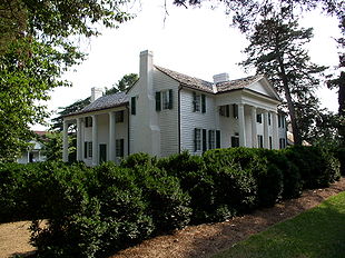 |
Clemson Clemson, South Carolina Clemson is a college town located in Pickens County in the U.S. state of South Carolina. The population was 11,939 at the 2000 census and center of an urban cluster with a total population of 42,199... 34.675976354°N 82.8392083668°W |
Pickens | Home of John C. Calhoun John C. Calhoun John Caldwell Calhoun was a leading politician and political theorist from South Carolina during the first half of the 19th century. Calhoun eloquently spoke out on every issue of his day, but often changed positions. Calhoun began his political career as a nationalist, modernizer, and proponent... , now within Clemson University Clemson University Clemson University is an American public, coeducational, land-grant, sea-grant, research university located in Clemson, South Carolina, United States.... campus. |
||
| William Gibbes House William Gibbes House The William Gibbes House, located at 64 South Battery, Charleston, South Carolina, was built for Mr. Gibbes between 1772 and 1788. The Smith family remodeled portions of the house in about 1800 in the Adamesque style including the marble steps in front. The cove-ceilinged ballroom is considered one... |
.jpg) |
Charleston Charleston, South Carolina Charleston is the second largest city in the U.S. state of South Carolina. It was made the county seat of Charleston County in 1901 when Charleston County was founded. The city's original name was Charles Towne in 1670, and it moved to its present location from a location on the west bank of the... 32.770701°N 79.934493°W |
Charleston Charleston County, South Carolina Charleston County is a county located in the U.S. state of South Carolina. According to a 2005 U.S. Census Bureau estimate, its population was 330,368. Its county seat is Charleston. It is the third-most populous county in the state . Charleston County was created in 1901 by an act of the South... |
Adamesque style home with a beautiful ballroom, and exceptional wrought iron work and marble steps in front | ||
| Graniteville Historic District Graniteville Historic District (South Carolina) Graniteville Historic District is a historic district that was declared a National Historic Landmark in 1978. It comprises a canal, a cotton mill, and an entire company town of Carpenter Gothic and other wooden buildings. The South Carolina Department of Archives and History summary is here... |
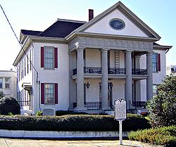 |
Graniteville Graniteville, South Carolina Graniteville is an unincorporated community in Aiken County, South Carolina, United States. It lies along U.S. 1, five miles west of Aiken. The town lies in Horse Creek Valley which originates in the nearby town of Vaucluse.... |
Aiken Aiken County, South Carolina Aiken County is a county located in the U.S. state of South Carolina. In 2000, its population was 142,552; in 2010, the U.S. Census Bureau estimated that its population had reached 160,099... |
Company town, of a company that did what?, with Gothic revival church and carpenter gothic Carpenter Gothic Carpenter Gothic, also sometimes called Carpenter's Gothic, and Rural Gothic, is a North American architectural style-designation for an application of Gothic Revival architectural detailing and picturesque massing applied to wooden structures built by house-carpenters... homes |
||
| Hampton Plantation Hampton Plantation Hampton Plantation, also known as Hampton Plantation House and Hampton Plantation State Historic Site is a building that evolved from a settler's home to become a Georgian style mansion... |
.jpg) |
McClellanville McClellanville, South Carolina McClellanville is a small fishing town in Charleston County, South Carolina, United States. The population was 459 at the 2000 census. It is situated on the Atlantic coast, on land surrounded by Francis Marion National Forest and has traditionally derived its livelihood from the sea and coastal... |
Charleston Charleston County, South Carolina Charleston County is a county located in the U.S. state of South Carolina. According to a 2005 U.S. Census Bureau estimate, its population was 330,368. Its county seat is Charleston. It is the third-most populous county in the state . Charleston County was created in 1901 by an act of the South... |
"South Carolina's finest example of a large two-and-a-half frame Georgian Georgian architecture Georgian architecture is the name given in most English-speaking countries to the set of architectural styles current between 1720 and 1840. It is eponymous for the first four British monarchs of the House of Hanover—George I of Great Britain, George II of Great Britain, George III of the United... plantation house" |
||
| Dubose Heyward House Dubose Heyward House Dubose Heyward House was a home of author Dubose Heyward.It was declared a National Historic Landmark in 1971.-References:... |
.jpg) |
Charleston Charleston, South Carolina Charleston is the second largest city in the U.S. state of South Carolina. It was made the county seat of Charleston County in 1901 when Charleston County was founded. The city's original name was Charles Towne in 1670, and it moved to its present location from a location on the west bank of the... 32.774663°N 79.929029°W |
Charleston Charleston County, South Carolina Charleston County is a county located in the U.S. state of South Carolina. According to a 2005 U.S. Census Bureau estimate, its population was 330,368. Its county seat is Charleston. It is the third-most populous county in the state . Charleston County was created in 1901 by an act of the South... |
Home of Dubose Heyward DuBose Heyward Edwin DuBose Heyward was a white American author best known for his 1925 novel Porgy. This novel was the basis for the play by the same name and, in turn, the opera Porgy and Bess with music by George Gershwin.-Life and career:Heyward was born in 1885 in Charleston, South Carolina and was a... , author of the novel Porgy Porgy Porgy is a novel written by American author DuBose Heyward in 1925, as well as a play Dorothy Heyward helped him to write which debuted in 1927.... . |
||
| Heyward-Washington House Heyward-Washington House Heyward-Washington House is a historic house museum in Charleston, South Carolina that is owned and operated by the Charleston Museum. Furnished for the late 18th century, the house includes a collection of Charleston-made furniture... |
.jpg) |
Charleston Charleston, South Carolina Charleston is the second largest city in the U.S. state of South Carolina. It was made the county seat of Charleston County in 1901 when Charleston County was founded. The city's original name was Charles Towne in 1670, and it moved to its present location from a location on the west bank of the... 32.775337°N 79.929125°W |
Charleston Charleston County, South Carolina Charleston County is a county located in the U.S. state of South Carolina. According to a 2005 U.S. Census Bureau estimate, its population was 330,368. Its county seat is Charleston. It is the third-most populous county in the state . Charleston County was created in 1901 by an act of the South... |
|||
| Hibernian Hall |  |
Charleston Charleston, South Carolina Charleston is the second largest city in the U.S. state of South Carolina. It was made the county seat of Charleston County in 1901 when Charleston County was founded. The city's original name was Charles Towne in 1670, and it moved to its present location from a location on the west bank of the... 32.777469°N 79.931148°W |
Charleston Charleston County, South Carolina Charleston County is a county located in the U.S. state of South Carolina. According to a 2005 U.S. Census Bureau estimate, its population was 330,368. Its county seat is Charleston. It is the third-most populous county in the state . Charleston County was created in 1901 by an act of the South... |
One of the "Four Corners of the Law Four Corners of the Law The Four Corners of the Law is a term commonly used to refer to the intersection of Meeting and Broad Streets in Charleston, South Carolina. The term was coined in the 1930's by Robert Ripley, creator of Ripley's Believe it or Not!. , constructed between 1752 and 1761, stands on the southeast... " |
||
| Hopsewee Hopsewee Hopsewee Plantation, also known as Thomas Lynch, Jr., Birthplace or Hopsewee-on-the-Santee, is a house built in 1749 near Georgetown, South Carolina... |
Georgetown Georgetown, South Carolina Georgetown is the third oldest city in the U.S. state of South Carolina and the county seat of Georgetown County, in the Low Country. Located on Winyah Bay at the confluence of the Great Pee Dee River, Waccamaw River, and Sampit River, Georgetown is the second largest seaport in South Carolina,... |
Georgetown | Plantation mansion built in 1749; the birthplace of Thomas Lynch, Jr. Thomas Lynch, Jr. Thomas Lynch, Jr. was a signer of the United States Declaration of Independence as a representative of South Carolina; his father was unable to sign the Declaration of Independence because of illness.-Biography:... |
|||
| Huguenot Church Huguenot Church The Huguenot Church, built in 1844 in Charleston, South Carolina, was the first Gothic Revival church in South Carolina and was designed by architect Edward Brickell White... |
.jpg) |
Charleston Charleston, South Carolina Charleston is the second largest city in the U.S. state of South Carolina. It was made the county seat of Charleston County in 1901 when Charleston County was founded. The city's original name was Charles Towne in 1670, and it moved to its present location from a location on the west bank of the... 32.778090°N 79.929312°W |
Charleston Charleston County, South Carolina Charleston County is a county located in the U.S. state of South Carolina. According to a 2005 U.S. Census Bureau estimate, its population was 330,368. Its county seat is Charleston. It is the third-most populous county in the state . Charleston County was created in 1901 by an act of the South... |
Gothic Revival church built in 1844; designed by architect E. B. White | ||
| Kahal Kadosh Beth Elohim Congregation Kahal Kadosh Beth Elohim Congregation Kahal Kadosh Beth Elohim is a historic synagogue located at 90 Hasell Street in Charleston, South Carolina... |
 |
Charleston Charleston, South Carolina Charleston is the second largest city in the U.S. state of South Carolina. It was made the county seat of Charleston County in 1901 when Charleston County was founded. The city's original name was Charles Towne in 1670, and it moved to its present location from a location on the west bank of the... 32.781979°N 79.932948°W |
Charleston Charleston County, South Carolina Charleston County is a county located in the U.S. state of South Carolina. According to a 2005 U.S. Census Bureau estimate, its population was 330,368. Its county seat is Charleston. It is the third-most populous county in the state . Charleston County was created in 1901 by an act of the South... |
Greek revival building from 1840; second oldest synagogue Synagogue A synagogue is a Jewish house of prayer. This use of the Greek term synagogue originates in the Septuagint where it sometimes translates the Hebrew word for assembly, kahal... in continuous use in the United States |
||
| USS LAFFEY (Destroyer) USS Laffey (DD-724) USS Laffey , an , was the 2nd ship of the United States Navy to be named for Bartlett Laffey. Seaman Laffey was awarded the Medal of Honor for his stand against Confederate forces on 5 March 1864... |
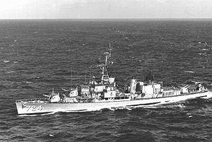 |
Mount Pleasant Mount Pleasant, South Carolina Mount Pleasant is a large affluent suburban town in Charleston County, South Carolina, United States. It is a member of the Charleston–North Charleston–Summerville Metropolitan Statistical Area, for statistical purpose only, as designated by the U.S. Office of Management and Budget.... 32.7878828892°N 79.9077444154°W |
Charleston Charleston County, South Carolina Charleston County is a county located in the U.S. state of South Carolina. According to a 2005 U.S. Census Bureau estimate, its population was 330,368. Its county seat is Charleston. It is the third-most populous county in the state . Charleston County was created in 1901 by an act of the South... |
A destroyer Destroyer In naval terminology, a destroyer is a fast and maneuverable yet long-endurance warship intended to escort larger vessels in a fleet, convoy or battle group and defend them against smaller, powerful, short-range attackers. Destroyers, originally called torpedo-boat destroyers in 1892, evolved from... |
||
| Lancaster County Courthouse | Lancaster Lancaster, South Carolina Lancaster is a city in Lancaster County, South Carolina which is in the United States and is located 35 miles south of Charlotte, North Carolina and 20 miles east of Rock Hill, South Carolina. As of the United States Census of 2010, the city population was 10,160. It is the county seat of... 34.721264°N 80.771369°W |
Lancaster | Courthouse in continuous use since 1828; designed by Robert Mills Robert Mills (architect) Robert Mills , most famously known for designing the Washington Monument, is sometimes called the first native born American to become a professional architect, though Charles Bulfinch perhaps has a clearer claim to this honor... |
|||
| Lancaster County Jail Lancaster County Jail (Lancaster, South Carolina) The Lancaster County Jail is a three-story stuccoed building in Lancaster, South Carolina that was built in 1823 and reflected innovations in jail design... |
_jail.jpg) |
Lancaster Lancaster, South Carolina Lancaster is a city in Lancaster County, South Carolina which is in the United States and is located 35 miles south of Charlotte, North Carolina and 20 miles east of Rock Hill, South Carolina. As of the United States Census of 2010, the city population was 10,160. It is the county seat of... 34.718335°N 80.771270°W |
Lancaster | Progressively designed jail, for its day | ||
| Joseph Manigault House Joseph Manigault House Joseph Manigault House is a historic house museum in Charleston, South Carolina that is owned and operated by the Charleston Museum. The house is significant for its Adam style architecture, and was designed by Gabriel Manigault to be the home of his brother, and was completed in 1803.It was... |
.jpg) |
Charleston Charleston, South Carolina Charleston is the second largest city in the U.S. state of South Carolina. It was made the county seat of Charleston County in 1901 when Charleston County was founded. The city's original name was Charles Towne in 1670, and it moved to its present location from a location on the west bank of the... 32.788703°N 79.935558°W |
Charleston Charleston County, South Carolina Charleston County is a county located in the U.S. state of South Carolina. According to a 2005 U.S. Census Bureau estimate, its population was 330,368. Its county seat is Charleston. It is the third-most populous county in the state . Charleston County was created in 1901 by an act of the South... |
Home designed by Gabriel Manigault Gabriel Manigault Gabriel Manigault was an American architect. He was born in Charleston, South Carolina, went to study in Geneva, Switzerland, and London, and came back to Charleston after the American Revolutionary War. He died in Philadelphia, Pennsylvania... |
||
| Market Hall and Sheds Market Hall and Sheds Market Hall and the sheds of the City Market, or Centre Market, comprise a historic market complex in downtown Charleston, South Carolina, USA... |
.jpg) |
Charleston Charleston, South Carolina Charleston is the second largest city in the U.S. state of South Carolina. It was made the county seat of Charleston County in 1901 when Charleston County was founded. The city's original name was Charles Towne in 1670, and it moved to its present location from a location on the west bank of the... 32.780720°N 79.931515°W |
Charleston Charleston County, South Carolina Charleston County is a county located in the U.S. state of South Carolina. According to a 2005 U.S. Census Bureau estimate, its population was 330,368. Its county seat is Charleston. It is the third-most populous county in the state . Charleston County was created in 1901 by an act of the South... |
Greek Revival market place and sheds | ||
| Marshlands (Dr. James Robert Verdier House) Marshlands (Beaufort, South Carolina) Marshlands, also known as James Robert Verdier House, is a house in Beaufort, South Carolina. It was the home of Dr. James Robert Verdier, who discovered a treatment for yellow fever.It was declared a National Historic Landmark in 1973.... |
.jpg) |
Beaufort Beaufort, South Carolina Beaufort is a city in and the county seat of Beaufort County, South Carolina, United States. Chartered in 1711, it is the second-oldest city in South Carolina, behind Charleston. The city's population was 12,361 in the 2010 census. It is located in the Hilton Head Island-Beaufort Micropolitan... 32.433520°N 80.665831°W |
Beaufort Beaufort County, South Carolina -National protected areas:*Ernest F. Hollings ACE Basin National Wildlife Refuge *Pinckney Island National Wildlife Refuge-Demographics:As of the census of 2000, there were 155,215 people, 45,532 households, and 33,056 families residing in the county. The population density was 206 people per... |
Home of Dr. James Robert Verdier, who discovered a treatment for yellow fever | ||
| Middleburg Plantation Middleburg Plantation Middleburg Plantation is a plantation founded by a French Huguenot in 1699 on the Cooper River near Huger, South Carolina.It was declared a National Historic Landmark in 1970.... |
.jpg) |
Huger Huger, South Carolina Huger is an unincorporated community in Berkeley County, South Carolina, United States. In South Carolina, Huger is pronounced . It is part of the Charleston–North Charleston–Summerville Metropolitan Statistical Area.... |
Berkeley Berkeley County, South Carolina Berkeley County is a county in the U.S. state of South Carolina. In 2000, its population was 142,651. The 2005 Census Bureau estimate placed the population at 151,673. Its county seat is Moncks Corner.... |
Plantation mansion | ||
| Middleton Place Middleton Place Middleton Place is a plantation in Dorchester County, directly across the Ashley River from North Charleston and about northwest of Charleston, in the U.S. state of South Carolina... |
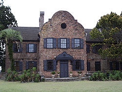 |
Summerville Summerville, South Carolina Summerville is a town in the U.S. state of South Carolina situated mostly in Dorchester County with small portions in Berkeley, and Charleston counties. It is part of the Charleston-North Charleston-Summerville Metropolitan Statistical Area as designated for statistical purposes by the U.S. Office... |
Dorchester | Plantation mansion and botanical gardens on the Ashley River | ||
| Millford Plantation Millford Plantation Millford Plantation is an historic place located on SC 261 west of Pinewood, South Carolina. Its monumental two-story Greek Revival mansion built in 1839 for John L... |
.jpg) |
Pinewood Pinewood, South Carolina Pinewood is a town located on South Carolina Highway 261 at the southern entrance to the High Hills of Santee in Sumter County, South Carolina, United States. The population was 459 at the 2000 census... |
Sumter | A monumental 2-story Greek Revival mansion built in 1839 and meticulously restored in the early 1990s. | ||
| Clark Mills Studio Clark Mills Studio Clark Mills Studio was the studio of self-taught sculptor Clark Mills, who created the bronze statue of Andrew Jackson in Lafayette Square in Washington, D. C.... |
.jpg) |
Charleston Charleston, South Carolina Charleston is the second largest city in the U.S. state of South Carolina. It was made the county seat of Charleston County in 1901 when Charleston County was founded. The city's original name was Charles Towne in 1670, and it moved to its present location from a location on the west bank of the... 32.776597°N 79.929503°W |
Charleston Charleston County, South Carolina Charleston County is a county located in the U.S. state of South Carolina. According to a 2005 U.S. Census Bureau estimate, its population was 330,368. Its county seat is Charleston. It is the third-most populous county in the state . Charleston County was created in 1901 by an act of the South... |
Studio of self-taught sculptor Clark Mills Clark Mills (sculptor) Clark Mills was an American sculptor, best known for three versions of an equestrian statue of Andrew Jackson, located in Washington, D.C., Nashville, Tennessee, and New Orleans, Louisiana.-Life:... |
||
| Robert Mills House Robert Mills House The Robert Mills House, also known as Robert Mills Historic House and Park or theAinsley Hall House, is a house in Columbia, South Carolina that was designed by Robert Mills .... |
.jpg) |
Columbia Columbia, South Carolina Columbia is the state capital and largest city in the U.S. state of South Carolina. The population was 129,272 according to the 2010 census. Columbia is the county seat of Richland County, but a portion of the city extends into neighboring Lexington County. The city is the center of a metropolitan... |
Richland Richland County, South Carolina Richland County is a county located in the U.S. state of South Carolina. The 2000 U.S. census recorded its population to be 320,677. In 2010, the U.S. Census Bureau recorded that its population had reached 384,504. It is the second most populous county in South Carolina, behind only Greenville... |
Home designed by architect Robert Mills Robert Mills (architect) Robert Mills , most famously known for designing the Washington Monument, is sometimes called the first native born American to become a professional architect, though Charles Bulfinch perhaps has a clearer claim to this honor... |
||
| Mills Building, South Carolina State Hospital Mills Building, South Carolina State Hospital Mills Building, South Carolina State Hospital, formerly known as the South Carolina Lunatic Asylum, is a building designed by Robert Mills in Columbia, South Carolina.... |
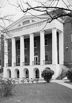 |
Columbia Columbia, South Carolina Columbia is the state capital and largest city in the U.S. state of South Carolina. The population was 129,272 according to the 2010 census. Columbia is the county seat of Richland County, but a portion of the city extends into neighboring Lexington County. The city is the center of a metropolitan... 34.015160°N 81.034151°W |
Richland Richland County, South Carolina Richland County is a county located in the U.S. state of South Carolina. The 2000 U.S. census recorded its population to be 320,677. In 2010, the U.S. Census Bureau recorded that its population had reached 384,504. It is the second most populous county in South Carolina, behind only Greenville... |
Designed by Robert Mills Robert Mills (architect) Robert Mills , most famously known for designing the Washington Monument, is sometimes called the first native born American to become a professional architect, though Charles Bulfinch perhaps has a clearer claim to this honor... , used from 1827 to 1937; "the oldest building in the country to be used continuously as a mental institution and one of the first mental hospitals built with public funds" |
||
| Mulberry Plantation Mulberry Plantation (Moncks Corner, South Carolina) Mulberry Plantation, built in 1714 by Thomas Broughton, who became the Royal governor of South Carolina, is one of the earliest plantation homes in the United States... |
.jpg) |
Moncks Corner Moncks Corner, South Carolina Moncks Corner is a town in and the county seat of Berkeley County, South Carolina, United States. The population was 5,952 at the 2000 census.... |
Berkeley Berkeley County, South Carolina Berkeley County is a county in the U.S. state of South Carolina. In 2000, its population was 142,651. The 2005 Census Bureau estimate placed the population at 151,673. Its county seat is Moncks Corner.... |
Built in 1714 for a Royal governor; one of the earliest plantation homes in the United States | ||
| Mulberry Plantation (James and Mary Boykin Chesnut House) Mulberry Plantation (James and Mary Boykin Chesnut House) Mulberry Plantation , also known as Mulberry Plantation "is nationally significant in the area of American literature for its association with Mary Boykin Chesnut's remarkable first-hand account of southern society during the Civil War... |
.jpg) |
Camden Camden, South Carolina Camden is the fourth oldest city in the U.S. state of South Carolina and is also the county seat of Kershaw County, South Carolina, United States. The population was an estimated 7,103 in 2009... |
Kershaw | Home of Mary Boykin Chesnut Mary Boykin Chesnut Mary Boykin Chesnut, born Mary Boykin Miller , was a South Carolina author noted for a book published as her Civil War diary, a "vivid picture of a society in the throes of its life-and-death struggle." She described the war from within her upper-class circles of Southern planter society, but... and source for her Civil War-time diary describing southern society, "acknowledged as the most important piece of Confederate literature" |
||
| Ninety-Six and Star Fort Ninety Six National Historic Site Ninety Six National Historic Site, also known as Old Ninety Six and Star Fort, is a United States National Historic Site located about 60 miles south of Greenville, South Carolina... |
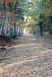 |
Ninety Six Ninety Six, South Carolina Ninety Six is a town in Greenwood County, South Carolina, United States. The population was 1,936 at the 2000 census.-Geography:Ninety Six is located at .... |
Greenwood | |||
| Old Marine Hospital (Charleston) Old Marine Hospital Old Marine Hospital was designed by Robert Mills. Construction started in 1831 and was completed in 1833. It is a Gothic revival building at 20 Franklin St. in Charleston, South Carolina. It was built for sick sailors and other transient persons.... |
.jpg) |
Charleston Charleston, South Carolina Charleston is the second largest city in the U.S. state of South Carolina. It was made the county seat of Charleston County in 1901 when Charleston County was founded. The city's original name was Charles Towne in 1670, and it moved to its present location from a location on the west bank of the... 32.777621°N 79.937483°W |
Charleston Charleston County, South Carolina Charleston County is a county located in the U.S. state of South Carolina. According to a 2005 U.S. Census Bureau estimate, its population was 330,368. Its county seat is Charleston. It is the third-most populous county in the state . Charleston County was created in 1901 by an act of the South... |
Gothic Revival design by Robert Mills Robert Mills (architect) Robert Mills , most famously known for designing the Washington Monument, is sometimes called the first native born American to become a professional architect, though Charles Bulfinch perhaps has a clearer claim to this honor... built in 1833 to serve sick sailors and other transients |
||
| Parish House of the Circular Congregational Church Circular Congregational Church and Parish House Circular Congregational Church and Parish House is a church in Charleston, South Carolina that was built in Richardsonian Romanesque style circa 1892 , and its Greek revival-style parish house built in about 1806. The parish house was designed by Robert Mills, along with the original church on the... |
.jpg) |
Charleston Charleston, South Carolina Charleston is the second largest city in the U.S. state of South Carolina. It was made the county seat of Charleston County in 1901 when Charleston County was founded. The city's original name was Charles Towne in 1670, and it moved to its present location from a location on the west bank of the... 32.779032°N 79.931308°W |
Charleston Charleston County, South Carolina Charleston County is a county located in the U.S. state of South Carolina. According to a 2005 U.S. Census Bureau estimate, its population was 330,368. Its county seat is Charleston. It is the third-most populous county in the state . Charleston County was created in 1901 by an act of the South... |
Parish house designed by Robert Mills Robert Mills (architect) Robert Mills , most famously known for designing the Washington Monument, is sometimes called the first native born American to become a professional architect, though Charles Bulfinch perhaps has a clearer claim to this honor... |
||
| Penn School Historic District Penn School Historic District Penn School Historic District, known also as Penn School or Penn Center Historic District, is a historic district on St. Helena Island in South Carolina... |
.jpg) |
Frogmore Frogmore, South Carolina Frogmore is an unincorporated community in Beaufort County, South Carolina, United States, along U.S. Route 21. Halfway between the Beaufort and Hunting Island State Park, the Frogmore area is primarily rural with easy access to the coast. The Beaufort airport is approximately three miles from... |
Beaufort Beaufort County, South Carolina -National protected areas:*Ernest F. Hollings ACE Basin National Wildlife Refuge *Pinckney Island National Wildlife Refuge-Demographics:As of the census of 2000, there were 155,215 people, 45,532 households, and 33,056 families residing in the county. The population density was 206 people per... |
School for freed slaves, Gullahs, on St. Helena Island which was occupied by the Union near the outset of the American Civil War American Civil War The American Civil War was a civil war fought in the United States of America. In response to the election of Abraham Lincoln as President of the United States, 11 southern slave states declared their secession from the United States and formed the Confederate States of America ; the other 25... |
||
| Pompion Hill Chapel Pompion Hill Chapel Pompion Hill Chapel is small "back parish" church near Huger, South Carolina that was built in 1763.It was declared a National Historic Landmark in 19.It is "original and unaltered."- External links :... |
.jpg) |
Huger Huger, South Carolina Huger is an unincorporated community in Berkeley County, South Carolina, United States. In South Carolina, Huger is pronounced . It is part of the Charleston–North Charleston–Summerville Metropolitan Statistical Area.... |
Berkeley Berkeley County, South Carolina Berkeley County is a county in the U.S. state of South Carolina. In 2000, its population was 142,651. The 2005 Census Bureau estimate placed the population at 151,673. Its county seat is Moncks Corner.... |
Beautiful small "back parish" church built in 1763, unaltered | ||
| Powder Magazine | 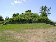 |
Charleston Charleston, South Carolina Charleston is the second largest city in the U.S. state of South Carolina. It was made the county seat of Charleston County in 1901 when Charleston County was founded. The city's original name was Charles Towne in 1670, and it moved to its present location from a location on the west bank of the... 32.779656°N 79.929791°W |
Charleston Charleston County, South Carolina Charleston County is a county located in the U.S. state of South Carolina. According to a 2005 U.S. Census Bureau estimate, its population was 330,368. Its county seat is Charleston. It is the third-most populous county in the state . Charleston County was created in 1901 by an act of the South... |
|||
| Joseph H. Rainey House Joseph H. Rainey House Joseph H. Rainey House, also known as Rainey-Camlin House, was the Georgetown, South Carolina home of the first black United States Congressman, Joseph H. Rainey, a former slave.-Rainey:... |
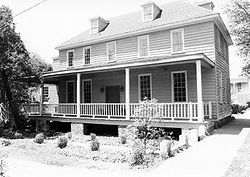 |
Georgetown Georgetown, South Carolina Georgetown is the third oldest city in the U.S. state of South Carolina and the county seat of Georgetown County, in the Low Country. Located on Winyah Bay at the confluence of the Great Pee Dee River, Waccamaw River, and Sampit River, Georgetown is the second largest seaport in South Carolina,... 33.368607°N 79.283817°W |
Georgetown | Home of the first black U.S. Congressman, Joseph H. Rainey, a former slave | ||
| Robert Barnwell Rhett House Robert Barnwell Rhett House Robert Barnwell Rhett House was the home of Robert Barnwell Rhett, an extreme secessionist politician. He opposed John C. Calhoun to lead the Bluffton Movement for separate state action on the Tariff of 1842... |
Charleston Charleston, South Carolina Charleston is the second largest city in the U.S. state of South Carolina. It was made the county seat of Charleston County in 1901 when Charleston County was founded. The city's original name was Charles Towne in 1670, and it moved to its present location from a location on the west bank of the... 32.786250°N 79.942502°W |
Charleston Charleston County, South Carolina Charleston County is a county located in the U.S. state of South Carolina. According to a 2005 U.S. Census Bureau estimate, its population was 330,368. Its county seat is Charleston. It is the third-most populous county in the state . Charleston County was created in 1901 by an act of the South... |
Home of Robert Barnwell Rhett, an extreme secessionist politician, a leading fire-eater Fire-Eater Fire-Eater may refer to:* Fire eater, a performer who places flaming objects into their mouth and extinguishes them.* Fire-Eaters pro-slavery politicians who pushed for secession from the United States of America* An episode of the Dragon Ball anime.... at the Nashville Convention of 1850, which failed to endorse his aim of secession |
|||
| Robert William Roper House Robert William Roper House Robert William Roper House was built about 1838 in Charleston, South Carolina on land purchased by Robert W. Roper in May 1838. The authors of the nomination form for the National Register of Historic Places speculated that Edward B. White was the architect, although no evidence is given in... |
.jpg) |
Charleston Charleston, South Carolina Charleston is the second largest city in the U.S. state of South Carolina. It was made the county seat of Charleston County in 1901 when Charleston County was founded. The city's original name was Charles Towne in 1670, and it moved to its present location from a location on the west bank of the... 32.770529°N 79.928419°W |
Charleston Charleston County, South Carolina Charleston County is a county located in the U.S. state of South Carolina. According to a 2005 U.S. Census Bureau estimate, its population was 330,368. Its county seat is Charleston. It is the third-most populous county in the state . Charleston County was created in 1901 by an act of the South... |
A grandiose brick house, probably designed by Edward B. White | ||
| Nathaniel Russell House Nathaniel Russell House The Nathaniel Russell House is a historic house located in downtown Charleston, South Carolina near High Battery. It belonged to Nathaniel Russell, a Rhode Island merchant, who spent $80,000 on this Adamesque building before 1809. He and his wife, Sarah Russell, lived in the house during the early... |
Charleston Charleston, South Carolina Charleston is the second largest city in the U.S. state of South Carolina. It was made the county seat of Charleston County in 1901 when Charleston County was founded. The city's original name was Charles Towne in 1670, and it moved to its present location from a location on the west bank of the... 32.774177°N 79.930737°W |
Charleston Charleston County, South Carolina Charleston County is a county located in the U.S. state of South Carolina. According to a 2005 U.S. Census Bureau estimate, its population was 330,368. Its county seat is Charleston. It is the third-most populous county in the state . Charleston County was created in 1901 by an act of the South... |
Adamesque home built in 1809 with a 3-story self-supporting elliptical stairway | |||
| Edward Rutledge House Edward Rutledge House Edward Rutledge House, also known as Carter-May House is a house in Charleston, South Carolina. It was the home of Edward Rutledge, who was a signer of the Declaration of Independence and later was governor of South Carolina.... |
.jpg) |
Charleston Charleston, South Carolina Charleston is the second largest city in the U.S. state of South Carolina. It was made the county seat of Charleston County in 1901 when Charleston County was founded. The city's original name was Charles Towne in 1670, and it moved to its present location from a location on the west bank of the... 32.776202°N 79.933560°W |
Charleston Charleston County, South Carolina Charleston County is a county located in the U.S. state of South Carolina. According to a 2005 U.S. Census Bureau estimate, its population was 330,368. Its county seat is Charleston. It is the third-most populous county in the state . Charleston County was created in 1901 by an act of the South... |
Home of Edward Rutledge Edward Rutledge Edward Rutledge was an American politician and youngest signer of the United States Declaration of Independence. He later served as the 39th Governor of South Carolina.-Early years and career:... , a signer of the Declaration of Independence, and a governor of South Carolina |
||
| John Rutledge House John Rutledge House Gov. John Rutledge House, also known as John Rutledge House, is a house at 116 Broad Street in Charleston, South Carolina. Completed in 1763 by an unknown architect, it was the home of John Rutledge, a governor of South Carolina and a signer of the U.S. Constitution... |
.jpg) |
Charleston Charleston, South Carolina Charleston is the second largest city in the U.S. state of South Carolina. It was made the county seat of Charleston County in 1901 when Charleston County was founded. The city's original name was Charles Towne in 1670, and it moved to its present location from a location on the west bank of the... 32.776231°N 79.933563°W |
Charleston Charleston County, South Carolina Charleston County is a county located in the U.S. state of South Carolina. According to a 2005 U.S. Census Bureau estimate, its population was 330,368. Its county seat is Charleston. It is the third-most populous county in the state . Charleston County was created in 1901 by an act of the South... |
Home of Gov. John Rutledge John Rutledge John Rutledge was an American statesman and judge. He was the first Governor of South Carolina following the signing of the Declaration of Independence, the 31st overall... , a signer of the U.S. Constitution. |
||
| St. James Church, Goose Creek St. James Church (Goose Creek, South Carolina) St. James' Church, Goose Creek is a church near Goose Creek, South Carolina. Its decorations include cherubs in stucco and a pelican feeding her young.It was declared a National Historic Landmark in 1970.... |
.jpg) |
Goose Creek Goose Creek, South Carolina Goose Creek is a city in Berkeley county in the U.S. state of South Carolina. The population was 35,938 at the 2010 census. Most of the Naval Weapons Station Charleston is in Goose Creek. As defined by the U.S. Office of Management and Budget, and used by the U.S... 32.9736161772°N 80.0295944031°W |
Berkeley Berkeley County, South Carolina Berkeley County is a county in the U.S. state of South Carolina. In 2000, its population was 142,651. The 2005 Census Bureau estimate placed the population at 151,673. Its county seat is Moncks Corner.... |
Small church | ||
| St. James Church, Santee St. James Episcopal Church (Santee, South Carolina) St. James Church, Santee, also known as St. James Episcopal Church, Santee, is a church near Georgetown, South Carolina.It was declared a National Historic Landmark in 1970.-External links:*, at Historic American Building Survey... |
.jpg) |
Georgetown Georgetown, South Carolina Georgetown is the third oldest city in the U.S. state of South Carolina and the county seat of Georgetown County, in the Low Country. Located on Winyah Bay at the confluence of the Great Pee Dee River, Waccamaw River, and Sampit River, Georgetown is the second largest seaport in South Carolina,... 33.1701661209°N 79.465689955°W |
Charleston Charleston County, South Carolina Charleston County is a county located in the U.S. state of South Carolina. According to a 2005 U.S. Census Bureau estimate, its population was 330,368. Its county seat is Charleston. It is the third-most populous county in the state . Charleston County was created in 1901 by an act of the South... |
Small church | ||
| Saint Michael's Episcopal Church St. Michael's Episcopal Church (Charleston, South Carolina) St. Michael's Episcopal Church is an historic Episcopal church and the oldest surviving religious structure in Charleston, South Carolina. It is located at Broad and Meeting streets on one of the Four Corners of the Law, and represents ecclesiastical law. It was built in the 1750s by order of the... |
.jpg) |
Charleston Charleston, South Carolina Charleston is the second largest city in the U.S. state of South Carolina. It was made the county seat of Charleston County in 1901 when Charleston County was founded. The city's original name was Charles Towne in 1670, and it moved to its present location from a location on the west bank of the... 32.775963°N 79.930931°W |
Charleston Charleston County, South Carolina Charleston County is a county located in the U.S. state of South Carolina. According to a 2005 U.S. Census Bureau estimate, its population was 330,368. Its county seat is Charleston. It is the third-most populous county in the state . Charleston County was created in 1901 by an act of the South... |
A church. | ||
| St. Philip's Episcopal Church (Charleston) St. Philip's Episcopal Church (Charleston, South Carolina) St. Philip's Episcopal Church is an historic Episcopal church in the French Quarter neighborhood of Charleston, South Carolina. Its National Historic Landmark description states: "Built in 1836 , this stuccoed brick church features an imposing tower designed in the Wren-Gibbs tradition... |
.jpg) |
Charleston Charleston, South Carolina Charleston is the second largest city in the U.S. state of South Carolina. It was made the county seat of Charleston County in 1901 when Charleston County was founded. The city's original name was Charles Towne in 1670, and it moved to its present location from a location on the west bank of the... 32.778874°N 79.929469°W |
Charleston Charleston County, South Carolina Charleston County is a county located in the U.S. state of South Carolina. According to a 2005 U.S. Census Bureau estimate, its population was 330,368. Its county seat is Charleston. It is the third-most populous county in the state . Charleston County was created in 1901 by an act of the South... |
Church with E. B. White Edward Brickell White Edward Brickell White , also known as E. B. White, was an American architect. He was known for his Gothic Revival architecture and his use of Roman and Greek designs.-Life:... -designed steeple |
||
| St. Stephen's Episcopal Church St. Stephen's Episcopal Church (St. Stephen, South Carolina) St. Stephen's Episcopal Church is an historic Episcopal church located at 196 Brick Church Circle in St. Stephen, South Carolina. On April 15, 1970, St. Stephen's was added to the National Register of Historic Places, and was declared a National Historic Landmark.-History:St... |
.jpg) |
St. Stephen St. Stephen, South Carolina St. Stephen is a town in Berkeley County, South Carolina, United States. The population was 1,776 at the 2000 census.As defined by the U.S. Office of Management and Budget, and used by the U.S. Census Bureau for statistical purposes only, St. Stephen is included within the Charleston-North... |
Berkeley Berkeley County, South Carolina Berkeley County is a county in the U.S. state of South Carolina. In 2000, its population was 142,651. The 2005 Census Bureau estimate placed the population at 151,673. Its county seat is Moncks Corner.... |
A small Georgian Georgian architecture Georgian architecture is the name given in most English-speaking countries to the set of architectural styles current between 1720 and 1840. It is eponymous for the first four British monarchs of the House of Hanover—George I of Great Britain, George II of Great Britain, George III of the United... brick country church with a high gambrel Gambrel A gambrel is a usually-symmetrical two-sided roof with two slopes on each side. The upper slope is positioned at a shallow angle, while the lower slope is steep. This design provides the advantages of a sloped roof while maximizing headroom on the building's upper level... roof. |
||
| Simmons-Edwards House Simmons-Edwards House The large, neoclassical Simmons-Edwards House was built for Francis Simmons, a Johns Island planter, about 1800. The house, located at 14 Legare St., Charleston, South Carolina, is famous for its large brick gates with decorative wrought iron. The gates, which were installed by George Edwards ... |
.jpg) |
Charleston Charleston, South Carolina Charleston is the second largest city in the U.S. state of South Carolina. It was made the county seat of Charleston County in 1901 when Charleston County was founded. The city's original name was Charles Towne in 1670, and it moved to its present location from a location on the west bank of the... 32.772912°N 79.933969°W |
Charleston Charleston County, South Carolina Charleston County is a county located in the U.S. state of South Carolina. According to a 2005 U.S. Census Bureau estimate, its population was 330,368. Its county seat is Charleston. It is the third-most populous county in the state . Charleston County was created in 1901 by an act of the South... |
Known as the "Pineapple Gates House" by locals, referring to finials upon its large brick gates | ||
| Robert Smalls House Robert Smalls House Robert Smalls House was a post-American Civil War home of Robert Smalls in Beaufort, South Carolina. An African-American slave, Smalls became a Union hero when he commandeered a Confederate ship out to Union blockaders. He went on to lead in combat and became a U.S... |
.jpg) |
Beaufort Beaufort, South Carolina Beaufort is a city in and the county seat of Beaufort County, South Carolina, United States. Chartered in 1711, it is the second-oldest city in South Carolina, behind Charleston. The city's population was 12,361 in the 2010 census. It is located in the Hilton Head Island-Beaufort Micropolitan... 32.435156°N 80.668186°W |
Beaufort Beaufort County, South Carolina -National protected areas:*Ernest F. Hollings ACE Basin National Wildlife Refuge *Pinckney Island National Wildlife Refuge-Demographics:As of the census of 2000, there were 155,215 people, 45,532 households, and 33,056 families residing in the county. The population density was 206 people per... |
Post-Civil War home of U.S. congressman Robert Smalls Robert Smalls Robert Smalls was an enslaved African American who, during and after the American Civil War, became a ship's pilot, sea captain, and politician. He freed himself and his family from slavery on May 13, 1862, by commandeering a Confederate transport ship, the Planter, to freedom in Charleston harbor... , a former slave who commandeered a Confederate ship out to Union lines |
||
| Snee Farm Charles Pinckney National Historic Site Charles Pinckney National Historic Site preserves a portion of Charles Pinckney's Snee Farm. The site is located at 1254 Long Point Road, Mount Pleasant, South Carolina.... |
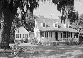 |
Mount Pleasant Mount Pleasant, South Carolina Mount Pleasant is a large affluent suburban town in Charleston County, South Carolina, United States. It is a member of the Charleston–North Charleston–Summerville Metropolitan Statistical Area, for statistical purpose only, as designated by the U.S. Office of Management and Budget.... |
Charleston Charleston County, South Carolina Charleston County is a county located in the U.S. state of South Carolina. According to a 2005 U.S. Census Bureau estimate, its population was 330,368. Its county seat is Charleston. It is the third-most populous county in the state . Charleston County was created in 1901 by an act of the South... |
NRHP 73001702. Try also Charles Pinckney National Historic Site Charles Pinckney National Historic Site Charles Pinckney National Historic Site preserves a portion of Charles Pinckney's Snee Farm. The site is located at 1254 Long Point Road, Mount Pleasant, South Carolina.... |
||
| Snow's Island Snow's Island "From approximately December 1780 to late March 1781, Snow's Island served as headquarters for forces led by Francis Marion , a South Carolina militia officer who is celebrated as the "Swamp Fox"... |
image pending | Johnsonville Johnsonville, South Carolina Johnsonville is a city in Florence County, South Carolina, United States. The population was 1,418 at the 2000 census. It is part of the Florence Metropolitan Statistical Area.-Geography:Johnsonville is located at .... |
Florence Florence County, South Carolina Florence is a county located in the U.S. state of South Carolina. In 2000, its population was recorded to be 125,761; in 2005, the U.S. Census Bureau estimated that its population had reached 131,097. Its county seat is Florence. The county's population is about 60% urban and it comprises part of... |
|||
| South Carolina State House South Carolina State House The South Carolina State House is the building housing the government of the U.S. state of South Carolina. The building houses the South Carolina General Assembly and the offices of the Governor and Lieutenant Governor of South Carolina. Until 1971, it also housed the Supreme Court... |
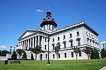 |
Columbia Columbia, South Carolina Columbia is the state capital and largest city in the U.S. state of South Carolina. The population was 129,272 according to the 2010 census. Columbia is the county seat of Richland County, but a portion of the city extends into neighboring Lexington County. The city is the center of a metropolitan... |
Richland Richland County, South Carolina Richland County is a county located in the U.S. state of South Carolina. The 2000 U.S. census recorded its population to be 320,677. In 2010, the U.S. Census Bureau recorded that its population had reached 384,504. It is the second most populous county in South Carolina, behind only Greenville... |
South Carolina State House South Carolina State House The South Carolina State House is the building housing the government of the U.S. state of South Carolina. The building houses the South Carolina General Assembly and the offices of the Governor and Lieutenant Governor of South Carolina. Until 1971, it also housed the Supreme Court... is PDF NHL name. |
||
| Stono River Slave Rebellion Site Stono River Slave Rebellion Site Stono River Slave Rebellion Site is a site significant for its association with the Stono Rebellion, the first slave revolt in the United States, in 1739... |
image pending | Rantowles Rantowles, South Carolina Rantowles, South Carolina is a hamlet or location in what is now Hollywood, South Carolina, near the Stono River.Google maps places it specifically on SC 162 near its intersection with United States Route 17.... 32.7855006028°N 80.1455604195°W |
Charleston Charleston County, South Carolina Charleston County is a county located in the U.S. state of South Carolina. According to a 2005 U.S. Census Bureau estimate, its population was 330,368. Its county seat is Charleston. It is the third-most populous county in the state . Charleston County was created in 1901 by an act of the South... |
Beginning point of the earliest slave revolt in the United States. | ||
| Colonel John Stuart House Colonel John Stuart House Colonel John Stuart House is a three-story Georgian style home built in 1772 in Charleston, South Carolina. It was the home of Colonel John Stuart, who was the King's Superintendent of Indian Affairs.It was declared a National Historic Landmark in 1973.... |
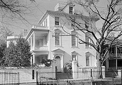 |
Charleston Charleston, South Carolina Charleston is the second largest city in the U.S. state of South Carolina. It was made the county seat of Charleston County in 1901 when Charleston County was founded. The city's original name was Charles Towne in 1670, and it moved to its present location from a location on the west bank of the... 32.774370°N 79.933807°W |
Charleston Charleston County, South Carolina Charleston County is a county located in the U.S. state of South Carolina. According to a 2005 U.S. Census Bureau estimate, its population was 330,368. Its county seat is Charleston. It is the third-most populous county in the state . Charleston County was created in 1901 by an act of the South... |
Home of Colonel John Stuart John Stuart (loyalist) John Stuart was a Scottish-born official of the British Empire in North America. He was the superintendent for the southern district of the British Indian Department from 1761 to 1779; his northern counterpart was Sir William Johnson.Born in Inverness, by 1748 Stuart had emigrated to South... . |
||
| The Unitarian Church (Charleston) | .jpg) |
Charleston Charleston, South Carolina Charleston is the second largest city in the U.S. state of South Carolina. It was made the county seat of Charleston County in 1901 when Charleston County was founded. The city's original name was Charles Towne in 1670, and it moved to its present location from a location on the west bank of the... 32.778149°N 79.934554°W |
Charleston Charleston County, South Carolina Charleston County is a county located in the U.S. state of South Carolina. According to a 2005 U.S. Census Bureau estimate, its population was 330,368. Its county seat is Charleston. It is the third-most populous county in the state . Charleston County was created in 1901 by an act of the South... |
Church built in 1772 that was "Gothicized" during 1852-1854 | ||
| Denmark Vesey House Denmark Vesey House Although named a National Historic Landmark in 1976 and commonly known as the Denmark Vesey House, the home today located at 56 Bull Street in Charleston, South Carolina is almost certainly not the house once inhabited by black abolitionist Denmark Vesey... |
Charleston Charleston, South Carolina Charleston is the second largest city in the U.S. state of South Carolina. It was made the county seat of Charleston County in 1901 when Charleston County was founded. The city's original name was Charles Towne in 1670, and it moved to its present location from a location on the west bank of the... 32.782209°N 79.941180°W |
Charleston Charleston County, South Carolina Charleston County is a county located in the U.S. state of South Carolina. According to a 2005 U.S. Census Bureau estimate, its population was 330,368. Its county seat is Charleston. It is the third-most populous county in the state . Charleston County was created in 1901 by an act of the South... |
Home of Denmark Vesey Denmark Vesey Denmark Vesey originally Telemaque, was an African American slave brought to the United States from the Caribbean of Coromantee background. After purchasing his freedom, he planned what would have been one of the largest slave rebellions in the United States... ? |
|||
| Woodlands Woodlands (Bamberg, South Carolina) Woodlands, or the William Gilmore Simms Estate, was the home of author William Gilmore Simms . It is known also as Woodlands Ruins. According to the South Carolina Department of Archives and History, it is a "significant literary landmark"... |
.jpg) |
Bamberg Bamberg, South Carolina Bamberg is a city in and the county seat of Bamberg County, South Carolina, United States. The population was 3,733 at the 2000 census.-Geography:Bamberg is located at .... |
Bamberg Bamberg County, South Carolina -Demographics:As of the census of 2000, there were 16,658 people, 6,123 households, and 4,255 families residing in the county. The population density was 42 people per square mile . There were 7,130 housing units at an average density of 18 per square mile... |
The primary residence of author William Gilmore Simms William Gilmore Simms William Gilmore Simms was a poet, novelist and historian from the American South. His writings achieved great prominence during the 19th century, with Edgar Allan Poe pronouncing him the best novelist America had ever produced... , whose main house was burned in 1865; the remaining wing and several outbuildings constitute a literary landmark. |
||
| USS YORKTOWN (Aircraft Carrier) USS Yorktown (CV-10) USS Yorktown is one of 24 s built during World War II for the United States Navy. She is named after the Battle of Yorktown of the American Revolutionary War, and is the fourth U.S. Navy ship to bear the name... |
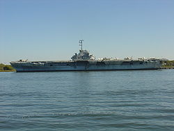 |
Mount Pleasant Mount Pleasant, South Carolina Mount Pleasant is a large affluent suburban town in Charleston County, South Carolina, United States. It is a member of the Charleston–North Charleston–Summerville Metropolitan Statistical Area, for statistical purpose only, as designated by the U.S. Office of Management and Budget.... 32.78879224°N 79.9085875915°W |
Charleston Charleston County, South Carolina Charleston County is a county located in the U.S. state of South Carolina. According to a 2005 U.S. Census Bureau estimate, its population was 330,368. Its county seat is Charleston. It is the third-most populous county in the state . Charleston County was created in 1901 by an act of the South... |
Famous World War II aircraft carrier Aircraft carrier An aircraft carrier is a warship designed with a primary mission of deploying and recovering aircraft, acting as a seagoing airbase. Aircraft carriers thus allow a naval force to project air power worldwide without having to depend on local bases for staging aircraft operations... |
Historic areas of the National Park System in South Carolina
National Historic Sites, National Historic Parks, National Memorials, and certain other areas listed in the National Park system are historic landmarks of national importance that are highly protected already, often before the inauguration of the NHL program in 1960, and are then often not also named NHLs per se. There are five of these in South Carolina. The National Park Service lists these five together with the NHLs in the state, The Charles Pinckney National Historic SiteCharles Pinckney National Historic Site
Charles Pinckney National Historic Site preserves a portion of Charles Pinckney's Snee Farm. The site is located at 1254 Long Point Road, Mount Pleasant, South Carolina....
(also known as Snee Farm) and Ninety Six National Historic Site
Ninety Six National Historic Site
Ninety Six National Historic Site, also known as Old Ninety Six and Star Fort, is a United States National Historic Site located about 60 miles south of Greenville, South Carolina...
are also NHLs and are listed above. The remaining three are:
| Landmark name |
Image | Date established | Location | County | Description | |
|---|---|---|---|---|---|---|
| Cowpens National Battlefield Cowpens National Battlefield Cowpens National Battlefield or Cowpens National Battlefield Park is a unit of the National Park Service just east of Chesnee, South Carolina, not far from the North Carolina state line.... |
 |
Gaffney Gaffney, South Carolina Gaffney is a city in and the county seat of Cherokee County, South Carolina, United States, in the upstate region of South Carolina. Gaffney is also sometimes referred to as the Peach capital of South Carolina. The population was 12,414 at the 2010 census... |
Cherokee Cherokee County, South Carolina Cherokee County is a county located in the U.S. state of South Carolina. The county was formed in 1897 from parts of York, Union, and Spartanburg Counties. It is included in the Gaffney, South Carolina Micropolitan Statistical Area. According to the 2010 United States Census, the county's... |
Site of Battle of Cowpens Battle of Cowpens The Battle of Cowpens was a decisive victory by Patriot Revolutionary forces under Brigadier General Daniel Morgan, in the Southern campaign of the American Revolutionary War... in 1781 |
||
| Fort Sumter National Monument | Charleston Charleston, South Carolina Charleston is the second largest city in the U.S. state of South Carolina. It was made the county seat of Charleston County in 1901 when Charleston County was founded. The city's original name was Charles Towne in 1670, and it moved to its present location from a location on the west bank of the... |
Charleston Charleston County, South Carolina Charleston County is a county located in the U.S. state of South Carolina. According to a 2005 U.S. Census Bureau estimate, its population was 330,368. Its county seat is Charleston. It is the third-most populous county in the state . Charleston County was created in 1901 by an act of the South... |
First shots of the American Civil War American Civil War The American Civil War was a civil war fought in the United States of America. In response to the election of Abraham Lincoln as President of the United States, 11 southern slave states declared their secession from the United States and formed the Confederate States of America ; the other 25... were fired here on January 9, 1861, and the Battle of Fort Sumter Battle of Fort Sumter The Battle of Fort Sumter was the bombardment and surrender of Fort Sumter, near Charleston, South Carolina, that started the American Civil War. Following declarations of secession by seven Southern states, South Carolina demanded that the U.S. Army abandon its facilities in Charleston Harbor. On... raged from April 12 to April 13. |
|||
| Kings Mountain National Military Park Kings Mountain National Military Park Kings Mountain National Military Park is a National Military Park near Blacksburg, South Carolina, along the North Carolina/South Carolina border... |
 |
Blacksburg Blacksburg, South Carolina Blacksburg is a town in Cherokee County, South Carolina, United States. The population was 1,848 at the 2010 census. The communities of Cherokee Falls, Kings Creek, Cashion Crossroads, Buffalo, and Mt... |
Cherokee Cherokee County, South Carolina Cherokee County is a county located in the U.S. state of South Carolina. The county was formed in 1897 from parts of York, Union, and Spartanburg Counties. It is included in the Gaffney, South Carolina Micropolitan Statistical Area. According to the 2010 United States Census, the county's... |
Site of Battle of Kings Mountain Battle of Kings Mountain The Battle of Kings Mountain was a decisive battle between the Patriot and Loyalist militias in the Southern campaign of the American Revolutionary War... on 7 October 1780 |
Former NHLs in South Carolina
The nuclear-powered commercial vessel NS SavannahNS Savannah
NS Savannah, named for SS Savannah, was the first nuclear-powered cargo-passenger ship, built in the late 1950s at a cost of $46.9 million, including a $28.3 million nuclear reactor and fuel core, funded by United States government agencies as a demonstration project for the potential...
was moved to Virginia
Virginia
The Commonwealth of Virginia , is a U.S. state on the Atlantic Coast of the Southern United States. Virginia is nicknamed the "Old Dominion" and sometimes the "Mother of Presidents" after the eight U.S. presidents born there...
. Piedmont Number One
Piedmont Number One
Piedmont Number One is a former textile plant and former National Historic Landmark in Piedmont, Greenville County, South Carolina. It burned in 1983.-Piedmont Manufacturing Company:...
, a historic textile mill
Cotton mill
A cotton mill is a factory that houses spinning and weaving machinery. Typically built between 1775 and 1930, mills spun cotton which was an important product during the Industrial Revolution....
, burned in 1983.
| Landmark name | Image | Date designated | Locality | County | Description | |
|---|---|---|---|---|---|---|
| NS Savannah NS Savannah NS Savannah, named for SS Savannah, was the first nuclear-powered cargo-passenger ship, built in the late 1950s at a cost of $46.9 million, including a $28.3 million nuclear reactor and fuel core, funded by United States government agencies as a demonstration project for the potential... |
 |
|
Patriot's Point Patriot's Point Patriots Point Naval & Maritime Museum is located in Mount Pleasant, South Carolina, at the mouth of the Cooper River on the Charleston Harbor, across from Charleston.-Museum ships and exhibits:... Charleston Charleston, South Carolina Charleston is the second largest city in the U.S. state of South Carolina. It was made the county seat of Charleston County in 1901 when Charleston County was founded. The city's original name was Charles Towne in 1670, and it moved to its present location from a location on the west bank of the... |
Charleston Charleston County, South Carolina Charleston County is a county located in the U.S. state of South Carolina. According to a 2005 U.S. Census Bureau estimate, its population was 330,368. Its county seat is Charleston. It is the third-most populous county in the state . Charleston County was created in 1901 by an act of the South... |
Nuclear-powered merchant cargo and passenger vessel. It was at Patriot's Point from 1982 until 1994, when it was removed to Baltimore, MD. So it was an NHL in SC from 1991 to 1994. It is now in Virginia. | |
| Piedmont Number One Piedmont Number One Piedmont Number One is a former textile plant and former National Historic Landmark in Piedmont, Greenville County, South Carolina. It burned in 1983.-Piedmont Manufacturing Company:... |
.jpg) |
Piedmont Piedmont, South Carolina Piedmont is a census-designated place along the Saluda River in Anderson and Greenville counties in the U.S. state of South Carolina. The population was 4,684 at the 2000 census.... |
Greenville Greenville County, South Carolina - External Links :*... |
A historic Southern textile mill Cotton mill A cotton mill is a factory that houses spinning and weaving machinery. Typically built between 1775 and 1930, mills spun cotton which was an important product during the Industrial Revolution.... that burned in 1983. Its National Historic Landmark Designation was removed on March 5, 1986. |

