
Lake Cook Road
Encyclopedia
Lake Cook Road is a major east–west highway in Cook
, Lake
, McHenry
, and Kane Counties
in Illinois
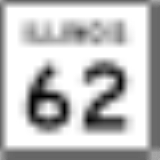
. For much of its length, it marks the border between Cook and Lake Counties, hence the name of the road. In its western stretch, it marks the border between McHenry and Cook Counties, and further west, McHenry and Kane Counties. The road is approximately 25.5 miles (41 km) in length, from its western terminus at Illinois Route 62
in Algonquin
to its eastern terminus at Sheridan Road
in Highland Park
and Glencoe
, near Lake Michigan
. The road is notable for its cross-section of Chicago
's northern suburbs, balancing densely developed commercial, industrial, and residential land uses, with open space areas such as forest preserves, parks, golf courses, creeks, rivers, gardens, and Lake Michigan.
, Barrington Hills
, Barrington
, Deer Park
, Palatine
, Long Grove
, Arlington Heights
, Buffalo Grove
, Wheeling
, Riverwoods
, Northbrook
, Deerfield
, Highland Park
, and Glencoe
.
(U.S. Route 41
) in Northbrook is maintained by the Cook County Highway Department designated Cook County Trunk Highway A50. This entire Cook County-maintained stretch is four lanes wide. The far western segment of the roadway (which is called Lake Cook Road in Algonquin and County Line Road in Barrington Hills) from Illinois Route 62 to Ridge Road in Algonquin and Barrington Hills is maintained by the McHenry County Division of Transportation designated McHenry County Highway A50. Other segments, such as the segment between Ridge Road and Quentin Road in Barrington and the eastern segment from Skokie Highway to Sheridan Road
in Highland Park and Glencoe are maintained by the Illinois Department of Transportation
without any route number.
(Algonquin Road), the roadway begins as a two-lane road called Lake Cook Road near a residential neighborhood and commercial area in Algonquin. Further east, the road's name changes to County Line Road at Haegers Bend Road and the road travels through largely rural and sparsely developed sections in Barrington Hills, with a significant amount of dense wooded areas and estate-style development, making for a very scenic drive. However, wildlife is also prevalent in this area, due to the presence of Spring Creek, which can make for hazardous nighttime driving conditions. As the road enters the town of Barrington, the road's name changes to Main Street and traffic notably increases, particularly in downtown Barrington at the intersections of Illinois Route 59
(Hough Street), U.S. Route 14
(Northwest Highway), and the at-grade Union Pacific/Northwest Line
, especially during weekday rush periods, when Metra
trains stop frequently at the nearby station. As the road continues east through the remainder of Barrington and Deer Park, it runs adjacent to more estate-style development and residential neighborhoods as well as another forested area near Deer Grove Forest Preserve in Palatine.
commercial center and soon after intersects U.S. Route 12
near a blighted commercial strip, which until recent signal and intersection modifications were made, was one of the most dangerous intersections in Illinois. The roadway then crosses Deerpath Lake over a bridge, intersects Hicks Road
, and then intersects the terminus of the Illinois Route 53
expressway, near a mass of apartment complexes in Palatine. After this intersection, the road is highlighted by the dense single-family neighborhoods on the south side of the roadway in Arlington Heights and the Buffalo Creek Forest Preserve in Long Grove, on the north side of the roadway. As the road intersects Arlington Heights Road near neighborhood commercial plazas, it enters Buffalo Grove and becomes a four-lane boulevard, going past more residential neighborhoods, the Buffalo Grove Municipal Complex, and Buffalo Creek, and then intersecting Buffalo Grove Road, Illinois Route 83
(McHenry Road), and Weiland Road, in rapid succession near an historic church and regional commercial plazas. After intersecting Weiland Road, the road is then bounded by Buffalo Grove on the north and Wheeling on the south. In this area, it goes past an apartment complex in Wheeling, crosses the Soo Line Railroad
(Metra's North Central Service
commuter rail line) at a bridge, goes past the Chevy Chase Golf Course in Buffalo Grove, and forms an interchange with Illinois Route 21
/U.S. Route 45
(Milwaukee Avenue) near the Westin North Shore Hotel and Convention Center.
, and goes through the Potawatomi Woods Forest Preserve before entering Riverwoods, Northbrook, and Deerfield. Here, the road intersects Portwine Road, Sanders Road, and Wilmot Road and forms an interchange with Interstate 94
/Interstate 294
(the Tri-State Tollway
) at the Edens Spur. This area is surrounded by numerous offices, industrial buildings, and corporate headquarters including those of Baxter International
, Walgreens
, and Underwriters Laboratories
. Near Underwriters, the road intersects Pfingsten Road and Metra's Milwaukee District/North Line
, where the Lake Cook Road (Metra)
station can be found. Shortly thereafter, the road intersects Illinois Route 43
(Waukegan Road) near a retail area and goes past the Northbrook Court
regional shopping mall
soon after. The road then intersects Ridge Road, a freight railroad track, Skokie Boulevard, and forms an interchange with Skokie Highway
(U.S. Route 41
). The road then narrows down to a two-lane road and goes past Chicago Botanic Garden
, intersects Green Bay Road, intersects Metra's Union Pacific/North Line
at Highland Park's Braeside (Metra)
station near the Ravinia Festival music center, and runs concurrent with, and terminates at, Sheridan Road
near the Lake Shore Country Club in Glencoe, only a few hundred feet from Lake Michigan
.
near the Potawatomi Forest Preserve. Even further east, it crosses north branches of the Chicago River
and the Skokie River
, runs past the Chicago Botanic Garden
and ends near Lake Michigan
. While this makes for very scenic views, it also presents a challenge to the region, as it works to balance environmental preservation with safety, transportation, recreation, and economic development needs.
, can be found along the road, which contain immense clusters of retail development in their vicinities, including big-box stores, fashion stores, upscale restaurants, and services. An additional smaller cluster of retail development can be found in Buffalo Grove. In addition, near the intersection of Lake Cook Road and the Tri-State Tollway
(near Northbrook, Riverwoods, and Deerfield) is a major cluster of office and industrial development which employs thousands of people (known as an edge city
), which contains the corporate headquarters for Walgreens
, Baxter International
, and Underwriters Laboratories
, which are all found along the road. Additional employers can be found within a few miles of the road, extending north–south along Milwaukee Avenue, the Tri-State Tollway, and Skokie Highway.
Because of the property tax structure of Cook County, where commercial properties are taxed at a higher rate than residential properites, a majority of the commercial properties along Lake-Cook road are on the north side of Lake-Cook road (which is in Lake County) and a majority of residential properties are located on the south side of Lake-Cook road (which is in Cook County).
Cook County, Illinois
Cook County is a county in the U.S. state of Illinois, with its county seat in Chicago. It is the second most populous county in the United States after Los Angeles County. The county has 5,194,675 residents, which is 40.5 percent of all Illinois residents. Cook County's population is larger than...
, Lake
Lake County, Illinois
Lake County is a county in the northeastern corner of the state of Illinois, on the shore of Lake Michigan. According to the 2010 census, it has a population of 703,462, which is an increase of 9.2% from 644,356 in 2000. Its county seat is Waukegan. The county is part of the Chicago metropolitan area...
, McHenry
McHenry County, Illinois
McHenry County is a county located in the U.S. state of Illinois. According to the 2010 census, it has a population of 308,760, which is an increase of 18.7% from 260,077 in 2000. Its county seat is Woodstock. This county is part of the Chicago metropolitan area. It is the sixth largest county, in...
, and Kane Counties
Kane County, Illinois
Kane County is a county located in the U.S. state of Illinois. According to the 2010 census, it has a population of 515,269, which is an increase of 27.5% from 404,119 in 2000. Its county seat is Geneva, and its largest city is Aurora.- Geography :...
in Illinois
Illinois
Illinois is the fifth-most populous state of the United States of America, and is often noted for being a microcosm of the entire country. With Chicago in the northeast, small industrial cities and great agricultural productivity in central and northern Illinois, and natural resources like coal,...
. For much of its length, it marks the border between Cook and Lake Counties, hence the name of the road. In its western stretch, it marks the border between McHenry and Cook Counties, and further west, McHenry and Kane Counties. The road is approximately 25.5 miles (41 km) in length, from its western terminus at Illinois Route 62
Illinois Route 62
Illinois Route 62 is an east–west state road in northeast Illinois. It runs from downtown Algonquin at Illinois Route 31 to the intersection with Illinois Route 83 by industrial Mount Prospect. This is a distance of ....
in Algonquin
Algonquin, Illinois
Algonquin is a village in Illinois located in both McHenry and Kane counties. It is a northwest suburb of Chicago, located approximately 40 miles from the Loop...
to its eastern terminus at Sheridan Road
Sheridan Road
Sheridan Road is a major north-south thoroughfare that leads from Diversey Parkway in Chicago, Illinois, north to the Illinois-Wisconsin border and beyond to Racine. Throughout most of its run, it is the easternmost north-south through street, closest to Lake Michigan...
in Highland Park
Highland Park, Illinois
Highland Park is a suburban municipality in Lake County, Illinois, United States, about north of downtown Chicago. As of 2009, the population is 33,492. Highland Park is one of several municipalities located on the North Shore of the Chicago Metropolitan Area.-Overview:Highland Park was founded...
and Glencoe
Glencoe, Illinois
Glencoe is a village in Cook County, Illinois, United States. As of the 2010 census, the village population was 8,723. Glencoe is located on suburban Chicago's North Shore. Glencoe is located within the New Trier High School District. Glencoe is regarded as one of the most affluent suburbs on...
, near Lake Michigan
Lake Michigan
Lake Michigan is one of the five Great Lakes of North America and the only one located entirely within the United States. It is the second largest of the Great Lakes by volume and the third largest by surface area, after Lake Superior and Lake Huron...
. The road is notable for its cross-section of Chicago
Chicago
Chicago is the largest city in the US state of Illinois. With nearly 2.7 million residents, it is the most populous city in the Midwestern United States and the third most populous in the US, after New York City and Los Angeles...
's northern suburbs, balancing densely developed commercial, industrial, and residential land uses, with open space areas such as forest preserves, parks, golf courses, creeks, rivers, gardens, and Lake Michigan.
Municipalities served
Lake Cook Road goes through, or runs adjacent to, sections of the following municipalities from west to east: AlgonquinAlgonquin, Illinois
Algonquin is a village in Illinois located in both McHenry and Kane counties. It is a northwest suburb of Chicago, located approximately 40 miles from the Loop...
, Barrington Hills
Barrington Hills, Illinois
Barrington Hills is a village located about northwest of Chicago in the U.S. state of Illinois. It straddles approximately over four counties, Cook, Kane, Lake, and McHenry. The population was 4,209 at the 2010 census...
, Barrington
Barrington, Illinois
Barrington is a suburban village in Cook County, Illinois and Lake County, Illinois. The population was 10,327 at the 2010 census. Located approximately northwest of Chicago, the area features wetlands, forest preserves, parks and horse trails in a country-suburban setting...
, Deer Park
Deer Park, Illinois
Deer Park is an affluent village in Lake and Cook Counties in the U.S. state of Illinois. The population was 3,200 at the 2010 census. The village is one of the few left in the Chicago area that enjoy a green belt which is bordered by two large natural areas providing outdoor recreation and open...
, Palatine
Palatine, Illinois
Palatine is a village in Cook County, Illinois, United States. It is a northwestern residential suburb of Chicago. As of the 2000 census, the village had a total population of 65,479, making it the sixth-largest community in Cook County and the 16th-largest in the state of Illinois at that time...
, Long Grove
Long Grove, Illinois
Long Grove is an affluent village located in Lake County, Illinois, approximately northwest of Chicago. As of the 2005 census, the village had a total population of 6,735...
, Arlington Heights
Arlington Heights, Illinois
Arlington Heights is a village in Cook and Lake counties in the U.S. state of Illinois. A suburb of Chicago, it lies about 25 miles northwest of the city's downtown. The population was 75,101 at the 2010 census....
, Buffalo Grove
Buffalo Grove, Illinois
Buffalo Grove is an affluent village located in the northern suburbs of Chicago, and in Cook and Lake counties in Illinois, United States. The town was named for Buffalo Creek, which was itself named for bison bones found in the area....
, Wheeling
Wheeling, Illinois
Wheeling is a village in Cook County, Illinois, United States, and a suburb of Chicago. The population was 34,496 at the 2000 census, and 38,555 at the 2006 special village census.-Geography:Wheeling is located at ....
, Riverwoods
Riverwoods, Illinois
Riverwoods is a village in Lake County, Illinois, United States. Riverwoods was established on the banks of the Des Plaines River in 1949 by local steel magnate Edward L. Ryerson. The population was 3,843 at the 2000 census...
, Northbrook
Northbrook, Illinois
Northbrook is a village located at the northern edge of Cook County, Illinois, which is also a North Shore suburb of Chicago. The population was 33,170 at the 2010 census....
, Deerfield
Deerfield, Illinois
Deerfield is a village in Lake County, Illinois, United States and is located approximately 25 miles north of Chicago, Illinois. A portion of the village is in Cook County, Illinois, United States...
, Highland Park
Highland Park, Illinois
Highland Park is a suburban municipality in Lake County, Illinois, United States, about north of downtown Chicago. As of 2009, the population is 33,492. Highland Park is one of several municipalities located on the North Shore of the Chicago Metropolitan Area.-Overview:Highland Park was founded...
, and Glencoe
Glencoe, Illinois
Glencoe is a village in Cook County, Illinois, United States. As of the 2010 census, the village population was 8,723. Glencoe is located on suburban Chicago's North Shore. Glencoe is located within the New Trier High School District. Glencoe is regarded as one of the most affluent suburbs on...
.
Roadway jurisdiction
The majority of the road, from Rand Road in Palatine to Skokie HighwaySkokie Highway
The Skokie Highway is a major arterial highway running north of Chicago through the far northeastern portion of the U.S. state of Illinois. It runs from the intersection of Illinois Route 50 in Skokie north to the Wisconsin state line at Interstate 94 near Wadsworth. All of the Skokie Highway is...
(U.S. Route 41
U.S. Route 41
U.S. Route 41 is a north–south United States Highway that runs from Miami, Florida to the Upper Peninsula of Michigan. Until 1949, the part in southern Florida, from Naples to Miami, was U.S...
) in Northbrook is maintained by the Cook County Highway Department designated Cook County Trunk Highway A50. This entire Cook County-maintained stretch is four lanes wide. The far western segment of the roadway (which is called Lake Cook Road in Algonquin and County Line Road in Barrington Hills) from Illinois Route 62 to Ridge Road in Algonquin and Barrington Hills is maintained by the McHenry County Division of Transportation designated McHenry County Highway A50. Other segments, such as the segment between Ridge Road and Quentin Road in Barrington and the eastern segment from Skokie Highway to Sheridan Road
Sheridan Road
Sheridan Road is a major north-south thoroughfare that leads from Diversey Parkway in Chicago, Illinois, north to the Illinois-Wisconsin border and beyond to Racine. Throughout most of its run, it is the easternmost north-south through street, closest to Lake Michigan...
in Highland Park and Glencoe are maintained by the Illinois Department of Transportation
Illinois Department of Transportation
The Illinois Department of Transportation is a state agency in charge of state-maintained public roadways of the U.S. state of Illinois. In addition, IDOT provides funding for rail, public transit and airport projects and administers fuel tax and federal funding to local juridictions in the...
without any route number.
Barrington area (Algonquin Road to Quentin Road)
At its western terminus at Illinois Route 62Illinois Route 62
Illinois Route 62 is an east–west state road in northeast Illinois. It runs from downtown Algonquin at Illinois Route 31 to the intersection with Illinois Route 83 by industrial Mount Prospect. This is a distance of ....
(Algonquin Road), the roadway begins as a two-lane road called Lake Cook Road near a residential neighborhood and commercial area in Algonquin. Further east, the road's name changes to County Line Road at Haegers Bend Road and the road travels through largely rural and sparsely developed sections in Barrington Hills, with a significant amount of dense wooded areas and estate-style development, making for a very scenic drive. However, wildlife is also prevalent in this area, due to the presence of Spring Creek, which can make for hazardous nighttime driving conditions. As the road enters the town of Barrington, the road's name changes to Main Street and traffic notably increases, particularly in downtown Barrington at the intersections of Illinois Route 59
Illinois Route 59
Illinois Route 59 is a north–south state highway in northeastern Illinois. It runs south from Illinois Route 83 in Antioch to Interstate Highway 55 in Shorewood, spanning the north–south width of Chicago's western suburbs...
(Hough Street), U.S. Route 14
U.S. Route 14
U.S. Route 14 , an east–west route, is one of the original United States highways of 1926. It currently has a length of 1,398 miles , but it had a peak length of 1,429 miles . For much of its length, it runs roughly parallel to Interstate 90.As of 2004, the highway's eastern terminus is in...
(Northwest Highway), and the at-grade Union Pacific/Northwest Line
Union Pacific/Northwest Line
The Union Pacific/Northwest is a commuter rail line provided by Metra and operated by the Union Pacific Railroad in Chicago, Illinois, and its surrounding suburbs...
, especially during weekday rush periods, when Metra
Metra
Metra is the commuter rail division of the Illinois Regional Transportation Authority. The system serves Chicago and its metropolitan area through 240 stations on 11 different rail lines. Throughout the 21st century, Metra has been the second busiest commuter rail system in the United States by...
trains stop frequently at the nearby station. As the road continues east through the remainder of Barrington and Deer Park, it runs adjacent to more estate-style development and residential neighborhoods as well as another forested area near Deer Grove Forest Preserve in Palatine.
Northwest Suburban area (Quentin Road to Milwaukee Avenue)
The road's name changes to Lake Cook Road and as the road intersects with Quentin Road, it becomes a four-lane highway (which it remains for much of the remainder of the road) near the Deer Park Town CenterDeer Park Town Center
Deer Park Town Center is an upscale lifestyle center in the Chicago suburb of Deer Park, Illinois, situated at the southwest corner of U.S. Highway 12 and Long Grove Road, just north of Lake Cook Road...
commercial center and soon after intersects U.S. Route 12
U.S. Route 12
U.S. Route 12 or US 12 is an east–west United States highway, running from Grays Harbor on the Pacific Ocean, in the state of Washington, to downtown Detroit, for almost . As a thoroughfare, it has mostly been supplanted by I-90 and I-94, but remains an important road for local travel.The...
near a blighted commercial strip, which until recent signal and intersection modifications were made, was one of the most dangerous intersections in Illinois. The roadway then crosses Deerpath Lake over a bridge, intersects Hicks Road
Illinois Route 53
Illinois Route 53 is an arterial north–south state highway in northeast Illinois. Route 53 runs south from Long Grove at Illinois Route 83 to Gardner at Interstate 55 west of old U.S. Highway 66, a distance of...
, and then intersects the terminus of the Illinois Route 53
Illinois Route 53
Illinois Route 53 is an arterial north–south state highway in northeast Illinois. Route 53 runs south from Long Grove at Illinois Route 83 to Gardner at Interstate 55 west of old U.S. Highway 66, a distance of...
expressway, near a mass of apartment complexes in Palatine. After this intersection, the road is highlighted by the dense single-family neighborhoods on the south side of the roadway in Arlington Heights and the Buffalo Creek Forest Preserve in Long Grove, on the north side of the roadway. As the road intersects Arlington Heights Road near neighborhood commercial plazas, it enters Buffalo Grove and becomes a four-lane boulevard, going past more residential neighborhoods, the Buffalo Grove Municipal Complex, and Buffalo Creek, and then intersecting Buffalo Grove Road, Illinois Route 83
Illinois Route 83
Illinois Route 83 is a major north–south state road in northeast Illinois. It stretches from U.S. Highway 30 by Lynwood and Dyer, Indiana north to the Wisconsin border by Antioch at Highway 83. Incidentally, this alignment is concentric with Interstate 294...
(McHenry Road), and Weiland Road, in rapid succession near an historic church and regional commercial plazas. After intersecting Weiland Road, the road is then bounded by Buffalo Grove on the north and Wheeling on the south. In this area, it goes past an apartment complex in Wheeling, crosses the Soo Line Railroad
Soo Line Railroad
The Soo Line Railroad is the primary United States railroad subsidiary of the Canadian Pacific Railway , controlled through the Soo Line Corporation, and one of seven U.S. Class I railroads. Although it is named for the Minneapolis, St. Paul and Sault Ste...
(Metra's North Central Service
North Central Service
The North Central Service is a commuter rail line provided and operated by Metra in Chicago, Illinois, and its surrounding suburbs. While Metra does not specifically refer to any of its lines by a particular color, the timetable accents for the North Central Service line are printed in light "Soo...
commuter rail line) at a bridge, goes past the Chevy Chase Golf Course in Buffalo Grove, and forms an interchange with Illinois Route 21
Illinois Route 21
Illinois Route 21 is an arterial north–south state highway in northeastern Illinois. It runs from Illinois Route 43 in Niles to U.S. Route 41 north of Gurnee. Illinois 21 is 28.13 miles long....
/U.S. Route 45
U.S. Route 45
U.S. Route 45 is a north–south United States highway. US 45 is a border-to-border route, from Lake Superior to the Gulf of Mexico. A sign at the highway's northern terminus notes the total distance as ....
(Milwaukee Avenue) near the Westin North Shore Hotel and Convention Center.
North Shore area (Milwaukee Avenue to Sheridan Road)
The road then crosses the Des Plaines RiverDes Plaines River
The Des Plaines River is a river that flows southward for through southern Wisconsin and northern Illinois in the U.S. Midwest, eventually meeting the Kankakee River west of Channahon to form the Illinois River, a tributary of the Mississippi River....
, and goes through the Potawatomi Woods Forest Preserve before entering Riverwoods, Northbrook, and Deerfield. Here, the road intersects Portwine Road, Sanders Road, and Wilmot Road and forms an interchange with Interstate 94
Interstate 94
Interstate 94 is the northernmost east–west Interstate Highway, connecting the Great Lakes and Intermountain regions of the United States. I-94's western terminus is in Billings, Montana at a junction with Interstate 90; its eastern terminus is the U.S...
/Interstate 294
Interstate 294
Interstate 294 is a tolled Interstate Highway in northeastern Illinois, U.S.A.. It forms the southern portion of the Tri-State Tollway in Illinois. I-294 runs from South Holland at Interstates 80 and 94, and Illinois Route 394 to Northbrook at I-94. Interstate 294 is long; are shared with I-80....
(the Tri-State Tollway
Tri-State Tollway
The Tri-State Tollway is a U.S. toll road maintained by the Illinois State Toll Highway Authority in northeastern Illinois which is considered one of the most heavily traveled highways in the country...
) at the Edens Spur. This area is surrounded by numerous offices, industrial buildings, and corporate headquarters including those of Baxter International
Baxter International
Baxter International Inc. , is an American health care company with headquarters in Deerfield, Illinois. The company primarily focuses on products to treat hemophilia, kidney disease, immune disorders and other chronic and acute medical conditions...
, Walgreens
Walgreens
Walgreen Co. , doing business as Walgreens , is the largest drugstore chain in the United States of America. As of August 31st, the company operates 8,210 locations across all 50 states, the District of Columbia and Puerto Rico. Founded in Chicago, Illinois in 1901, and has since expanded...
, and Underwriters Laboratories
Underwriters Laboratories
Underwriters Laboratories Inc. is an independent product safety certification organization. Established in 1894, the company has its headquarters in Northbrook, Illinois. UL develops standards and test procedures for products, materials, components, assemblies, tools and equipment, chiefly dealing...
. Near Underwriters, the road intersects Pfingsten Road and Metra's Milwaukee District/North Line
Milwaukee District/North Line
The Milwaukee District/North is a commuter rail line provided and operated by Metra in Chicago, Illinois, and its surrounding suburbs...
, where the Lake Cook Road (Metra)
Lake Cook Road (Metra)
Lake Cook Road Station is one of two Metra commuter railroad stations in Deerfield, Illinois, along the Milwaukee District/North Line. It is located at 601 Lake Cook Road , is away from Union Station, the southern terminus of the line, and serves commuters between Union Station and Fox Lake,...
station can be found. Shortly thereafter, the road intersects Illinois Route 43
Illinois Route 43
Illinois Route 43 is a major north–south state road in the U.S. state of Illinois. It runs from U.S. Route 30 in Frankfort north to the large intersection of Illinois Route 120 and U.S...
(Waukegan Road) near a retail area and goes past the Northbrook Court
Northbrook Court
Northbrook Court is a large, upscale Super-regional Mall in Northbrook, Illinois. The mall is one of the most upscale collection of shops in the midwest, and even the nation. Located on its three current anchor stores are Lord & Taylor, Macy's, and Neiman Marcus...
regional shopping mall
Shopping mall
A shopping mall, shopping centre, shopping arcade, shopping precinct or simply mall is one or more buildings forming a complex of shops representing merchandisers, with interconnecting walkways enabling visitors to easily walk from unit to unit, along with a parking area — a modern, indoor version...
soon after. The road then intersects Ridge Road, a freight railroad track, Skokie Boulevard, and forms an interchange with Skokie Highway
Skokie Highway
The Skokie Highway is a major arterial highway running north of Chicago through the far northeastern portion of the U.S. state of Illinois. It runs from the intersection of Illinois Route 50 in Skokie north to the Wisconsin state line at Interstate 94 near Wadsworth. All of the Skokie Highway is...
(U.S. Route 41
U.S. Route 41
U.S. Route 41 is a north–south United States Highway that runs from Miami, Florida to the Upper Peninsula of Michigan. Until 1949, the part in southern Florida, from Naples to Miami, was U.S...
). The road then narrows down to a two-lane road and goes past Chicago Botanic Garden
Chicago Botanic Garden
Located at 1000 Lake Cook Road, Glencoe, Illinois, USA, the Chicago Botanic Garden is a living plant museum situated on nine islands featuring 24 display gardens and surrounded by four natural habitats: McDonald Woods, Dixon Prairie, Skokie River Corridor, and Lakes and Shores. The Garden is open...
, intersects Green Bay Road, intersects Metra's Union Pacific/North Line
Union Pacific/North Line
The Union Pacific/North is a commuter rail line in the Chicago metropolitan area that runs between Chicago and Waukegan, Illinois, with some trains continuing to Kenosha, Wisconsin. It is part of the Metra system, but it is operated by the Union Pacific Railroad...
at Highland Park's Braeside (Metra)
Braeside (Metra)
Braeside is a railroad station near Highland Park, Illinois serving Metra's Union Pacific/North Line, in the Braeside neighborhood of Highland Park. It is located at 10 North St. Johns Avenue, just off Lake Cook Road. In Metra's zone-based fare schedule, Braeside is in zone E. Cook County Forest...
station near the Ravinia Festival music center, and runs concurrent with, and terminates at, Sheridan Road
Sheridan Road
Sheridan Road is a major north-south thoroughfare that leads from Diversey Parkway in Chicago, Illinois, north to the Illinois-Wisconsin border and beyond to Racine. Throughout most of its run, it is the easternmost north-south through street, closest to Lake Michigan...
near the Lake Shore Country Club in Glencoe, only a few hundred feet from Lake Michigan
Lake Michigan
Lake Michigan is one of the five Great Lakes of North America and the only one located entirely within the United States. It is the second largest of the Great Lakes by volume and the third largest by surface area, after Lake Superior and Lake Huron...
.
Limited-access highways
Lake-Cook Road forms interchanges with the following limited-access highways, from west to east:- Illinois Route 53Illinois Route 53Illinois Route 53 is an arterial north–south state highway in northeast Illinois. Route 53 runs south from Long Grove at Illinois Route 83 to Gardner at Interstate 55 west of old U.S. Highway 66, a distance of...
- Interstate 94Interstate 94Interstate 94 is the northernmost east–west Interstate Highway, connecting the Great Lakes and Intermountain regions of the United States. I-94's western terminus is in Billings, Montana at a junction with Interstate 90; its eastern terminus is the U.S...
/Interstate 294Interstate 294Interstate 294 is a tolled Interstate Highway in northeastern Illinois, U.S.A.. It forms the southern portion of the Tri-State Tollway in Illinois. I-294 runs from South Holland at Interstates 80 and 94, and Illinois Route 394 to Northbrook at I-94. Interstate 294 is long; are shared with I-80....
(The Tri-State TollwayTri-State TollwayThe Tri-State Tollway is a U.S. toll road maintained by the Illinois State Toll Highway Authority in northeastern Illinois which is considered one of the most heavily traveled highways in the country...
at the Edens Spur) - U.S. Route 41U.S. Route 41U.S. Route 41 is a north–south United States Highway that runs from Miami, Florida to the Upper Peninsula of Michigan. Until 1949, the part in southern Florida, from Naples to Miami, was U.S...
(Skokie HighwaySkokie HighwayThe Skokie Highway is a major arterial highway running north of Chicago through the far northeastern portion of the U.S. state of Illinois. It runs from the intersection of Illinois Route 50 in Skokie north to the Wisconsin state line at Interstate 94 near Wadsworth. All of the Skokie Highway is...
)
Major roadways
- Illinois Route 62Illinois Route 62Illinois Route 62 is an east–west state road in northeast Illinois. It runs from downtown Algonquin at Illinois Route 31 to the intersection with Illinois Route 83 by industrial Mount Prospect. This is a distance of ....
(Algonquin Road) - Illinois Route 59Illinois Route 59Illinois Route 59 is a north–south state highway in northeastern Illinois. It runs south from Illinois Route 83 in Antioch to Interstate Highway 55 in Shorewood, spanning the north–south width of Chicago's western suburbs...
(Hough Street) - U.S. Route 14U.S. Route 14U.S. Route 14 , an east–west route, is one of the original United States highways of 1926. It currently has a length of 1,398 miles , but it had a peak length of 1,429 miles . For much of its length, it runs roughly parallel to Interstate 90.As of 2004, the highway's eastern terminus is in...
(Northwest Highway) - Ela Road
- Quentin Road
- U.S. Route 12U.S. Route 12U.S. Route 12 or US 12 is an east–west United States highway, running from Grays Harbor on the Pacific Ocean, in the state of Washington, to downtown Detroit, for almost . As a thoroughfare, it has mostly been supplanted by I-90 and I-94, but remains an important road for local travel.The...
(Rand Road) - Illinois Route 53Illinois Route 53Illinois Route 53 is an arterial north–south state highway in northeast Illinois. Route 53 runs south from Long Grove at Illinois Route 83 to Gardner at Interstate 55 west of old U.S. Highway 66, a distance of...
(Hicks Road) - Arlington Heights Road
- Buffalo Grove Road
- Illinois Route 83Illinois Route 83Illinois Route 83 is a major north–south state road in northeast Illinois. It stretches from U.S. Highway 30 by Lynwood and Dyer, Indiana north to the Wisconsin border by Antioch at Highway 83. Incidentally, this alignment is concentric with Interstate 294...
(McHenry Road) - Weiland Road
- Illinois Route 21Illinois Route 21Illinois Route 21 is an arterial north–south state highway in northeastern Illinois. It runs from Illinois Route 43 in Niles to U.S. Route 41 north of Gurnee. Illinois 21 is 28.13 miles long....
/U.S. Route 45U.S. Route 45U.S. Route 45 is a north–south United States highway. US 45 is a border-to-border route, from Lake Superior to the Gulf of Mexico. A sign at the highway's northern terminus notes the total distance as ....
(Milwaukee Avenue) - Sanders Road
- Pfingsten Road
- Illinois Route 43Illinois Route 43Illinois Route 43 is a major north–south state road in the U.S. state of Illinois. It runs from U.S. Route 30 in Frankfort north to the large intersection of Illinois Route 120 and U.S...
(Waukegan Road) - Skokie Boulevard
- Green Bay Road
- Sheridan RoadSheridan RoadSheridan Road is a major north-south thoroughfare that leads from Diversey Parkway in Chicago, Illinois, north to the Illinois-Wisconsin border and beyond to Racine. Throughout most of its run, it is the easternmost north-south through street, closest to Lake Michigan...
Major commuter rail lines
- MetraMetraMetra is the commuter rail division of the Illinois Regional Transportation Authority. The system serves Chicago and its metropolitan area through 240 stations on 11 different rail lines. Throughout the 21st century, Metra has been the second busiest commuter rail system in the United States by...
's Union Pacific/Northwest LineUnion Pacific/Northwest LineThe Union Pacific/Northwest is a commuter rail line provided by Metra and operated by the Union Pacific Railroad in Chicago, Illinois, and its surrounding suburbs...
(at-grade intersection at the BarringtonBarrington (Metra)Barrington is a station on Metra's Union Pacific/Northwest Line located in Barrington, Illinois. The station is located at 201 South Spring Street in Barrington, and is from Ogilvie Transportation Center, the southern terminus of the Union Pacific/Northwest Line. In Metra's zone-based fare...
station) - Metra's North Central ServiceNorth Central ServiceThe North Central Service is a commuter rail line provided and operated by Metra in Chicago, Illinois, and its surrounding suburbs. While Metra does not specifically refer to any of its lines by a particular color, the timetable accents for the North Central Service line are printed in light "Soo...
line (at a bridge, located equidistant between the Buffalo GroveBuffalo Grove (Metra)Buffalo Grove is a station on Metra's North Central Service in Buffalo Grove, Illinois. The station is away from Union Station, the southern terminus of the line. In Metra's zone-based fare system, Buffalo Grove is in zone F....
station and the WheelingWheeling (Metra)Wheeling is a station on Metra's North Central Service in Wheeling, Illinois. The station is away from Union Station, the southern terminus of the line. In Metra's zone-based fare system, Wheeling is in zone F....
station) - Metra's Milwaukee District/North LineMilwaukee District/North LineThe Milwaukee District/North is a commuter rail line provided and operated by Metra in Chicago, Illinois, and its surrounding suburbs...
(at a bridge at the Lake Cook RoadLake Cook Road (Metra)Lake Cook Road Station is one of two Metra commuter railroad stations in Deerfield, Illinois, along the Milwaukee District/North Line. It is located at 601 Lake Cook Road , is away from Union Station, the southern terminus of the line, and serves commuters between Union Station and Fox Lake,...
station) - Metra's Union Pacific/North LineUnion Pacific/North LineThe Union Pacific/North is a commuter rail line in the Chicago metropolitan area that runs between Chicago and Waukegan, Illinois, with some trains continuing to Kenosha, Wisconsin. It is part of the Metra system, but it is operated by the Union Pacific Railroad...
(at-grade intersection at the BraesideBraeside (Metra)Braeside is a railroad station near Highland Park, Illinois serving Metra's Union Pacific/North Line, in the Braeside neighborhood of Highland Park. It is located at 10 North St. Johns Avenue, just off Lake Cook Road. In Metra's zone-based fare schedule, Braeside is in zone E. Cook County Forest...
station)
Ecology
Lake Cook Road travels through some of the most important and ecologically diverse areas in the Chicago metropolitan area. In its western part, it goes through heavily wooded areas, and goes through Spring Creek Forest Preserve and crosses Spring Creek. In its central sections, it runs adjacent to the Deer Grove Forest Preserve and Buffalo Creek Forest Preserve and crosses Buffalo Creek. Further east, it crosses the Des Plaines RiverDes Plaines River
The Des Plaines River is a river that flows southward for through southern Wisconsin and northern Illinois in the U.S. Midwest, eventually meeting the Kankakee River west of Channahon to form the Illinois River, a tributary of the Mississippi River....
near the Potawatomi Forest Preserve. Even further east, it crosses north branches of the Chicago River
Chicago River
The Chicago River is a system of rivers and canals with a combined length of that runs through the city of the same name, including its center . Though not especially long, the river is notable for being the reason why Chicago became an important location, as the link between the Great Lakes and...
and the Skokie River
Skokie River
The Skokie River is a river that flows through the northern suburbs of Chicago, Illinois. It flows almost parallel to the shore of Lake Michigan, and historically discharged its outflow into that lake via the Chicago River...
, runs past the Chicago Botanic Garden
Chicago Botanic Garden
Located at 1000 Lake Cook Road, Glencoe, Illinois, USA, the Chicago Botanic Garden is a living plant museum situated on nine islands featuring 24 display gardens and surrounded by four natural habitats: McDonald Woods, Dixon Prairie, Skokie River Corridor, and Lakes and Shores. The Garden is open...
and ends near Lake Michigan
Lake Michigan
Lake Michigan is one of the five Great Lakes of North America and the only one located entirely within the United States. It is the second largest of the Great Lakes by volume and the third largest by surface area, after Lake Superior and Lake Huron...
. While this makes for very scenic views, it also presents a challenge to the region, as it works to balance environmental preservation with safety, transportation, recreation, and economic development needs.
Economics
In addition to traversing natural areas, Lake Cook Road also is known for traversing some of the most economically advanced areas in the Chicago metropolitan area. Two regional malls, Deer Park Town Center and Northbrook CourtNorthbrook Court
Northbrook Court is a large, upscale Super-regional Mall in Northbrook, Illinois. The mall is one of the most upscale collection of shops in the midwest, and even the nation. Located on its three current anchor stores are Lord & Taylor, Macy's, and Neiman Marcus...
, can be found along the road, which contain immense clusters of retail development in their vicinities, including big-box stores, fashion stores, upscale restaurants, and services. An additional smaller cluster of retail development can be found in Buffalo Grove. In addition, near the intersection of Lake Cook Road and the Tri-State Tollway
Tri-State Tollway
The Tri-State Tollway is a U.S. toll road maintained by the Illinois State Toll Highway Authority in northeastern Illinois which is considered one of the most heavily traveled highways in the country...
(near Northbrook, Riverwoods, and Deerfield) is a major cluster of office and industrial development which employs thousands of people (known as an edge city
Edge city
"Edge city" is an American term for a concentration of business, shopping, and entertainment outside a traditional urban area in what had recently been a residential suburb or semi-rural community...
), which contains the corporate headquarters for Walgreens
Walgreens
Walgreen Co. , doing business as Walgreens , is the largest drugstore chain in the United States of America. As of August 31st, the company operates 8,210 locations across all 50 states, the District of Columbia and Puerto Rico. Founded in Chicago, Illinois in 1901, and has since expanded...
, Baxter International
Baxter International
Baxter International Inc. , is an American health care company with headquarters in Deerfield, Illinois. The company primarily focuses on products to treat hemophilia, kidney disease, immune disorders and other chronic and acute medical conditions...
, and Underwriters Laboratories
Underwriters Laboratories
Underwriters Laboratories Inc. is an independent product safety certification organization. Established in 1894, the company has its headquarters in Northbrook, Illinois. UL develops standards and test procedures for products, materials, components, assemblies, tools and equipment, chiefly dealing...
, which are all found along the road. Additional employers can be found within a few miles of the road, extending north–south along Milwaukee Avenue, the Tri-State Tollway, and Skokie Highway.
Because of the property tax structure of Cook County, where commercial properties are taxed at a higher rate than residential properites, a majority of the commercial properties along Lake-Cook road are on the north side of Lake-Cook road (which is in Lake County) and a majority of residential properties are located on the south side of Lake-Cook road (which is in Cook County).