
Illinois Route 62
Encyclopedia
Illinois Route 62 is an east–west state road in northeast Illinois
. It runs from downtown Algonquin
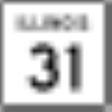
at Illinois Route 31
(Main Street) to the intersection with Illinois Route 83
(Elmhurst Road) by industrial Mount Prospect
. This is a distance of 20.82 miles (33.51 km).
. It is one of the few state roads in Illinois to be shorter than the name of the road that it marks, as Algonquin Road continues westward as McHenry CR A48 to Illinois Route 47
(about 8 miles (12.9 km), or 13 km), eastward as a local road to Oakton Street and Riverside Drive by Interstate 294
(about 5 miles (8 km), or 8 km), and northward as a local road to U.S. Highway 14 (about 5 miles (8 km), or 8 km) in Fox River Grove
. The eastward extent of Algonquin Road is mainly residential, however.
along the current Illinois 62. It followed Oakton Street and Talcott Road (in Park Ridge
) to reach Illinois Route 43
. In 1974, Illinois 62 was dropped east of Illinois 83.
Illinois
Illinois is the fifth-most populous state of the United States of America, and is often noted for being a microcosm of the entire country. With Chicago in the northeast, small industrial cities and great agricultural productivity in central and northern Illinois, and natural resources like coal,...
. It runs from downtown Algonquin
Algonquin, Illinois
Algonquin is a village in Illinois located in both McHenry and Kane counties. It is a northwest suburb of Chicago, located approximately 40 miles from the Loop...
at Illinois Route 31
Illinois Route 31
Illinois Route 31 is a north–south state road in northeastern Illinois, United States. It runs from U.S. Highway 34 in Oswego north to U.S. Highway 12, near the Wisconsin border, just south of Richmond. Illinois 31 is long.- Route description :...
(Main Street) to the intersection with Illinois Route 83
Illinois Route 83
Illinois Route 83 is a major north–south state road in northeast Illinois. It stretches from U.S. Highway 30 by Lynwood and Dyer, Indiana north to the Wisconsin border by Antioch at Highway 83. Incidentally, this alignment is concentric with Interstate 294...
(Elmhurst Road) by industrial Mount Prospect
Mount Prospect, Illinois
Mount Prospect is a village in Elk Grove and Wheeling Townships in Cook County, Illinois, about northwest of downtown Chicago. As of the 2010 census, the village had a total population of 54,167.-Geography:...
. This is a distance of 20.82 miles (33.51 km).
Route description
Illinois 62 is called Algonquin Road for its entire length, and is a northern parallel to Interstate 90Interstate 90
Interstate 90 is the longest Interstate Highway in the United States at . It is the northernmost coast-to-coast interstate, and parallels US 20 for the most part. Its western terminus is in Seattle, at Edgar Martinez Drive S. near Safeco Field and CenturyLink Field, and its eastern terminus is in...
. It is one of the few state roads in Illinois to be shorter than the name of the road that it marks, as Algonquin Road continues westward as McHenry CR A48 to Illinois Route 47
Illinois Route 47
Illinois Route 47 is a largely rural north–south state highway that runs from the Wisconsin state border at Highway 120 near Hebron, to Illinois Route 10, just south of Interstate 72 near Seymour. This is a distance of . Even though Route 47 is primarily rural, in several suburbs of Chicago,...
(about 8 miles (12.9 km), or 13 km), eastward as a local road to Oakton Street and Riverside Drive by Interstate 294
Interstate 294
Interstate 294 is a tolled Interstate Highway in northeastern Illinois, U.S.A.. It forms the southern portion of the Tri-State Tollway in Illinois. I-294 runs from South Holland at Interstates 80 and 94, and Illinois Route 394 to Northbrook at I-94. Interstate 294 is long; are shared with I-80....
(about 5 miles (8 km), or 8 km), and northward as a local road to U.S. Highway 14 (about 5 miles (8 km), or 8 km) in Fox River Grove
Fox River Grove, Illinois
Fox River Grove is a village in the Cuba Township of Lake County and the Algonquin Township of McHenry County, Illinois, United States. The population was 4,862 at the 2000 census.-History:...
. The eastward extent of Algonquin Road is mainly residential, however.
History
SBI Route 62 was Algonquin to ChicagoChicago
Chicago is the largest city in the US state of Illinois. With nearly 2.7 million residents, it is the most populous city in the Midwestern United States and the third most populous in the US, after New York City and Los Angeles...
along the current Illinois 62. It followed Oakton Street and Talcott Road (in Park Ridge
Park Ridge, Illinois
-Climate:-Demographics:As of the census of 2000, there were 37,775 people, 14,219 households, and 10,465 families residing in the city. The population density was 5,374.6 people per square mile . There were 14,646 housing units at an average density of 2,083.8 per square mile...
) to reach Illinois Route 43
Illinois Route 43
Illinois Route 43 is a major north–south state road in the U.S. state of Illinois. It runs from U.S. Route 30 in Frankfort north to the large intersection of Illinois Route 120 and U.S...
. In 1974, Illinois 62 was dropped east of Illinois 83.