

Ladle Hill
Encyclopedia
Ladle Hill lies on Great Litchfield Down, near the village of Burghclere
and Watership Down
, in north Hampshire
. It is immediately to the East of Beacon Hill
. Part of the hill is a 10.37 hectares (25.6 acre) biological SSSI, number 1000642, first notified in 1978. It is 232 metres high and has a hill fort
s and Tumulus
on its slopes. The hill is easily accessed from the nearby cross county footpath, Wayfarer's Walk. The hill falls within the North Wessex Downs Area of Outstanding Natural Beauty
.
in 1931. The site has been invaluable to help archeologists understand the methods employed in the creation of Iron Age date univallate enclosures, with the partially constructed nature of the site revealing features that would normally be concealed in a completed example, such as for for possible setting-out ditches, and piles of chalky soil initially quarried from the ditch and deposited in the interior for finishing the rampart.
At Ladle Hill it has long been suspected that the area demarcated by the unfinished earthworks never actually contained a settlement, although there is a possibility that the hillfort was to be constructed over an earlier unenclosed settlement. Magnetometer surveys from 1997 shows none of the variation normally associated with former occupation sites on chalk geology, and this would seem to confirm that a settlement with typical Iron Age characteristics, such as storage pits, was never established within the boundary of the earthwork.
The earthworks were intended to enclose an area of approximately 3.5 ha (8.6 acre) and was marked by a slight ditch, or possibly an earlier palisaded enclosure. Apart from the dumps of material associated with the abandoned construction works, the interior has very few other earthworks of intelligible character.
. For a kilometer or so of its visible southern course, this earthwork also forms the western boundary of a large field system on Great Litchfield Down. This field system does not extend northwards as far as Ladle Hill.
Immediately to the east of the unfinished hillfort is another linear ditch, not overlain by the hillfort, and is approximately 700 m (765.5 yd) in length, finishing at the head of a coombe below Hare Warren Down. To the east of this linear ditch is another large field system, visible both as areas of earthworks and as soil and crop marks on aerial photographs.
To the southwest of Ladle Hill are two sub-square earthwork enclosures, each of approximately 0.3 ha (0.741315489045828 acre). Both are undated, but a possible link exists between such enclosures, linear ditches, and areas of probable grazing during the time of the late Bronze Age to early Iron Age transition (Cunliffe 1991, pg386). The features surrounding Ladle Hill are beyond the northern limit of the known field system on Great Litchfield Down and west of the fields on Hare Warren Down and Nuthanger Down. The unfinished hill-fort therefore appears to be in an atypical Wessex location, being very close to major linear earthwork features, and in an area without an existing field system.
Immediately to the north of Ladle Hill lies a well preserved disc barrow, some 170 ft (51.8 m) in diameter. Just beyond this there is evidence for traces of platforms that may represent the remains of an unenclosed settlement (Piggott 1931). This feature has never been surveyed in detail and although an open settlement is possible it may be that these are features of other disturbance such as localized surface quarrying.
Within in the northern half of the camp there are traces of a small, low mound, approximately 3 m (9.8 ft) in diameter, thought to be a disc barrow, but magnetometer surveys did not show any trace of a surrounding ditch. The mound today is hardly discernable, but early aerial photographs of the site (circa 1929) show that the mound was better preserved at the time of Piggott’s original surveys in the first half of the 20th century.
or pond.
Upper Chalk, supporting shallow well drained calcareous
silty soils over chalk on slopes and crests. Typically these landscapes may be described as 'dramatic', due to their local scale, visual aesthetic and undulating nature. Escarpments are often formed where layers of chalk have been compressed to form a fold, or where the chalk has been faulted, resulting in accelerated erosion along the line of the weakness.
Many chalk grassland slopes in England show the mark of centuries of grazing by sheep, the slopes bearing a stepped or striped appearance formed by a mixture of soil creep and sheep paths. Such erosion is clearly visible on the slopes of Ladle Hill.
 The flora and fauna on the hill has been recognised to be of particular importance, and is such that it was designated as a biological Site of Special Scientific Interest in 1978. Ladle Hill typifies a calcareous grassland
chalk
downland
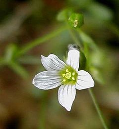
habitat now scarce in Britain, and is home to some unusual and rare species. The earthwork in particular is very rich in species, with a good range of downland grasses and large populations of rare and local plants such as field fleawort Senecio integrifolius, chalk milkwort Polygala calcarea, hairy rock-cress
Arabis hirsuta, fragrant orchid
, Gymnadenia conopsea and pyramidal orchid
, Anacamptis pyramidalis. The earthwork escarpment slopes, though species-rich, support fewer species than within the fort, but some, notably clustered bellflower Campanula glomerata, only occur there.
The site is also importance for its population of the rare July flowering form of the burnt-tip orchid
Orchis ustulata. This form is morphologically distinct, has a peculiar flowering period, and survives now only on a few sites in Britain.
The hill also supports salad burnet
, thyme
, fairy flax
and hairy violet
. There is some scattered scrub on the north-facing slope but there does not appear to be on-going encroachment.
, in the county of Hampshire
. The hill has a summit of 232 m (761.2 ft) AOD just within the civil parish of Litchfield and Woodcott, with the hill also falling within the two other civil parishes of Burghclere
, and Ecchinswell, Sydmonton and Bishops Green
. Nearby to the west lies Beacon Hill
and to the immediate east is Watership Down
. Also to the north east lies Old Burghclere Lime Quarry SSSI. The A303
runs between the Ladle Hill and Beacon Hill to the east. The site and surrounding downs are easily accessible by public footpath, including the nearby cross county footpath, Wayfarer's Walk.
Burghclere
Burghclere is a village and civil parish in the Basingstoke and Deane district of Hampshire, England. According to the 2001 census it had a population of 1,138...
and Watership Down
Watership Down, Hampshire
Watership Down is a hill, or down, at Ecchinswell in the civil parish of Ecchinswell, Sydmonton and Bishops Green in the English county of Hampshire. It rises fairly steeply on its northern flank , but to the south the slope is much gentler . .The Down is best known as the setting for Richard...
, in north Hampshire
Hampshire
Hampshire is a county on the southern coast of England in the United Kingdom. The county town of Hampshire is Winchester, a historic cathedral city that was once the capital of England. Hampshire is notable for housing the original birthplaces of the Royal Navy, British Army, and Royal Air Force...
. It is immediately to the East of Beacon Hill
Beacon Hill, Burghclere, Hampshire
Beacon Hill is near the village of Burghclere and Watership Down, in north Hampshire. The hill's name is derived from the fact that it was one of many Beacon Hills in England and beyond. This hill was once the site of the most famous beacon in Hampshire. It is 261 metres high and has one of...
. Part of the hill is a 10.37 hectares (25.6 acre) biological SSSI, number 1000642, first notified in 1978. It is 232 metres high and has a hill fort
Hill fort
A hill fort is a type of earthworks used as a fortified refuge or defended settlement, located to exploit a rise in elevation for defensive advantage. They are typically European and of the Bronze and Iron Ages. Some were used in the post-Roman period...
s and Tumulus
Tumulus
A tumulus is a mound of earth and stones raised over a grave or graves. Tumuli are also known as barrows, burial mounds, Hügelgrab or kurgans, and can be found throughout much of the world. A tumulus composed largely or entirely of stones is usually referred to as a cairn...
on its slopes. The hill is easily accessed from the nearby cross county footpath, Wayfarer's Walk. The hill falls within the North Wessex Downs Area of Outstanding Natural Beauty
Area of Outstanding Natural Beauty
An Area of Outstanding Natural Beauty is an area of countryside considered to have significant landscape value in England, Wales or Northern Ireland, that has been specially designated by the Countryside Agency on behalf of the United Kingdom government; the Countryside Council for Wales on...
.
Archaeology
The hill fort on the top of the hill has never been excavated, but the land and ditch are sharply defined and well preserved. This iron age fort is roughly rectangular and enclosed 7 acres within an embankment and ditch. There are two probable entrances to the east and west. The work seems to have been undertaken by several different labour forces, each working on a section of the defences, but for some reason the task was abandoned and the fort left unfinished. A 170 ft diameter disc barrow lies just to the North, (scheduled ancient monument number 43) and there are several other barrows in the area, mostly ploughed-out.The unfinished hillfort
Ladle Hill is perhaps the best known of all of the unfinished hillforts in Britain (Feacham 1971). It was First correctly identified as an unfinished hillfort and described in detail by the archaeologist Stuart PiggottStuart Piggott
Stuart Ernest Piggott CBE was a British archaeologist best known for his work on prehistoric Wessex.Born in Petersfield, Hampshire, Piggott was educated at Churcher's College and on leaving school in 1927 took up a post as assistant at Reading Museum where he developed an expertise in Neolithic...
in 1931. The site has been invaluable to help archeologists understand the methods employed in the creation of Iron Age date univallate enclosures, with the partially constructed nature of the site revealing features that would normally be concealed in a completed example, such as for for possible setting-out ditches, and piles of chalky soil initially quarried from the ditch and deposited in the interior for finishing the rampart.
At Ladle Hill it has long been suspected that the area demarcated by the unfinished earthworks never actually contained a settlement, although there is a possibility that the hillfort was to be constructed over an earlier unenclosed settlement. Magnetometer surveys from 1997 shows none of the variation normally associated with former occupation sites on chalk geology, and this would seem to confirm that a settlement with typical Iron Age characteristics, such as storage pits, was never established within the boundary of the earthwork.
The earthworks were intended to enclose an area of approximately 3.5 ha (8.6 acre) and was marked by a slight ditch, or possibly an earlier palisaded enclosure. Apart from the dumps of material associated with the abandoned construction works, the interior has very few other earthworks of intelligible character.
Surrounding area
By contrast the surrounding areas contain a number of features of interest, including for a linear ditch that runs along the crest of the west-facing escarpment of Great Litchfield Down and Ladle Hill, and is approximately 2000 m (2,187.2 yd) in length. It ends at a slight spur overlooking the valley floor barrow cemetery of Seven BarrowsSeven Barrows
thumb|300px|right|A view of four of the barrowsSeven Barrows, situated just North of Lambourn, Berkshire, England, is a site of a Bronze Age cemetery. Excavators have found that one grave alone contained the cremated remains of 100 individuals dating from 2200 BC. The site lies along the Lambourn...
. For a kilometer or so of its visible southern course, this earthwork also forms the western boundary of a large field system on Great Litchfield Down. This field system does not extend northwards as far as Ladle Hill.
Immediately to the east of the unfinished hillfort is another linear ditch, not overlain by the hillfort, and is approximately 700 m (765.5 yd) in length, finishing at the head of a coombe below Hare Warren Down. To the east of this linear ditch is another large field system, visible both as areas of earthworks and as soil and crop marks on aerial photographs.
To the southwest of Ladle Hill are two sub-square earthwork enclosures, each of approximately 0.3 ha (0.741315489045828 acre). Both are undated, but a possible link exists between such enclosures, linear ditches, and areas of probable grazing during the time of the late Bronze Age to early Iron Age transition (Cunliffe 1991, pg386). The features surrounding Ladle Hill are beyond the northern limit of the known field system on Great Litchfield Down and west of the fields on Hare Warren Down and Nuthanger Down. The unfinished hill-fort therefore appears to be in an atypical Wessex location, being very close to major linear earthwork features, and in an area without an existing field system.
Immediately to the north of Ladle Hill lies a well preserved disc barrow, some 170 ft (51.8 m) in diameter. Just beyond this there is evidence for traces of platforms that may represent the remains of an unenclosed settlement (Piggott 1931). This feature has never been surveyed in detail and although an open settlement is possible it may be that these are features of other disturbance such as localized surface quarrying.
Within in the northern half of the camp there are traces of a small, low mound, approximately 3 m (9.8 ft) in diameter, thought to be a disc barrow, but magnetometer surveys did not show any trace of a surrounding ditch. The mound today is hardly discernable, but early aerial photographs of the site (circa 1929) show that the mound was better preserved at the time of Piggott’s original surveys in the first half of the 20th century.
Roman features
Sited on the steep west slope of the hill is a Roman earthwork, formed by the erection of a substantial bank on the down hill side of the slope. It may have been a small circusCircus (building)
The Roman circus was a large open-air venue used for public events in the ancient Roman Empire. The circuses were similar to the ancient Greek hippodromes, although serving varying purposes. Along with theatres and amphitheatres, Circuses were one of the main entertainment sites of the time...
or pond.
Geology
The underlying geology at the site is CretaceousCretaceous
The Cretaceous , derived from the Latin "creta" , usually abbreviated K for its German translation Kreide , is a geologic period and system from circa to million years ago. In the geologic timescale, the Cretaceous follows the Jurassic period and is followed by the Paleogene period of the...
Upper Chalk, supporting shallow well drained calcareous
Calcareous
Calcareous is an adjective meaning mostly or partly composed of calcium carbonate, in other words, containing lime or being chalky. The term is used in a wide variety of scientific disciplines.-In zoology:...
silty soils over chalk on slopes and crests. Typically these landscapes may be described as 'dramatic', due to their local scale, visual aesthetic and undulating nature. Escarpments are often formed where layers of chalk have been compressed to form a fold, or where the chalk has been faulted, resulting in accelerated erosion along the line of the weakness.
Many chalk grassland slopes in England show the mark of centuries of grazing by sheep, the slopes bearing a stepped or striped appearance formed by a mixture of soil creep and sheep paths. Such erosion is clearly visible on the slopes of Ladle Hill.
Ecology
Calcareous grassland
Calcareous grassland is an ecosystem associated with thin basic soil, such as that on chalk and limestone downland. Plants on calcareous grassland are typically short and hardy, and include grasses and herbs such as clover...
chalk
Chalk
Chalk is a soft, white, porous sedimentary rock, a form of limestone composed of the mineral calcite. Calcite is calcium carbonate or CaCO3. It forms under reasonably deep marine conditions from the gradual accumulation of minute calcite plates shed from micro-organisms called coccolithophores....
downland
Downland
A downland is an area of open chalk hills. This term is especially used to describe the chalk countryside in southern England. Areas of downland are often referred to as Downs....
habitat now scarce in Britain, and is home to some unusual and rare species. The earthwork in particular is very rich in species, with a good range of downland grasses and large populations of rare and local plants such as field fleawort Senecio integrifolius, chalk milkwort Polygala calcarea, hairy rock-cress
Arabis hirsuta
Arabis hirsuta is a flowering plant of the genus Arabis in the family Brassicaceae. It is native to Europe, Asia, and the northern half of North America.-External links:****...
Arabis hirsuta, fragrant orchid
Fragrant orchid
Fragrant Orchid is an herbaceous plant belonging to the family Orchidaceae.-Etymology:The name of the genus Gymnodenia is formed from Greek words "gymnos" meaning "nude" and "adèn" meaning "gland" and refers to the characteristics of the organs for secreting nectar...
, Gymnadenia conopsea and pyramidal orchid
Pyramidal orchid
The Pyramidal Orchid, Anacamptis pyramidalis, is an herbaceous perennial plant belonging to the Genus Anacamptis of the family Orchidaceae...
, Anacamptis pyramidalis. The earthwork escarpment slopes, though species-rich, support fewer species than within the fort, but some, notably clustered bellflower Campanula glomerata, only occur there.
The site is also importance for its population of the rare July flowering form of the burnt-tip orchid
Burnt orchid
The Burnt Orchid is a European terrestrial orchid, most common in the mountains. It flowers between April and August depending on the altitude....
Orchis ustulata. This form is morphologically distinct, has a peculiar flowering period, and survives now only on a few sites in Britain.
The hill also supports salad burnet
Salad Burnet
Sanguisorba minor is a plant in the family Rosaceae that is native to western, central and southern Europe; northwest Africa and southwest Western Asia; and which has naturalized in most of North America...
, thyme
Thyme
Thyme is a culinary and medicinal herb of the genus Thymus.-History:Ancient Egyptians used thyme for embalming. The ancient Greeks used it in their baths and burnt it as incense in their temples, believing it was a source of courage...
, fairy flax
Linum catharticum
Linum catharticum or Fairy Flax is an herbaceous flowering plant in the genus Linum, native to central Europe and Western Asia. The plant is annual and blooms in July and August....
and hairy violet
Viola hirta
Viola hirta is a species of the plant genus Viola. It is also called Hairy violet. As with the Sweet Violet no fossil seeds of this species have been found. It is confined to the cold Temperate Zone, in Europe, N. and W. Asia, extending as far as N.-W. India...
. There is some scattered scrub on the north-facing slope but there does not appear to be on-going encroachment.
Location
The site is located at , on Great Litchfield Down, to the southeast of the village of Old BurghclereOld Burghclere
Old Burghclere is a village in Hampshire, England, located south of the large town of Newbury near the A34 road. The village was once on the A34 road and has now been by-passed, although this section is not part of the Newbury bypass.-Governance:...
, in the county of Hampshire
Hampshire
Hampshire is a county on the southern coast of England in the United Kingdom. The county town of Hampshire is Winchester, a historic cathedral city that was once the capital of England. Hampshire is notable for housing the original birthplaces of the Royal Navy, British Army, and Royal Air Force...
. The hill has a summit of 232 m (761.2 ft) AOD just within the civil parish of Litchfield and Woodcott, with the hill also falling within the two other civil parishes of Burghclere
Burghclere
Burghclere is a village and civil parish in the Basingstoke and Deane district of Hampshire, England. According to the 2001 census it had a population of 1,138...
, and Ecchinswell, Sydmonton and Bishops Green
Ecchinswell, Sydmonton and Bishops Green
Ecchinswell, Sydmonton and Bishops Green is a civil parish within the district of Basingstoke and Deane in Hampshire, United Kingdom....
. Nearby to the west lies Beacon Hill
Beacon Hill, Burghclere, Hampshire
Beacon Hill is near the village of Burghclere and Watership Down, in north Hampshire. The hill's name is derived from the fact that it was one of many Beacon Hills in England and beyond. This hill was once the site of the most famous beacon in Hampshire. It is 261 metres high and has one of...
and to the immediate east is Watership Down
Watership Down, Hampshire
Watership Down is a hill, or down, at Ecchinswell in the civil parish of Ecchinswell, Sydmonton and Bishops Green in the English county of Hampshire. It rises fairly steeply on its northern flank , but to the south the slope is much gentler . .The Down is best known as the setting for Richard...
. Also to the north east lies Old Burghclere Lime Quarry SSSI. The A303
A303 road
The A303 is a 92-mile long trunk road in England. It is the main road between Basingstoke in Hampshire and Honiton in Devon. The M3, the A303 and the A30 together make up one of the main routes from London to South West England, running from London to Land's End in Cornwall...
runs between the Ladle Hill and Beacon Hill to the east. The site and surrounding downs are easily accessible by public footpath, including the nearby cross county footpath, Wayfarer's Walk.