
Kugluktuk, Nunavut
Encyclopedia
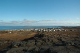
Kugluktuk is a hamlet
located at the mouth of the Coppermine River
in the Kitikmeot Region
of Nunavut
, Canada
, on Coronation Gulf
, southwest of Victoria Island. It is the westernmost community in Nunavut, almost on the border with the Northwest Territories
.
The traditional language of the area was Inuinnaqtun
and is written using the Latin alphabet
rather than the syllabics
of the Inuktitut writing system. Like Cambridge Bay
, Bathurst Inlet
and Umingmaktok
syllabics are rarely seen and used mainly by the Government of Nunavut.
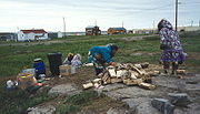
, Northern Store
, co-op store
, and Hunters & Trappers Association. There are two schools, the Kugluktuk High School
and the Jimmy Hikok Ilihakvik. In June 2004, a fuel line broke in the center of Kugluktuk, spilling 2000 l (4,226.8 US pt) of diesel fuel.
 As of the 2006 census
the population was 1,302, an increase of 7.4% from the 2001 census
.
In 1982 a division plebiscite was held. Although about 80% of the population then living in what is now Nunavut voted in favour of division, Kugluktuk, then called Coppermine, was one of only two communities to vote against division, Cambridge Bay
was the other.
. The surrounding landscape is dominated by the rocky and often barren Canadian Shield
. The region has a semi-arid Arctic climate, with very cold winters, light snowfall, and summers too cool to permit the growth of trees. Though trees do exist in the region, they are dwarfed and extremely sparse.
Hamlet (place)
A hamlet is usually a rural settlement which is too small to be considered a village, though sometimes the word is used for a different sort of community. Historically, when a hamlet became large enough to justify building a church, it was then classified as a village...
located at the mouth of the Coppermine River
Coppermine River
The Coppermine River is a river in the North Slave and Kitikmeot regions of the Northwest Territories and Nunavut in Canada. It is long. It rises in Lac de Gras, a small lake near Great Slave Lake and flows generally north to Coronation Gulf, an arm of the Arctic Ocean...
in the Kitikmeot Region
Kitikmeot Region, Nunavut
Kitikmeot Region is an administrative region of Nunavut, Canada. It consists of the southern and eastern parts of Victoria Island with the adjacent part of the mainland as far as the Boothia Peninsula, together with King William Island and the southern portion of Prince of Wales Island...
of Nunavut
Nunavut
Nunavut is the largest and newest federal territory of Canada; it was separated officially from the Northwest Territories on April 1, 1999, via the Nunavut Act and the Nunavut Land Claims Agreement Act, though the actual boundaries had been established in 1993...
, Canada
Canada
Canada is a North American country consisting of ten provinces and three territories. Located in the northern part of the continent, it extends from the Atlantic Ocean in the east to the Pacific Ocean in the west, and northward into the Arctic Ocean...
, on Coronation Gulf
Coronation Gulf
Coronation Gulf lies between Victoria Island and mainland Nunavut in Canada. To the northwest it connects with Dolphin and Union Strait and thence the Beaufort Sea and Arctic Ocean; to the northeast it connects with Dease Strait and thence Queen Maud Gulf. To the southeast lies Bathurst...
, southwest of Victoria Island. It is the westernmost community in Nunavut, almost on the border with the Northwest Territories
Northwest Territories
The Northwest Territories is a federal territory of Canada.Located in northern Canada, the territory borders Canada's two other territories, Yukon to the west and Nunavut to the east, and three provinces: British Columbia to the southwest, and Alberta and Saskatchewan to the south...
.
The traditional language of the area was Inuinnaqtun
Inuinnaqtun
Inuinnaqtun , is an indigenous Inuit language of Canada and a dialect of Inuvialuktun. It is related very closely to Inuktitut, and some scholars, such as Richard Condon, believe that Inuinnaqtun is more appropriately classified as a dialect of Inuktitut...
and is written using the Latin alphabet
Latin alphabet
The Latin alphabet, also called the Roman alphabet, is the most recognized alphabet used in the world today. It evolved from a western variety of the Greek alphabet called the Cumaean alphabet, which was adopted and modified by the Etruscans who ruled early Rome...
rather than the syllabics
Inuktitut syllabics
Inuktitut syllabics is a writing system used by the Inuit in Nunavut and in Nunavik, Quebec...
of the Inuktitut writing system. Like Cambridge Bay
Cambridge Bay, Nunavut
Cambridge Bay, named for Prince Adolphus, Duke of Cambridge, is a hamlet located in the Kitikmeot Region of Nunavut, Canada...
, Bathurst Inlet
Bathurst Inlet, Nunavut
Bathhurst Inlet, , is a small Inuit community located in Bathurst Inlet in the Kitikmeot Region of Canada's Nunavut Territory...
and Umingmaktok
Umingmaktok, Nunavut
The community of Umingmaktok is located in Bathurst Inlet in the Kitikmeot Region of Canada's Nunavut Territory...
syllabics are rarely seen and used mainly by the Government of Nunavut.
Location
The community has the usual services, a post officeCanada Post
Canada Post Corporation, known more simply as Canada Post , is the Canadian crown corporation which functions as the country's primary postal operator...
, Northern Store
The North West Company
The North West Company is a grocery and merchandise store in remote communities across northern Canada and Alaska. Through its subsidiary, Cost-U-Less stores it also operates in the US territories of Guam, The CNMI, and American Samoa and in the Caribbean....
, co-op store
Consumers' cooperative
Consumer cooperatives are enterprises owned by consumers and managed democratically which aim at fulfilling the needs and aspirations of their members. They operate within the market system, independently of the state, as a form of mutual aid, oriented toward service rather than pecuniary profit...
, and Hunters & Trappers Association. There are two schools, the Kugluktuk High School
Kugluktuk High School
Kugluktuk High School is a high school in Kugluktuk, Nunavut, Canada. The school, which serves a town of some thirteen hundred people has about 160 students from grades seven to twelve...
and the Jimmy Hikok Ilihakvik. In June 2004, a fuel line broke in the center of Kugluktuk, spilling 2000 l (4,226.8 US pt) of diesel fuel.
Demographics
Canada 2006 Census
The Canada 2006 Census was a detailed enumeration of the Canadian population. Census day was May 16, 2006. The next census following will be the 2011 Census. Canada's total population enumerated by the 2006 census was 31,612,897...
the population was 1,302, an increase of 7.4% from the 2001 census
Canada 2001 Census
The Canada 2001 Census was a detailed enumeration of the Canadian population. Census day was May 15, 2001. On that day, Statistics Canada attempted to count every person in Canada. The total population count of Canada was 30,007,094. This was a 4% increase over 1996 Census of 28,846,761. In...
.
In 1982 a division plebiscite was held. Although about 80% of the population then living in what is now Nunavut voted in favour of division, Kugluktuk, then called Coppermine, was one of only two communities to vote against division, Cambridge Bay
Cambridge Bay, Nunavut
Cambridge Bay, named for Prince Adolphus, Duke of Cambridge, is a hamlet located in the Kitikmeot Region of Nunavut, Canada...
was the other.
Geography
Kugluktuk is located on the shore of the Arctic OceanArctic Ocean
The Arctic Ocean, located in the Northern Hemisphere and mostly in the Arctic north polar region, is the smallest and shallowest of the world's five major oceanic divisions...
. The surrounding landscape is dominated by the rocky and often barren Canadian Shield
Canadian Shield
The Canadian Shield, also called the Laurentian Plateau, or Bouclier Canadien , is a vast geological shield covered by a thin layer of soil that forms the nucleus of the North American or Laurentia craton. It is an area mostly composed of igneous rock which relates to its long volcanic history...
. The region has a semi-arid Arctic climate, with very cold winters, light snowfall, and summers too cool to permit the growth of trees. Though trees do exist in the region, they are dwarfed and extremely sparse.
Flora and fauna
Plant growth in the region during summer months includes small shrubs, grass, moss, lichens, blueberries, blackberries, cranberries, various flowers, and dwarfed pine and birch trees.Climate
See also
- Kugluk/Bloody Falls Territorial ParkKugluk/Bloody Falls Territorial ParkKugluk/Bloody Falls Territorial Park is located about southwest of Kugluktuk, Nunavut, Canada. The park is situated around the Bloody Falls on the Coppermine River and was listed as a national historic site in 1978.The park is probably best known as the site of the Bloody Falls Massacre that...
- Bloody Falls MassacreBloody Falls MassacreThe Massacre at Bloody Falls was an incident that took place during Samuel Hearne's exploration of the Coppermine River on 17 July 1771. Chipewyan and "Copper Indian" Dene men led by Hearne's guide and companion Matonabbee attacked a group of Copper Inuit camped by rapids approximately upstream...
- Bloody FallsBloody FallsBloody Falls is a waterfall in the Kugluk/Bloody Falls Territorial Park and is the site of the Bloody Falls Massacre and the murder of two priests by Copper Inuit Uloqsaq and Sinnisiak in 1913...
- Kugluktuk AirportKugluktuk AirportKugluktuk Airport is located at Kugluktuk, Nunavut, Canada, and is operated by the Government of Nunavut.-Airlines and destinations:...
- Joe Allen EvyagotailakJoe Allen EvyagotailakJoe Allen Evyagotailak was born 15 July 1953 in Kugluktuk, Nunavut, Canada. Evyagotailak was the Member of the Legislative Assembly for the electoral district of Kugluktuk having won the seat in the 2004 Nunavut election....
- Donald HavioyakDonald HavioyakDonald Havioyak is a territorial level politician in Canada. He served as a member of the Nunavut Legislature.Havioyak was elected to the Nunavut legislature in the 1999 Nunavut general election. He won the Kugluktuk electoral district with a plurality of six votes defeating three other candidates...
- Lena Pedersen
- KangiryuatjagmiutKangiryuatjagmiutKangiryuatjagmiut were a Copper Inuit subgroup. They lived around Minto Inlet, and between Minto inlet and Walker Bay....
- KangiryuarmiutKangiryuarmiutThe Kangiryuarmiut were a Copper Inuit subgroup. They were located on Victoria Island in the areas of Prince Albert Sound, Cape Baring, and central Victoria island. They were also found around Nelson Head on Banks Island. Kangiryuarmiut subsisted on bear. They were the only Copper Inuit who...
- John Reginald SperryJohn Reginald SperryThe Rt Rev. John Reginald Sperry was Bishop of The Arctic from 1974 to 1990.Born on 2 May 1924, educated at King's College, Halifax and ordained in 1951, he began his career at St Andrew’s Mission in the Northwest Territories. Later he was a Canon at All Saints’ Cathedral, Aklavik and then...