

Kilcommon
Encyclopedia
Kilcommon is a civil parish
in Erris
, north Mayo
consisting of two large peninsulas; Dún Chaocháin
and Dún Chiortáin
. It consists of 37 townland
s, some of which are so remote that they have no inhabitants. Habitation is concentrated mainly along both sides of Sruwaddacon Bay
which flows into Broadhaven Bay
, in villages including Glengad
, Pollathomas, Rossport
and Carrowteige
, and in the Glenamoy
area further inland.
Letters of 1838 (O'Donovan), the writers says "of the old church itself only a part of one gable remains from which little can be learned of its style or age".
which, for thousands of years has remained relatively unscathed by over-development by successive generations of Kilcommon inhabitants. Farming is small scale non-intensive.
Situated at the mouth of Broadhaven Bay
, on its 21st century surface, Kilcommon is characterised by its scenery, huge towering cliffs and rugged sea stacks interspersed with miles of white sandy beaches, tranquil islands and vast tracts of blanket bog with its rare and fragile biodiversity
. Unlike the west of Ireland landscape further south in Galway and Clare, there are few huge rocks randomly scattered across this landscape.
The blanket bog dominates the landscape changing its hues and texture in accordance with the seasons – sometimes fresh and brightest green, sometimes purple and gold and covered with billowing white bog cotton, and, in November and December, the wonderful rustic tones of golden orange/red species light up the winter landscape. At all times the bog is a living habitat for many species of insects, spiders and plants for whom this is the perfect habitat not found anywhere else. Grey fronted geese fly across on their way to their breeding grounds further north and it is possible to spot the corncrake and the rare Red-necked Phalarope
whose only breeding ground left in Ireland is in this remote corner of the country.
 Kilcommon parish comprises a very ancient landscape of glittering schist
and pale creamy psammite
along with some two billion year old pre-Cambrian pink striped gneiss
es. Boulders of snow white quartz which intruded into the bedrock from geological turmoil below, some 450 million years ago (Silurian period) are to be found in the western part of the parish. The bedrock, exposed when the blanket bog is cut away to provide fuel for the rural community here, demonstrate that this land has seen geomorphological turmoil over the last two billion years – periods of intense heat, intense cold, pressure and tectonic shifts which have moulded and remoulded the landscape into what it is today.
There are two main peninsulas in the parish - Dún Chiortáin and Dún Chaocháin. They are named for two 'giant' brothers who live on in the folklore of the area. They each had a Dún or a promontory fort and folktales relate that they shared kitchen utensils which they used to throw across Sruwaddacon Bay
(Sruth Fhada Chonn - Bay of the Long Hound) which divided their territories.
Sea cliffs run along much of the coast from the 892 feet (271.9 m) high Benwee Head
and along the north coastline to Glinsc
mountain. The rocky islands known as The Stags, pictured below are to be seen off the North Kilcommon coastline.
trees which were part of the ancient forests which covered most of inland Ireland after the retreat of the last Ice Age some 15,000 years ago are to be seen across the landscape, exposed by turf cutting in recent years. There are many archaeological remains
throughout the parish also, mainly in the western portion as the land to the east was, and still remains to a great extent, inaccessible and uninhabited. The area has a very large number of megalithic tomb remains and most types of megalithic are represented although because there has been no money spent on archaeological investigation in this parish, the archaeological resource is little documented. In the eastern portion of the parish there is evidence of the presence of possible crannogs in lakes which point towards some habitation in the past. In recent times the growth of blanket bog, conifer forestry plantations and the absence of roads through the area, has made townlands such as Bunalty, Barrooskey, Baralty, Srahnaplaigh and Muingnabo difficult to access except by the most intrepid of explorers. In the western parts of the parish, archaeological remains stretching from the Mesolithic
through Neolithic
, Bronze Age
, Iron Age
, Early Christian, Plantations, to the current day are widely seen.
, Ceathru Thaidhg as Dún Chaocháin Walks and Suiloídi Iorrais.
speaking and Catholic Mass is celebrated in Irish in Ceathru Thaidhg in the far north of the parish. There is an Irish language summer school
in Ceathru Thaidhg
.
Christ the King Church, Aughoose,
St. Paul's Church, Glenamoy,
St. Patrick's Church, Inver,
Star of the Sea Church, Cornboy, and
Séipéal Muire gan Smál, Ceathru Thaidhg
During the 18th century, at a time known as the Penal Times, the Dublin government restricted the number and movement of Roman Catholic clergy. At that time the parish of Kilcommon comprised all of 'mainland' Erris (from Claggan, Ballycroy to Portacloy). That territorial name and boundary is still used for civil administration.
and Kilcommon which remain to this day. There are 37 townlands in the modern parish of Kilcommon. Some of these are:-
and the Mullet Peninsula, northwards out the Dun Chaocháin peninsula to Glengad
and Pollathomas, eastwards to Glenamoy
and the Ceide Fields
and southwards to Carrowmore Lake
, Bangor Erris
and hence eventually to Castlebar
and Ballina
some 80 km distant. John Healy runs a fairly large general store, shop and petrol station at Barnatra which serves much of the Kilcommon area.
under heavy security which has been built on Irish government
Coillte controlled afforested conifer plantation land by Royal Dutch Shell
. The townland is situated at the most south easterly point of the Sruwaddacon Bay
estuary. The Aughoose River, also known as the Yellow river flows through the townland on its way to Carrowmore Lake, the drinking water supply for the whole of Erris. Found along the river bed is the soft yellow subsoil which gives the townland its name. The townland has flooded many times over the years and people have been killed in these floods. In the 19th century the home of the Swift family in this townland was a well known house of hospitality where any travellers were welcomed for overnight stays as they travelled between Belmullet
and Ballycastle
/Killala
.
is based in this village and way-marked cliff walks start from here.
and the wider Atlantic Ocean
. Notable for its massive microtoponymic collection and its ancient graveyard
situated on the northern side of Sruwaddacon Bay
.
. The people once lived further down close to Cornboy Pier but over the years blowing sand has moved the centre of population further from the extensive sand dune areas.
There is an area known as the 'Sandhills Settlement' which consists of settlement features, possibly cairns and middens where a population lived (possibly Iron Age). It is a large area consisting of large sand dunes and sandy beaches which sometimes becomes exposed after a storm but the next storm covers it up again with deep sand. The Gweedaney River rises at Portacloy and flows past the old chapel in the dunes into Sruth Fada Conn bay. The modern church is situated much further inland. Cornboy shares Knockadaff mountain with Garter Hill. Knockadaff was an electoral district of the Belmullet
Poor Union and was a local administrative body of Erris
. Cornboy was, at the end of the 19th century the most progressive village in the area. These days it has a community centre which serves meals at lunch-time and is a centre where some classes take place for local people.
. Its area is 946 acres (3.8 km²) lying along the northern boundary of Carrowmore Lake. This remote spot, much of it blanketed in bog nowadays, belies its busy prehistoric past. There are many prehistoric megaliths and prehistoric field systems across its landscape and that of its neighbour, Muingerroon td.
. Lace school
s were one of the more common industries in the area in the past. There were several shooting lodges in this area where the landlords held shooting parties for the gentry in the 19th century. Nowadays, mostly small farms and football are the interests of the inhabitants.
System of farming which can be seen in many areas of the parish. In recent years Glengad has been the scene for much of the Corrib gas controversy.
is a remote townland in Erris
, North West Mayo. Glinsk Mountain is covered with blanket bog and rises steeply to overlook Broadhaven Bay
and the Stags of Broadhaven, pictured below, from very high vertical cliffs continuing from the spectacular Benwee Head
cliffs. Its area covers 2054 acres (8.3 km²). There are currently no human inhabitants of this townland and the road past it was only tarred for the first time in 2004. There is the ruins of a 1798 English watch tower on the southern slopes of Glinsk mountain.
through Inver td. In 1636 Michael Cormuck lived in Inver Castle which was built close to the shore. While Cormuck laid claim to much of the land in Erris, the Protestant bishop had, according to the Stafford Inquisition of Mayo which investigated the ownership of land in the county in the early 17th century, the "right of the sea all around Erris". The castle had fallen by 1802 and on its site today there is very little to be seen except its gate posts. Many cottages locally, now mostly in ruins, are constructed of particularly well masonried stone blocks, so presumably the castle was pilfered of its stonework due to population pressure in the years between 1802 and the Irish Famine some 40 years later. Several ships of the Spanish Armada
and many other ships were lost on the rugged coastline of the Dún Chiortán peninsula over the years. The 17th century story of Brian Rua relates just such a story. This townland was the centre of sporting activity down through the years. Sports such as horse-racing and curragh racing were held at the Inver sand-banks. There are many megalithic relics in the Inver area. Its a pretty place on the southern slopes of the hills and gets a lot of sunshine throughout the year.
This townland features in the story of the Táin Bó Flidhais
and an archaeological mound found in Inver is alleged to be the burial place of the unfortunate husband of Flidhais
when left stranded by the Kilcommon Celtic hero, Chiortain, after whom this peninsula is named.
, Co. Mayo. It is one of the largest sites in the Bog Restoration project http://www.irishbogrestorationproject.ie/index.html covering an area of 166 hectares, c. 100 hectares of which are planted with conifers. A portion of the site lies within the Glenamoy
Bog Complex Special Area of Conservation
. The blanket bog habitat within this SAC is one of the largest areas of the habitat in the country and is perhaps the best example of blanket bog occurring in an extreme oceanic environment. The SAC area in general has an excellent representation of typical blanket bog habitats. Of particular note is the occurrence of numerous flushes and streams, some of which are extensive and support rare plant species such as the moss Homalothecium nitens and the legally protected marsh saxifrage (Saxifraga hirculus).
Much of the afforested portion of the site comprises relatively young conifer trees under which there still exists a bog flora, albeit modified and species-poor. A substantial area of high quality, uplanted blanket bog also occurs within the site and this area contains many large pools. The bog vegetation is generally dominated by purple moor-grass (Molinia caerulea) and black bog-rush (Schoenus nigricans) while the blanket bog pools are characterised by a sparse flora which includes bog bean (Menyanthes trifoliata), many-stemmed spike-rush (Eleocharis multicaulis) and pipewort (Eriocaulon aquaticum). The European distribution of this latter species is confined to lakes and pools in lowland blanket bog areas of Ireland and western Scotland. This area of bog has also a well- developed Sphagnum cover including some large hummocks of Sphagnum imbricatum and S. fuscum.
. It has a post office/shop, a busy hostel, a couple of pubs, a national school and a sizeable population. The graveyard had a 6th century religious establishment of St. Coman which was mentioned in the Annals of the Four Masters
. When the Anglo Normans came to Ireland there were several slayings recorded of the new English by the native tribespeople. In 1585 during the Reformation
Pollathomas became the property of the Protestant Bishop of Killala
and Michael Cormuck who lived at Inver Castle was the lessee. Several religious settlers including the Augustinians
, were driven out of the area during the penal law
period of the 17th century. In 1770 Pollathomas and Glengad
were leased from the Protestant Bishop by the O'Donel's of Termon, and Kilcommon Lodge, now a thriving hostel was built. Famine and devastation hit Pollathomas several times in the 19th century before the Irish Famine of 1845/47 due to sheer pressure of population. During the Great Famine of 1845/47 the little relief came from the Quakers when the response for provisions to be sent to the area urgently, was to turn down the request. The people ate seaweed and sea-gulls eggs. The landlord, James O'Donel was attacked in Kilcommon Lodge. He demanded that a police barracks be built to protect his family but none was ever built. He bred crow
s and nurtured them so that they would protect his property. Throughout the 19th century, evictions and proselytising were commonplace. It is now a quiet village, occasionally affected by the rumblings of the Corrib gas project with a couple of public houses (Maguires and McGraths), a general store and post office and Kilcommon Lodge Hostel, a popular destination for visitors to the area.
has its nearest shop. There is the remains of a promontory fort
and an English watchtower
here. The Government neglected Portacloy as a fishing port, building a harbour in Porturlin instead but in 1909 a boat slip, breakwater and landing place were built to facilitate the fish curing station which had been built a few years earlier to process mackerel
. In the 1960s a second small pier was built. Portacloy still remains a peaceful pleasant cove.
erected a curing station for herring and mackerel in 1894. By 1952 the old pier had fallen asunder and was replaced in 1965 by Mayo County Council
.
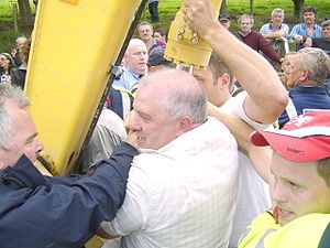
In February 2010, Pat 'The Chief' O'Donnell, owner of a fish processing plant in Porturlin and fifth generation fisherman served a contested seven-month sentence in Castlerea
Prison for his participation in protests against the Corrib gas project
which he believes poses an unacceptable risk to the area, including his own livelihood and that of all fishermen in the Broadhaven Bay
area.
 Rossport has an area of 1446 acres (5.9 km²). There is a national school and the Gaelic speaking secondary school, Colaiste Chomain in Rossport. There have been many suggestions over the years to build a bridge across the 'ferry' to connect Rossport with the Dún Chiortáin peninsula as it is very close as the crow flies but a very great distance by vehicle. The flowing and ebbing tides of Sruwaddacon Bay
are hazardous even for the most experienced boatman. The words of a song describe the rapidity of the current:
In more recent years, Rossport
has been the scene of conflict with the Corrib gas project and protests
against same.
reported, "remote as these habitations may appear to many, there is no lack of worldly knowledge and cultural attainments and many of their sons and daughters have risen to important posts in countries beyond the seas".
. After many years and many changes of proposed route for a high pressure raw gas pipeline running through the area many aspects of the proposed project have been strongly disputed. A refinery has been built 10 kilometres inland by Royal Dutch Shell
that has no access to the proposed landfall site. There have been several Oral Hearings held about this problem by An Bord Pleanála
but Permission has now been granted. Works commenced in July 2011.
resources in the world due to its location on the Atlantic Ocean
which brings almost constant winds from the sea. The natural resources of ocean and wind available in Kilcommon are very valuable resources for sustainable alternative, renewable energy
production for the future.
There are opportunities for the development of ocean wave power
projects, one of the best wave energy resources in the world lies off the shores of North Mayo. Tidal power
, hydroelectric schemes, and extensive wind farms are amongst many other clean, alternative energy generation opportunities for which the area has great potential for a beneficial sustainable future.
Civil parish
In England, a civil parish is a territorial designation and, where they are found, the lowest tier of local government below districts and counties...
in Erris
Erris
Erris is a barony in northwestern County Mayo in Ireland consisting of over , much of which is mountainous blanket bog. It has extensive sea coasts along its west and north boundaries. The main towns are Belmullet and Bangor Erris. The name Erris derives from the Irish 'Iar Ros' meaning 'western...
, north Mayo
County Mayo
County Mayo is a county in Ireland. It is located in the West Region and is also part of the province of Connacht. It is named after the village of Mayo, which is now generally known as Mayo Abbey. Mayo County Council is the local authority for the county. The population of the county is 130,552...
consisting of two large peninsulas; Dún Chaocháin
Carrowteige
Ceathrú Thaidhg is a Gaeltacht village and townland on the Dún Chaocháin peninsula in northwestern County Mayo, Ireland. It is within Kilcommon parish in the barony of Erris...
and Dún Chiortáin
Táin Bó Flidhais
Táin Bó Flidhais, also known as the Mayo Táin, is a tale from the Ulster Cycle of early Irish literature. It is one of a group of works known as Táin Bó, or "cattle raid" stories, the best known of which is Táin Bó Cúailnge...
. It consists of 37 townland
Townland
A townland or bally is a small geographical division of land used in Ireland. The townland system is of Gaelic origin—most townlands are believed to pre-date the Norman invasion and most have names derived from the Irish language...
s, some of which are so remote that they have no inhabitants. Habitation is concentrated mainly along both sides of Sruwaddacon Bay
Sruwaddacon Bay
Sruwaddacon Bay is a tidal estuary which runs through the middle of the Gaeltacht Kilcommon Parish, Erris, North County Mayo; it is of historical importance in Irish legend, an important marine habitat, an E.U. Special Area of Conservation and an E.U...
which flows into Broadhaven Bay
Broadhaven Bay
Broadhaven Bay is a natural bay of the Atlantic Ocean situated on the northwestern coast of County Mayo, Ireland. The opening of the bay faces northward, stretching between Erris Head on the west side and Kid Island on the east side with approximately 8.6 km between the two sides.It borders...
, in villages including Glengad
Glengad
Glengad is a small Gaeltacht village in the parish of Kilcommon in northwest County Mayo, Ireland. The townland is also known as Dooncarton , a name which comes from an Iron Age tribal chieftain called Ciortan, a character who appears in the Ulster Cycle legend of the Táin Bó Flidhais.The village...
, Pollathomas, Rossport
Rossport
Ros Dumhach is a Gaeltacht village and townland in northwest County Mayo, Ireland. It is within the barony of Erris and parish of Kilcommon...
and Carrowteige
Carrowteige
Ceathrú Thaidhg is a Gaeltacht village and townland on the Dún Chaocháin peninsula in northwestern County Mayo, Ireland. It is within Kilcommon parish in the barony of Erris...
, and in the Glenamoy
Glenamoy
Glenamoy is a village in the parish of Kilcommon, Erris in the northern part of County Mayo in Ireland.Glenamoy is a general term for the following townlands:* Bellagelly North...
area further inland.
History
Kilcommon parish takes it name from St. Comán who lived around the end of the sixth century AD. The saint is allegedly buried in the old church yard at Pollatomais, near to the entrance where the walls of the old Church can still be seen. In the Ordnance SurveyOrdnance Survey
Ordnance Survey , an executive agency and non-ministerial government department of the Government of the United Kingdom, is the national mapping agency for Great Britain, producing maps of Great Britain , and one of the world's largest producers of maps.The name reflects its creation together with...
Letters of 1838 (O'Donovan), the writers says "of the old church itself only a part of one gable remains from which little can be learned of its style or age".
Topography
Much of the Kilcommon landscape of elevated moorland, borders the Atlantic coast. It is a wild and rugged landscape with large tracts of blanket bog, tiny isolated villages, white sandy beaches and towering cliffs of Benwee HeadBenwee Head
Benwee Head Cliffs County MayoGaelic: An Bhinn BhuíHeight: 304 metres OS 1/50k Mapsheet: 22 for topGrid Ref: F816 443 Latitude: 54.333659 Longitude: -9.820924ITM: 481576 844301 Prominence: 230m Isolation: 5.4 km...
which, for thousands of years has remained relatively unscathed by over-development by successive generations of Kilcommon inhabitants. Farming is small scale non-intensive.
Situated at the mouth of Broadhaven Bay
Broadhaven Bay
Broadhaven Bay is a natural bay of the Atlantic Ocean situated on the northwestern coast of County Mayo, Ireland. The opening of the bay faces northward, stretching between Erris Head on the west side and Kid Island on the east side with approximately 8.6 km between the two sides.It borders...
, on its 21st century surface, Kilcommon is characterised by its scenery, huge towering cliffs and rugged sea stacks interspersed with miles of white sandy beaches, tranquil islands and vast tracts of blanket bog with its rare and fragile biodiversity
Biodiversity
Biodiversity is the degree of variation of life forms within a given ecosystem, biome, or an entire planet. Biodiversity is a measure of the health of ecosystems. Biodiversity is in part a function of climate. In terrestrial habitats, tropical regions are typically rich whereas polar regions...
. Unlike the west of Ireland landscape further south in Galway and Clare, there are few huge rocks randomly scattered across this landscape.
The blanket bog dominates the landscape changing its hues and texture in accordance with the seasons – sometimes fresh and brightest green, sometimes purple and gold and covered with billowing white bog cotton, and, in November and December, the wonderful rustic tones of golden orange/red species light up the winter landscape. At all times the bog is a living habitat for many species of insects, spiders and plants for whom this is the perfect habitat not found anywhere else. Grey fronted geese fly across on their way to their breeding grounds further north and it is possible to spot the corncrake and the rare Red-necked Phalarope
Red-necked Phalarope
The Red-necked Phalarope, Phalaropus lobatus, is a small wader. This phalarope breeds in the Arctic regions of North America and Eurasia. It is migratory, and, unusually for a wader, winters at sea on tropical oceans....
whose only breeding ground left in Ireland is in this remote corner of the country.
Geology
Schist
The schists constitute a group of medium-grade metamorphic rocks, chiefly notable for the preponderance of lamellar minerals such as micas, chlorite, talc, hornblende, graphite, and others. Quartz often occurs in drawn-out grains to such an extent that a particular form called quartz schist is...
and pale creamy psammite
Psammite
Psammite is a general term for sandstone. It is equivalent to the Latin-derived term arenite. Also, it is commonly used in various publications to describe a metamorphosed sedimentary rock with a dominantly sandstone protolith. In Europe, this term was formerly used for a fine-grained, fissile,...
along with some two billion year old pre-Cambrian pink striped gneiss
Gneiss
Gneiss is a common and widely distributed type of rock formed by high-grade regional metamorphic processes from pre-existing formations that were originally either igneous or sedimentary rocks.-Etymology:...
es. Boulders of snow white quartz which intruded into the bedrock from geological turmoil below, some 450 million years ago (Silurian period) are to be found in the western part of the parish. The bedrock, exposed when the blanket bog is cut away to provide fuel for the rural community here, demonstrate that this land has seen geomorphological turmoil over the last two billion years – periods of intense heat, intense cold, pressure and tectonic shifts which have moulded and remoulded the landscape into what it is today.
There are two main peninsulas in the parish - Dún Chiortáin and Dún Chaocháin. They are named for two 'giant' brothers who live on in the folklore of the area. They each had a Dún or a promontory fort and folktales relate that they shared kitchen utensils which they used to throw across Sruwaddacon Bay
Sruwaddacon Bay
Sruwaddacon Bay is a tidal estuary which runs through the middle of the Gaeltacht Kilcommon Parish, Erris, North County Mayo; it is of historical importance in Irish legend, an important marine habitat, an E.U. Special Area of Conservation and an E.U...
(Sruth Fhada Chonn - Bay of the Long Hound) which divided their territories.
Sea cliffs run along much of the coast from the 892 feet (271.9 m) high Benwee Head
Benwee Head
Benwee Head Cliffs County MayoGaelic: An Bhinn BhuíHeight: 304 metres OS 1/50k Mapsheet: 22 for topGrid Ref: F816 443 Latitude: 54.333659 Longitude: -9.820924ITM: 481576 844301 Prominence: 230m Isolation: 5.4 km...
and along the north coastline to Glinsc
Glinsc
Glinsce is a Gaeltacht townland in County Mayo, Ireland. It is in the parish of Kilcommon and barony of Erris...
mountain. The rocky islands known as The Stags, pictured below are to be seen off the North Kilcommon coastline.
Archaeology
The fossilised remains of ancient Scots PineScots Pine
Pinus sylvestris, commonly known as the Scots Pine, is a species of pine native to Europe and Asia, ranging from Scotland, Ireland and Portugal in the west, east to eastern Siberia, south to the Caucasus Mountains, and as far north as well inside the Arctic Circle in Scandinavia...
trees which were part of the ancient forests which covered most of inland Ireland after the retreat of the last Ice Age some 15,000 years ago are to be seen across the landscape, exposed by turf cutting in recent years. There are many archaeological remains
Faulagh
Faulagh is a townland in Kilcommon, Erris, County Mayo, Ireland, some in size. It's a remote spot on the main Ballycastle to Belmullet road. Faulagh and its neighbouring townland Muingerroon South are located on a mountain which skirts the townland of Bellanaboy where the contentious Corrib Gas...
throughout the parish also, mainly in the western portion as the land to the east was, and still remains to a great extent, inaccessible and uninhabited. The area has a very large number of megalithic tomb remains and most types of megalithic are represented although because there has been no money spent on archaeological investigation in this parish, the archaeological resource is little documented. In the eastern portion of the parish there is evidence of the presence of possible crannogs in lakes which point towards some habitation in the past. In recent times the growth of blanket bog, conifer forestry plantations and the absence of roads through the area, has made townlands such as Bunalty, Barrooskey, Baralty, Srahnaplaigh and Muingnabo difficult to access except by the most intrepid of explorers. In the western parts of the parish, archaeological remains stretching from the Mesolithic
Mesolithic
The Mesolithic is an archaeological concept used to refer to certain groups of archaeological cultures defined as falling between the Paleolithic and the Neolithic....
through Neolithic
Neolithic
The Neolithic Age, Era, or Period, or New Stone Age, was a period in the development of human technology, beginning about 9500 BC in some parts of the Middle East, and later in other parts of the world. It is traditionally considered as the last part of the Stone Age...
, Bronze Age
Bronze Age
The Bronze Age is a period characterized by the use of copper and its alloy bronze as the chief hard materials in the manufacture of some implements and weapons. Chronologically, it stands between the Stone Age and Iron Age...
, Iron Age
Iron Age
The Iron Age is the archaeological period generally occurring after the Bronze Age, marked by the prevalent use of iron. The early period of the age is characterized by the widespread use of iron or steel. The adoption of such material coincided with other changes in society, including differing...
, Early Christian, Plantations, to the current day are widely seen.
Cliff Walks - way-marked walks
There are several way-marked walks along the remote cliffs of Benwee Head in the north of the parish. Maps have been published by Comhar Dún Chaocháin TeoComhar Dún Chaocháin Teo
Comhar Dún Chaocháin Teo is a community development co-operative based in the peripheral, rural, Gaeltacht, North Mayo area of Ireland. It is registered with the Registry of Friendly Societies and its purpose is to promote the linguistic, cultural, infrastructural, educational and social...
, Ceathru Thaidhg as Dún Chaocháin Walks and Suiloídi Iorrais.
Gaeltacht
Much of Kilcommon (Cill Chomáin) parish is GaelicIrish language
Irish , also known as Irish Gaelic, is a Goidelic language of the Indo-European language family, originating in Ireland and historically spoken by the Irish people. Irish is now spoken as a first language by a minority of Irish people, as well as being a second language of a larger proportion of...
speaking and Catholic Mass is celebrated in Irish in Ceathru Thaidhg in the far north of the parish. There is an Irish language summer school
Comhar Dún Chaocháin Teo
Comhar Dún Chaocháin Teo is a community development co-operative based in the peripheral, rural, Gaeltacht, North Mayo area of Ireland. It is registered with the Registry of Friendly Societies and its purpose is to promote the linguistic, cultural, infrastructural, educational and social...
in Ceathru Thaidhg
Carrowteige
Ceathrú Thaidhg is a Gaeltacht village and townland on the Dún Chaocháin peninsula in northwestern County Mayo, Ireland. It is within Kilcommon parish in the barony of Erris...
.
Kilcommon Churches
There are five Roman Catholic Churches in the parish namely:-Christ the King Church, Aughoose,
St. Paul's Church, Glenamoy,
St. Patrick's Church, Inver,
Star of the Sea Church, Cornboy, and
Séipéal Muire gan Smál, Ceathru Thaidhg
During the 18th century, at a time known as the Penal Times, the Dublin government restricted the number and movement of Roman Catholic clergy. At that time the parish of Kilcommon comprised all of 'mainland' Erris (from Claggan, Ballycroy to Portacloy). That territorial name and boundary is still used for civil administration.
Kilcommon Townlands
Kilcommon used to refer to almost all of Erris but it was so large that in the early 19th century, it was further divided into three districts - Ballycroy, Kilcommon West and Kilcommon East. In 1873 it was again reorganised and divided into four parishes - Kilmore, Ballycroy, KiltaneKiltane
-Origins:Kiltane derives its name from Cill Seadhna, or Seadhna's church, which was in the townland of Kiltane by the banks of the Owenmore river. The name 'Seadhna' was well known in the Early Christian Period. There is mention of a bishop and priest of that name in an old tract but no detail as...
and Kilcommon which remain to this day. There are 37 townlands in the modern parish of Kilcommon. Some of these are:-
Aghoose
Aghoose townland is on the Dún Chiortáin peninsula overlooking the lower reaches of Sruth Fada Conn Bay. It consists of 898 acres (3.6 km²). There was a little chapel along the stream at Lenamore in the 18th century (a rare sight due to the Penal Laws at that time). Until the 1950s Aghoose had a dance hall where the young people flocked from outlying areas. There was a lace school organised by the Congested Districts Board. Lace schools were at their prime during the World Wars when they made buttons for uniforms and other goods for foreign armies. Later on they turned to knitted and crocheted goods. From the early 20th century local headquarters of the Lady Dudley Nursing Scheme was based at Aghoose. The nurses based here cared for patients across the whole parish. In the early 1970s the Nursing Scheme was absorbed into the current Health Services structure. Aghoose townland is close to Bellanaboy where the Corrib Gas pipeline tunnel is proposed to come above ground again. The people of Aghoose are opposed to the development but a large portion of Lenamore has been sold to Shell.Barnatra
Barnatra straddles the parishes of Kilcommon and Kilmore at the lower end of Broadhaven Bay. Situated at a crossroads, its roads lead westwards into BelmulletBelmullet
Belmullet is a coastal Gaeltacht town with a population of around 2,000 on the Mullet Peninsula in the barony of Erris, County Mayo, Ireland. Its name means the "mouth of the mullet"...
and the Mullet Peninsula, northwards out the Dun Chaocháin peninsula to Glengad
Glengad
Glengad is a small Gaeltacht village in the parish of Kilcommon in northwest County Mayo, Ireland. The townland is also known as Dooncarton , a name which comes from an Iron Age tribal chieftain called Ciortan, a character who appears in the Ulster Cycle legend of the Táin Bó Flidhais.The village...
and Pollathomas, eastwards to Glenamoy
Glenamoy
Glenamoy is a village in the parish of Kilcommon, Erris in the northern part of County Mayo in Ireland.Glenamoy is a general term for the following townlands:* Bellagelly North...
and the Ceide Fields
Céide Fields
The Céide Fields is an archaeological site on the north Mayo coast in the west of Ireland, about 8 kilometres northwest of Ballycastle. The site is the most extensive Stone Age site in the world and contains the oldest known field systems in the world...
and southwards to Carrowmore Lake
Carrowmore Lake
Carrowmore Lake is situated in the parishes of Kiltane and Kilcommon Erris, County Mayo between the villages of Bangor Erris and Barnatra at the southern end of Broadhaven Bay. The freshwater lake is over four miles long and almost 3 miles wide at its widest point...
, Bangor Erris
Bangor Erris
Bangor Erris is a town in Kiltane parish in Erris, County Mayo, Ireland with a population of 500. It is on the banks of the Owenmore River and is the gateway to the Erris Peninsula linking Belmullet with Ballina and Westport, nestled at the foot of the "Bangor Trail" a 22-mile mountain pass across...
and hence eventually to Castlebar
Castlebar
Castlebar is the county town of, and at the centre of, County Mayo in Ireland. It is Mayo's largest town by population. The town's population exploded in the late 1990s, increasing by one-third in just six years, though this massive growth has slowed down greatly in recent years...
and Ballina
Ballina, County Mayo
Ballina is a large town in north County Mayo in Ireland. It lies at the mouth of the River Moy near Killala Bay, in the Moy valley and Parish of Kilmoremoy, with the Ox Mountain range to the east and the Nephin Beg mountains to the west...
some 80 km distant. John Healy runs a fairly large general store, shop and petrol station at Barnatra which serves much of the Kilcommon area.
Bellanaboy
This townland consists of an area of 1050 acres (4.2 km²), most of which is now enclosed around a fossil fuel refineryCorrib gas controversy
The Corrib gas controversy concerns plans by Shell E&P Ireland, Statoil Exploration Limited, Vermilion Energy Trust and the Irish government for processing the Corrib gas field through Broadhaven Bay and Sruth Fada Conn Bay in Kilcommon parish, Erris, County Mayo, and objections raised against...
under heavy security which has been built on Irish government
Irish Government
The Government of Ireland is the cabinet that exercises executive authority in Ireland.-Members of the Government:Membership of the Government is regulated fundamentally by the Constitution of Ireland. The Government is headed by a prime minister called the Taoiseach...
Coillte controlled afforested conifer plantation land by Royal Dutch Shell
Royal Dutch Shell
Royal Dutch Shell plc , commonly known as Shell, is a global oil and gas company headquartered in The Hague, Netherlands and with its registered office in London, United Kingdom. It is the fifth-largest company in the world according to a composite measure by Forbes magazine and one of the six...
. The townland is situated at the most south easterly point of the Sruwaddacon Bay
Sruwaddacon Bay
Sruwaddacon Bay is a tidal estuary which runs through the middle of the Gaeltacht Kilcommon Parish, Erris, North County Mayo; it is of historical importance in Irish legend, an important marine habitat, an E.U. Special Area of Conservation and an E.U...
estuary. The Aughoose River, also known as the Yellow river flows through the townland on its way to Carrowmore Lake, the drinking water supply for the whole of Erris. Found along the river bed is the soft yellow subsoil which gives the townland its name. The townland has flooded many times over the years and people have been killed in these floods. In the 19th century the home of the Swift family in this townland was a well known house of hospitality where any travellers were welcomed for overnight stays as they travelled between Belmullet
Belmullet
Belmullet is a coastal Gaeltacht town with a population of around 2,000 on the Mullet Peninsula in the barony of Erris, County Mayo, Ireland. Its name means the "mouth of the mullet"...
and Ballycastle
Ballycastle, County Mayo
Ballycastle is a village in County Mayo, Ireland, situated northwest from Ballina, near Mayo's north coast in the West of Ireland. Ballycastle is also on the edge of an Irish speaking area called a Gaeltacht....
/Killala
Killala
Killala is a village in County Mayo in Ireland, north of Ballina. The railway line from Dublin to Ballina once extended to Killala. To the west of Killala is a Townsplots West , which contains numerous ancient forts.- History :...
.
Carrowteige
Carrowteige (Irish: Ceathru Thaidhg) is a Gaeltacht village situated close to the end of the Dún Chaocháin peninsula. It consists of 403 acres (1.6 km²). It has a Catholic Church, a national school and a shop. Comhar Dún Chaocháin TeoComhar Dún Chaocháin Teo
Comhar Dún Chaocháin Teo is a community development co-operative based in the peripheral, rural, Gaeltacht, North Mayo area of Ireland. It is registered with the Registry of Friendly Societies and its purpose is to promote the linguistic, cultural, infrastructural, educational and social...
is based in this village and way-marked cliff walks start from here.
Cill Ghallagháin
Cill Ghallagáin (English: Kilgalligan) is a coastal townland situated on the extreme north tip of the Dun Chiortáin peninsula in Kilcommon parish. There is a small village of the same name. It is a wild and rugged place of immense beauty overlooking Broadhaven BayBroadhaven Bay
Broadhaven Bay is a natural bay of the Atlantic Ocean situated on the northwestern coast of County Mayo, Ireland. The opening of the bay faces northward, stretching between Erris Head on the west side and Kid Island on the east side with approximately 8.6 km between the two sides.It borders...
and the wider Atlantic Ocean
Atlantic Ocean
The Atlantic Ocean is the second-largest of the world's oceanic divisions. With a total area of about , it covers approximately 20% of the Earth's surface and about 26% of its water surface area...
. Notable for its massive microtoponymic collection and its ancient graveyard
Comhar Dún Chaocháin Teo
Comhar Dún Chaocháin Teo is a community development co-operative based in the peripheral, rural, Gaeltacht, North Mayo area of Ireland. It is registered with the Registry of Friendly Societies and its purpose is to promote the linguistic, cultural, infrastructural, educational and social...
situated on the northern side of Sruwaddacon Bay
Sruwaddacon Bay
Sruwaddacon Bay is a tidal estuary which runs through the middle of the Gaeltacht Kilcommon Parish, Erris, North County Mayo; it is of historical importance in Irish legend, an important marine habitat, an E.U. Special Area of Conservation and an E.U...
.
Cornboy
Cornboy is a coastal townland on the Dún Chaocháin peninsula. It extends 2755 acres (11.1 km²) in size. The village centre is now situated as far inland as the townland extends, close to Garterhill td. In the past the centre of population was based around the old chapel on the hill overlooking Broadhaven BayBroadhaven Bay
Broadhaven Bay is a natural bay of the Atlantic Ocean situated on the northwestern coast of County Mayo, Ireland. The opening of the bay faces northward, stretching between Erris Head on the west side and Kid Island on the east side with approximately 8.6 km between the two sides.It borders...
. The people once lived further down close to Cornboy Pier but over the years blowing sand has moved the centre of population further from the extensive sand dune areas.
There is an area known as the 'Sandhills Settlement' which consists of settlement features, possibly cairns and middens where a population lived (possibly Iron Age). It is a large area consisting of large sand dunes and sandy beaches which sometimes becomes exposed after a storm but the next storm covers it up again with deep sand. The Gweedaney River rises at Portacloy and flows past the old chapel in the dunes into Sruth Fada Conn bay. The modern church is situated much further inland. Cornboy shares Knockadaff mountain with Garter Hill. Knockadaff was an electoral district of the Belmullet
Belmullet
Belmullet is a coastal Gaeltacht town with a population of around 2,000 on the Mullet Peninsula in the barony of Erris, County Mayo, Ireland. Its name means the "mouth of the mullet"...
Poor Union and was a local administrative body of Erris
Erris
Erris is a barony in northwestern County Mayo in Ireland consisting of over , much of which is mountainous blanket bog. It has extensive sea coasts along its west and north boundaries. The main towns are Belmullet and Bangor Erris. The name Erris derives from the Irish 'Iar Ros' meaning 'western...
. Cornboy was, at the end of the 19th century the most progressive village in the area. These days it has a community centre which serves meals at lunch-time and is a centre where some classes take place for local people.
Faulagh
Faulagh Village lies on the southern slopes of the mountain of the same name overlooking Carrowmore LakeCarrowmore Lake
Carrowmore Lake is situated in the parishes of Kiltane and Kilcommon Erris, County Mayo between the villages of Bangor Erris and Barnatra at the southern end of Broadhaven Bay. The freshwater lake is over four miles long and almost 3 miles wide at its widest point...
. Its area is 946 acres (3.8 km²) lying along the northern boundary of Carrowmore Lake. This remote spot, much of it blanketed in bog nowadays, belies its busy prehistoric past. There are many prehistoric megaliths and prehistoric field systems across its landscape and that of its neighbour, Muingerroon td.
Glenamoy
Glenamoy is a general name for nine Kilcommon townlands - Bellagelly North & South, Baralty, Bunalty, Gortleatilla, Srahnaplaia, Pollboy, Lenarevagh and Barroosky. Glenamoy consists of some 16700 acres (67.6 km²) of land, much of it blanket bog interspersed with small lakes and conifer forestry, some of it pretty inaccessible and remote. It lies inland from the coastal townlands of the parish. The Glenamoy River and the Owenmore rivers rise in the mountains above Glenamoy. The Owenmore river flows into Blacksod Bay, the Glenamoy River into Broadhaven BayBroadhaven Bay
Broadhaven Bay is a natural bay of the Atlantic Ocean situated on the northwestern coast of County Mayo, Ireland. The opening of the bay faces northward, stretching between Erris Head on the west side and Kid Island on the east side with approximately 8.6 km between the two sides.It borders...
. Lace school
Lace school
Lace schools were common in Britain from the 17th to 19th century to teach lace-making.Lace schools were often the living rooms of small cottages and were known for being overcrowded, badly lit and often unsanitary...
s were one of the more common industries in the area in the past. There were several shooting lodges in this area where the landlords held shooting parties for the gentry in the 19th century. Nowadays, mostly small farms and football are the interests of the inhabitants.
Glengad
Glengad (Glen of the Gads), also known as Dooncarton is a large townland stretching along the north western shores of Sruwaddacon Bay. Its name is derived from willows or 'gads' from the Cromwellian period when the native Irish were sent "to hell or to Connaught". The settlers who came to Glengad brought with them the craft of basket weaving. They planted willow branches on wet sites in the townland and willows have grown in the streams of Glengad ever since. It is a linear village with individual houses and farms all along the main road. The land here was divided up by the Land Commission in the early 20th century and each farm is a narrow strip of land which runs from the mountain down to the sea, a remnant of the RundaleRundale
The rundale system was a form of occupation of land, somewhat resembling the English common field system. The land is divided into discontinuous plots, and cultivated and occupied by a number of tenants to whom it is leased jointly...
System of farming which can be seen in many areas of the parish. In recent years Glengad has been the scene for much of the Corrib gas controversy.
Glinsk
GlinskGlinsc
Glinsce is a Gaeltacht townland in County Mayo, Ireland. It is in the parish of Kilcommon and barony of Erris...
is a remote townland in Erris
Erris
Erris is a barony in northwestern County Mayo in Ireland consisting of over , much of which is mountainous blanket bog. It has extensive sea coasts along its west and north boundaries. The main towns are Belmullet and Bangor Erris. The name Erris derives from the Irish 'Iar Ros' meaning 'western...
, North West Mayo. Glinsk Mountain is covered with blanket bog and rises steeply to overlook Broadhaven Bay
Broadhaven Bay
Broadhaven Bay is a natural bay of the Atlantic Ocean situated on the northwestern coast of County Mayo, Ireland. The opening of the bay faces northward, stretching between Erris Head on the west side and Kid Island on the east side with approximately 8.6 km between the two sides.It borders...
and the Stags of Broadhaven, pictured below, from very high vertical cliffs continuing from the spectacular Benwee Head
Benwee Head
Benwee Head Cliffs County MayoGaelic: An Bhinn BhuíHeight: 304 metres OS 1/50k Mapsheet: 22 for topGrid Ref: F816 443 Latitude: 54.333659 Longitude: -9.820924ITM: 481576 844301 Prominence: 230m Isolation: 5.4 km...
cliffs. Its area covers 2054 acres (8.3 km²). There are currently no human inhabitants of this townland and the road past it was only tarred for the first time in 2004. There is the ruins of a 1798 English watch tower on the southern slopes of Glinsk mountain.
Gortbrack
Gortbrack td. occupies a large section of the southern side of the western peninsula, Dun Chiortain. It is 1070 acres (4.3 km²) in size. The Owenduff River flows through the townland It has much of archaeological interest due to its location along the south facing slopes along the coastline. There are many megaliths dating from the Neolithic period.Gortmelia
Gortmelia is on the west side of the Dún Chiortáin peninsula overlooking Inver Bay. It is 1237 acres (5 km²) in size. In the Tithe composition Book of 1834, Gortmelia was divided into three parts - Gortmelia Mills, Gortmellia Gallagher and Rookstown. Later in the raeable valuation Books the three areas are colled Gortmellia Mills, Gortmellia Gallagher and Gortmellia Houston.Today, the townland is in four areas: Gortmellia, Parkbaun, Ballur and Ballyhonry.Inver
Area: 663 acres (2.7 km²). This townland is situated on the western side of the Dún Chiortán peninsula overlooking Trá Kirtaan (Chiortáin's Beach). The Owenduff River which rises in Knocknalower td. flows into Broadhaven BayBroadhaven Bay
Broadhaven Bay is a natural bay of the Atlantic Ocean situated on the northwestern coast of County Mayo, Ireland. The opening of the bay faces northward, stretching between Erris Head on the west side and Kid Island on the east side with approximately 8.6 km between the two sides.It borders...
through Inver td. In 1636 Michael Cormuck lived in Inver Castle which was built close to the shore. While Cormuck laid claim to much of the land in Erris, the Protestant bishop had, according to the Stafford Inquisition of Mayo which investigated the ownership of land in the county in the early 17th century, the "right of the sea all around Erris". The castle had fallen by 1802 and on its site today there is very little to be seen except its gate posts. Many cottages locally, now mostly in ruins, are constructed of particularly well masonried stone blocks, so presumably the castle was pilfered of its stonework due to population pressure in the years between 1802 and the Irish Famine some 40 years later. Several ships of the Spanish Armada
Spanish Armada
This article refers to the Battle of Gravelines, for the modern navy of Spain, see Spanish NavyThe Spanish Armada was the Spanish fleet that sailed against England under the command of the Duke of Medina Sidonia in 1588, with the intention of overthrowing Elizabeth I of England to stop English...
and many other ships were lost on the rugged coastline of the Dún Chiortán peninsula over the years. The 17th century story of Brian Rua relates just such a story. This townland was the centre of sporting activity down through the years. Sports such as horse-racing and curragh racing were held at the Inver sand-banks. There are many megalithic relics in the Inver area. Its a pretty place on the southern slopes of the hills and gets a lot of sunshine throughout the year.
This townland features in the story of the Táin Bó Flidhais
Táin Bó Flidhais
Táin Bó Flidhais, also known as the Mayo Táin, is a tale from the Ulster Cycle of early Irish literature. It is one of a group of works known as Táin Bó, or "cattle raid" stories, the best known of which is Táin Bó Cúailnge...
and an archaeological mound found in Inver is alleged to be the burial place of the unfortunate husband of Flidhais
Flidais
Flidais is a female mythological figure in early Irish literature, including the Lebor Gabála Érenn, the Metrical Dindsenchas and the Ulster Cycle...
when left stranded by the Kilcommon Celtic hero, Chiortain, after whom this peninsula is named.
Owenanirragh
Owenanirragh td meaning River of the Black Mud, is an isolated area of conifer plantation which lies 6 kilometres northeast of GlenamoyGlenamoy
Glenamoy is a village in the parish of Kilcommon, Erris in the northern part of County Mayo in Ireland.Glenamoy is a general term for the following townlands:* Bellagelly North...
, Co. Mayo. It is one of the largest sites in the Bog Restoration project http://www.irishbogrestorationproject.ie/index.html covering an area of 166 hectares, c. 100 hectares of which are planted with conifers. A portion of the site lies within the Glenamoy
Glenamoy
Glenamoy is a village in the parish of Kilcommon, Erris in the northern part of County Mayo in Ireland.Glenamoy is a general term for the following townlands:* Bellagelly North...
Bog Complex Special Area of Conservation
Special Area of Conservation
A Special Area of Conservation is defined in the European Union's Habitats Directive , also known as the Directive on the Conservation of Natural Habitats and of Wild Fauna and Flora...
. The blanket bog habitat within this SAC is one of the largest areas of the habitat in the country and is perhaps the best example of blanket bog occurring in an extreme oceanic environment. The SAC area in general has an excellent representation of typical blanket bog habitats. Of particular note is the occurrence of numerous flushes and streams, some of which are extensive and support rare plant species such as the moss Homalothecium nitens and the legally protected marsh saxifrage (Saxifraga hirculus).
Much of the afforested portion of the site comprises relatively young conifer trees under which there still exists a bog flora, albeit modified and species-poor. A substantial area of high quality, uplanted blanket bog also occurs within the site and this area contains many large pools. The bog vegetation is generally dominated by purple moor-grass (Molinia caerulea) and black bog-rush (Schoenus nigricans) while the blanket bog pools are characterised by a sparse flora which includes bog bean (Menyanthes trifoliata), many-stemmed spike-rush (Eleocharis multicaulis) and pipewort (Eriocaulon aquaticum). The European distribution of this latter species is confined to lakes and pools in lowland blanket bog areas of Ireland and western Scotland. This area of bog has also a well- developed Sphagnum cover including some large hummocks of Sphagnum imbricatum and S. fuscum.
Pollathomas
Situated on the Dún Chiortáin peninsula and also known as Poll a tSomais, Pollatomais, Kilcommon and Pollatomish, this townland consists of 673 acres (2.7 km²). Pollathomas village has had a substantial population throughout the years. The village straddles a small crossroads and has a lovely location with views over Sruwaddacon BaySruwaddacon Bay
Sruwaddacon Bay is a tidal estuary which runs through the middle of the Gaeltacht Kilcommon Parish, Erris, North County Mayo; it is of historical importance in Irish legend, an important marine habitat, an E.U. Special Area of Conservation and an E.U...
. It has a post office/shop, a busy hostel, a couple of pubs, a national school and a sizeable population. The graveyard had a 6th century religious establishment of St. Coman which was mentioned in the Annals of the Four Masters
Annals of the Four Masters
The Annals of the Kingdom of Ireland or the Annals of the Four Masters are a chronicle of medieval Irish history...
. When the Anglo Normans came to Ireland there were several slayings recorded of the new English by the native tribespeople. In 1585 during the Reformation
English Reformation
The English Reformation was the series of events in 16th-century England by which the Church of England broke away from the authority of the Pope and the Roman Catholic Church....
Pollathomas became the property of the Protestant Bishop of Killala
Bishop of Killala
The Bishop of Killala is an episcopal title which takes its name after the town of Killala in County Mayo, Ireland. In the Roman Catholic Church it remains a separate title, but in the Church of Ireland it has been united with other bishoprics.-History:...
and Michael Cormuck who lived at Inver Castle was the lessee. Several religious settlers including the Augustinians
Augustinians
The term Augustinians, named after Saint Augustine of Hippo , applies to two separate and unrelated types of Catholic religious orders:...
, were driven out of the area during the penal law
Penal law
In the most general sense, penal is the body of laws that are enforced by the State in its own name and impose penalties for their violation, as opposed to civil law that seeks to redress private wrongs...
period of the 17th century. In 1770 Pollathomas and Glengad
Glengad
Glengad is a small Gaeltacht village in the parish of Kilcommon in northwest County Mayo, Ireland. The townland is also known as Dooncarton , a name which comes from an Iron Age tribal chieftain called Ciortan, a character who appears in the Ulster Cycle legend of the Táin Bó Flidhais.The village...
were leased from the Protestant Bishop by the O'Donel's of Termon, and Kilcommon Lodge, now a thriving hostel was built. Famine and devastation hit Pollathomas several times in the 19th century before the Irish Famine of 1845/47 due to sheer pressure of population. During the Great Famine of 1845/47 the little relief came from the Quakers when the response for provisions to be sent to the area urgently, was to turn down the request. The people ate seaweed and sea-gulls eggs. The landlord, James O'Donel was attacked in Kilcommon Lodge. He demanded that a police barracks be built to protect his family but none was ever built. He bred crow
Crow
Crows form the genus Corvus in the family Corvidae. Ranging in size from the relatively small pigeon-size jackdaws to the Common Raven of the Holarctic region and Thick-billed Raven of the highlands of Ethiopia, the 40 or so members of this genus occur on all temperate continents and several...
s and nurtured them so that they would protect his property. Throughout the 19th century, evictions and proselytising were commonplace. It is now a quiet village, occasionally affected by the rumblings of the Corrib gas project with a couple of public houses (Maguires and McGraths), a general store and post office and Kilcommon Lodge Hostel, a popular destination for visitors to the area.
Portacloy
A townland on the north of the Dún Chaocháin peninsula consisting of 922 acres (3.7 km²) on the western boundary of Porturlin, it is set around a picturesque horseshoe shaped bay with a sandy beach and water, a couple of piers and several cliff walks. CarrowteigeCarrowteige
Ceathrú Thaidhg is a Gaeltacht village and townland on the Dún Chaocháin peninsula in northwestern County Mayo, Ireland. It is within Kilcommon parish in the barony of Erris...
has its nearest shop. There is the remains of a promontory fort
Promontory fort
A promontory fort is a defensive structure located above a steep cliff, often only connected to the mainland by a small neck of land, thus utilizing the topography to reduce the ramparts needed. Although their dating is problematic, most seem to date to the Iron Age...
and an English watchtower
Watchtower
A watchtower is a type of fortification used in many parts of the world. It differs from a regular tower in that its primary use is military, and from a turret in that it is usually a freestanding structure. Its main purpose is to provide a high, safe place from which a sentinel or guard may...
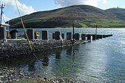
here. The Government neglected Portacloy as a fishing port, building a harbour in Porturlin instead but in 1909 a boat slip, breakwater and landing place were built to facilitate the fish curing station which had been built a few years earlier to process mackerel
Mackerel
Mackerel is a common name applied to a number of different species of fish, mostly, but not exclusively, from the family Scombridae. They may be found in all tropical and temperate seas. Most live offshore in the oceanic environment but a few, like the Spanish mackerel , enter bays and can be...
. In the 1960s a second small pier was built. Portacloy still remains a peaceful pleasant cove.
Porturlin
Porturlin (Gaelic: Port Durlainne) is a coastal townland on the east coast of the Dún Chaocháin peninsula consisting of 2120 acres (8.6 km²). During the famine, Richard Webb, bringing relief for the distressed from the Society of Friends described it as the finest fishing grounds in Mayo but wrote that "the only access by land is over a high and boggy mountain, so wet and swampy that it is difficult to reach it even in summer. There is probably not in Ireland, a cluster of human habitations so completely secluded from easy access...". When William Bald had been carrying out improvement works in the Erris area in 1835 he recommended building piers at Porturlin and in Portacloy, claiming it would aid the fishermen of the area greatly. During the 1840s roads were made to the area. In 1886 the Roads and Harbour Commissioners finally built a landing slip 210 feet (64 m) in length at a cost of £204.00. The Congested Districts Board for IrelandCongested Districts Board for Ireland
The Congested Districts Board for Ireland was established by the Chief Secretary, Arthur Balfour in 1891 to alleviate poverty and "congested" living conditions in the west of Ireland....
erected a curing station for herring and mackerel in 1894. By 1952 the old pier had fallen asunder and was replaced in 1965 by Mayo County Council
Mayo County Council
Mayo County council is the local authority which is responsible for County Mayo in Ireland. The Council is responsible for Housing and Community, Roads and Transportation, Urban planning and Development, Amenity and Culture, and Environment. The county council is governed by the Local Government...
.
In February 2010, Pat 'The Chief' O'Donnell, owner of a fish processing plant in Porturlin and fifth generation fisherman served a contested seven-month sentence in Castlerea
Castlerea
Castlerea is located in the west of County Roscommon, Ireland. It is the second largest town in the county with a population of 3,055 . Roughly translated from Irish, Castlerea can mean Brindled Castle or King's Castle...
Prison for his participation in protests against the Corrib gas project
Corrib gas controversy
The Corrib gas controversy concerns plans by Shell E&P Ireland, Statoil Exploration Limited, Vermilion Energy Trust and the Irish government for processing the Corrib gas field through Broadhaven Bay and Sruth Fada Conn Bay in Kilcommon parish, Erris, County Mayo, and objections raised against...
which he believes poses an unacceptable risk to the area, including his own livelihood and that of all fishermen in the Broadhaven Bay
Broadhaven Bay
Broadhaven Bay is a natural bay of the Atlantic Ocean situated on the northwestern coast of County Mayo, Ireland. The opening of the bay faces northward, stretching between Erris Head on the west side and Kid Island on the east side with approximately 8.6 km between the two sides.It borders...
area.
Rossport/Ros Dumhach
Sruwaddacon Bay
Sruwaddacon Bay is a tidal estuary which runs through the middle of the Gaeltacht Kilcommon Parish, Erris, North County Mayo; it is of historical importance in Irish legend, an important marine habitat, an E.U. Special Area of Conservation and an E.U...
are hazardous even for the most experienced boatman. The words of a song describe the rapidity of the current:
- "the Rossport Ferry and its rapid current
- The second strongest that our State possess'"
In more recent years, Rossport
Rossport
Ros Dumhach is a Gaeltacht village and townland in northwest County Mayo, Ireland. It is within the barony of Erris and parish of Kilcommon...
has been the scene of conflict with the Corrib gas project and protests
Corrib gas controversy
The Corrib gas controversy concerns plans by Shell E&P Ireland, Statoil Exploration Limited, Vermilion Energy Trust and the Irish government for processing the Corrib gas field through Broadhaven Bay and Sruth Fada Conn Bay in Kilcommon parish, Erris, County Mayo, and objections raised against...
against same.
Srahataggle
Srahataggle townland consists of 4167 acres (16.9 km²). It is a remote village which is reached via a turn off just before Porturlin Village. In 2004 a road which connects Srahataggle with Belderrig was tarred for the first time. Commenting on the people of Srahataggle in the early 1950s, the Western PeopleWestern People
The Western People is a weekly local newspaper published in Ballina, County Mayo in the Republic of Ireland, it was first published in 1883. The paper is now owned by Cork-based Thomas Crosbie Holdings...
reported, "remote as these habitations may appear to many, there is no lack of worldly knowledge and cultural attainments and many of their sons and daughters have risen to important posts in countries beyond the seas".
Notable Kilcommon people
- Brian Rua U'CearbhainBrian Rua U'Cearbhain- Brian Rua O’Cearbhain :Brian Rua is a well-known 17th century Errisman. He is remembered as the prophet of Erris, a large Barony in the north west of County Mayo...
17th century prophet from Inbhear - Willie CorduffWillie CorduffWillie Corduff is an Irish environmental activist from the farming community of Rossport, parish of Kilcommon, Erris. Corduff's parents first arrived in Rossport in 1947, and reclaimed a farm by hand out of bogland. He became a campaigner against Shells' activities in his local area...
Winner of Goldman Environmental PrizeGoldman Environmental PrizeThe Goldman Environmental Prize is a prize awarded annually to grassroots environmental activists, one from each of the world's six geographic regions: Africa, Asia, Europe, Islands and Island Nations, North America, and South and Central America. The prize includes a no-strings-attached award of...
2007
Corrib Gas
Since around the turn of the 21st century, Kilcommon Parish has been affected by Corrib gas project, under the ownership of Royal Dutch ShellRoyal Dutch Shell
Royal Dutch Shell plc , commonly known as Shell, is a global oil and gas company headquartered in The Hague, Netherlands and with its registered office in London, United Kingdom. It is the fifth-largest company in the world according to a composite measure by Forbes magazine and one of the six...
. After many years and many changes of proposed route for a high pressure raw gas pipeline running through the area many aspects of the proposed project have been strongly disputed. A refinery has been built 10 kilometres inland by Royal Dutch Shell
Royal Dutch Shell
Royal Dutch Shell plc , commonly known as Shell, is a global oil and gas company headquartered in The Hague, Netherlands and with its registered office in London, United Kingdom. It is the fifth-largest company in the world according to a composite measure by Forbes magazine and one of the six...
that has no access to the proposed landfall site. There have been several Oral Hearings held about this problem by An Bord Pleanála
An Bord Pleanála
An Bord Pleanála is an independent statutory administrative tribunal that decides on appeals from planning decisions made by local authorities in the Republic of Ireland. As of 2007 The Planning Board directly decides major strategic infrastructural projects under the provisions of the Planning...
but Permission has now been granted. Works commenced in July 2011.
Natural Resources
Kilcommon Erris has some of the best natural alternative energyAlternative energy
Alternative energy is an umbrella term that refers to any source of usable energy intended to replace fuel sources without the undesired consequences of the replaced fuels....
resources in the world due to its location on the Atlantic Ocean
Atlantic Ocean
The Atlantic Ocean is the second-largest of the world's oceanic divisions. With a total area of about , it covers approximately 20% of the Earth's surface and about 26% of its water surface area...
which brings almost constant winds from the sea. The natural resources of ocean and wind available in Kilcommon are very valuable resources for sustainable alternative, renewable energy
Renewable energy
Renewable energy is energy which comes from natural resources such as sunlight, wind, rain, tides, and geothermal heat, which are renewable . About 16% of global final energy consumption comes from renewables, with 10% coming from traditional biomass, which is mainly used for heating, and 3.4% from...
production for the future.
There are opportunities for the development of ocean wave power
Wave power
Wave power is the transport of energy by ocean surface waves, and the capture of that energy to do useful work — for example, electricity generation, water desalination, or the pumping of water...
projects, one of the best wave energy resources in the world lies off the shores of North Mayo. Tidal power
Tidal power
Tidal power, also called tidal energy, is a form of hydropower that converts the energy of tides into useful forms of power - mainly electricity....
, hydroelectric schemes, and extensive wind farms are amongst many other clean, alternative energy generation opportunities for which the area has great potential for a beneficial sustainable future.
External links
- http://www.vimeo.com/8668733
- http://www.thepipethefilm.com/
- http://www.arasinisgluaire.ie/
- http://www.kilcommonlodge.ie
- http://shelltosea.com
- http://www.mayowalks.ie
- http://www.uisce.ie/
- http://errisunitedfc.ie
- http://bangorerrisangling.com
- http://www.gaeltacht.eu/
- http://errisbeo.ie