
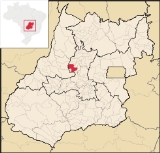
Itapuranga
Encyclopedia
| Itapuranga | |
|---|---|
| State | Goiás Goiás Goiás is a state of Brazil, located in the central part of the country. The name Goiás comes from the name of an indigenous community... |
| Area: | 1,277,2 km² |
| Population: | 24,832 (IBGE 2007) |
| Elevation: | 651m above sea level |
| Postcode (CEP): | 76680-000 |
| IBGE statistical microregion: | Ceres Microregion Ceres Microregion The Ceres Microregion is located in north-central Goiás state, Brazil. It includes 22 cities with a total population of 215,820 inhabitants . The total area is 13,224.40 km² and the population density is 16.32 inhab/km². The most important cities are Ceres and Goianésia.The most populous... |
| Became a city: | 1953 |
| Mayor: | Régis Washington |
| Distance to Goiânia Goiânia -Climate:The city has a tropical wet and dry climate with an average temperature of . There's a wet season, from October to April, and a dry one, from May to September. Annual rainfall is around 1,520 mm.... : |
171 km. |
| Website: | HallTv |

Town
A town is a human settlement larger than a village but smaller than a city. The size a settlement must be in order to be called a "town" varies considerably in different parts of the world, so that, for example, many American "small towns" seem to British people to be no more than villages, while...
and municipality
Municipality
A municipality is essentially an urban administrative division having corporate status and usually powers of self-government. It can also be used to mean the governing body of a municipality. A municipality is a general-purpose administrative subdivision, as opposed to a special-purpose district...
in northern Goiás
Goiás
Goiás is a state of Brazil, located in the central part of the country. The name Goiás comes from the name of an indigenous community...
state, Brazil
Brazil
Brazil , officially the Federative Republic of Brazil , is the largest country in South America. It is the world's fifth largest country, both by geographical area and by population with over 192 million people...
.
Location and Climate
Itapuranga is located northwest of GoiâniaGoiânia
-Climate:The city has a tropical wet and dry climate with an average temperature of . There's a wet season, from October to April, and a dry one, from May to September. Annual rainfall is around 1,520 mm....
and north of Goiás
Goiás, Goiás
Goiás is a small city and municipality in the state of Goiás in Brazil. The population was 24,072 in a total area of 3,108 km² . It is the former capital of the state and preserves much of its colonial heritage...
, the old capital of the state.
- Main highways of access from Goiânia are G0-070 to ItaberaíItaberaíItaberaí is a small city and municipality in central Goiás state, Brazil. Itaberaí is a large producer of agricultural products including corn, rice, soybeans, tomatoes, and sugarcane.-Location:...
and state highway GO-156 north through HeitoraíHeitoraíHeitoraí is a small town and municipality in central Goiás state, Brazil.-Location:Heitoraí lies 142 km. from the regional center of Anápolis...
. See Seplan
Because of its fertile soil and geo-economic location, Itapuranga is considered the capital of the Vale do São Patrício.
Municipal boundaries are with: Carmo do Rio Verde
Carmo do Rio Verde
Carmo do Rio Verde is a small town and municipality in central Goiás state, Brazil. The population was 8,897 in a total area of 457.5 km². Carmo do Rio Verde is a major producer of sugar cane for production of alcohol.-Location:...
, Faina, Goiás
Goiás, Goiás
Goiás is a small city and municipality in the state of Goiás in Brazil. The population was 24,072 in a total area of 3,108 km² . It is the former capital of the state and preserves much of its colonial heritage...
, Guarita
Guarita
Guarita is a municipality in the Honduran department of Lempira.Guarita is one of the oldest municipalities of the Lempira department. The best way to go to Guarita is via Santa Rosa de Copán-San Marcos de Ocotepeque-Cololaca-Guarita and it takes about 2.5 hours. This way is much more preferable...
, Heitoraí
Heitoraí
Heitoraí is a small town and municipality in central Goiás state, Brazil.-Location:Heitoraí lies 142 km. from the regional center of Anápolis...
, Morro Agudo de Goiás
Morro Agudo de Goiás
Morro Agudo de Goiás is a small town and municipality in northeastern Goiás state, Brazil.-Location:Monte Agudo de Goiás is located in the north-eastern region of the state near the source of the Rio Tesouras, which flows north into the Araguaia River....
, Uruana
Uruana
Uruana is a small city and municipality in central Goiás state, Brazil. It is known statewide as the watermelon capital of the state.-Location:...
and São Patrício
São Patrício
São Patrício is a small town and municipality in the northwestern portion of the Brazilian state of Goiás.-Location:São Patrício is located 42 km. west of Ceres. Highway connections from Goiânia: GO-070 / Goianira / Inhumas / GO-154 / Itaguaru / Uruana / Carmo do Rio Verde / GO-460...
.
There are two well defined seasons, a rainy season from October to April, and a dry season, from May to September. The average annual minimum temperature is 11 °C, the maximum, 38 °C, and the average, 25 °C.
The vegetation is quite diversified: small clumps of forest, bushes, and grasses. The types of vegetation cover are: cerrado
Cerrado
The Cerrado, is a vast tropical savanna ecoregion of Brazil, particularly in the states of Gioas and Minas Gerais...
8.2%, fields 4.4%, forest 3.0%. The cultivated area is 8.7% and the pasture land is 74.8%.
Districts, Villages, and Hamlets
- Districts: Cibele and Diolândia.
- Hamlets: Lajes and São José
History
Itapuranga began in 1933 when Dominican monks from GoiásGoiás, Goiás
Goiás is a small city and municipality in the state of Goiás in Brazil. The population was 24,072 in a total area of 3,108 km² . It is the former capital of the state and preserves much of its colonial heritage...
, acquired land from the government on the left bank of the Rio Canastra. The name of the settlement was "Xixá", taken from the Xixazeiro tree under which the first mass was celebrated. Joaquim Moreira da Silva opened the first general store and the town began to grow. Soon a public school was built and a road opened to the city of Goiás. In 1943 Xixá became a district of Goiás and the name was changed to Itapuranga, which means in the Tupi language "red rock" or "place of pretty rocks". In 1953 it was dismembered from Goiás to form a municipality.
Demographics
- Population density: 19.44 inhab/km² (2007)
- Population growth rate: -1.05% from 1996/2007
- Population in 1980: 30,358
- Population in 2007: 24,832
- Urban population in 1980: 15,492
- Urban population in 2007: 19,090
- Rural population in 1980: 14,866
- Rural population in 2007: 5,742
The economy
The main economic activities were cattle raising, services, small industries, and agriculture are the main economic activities. In 2006 there were 1,441 farms with a total area of 65,894 hectares, of which 11,000 hectares were cropland and 40,400 hectares were pasture. The cattle herd had 134,000 head in 2006 and the main crops cultivated were bananas, sugarcane, rice, corn, coconuts, and soybeans. Sugarcane was the most important crop with 9,400 ha. planted and a production of 855,000 tons (2006). Corn was second with 5,500 ha. and 17,600 tons.- Industrial establishments: 87
- Commercial retail establishments: 243
- Industrial park: Distrito Agroindustrial de Itapuranga - DIAI (June/2006)
- Financial institutions: Banco do Brasil S.A., BRADESCO S.A., Banco Itaú S.A.
Education and Health
In 2006 there were 27 schools with an enrollment of 6,799 students. There was one institute of higher education: UEG - Faculdade de Educação, Ciências e Letras de Itapuranga. The literacy Rate was 82.9%. In the health sector there were 5 hospitals with 141 beds. The infant mortality rate was 26.53 (in 1,000 live births)Municipal Human Development Index
Human Development Index
The Human Development Index is a composite statistic used to rank countries by level of "human development" and separate "very high human development", "high human development", "medium human development", and "low human development" countries...
- MHDI: 0.735
- State ranking: 128 (out of 242 municipalities in 2000)
- National ranking: 2,312 (out of 5,507 municipalities in 2000)
For the complete list see frigoletto.com.br