
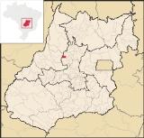
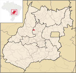
Morro Agudo de Goiás
Encyclopedia
| Morro Agudo de Goiás | |
|---|---|
| State | Goiás Goiás Goiás is a state of Brazil, located in the central part of the country. The name Goiás comes from the name of an indigenous community... |
| Area: | 283 km² |
| Population: | 2,339 (IBGE 2007) |
| Elevation: | 691 m above sea level |
| Postcode (CEP): | 76355-000 |
| Became a city: | 1989 |
| Microregion: | Ceres Ceres Microregion The Ceres Microregion is located in north-central Goiás state, Brazil. It includes 22 cities with a total population of 215,820 inhabitants . The total area is 13,224.40 km² and the population density is 16.32 inhab/km². The most important cities are Ceres and Goianésia.The most populous... |
| Mayor: | Moisés Simião de Carvalho |
| Distance to Goiânia Goiânia -Climate:The city has a tropical wet and dry climate with an average temperature of . There's a wet season, from October to April, and a dry one, from May to September. Annual rainfall is around 1,520 mm.... : |
212 km |
| Website: | none |
Town
A town is a human settlement larger than a village but smaller than a city. The size a settlement must be in order to be called a "town" varies considerably in different parts of the world, so that, for example, many American "small towns" seem to British people to be no more than villages, while...
and municipality
Municipality
A municipality is essentially an urban administrative division having corporate status and usually powers of self-government. It can also be used to mean the governing body of a municipality. A municipality is a general-purpose administrative subdivision, as opposed to a special-purpose district...
in northeastern Goiás
Goiás
Goiás is a state of Brazil, located in the central part of the country. The name Goiás comes from the name of an indigenous community...
state, Brazil
Brazil
Brazil , officially the Federative Republic of Brazil , is the largest country in South America. It is the world's fifth largest country, both by geographical area and by population with over 192 million people...
.
Location
Monte Agudo de Goiás is located in the north-eastern region of the state near the source of the Rio Tesouras, which flows north into the Araguaia RiverAraguaia River
The Araguaia River or, in Portuguese, Rio Araguaia is one of the major rivers of Brazil, and the principal tributary of the Tocantins. It has a total length of approximately 2,627 km. Araguaia means "river of macaws" in the Tupi language....
.
- Distance to GoiâniaGoiânia-Climate:The city has a tropical wet and dry climate with an average temperature of . There's a wet season, from October to April, and a dry one, from May to September. Annual rainfall is around 1,520 mm....
: 212 km. - Distance to ItapurangaItapurangaItapuranga is a small town and municipality in northern Goiás state, Brazil.-Location and Climate:Itapuranga is located northwest of Goiânia and north of Goiás, the old capital of the state....
: 35 km. - Highway connections: GO-070 from GoiâniaGoiânia-Climate:The city has a tropical wet and dry climate with an average temperature of . There's a wet season, from October to April, and a dry one, from May to September. Annual rainfall is around 1,520 mm....
to ItaberaíItaberaíItaberaí is a small city and municipality in central Goiás state, Brazil. Itaberaí is a large producer of agricultural products including corn, rice, soybeans, tomatoes, and sugarcane.-Location:...
, GO-156 north to ItapurangaItapurangaItapuranga is a small town and municipality in northern Goiás state, Brazil.-Location and Climate:Itapuranga is located northwest of Goiânia and north of Goiás, the old capital of the state....
, passing through Diolândia. See Seplan
Neighboring municipalities: Rubiataba
Rubiataba
Rubiataba is a small city and municipality in northeastern Goiás state, Brazil.-Location and Geography:Rubiataba is located in the north of the state, south of the source of the Crixás River. It is 235 kilometres to the state capital of Goiânia. Other distances are:*Nova América: 21 km. to the...
, Araguapaz
Araguapaz
Araguapaz is a small town and municipality in north-western Goiás state, Brazil. The population was 7,482 in a total area of 2,193.6 km². It is a major producer of cattle.-Location and Municipal Boundaries:...
, São Patrício
São Patrício
São Patrício is a small town and municipality in the northwestern portion of the Brazilian state of Goiás.-Location:São Patrício is located 42 km. west of Ceres. Highway connections from Goiânia: GO-070 / Goianira / Inhumas / GO-154 / Itaguaru / Uruana / Carmo do Rio Verde / GO-460...
, Itapuranga
Itapuranga
Itapuranga is a small town and municipality in northern Goiás state, Brazil.-Location and Climate:Itapuranga is located northwest of Goiânia and north of Goiás, the old capital of the state....
, and Faina
Political and Demographic Information
In January 2005 the Mayor was Moisés Simião de Carvalho and the Vice-mayor was Sebastião Tavares de Oliveira. The city council had 9 members and there were 2,172 eligible voters in 2007.In 2007 the population density was 8.28 inhab/km². The population has decreased since 1991, when it was 2,526. The geometric rate of increase between 1996 and 2007 was -0.09.%. In 2007 most of the population was urban with 1,567 living in the urban area and 772 living in the rural area.
Economic Information
The economy was based on agriculture, cattle-raising, services, modest transformation industries and public administration. In 2007 there were 3 industrial units and 17 retail units. There were no banking institutions. The number of motor vehicles was modest: 144 automobiles, 9 trucks, 31 pickup trucks, and 234 motorcycles.Due to the small area of the municipality the cattle herd was small: 32,000, of which 5,100 were milk cows. Raising of poultry and swine was modest. The main agricultural products were rice, bananas, sugarcane, beans, manioc, and corn. None of these exceeded 500 hectares in planted area. In 2006 there were 335 farms with a total area of 31,914 hectares, of which 500 hectares were cropland and 28,328 hectares were pasture.
Health and education
In 2007 there was 1 hospital with 17 beds and 2 walk-in clinics. The infant mortality rate was 31.12 in every 1,000 live births in 2000, lower than the national rate of 35.0 in the same year.In 2006 the school system had 5 schools, 18 classrooms, 37 teachers, and 695 students. One of the schools was middle and secondary level. There were no institutions of higher learning. The adult literacy rate was 85.7% in 2000, below the national average of 86.4% in the same year.
Ranking on the Municipal Human Development Index
Human Development Index
The Human Development Index is a composite statistic used to rank countries by level of "human development" and separate "very high human development", "high human development", "medium human development", and "low human development" countries...
- MHDI: 0.717
- State ranking: 180 (out of 242 municipalities)
- National ranking: 2,677 (out of 5,507 municipalities)
For the complete list see Frigoletto.com.br