
São Patrício
Encyclopedia
| São Patrício | |
|---|---|
| State | Goiás Goiás Goiás is a state of Brazil, located in the central part of the country. The name Goiás comes from the name of an indigenous community... |
| Area: | 134.5 km² |
| Population: | 2,051 (IBGE 2007) |
| Elevation: | 560 m above sea level |
| Postcode (CEP): | 76343-000 |
| IBGE statistical microregion: | 006 Ceres Microregion Ceres Microregion The Ceres Microregion is located in north-central Goiás state, Brazil. It includes 22 cities with a total population of 215,820 inhabitants . The total area is 13,224.40 km² and the population density is 16.32 inhab/km². The most important cities are Ceres and Goianésia.The most populous... |
| Mayor: | Lery Guedes de Queiroz Filho (Jan 2005) |
| Became a city: | 1997 |
| Distance to Goiânia Goiânia -Climate:The city has a tropical wet and dry climate with an average temperature of . There's a wet season, from October to April, and a dry one, from May to September. Annual rainfall is around 1,520 mm.... : |
189 km. |
| Website: | none |
| Coordinates: | 15°20′54"S 49°48′50"W |

Town
A town is a human settlement larger than a village but smaller than a city. The size a settlement must be in order to be called a "town" varies considerably in different parts of the world, so that, for example, many American "small towns" seem to British people to be no more than villages, while...
and municipality
Municipality
A municipality is essentially an urban administrative division having corporate status and usually powers of self-government. It can also be used to mean the governing body of a municipality. A municipality is a general-purpose administrative subdivision, as opposed to a special-purpose district...
in the northwestern portion of the Brazil
Brazil
Brazil , officially the Federative Republic of Brazil , is the largest country in South America. It is the world's fifth largest country, both by geographical area and by population with over 192 million people...
ian state of Goiás
Goiás
Goiás is a state of Brazil, located in the central part of the country. The name Goiás comes from the name of an indigenous community...
.
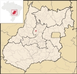
Location
São Patrício is located 42 km. west of CeresCeres, Goiás
Ceres is a small city and municipality in central Goiás state, Brazil. It was the first agricultural colony built in the state of Goiás.-Geography:...
. Highway connections from Goiânia
Goiânia
-Climate:The city has a tropical wet and dry climate with an average temperature of . There's a wet season, from October to April, and a dry one, from May to September. Annual rainfall is around 1,520 mm....
: GO-070 / Goianira
Goianira
Goianira is a small city and municipality in central Goiás state, Brazil, located 32 kilometers northwest of the state capital, Goiânia. The population was 24,110 in a total area of 200.4 km² . Goianira is becoming a major producer of shoes.Goianira is four kilometers east of highway BR-457 /...
/ Inhumas
Inhumas
Inhumas is a small city and municipality in central Goiás state, Brazil. The population was 47,361 in a total area of 613.3 km²...
/ GO-154 / Itaguaru
Itaguaru
Itaguaru is a small town and municipality in central Goiás state, Brazil.-Location:The distance to the regional center of is 127 km....
/ Uruana
Uruana
Uruana is a small city and municipality in central Goiás state, Brazil. It is known statewide as the watermelon capital of the state.-Location:...
/ Carmo do Rio Verde
Carmo do Rio Verde
Carmo do Rio Verde is a small town and municipality in central Goiás state, Brazil. The population was 8,897 in a total area of 457.5 km². Carmo do Rio Verde is a major producer of sugar cane for production of alcohol.-Location:...
/ GO-460. See Seplan
Neighboring municipalities are Morro Agudo de Goiás
Morro Agudo de Goiás
Morro Agudo de Goiás is a small town and municipality in northeastern Goiás state, Brazil.-Location:Monte Agudo de Goiás is located in the north-eastern region of the state near the source of the Rio Tesouras, which flows north into the Araguaia River....
, Rubiataba
Rubiataba
Rubiataba is a small city and municipality in northeastern Goiás state, Brazil.-Location and Geography:Rubiataba is located in the north of the state, south of the source of the Crixás River. It is 235 kilometres to the state capital of Goiânia. Other distances are:*Nova América: 21 km. to the...
, Carmo do Rio Verde
Carmo do Rio Verde
Carmo do Rio Verde is a small town and municipality in central Goiás state, Brazil. The population was 8,897 in a total area of 457.5 km². Carmo do Rio Verde is a major producer of sugar cane for production of alcohol.-Location:...
, Itapuranga
Itapuranga
Itapuranga is a small town and municipality in northern Goiás state, Brazil.-Location and Climate:Itapuranga is located northwest of Goiânia and north of Goiás, the old capital of the state....
Demographics
- Population Density: 15.25/km² (2007)
- Urban population: 980
- Population growth rate: 1.60% 2000/2007
The economy
The economy is based on subsistence agriculture, cattle raising (19,000 head in 2006), services, public administration, and small transformation industries. There was one dairy in 2007. There were 260 farms in 2006 with 12,385 hectares of cropland and pasture.The main crops were rice (250 hectares), sugarcane (2,000 hectares), beans, manioc, passion fruit, corn (600 hectares), and tomatoes.
Health and education
There were 03 schools with 588 students (2006). The adult literacy rate was 84.0% (2000) (national average was 86.4%). In the health sector there were no hospitals. The infant mortality rate was 22.85 (2000) (national average was 33.0). The Municipal Human Development IndexHuman Development Index
The Human Development Index is a composite statistic used to rank countries by level of "human development" and separate "very high human development", "high human development", "medium human development", and "low human development" countries...
score was 0.728. For the complete list see frigoletto.com.br
Temperatures
→ Winter temperatures: low: 14°C/high: 32°C;→ Spring temperatures: low: 23°C/high: 36°C;
→ Summer temperatures: low: 22°C/high: 29°C;
→ Autumn temperatures: low: 17°C/high: 29°C.
See also
Sources of data