
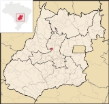
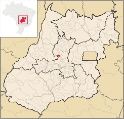
Heitoraí
Encyclopedia
| Heitoraí | |
|---|---|
| State | Goiás Goiás Goiás is a state of Brazil, located in the central part of the country. The name Goiás comes from the name of an indigenous community... |
| Area: | 229.6 km² |
| Population: | 3,556 (IBGE 2007) |
| Population Density: | 15.57 hab/km² (2003) |
| Elevation: | 658 m above sea level |
| Postcode (CEP): | 76670-000 |
| Became a city: | 1963 |
| Distance to Goiânia Goiânia -Climate:The city has a tropical wet and dry climate with an average temperature of . There's a wet season, from October to April, and a dry one, from May to September. Annual rainfall is around 1,520 mm.... : |
145 km. |
| IBGE statistical microregion: | Anápolis Microregion Anápolis Microregion The Anápolis Microregion is a region of central Goiás state, Brazil, including municipalities surrounding the city of Anápolis. For a map see *Population: 517,221 inhabitants *Cities: 19*Total Area: 8,386.80 km²... |
| Website: | n/a |
| Coordinates: | 15°43′22"S 49°49′36"W |
Town
A town is a human settlement larger than a village but smaller than a city. The size a settlement must be in order to be called a "town" varies considerably in different parts of the world, so that, for example, many American "small towns" seem to British people to be no more than villages, while...
and municipality
Municipality
A municipality is essentially an urban administrative division having corporate status and usually powers of self-government. It can also be used to mean the governing body of a municipality. A municipality is a general-purpose administrative subdivision, as opposed to a special-purpose district...
in central Goiás
Goiás
Goiás is a state of Brazil, located in the central part of the country. The name Goiás comes from the name of an indigenous community...
state, Brazil
Brazil
Brazil , officially the Federative Republic of Brazil , is the largest country in South America. It is the world's fifth largest country, both by geographical area and by population with over 192 million people...
.
Location
Heitoraí lies 142 km. from the regional center of AnápolisAnápolis
Anápolis is the third largest city in the State of Goiás in Brazil. It lies in the center of a rich agricultural region and has become a leader in food processing and pharmaceutical plants.-Location and population:...
. Highway connections are made by federal highway BR-153 from Goiânia
Goiânia
-Climate:The city has a tropical wet and dry climate with an average temperature of . There's a wet season, from October to April, and a dry one, from May to September. Annual rainfall is around 1,520 mm....
to Itaberaí
Itaberaí
Itaberaí is a small city and municipality in central Goiás state, Brazil. Itaberaí is a large producer of agricultural products including corn, rice, soybeans, tomatoes, and sugarcane.-Location:...
then north on GO-156 for 38 kilometers.
Neighboring municipalities are Guaraíta
Guaraíta
Guaraíta is a small town and municipality in central Goiás state, Brazil.-Location:It is included in the Ceres Microregion and is bordered on the north and east by the municipalities of Itapuranga and on the west and south by Goiás....
, Itapuranga
Itapuranga
Itapuranga is a small town and municipality in northern Goiás state, Brazil.-Location and Climate:Itapuranga is located northwest of Goiânia and north of Goiás, the old capital of the state....
, Itaguaru
Itaguaru
Itaguaru is a small town and municipality in central Goiás state, Brazil.-Location:The distance to the regional center of is 127 km....
and Itaberaí
Itaberaí
Itaberaí is a small city and municipality in central Goiás state, Brazil. Itaberaí is a large producer of agricultural products including corn, rice, soybeans, tomatoes, and sugarcane.-Location:...
Demographics
- Population density: 15.48 inhab/km² (2007)
- Population growth rate: 1.67% 1996/2007
- Population in 2007: 3,556 (3,283 in 1980)
- Urban population in 2007: 2,468 (1,088 in 1980)
- Rural population in 2007: 1,088 (1,450 in 1980)
The economy
The main economic activities are cattle raising with 23,890 head (2005) and agriculture. The main crops cultivated are rice, beans, sugarcane, manioc, corn, and banana. In 2006 there were 376 farms with an area of 12,856 ha. of which 9,000 ha. were natural pasture. Approximately 1,000 workers were in the agricultural sector.- Number of industrial establishments: 5
- Number of retail establishments: 29
- Number of motor vehicles: 249 automobiles and 43 pickup trucks
- Number of banking establishments: none
Health and education
The literacy rate was 85.8% in 2000 while the infant mortality rate was 21.53 in 1,000 live births. There were 06 schools in 2006, with 1,129 students. Health care was provided by 1 hospital with 19 beds (2007).Hectoraí ranked 0.744 on the Municipal Human Development Index
Human Development Index
The Human Development Index is a composite statistic used to rank countries by level of "human development" and separate "very high human development", "high human development", "medium human development", and "low human development" countries...
, giving it a state ranking of 93 (out of 242 municipalities)
and a national ranking of 2,055 (out of 5,507 municipalities). (2000) For the complete list see frigoletto.com.br
Sources of Data
See also
- List of municipalities in Goiás
- Anápolis MicroregionAnápolis MicroregionThe Anápolis Microregion is a region of central Goiás state, Brazil, including municipalities surrounding the city of Anápolis. For a map see *Population: 517,221 inhabitants *Cities: 19*Total Area: 8,386.80 km²...
- Microregions of Goiás