
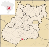
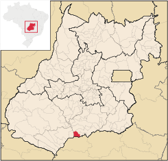
Inaciolândia
Encyclopedia
| Inaciolândia | |
|---|---|
| State | Goiás Goiás Goiás is a state of Brazil, located in the central part of the country. The name Goiás comes from the name of an indigenous community... |
| Coordinates: | 18°29′18"S 49°59′04"W |
| Area: | 688.3 km² |
| Population: | 5,650 (IBGE 2007) |
| Elevation: | 442 m above sea level |
| Postcode (CEP): | 75550-000 |
| Became a city: | 1993 |
| Mayor: | Gilson José Teixeira |
| Distance to Goiânia Goiânia -Climate:The city has a tropical wet and dry climate with an average temperature of . There's a wet season, from October to April, and a dry one, from May to September. Annual rainfall is around 1,520 mm.... : |
282 km. |
| IBGE statistical microregion: | Meia Ponte Microregion Meia Ponte Microregion The Meia Ponte Microregion is a statistical region of Goiás state, Brazil created by the IBGE . It is located south of the state capital, Goiânia, and includes 21 cities with a total population of 338,147 inhabitants . The total area is 21,229.00 km² and the population density is 14.39 inhab/km²... |
| Website: | none |
Town
A town is a human settlement larger than a village but smaller than a city. The size a settlement must be in order to be called a "town" varies considerably in different parts of the world, so that, for example, many American "small towns" seem to British people to be no more than villages, while...
and municipality
Municipality
A municipality is essentially an urban administrative division having corporate status and usually powers of self-government. It can also be used to mean the governing body of a municipality. A municipality is a general-purpose administrative subdivision, as opposed to a special-purpose district...
in south Goiás
Goiás
Goiás is a state of Brazil, located in the central part of the country. The name Goiás comes from the name of an indigenous community...
state, Brazil
Brazil
Brazil , officially the Federative Republic of Brazil , is the largest country in South America. It is the world's fifth largest country, both by geographical area and by population with over 192 million people...
. The population was 5,650 inhabitants (2007 IBGE) in a total area of 688.3 km². Inaciolândia is a large producer of cotton and soybeans.
Geographical Information
Inaciolândia is located in the Meia Ponte MicroregionMeia Ponte Microregion
The Meia Ponte Microregion is a statistical region of Goiás state, Brazil created by the IBGE . It is located south of the state capital, Goiânia, and includes 21 cities with a total population of 338,147 inhabitants . The total area is 21,229.00 km² and the population density is 14.39 inhab/km²...
in the extreme south of the state. It is connected by paved road to Cachoeira Dourada
Cachoeira Dourada
Cachoeira Dourada is a small town and municipality in south-central Goiás state, Brazil. The population was 7,567 in a total area of 521.1 km².-Geographical Information:...
, 57 km., and Gouvelândia
Gouvelândia
Gouvelândia is a small town and municipality in south Goiás state, Brazil. Gouvelândia is a large producer of sesame and peanuts.-Location:...
, 15 km. The Rio dos Bois lies a short distance to the west.
The distance to the state capital, Goiânia
Goiânia
-Climate:The city has a tropical wet and dry climate with an average temperature of . There's a wet season, from October to April, and a dry one, from May to September. Annual rainfall is around 1,520 mm....
, is 282 km. Highway connections are made by GO-040, passing through Aragoiânia
Aragoiânia
Aragoiânia is a small town and municipality in central Goiás state, Brazil. The population was 7,243 in a total area of 219.5 km²....
/ Cromínia
Cromínia
Cromínia is a small town and municipality in south Goiás state, Brazil. It is famous for its chrome mines.-Geographical Information:Cromínia is located in the Meia Ponte Microregion, which includes the cities in the Meia Ponte River basin...
, taking GO-215 to Pontalina
Pontalina
Pontalina is a small city and municipality in south-central Goiás state, Brazil.GeographyPontalina is 125 kilometers from the state capital, Goiânia. It is connected by highways BR-153 and GO-19...
, then GO-040 to Aloândia
Aloândia
Aloândia is a small town and municipality in south Goiás state, Brazil. The population was 2,065 in 2007 and the municipal area was 102.1 km², one of the smallest in the state of Goiás.-Geographical Information:...
and Bom Jesus de Goiás
Bom Jesus de Goiás
Bom Jesus de Goiás is a town and municipality in south Goiás state, Brazil. It is a large producer of soybeans.-Geographical Information:The distance to the state capital, Goiânia, is 223 km and it is linked by highways BR-452 and GO-040...
, taking BR-452 to Itumbiara
Itumbiara
Itumbiara is a small city and municipality in the extreme south of the state of Goiás, Brazil. The population was 100,000 in a total area of 2,461,3 km²...
, then GO-206 / BR-483 passing through Cachoeira Dourada
Cachoeira Dourada
Cachoeira Dourada is a small town and municipality in south-central Goiás state, Brazil. The population was 7,567 in a total area of 521.1 km².-Geographical Information:...
. For the complete list of distances in Goiás
Goiás
Goiás is a state of Brazil, located in the central part of the country. The name Goiás comes from the name of an indigenous community...
see Sepin
Neighboring municipalities are:
- north: Bom Jesus de GoiásBom Jesus de GoiásBom Jesus de Goiás is a town and municipality in south Goiás state, Brazil. It is a large producer of soybeans.-Geographical Information:The distance to the state capital, Goiânia, is 223 km and it is linked by highways BR-452 and GO-040...
and ItumbiaraItumbiaraItumbiara is a small city and municipality in the extreme south of the state of Goiás, Brazil. The population was 100,000 in a total area of 2,461,3 km²... - south: Minas GeraisMinas GeraisMinas Gerais is one of the 26 states of Brazil, of which it is the second most populous, the third richest, and the fourth largest in area. Minas Gerais is the Brazilian state with the largest number of Presidents of Brazil, the current one, Dilma Rousseff, being one of them. The capital is the...
- east: GouvelândiaGouvelândiaGouvelândia is a small town and municipality in south Goiás state, Brazil. Gouvelândia is a large producer of sesame and peanuts.-Location:...
- west: Cachoeira DouradaCachoeira DouradaCachoeira Dourada is a small town and municipality in south-central Goiás state, Brazil. The population was 7,567 in a total area of 521.1 km².-Geographical Information:...
Political data
- Mayor: Gilson José Teixeira (January 2005)
- Vice-mayor: Paulo César Sisdelli
- Councilmembers: 09
Demographics
- Population density: 8.21 inhab/km² (2007)
- Population growth rate 1996/2007: 1.12%
- Urban population in 2007: 4,582
- Rural population in 2007: 1,068
The economy
The economy is based on agriculture, cattle raising, small transformation industries, services, and government employment.Economic data
- Industrial units: 05 ((June/2007))
- Retail units: 48 (August/2007)
- Lodging and restaurants: 04 units
- Banking institutions: Banco do Brasil S.A. (August/2007)
- Automobiles: 252 in 2007
(Sepin/IBGE)
Main agricultural activities
- Cattle raising: 51,965 head (2006)
- Cotton: 830 ha.
- Rice: 400 ha.
- Rubber: 116 ha.
- Sugarcane: 1,200 ha.
- Corn: 2,200 ha.
- Soybeans: 11,300 ha.
- Agricultural establishments: 421
- Total agricultural area: 62,157 ha.
- Area of perennial crops: 1,923 ha.
- Area of permanent crops: 20,712 ha.
- Area of natural pasture: 32,020 ha.
- Workers in agriculture: 1,170 IBGE
Education and health
- Literacy rate: 78.5%
- Infant mortality rate: 26.58 in 1,000 live births
- Schools: 4
- Students: 1,804 (2006)
- Hospitals: 01 (2007
- Hospital beds: 16
(Sepin/IBGE)
Inaciolândia is ranked 0.717 on the 2000 United Nations Human Development Index
Human Development Index
The Human Development Index is a composite statistic used to rank countries by level of "human development" and separate "very high human development", "high human development", "medium human development", and "low human development" countries...
and is 179 out of 242 municipalities in the state. For the complete list see Frigoletto