

Herval
Encyclopedia
{| border="1" cellpadding="2" cellspacing="0" style="float:right; empty-cells:show; margin-left:1em; margin-bottom:0,5em; background:#FFDEAD;"
|-
! colspan="2" | Map
|---- bgcolor="#FFFFFF"
! colspan="2" align="center" |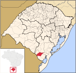 |-
|-
! colspan="2" | Statistics
|---- bgcolor="#FFFFFF"
| State: || Rio Grande do Sul
|---- bgcolor="#FFFFFF"
| Meso-region: || Southwestern Rio Grande do Sul
(Sudoeste Rio-Grandense)
|---- bgcolor="#FFFFFF"
| Micro-Region: || Jaguarão
|---- bgcolor="#FFFFFF"
| Founded: || May 20, 1881
|---- bgcolor="#FFFFFF" valign="top"
| Location
: || 32.0227 or 32° 1' 25" S lat.
52.496 or 52° 23' 44" W long.
|---- bgcolor="#FFFFFF"
| Area
: || 2,798.3 km²
|---- bgcolor="#FFFFFF"
| Population
(2005):
- Total
- Change
- Density ||
7,395
-
2.64/km²
|---- bgcolor="#FFFFFF"
| Elevation
: || 287 m
|---- bgcolor="#FFFFFF"
| Postal code: || -
{| border="1" cellpadding="2" cellspacing="0" style="float:right; empty-cells:show; margin-left:1em; margin-bottom:0,5em; background:#FFDEAD;"
|-
! colspan="2" | Map
|---- bgcolor="#FFFFFF"
! colspan="2" align="center" |
|-
! colspan="2" | Statistics
|---- bgcolor="#FFFFFF"
| State: || Rio Grande do Sul
|---- bgcolor="#FFFFFF"
| Meso-region: || Southwestern Rio Grande do Sul
(Sudoeste Rio-Grandense)
|---- bgcolor="#FFFFFF"
| Micro-Region: || Jaguarão
|---- bgcolor="#FFFFFF"
| Founded: || May 20, 1881
|---- bgcolor="#FFFFFF" valign="top"
| Location
: || 32.0227 or 32° 1' 25" S lat.
52.496 or 52° 23' 44" W long.
|---- bgcolor="#FFFFFF"
| Area
: || 2,798.3 km²
|---- bgcolor="#FFFFFF"
| Population
(2005):
- Total
- Change
- Density ||
7,395
-
2.64/km²
|---- bgcolor="#FFFFFF"
| Elevation
: || 287 m
|---- bgcolor="#FFFFFF"
| Postal code: || -
|}
Herval is a small Brazil
ian town in the southern part of the state of Rio Grande do Sul
. It has a population of 7,395 (2005). Its elevation is 287 m. It has an area of 2798.3 km². It is located 302.4 km west of the state capital of Porto Alegre
. The nickname of the city is Sao Chico. Its main industry is agriculture.
In 1777, Spain
and Portugal
firmed an area and received the name. Rio Paratin which has a tributary with Arroio Basílio that bounded with the possession of the two modern countries. This stream bounded north of the current municipality of Herval, in the treaty of 1777 to the Spanish Empire. Rafael Pinto Bandeira marked the frontier that became demarcated and included the rio Jaguarão to the Portuguese dominion.
Herval is famous for its international rodeo
festival and occurs every January. It is organized with the CTG Minuano with the municipality.
|-
! colspan="2" | Map
|---- bgcolor="#FFFFFF"
! colspan="2" align="center" |
! colspan="2" | Statistics
|---- bgcolor="#FFFFFF"
| State: || Rio Grande do Sul
Rio Grande do Sul
Rio Grande do Sul is the southernmost state in Brazil, and the state with the fifth highest Human Development Index in the country. In this state is located the southernmost city in the country, Chuí, on the border with Uruguay. In the region of Bento Gonçalves and Caxias do Sul, the largest wine...
|---- bgcolor="#FFFFFF"
| Meso-region: || Southwestern Rio Grande do Sul
(Sudoeste Rio-Grandense)
|---- bgcolor="#FFFFFF"
| Micro-Region: || Jaguarão
Jaguarão (micro-region)
The Jaguarão micro-region is a micro-region in the southern part of the state of Rio Grande do Sul, Brazil. The area is 6,331.228 km².-Bounding micro-regions:*Litoral Lagunar*Pelotas*Serras de Sudeste- Municipalities:...
|---- bgcolor="#FFFFFF"
| Founded: || May 20, 1881
|---- bgcolor="#FFFFFF" valign="top"
| Location
Location (geography)
The terms location and place in geography are used to identify a point or an area on the Earth's surface or elsewhere. The term 'location' generally implies a higher degree of can certainty than "place" which often has an ambiguous boundary relying more on human/social attributes of place identity...
: || 32.0227 or 32° 1' 25" S lat.
52.496 or 52° 23' 44" W long.
|---- bgcolor="#FFFFFF"
| Area
Area
Area is a quantity that expresses the extent of a two-dimensional surface or shape in the plane. Area can be understood as the amount of material with a given thickness that would be necessary to fashion a model of the shape, or the amount of paint necessary to cover the surface with a single coat...
: || 2,798.3 km²
|---- bgcolor="#FFFFFF"
| Population
Population
A population is all the organisms that both belong to the same group or species and live in the same geographical area. The area that is used to define a sexual population is such that inter-breeding is possible between any pair within the area and more probable than cross-breeding with individuals...
(2005):
- Total
- Change
- Density ||
7,395
-
2.64/km²
|---- bgcolor="#FFFFFF"
| Elevation
Elevation
The elevation of a geographic location is its height above a fixed reference point, most commonly a reference geoid, a mathematical model of the Earth's sea level as an equipotential gravitational surface ....
: || 287 m
|---- bgcolor="#FFFFFF"
| Postal code: || -
{| border="1" cellpadding="2" cellspacing="0" style="float:right; empty-cells:show; margin-left:1em; margin-bottom:0,5em; background:#FFDEAD;"
|-
! colspan="2" | Map
|---- bgcolor="#FFFFFF"
! colspan="2" align="center" |
! colspan="2" | Statistics
|---- bgcolor="#FFFFFF"
| State: || Rio Grande do Sul
Rio Grande do Sul
Rio Grande do Sul is the southernmost state in Brazil, and the state with the fifth highest Human Development Index in the country. In this state is located the southernmost city in the country, Chuí, on the border with Uruguay. In the region of Bento Gonçalves and Caxias do Sul, the largest wine...
|---- bgcolor="#FFFFFF"
| Meso-region: || Southwestern Rio Grande do Sul
(Sudoeste Rio-Grandense)
|---- bgcolor="#FFFFFF"
| Micro-Region: || Jaguarão
Jaguarão (micro-region)
The Jaguarão micro-region is a micro-region in the southern part of the state of Rio Grande do Sul, Brazil. The area is 6,331.228 km².-Bounding micro-regions:*Litoral Lagunar*Pelotas*Serras de Sudeste- Municipalities:...
|---- bgcolor="#FFFFFF"
| Founded: || May 20, 1881
|---- bgcolor="#FFFFFF" valign="top"
| Location
Location (geography)
The terms location and place in geography are used to identify a point or an area on the Earth's surface or elsewhere. The term 'location' generally implies a higher degree of can certainty than "place" which often has an ambiguous boundary relying more on human/social attributes of place identity...
: || 32.0227 or 32° 1' 25" S lat.
52.496 or 52° 23' 44" W long.
|---- bgcolor="#FFFFFF"
| Area
Area
Area is a quantity that expresses the extent of a two-dimensional surface or shape in the plane. Area can be understood as the amount of material with a given thickness that would be necessary to fashion a model of the shape, or the amount of paint necessary to cover the surface with a single coat...
: || 2,798.3 km²
|---- bgcolor="#FFFFFF"
| Population
Population
A population is all the organisms that both belong to the same group or species and live in the same geographical area. The area that is used to define a sexual population is such that inter-breeding is possible between any pair within the area and more probable than cross-breeding with individuals...
(2005):
- Total
- Change
- Density ||
7,395
-
2.64/km²
|---- bgcolor="#FFFFFF"
| Elevation
Elevation
The elevation of a geographic location is its height above a fixed reference point, most commonly a reference geoid, a mathematical model of the Earth's sea level as an equipotential gravitational surface ....
: || 287 m
|---- bgcolor="#FFFFFF"
| Postal code: || -
|}
Herval is a small Brazil
Brazil
Brazil , officially the Federative Republic of Brazil , is the largest country in South America. It is the world's fifth largest country, both by geographical area and by population with over 192 million people...
ian town in the southern part of the state of Rio Grande do Sul
Rio Grande do Sul
Rio Grande do Sul is the southernmost state in Brazil, and the state with the fifth highest Human Development Index in the country. In this state is located the southernmost city in the country, Chuí, on the border with Uruguay. In the region of Bento Gonçalves and Caxias do Sul, the largest wine...
. It has a population of 7,395 (2005). Its elevation is 287 m. It has an area of 2798.3 km². It is located 302.4 km west of the state capital of Porto Alegre
Porto Alegre
Porto Alegre is the tenth most populous municipality in Brazil, with 1,409,939 inhabitants, and the centre of Brazil's fourth largest metropolitan area . It is also the capital city of the southernmost Brazilian state of Rio Grande do Sul. The city is the southernmost capital city of a Brazilian...
. The nickname of the city is Sao Chico. Its main industry is agriculture.
In 1777, Spain
Spain
Spain , officially the Kingdom of Spain languages]] under the European Charter for Regional or Minority Languages. In each of these, Spain's official name is as follows:;;;;;;), is a country and member state of the European Union located in southwestern Europe on the Iberian Peninsula...
and Portugal
Portugal
Portugal , officially the Portuguese Republic is a country situated in southwestern Europe on the Iberian Peninsula. Portugal is the westernmost country of Europe, and is bordered by the Atlantic Ocean to the West and South and by Spain to the North and East. The Atlantic archipelagos of the...
firmed an area and received the name. Rio Paratin which has a tributary with Arroio Basílio that bounded with the possession of the two modern countries. This stream bounded north of the current municipality of Herval, in the treaty of 1777 to the Spanish Empire. Rafael Pinto Bandeira marked the frontier that became demarcated and included the rio Jaguarão to the Portuguese dominion.
Herval is famous for its international rodeo
Rodeo
Rodeo is a competitive sport which arose out of the working practices of cattle herding in Spain, Mexico, and later the United States, Canada, South America and Australia. It was based on the skills required of the working vaqueros and later, cowboys, in what today is the western United States,...
festival and occurs every January. It is organized with the CTG Minuano with the municipality.
Bounding municipalities
- Arroio GrandeArroio GrandeArroio Grande is a small Brazilian town in the southeastwern part of the state of Rio Grande do Sul. Its population is around 19,000. Its second industry is agriculture which was primary until the 1970s, it currently has more urban population than rural...
- JaguarãoJaguarãoJaguarão is a town in the southern Brazilian state of Rio Grande do Sul located on the shores of the Jaguarão River bordering Uruguay.Is there a place of Battle of Jaguarão-External links:*...
- Pedras AltasPedras AltasPedras Altas is a small Brazilian town in the southeastwern part of the state of Rio Grande do Sul. It is bounded by a river where it is bordered with Uruguay to the southwest, a part of the area are forested.-History:...
- Pedro Osório
- Pinheiro Machado
- PiratiniPiratiniPiratini is a city in the Brazilian state of Rio Grande do Sul with a population of some 19,000. It is the former capital of the short-lived Riograndense Republic which was proclaimed on September 11, 1836....
External links
- http://www.citybrazil.com.br/rs/herval/
- Map and Aerial photos:
- Coordinates: 30°15′28"S 54°54′50"W
- Street maps: Street map from Mapquest, MapPoint or Google
- Satellite images and Aerial photos: Google