
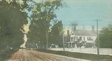
Haverhill, New Hampshire
Encyclopedia
Haverhill is a town in Grafton County
, New Hampshire
, United States
. The population was 4,697 at the 2010 census. Haverhill includes the villages of Woodsville
, Pike
, and North Haverhill, the historic town center at Haverhill Corner, and the district of Mountain Lakes
. Located here are Bedell Bridge State Park
, Black Mountain State Forest, Kinder Memorial Forest, and Oliverian Valley Wildlife Preserve. It is home to the annual North Haverhill Fair, and to a branch of the New Hampshire Community Technical Colleges. The village of North Haverhill is the county seat
of Grafton County.
, Massachusetts
, the town was first known as Lower Cohos. It was incorporated in 1763 by Colonial
Governor Benning Wentworth
, and in 1773, became the county seat of Grafton County. Haverhill was the terminus of the old Province Road, which connected the northern and western settlements with the seacoast. By 1859, when the town had 2,405 inhabitants, industries included 3 gristmill
s, 12 sawmill
s, a paper mill
, a large tannery
, a carriage
manufacturer, an iron
foundry
, 7 shoe factories
, a printing
office, and several mechanic shops. The town is home to the oldest documented covered bridge
in the country still standing—the Haverhill-Bath Bridge
, built in 1829.
The village of Woodsville, named for John L. Woods of Wells River
, Vermont
, was once a very important railroad center. Woods operated a sawmill on the Ammonoosuc River
, and developed a railroad supply enterprise following the establishment of the Boston, Concord & Montreal Railroad. The village of Pike was settled by future employees of the Pike Manufacturing Company, which was once the world's leading manufacturer of whetstones.
While the village of Haverhill Corner was historically considered to be the major settlement in town, the town's municipal offices are currently located in the village of North Haverhill, with Grafton County's offices and courthouse located just two miles further north along Route 10. Woodsville served as the county seat until 1972, when the administrative offices relocated to rural land halfway between Woodsville and the smaller village of North Haverhill.
The village of Woodsville is now the commercial center of Haverhill and its smaller surrounding towns, including several in Vermont. Woodsville is home to the town's supermarkets, banks (including the headquarters of the regional Woodsville Guaranty Savings Bank), chain stores, state liquor store, hospital, and restaurants.
, the town has a total area of 52.1 square miles (134.9 km²), of which 51 square miles (132.1 km²) is land and 1.1 square miles (2.8 km²) is water, comprising 2.15% of the town. Bounded on the west by the Connecticut River
, Haverhill is drained by the Ammonoosuc River
, in addition to Oliverian Brook
and Clark Brook. Haverhill lies fully within the Connecticut River
watershed
.
The highest point in Haverhill, at 2320 feet (707.1 m) above sea level
, is on the western slope of Black Mountain, whose 2830 ft (862.6 m) summit is in the neighboring town of Benton
.
The town is served by several state-maintained routes. New Hampshire Route 10
is the main north-south highway through Haverhill, parallelling the Connecticut River. U.S. Route 302
enters from Vermont and passes east-west through Woodsville in the northern part of town, joining with Route 10 to head northeast to Bath
and Littleton
. New Hampshire Route 25
enters Haverhill from Piermont
while co-signed with Route 10, splitting off by itself to the southeast in Haverhill Corner. New Hampshire Route 116
has its southern terminus at Route 10 in North Haverhill, and New Hampshire Route 135
has its southern terminus at Route 10 just south of Woodsville. Haverhill also has easy access to U.S. Route 5
in Vermont via bridges in North Haverhill and Woodsville.
of 2000, there were 4,416 people, 1,755 households, and 1,147 families residing in the town. The population density
was 86.5 people per square mile (33.4/km²). There were 2,148 housing units at an average density of 42.1 per square mile (16.2/km²). The racial makeup of the town was 98.23% White, 0.45% African American, 0.25% Native American, 0.36% Asian, 0.02% Pacific Islander, 0.20% from other races
, and 0.48% from two or more races. Hispanic or Latino of any race were 0.61% of the population.
There were 1,755 households out of which 28.3% had children under the age of 18 living with them, 52.6% were married couples
living together, 8.7% had a female householder with no husband present, and 34.6% were non-families. 27.9% of all households were made up of individuals and 12.9% had someone living alone who was 65 years of age or older. The average household size was 2.38 and the average family size was 2.91.
In the town the population was spread out with 23.6% under the age of 18, 7.5% from 18 to 24, 26.6% from 25 to 44, 24.6% from 45 to 64, and 17.6% who were 65 years of age or older. The median age was 40 years. For every 100 females there were 99.5 males. For every 100 females age 18 and over, there were 94.1 males.
The median income for a household in the town was $36,853, and the median income for a family was $44,816. Males had a median income of $27,100 versus $23,828 for females. The per capita income
for the town was $17,465. About 6.4% of families and 6.8% of the population were below the poverty line, including 6.1% of those under age 18 and 6.0% of those age 65 or over.
Grafton County, New Hampshire
Grafton County is a county located in the U.S. state of New Hampshire. As of the 2010 census, the population was 89,118. Its county seat is North Haverhill, which is a village within the town of Haverhill. Until 1972, the county courthouse and other offices were located in downtown Woodsville, a...
, New Hampshire
New Hampshire
New Hampshire is a state in the New England region of the northeastern United States of America. The state was named after the southern English county of Hampshire. It is bordered by Massachusetts to the south, Vermont to the west, Maine and the Atlantic Ocean to the east, and the Canadian...
, United States
United States
The United States of America is a federal constitutional republic comprising fifty states and a federal district...
. The population was 4,697 at the 2010 census. Haverhill includes the villages of Woodsville
Woodsville, New Hampshire
Woodsville is a census-designated place in the town of Haverhill in Grafton County, New Hampshire, U.S., along the Connecticut River at the mouth of the Ammonoosuc River. The population was 1,126 at the 2010 census...
, Pike
Pike, New Hampshire
Pike is a small village within the town of Haverhill, New Hampshire, in the United States. It is located in western Grafton County, approximately east of the village of Haverhill, on Oliverian Brook...
, and North Haverhill, the historic town center at Haverhill Corner, and the district of Mountain Lakes
Mountain Lakes, New Hampshire
Mountain Lakes is a census-designated place in the towns of Haverhill and Bath in Grafton County, New Hampshire. It had a population of 488 at the 2010 census....
. Located here are Bedell Bridge State Park
Bedell Covered Bridge
The Bedell Bridge was a Burr truss covered bridge that spanned the Connecticut River between Newbury, Vermont and Haverhill, New Hampshire. Until its most recent destruction in 1979, it was the second longest covered bridge in the United States.- History :...
, Black Mountain State Forest, Kinder Memorial Forest, and Oliverian Valley Wildlife Preserve. It is home to the annual North Haverhill Fair, and to a branch of the New Hampshire Community Technical Colleges. The village of North Haverhill is the county seat
County seat
A county seat is an administrative center, or seat of government, for a county or civil parish. The term is primarily used in the United States....
of Grafton County.
History
Settled by citizens from HaverhillHaverhill, Massachusetts
Haverhill is a city in Essex County, Massachusetts, United States. The population was 60,879 at the 2010 census.Located on the Merrimack River, it began as a farming community that would evolve into an important industrial center, beginning with sawmills and gristmills run by water power. In the...
, Massachusetts
Massachusetts
The Commonwealth of Massachusetts is a state in the New England region of the northeastern United States of America. It is bordered by Rhode Island and Connecticut to the south, New York to the west, and Vermont and New Hampshire to the north; at its east lies the Atlantic Ocean. As of the 2010...
, the town was first known as Lower Cohos. It was incorporated in 1763 by Colonial
Colony
In politics and history, a colony is a territory under the immediate political control of a state. For colonies in antiquity, city-states would often found their own colonies. Some colonies were historically countries, while others were territories without definite statehood from their inception....
Governor Benning Wentworth
Benning Wentworth
Benning Wentworth was the colonial governor of New Hampshire from 1741 to 1766.-Biography:The eldest child of the John Wentworth who had been Lieutenant Governor, he was born and died in Portsmouth, New Hampshire. Wentworth graduated from Harvard College in 1715...
, and in 1773, became the county seat of Grafton County. Haverhill was the terminus of the old Province Road, which connected the northern and western settlements with the seacoast. By 1859, when the town had 2,405 inhabitants, industries included 3 gristmill
Gristmill
The terms gristmill or grist mill can refer either to a building in which grain is ground into flour, or to the grinding mechanism itself.- Early history :...
s, 12 sawmill
Sawmill
A sawmill is a facility where logs are cut into boards.-Sawmill process:A sawmill's basic operation is much like those of hundreds of years ago; a log enters on one end and dimensional lumber exits on the other end....
s, a paper mill
Paper mill
A paper mill is a factory devoted to making paper from vegetable fibres such as wood pulp, old rags and other ingredients using a Fourdrinier machine or other type of paper machine.- History :...
, a large tannery
Tanning
Tanning is the making of leather from the skins of animals which does not easily decompose. Traditionally, tanning used tannin, an acidic chemical compound from which the tanning process draws its name . Coloring may occur during tanning...
, a carriage
Carriage
A carriage is a wheeled vehicle for people, usually horse-drawn; litters and sedan chairs are excluded, since they are wheelless vehicles. The carriage is especially designed for private passenger use and for comfort or elegance, though some are also used to transport goods. It may be light,...
manufacturer, an iron
Iron
Iron is a chemical element with the symbol Fe and atomic number 26. It is a metal in the first transition series. It is the most common element forming the planet Earth as a whole, forming much of Earth's outer and inner core. It is the fourth most common element in the Earth's crust...
foundry
Foundry
A foundry is a factory that produces metal castings. Metals are cast into shapes by melting them into a liquid, pouring the metal in a mold, and removing the mold material or casting after the metal has solidified as it cools. The most common metals processed are aluminum and cast iron...
, 7 shoe factories
Shoemaking
Shoemaking is the process of making footwear. Originally, shoes were made one at a time by hand. Traditional handicraft shoemaking has now been largely superseded in volume of shoes produced by industrial mass production of footwear, but not necessarily in quality, attention to detail, or...
, a printing
Printing
Printing is a process for reproducing text and image, typically with ink on paper using a printing press. It is often carried out as a large-scale industrial process, and is an essential part of publishing and transaction printing....
office, and several mechanic shops. The town is home to the oldest documented covered bridge
Covered bridge
A covered bridge is a bridge with enclosed sides and a roof, often accommodating only a single lane of traffic. Most covered bridges are wooden; some newer ones are concrete or metal with glass sides...
in the country still standing—the Haverhill-Bath Bridge
Haverhill-Bath Covered Bridge
Haverhill-Bath Covered Bridge is a historic covered bridge over the Ammonoosuc River in Woodsville, New Hampshire. Formerly used by New Hampshire Route 135, the bridge was idled in 1999. Restored in 2004, it is now open to foot traffic only....
, built in 1829.
The village of Woodsville, named for John L. Woods of Wells River
Wells River, Vermont
Wells River is a village in the town of Newbury in Orange County, Vermont, United States. The population was 325 at the 2000 census. The village center is located at the junction of U.S...
, Vermont
Vermont
Vermont is a state in the New England region of the northeastern United States of America. The state ranks 43rd in land area, , and 45th in total area. Its population according to the 2010 census, 630,337, is the second smallest in the country, larger only than Wyoming. It is the only New England...
, was once a very important railroad center. Woods operated a sawmill on the Ammonoosuc River
Ammonoosuc River
The Ammonoosuc River is a river, 55 mi long, in northwestern New Hampshire in the United States. It is a tributary of the Connecticut River, which flows to Long Island Sound. "Ammonoosuc" is Abnaki for "small, narrow fishing place"....
, and developed a railroad supply enterprise following the establishment of the Boston, Concord & Montreal Railroad. The village of Pike was settled by future employees of the Pike Manufacturing Company, which was once the world's leading manufacturer of whetstones.
While the village of Haverhill Corner was historically considered to be the major settlement in town, the town's municipal offices are currently located in the village of North Haverhill, with Grafton County's offices and courthouse located just two miles further north along Route 10. Woodsville served as the county seat until 1972, when the administrative offices relocated to rural land halfway between Woodsville and the smaller village of North Haverhill.
The village of Woodsville is now the commercial center of Haverhill and its smaller surrounding towns, including several in Vermont. Woodsville is home to the town's supermarkets, banks (including the headquarters of the regional Woodsville Guaranty Savings Bank), chain stores, state liquor store, hospital, and restaurants.
Geography
According to the United States Census BureauUnited States Census Bureau
The United States Census Bureau is the government agency that is responsible for the United States Census. It also gathers other national demographic and economic data...
, the town has a total area of 52.1 square miles (134.9 km²), of which 51 square miles (132.1 km²) is land and 1.1 square miles (2.8 km²) is water, comprising 2.15% of the town. Bounded on the west by the Connecticut River
Connecticut River
The Connecticut River is the largest and longest river in New England, and also an American Heritage River. It flows roughly south, starting from the Fourth Connecticut Lake in New Hampshire. After flowing through the remaining Connecticut Lakes and Lake Francis, it defines the border between the...
, Haverhill is drained by the Ammonoosuc River
Ammonoosuc River
The Ammonoosuc River is a river, 55 mi long, in northwestern New Hampshire in the United States. It is a tributary of the Connecticut River, which flows to Long Island Sound. "Ammonoosuc" is Abnaki for "small, narrow fishing place"....
, in addition to Oliverian Brook
Oliverian Brook
Oliverian Brook is a 13.1 mile long river in western New Hampshire in the United States. It is a tributary of the Connecticut River, which flows to Long Island Sound....
and Clark Brook. Haverhill lies fully within the Connecticut River
Connecticut River
The Connecticut River is the largest and longest river in New England, and also an American Heritage River. It flows roughly south, starting from the Fourth Connecticut Lake in New Hampshire. After flowing through the remaining Connecticut Lakes and Lake Francis, it defines the border between the...
watershed
Drainage basin
A drainage basin is an extent or an area of land where surface water from rain and melting snow or ice converges to a single point, usually the exit of the basin, where the waters join another waterbody, such as a river, lake, reservoir, estuary, wetland, sea, or ocean...
.
The highest point in Haverhill, at 2320 feet (707.1 m) above sea level
Sea level
Mean sea level is a measure of the average height of the ocean's surface ; used as a standard in reckoning land elevation...
, is on the western slope of Black Mountain, whose 2830 ft (862.6 m) summit is in the neighboring town of Benton
Benton, New Hampshire
Benton is a town in Grafton County, New Hampshire, United States. The population was 364 at the 2010 census. Located in the White Mountains, Benton is largely surrounded by the White Mountain National Forest. The town is crossed by the Appalachian Trail....
.
The town is served by several state-maintained routes. New Hampshire Route 10
New Hampshire Route 10
New Hampshire Route 10 is a north–south state highway in the U.S. state of New Hampshire. Its southern terminus is at the Massachusetts state line in the town of Winchester. In Massachusetts the highway becomes Massachusetts Route 10. Total length of the highway is .-Route description:NH 10...
is the main north-south highway through Haverhill, parallelling the Connecticut River. U.S. Route 302
U.S. Route 302
U.S. Route 302 is a spur of U.S. Route 2. It currently runs 171 miles north from Portland, Maine, at U.S. Route 1, to Montpelier, Vermont, at US 2...
enters from Vermont and passes east-west through Woodsville in the northern part of town, joining with Route 10 to head northeast to Bath
Bath, New Hampshire
Bath is a town in Grafton County, New Hampshire, United States. The population was 1,077 at the 2010 census. Now a tourist destination and bedroom community for Littleton, the town is noted for its historic architecture, including the Brick Store and three covered bridges...
and Littleton
Littleton, New Hampshire
Littleton is a town in Grafton County, New Hampshire, United States. The population was 5,928 at the 2010 census. Situated at the edge of the White Mountains, Littleton is bounded on the northwest by the Connecticut River....
. New Hampshire Route 25
New Hampshire Route 25
New Hampshire Route 25 is a long east–west state highway in New Hampshire. It runs completely across the state from Vermont to Maine.The western terminus of Route 25 is at the Vermont state line on the Connecticut River in Piermont, where the road continues west as Vermont Route 25...
enters Haverhill from Piermont
Piermont, New Hampshire
Piermont is a town in Grafton County, New Hampshire, United States. The population was 790 at the 2010 census. It is home to several summer camps.-History:...
while co-signed with Route 10, splitting off by itself to the southeast in Haverhill Corner. New Hampshire Route 116
New Hampshire Route 116
New Hampshire Route 116 is a long east–west highway in northern New Hampshire. NH 116 is a scenic rural highway stretching from Haverhill, which lies along the Connecticut River, to Jefferson, in the White Mountains Region....
has its southern terminus at Route 10 in North Haverhill, and New Hampshire Route 135
New Hampshire Route 135
New Hampshire Route 135 is a long north–south state highway in New Hampshire. The highway runs north along the Connecticut River from Woodsville to Lancaster....
has its southern terminus at Route 10 just south of Woodsville. Haverhill also has easy access to U.S. Route 5
U.S. Route 5
U.S. Route 5 is a north–south United States highway running through the New England states of Connecticut, Massachusetts, and Vermont. Significant cities along the route include New Haven, Connecticut; Hartford, Connecticut; and Springfield, Massachusetts. From Hartford northward to St...
in Vermont via bridges in North Haverhill and Woodsville.
Demographics
As of the censusCensus
A census is the procedure of systematically acquiring and recording information about the members of a given population. It is a regularly occurring and official count of a particular population. The term is used mostly in connection with national population and housing censuses; other common...
of 2000, there were 4,416 people, 1,755 households, and 1,147 families residing in the town. The population density
Population density
Population density is a measurement of population per unit area or unit volume. It is frequently applied to living organisms, and particularly to humans...
was 86.5 people per square mile (33.4/km²). There were 2,148 housing units at an average density of 42.1 per square mile (16.2/km²). The racial makeup of the town was 98.23% White, 0.45% African American, 0.25% Native American, 0.36% Asian, 0.02% Pacific Islander, 0.20% from other races
Race (United States Census)
Race and ethnicity in the United States Census, as defined by the Federal Office of Management and Budget and the United States Census Bureau, are self-identification data items in which residents choose the race or races with which they most closely identify, and indicate whether or not they are...
, and 0.48% from two or more races. Hispanic or Latino of any race were 0.61% of the population.
There were 1,755 households out of which 28.3% had children under the age of 18 living with them, 52.6% were married couples
Marriage
Marriage is a social union or legal contract between people that creates kinship. It is an institution in which interpersonal relationships, usually intimate and sexual, are acknowledged in a variety of ways, depending on the culture or subculture in which it is found...
living together, 8.7% had a female householder with no husband present, and 34.6% were non-families. 27.9% of all households were made up of individuals and 12.9% had someone living alone who was 65 years of age or older. The average household size was 2.38 and the average family size was 2.91.
In the town the population was spread out with 23.6% under the age of 18, 7.5% from 18 to 24, 26.6% from 25 to 44, 24.6% from 45 to 64, and 17.6% who were 65 years of age or older. The median age was 40 years. For every 100 females there were 99.5 males. For every 100 females age 18 and over, there were 94.1 males.
The median income for a household in the town was $36,853, and the median income for a family was $44,816. Males had a median income of $27,100 versus $23,828 for females. The per capita income
Per capita income
Per capita income or income per person is a measure of mean income within an economic aggregate, such as a country or city. It is calculated by taking a measure of all sources of income in the aggregate and dividing it by the total population...
for the town was $17,465. About 6.4% of families and 6.8% of the population were below the poverty line, including 6.1% of those under age 18 and 6.0% of those age 65 or over.
Sites of interest
- Bedell Bridge State Park
- Haverhill-Bath Covered Bridge (1829)
- Haverhill Historical Society & Museum
- Museum of American Weather
Notable residents
- Samuel BrooksSamuel Brooks (Canadian politician)Samuel Brooks was an American-born merchant and political figure in Lower Canada.He was born in Haverhill, New Hampshire, the son of merchant Samuel Brooks. He set up business in Newbury, Vermont. He married Elizabeth Towle in 1813. Around 1820, he moved to Stanstead in Lower Canada, later moving...
, merchant and politician - Noah DavisNoah DavisNoah Davis was an American lawyer and politician from New York-Life:...
, congressman - Betty JohnsonBetty JohnsonBetty Johnson is an American traditional pop and cabaret singer.-Biography:Johnson was born in Guilford County, North Carolina. Her professional debut was in a family group, The Johnson Family Singers, including her parents and three brothers, singing a repertoire primarily of religious material...
, singer - Henry W. KeyesHenry W. KeyesHenry Wilder Keyes was an American farmer, banker, and Republican politician from Haverhill, New Hampshire. Born in 1863 in Newbury, Vermont, he was raised in New Hampshire. His father was a prominent New England farmer, merchant, and railroad investor. Keyes graduated from Harvard with a B.A...
, governor of New Hampshire - Thomas Leverett NelsonThomas Leverett Nelson-Early life:Thomas Nelson was born in Haverhill, New Hampshire, March 4, 1827, one of twelve children of John and Lois Leverett Nelson. Nelson attended Kimball Union Academy in Meriden, New Hampshire and Dartmouth College. After two years at Dartmouth, he enrolled at the University of Vermont in...
, judge - Chad ParontoChad ParontoChad Michael Paronto is an American Baseball player. Paronto attended the University of Massachusetts before being drafted by the Baltimore Orioles in the eighth round of the amateur draft. Paronto's best pitches include a 90-94 mph fastball and a heavy sinker which he uses mainly with men...
, baseball player - Jonathan H. RowellJonathan H. RowellJonathan Harvey Rowell was a U.S. Representative from Illinois.Born in Haverhill, New Hampshire, Rowell attended Rock Creek School.He graduated from Eureka College, Illinois....
, congressman - Bob Smith, baseball player
- Mark SteynMark SteynMark Steyn is a Canadian-born writer, conservative-leaning political commentator, and cultural critic. He has written five books, including America Alone: The End of the World As We Know It, a New York Times bestseller...
, writer and political commentator - Frank StoddardFrank StoddardFrank Stoddard is a NASCAR crew chief and owner from Haverhill, New Hampshire. He is the owner of FAS Lane Racing, a NASCAR Sprint Cup Series team. He began his career with Dana Patten in the Busch Series. Later, he worked with Jeff Burton and Roush Racing, and won seventeen races together...
, NASCAR crew chief