
Wells River, Vermont
Encyclopedia
Wells River is a village in the town of Newbury
in Orange County, Vermont
, United States
. The population was 325 at the 2000 census. The village center is located at the junction of U.S. Routes 5 and 302.
The village center (the portion near the confluence
of the Wells River
and the Connecticut River
) was added to the National Register of Historic Places
in 1983 as Wells River Village Historic District. The district covers 84 contributing properties over an area of 390 acres (1.6 km²). It includes examples of Classical Revival, Federal, and Late Victorian styles. The architectural character of the district represents the building traditions of nineteenth-century Vermont, showcasing a wide array of building styles.
 The area was first called Governor's Right because 500 acres (200 hectares) were granted to Governor Benning Wentworth
of New Hampshire
. It was purchased by Er Chamberlin, who built a gristmill
on the Wells River
. Located at the head of navigation for the Connecticut River
, Wells River developed as a center for trade
. Canal boats guided by long poles floated downriver laden with lumber
, clapboard
s and shingles, returning with goods such as iron
, salt
, rum
and molasses
.
On November 6, 1848, the Connecticut & Passumpsic Rivers Railroad opened to Wells River, rendering obsolete the river's barge traffic. In 1853-1854, the Boston, Concord & Montreal Railroad reached Woodsville, New Hampshire
across the Connecticut River. It built division offices and repair facilities, transforming that village into a booming railway town
. The line replaced the 1805 bridge over the narrows to Wells River with a two-level wooden span which combined a toll highway deck at the bottom of the truss
, with railroad tracks on the roof. In 1903, a steel bridge of similar configuration replaced it. In 1873, the Montpelier & Wells River Railroad was completed, enhancing the region's position as a railroad junction.
, which flows into the Connecticut River
at the eastern edge of the village. According to the United States Census Bureau
, the village has a total area of 2.0 square miles (5.1 km²), all of it land.
Wells River is crossed by Interstate 91, U.S. Route 5, and U.S. Route 302, with Routes 5 and 302 briefly running concurrently, before Route 302 crosses the Connecticut River.
of 2000, there were 325 people, 156 households, and 92 families residing in the village. The population density
was 167.0 people per square mile (64.4/km²). There were 178 housing units at an average density of 91.5/sq mi (35.2/km²). The racial makeup of the village was 99.69% White and 0.31% African American.
There were 156 households out of which 25.0% had children under the age of 18 living with them, 42.3% were married couples
living together, 11.5% had a female householder with no husband present, and 40.4% were non-families. 39.1% of all households were made up of individuals and 19.2% had someone living alone who was 65 years of age or older. The average household size was 2.08 and the average family size was 2.67.
In the village the population was spread out with 23.1% under the age of 18, 5.8% from 18 to 24, 22.8% from 25 to 44, 24.9% from 45 to 64, and 23.4% who were 65 years of age or older. The median age was 44 years. For every 100 females there were 77.6 males. For every 100 females age 18 and over, there were 83.8 males.
The median income for a household in the village was $28,021, and the median income for a family was $32,708. Males had a median income of $28,056 versus $21,250 for females. The per capita income
for the village was $14,705. About 6.5% of families and 11.1% of the population were below the poverty line, including 6.1% of those under age 18 and 2.1% of those age 65 or over.
Newbury (town), Vermont
Newbury is a town in Orange County, Vermont, United States. The population was 1,955 at the 2000 census. Newbury includes the villages of Newbury, Center Newbury, West Newbury, South Newbury, Boltonville, Peach Four Corners, and Wells River.-History:...
in Orange County, Vermont
Vermont
Vermont is a state in the New England region of the northeastern United States of America. The state ranks 43rd in land area, , and 45th in total area. Its population according to the 2010 census, 630,337, is the second smallest in the country, larger only than Wyoming. It is the only New England...
, United States
United States
The United States of America is a federal constitutional republic comprising fifty states and a federal district...
. The population was 325 at the 2000 census. The village center is located at the junction of U.S. Routes 5 and 302.
The village center (the portion near the confluence
Confluence
Confluence, in geography, describes the meeting of two or more bodies of water.Confluence may also refer to:* Confluence , a property of term rewriting systems...
of the Wells River
Wells River (Vermont)
The Wells River is a river, approximately long, in the U.S. state of Vermont. It is a tributary of the Connecticut River.The Wells River begins at the outlet of Ricker Pond at the southern boundary of Groton State Forest in the town of Groton. The river flows generally southeast through the...
and the Connecticut River
Connecticut River
The Connecticut River is the largest and longest river in New England, and also an American Heritage River. It flows roughly south, starting from the Fourth Connecticut Lake in New Hampshire. After flowing through the remaining Connecticut Lakes and Lake Francis, it defines the border between the...
) was added to the National Register of Historic Places
National Register of Historic Places
The National Register of Historic Places is the United States government's official list of districts, sites, buildings, structures, and objects deemed worthy of preservation...
in 1983 as Wells River Village Historic District. The district covers 84 contributing properties over an area of 390 acres (1.6 km²). It includes examples of Classical Revival, Federal, and Late Victorian styles. The architectural character of the district represents the building traditions of nineteenth-century Vermont, showcasing a wide array of building styles.
History
Benning Wentworth
Benning Wentworth was the colonial governor of New Hampshire from 1741 to 1766.-Biography:The eldest child of the John Wentworth who had been Lieutenant Governor, he was born and died in Portsmouth, New Hampshire. Wentworth graduated from Harvard College in 1715...
of New Hampshire
New Hampshire
New Hampshire is a state in the New England region of the northeastern United States of America. The state was named after the southern English county of Hampshire. It is bordered by Massachusetts to the south, Vermont to the west, Maine and the Atlantic Ocean to the east, and the Canadian...
. It was purchased by Er Chamberlin, who built a gristmill
Gristmill
The terms gristmill or grist mill can refer either to a building in which grain is ground into flour, or to the grinding mechanism itself.- Early history :...
on the Wells River
Wells River (Vermont)
The Wells River is a river, approximately long, in the U.S. state of Vermont. It is a tributary of the Connecticut River.The Wells River begins at the outlet of Ricker Pond at the southern boundary of Groton State Forest in the town of Groton. The river flows generally southeast through the...
. Located at the head of navigation for the Connecticut River
Connecticut River
The Connecticut River is the largest and longest river in New England, and also an American Heritage River. It flows roughly south, starting from the Fourth Connecticut Lake in New Hampshire. After flowing through the remaining Connecticut Lakes and Lake Francis, it defines the border between the...
, Wells River developed as a center for trade
Trade
Trade is the transfer of ownership of goods and services from one person or entity to another. Trade is sometimes loosely called commerce or financial transaction or barter. A network that allows trade is called a market. The original form of trade was barter, the direct exchange of goods and...
. Canal boats guided by long poles floated downriver laden with lumber
Lumber
Lumber or timber is wood in any of its stages from felling through readiness for use as structural material for construction, or wood pulp for paper production....
, clapboard
Clapboard (architecture)
Clapboard, also known as bevel siding or lap siding or weather-board , is a board used typically for exterior horizontal siding that has one edge thicker than the other and where the board above laps over the one below...
s and shingles, returning with goods such as iron
Iron
Iron is a chemical element with the symbol Fe and atomic number 26. It is a metal in the first transition series. It is the most common element forming the planet Earth as a whole, forming much of Earth's outer and inner core. It is the fourth most common element in the Earth's crust...
, salt
Salt
In chemistry, salts are ionic compounds that result from the neutralization reaction of an acid and a base. They are composed of cations and anions so that the product is electrically neutral...
, rum
Rum
Rum is a distilled alcoholic beverage made from sugarcane by-products such as molasses, or directly from sugarcane juice, by a process of fermentation and distillation. The distillate, a clear liquid, is then usually aged in oak barrels...
and molasses
Molasses
Molasses is a viscous by-product of the processing of sugar cane, grapes or sugar beets into sugar. The word molasses comes from the Portuguese word melaço, which ultimately comes from mel, the Latin word for "honey". The quality of molasses depends on the maturity of the sugar cane or sugar beet,...
.
On November 6, 1848, the Connecticut & Passumpsic Rivers Railroad opened to Wells River, rendering obsolete the river's barge traffic. In 1853-1854, the Boston, Concord & Montreal Railroad reached Woodsville, New Hampshire
Woodsville, New Hampshire
Woodsville is a census-designated place in the town of Haverhill in Grafton County, New Hampshire, U.S., along the Connecticut River at the mouth of the Ammonoosuc River. The population was 1,126 at the 2010 census...
across the Connecticut River. It built division offices and repair facilities, transforming that village into a booming railway town
Railway town
A railway town is a settlement that originated or was greatly developed because of a railway station or junction at its site.In Victorian Britain, the spread of railways greatly affected the fate of many small towns...
. The line replaced the 1805 bridge over the narrows to Wells River with a two-level wooden span which combined a toll highway deck at the bottom of the truss
Truss
In architecture and structural engineering, a truss is a structure comprising one or more triangular units constructed with straight members whose ends are connected at joints referred to as nodes. External forces and reactions to those forces are considered to act only at the nodes and result in...
, with railroad tracks on the roof. In 1903, a steel bridge of similar configuration replaced it. In 1873, the Montpelier & Wells River Railroad was completed, enhancing the region's position as a railroad junction.
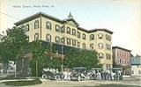
Historic buildings
Some of the more significant historic structures in the village are:- Wells River Congregational Church, Main Street, 1839, 1869, 1894
- Wells River School, Main Street, 1874 (listed separately on the National Register)
- Mulliken-Davis Store, Main Street, c.1871
- U.S. Post Office, 26 Main Street: (c.1840)
- Baldwin Memorial Library, Main Street, c. 1840
- G. Gould House, 7 Main Street, c.1794, c. 1830
- Baldwin-Simonds House, North end of Main Street, c. 1890
- Wells River Village Hall, Cross Street, 1908
Geography
The village takes its name from the Wells RiverWells River (Vermont)
The Wells River is a river, approximately long, in the U.S. state of Vermont. It is a tributary of the Connecticut River.The Wells River begins at the outlet of Ricker Pond at the southern boundary of Groton State Forest in the town of Groton. The river flows generally southeast through the...
, which flows into the Connecticut River
Connecticut River
The Connecticut River is the largest and longest river in New England, and also an American Heritage River. It flows roughly south, starting from the Fourth Connecticut Lake in New Hampshire. After flowing through the remaining Connecticut Lakes and Lake Francis, it defines the border between the...
at the eastern edge of the village. According to the United States Census Bureau
United States Census Bureau
The United States Census Bureau is the government agency that is responsible for the United States Census. It also gathers other national demographic and economic data...
, the village has a total area of 2.0 square miles (5.1 km²), all of it land.
Wells River is crossed by Interstate 91, U.S. Route 5, and U.S. Route 302, with Routes 5 and 302 briefly running concurrently, before Route 302 crosses the Connecticut River.
Demographics
As of the censusCensus
A census is the procedure of systematically acquiring and recording information about the members of a given population. It is a regularly occurring and official count of a particular population. The term is used mostly in connection with national population and housing censuses; other common...
of 2000, there were 325 people, 156 households, and 92 families residing in the village. The population density
Population density
Population density is a measurement of population per unit area or unit volume. It is frequently applied to living organisms, and particularly to humans...
was 167.0 people per square mile (64.4/km²). There were 178 housing units at an average density of 91.5/sq mi (35.2/km²). The racial makeup of the village was 99.69% White and 0.31% African American.
There were 156 households out of which 25.0% had children under the age of 18 living with them, 42.3% were married couples
Marriage
Marriage is a social union or legal contract between people that creates kinship. It is an institution in which interpersonal relationships, usually intimate and sexual, are acknowledged in a variety of ways, depending on the culture or subculture in which it is found...
living together, 11.5% had a female householder with no husband present, and 40.4% were non-families. 39.1% of all households were made up of individuals and 19.2% had someone living alone who was 65 years of age or older. The average household size was 2.08 and the average family size was 2.67.
In the village the population was spread out with 23.1% under the age of 18, 5.8% from 18 to 24, 22.8% from 25 to 44, 24.9% from 45 to 64, and 23.4% who were 65 years of age or older. The median age was 44 years. For every 100 females there were 77.6 males. For every 100 females age 18 and over, there were 83.8 males.
The median income for a household in the village was $28,021, and the median income for a family was $32,708. Males had a median income of $28,056 versus $21,250 for females. The per capita income
Per capita income
Per capita income or income per person is a measure of mean income within an economic aggregate, such as a country or city. It is calculated by taking a measure of all sources of income in the aggregate and dividing it by the total population...
for the village was $14,705. About 6.5% of families and 11.1% of the population were below the poverty line, including 6.1% of those under age 18 and 2.1% of those age 65 or over.