
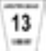
Greater Sudbury Road 13
Encyclopedia
Greater Sudbury Road 13, also known as Vermilion Lake Road, is a municipal road in the city of Greater Sudbury, Ontario
, Canada
. It was voted as the worst road in Ontario in the Canadian Automobile Association
's annual Ontario's Worst Roads survey in 2007. In the 2008 survey, Vermilion Lake Road dropped to third place behind Steeles Avenue
in Toronto
and Brock Street in Kingston
, while in 2009 the road dropped to ninth place. In 2010, however, the road rose to second place again, behind only Pelican Falls Road in Sioux Lookout.
The road begins at Highway 144, travelling at a south-westerly direction, until ending its numbered municipal road status at Brosseau Street. However, west of Brosseau Street, the Vermilion Lake Road name continues for a further 1.5 km, ending at a dead end near Vermilion Lake
. The road primarily serves the communities of Larchwood and Hull.
In October 2007, shortly after the road was named to the Worst Roads survey, the city launched a construction project to replace four culvert
s on the road.
Greater Sudbury Road 13 only intersects with one other numbered municipal road, Greater Sudbury Road 12 (Gordon Lake Road).
Ontario
Ontario is a province of Canada, located in east-central Canada. It is Canada's most populous province and second largest in total area. It is home to the nation's most populous city, Toronto, and the nation's capital, Ottawa....
, Canada
Canada
Canada is a North American country consisting of ten provinces and three territories. Located in the northern part of the continent, it extends from the Atlantic Ocean in the east to the Pacific Ocean in the west, and northward into the Arctic Ocean...
. It was voted as the worst road in Ontario in the Canadian Automobile Association
Canadian Automobile Association
The Canadian Automobile Association , commonly known as CAA, is a non-profit federation, founded in 1913, of nine clubs across Canada, providing roadside assistance service, a complete range of auto touring and leisure travel services, insurance services, and member discounts with preferred...
's annual Ontario's Worst Roads survey in 2007. In the 2008 survey, Vermilion Lake Road dropped to third place behind Steeles Avenue
Steeles Avenue
Steeles Avenue is an east-west street that forms the northern city limit of Toronto and the southern limit of York Region, Ontario, Canada. It stretches across the western Greater Toronto Area from Milborough Townline in Halton Region east to the Scarborough-Pickering limit. It runs for within...
in Toronto
Toronto
Toronto is the provincial capital of Ontario and the largest city in Canada. It is located in Southern Ontario on the northwestern shore of Lake Ontario. A relatively modern city, Toronto's history dates back to the late-18th century, when its land was first purchased by the British monarchy from...
and Brock Street in Kingston
Kingston, Ontario
Kingston, Ontario is a Canadian city located in Eastern Ontario where the St. Lawrence River flows out of Lake Ontario. Originally a First Nations settlement called "Katarowki," , growing European exploration in the 17th Century made it an important trading post...
, while in 2009 the road dropped to ninth place. In 2010, however, the road rose to second place again, behind only Pelican Falls Road in Sioux Lookout.
The road begins at Highway 144, travelling at a south-westerly direction, until ending its numbered municipal road status at Brosseau Street. However, west of Brosseau Street, the Vermilion Lake Road name continues for a further 1.5 km, ending at a dead end near Vermilion Lake
Vermilion Lake (Sudbury)
Vermilion Lake is a lake in the city of Greater Sudbury, Ontario which is situated approximately 33 km west of downtown, in Fairbank Township. The lake's primary inflow and outflow is the Vermilion River. There is also a small creek that flows into Vermillion Lake, Cameron Creek. This creek...
. The road primarily serves the communities of Larchwood and Hull.
In October 2007, shortly after the road was named to the Worst Roads survey, the city launched a construction project to replace four culvert
Culvert
A culvert is a device used to channel water. It may be used to allow water to pass underneath a road, railway, or embankment. Culverts can be made of many different materials; steel, polyvinyl chloride and concrete are the most common...
s on the road.
Greater Sudbury Road 13 only intersects with one other numbered municipal road, Greater Sudbury Road 12 (Gordon Lake Road).