Glen Roy
Encyclopedia


Lochaber
District of Lochaber 1975 to 1996Highland council area shown as one of the council areas of ScotlandLochaber is one of the 16 ward management areas of the Highland Council of Scotland and one of eight former local government districts of the two-tier Highland region...
area of the Highlands
Scottish Highlands
The Highlands is an historic region of Scotland. The area is sometimes referred to as the "Scottish Highlands". It was culturally distinguishable from the Lowlands from the later Middle Ages into the modern period, when Lowland Scots replaced Scottish Gaelic throughout most of the Lowlands...
of Scotland
Scotland
Scotland is a country that is part of the United Kingdom. Occupying the northern third of the island of Great Britain, it shares a border with England to the south and is bounded by the North Sea to the east, the Atlantic Ocean to the north and west, and the North Channel and Irish Sea to the...
is a National Nature Reserve
National Nature Reserve
For details of National nature reserves in the United Kingdom see:*National Nature Reserves in England*National Nature Reserves in Northern Ireland*National Nature Reserves in Scotland*National Nature Reserves in Wales...
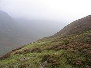
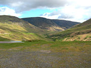
and is noted for the geological puzzle of the three roads ("Parallel Roads").
The "Parallel Roads" of Glen Roy are lake terraces that formed along the shorelines of an ancient ice-dammed lake. The lake existed during a brief period (some 900-1,100 years in duration) of climatic deterioration, during a much longer period of deglaciation, subsequent to the last main ice age
Ice age
An ice age or, more precisely, glacial age, is a generic geological period of long-term reduction in the temperature of the Earth's surface and atmosphere, resulting in the presence or expansion of continental ice sheets, polar ice sheets and alpine glaciers...
(The Devensian). From a distance they resemble man-made roads running along the side of the Glen, hence the name.

Location and access
The glen runs north from Glen Spean which takes the main A86A86 road
The A86 is a major road in Scotland, United Kingdom, it runs from Spean Bridge to Kingussie. It is a primary route for all of its length.Travelling along this route carries a medium to high risk of suffering a death or serious injury accident according to EuroRAP.-References:...
trunk road
Trunk road
A trunk road, trunk highway, or strategic road is a major road—usually connecting two or more cities, ports, airports, and other things.—which is the recommended route for long-distance and freight traffic...
and the railway of the West Highland Line
West Highland Line
The West Highland Line is considered the most scenic railway line in Britain, linking the ports of Mallaig and Oban on the west coast of Scotland to Glasgow. The line was voted the top rail journey in the world by readers of independent travel magazine Wanderlust in 2009, ahead of the iconic...
, both running about a further 14 miles southwest via Spean Bridge
Spean Bridge
Spean Bridge is a village, in the Highland region of Scotland.The village takes its name from the Highbridge over the River Spean on General Wade's military road between Fort William and Fort Augustus, and not from Telford's bridge of 1819 which carries the A82 over the river at the heart of the...
to Fort William. The village of Roybridge
Roybridge
Roybridge is a small village, that lies at the confluence of the rivers River Roy and River Spean, located 3 miles east of Spean Bridge, in Inverness-shire, Scottish Highlands and is in the Scottish council area of Highland....
and Roy Bridge railway station
Roy Bridge railway station
Roy Bridge railway station is a railway station serving the village of Roybridge in the Highland region of Scotland. This station is on the West Highland Line.The station was originally a two platform station, the up loop being removed in 1966...
are sited where the River Roy joins the River Spean, and from there a narrow single track road runs north up the glen for almost 10 miles to Brae Roy Lodge.

The Parallel Roads of Glen Roy
The Parallel Roads of Glen Roy, Scottish Highlands, represent a series of ice-dammed proglacial lakeProglacial lake
In geology, a proglacial lake is a lake formed either by the damming action of a moraine or ice dam during the retreat of a melting glacier, or by meltwater trapped against an ice sheet due to isostatic depression of the crust around the ice...
shorelines produced during the cold climate of the Younger Dryas
Younger Dryas
The Younger Dryas stadial, also referred to as the Big Freeze, was a geologically brief period of cold climatic conditions and drought between approximately 12.8 and 11.5 ka BP, or 12,800 and 11,500 years before present...
(GS1). It has been demonstrated by Dawson, Hampton, Harrison, Greengrass and Fretwell (2002) that each lake shoreline exhibits evidence of glacio-isostatic tilting associated with the decay of the last (Late Devensian) ice sheet. The directions of tilting of the three shorelines (in the quadrant between north and east), are at variance with published glacio-isostatic uplift isobases based on marine shoreline data that suggest a pattern of decreased uplift towards the northwest. The gradient of shoreline tilting (between 0.11 and 0.14 m/km) is similar to measured regional tilts of a well-developed marine shoreline (the Main Rock Platform) considered to have been produced in Scotland during the same period of extreme cold climate. Consideration of the ice-dammed lake shoreline data also points to the former occurrence of two separate episodes of tectonic activity during the Younger Dryas (Greenland Stadial 1 - GS1).
Historic geological investigations
In the 19th century, the Parallel Roads attracted the attention of many early geologists, including the Reverend William BucklandWilliam Buckland
The Very Rev. Dr William Buckland DD FRS was an English geologist, palaeontologist and Dean of Westminster, who wrote the first full account of a fossil dinosaur, which he named Megalosaurus...
, James Geikie
James Geikie
James Geikie was a Scottish geologist.He was born in Edinburgh, the son of James Stuart Geikie and younger brother of Sir Archibald Geikie...
, Charles Darwin
Charles Darwin
Charles Robert Darwin FRS was an English naturalist. He established that all species of life have descended over time from common ancestry, and proposed the scientific theory that this branching pattern of evolution resulted from a process that he called natural selection.He published his theory...
, Charles Lyell
Charles Lyell
Sir Charles Lyell, 1st Baronet, Kt FRS was a British lawyer and the foremost geologist of his day. He is best known as the author of Principles of Geology, which popularised James Hutton's concepts of uniformitarianism – the idea that the earth was shaped by slow-moving forces still in operation...
and Joseph Prestwich
Joseph Prestwich
Sir Joseph Prestwich FRS, was a British geologist and businessman, known as an expert on the Tertiary Period and for having confirmed the findings of Boucher de Perthes of ancient flint tools in the Somme valley gravel beds....
. This interest ensured that the Parallel Roads featured prominently in the development of geological science.

South America
South America is a continent situated in the Western Hemisphere, mostly in the Southern Hemisphere, with a relatively small portion in the Northern Hemisphere. The continent is also considered a subcontinent of the Americas. It is bordered on the west by the Pacific Ocean and on the north and east...
during the Beagle expedition
Second voyage of HMS Beagle
The second voyage of HMS Beagle, from 27 December 1831 to 2 October 1836, was the second survey expedition of HMS Beagle, under captain Robert FitzRoy who had taken over command of the ship on its first voyage after her previous captain committed suicide...
and believing that the shorelines were of marine origin. This was contradicted by Louis Agassiz
Louis Agassiz
Jean Louis Rodolphe Agassiz was a Swiss paleontologist, glaciologist, geologist and a prominent innovator in the study of the Earth's natural history. He grew up in Switzerland and became a professor of natural history at University of Neuchâtel...
's Glacial theory of 1840 which postulated that the shorelines had been cut by freeze-thaw processes of lake ice during the maximum extent of glacial ice in the climatic reversal known as the Younger Dryas
Younger Dryas
The Younger Dryas stadial, also referred to as the Big Freeze, was a geologically brief period of cold climatic conditions and drought between approximately 12.8 and 11.5 ka BP, or 12,800 and 11,500 years before present...
/ Greenland Stadial 1 or locally the Loch Lomond Readvance.
Four decades after his 1839 paper and shortly before his death, Darwin conceded that he was incorrect. However, he had conceded that he was embarrassed by "that confounded paper of mine" as early as 1861, in letters to Thomas Jamieson
Thomas Jamieson
Thomas Francis Jamieson was a Scottish scientist most associated with his studies of sea level and glacial isostasy during the Quaternary....
, quoted by Jamieson (1863; 1892).
Interest in the Parallel Roads continues to this day, both among earth scientists intrigued by the dramatic processes that shaped that landscape, and among tourists attracted by the natural wonder of the landforms.

