

European route E60
Encyclopedia
European route E 60 is a E-road running from Brest
, France
(on the Atlantic
coast), to Irkeshtam
, Kyrgyzstan
(on the border with People's Republic of China
). The road crosses:
Basel
, Zürich
, Winterthur
, St. Gallen
and St. Margrethen
Bregenz
, Lauterach
, Feldkirch
, Landeck
, Telfs
, Innsbruck
Rosenheim
, Bad Reichenhall
/Piding
Salzburg
, Sattledt
, Linz
, Sankt Pölten
, Vienna
and Nickelsdorf
Mosonmagyaróvár
, Győr
, Tatabánya
, Budapest
, Cegléd
, Szolnok
, Kisújszállás
, Püspökladány
, Berettyóújfalu


Oradea
, Aleşd
, Huedin
, Cluj-Napoca
, Turda
, Câmpia Turzii
, Luduş
, Iernut
, Târgu Mureş, Sighişoara
, Braşov
, Predeal
, Azuga
, Ploieşti
, Otopeni
, Bucharest
, Urziceni
, Slobozia
, Hârşova
, Constanţa
, Agigea
Türkmenbaşy
, Serdar (Gyzylarbat), Ashgabat, Tejen
, Mary
, Türkmenabat
(Chardzhou)) M37 highway
Qorako‘l
, Bukhara
, Qarshi
, G‘uzor
, Sherobod, Termez
Dushanbe
, Jirgatol
Sary-Tash
and Irkeshtam
Brest, France
Brest is a city in the Finistère department in Brittany in northwestern France. Located in a sheltered position not far from the western tip of the Breton peninsula, and the western extremity of metropolitan France, Brest is an important harbour and the second French military port after Toulon...
, France
France
The French Republic , The French Republic , The French Republic , (commonly known as France , is a unitary semi-presidential republic in Western Europe with several overseas territories and islands located on other continents and in the Indian, Pacific, and Atlantic oceans. Metropolitan France...
(on the Atlantic
Atlantic Ocean
The Atlantic Ocean is the second-largest of the world's oceanic divisions. With a total area of about , it covers approximately 20% of the Earth's surface and about 26% of its water surface area...
coast), to Irkeshtam
Irkeshtam
Irkeshtam is a village east of the Alay Valley in southern Osh Province, Kyrgyzstan. It is one of the two main border crossings between Kyrgyzstan and Xinjiang, China, the other being Torugart, some to the northeast...
, Kyrgyzstan
Kyrgyzstan
Kyrgyzstan , officially the Kyrgyz Republic is one of the world's six independent Turkic states . Located in Central Asia, landlocked and mountainous, Kyrgyzstan is bordered by Kazakhstan to the north, Uzbekistan to the west, Tajikistan to the southwest and China to the east...
(on the border with People's Republic of China
People's Republic of China
China , officially the People's Republic of China , is the most populous country in the world, with over 1.3 billion citizens. Located in East Asia, the country covers approximately 9.6 million square kilometres...
). The road crosses:
-
[ N 165Route nationale 165The Route nationale 165 is a highway in western France. It connects the towns of Brest and Nantes. It is also numbered European Route 60. The majority of the route is autoroute standard.-Route:...] BrestBrest, FranceBrest is a city in the Finistère department in Brittany in northwestern France. Located in a sheltered position not far from the western tip of the Breton peninsula, and the western extremity of metropolitan France, Brest is an important harbour and the second French military port after Toulon...
, LorientLorientLorient, or L'Orient, is a commune and a seaport in the Morbihan department in Brittany in north-western France.-History:At the beginning of the 17th century, merchants who were trading with India had established warehouses in Port-Louis...
, VannesVannesVannes is a commune in the Morbihan department in Brittany in north-western France. It was founded over 2000 years ago.-Geography:Vannes is located on the Gulf of Morbihan at the mouth of two rivers, the Marle and the Vincin. It is around 100 km northwest of Nantes and 450 km south west...
, NantesNantesNantes is a city in western France, located on the Loire River, from the Atlantic coast. The city is the 6th largest in France, while its metropolitan area ranks 8th with over 800,000 inhabitants....[ A 11A11 autorouteThe A11 autoroute is a motorway which connects Paris with Nantes via Le Mans and Angers. It is called L'Océane .- Regions crossed :The following list indexes the sites worth visiting within 14 km of the road.* Paris* Chartres* Le Mans...] NantesNantesNantes is a city in western France, located on the Loire River, from the Atlantic coast. The city is the 6th largest in France, while its metropolitan area ranks 8th with over 800,000 inhabitants....
, AngersAngersAngers is the main city in the Maine-et-Loire department in western France about south-west of Paris. Angers is located in the French region known by its pre-revolutionary, provincial name, Anjou, and its inhabitants are called Angevins....[ A 85A85 autorouteThe A85 autoroute is a motorway in France. It connects the A11 at Angers to the A71 at Vierzon. It is 270 km long.-History:The motorway was opened in 1997...] AngersAngersAngers is the main city in the Maine-et-Loire department in western France about south-west of Paris. Angers is located in the French region known by its pre-revolutionary, provincial name, Anjou, and its inhabitants are called Angevins....
, ToursToursTours is a city in central France, the capital of the Indre-et-Loire department.It is located on the lower reaches of the river Loire, between Orléans and the Atlantic coast. Touraine, the region around Tours, is known for its wines, the alleged perfection of its local spoken French, and for the...[ A 10A10 autoroute (France)The A10, also called L'Aquitaine, is an Autoroute in France, running for 549 km from the A6 south of Paris to the A630 at Bordeaux. It generally parallels the N10 Route Nationale, but deviates significantly from the older N10 between Paris and Tours and between Poitiers and Bordeaux...] ToursToursTours is a city in central France, the capital of the Indre-et-Loire department.It is located on the lower reaches of the river Loire, between Orléans and the Atlantic coast. Touraine, the region around Tours, is known for its wines, the alleged perfection of its local spoken French, and for the...
, OrléansOrléans-Prehistory and Roman:Cenabum was a Gallic stronghold, one of the principal towns of the Carnutes tribe where the Druids held their annual assembly. It was conquered and destroyed by Julius Caesar in 52 BC, then rebuilt under the Roman Empire...[ N 60Route nationale 60Route nationale 60 is a Route nationale in France, connecting the commune of Orléans to that of Troyes. Before alterations in 1972, it joined Châteauneuf-sur-Loire to Toul via Troyes. A decree of December 5, 2005 has set out the declassification of the route. A high-speed roadway was...] OrléansOrléans-Prehistory and Roman:Cenabum was a Gallic stronghold, one of the principal towns of the Carnutes tribe where the Druids held their annual assembly. It was conquered and destroyed by Julius Caesar in 52 BC, then rebuilt under the Roman Empire...
, MontargisMontargisMontargis is a commune in the Loiret department in north-central France. The town is located about south of Paris and east of Orléans in the Gâtinais....[ A 6A6 autoroute (France)The A6, also known as the Autoroute du Soleil, Sun's Motorway, , is an Autoroute in France, linking Paris to Lyon. The motorway starts at Paris's Porte d'Orléans and Porte d'Italie with two branches, numbered A6a and A6b respectively, that join south of Paris...] MontargisMontargisMontargis is a commune in the Loiret department in north-central France. The town is located about south of Paris and east of Orléans in the Gâtinais....
, AuxerreAuxerreAuxerre is a commune in the Bourgogne region in north-central France, between Paris and Dijon. It is the capital of the Yonne department.Auxerre's population today is about 45,000...
, BeauneBeauneBeaune is the wine capital of Burgundy in the Cote d'Or department in eastern France. It is located between Paris and Geneva.Beaune is one of the key wine centers in France and the annual wine auction of the Hospices de Beaune is the primary wine auction in France...[ A 36A36 autorouteThe A36 autoroute is a toll motorway in north eastern France connecting the German border with Burgundy. It is also known as La Comtoise. The road forms part of the European route E60.-Junctions:...] BeauneBeauneBeaune is the wine capital of Burgundy in the Cote d'Or department in eastern France. It is located between Paris and Geneva.Beaune is one of the key wine centers in France and the annual wine auction of the Hospices de Beaune is the primary wine auction in France...
, DoleDole, JuraDole is a commune in the Jura department in the Franche-Comté region in eastern France, of which it is a subprefecture ....
, BesançonBesançonBesançon , is the capital and principal city of the Franche-Comté region in eastern France. It had a population of about 237,000 inhabitants in the metropolitan area in 2008...
, BelfortBelfortBelfort is a commune in the Territoire de Belfort department in Franche-Comté in northeastern France and is the prefecture of the department. It is located on the Savoureuse, on the strategically important natural route between the Rhine and the Rhône – the Belfort Gap or Burgundian Gate .-...
, MulhouseMulhouseMulhouse |mill]] hamlet) is a city and commune in eastern France, close to the Swiss and German borders. With a population of 110,514 and 278,206 inhabitants in the metropolitan area in 2006, it is the largest city in the Haut-Rhin département, and the second largest in the Alsace region after...[ A 35A35 autorouteThe A35 autoroute is a toll free highway in north eastern France. It is also known as the autoroute des cigognes and the Voie Rapide du Piémont des Vosges. It connects the German border in the Rhine valley with the Swiss frontier via Strasbourg...] MulhouseMulhouseMulhouse |mill]] hamlet) is a city and commune in eastern France, close to the Swiss and German borders. With a population of 110,514 and 278,206 inhabitants in the metropolitan area in 2006, it is the largest city in the Haut-Rhin département, and the second largest in the Alsace region after...
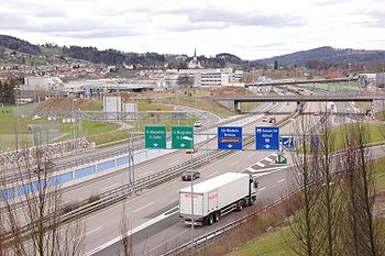
Basel
Basel
Basel or Basle In the national languages of Switzerland the city is also known as Bâle , Basilea and Basilea is Switzerland's third most populous city with about 166,000 inhabitants. Located where the Swiss, French and German borders meet, Basel also has suburbs in France and Germany...
, Zürich
Zürich
Zurich is the largest city in Switzerland and the capital of the canton of Zurich. It is located in central Switzerland at the northwestern tip of Lake Zurich...
, Winterthur
Winterthur
Winterthur is a city in the canton of Zurich in northern Switzerland. It has the country's sixth largest population with an estimate of more than 100,000 people. In the local dialect and by its inhabitants, it is usually abbreviated to Winti...
, St. Gallen
St. Gallen
St. Gallen is the capital of the canton of St. Gallen in Switzerland. It evolved from the hermitage of Saint Gall, founded in the 7th century. Today, it is a large urban agglomeration and represents the center of eastern Switzerland. The town mainly relies on the service sector for its economic...
and St. Margrethen
St. Margrethen
St. Margrethen is a municipality in the Wahlkreis of Rheintal in the canton of St. Gallen in Switzerland.-Geography:...
Bregenz
Bregenz
-Culture:The annual summer music festival Bregenzer Festspiele is a world-famous festival which takes place on and around a stage on Lake Constance, where a different opera is performed every second year.-Sport:* A1 Bregenz HB is a handball team....
, Lauterach
Lauterach
Lauterach is a market town in the district of Bregenz, Vorarlberg, Austria. Its population was recorded as 9,183 in 2003.Honorary consulates of Finland, and the United Kingdom are located in Lauterach....
, Feldkirch
Feldkirch, Vorarlberg
- Schools :* Bundesgymnasium und Bundesrealgymnasium Feldkirch * Bundeshandelsakademie und Bundeshandelsschule Feldkirch* Bundesoberstufenrealgymnasium und Bundesrealgymnasium Schillerstrasse...
, Landeck
Landeck
Landeck is a city in Tyrol, Austria with approximately 7,633 inhabitants. It is located at an elevation of about 820 m in the west of Tyrol, on the rivers Sanna and Inn...
, Telfs
Telfs
Telfs is an Austrian market town in the district of Innsbruck-Land and is located 27 km west of Innsbruck. It is the third largest location of Tyrol and received its status in 1908. Telfs possesses an own district court. In the last years Telfs has frequently been increasing in the number of...
, Innsbruck
Innsbruck
- Main sights :- Buildings :*Golden Roof*Kaiserliche Hofburg *Hofkirche with the cenotaph of Maximilian I, Holy Roman Emperor*Altes Landhaus...
Rosenheim
Rosenheim
Rosenheim is a town in Bavaria at the confluence of the rivers Inn and Mangfall. It is seat of administration of the district of Rosenheim, but is not a part of it.-Geography:...
, Bad Reichenhall
Bad Reichenhall
Bad Reichenhall is a spa town, and administrative center of the Berchtesgadener Land district in Upper Bavaria, Germany. It is located near Salzburg in a basin encircled by the Chiemgauer Alps ....
/Piding
Piding
Piding is an approved climatic spa in Bavaria near to the border of Austria close to Bad Reichenhall and Freilassing.-Geographical position:Piding is located in the middle of the Landkreis Berchtesgadener Land....
Salzburg
Salzburg
-Population development:In 1935, the population significantly increased when Salzburg absorbed adjacent municipalities. After World War II, numerous refugees found a new home in the city. New residential space was created for American soldiers of the postwar Occupation, and could be used for...
, Sattledt
Sattledt
Sattledt is a municipality in the district of Wels-Land in Upper Austria, Austria....
, Linz
Linz
Linz is the third-largest city of Austria and capital of the state of Upper Austria . It is located in the north centre of Austria, approximately south of the Czech border, on both sides of the river Danube. The population of the city is , and that of the Greater Linz conurbation is about...
, Sankt Pölten
Sankt Pölten
Sankt Pölten is the capital city of the State of Lower Austria in northeast Austria. With inhabitants , it is Lower Austria's largest city...
, Vienna
Vienna
Vienna is the capital and largest city of the Republic of Austria and one of the nine states of Austria. Vienna is Austria's primary city, with a population of about 1.723 million , and is by far the largest city in Austria, as well as its cultural, economic, and political centre...
and Nickelsdorf
Nickelsdorf
Nickelsdorf is a town in the district of Neusiedl am See in Burgenland in Austria.- Geography :Nickelsdorf is the only town in the municipality...
Mosonmagyaróvár
Mosonmagyaróvár
Mosonmagyaróvár is a city in Győr-Moson-Sopron county in northwestern Hungary. It lies close to both the Austrian and Slovakian borders and has a population of 30,200 ....
, Győr
Gyor
-Climate:-Main sights:The ancient core of the city is Káptalan Hill at the confluence of three rivers: the Danube, Rába and Rábca. Püspökvár, the residence of Győr’s bishops can be easily recognised by its incomplete tower. Győr’s oldest buildings are the 13th-century dwelling tower and the...
, Tatabánya
Tatabánya
Tatabánya is a city of 69,988 inhabitants in north-western Hungary, in the Central Transdanubian region. It is the capital of Komárom-Esztergom County.- Location :...
, Budapest
Budapest
Budapest is the capital of Hungary. As the largest city of Hungary, it is the country's principal political, cultural, commercial, industrial, and transportation centre. In 2011, Budapest had 1,733,685 inhabitants, down from its 1989 peak of 2,113,645 due to suburbanization. The Budapest Commuter...
, Cegléd
Cegléd
Cegléd is a city in Pest county, Hungary, approximately southeast of the Hungarian capital, Budapest.-Name:There are discussions going on about the origin of the name of the town...
, Szolnok
Szolnok
Szolnok is the county seat of Jász-Nagykun-Szolnok county in central Hungary. Its location on the banks of the Tisza river, at the heart of the Great Hungarian Plain, has made it an important cultural and economic crossroads for centuries....
, Kisújszállás
Kisújszállás
Kisújszállás is a town in Jász-Nagykun-Szolnok county, in the Northern Great Plain region of central Hungary.-Geography:It covers an area of and has a population of 12,869 people .-History:History of the city...
, Püspökladány
Püspökladány
Püspökladány is the sixth largest town of Hajdú-Bihar county in North Eastern Hungary with a population of approximately 16,000 people. It is located southeast of Debrecen at the juncture of three regions: Sárrét, Hortobágy and Nagykunság. It is an important transportation hub at the junction of...
, Berettyóújfalu
Berettyóújfalu
Berettyóújfalu is a town in Hajdú-Bihar county, in the Northern Great Plain region of eastern Hungary. It is named after the river Berettyó.-Geography:It covers an area of and has a population of 16,107 people .-External links:*...
Oradea
Oradea
Oradea is the capital city of Bihor County, in the Crișana region of north-western Romania. The city has a population of 204,477, according to the 2009 estimates. The wider Oradea metropolitan area has a total population of 245,832.-Geography:...
, Aleşd
Alesd
Aleşd is a town in Bihor County, western Romania. It is located in the east of the county, near the border with Cluj County.-Geography:Aleşd is located on the main railway line between Oradea and Bucharest...
, Huedin
Huedin
Huedin is a town in Cluj County, Romania.Huedin is located at the northern edge of the Apuseni Mountains. It is surrounded by the villages of Nearşova, Domoşu, Horlacea and others. The town administers one village, Bicălatu...
, Cluj-Napoca
Cluj-Napoca
Cluj-Napoca , commonly known as Cluj, is the fourth most populous city in Romania and the seat of Cluj County in the northwestern part of the country. Geographically, it is roughly equidistant from Bucharest , Budapest and Belgrade...
, Turda
Turda
Turda is a city and Municipality in Cluj County, Romania, situated on the Arieş River.- Ancient times :The city was founded by Dacians under the name Patavissa or Potaissa...
, Câmpia Turzii
Câmpia Turzii
Câmpia Turzii is a city in Cluj County, Romania, which was formed in 1925 by the union of two villages, Ghiriş and Sâncrai...
, Luduş
Ludus
Luduș is a town in central Romania in Mureș County, 44 km south-west from the county's capital Târgu Mureș.Six villages are administered by the town: Avrămeşti , Cioarga , Ciurgău , Fundătura , Gheja and Roșiori .-History:* 1330 - First mentioned as Plehanus de...
, Iernut
Iernut
Iernut is a town in Mureş County, central Transylvania, Romania. It administers eight villages: Cipău, Deag, Lechinţa, Oarba de Mureş, Porumbac, Racameţ, Sălcud and Sfântu Gheorghe.-Demographics:The 2002 census revealed the following demographic data :...
, Târgu Mureş, Sighişoara
Sighisoara
Sighişoara is a city and municipality on the Târnava Mare River in Mureş County, Romania. Located in the historic region Transylvania, Sighişoara has a population of 27,706 ....
, Braşov
Brasov
Brașov is a city in Romania and the capital of Brașov County.According to the last Romanian census, from 2002, there were 284,596 people living within the city of Brașov, making it the 8th most populated city in Romania....
, Predeal
Predeal
Predeal is a town in Braşov County, Romania. It is the highest town and one of the most important mountain resorts in Romania, being located on the Prahova Valley at over...
, Azuga
Azuga
Azuga is a small resort town nestled in the mountains of Prahova county in the Wallachian region of Romania. Azuga is located at the foot of the Bucegi mountains, and contains the longest ski run in Romania, the Sorica - together with other ski slopes...
, Ploieşti
Ploiesti
Ploiești is the county seat of Prahova County and lies in the historical region of Wallachia in Romania. The city is located north of Bucharest....
, Otopeni
Otopeni
Otopeni is a town in Ilfov County, Romania, some north of Bucharest along the road to Ploieşti. It has 10,215 inhabitants, of which 99.0% are Romanians. One village, Odăile, is administered by the town....
, Bucharest
Bucharest
Bucharest is the capital municipality, cultural, industrial, and financial centre of Romania. It is the largest city in Romania, located in the southeast of the country, at , and lies on the banks of the Dâmbovița River....
, Urziceni
Urziceni
Urziceni is a town in Ialomiţa County, Romania, located around 60 km north-east of Bucharest. It has a population of 17,090.Founded by Romanian shepherds, its name is derived from the word "urzică" . It was mentioned for the first time in a written document on 23 April 1596, during the reign...
, Slobozia
Slobozia
Slobozia is the capital city of Ialomiţa County, Romania, with a population of 52,710 in 2002.-Geography:Slobozia lies roughly in the middle of the county, on the banks of Ialomita River, at ca. east of Bucharest and west of Constanţa, important port at the Black Sea...
, Hârşova
Hârsova
Hârşova is a town located on the right bank of the Danube, in Constanţa County, Romania, with a population of 11,000.The village of Vadu Oii is administered by the town...
, Constanţa
Constanta
Constanța is the oldest extant city in Romania, founded around 600 BC. The city is located in the Dobruja region of Romania, on the Black Sea coast. It is the capital of Constanța County and the largest city in the region....
, Agigea
Agigea
Agigea is a commune in Constanţa County, Romania. The commune includes two villages: Agigea and Lazu ....
- Ferry Romania-Georgia (Black SeaBlack SeaThe Black Sea is bounded by Europe, Anatolia and the Caucasus and is ultimately connected to the Atlantic Ocean via the Mediterranean and the Aegean seas and various straits. The Bosphorus strait connects it to the Sea of Marmara, and the strait of the Dardanelles connects that sea to the Aegean...
)- [ს 2] PotiPotiPoti is a port city in Georgia, located on the eastern Black Sea coast in the region of Samegrelo-Zemo Svaneti in the west of the country. Built near the site of the ancient Greek colony of Phasis, the city has become a major port city and industrial center since the early 20th century. It is also...
, SenakiSenakiSenaki is a town in Samegrelo-Zemo Svaneti region, western Georgia. It is located at around .From 1935 to 1976 it was called Tskhakaya in honor of the Georgian Bolshevik revolutionary leader Mikhail Tskhakaya.... - [ს 1] SenakiSenakiSenaki is a town in Samegrelo-Zemo Svaneti region, western Georgia. It is located at around .From 1935 to 1976 it was called Tskhakaya in honor of the Georgian Bolshevik revolutionary leader Mikhail Tskhakaya....
, SamtrediaSamtrediaSamtredia is a town in Imereti, Georgia, lying in a lowland between the rivers Rioni and Tskhenis-Tsqali, 244 km west of Tbilisi, and 27 km west of Kutaisi, the nation’s capital and the second largest city respectively. Georgia’s most important roads and railways converge there, making Samtredia...
, KutaisiKutaisiKutaisi is Georgia's second largest city and the capital of the western region of Imereti. It is 221 km to the west of Tbilisi.-Geography:...
, KhashuriKhashuriKhashuri is a town in central Georgia. It is located on the Mtkvari River.Khashuri is first mentioned in the 1693 document. Modern Khashuri was founded in 1872 as a modest railway halt called "Mikhaylovo" after Grand Duke Michael Nikolaevich of Russia, Viceroy of the Caucasus. In 1917, it was...
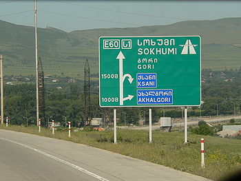
, GoriGori, GeorgiaGori is a city in eastern Georgia, which serves as the regional capital of Shida Kartli and the centre of the homonymous administrative district. The name is from Georgian gora , that is, "heap", or "hill"...
, TbilisiTbilisiTbilisi is the capital and the largest city of Georgia, lying on the banks of the Mt'k'vari River. The name is derived from an early Georgian form T'pilisi and it was officially known as Tiflis until 1936... - [ს 9] TbilisiTbilisiTbilisi is the capital and the largest city of Georgia, lying on the banks of the Mt'k'vari River. The name is derived from an early Georgian form T'pilisi and it was officially known as Tiflis until 1936...
- [ს 4] TbilisiTbilisiTbilisi is the capital and the largest city of Georgia, lying on the banks of the Mt'k'vari River. The name is derived from an early Georgian form T'pilisi and it was officially known as Tiflis until 1936...
, RustaviRustaviRustavi is a city in the southeast of Georgia, in the province of Kvemo Kartli, situated southeast of the capital Tbilisi. It stands on the Mtkvari River at... - [M 1] GanjaGanja, AzerbaijanGanja is Azerbaijan's second-largest city with a population of around 313,300. It was named Yelizavetpol in the Russian Empire period. The city regained its original name—Ganja—from 1920–1935 during the first part of its incorporation into the Soviet Union. However, its name was changed again and...
, YevlakhYevlakhYevlakh is a small city in Azerbaijan, 265 km west of capital Baku. It is surrounded by, but administratively separate from, the rayon of the same name...
, BakuBakuBaku , sometimes spelled as Baki or Bakou, is the capital and largest city of Azerbaijan, as well as the largest city on the Caspian Sea and of the Caucasus region. It is located on the southern shore of the Absheron Peninsula, which projects into the Caspian Sea. The city consists of two principal...
- [ს 2] Poti
- Ferry Azerbaijan-Turkmenistan (Caspian SeaCaspian SeaThe Caspian Sea is the largest enclosed body of water on Earth by area, variously classed as the world's largest lake or a full-fledged sea. The sea has a surface area of and a volume of...
)
Türkmenbaşy
Türkmenbasy, Turkmenistan
Türkmenbaşy , formerly known as Krasnovodsk and, more properly, Kyzyl-Su, is a city in Balkan Province in Turkmenistan, on the Krasnovodsk Gulf of the Caspian Sea. It is located at latitude 40.0231 North; longitude 52.9697 East, at an altitude of 27 meters. The population was 86,800, mostly...
, Serdar (Gyzylarbat), Ashgabat, Tejen
Tejen
Tejen is an oasis city in the Karakum Desert, in Ahal Province of Turkmenistan. It is located at latitude 37.3786 North; longitude 60.4961 East at an altitude of 161 meters...
, Mary
Mary, Turkmenistan
Mary is the capital city of Mary Province in Turkmenistan. Former names include Merv, Meru and Margiana. It is located at . The city is an oasis in the Karakum Desert, located on the Murghab river. In 2009, Mary had a population of 123,000 , up from 92,000 in the 1989 census.-History:The ancient...
, Türkmenabat
Türkmenabat
Türkmenabat , formerly and since the medieval times, Chardzhou , also spelled Çärjew, Chardjui, Charjou, Chardzhev, Charjev, Chärjew, or Charjew , ancient Amul, is a town in Turkmenistan, capital of Lebap Province...
(Chardzhou)) M37 highway
Qorako‘l
Qorako‘l
See also: Karakul Qorako‘l also spelled as Karakul is a town in the Buxoro Province of Uzbekistan. It is the capital of Qorako‘l District ....
, Bukhara
Bukhara
Bukhara , from the Soghdian βuxārak , is the capital of the Bukhara Province of Uzbekistan. The nation's fifth-largest city, it has a population of 263,400 . The region around Bukhara has been inhabited for at least five millennia, and the city has existed for half that time...
, Qarshi
Qarshi
Qarshi is a city in southern Uzbekistan. It is the capital of Qashqadaryo Province and has a population of 197,600 . It is about 520 km south-southwest of Tashkent, and about 335 km north of Uzbekistan's border with Afghanistan. It is located at latitude 38° 51' 48N; longitude 65° 47'...
, G‘uzor
G‘uzor
G‘uzor also spelled as Guzar is a town in Uzbekistan....
, Sherobod, Termez
Termez
Termez is a city in southern Uzbekistan near the border with Afghanistan.Some link the name of the city to thermos, "hot" in Greek, tracing its name back to Alexander the Great. Others suggest that it came from Sanskrit taramato, meaning "on the river bank". It is the hottest point of Uzbekistan...
Dushanbe
Dushanbe
-Economy:Coal, lead, and arsenic are mined nearby in the cities of Nurek and Kulob allowing for the industrialization of Dushanbe. The Nurek Dam, the world's highest as of 2008, generates 95% of Tajikistan's electricity, and another dam, the Roghun Dam, is planned on the Vakhsh River...
, Jirgatol
Sary-Tash
Sary-Tash
Sary-Tash is a minor village and major crossroads in the Alay Valley of Osh Province, Kyrgyzstan. Nearby towns and villages to the north include Akbosaga , Shumkar and Chagyr ....
and Irkeshtam
Irkeshtam
Irkeshtam is a village east of the Alay Valley in southern Osh Province, Kyrgyzstan. It is one of the two main border crossings between Kyrgyzstan and Xinjiang, China, the other being Torugart, some to the northeast...