

El Centro, California
Encyclopedia
El Centro is a city
in and county seat of Imperial County
, the largest city in the Imperial Valley
and the east anchor of the Southern California Border Region, and the core urban area and principal city of the El Centro metropolitan area which encompasses all of Imperial County. El Centro is also the largest American city to lie entirely below sea level (- 50 feet). The city, located in the far southeastern corner of California, is conveniently near the major Southern California cities of San Diego and Los Angeles
to its west as well as Phoenix
and Tucson to its east.
Founded in 1906 W. F. Holt and C.A. Barker purchased the land on which El Centro was eventually built for about forty dollars an acre and invested $100,000 in improvements. As one historian of Valley life put it, "in only five months El Centro went from a barley field to a city...".
It is home to retail, transportation, wholesale, and agricultural industries. There are also two international border crossings nearby for commercial and noncommercial vehicles. The city's population was 42,598 at the 2010 census, up from 37,835 at the 2000 census
. As of December 2010, El Centro has the highest unemployment rate among American cities
, at 28.3%.
 According to the United States Census Bureau
, the city has a total area of 11.1 square miles (28.7 km²), of which over 99% is land.
El Centro is located in the Imperial Valley
(considered locally as synonymous with Imperial County). The city is 50 feet (15.2 m) below sea level and the largest city in the United States below sea level. The Imperial Valley is in the Colorado Desert
, an extension of the larger Sonoran Desert
.
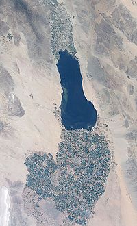
The agriculture industry's demand for water is supplied by canals diverting water from the nearby Colorado River
. The Salton Sea
was created after a 1905 flood from the Colorado River.
In this region, the geology
is dominated by the transition of the tectonic plate boundary from rift
to fault. The southernmost strands of the San Andreas Fault
connect the northern-most extensions of the East Pacific Rise
. Consequently, the region is subject to earthquakes, and the crust is being stretched, resulting in a sinking of the terrain over time.
also explored the area in 1776 (an elementary school in El Centro now bears his name). Years later, after the Mexican-American War, the northern half of the valley was annexed by the U.S., while the southern half remained under Mexican rule. Small scale settlement in natural aquifer areas occurred in the early 19th century (the present-day site of Mexicali
), but most permanent settlement (Anglo Americans in the U.S. side, Mexicans in the other side) was after 1900.
Originally part of San Diego County
, the Imperial Valley was settled by farmers once water from the Colorado River was diverted via canals
to irrigate the desert valley floor.
In 1906, the land on which El Centro was later built was purchased by W. F. Holt and C.A. Barker.
By 1907 Imperial County was incorporated into California and by then much of the valley was successfully irrigated.
Before the town began, the railroad had established a station and named the place Cabarker. The name honored C.A. Barker, a friend of the landowner. The first post office in El Centro opened in 1905.
The City of El Centro was incorporated on April 16, 1908. By 1910, the population of the city had reached 1,610. By 1920 it was 5,646. One reason for this rapid growth was El Centro's becoming the county seat of Imperial County.
Population growth was slow, but accelerated in the 1930s, and again in the World War II era (1940s), despite that the city was hard hit by a 7.1 earthquake
in July 1940.
By the mid-1940s, El Centro had become the second largest city in the Imperial Valley, with a population of about 11,000 people. El Centro had also become the location of the Imperial Irrigation District
(IID) administrative offices.
Agriculture has been an important industry within El Centro since the 1940s, because of its strategic location near rail lines and Highways 80 and 99 – more than 35 growers and shippers still operate in El Centro. However, by the early 1980s the two largest employment sectors in El Centro were Government and Wholesale/Retail Trade, reflecting El Centro's emerging role as a regional administrative and commercial center.
, the largest dune field in the US, draws thousands of visitors each year, mainly for off-road driving. The Salton Sea
lies 30 miles (48.3 km) north of El Centro, but water sport enthusiasts head to the Colorado River
, 50 miles (80.5 km) to the east near Yuma, Arizona
. The El Centro Naval Air Facility
10 miles (16.1 km) to the west is home to the annual Blue Angels
flight maneuvering event. Stark Field is home of a minor league baseball team El Centro Imperials
of the Arizona Summer League
. Mexico (the border city of Mexicali, Baja California) is 10 miles (16.1 km) away, which offers big city amenities like museums, a zoo and a sports/convention center.
Snow is almost totally unknown in the town, except for a very brief falling of sleet mixed with hail during a shower in December 1967.
states that the prisons and border patrol were "relatively untouched" by the late-2000s recession. The El Centro area has many farming plots, where carrots, lettuce, and other crops are produced, and therefore the El Centro economy is subject to seasonal variations like other farming areas. Between November and March in winter periods, El Centro-area farmers harvest lettuce for $8–10 per hour. During March the harvest moves to the north and is no longer in El Centro; in previous eras farmers migrated, while in the first decade of the 21st century many collect unemployment benefits during the summer.
El Centro is surrounded by thousands of acres of farmland that has transformed the desert into one of the most productive farming regions in California with an annual crop production of over $1 billion. Agriculture is the largest industry in Imperial County and accounts for 48% of all employment.
Being the commercial center of Imperial County, fifty percent of the jobs in the El Centro come from the service and retail sector.
A recent growth in the interest of Imperial County as a filming location, has spurred growth in servicing this industry. Due to its desert environment and proximity to Los Angeles, California, movies are sometimes filmed in the sand dunes outside the agricultural portions of the Imperial County. These have included Star Wars Episode VI: Return of the Jedi
, Stargate
, The Scorpion King
, and Into the Wild
. Additionally, portions of the 2005 film Jarhead
were filmed here because of its similarity to the desert terrain of Iraq
.
work in El Centro. The Economist added that there are likely many El Centro residents who work in Mexicali and collect unemployment benefits in El Centro; Ruben Duran, the city manager of El Centro, said that if the Mexicali jobs were factored into the employment rate, El Centro would have a normal employment rate. The manager of a job search agency called One Stop, said that about 3,000 people per month come into her agency; she says that some make a genuine effort to find jobs, while many do not have motivation to actually find a job, but to instead show proof that they tried to find a job. Kelly stated that unemployment fraud does not account for all of the issues with the El Centro area; he said that many residents have a lack of education and a lack of English language
proficiency, so some of them cannot find jobs. The Economist added that the collapse of the housing market eliminated some construction jobs; the magazine countered that the scenario is true in many places in the United States. In December 2008 listed as #5 on Forbes.com's list of "The Top 10 Places in America Where Homes are Losing their Value Fastest" with 31.4% of homeowners owing more on their mortgages than their homes are worth. A national report on the effects of the "Great recession" of 2008/09 has found El Centro and the Imperial Valley in the top 5 poorest medium-sized cities in the U.S. in poverty and unemployment rates.
was 3,838.1 people per square mile (1,481.9/km²). The racial makeup of El Centro was 25,376 (59.6%) White, 1,081 (2.5%) African American, 554 (1.3%) Native American, 965 (2.3%) Asian, 34 (0.1%) Pacific Islander, 12,356 (29.0%) from other races
, and 2,232 (5.2%) from two or more races. Hispanic or Latino of any race were 34,751 persons (81.6%).
The Census reported that 41,782 people (98.1% of the population) lived in households, 296 (0.7%) lived in non-institutionalized group quarters, and 520 (1.2%) were institutionalized.
There were 13,108 households, out of which 6,257 (47.7%) had children under the age of 18 living in them, 6,550 (50.0%) were opposite-sex married couples
living together, 2,845 (21.7%) had a female householder with no husband present, 815 (6.2%) had a male householder with no wife present. There were 804 (6.1%) unmarried opposite-sex partnerships
, and 58 (0.4%) same-sex married couples or partnerships. 2,458 households (18.8%) were made up of individuals and 1,004 (7.7%) had someone living alone who was 65 years of age or older. The average household size was 3.19. There were 10,210 families
(77.9% of all households); the average family size was 3.64.
The population was spread out with 12,671 people (29.7%) under the age of 18, 4,803 people (11.3%) aged 18 to 24, 10,661 people (25.0%) aged 25 to 44, 9,907 people (23.3%) aged 45 to 64, and 4,556 people (10.7%) who were 65 years of age or older. The median age was 31.8 years. For every 100 females there were 94.7 males. For every 100 females age 18 and over, there were 90.3 males.
There were 14,476 housing units at an average density of 1,304.3 per square mile (503.6/km²), of which 6,488 (49.5%) were owner-occupied, and 6,620 (50.5%) were occupied by renters. The homeowner vacancy rate was 2.8%; the rental vacancy rate was 7.2%. 21,429 people (50.3% of the population) lived in owner-occupied housing units and 20,353 people (47.8%) lived in rental housing units.
of 2000, there were 37,835 people, 11,439 households, and 8,910 families residing in the city. The population density
was 3,950.2 people per square mile (1,524.9/km²). There were 12,263 housing units at an average density of 1,280.3 per square mile (494.2/km²). The racial makeup of the city was 46.9% White
, 3.2% Black
or African American
, 1.0% Native American
, 3.5% Asian
, 0.1% Pacific Islander
, 41.7% from other races
, and 3.7% from two or more races. 74.6% of the population were Hispanic
or Latino
of any race.
There were 11,439 households out of which 47.4% had children under the age of 18 living with them, 53.9% were married couples living together, 18.7% had a female householder with no husband present, and 22.1% were non-families. 18.8% of all households were made up of individuals and 7.3% had someone living alone who was 65 years of age or older. The average household size was 3.2 and the average family size was 3.7.
In the city the population was spread out with 33.6% under the age of 18, 9.7% from 18 to 24, 28.9% from 25 to 44, 18.5% from 45 to 64, and 9.3% who were 65 years of age or older. The median age was 30 years. For every 100 females there were 96.6 males. For every 100 females age 18 and over, there were 93.5 males.
The median income
for a household in the city was $33,161, and the median income for a family was $36,910. Males had a median income of $36,753 versus $24,514 for females. The per capita income
for the city was $13,874. About 20.6% of families and 22.8% of the population were below the poverty line, including 29.5% of those under age 18 and 14.8% of those age 65 or over.
In 2009 the Latinos in El Centro mainly consisted of dual citizens and permanent resident card (green card) holders. Illegal immigrants tended to go through Imperial County instead of staying in Imperial County.
.
El Centro has 11 Elementary schools, 3 Middle/Junior High schools and 3 High Schools:
includes two four-year comprehensive high schools(Central Union and Southwest) and one alternative education school (Desert Oasis). The school district's 3,450 students are supported by more than 350 certified and classified staff. The District is governed by a five member Board of Trustees.
are available through Imperial Valley College
, a local 2-year college, and an extension of San Diego State University
located in Calexico, CA. San Diego State University's Calexico Campus offers a variety of Bachelors and Masters degrees.
connects San Diego to the west and Yuma, Arizona
to the east. California State Route 86
and California State Route 111
parallel each other as they go north to Brawley
before running along the west and east shores of the Salton Sea
, respectively, on their way to the Palm Springs
area. Going south from El Centro, Highway 86 terminates at Highway 111 before the latter runs to Calexico
and Mexicali, Mexico.
is the primary provider of mass transportation in the Imperial Valley. Formed in 1989 with just 3 buses and serving just 3000 people per month, the agency now currently serves more than 45,000 riders within the area per month.
is located in nearby Imperial
. Service is subsidized by the Essential Air Service
program. The nearest large international airports are San Diego International Airport
and Mexicali International Airport
.
In the state legislature
El Centro is located in the 40th Senate
District, represented by Democrat
Juan Vargas
, and in the 80th Assembly
District, represented by Democrat
Manuel Perez
. Federally, El Centro is located in California's 51st congressional district
, which has a Cook PVI
of D +7 and is represented by Democrat Bob Filner
.
City
A city is a relatively large and permanent settlement. Although there is no agreement on how a city is distinguished from a town within general English language meanings, many cities have a particular administrative, legal, or historical status based on local law.For example, in the U.S...
in and county seat of Imperial County
Imperial County, California
Imperial County is a county located in the Imperial Valley, in the far southeast of the U.S. state of California, bordering both Arizona and Mexico. It is part of the El Centro Metropolitan Area, which encompasses all of Imperial County. The population as of 2000 was 142,361. The county seat is the...
, the largest city in the Imperial Valley
Imperial Valley
The Imperial Valley is an agricultural area of Southern California's Imperial County. It is located in southeastern Southern California, centered around the city of El Centro. Locally, the terms "Imperial Valley" and "Imperial County" are used synonymously. The Valley is bordered between the...
and the east anchor of the Southern California Border Region, and the core urban area and principal city of the El Centro metropolitan area which encompasses all of Imperial County. El Centro is also the largest American city to lie entirely below sea level (- 50 feet). The city, located in the far southeastern corner of California, is conveniently near the major Southern California cities of San Diego and Los Angeles
Los Ángeles
Los Ángeles is the capital of the province of Biobío, in the commune of the same name, in Region VIII , in the center-south of Chile. It is located between the Laja and Biobío rivers. The population is 123,445 inhabitants...
to its west as well as Phoenix
Phoenix, Arizona
Phoenix is the capital, and largest city, of the U.S. state of Arizona, as well as the sixth most populated city in the United States. Phoenix is home to 1,445,632 people according to the official 2010 U.S. Census Bureau data...
and Tucson to its east.
Founded in 1906 W. F. Holt and C.A. Barker purchased the land on which El Centro was eventually built for about forty dollars an acre and invested $100,000 in improvements. As one historian of Valley life put it, "in only five months El Centro went from a barley field to a city...".
It is home to retail, transportation, wholesale, and agricultural industries. There are also two international border crossings nearby for commercial and noncommercial vehicles. The city's population was 42,598 at the 2010 census, up from 37,835 at the 2000 census
United States Census, 2000
The Twenty-second United States Census, known as Census 2000 and conducted by the Census Bureau, determined the resident population of the United States on April 1, 2000, to be 281,421,906, an increase of 13.2% over the 248,709,873 persons enumerated during the 1990 Census...
. As of December 2010, El Centro has the highest unemployment rate among American cities
City
A city is a relatively large and permanent settlement. Although there is no agreement on how a city is distinguished from a town within general English language meanings, many cities have a particular administrative, legal, or historical status based on local law.For example, in the U.S...
, at 28.3%.
Geography
El Centro is located at 32°47′31"N 115°33′47"W.United States Census Bureau
The United States Census Bureau is the government agency that is responsible for the United States Census. It also gathers other national demographic and economic data...
, the city has a total area of 11.1 square miles (28.7 km²), of which over 99% is land.
El Centro is located in the Imperial Valley
Imperial Valley
The Imperial Valley is an agricultural area of Southern California's Imperial County. It is located in southeastern Southern California, centered around the city of El Centro. Locally, the terms "Imperial Valley" and "Imperial County" are used synonymously. The Valley is bordered between the...
(considered locally as synonymous with Imperial County). The city is 50 feet (15.2 m) below sea level and the largest city in the United States below sea level. The Imperial Valley is in the Colorado Desert
Colorado Desert
California's Colorado Desert is a part of the larger Sonoran Desert, which extends across southwest North America. The Colorado Desert region encompasses approximately , reaching from the Mexican border in the south to the higher-elevation Mojave Desert in the north and from the Colorado River in...
, an extension of the larger Sonoran Desert
Sonoran Desert
The Sonoran Desert is a North American desert which straddles part of the United States-Mexico border and covers large parts of the U.S. states of Arizona and California and the northwest Mexican states of Sonora, Baja California, and Baja California Sur. It is one of the largest and hottest...
.
The agriculture industry's demand for water is supplied by canals diverting water from the nearby Colorado River
Colorado River
The Colorado River , is a river in the Southwestern United States and northwestern Mexico, approximately long, draining a part of the arid regions on the western slope of the Rocky Mountains. The watershed of the Colorado River covers in parts of seven U.S. states and two Mexican states...
. The Salton Sea
Salton Sea
The Salton Sea is a shallow, saline, endorheic rift lake located directly on the San Andreas Fault, predominantly in California's Imperial Valley. The lake occupies the lowest elevations of the Salton Sink in the Colorado Desert of Imperial and Riverside counties in Southern California. Like Death...
was created after a 1905 flood from the Colorado River.
In this region, the geology
Geology
Geology is the science comprising the study of solid Earth, the rocks of which it is composed, and the processes by which it evolves. Geology gives insight into the history of the Earth, as it provides the primary evidence for plate tectonics, the evolutionary history of life, and past climates...
is dominated by the transition of the tectonic plate boundary from rift
Rift
In geology, a rift or chasm is a place where the Earth's crust and lithosphere are being pulled apart and is an example of extensional tectonics....
to fault. The southernmost strands of the San Andreas Fault
San Andreas Fault
The San Andreas Fault is a continental strike-slip fault that runs a length of roughly through California in the United States. The fault's motion is right-lateral strike-slip...
connect the northern-most extensions of the East Pacific Rise
East Pacific Rise
The East Pacific Rise is a mid-oceanic ridge, a divergent tectonic plate boundary located along the floor of the Pacific Ocean. It separates the Pacific Plate to the west from the North American Plate, the Rivera Plate, the Cocos Plate, the Nazca Plate, and the Antarctic Plate...
. Consequently, the region is subject to earthquakes, and the crust is being stretched, resulting in a sinking of the terrain over time.
History
Spanish explorer Melchior Díaz was one of the first Europeans to visit the area around El Centro and Imperial Valley in 1540. The explorer Juan Bautista de AnzaJuan Bautista de Anza
Juan Bautista de Anza Bezerra Nieto was a Novo-Spanish explorer and Governor of New Mexico for the Spanish Empire.-Early life:...
also explored the area in 1776 (an elementary school in El Centro now bears his name). Years later, after the Mexican-American War, the northern half of the valley was annexed by the U.S., while the southern half remained under Mexican rule. Small scale settlement in natural aquifer areas occurred in the early 19th century (the present-day site of Mexicali
Mexicali
Mexicali is the capital of the State of Baja California, seat of the Municipality of Mexicali, and 2nd largest city in Baja California. The City of Mexicali has a population of 689,775, according to the 2010 census, while the population of the entire metropolitan area reaches 936,826.The city...
), but most permanent settlement (Anglo Americans in the U.S. side, Mexicans in the other side) was after 1900.
Originally part of San Diego County
San Diego County, California
San Diego County is a large county located in the southwestern corner of the US state of California. Hence, San Diego County is also located in the southwestern corner of the 48 contiguous United States. Its county seat and largest city is San Diego. Its population was about 2,813,835 in the 2000...
, the Imperial Valley was settled by farmers once water from the Colorado River was diverted via canals
Alamo Canal
The Alamo Canal was a long waterway that connected the Colorado River to the head of the Alamo River. The canal was constructed to provide irrigation to the Imperial Valley. A small portion of the canal was located in the United States but the majority of the canal was located in Mexico...
to irrigate the desert valley floor.
In 1906, the land on which El Centro was later built was purchased by W. F. Holt and C.A. Barker.
By 1907 Imperial County was incorporated into California and by then much of the valley was successfully irrigated.
Before the town began, the railroad had established a station and named the place Cabarker. The name honored C.A. Barker, a friend of the landowner. The first post office in El Centro opened in 1905.
The City of El Centro was incorporated on April 16, 1908. By 1910, the population of the city had reached 1,610. By 1920 it was 5,646. One reason for this rapid growth was El Centro's becoming the county seat of Imperial County.
Population growth was slow, but accelerated in the 1930s, and again in the World War II era (1940s), despite that the city was hard hit by a 7.1 earthquake
1940 El Centro earthquake
The 1940 El Centro earthquake struck on 18 May 1940, due to a rupture of the Imperial Fault, and was the strongest recorded earthquake to hit the Imperial Valley...
in July 1940.
By the mid-1940s, El Centro had become the second largest city in the Imperial Valley, with a population of about 11,000 people. El Centro had also become the location of the Imperial Irrigation District
Imperial Irrigation District
The Imperial Irrigation District was formed in 1911 under the California Irrigation District Act to acquire the properties of the bankrupt California Development Company and its Mexican subsidiary. The IID had acquired 13 mutual water companies, which had developed and operated distribution canals...
(IID) administrative offices.
Agriculture has been an important industry within El Centro since the 1940s, because of its strategic location near rail lines and Highways 80 and 99 – more than 35 growers and shippers still operate in El Centro. However, by the early 1980s the two largest employment sectors in El Centro were Government and Wholesale/Retail Trade, reflecting El Centro's emerging role as a regional administrative and commercial center.
Sites of interest
The nearby Algodones DunesAlgodones Dunes
The Algodones Dunes is a large erg located in the southeastern portion of the U.S. state of California, near the border with Arizona and the Mexican state of Baja California. The field is approximately 45 miles long by 6 miles wide and extends along a northwest-southeast line that correlates to...
, the largest dune field in the US, draws thousands of visitors each year, mainly for off-road driving. The Salton Sea
Salton Sea
The Salton Sea is a shallow, saline, endorheic rift lake located directly on the San Andreas Fault, predominantly in California's Imperial Valley. The lake occupies the lowest elevations of the Salton Sink in the Colorado Desert of Imperial and Riverside counties in Southern California. Like Death...
lies 30 miles (48.3 km) north of El Centro, but water sport enthusiasts head to the Colorado River
Colorado River
The Colorado River , is a river in the Southwestern United States and northwestern Mexico, approximately long, draining a part of the arid regions on the western slope of the Rocky Mountains. The watershed of the Colorado River covers in parts of seven U.S. states and two Mexican states...
, 50 miles (80.5 km) to the east near Yuma, Arizona
Yuma, Arizona
Yuma is a city in and the county seat of Yuma County, Arizona, United States. It is located in the southwestern corner of the state, and the population of the city was 77,515 at the 2000 census, with a 2008 Census Bureau estimated population of 90,041....
. The El Centro Naval Air Facility
Naval Air Facility El Centro
Naval Air Facility El Centro or NAF El Centro is a military airport located six miles northwest of El Centro, in Imperial County, California, USA.-History:...
10 miles (16.1 km) to the west is home to the annual Blue Angels
Blue Angels
The United States Navy's Navy Flight Demonstration Squadron, popularly known as the Blue Angels, was formed in 1946 and is currently the oldest formal flying aerobatic team...
flight maneuvering event. Stark Field is home of a minor league baseball team El Centro Imperials
El Centro Imperials
The El Centro Imperials are an inactive independent professional baseball team based out of El Centro, California. Founded in 1947 and revived on April 3, 2009, the Imperials were introduced as one of the four charter members of the new Arizona Summer League, an instructional summer professional...
of the Arizona Summer League
Arizona Summer League
The Arizona Summer League is a short-season instructional summer professional baseball league affiliated with the independent North American League...
. Mexico (the border city of Mexicali, Baja California) is 10 miles (16.1 km) away, which offers big city amenities like museums, a zoo and a sports/convention center.
Climate
El Centro has an arid climate and is the southernmost desert city in the continental US with an elevation below sea-level. El Centro has over 350 days of sunshine and under 3 inches (76.2 mm) of rain annually. Winter temperatures are in the mid 70s to mid 80s with over-night lows in the low 50s to mid 40s. During summer days, the dry, desert heat can push temperatures well into the 100s, while the nights stay in the low 80s to mid 70s. Average annual humidity is 24%.Snow is almost totally unknown in the town, except for a very brief falling of sleet mixed with hail during a shower in December 1967.
Economy
As of 2009 the employment of El Centro residents is dominated by the local government, California state government, and federal government. Two nearby prisons and the U.S. Border Patrol provide employment; The EconomistThe Economist
The Economist is an English-language weekly news and international affairs publication owned by The Economist Newspaper Ltd. and edited in offices in the City of Westminster, London, England. Continuous publication began under founder James Wilson in September 1843...
states that the prisons and border patrol were "relatively untouched" by the late-2000s recession. The El Centro area has many farming plots, where carrots, lettuce, and other crops are produced, and therefore the El Centro economy is subject to seasonal variations like other farming areas. Between November and March in winter periods, El Centro-area farmers harvest lettuce for $8–10 per hour. During March the harvest moves to the north and is no longer in El Centro; in previous eras farmers migrated, while in the first decade of the 21st century many collect unemployment benefits during the summer.
El Centro is surrounded by thousands of acres of farmland that has transformed the desert into one of the most productive farming regions in California with an annual crop production of over $1 billion. Agriculture is the largest industry in Imperial County and accounts for 48% of all employment.
Being the commercial center of Imperial County, fifty percent of the jobs in the El Centro come from the service and retail sector.
A recent growth in the interest of Imperial County as a filming location, has spurred growth in servicing this industry. Due to its desert environment and proximity to Los Angeles, California, movies are sometimes filmed in the sand dunes outside the agricultural portions of the Imperial County. These have included Star Wars Episode VI: Return of the Jedi
Star Wars Episode VI: Return of the Jedi
Star Wars Episode VI: Return of the Jedi is a 1983 American epic space opera film directed by Richard Marquand and written by George Lucas and Lawrence Kasdan. It is the third film released in the Star Wars saga, and the sixth in terms of the series' internal chronology...
, Stargate
Stargate
Stargate is a adventure military science fiction franchise, initially conceived by Roland Emmerich and Dean Devlin. The first film in the franchise was simply titled Stargate. It was originally released on October 28, 1994, by Metro-Goldwyn-Mayer and Carolco, and became a hit, grossing nearly...
, The Scorpion King
The Scorpion King
The Scorpion King is a 2002 American action film directed by Chuck Russell, starring Dwayne "The Rock" Johnson, Kelly Hu, Grant Heslov, and Michael Clarke Duncan...
, and Into the Wild
Into the Wild (film)
Into the Wild is a 2007 American biographical drama film directed by Sean Penn. It is an adaptation of 1996 non-fiction book of the same name by Jon Krakauer based on the travels of Christopher McCandless across North America in the early 1990s. The film stars Emile Hirsch as McCandless with...
. Additionally, portions of the 2005 film Jarhead
Jarhead (film)
Jarhead is a 2005 biographical drama war film based on U.S. Marine Anthony Swofford's 1991 Gulf War memoir of the same name, directed by Sam Mendes, starring Jake Gyllenhaal as Swofford with co-stars Jamie Foxx, Peter Sarsgaard, and Chris Cooper. The title comes from the slang term used to refer to...
were filmed here because of its similarity to the desert terrain of Iraq
Iraq
Iraq ; officially the Republic of Iraq is a country in Western Asia spanning most of the northwestern end of the Zagros mountain range, the eastern part of the Syrian Desert and the northern part of the Arabian Desert....
.
El Centro during the late-2000s recession
According to the Bureau of Labor Statistics, as of April 30, 2009 the El Centro area had a 25.0% unemployment rate, the highest for a Metropolitan Area in the country. By August of that year, El Centro's unemployment rate was 27.5%, three times the overall United States unemployment rate of 9.7%. The Economist stated that the city is not the "centre of the Great Recession" like the figure would appear to indicate. While El Centro has a seasonal farming economy, there is still a fixed "baseline" unemployment at 12%. Timothy Kelly, the head of the Imperial Valley Economic Development Corporation, estimated that between 40,000 to 60,000 residents of MexicaliMexicali
Mexicali is the capital of the State of Baja California, seat of the Municipality of Mexicali, and 2nd largest city in Baja California. The City of Mexicali has a population of 689,775, according to the 2010 census, while the population of the entire metropolitan area reaches 936,826.The city...
work in El Centro. The Economist added that there are likely many El Centro residents who work in Mexicali and collect unemployment benefits in El Centro; Ruben Duran, the city manager of El Centro, said that if the Mexicali jobs were factored into the employment rate, El Centro would have a normal employment rate. The manager of a job search agency called One Stop, said that about 3,000 people per month come into her agency; she says that some make a genuine effort to find jobs, while many do not have motivation to actually find a job, but to instead show proof that they tried to find a job. Kelly stated that unemployment fraud does not account for all of the issues with the El Centro area; he said that many residents have a lack of education and a lack of English language
English language
English is a West Germanic language that arose in the Anglo-Saxon kingdoms of England and spread into what was to become south-east Scotland under the influence of the Anglian medieval kingdom of Northumbria...
proficiency, so some of them cannot find jobs. The Economist added that the collapse of the housing market eliminated some construction jobs; the magazine countered that the scenario is true in many places in the United States. In December 2008 listed as #5 on Forbes.com's list of "The Top 10 Places in America Where Homes are Losing their Value Fastest" with 31.4% of homeowners owing more on their mortgages than their homes are worth. A national report on the effects of the "Great recession" of 2008/09 has found El Centro and the Imperial Valley in the top 5 poorest medium-sized cities in the U.S. in poverty and unemployment rates.
Culture
While the majority of the residents in this community are Hispanic, there is a diverse population with a wide array of interests. In the winter residents race on nearby sand dunes using four wheel drive buggies. During the summer residents spend time indoors instead of outside. Spanish is a dominant language among residents and over the radio. Many area residents live in both the United States and Mexico and go across the border frequently.2010
The 2010 United States Census reported that El Centro had a population of 42,598. The population densityPopulation density
Population density is a measurement of population per unit area or unit volume. It is frequently applied to living organisms, and particularly to humans...
was 3,838.1 people per square mile (1,481.9/km²). The racial makeup of El Centro was 25,376 (59.6%) White, 1,081 (2.5%) African American, 554 (1.3%) Native American, 965 (2.3%) Asian, 34 (0.1%) Pacific Islander, 12,356 (29.0%) from other races
Race (United States Census)
Race and ethnicity in the United States Census, as defined by the Federal Office of Management and Budget and the United States Census Bureau, are self-identification data items in which residents choose the race or races with which they most closely identify, and indicate whether or not they are...
, and 2,232 (5.2%) from two or more races. Hispanic or Latino of any race were 34,751 persons (81.6%).
The Census reported that 41,782 people (98.1% of the population) lived in households, 296 (0.7%) lived in non-institutionalized group quarters, and 520 (1.2%) were institutionalized.
There were 13,108 households, out of which 6,257 (47.7%) had children under the age of 18 living in them, 6,550 (50.0%) were opposite-sex married couples
Marriage
Marriage is a social union or legal contract between people that creates kinship. It is an institution in which interpersonal relationships, usually intimate and sexual, are acknowledged in a variety of ways, depending on the culture or subculture in which it is found...
living together, 2,845 (21.7%) had a female householder with no husband present, 815 (6.2%) had a male householder with no wife present. There were 804 (6.1%) unmarried opposite-sex partnerships
POSSLQ
POSSLQ is an abbreviation for "Persons of Opposite Sex Sharing Living Quarters," a term coined in the late 1970s by the United States Census Bureau as part of an effort to more accurately gauge the prevalence of cohabitation in American households....
, and 58 (0.4%) same-sex married couples or partnerships. 2,458 households (18.8%) were made up of individuals and 1,004 (7.7%) had someone living alone who was 65 years of age or older. The average household size was 3.19. There were 10,210 families
Family (U.S. Census)
A family or family household is defined by the United States Census Bureau for statistical purposes as "a householder and one or more other people related to the householder by birth, marriage, or adoption. They do not include same-sex married couples even if the marriage was performed in a state...
(77.9% of all households); the average family size was 3.64.
The population was spread out with 12,671 people (29.7%) under the age of 18, 4,803 people (11.3%) aged 18 to 24, 10,661 people (25.0%) aged 25 to 44, 9,907 people (23.3%) aged 45 to 64, and 4,556 people (10.7%) who were 65 years of age or older. The median age was 31.8 years. For every 100 females there were 94.7 males. For every 100 females age 18 and over, there were 90.3 males.
There were 14,476 housing units at an average density of 1,304.3 per square mile (503.6/km²), of which 6,488 (49.5%) were owner-occupied, and 6,620 (50.5%) were occupied by renters. The homeowner vacancy rate was 2.8%; the rental vacancy rate was 7.2%. 21,429 people (50.3% of the population) lived in owner-occupied housing units and 20,353 people (47.8%) lived in rental housing units.
2000
As of the censusCensus
A census is the procedure of systematically acquiring and recording information about the members of a given population. It is a regularly occurring and official count of a particular population. The term is used mostly in connection with national population and housing censuses; other common...
of 2000, there were 37,835 people, 11,439 households, and 8,910 families residing in the city. The population density
Population density
Population density is a measurement of population per unit area or unit volume. It is frequently applied to living organisms, and particularly to humans...
was 3,950.2 people per square mile (1,524.9/km²). There were 12,263 housing units at an average density of 1,280.3 per square mile (494.2/km²). The racial makeup of the city was 46.9% White
Race (United States Census)
Race and ethnicity in the United States Census, as defined by the Federal Office of Management and Budget and the United States Census Bureau, are self-identification data items in which residents choose the race or races with which they most closely identify, and indicate whether or not they are...
, 3.2% Black
Race (United States Census)
Race and ethnicity in the United States Census, as defined by the Federal Office of Management and Budget and the United States Census Bureau, are self-identification data items in which residents choose the race or races with which they most closely identify, and indicate whether or not they are...
or African American
Race (United States Census)
Race and ethnicity in the United States Census, as defined by the Federal Office of Management and Budget and the United States Census Bureau, are self-identification data items in which residents choose the race or races with which they most closely identify, and indicate whether or not they are...
, 1.0% Native American
Race (United States Census)
Race and ethnicity in the United States Census, as defined by the Federal Office of Management and Budget and the United States Census Bureau, are self-identification data items in which residents choose the race or races with which they most closely identify, and indicate whether or not they are...
, 3.5% Asian
Race (United States Census)
Race and ethnicity in the United States Census, as defined by the Federal Office of Management and Budget and the United States Census Bureau, are self-identification data items in which residents choose the race or races with which they most closely identify, and indicate whether or not they are...
, 0.1% Pacific Islander
Race (United States Census)
Race and ethnicity in the United States Census, as defined by the Federal Office of Management and Budget and the United States Census Bureau, are self-identification data items in which residents choose the race or races with which they most closely identify, and indicate whether or not they are...
, 41.7% from other races
Race (United States Census)
Race and ethnicity in the United States Census, as defined by the Federal Office of Management and Budget and the United States Census Bureau, are self-identification data items in which residents choose the race or races with which they most closely identify, and indicate whether or not they are...
, and 3.7% from two or more races. 74.6% of the population were Hispanic
Hispanic
Hispanic is a term that originally denoted a relationship to Hispania, which is to say the Iberian Peninsula: Andorra, Gibraltar, Portugal and Spain. During the Modern Era, Hispanic sometimes takes on a more limited meaning, particularly in the United States, where the term means a person of ...
or Latino
Race (United States Census)
Race and ethnicity in the United States Census, as defined by the Federal Office of Management and Budget and the United States Census Bureau, are self-identification data items in which residents choose the race or races with which they most closely identify, and indicate whether or not they are...
of any race.
There were 11,439 households out of which 47.4% had children under the age of 18 living with them, 53.9% were married couples living together, 18.7% had a female householder with no husband present, and 22.1% were non-families. 18.8% of all households were made up of individuals and 7.3% had someone living alone who was 65 years of age or older. The average household size was 3.2 and the average family size was 3.7.
In the city the population was spread out with 33.6% under the age of 18, 9.7% from 18 to 24, 28.9% from 25 to 44, 18.5% from 45 to 64, and 9.3% who were 65 years of age or older. The median age was 30 years. For every 100 females there were 96.6 males. For every 100 females age 18 and over, there were 93.5 males.
The median income
Income
Income is the consumption and savings opportunity gained by an entity within a specified time frame, which is generally expressed in monetary terms. However, for households and individuals, "income is the sum of all the wages, salaries, profits, interests payments, rents and other forms of earnings...
for a household in the city was $33,161, and the median income for a family was $36,910. Males had a median income of $36,753 versus $24,514 for females. The per capita income
Per capita income
Per capita income or income per person is a measure of mean income within an economic aggregate, such as a country or city. It is calculated by taking a measure of all sources of income in the aggregate and dividing it by the total population...
for the city was $13,874. About 20.6% of families and 22.8% of the population were below the poverty line, including 29.5% of those under age 18 and 14.8% of those age 65 or over.
In 2009 the Latinos in El Centro mainly consisted of dual citizens and permanent resident card (green card) holders. Illegal immigrants tended to go through Imperial County instead of staying in Imperial County.
Education
Within its boundary, there are three school districts – McCabe Union Elementary School District, El Centro School District and The Central Union High School DistrictCentral Union High School District
Central Union High School District is the district of the 3 high schools in El Centro, California — Central Union High School , Southwest High School , and Desert Oasis High School .CUHSD is next to DOHS....
.
El Centro has 11 Elementary schools, 3 Middle/Junior High schools and 3 High Schools:
Elementary schools
- De AnzaJuan Bautista de AnzaJuan Bautista de Anza Bezerra Nieto was a Novo-Spanish explorer and Governor of New Mexico for the Spanish Empire.-Early life:...
Magnet SchoolMagnet schoolIn education in the United States, magnet schools are public schools with specialized courses or curricula. "Magnet" refers to how the schools draw students from across the normal boundaries defined by authorities as school zones that feed into certain schools.There are magnet schools at the... - Desert Garden Elementary School
- Harding Elementary School
- McCabe Elementary School
- McKinley Elementary School
- Margaret Hedrick Elementary School (named after a woman who had been teaching and working in schools for 55 years, 35 of them in the El Centro School system).
- Martin Luther King JrMartin Luther King, Jr.Martin Luther King, Jr. was an American clergyman, activist, and prominent leader in the African-American Civil Rights Movement. He is best known for being an iconic figure in the advancement of civil rights in the United States and around the world, using nonviolent methods following the...
Elementary School - Meadows Elementary School
- Lincoln Elementary School
- Sunflower Elementary
- Washington Elementary School
- St. Mary's Catholic School
Middle and junior high schools
- Corfman Middle School (Grades 4–8)
- Kennedy Middle School
- Woodrow WilsonWoodrow WilsonThomas Woodrow Wilson was the 28th President of the United States, from 1913 to 1921. A leader of the Progressive Movement, he served as President of Princeton University from 1902 to 1910, and then as the Governor of New Jersey from 1911 to 1913...
Junior High - St. Mary's Catholic School
High schools
The Central Union High School DistrictCentral Union High School District
Central Union High School District is the district of the 3 high schools in El Centro, California — Central Union High School , Southwest High School , and Desert Oasis High School .CUHSD is next to DOHS....
includes two four-year comprehensive high schools(Central Union and Southwest) and one alternative education school (Desert Oasis). The school district's 3,450 students are supported by more than 350 certified and classified staff. The District is governed by a five member Board of Trustees.
- Central Union High School (Central Union was established near the time when the city was established and celebrated its 100th year in 2008.)
- Desert Oasis High School
- Southwest High School
Colleges and universities
Opportunities to attend collegeCollege
A college is an educational institution or a constituent part of an educational institution. Usage varies in English-speaking nations...
are available through Imperial Valley College
Imperial Valley College
Imperial Valley College is a college in Imperial County, California, USA. Founded in 1962 the college currently enrolls around 7,000 students per year. Currently, Ed Gould is President of the college. The main campus is located on a site in the city of Imperial...
, a local 2-year college, and an extension of San Diego State University
San Diego State University
San Diego State University , founded in 1897 as San Diego Normal School, is the largest and oldest higher education facility in the greater San Diego area , and is part of the California State University system...
located in Calexico, CA. San Diego State University's Calexico Campus offers a variety of Bachelors and Masters degrees.
Freeways and highways
There are three major highways that serve El Centro. Interstate 8Interstate 8
Interstate 8 is an Interstate Highway in the southwestern United States. It runs from the southern edge of Mission Bay at Sunset Cliffs Blvd, in San Diego, California, almost at the Pacific Ocean, to the junction with Interstate 10, just southeast of Casa Grande, Arizona...
connects San Diego to the west and Yuma, Arizona
Yuma, Arizona
Yuma is a city in and the county seat of Yuma County, Arizona, United States. It is located in the southwestern corner of the state, and the population of the city was 77,515 at the 2000 census, with a 2008 Census Bureau estimated population of 90,041....
to the east. California State Route 86
California State Route 86
State Route 86 is a north–south state highway in the southeastern desert region of Southern California, United States. It runs from State Route 111, near the Mexican border crossing at Calexico, north through the Imperial Valley via El Centro and Brawley, and around the west side of the...
and California State Route 111
California State Route 111
State Route 111 is a state highway in the U.S. state of California. It is the main north/south state highway and retail corridor through the Coachella Valley, a part of the Colorado Desert in the southeastern corner of the state and famous as a resort destination...
parallel each other as they go north to Brawley
Brawley, California
Brawley is a city in Imperial County, California, United States. Brawley is located north of El Centro. The population was 24,953 at the 2010 census, up from 22,052 at the 2000 census. The town has a significant cattle and feed industry, and hosts the annual Cattle Call Rodeo. Year-round...
before running along the west and east shores of the Salton Sea
Salton Sea
The Salton Sea is a shallow, saline, endorheic rift lake located directly on the San Andreas Fault, predominantly in California's Imperial Valley. The lake occupies the lowest elevations of the Salton Sink in the Colorado Desert of Imperial and Riverside counties in Southern California. Like Death...
, respectively, on their way to the Palm Springs
Palm Springs
Palm Springs is a desert city in CaliforniaPalm Springs may also refer to:* Palm Springs, Florida* Palm Springs, Hong Kong, a residential development in Yuen Long, Hong Kong* Coachella Valley, also known as the Palm Springs area...
area. Going south from El Centro, Highway 86 terminates at Highway 111 before the latter runs to Calexico
Calexico, California
Calexico is a city in Imperial County, California. The population was 38,572 at the 2010 census, up from 27,109 at the 2000 census. Calexico is about east of San Diego and west of Yuma, Arizona...
and Mexicali, Mexico.
Public transportation
Imperial Valley TransitImperial Valley Transit
Imperial Valley Transit is the provider of mass transportation in California's Imperial Valley, including the cities of El Centro, Calexico, and Brawley. Formed in 1989 with just 3 buses and serving just 3000 people per month, the agency currently serves more than 45,000 riders per month...
is the primary provider of mass transportation in the Imperial Valley. Formed in 1989 with just 3 buses and serving just 3000 people per month, the agency now currently serves more than 45,000 riders within the area per month.
Airports
Imperial County AirportImperial County Airport
Imperial County Airport , also known as Boley Field, is a public airport located partially in the city of Imperial and partially in an unincorporated area in Imperial County, California, United States. The airport is located 0.94 miles south of the central business district of Imperial. The...
is located in nearby Imperial
Imperial, California
Imperial is a city in Imperial County, California. Imperial is located north of El Centro. As of the 2010 census, the city had a population of 14,758. It is part of the El Centro metropolitan area. The City of Imperial is a bustling center in the Imperial Valley due to its central location in The...
. Service is subsidized by the Essential Air Service
Essential Air Service
Essential Air Service is a U.S. government program enacted to guarantee that small communities in the United States, which, prior to deregulation, were served by certificated airlines, maintained commercial service. Its aim is to maintain a minimal level of scheduled air service to these...
program. The nearest large international airports are San Diego International Airport
San Diego International Airport
San Diego International Airport , sometimes referred to as Lindbergh Field, is a public airport located northwest of the central business district of San Diego, California and from the Mexico – United States border at Tijuana, Mexico...
and Mexicali International Airport
General Rodolfo Sánchez Taboada International Airport
General Rodolfo Sánchez Taboada International Airport Is an international airport located outside Mexicali, Baja California, Mexico. It is the northern-most airport in the state of Baja California and the country of Mexico.- Information :...
.
Politics
El Centro is operated by a council/manager form of government. The members of the City Council also sit as the Community Development Commission (Commission) and Redevelopment Agency (Agency) governing boards. The City Manager is empowered as the Executive Director of the Commission and Agency.In the state legislature
California State Legislature
The California State Legislature is the state legislature of the U.S. state of California. It is a bicameral body consisting of the lower house, the California State Assembly, with 80 members, and the upper house, the California State Senate, with 40 members...
El Centro is located in the 40th Senate
California State Senate
The California State Senate is the upper house of the California State Legislature. There are 40 state senators. The state legislature meets in the California State Capitol in Sacramento. The Lieutenant Governor is the ex officio President of the Senate and may break a tied vote...
District, represented by Democrat
Democratic Party (United States)
The Democratic Party is one of two major contemporary political parties in the United States, along with the Republican Party. The party's socially liberal and progressive platform is largely considered center-left in the U.S. political spectrum. The party has the lengthiest record of continuous...
Juan Vargas
Juan Vargas
Juan C. Vargas is a Senator in the State of California, 40th District. He is a Democrat and former member of the California State Assembly, San Diego City Council, and Order of the Jesuits, having fought for the poor, aged, and infirmed....
, and in the 80th Assembly
California State Assembly
The California State Assembly is the lower house of the California State Legislature. There are 80 members in the Assembly, representing an approximately equal number of constituents, with each district having a population of at least 420,000...
District, represented by Democrat
Democratic Party (United States)
The Democratic Party is one of two major contemporary political parties in the United States, along with the Republican Party. The party's socially liberal and progressive platform is largely considered center-left in the U.S. political spectrum. The party has the lengthiest record of continuous...
Manuel Perez
Manuel Perez (politician)
V. Manuel Pérez is a Democratic Assemblymember from California's 80th State Assembly district from Coachella, California, United States.-Biography:...
. Federally, El Centro is located in California's 51st congressional district
California's 51st congressional district
California's 51st congressional district is a congressional district in the U.S. state of California. The district includes all of Imperial County and the extreme southern portions of San Diego County that run across the U.S.-Mexico border...
, which has a Cook PVI
Cook Partisan Voting Index
The Cook Partisan Voting Index , sometimes referred to as simply the Partisan Voting Index , is a measurement of how strongly an American congressional district or state leans toward one political party compared to the nation as a whole...
of D +7 and is represented by Democrat Bob Filner
Bob Filner
Robert Earl Filner is the U.S. Representative for , and previously the 50th, serving since 1993, and Chairman of the House Committee on Veterans' Affairs since 2007. He is a member of the Democratic Party...
.