
.gif)
Corridor D (Appalachian Development Highway System)
Encyclopedia
Corridor D is part of the Appalachian Development Highway System
. It travels from Bridgeport, West Virginia
to Cincinnati, Ohio
. It travels US 50
for much of its eastern portion. The western portion of road in Ohio
is known as State Route 32. ADHS Funding is separate from other Federal Highway funds.
between Clarksburg
and Bridgeport, West Virginia
, at Interstate 79
. US-50 continues on its westerly heading toward Parkersburg
and intersects Interstate 77
just outside downtown Parkersburg. The highway continues over the Ohio River
on the Blennerhassett Island Bridge
.
, the highway joins with State Route 32 and starts southwest for about 15 miles (24.1 km) then turns northwest for another 15 miles (24.1 km) reaching Athens
. The combined US-50/OH-32 makes another turn southwest for about 12 miles (19.3 km). Then, US 50 and OH-32 diverge. US-50 begins heading west, OH-32, southwest. Corridor D follows OH-32 about 20 miles (32.2 km) to Jackson
, where it is intersected by US-35. The highway heads due west for about 25 miles (40.2 km) and intersects US 23, Corridor C between Portsmouth
and Chillicothe
. OH-32 continues west for about 100 miles (160.9 km) into Cincinnati, crossing US-62, US-68 and Interstate 275
, Cincinnati's beltway, in the process.
 One of the original 23 corridors, Corridor D (U.S. Highway 50) was to provide access to major urban centers along the east coast from the midwest, while creating economic development for northwest and North-Central West Virginia
and southeast Ohio
.
The Blennerhassett Island Bridge
, a tied-arch bridge, opened to traffic on June 13, 2008 over the Ohio River
thus completing Corridor D in its entirety.
(MP 15) to WV 23 in Salem
in Harrison County
(MP 1.52). Two years later, a segment from Salem east to CR 11 at Wolf Summit
(MP 7) opened to traffic.
In 1970, major portions of Corridor D opened to traffic :
Most of Corridor D opened a year later .
In 1974 , a segment of Corridor D in Harrison County opened to traffic from CR 11 at Wolf Summit (MP 7) to the CR 11 at Wilsonburg
(MP 11). In 1977, this was extended eastward to WV 20 at Montpelier east of Clarksburg
(MP 15.5), and a year later, to Interstate 79
west of Bridgeport
(MP 18.25).
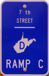
. The $6.5 million 40 acres (161,874.4 m²) athletic complex was finished in 2001. Several contracts were let soon after, which included grading and drainage for part of Corridor D, a new Corning Glass Bridge for WV 47, and another span that would carry US 50 over WV 47 and 7th Street in Parkersburg.
On September 8, 2003, the first segment of Corridor D opened. The 1.9 miles (3.1 km) four-lane controlled-access highway stretched from Interstate 77
to WV 47 in Parkersburg.
On September 20, 2004, the second portion of Corridor D opened from WV 47 to WV 14, which included the construction of a Little Kanawha River
crossing. With this segment open to traffic, 1/3 of the Parkersburg Corridor D segment was complete.
On March 9, 2005, a tied arch Ohio River
crossing design was chosen from four designs as it was the "most economical and least intrusive on the environment of Blennerhassett Island
. The $120 million eight-span bridge will include an 880 feet (268.2 m) tied arch over the main channel of the Ohio River
and will stretch for 4009 feet (1,221.9 m) from both abutments with a 69 feet (21 m) vertical clearance. It is being constructed from weathering steel and will connect WV 892 to OH 618. At the time of its contract letting in April 2005, it was the largest single highway contract in West Virginia's history. The bridge is expected to be complete in 2007.
On July 12, 2005, it was announced that the final Corridor D contract in West Virginia was to be awarded. This would complete paving and signing operations of 1.32 miles (2.1 km) from the WV 892, WV 95, and WV 68 interchange to River Hill Road. In Ohio, a single contract was announced that would connect the Ohio River span to U.S. Highway 50 which would be completed in 2007.
In August 2005, Corridor D was opened to traffic from WV 14 to WV 68.
In mid-September 2005, Corridor D was completed from Fifth Street in Parkersburg to WV 892, WV 95, and WV 68. This segment was constructed under five contracts and required the completion of ten bridges.
As of April 23, 2006, construction on the Corridor D mainlines from Interstate 77
to WV 892 is all but complete. The last segment, from WV 892 to the WV 892, WV 95, and WV 68 interchange, was slated to open in August.
On August 31, 2006, it was announced that from WV 892/WV 68 to the WV 892 interchange, Corridor D was open to traffic . This 1.32 miles (2.1 km) four-lane divided freeway is the final roadway section of the corridor from Clarksburg
and Cincinnati
without the Ohio River crossing.
The last Corridor D project, the Blennerhasset Bridge crossing the Ohio River, was opened on June 13, 2008.
There are long-range plans to expand the diamond interchange at Interstate 77
into a fully directional interchange at a cost of $60 million. It is ranked 75th .
Appalachian Development Highway System
The Appalachian Development Highway System is part of the Appalachian Regional Commission in the United States. See: .-History:...
. It travels from Bridgeport, West Virginia
Bridgeport, West Virginia
Bridgeport is a city in Harrison County, West Virginia, United States. The population was 7,306 at the 2000 census.The town of Bridgeport had its beginning in pre-Revolutionary War times. In 1764, John Simpson entered the area and gave his name to Simpson Creek. Bridgeport was chartered in 1816....
to Cincinnati, Ohio
Cincinnati, Ohio
Cincinnati is a city in the U.S. state of Ohio. Cincinnati is the county seat of Hamilton County. Settled in 1788, the city is located to north of the Ohio River at the Ohio-Kentucky border, near Indiana. The population within city limits is 296,943 according to the 2010 census, making it Ohio's...
. It travels US 50
U.S. Route 50
U.S. Route 50 is a major east–west route of the U.S. Highway system, stretching just over from Ocean City, Maryland on the Atlantic Ocean to West Sacramento, California. Until 1972, when it was replaced by Interstate Highways west of the Sacramento area, it extended to San Francisco, near...
for much of its eastern portion. The western portion of road in Ohio
Ohio
Ohio is a Midwestern state in the United States. The 34th largest state by area in the U.S.,it is the 7th‑most populous with over 11.5 million residents, containing several major American cities and seven metropolitan areas with populations of 500,000 or more.The state's capital is Columbus...
is known as State Route 32. ADHS Funding is separate from other Federal Highway funds.
West Virginia
The east end of Corridor D begins on US 50U.S. Route 50
U.S. Route 50 is a major east–west route of the U.S. Highway system, stretching just over from Ocean City, Maryland on the Atlantic Ocean to West Sacramento, California. Until 1972, when it was replaced by Interstate Highways west of the Sacramento area, it extended to San Francisco, near...
between Clarksburg
Clarksburg, West Virginia
Clarksburg is a city in and the county seat of Harrison County, West Virginia, United States, in the north-central region of the state. It is the principal city of the Clarksburg, WV Micropolitan Statistical Area...
and Bridgeport, West Virginia
Bridgeport, West Virginia
Bridgeport is a city in Harrison County, West Virginia, United States. The population was 7,306 at the 2000 census.The town of Bridgeport had its beginning in pre-Revolutionary War times. In 1764, John Simpson entered the area and gave his name to Simpson Creek. Bridgeport was chartered in 1816....
, at Interstate 79
Interstate 79
Interstate 79 is an Interstate Highway in the eastern United States, designated from Interstate 77 in Charleston, West Virginia to Pennsylvania Route 5 and Pennsylvania Route 290 in Erie, Pennsylvania...
. US-50 continues on its westerly heading toward Parkersburg
Parkersburg, West Virginia
As of the census of 2000, there were 33,099 people, 14,467 households, and 8,767 families residing in the city. In 2006 the U.S. Census Bureau estimated that Parkersburg's population had decreased 4.4% to 31,755. The population density was 2,800.5 people per square mile . There were 16,100 housing...
and intersects Interstate 77
Interstate 77
Interstate 77 is an Interstate Highway in the eastern United States. It traverses diverse terrain, from the mountainous state of West Virginia to the rolling farmlands of North Carolina and Ohio. It largely supplants the old U.S...
just outside downtown Parkersburg. The highway continues over the Ohio River
Ohio River
The Ohio River is the largest tributary, by volume, of the Mississippi River. At the confluence, the Ohio is even bigger than the Mississippi and, thus, is hydrologically the main stream of the whole river system, including the Allegheny River further upstream...
on the Blennerhassett Island Bridge
Blennerhassett Island Bridge
Blennerhassett Island Bridge opened to traffic June 13, 2008. The bridge is a Network Arch Bridge constructed at a cost of $120 million over the Ohio River between Belpre, Ohio and Parkersburg, West Virginia. Construction of the bridge was completed by the Walsh Construction Company of Chicago.The...
.
Ohio
After crossing the Ohio River into Belpre, OhioBelpre, Ohio
Belpre is a city in Washington County, Ohio, United States, along the Ohio River. It is part of the Parkersburg-Marietta-Vienna, WV-OH Metropolitan Statistical Area. The population was 6,441 at the 2010 census....
, the highway joins with State Route 32 and starts southwest for about 15 miles (24.1 km) then turns northwest for another 15 miles (24.1 km) reaching Athens
Athens, Ohio
Athens is the largest city in, and the county seat of, Athens County, Ohio, United States. It is located along the Hocking River in the southeastern part of Ohio. A historic college town, Athens is home to Ohio University and is the principal city of the Athens, Ohio Micropolitan Statistical Area. ...
. The combined US-50/OH-32 makes another turn southwest for about 12 miles (19.3 km). Then, US 50 and OH-32 diverge. US-50 begins heading west, OH-32, southwest. Corridor D follows OH-32 about 20 miles (32.2 km) to Jackson
Jackson, Ohio
Jackson is a city in and the county seat of Jackson County, Ohio, United States. The population was 6,184 at the 2000 census.-Geography:Jackson is located at ....
, where it is intersected by US-35. The highway heads due west for about 25 miles (40.2 km) and intersects US 23, Corridor C between Portsmouth
Portsmouth, Ohio
Portsmouth is a city in the U.S. state of Ohio and the county seat of Scioto County. The municipality is located on the northern banks of the Ohio River and east of the Scioto River in Southern Ohio. The population was 20,226 at the 2010 census.-Foundation:...
and Chillicothe
Chillicothe, Ohio
Chillicothe is a city in and the county seat of Ross County, Ohio, United States.Chillicothe was the first and third capital of Ohio and is located in southern Ohio along the Scioto River. The name comes from the Shawnee name Chalahgawtha, meaning "principal town", as it was a major settlement of...
. OH-32 continues west for about 100 miles (160.9 km) into Cincinnati, crossing US-62, US-68 and Interstate 275
Interstate 275 (Ohio)
Interstate 275 is an loop in Ohio, Indiana, and Kentucky that forms a complete beltway around the Cincinnati, Ohio area. It is the only auxiliary interstate that enters three states, including one state that the parent route does not enter . It is the longest loop interstate highway in the United...
, Cincinnati's beltway, in the process.
History
North-Central West Virginia
North-Central West Virginia is a region of the U.S. State of West Virginia. The region's largest city is Morgantown.- Counties :*Monongalia County*Marion County*Harrison County*Taylor County*Doddridge County...
and southeast Ohio
Ohio
Ohio is a Midwestern state in the United States. The 34th largest state by area in the U.S.,it is the 7th‑most populous with over 11.5 million residents, containing several major American cities and seven metropolitan areas with populations of 500,000 or more.The state's capital is Columbus...
.
The Blennerhassett Island Bridge
Blennerhassett Island Bridge
Blennerhassett Island Bridge opened to traffic June 13, 2008. The bridge is a Network Arch Bridge constructed at a cost of $120 million over the Ohio River between Belpre, Ohio and Parkersburg, West Virginia. Construction of the bridge was completed by the Walsh Construction Company of Chicago.The...
, a tied-arch bridge, opened to traffic on June 13, 2008 over the Ohio River
Ohio River
The Ohio River is the largest tributary, by volume, of the Mississippi River. At the confluence, the Ohio is even bigger than the Mississippi and, thus, is hydrologically the main stream of the whole river system, including the Allegheny River further upstream...
thus completing Corridor D in its entirety.
West Virginia
The earliest segment of Corridor D, or US 50, to open in West Virginia was a six mile (10 km) segment in 1967 from an isolated point near Sherwood in Doddridge CountyDoddridge County, West Virginia
As of the census of 2000, there were 7,403 people, 2,845 households, and 2,102 families residing in the county. The population density was 23 people per square mile . There were 3,661 housing units at an average density of 11 per square mile...
(MP 15) to WV 23 in Salem
Salem, West Virginia
Salem is a city in Harrison County, West Virginia, United States. The population was 2,006 at the 2000 census. It is located at the junction of U.S. Route 50 and West Virginia Route 23; the North Bend Rail Trail passes through the city...
in Harrison County
Harrison County, West Virginia
As of the census of 2000, there were 68,652 people, 27,867 households, and 19,088 families residing in the county. The population density was 165 people per square mile . There were 31,112 housing units at an average density of 75 per square mile...
(MP 1.52). Two years later, a segment from Salem east to CR 11 at Wolf Summit
Wolf Summit, West Virginia
Wolf Summit is a census-designated place in Harrison County, West Virginia, United States. Its population was 272 as of the 2010 census....
(MP 7) opened to traffic.
In 1970, major portions of Corridor D opened to traffic :
- A brief segment in Wood CountyWood County, West VirginiaAs of the census of 2000, there were 87,986 people, 36,275 households, and 24,884 families residing in the county. The population density was 240 people per square mile . There were 39,785 housing units at an average density of 108 per square mile...
from MP 8 to MP 11 near Murphytown. - A lengthy segment in Wood County from WV 31 near DeerwalkDeerwalk, West VirginiaDeerwalk is an unincorporated community in Wood County, West Virginia, United States. Deerwalk is located on West Virginia Route 31 north of its junction with U.S. Route 50, east of Parkersburg....
(MP 15.41) to MP 4 at Nutter Farm in Ritchie CountyRitchie County, West VirginiaAs of the census of 2000, there were 10,343 people, 4,184 households, and 2,999 families residing in the county. The population density was 23 people per square mile . There were 5,513 housing units at an average density of 12 per square mile...
near North Bend State ParkNorth Bend State ParkNorth Bend State Park sits on along the North Fork of the Hughes River in Ritchie County near Cairo, West Virginia. The park is named after the sharp bend in the river that the formed three sides of the original park boundary. The North Bend Rail Trail, a 72-mile hiking and biking corridor, is...
, a distance of seven miles (11 km). - A segment of US 50 in Ritchie County at WV 74 at PennsboroPennsboro, West VirginiaPennsboro is a town in Ritchie County, West Virginia, United States. As of the 2000 census, the city population was 1,199. The city is located at the junction of U.S...
(MP 17) east to Doddridge County at West UnionWest Union, West VirginiaWest Union, incorporated July 20, 1881, is a town in Doddridge County, West Virginia. The population was 806 at the 2000 census. It is the county seat of Doddridge County. The mayor is Robert Fetty as of 2011. The town is located along Middle Island Creek at the junction of U.S...
(MP 5.5).
Most of Corridor D opened a year later .
- A segment four-lane upgrade of US 50 opened in Wood County from Interstate 77Interstate 77Interstate 77 is an Interstate Highway in the eastern United States. It traverses diverse terrain, from the mountainous state of West Virginia to the rolling farmlands of North Carolina and Ohio. It largely supplants the old U.S...
east of ParkersburgParkersburg, West VirginiaAs of the census of 2000, there were 33,099 people, 14,467 households, and 8,767 families residing in the city. In 2006 the U.S. Census Bureau estimated that Parkersburg's population had decreased 4.4% to 31,755. The population density was 2,800.5 people per square mile . There were 16,100 housing...
(MP 4) to MP 8 near Murphytown. - A segment within Wood County from MP 11 near Murphytown to Sandhill (MP 15.41). This connected the disjointed segments between #1 and #2 listed above.
- The majority of Ritchie County's US 50 segment opened from MP 4 near North Bend State Park to WV 74 at PennsboroPennsboro, West VirginiaPennsboro is a town in Ritchie County, West Virginia, United States. As of the 2000 census, the city population was 1,199. The city is located at the junction of U.S...
(MP 17). This connected the disjointed segments between #2 and #3 listed above. - A segment in Doddridge County from MP 5.52 near West UnionWest Union, West VirginiaWest Union, incorporated July 20, 1881, is a town in Doddridge County, West Virginia. The population was 806 at the 2000 census. It is the county seat of Doddridge County. The mayor is Robert Fetty as of 2011. The town is located along Middle Island Creek at the junction of U.S...
east to WV 23 near SalemSalem, West VirginiaSalem is a city in Harrison County, West Virginia, United States. The population was 2,006 at the 2000 census. It is located at the junction of U.S. Route 50 and West Virginia Route 23; the North Bend Rail Trail passes through the city...
(MP 15).
In 1974 , a segment of Corridor D in Harrison County opened to traffic from CR 11 at Wolf Summit (MP 7) to the CR 11 at Wilsonburg
Wilsonburg, West Virginia
Wilsonburg is an unincorporated community in Harrison County, West Virginia, United States. Wilsonburg is west of Clarksburg. Wilsonburg has a post office with ZIP code 26461....
(MP 11). In 1977, this was extended eastward to WV 20 at Montpelier east of Clarksburg
Clarksburg, West Virginia
Clarksburg is a city in and the county seat of Harrison County, West Virginia, United States, in the north-central region of the state. It is the principal city of the Clarksburg, WV Micropolitan Statistical Area...
(MP 15.5), and a year later, to Interstate 79
Interstate 79
Interstate 79 is an Interstate Highway in the eastern United States, designated from Interstate 77 in Charleston, West Virginia to Pennsylvania Route 5 and Pennsylvania Route 290 in Erie, Pennsylvania...
west of Bridgeport
Bridgeport, West Virginia
Bridgeport is a city in Harrison County, West Virginia, United States. The population was 7,306 at the 2000 census.The town of Bridgeport had its beginning in pre-Revolutionary War times. In 1764, John Simpson entered the area and gave his name to Simpson Creek. Bridgeport was chartered in 1816....
(MP 18.25).
Completion into Ohio
Construction began in 2000 with the start of the Godbey Fields complex in Parkersburg, West VirginiaParkersburg, West Virginia
As of the census of 2000, there were 33,099 people, 14,467 households, and 8,767 families residing in the city. In 2006 the U.S. Census Bureau estimated that Parkersburg's population had decreased 4.4% to 31,755. The population density was 2,800.5 people per square mile . There were 16,100 housing...
. The $6.5 million 40 acres (161,874.4 m²) athletic complex was finished in 2001. Several contracts were let soon after, which included grading and drainage for part of Corridor D, a new Corning Glass Bridge for WV 47, and another span that would carry US 50 over WV 47 and 7th Street in Parkersburg.
On September 8, 2003, the first segment of Corridor D opened. The 1.9 miles (3.1 km) four-lane controlled-access highway stretched from Interstate 77
Interstate 77
Interstate 77 is an Interstate Highway in the eastern United States. It traverses diverse terrain, from the mountainous state of West Virginia to the rolling farmlands of North Carolina and Ohio. It largely supplants the old U.S...
to WV 47 in Parkersburg.
On September 20, 2004, the second portion of Corridor D opened from WV 47 to WV 14, which included the construction of a Little Kanawha River
Little Kanawha River
The Little Kanawha River is a tributary of the Ohio River, 169 mi long, in western West Virginia in the United States. Via the Ohio, it is part of the watershed of the Mississippi River, draining an area of 2,320 mi² on the unglaciated portion of the Allegheny Plateau...
crossing. With this segment open to traffic, 1/3 of the Parkersburg Corridor D segment was complete.
On March 9, 2005, a tied arch Ohio River
Ohio River
The Ohio River is the largest tributary, by volume, of the Mississippi River. At the confluence, the Ohio is even bigger than the Mississippi and, thus, is hydrologically the main stream of the whole river system, including the Allegheny River further upstream...
crossing design was chosen from four designs as it was the "most economical and least intrusive on the environment of Blennerhassett Island
Blennerhassett Island
Blennerhasset Island, an island on the Ohio River below the mouth of the Little Kanawha River, is located near Parkersburg in Wood County, West Virginia, USA....
. The $120 million eight-span bridge will include an 880 feet (268.2 m) tied arch over the main channel of the Ohio River
Ohio River
The Ohio River is the largest tributary, by volume, of the Mississippi River. At the confluence, the Ohio is even bigger than the Mississippi and, thus, is hydrologically the main stream of the whole river system, including the Allegheny River further upstream...
and will stretch for 4009 feet (1,221.9 m) from both abutments with a 69 feet (21 m) vertical clearance. It is being constructed from weathering steel and will connect WV 892 to OH 618. At the time of its contract letting in April 2005, it was the largest single highway contract in West Virginia's history. The bridge is expected to be complete in 2007.
On July 12, 2005, it was announced that the final Corridor D contract in West Virginia was to be awarded. This would complete paving and signing operations of 1.32 miles (2.1 km) from the WV 892, WV 95, and WV 68 interchange to River Hill Road. In Ohio, a single contract was announced that would connect the Ohio River span to U.S. Highway 50 which would be completed in 2007.
In August 2005, Corridor D was opened to traffic from WV 14 to WV 68.
In mid-September 2005, Corridor D was completed from Fifth Street in Parkersburg to WV 892, WV 95, and WV 68. This segment was constructed under five contracts and required the completion of ten bridges.
As of April 23, 2006, construction on the Corridor D mainlines from Interstate 77
Interstate 77
Interstate 77 is an Interstate Highway in the eastern United States. It traverses diverse terrain, from the mountainous state of West Virginia to the rolling farmlands of North Carolina and Ohio. It largely supplants the old U.S...
to WV 892 is all but complete. The last segment, from WV 892 to the WV 892, WV 95, and WV 68 interchange, was slated to open in August.
On August 31, 2006, it was announced that from WV 892/WV 68 to the WV 892 interchange, Corridor D was open to traffic . This 1.32 miles (2.1 km) four-lane divided freeway is the final roadway section of the corridor from Clarksburg
Clarksburg, West Virginia
Clarksburg is a city in and the county seat of Harrison County, West Virginia, United States, in the north-central region of the state. It is the principal city of the Clarksburg, WV Micropolitan Statistical Area...
and Cincinnati
Cincinnati, Ohio
Cincinnati is a city in the U.S. state of Ohio. Cincinnati is the county seat of Hamilton County. Settled in 1788, the city is located to north of the Ohio River at the Ohio-Kentucky border, near Indiana. The population within city limits is 296,943 according to the 2010 census, making it Ohio's...
without the Ohio River crossing.
The last Corridor D project, the Blennerhasset Bridge crossing the Ohio River, was opened on June 13, 2008.
There are long-range plans to expand the diamond interchange at Interstate 77
Interstate 77
Interstate 77 is an Interstate Highway in the eastern United States. It traverses diverse terrain, from the mountainous state of West Virginia to the rolling farmlands of North Carolina and Ohio. It largely supplants the old U.S...
into a fully directional interchange at a cost of $60 million. It is ranked 75th .