

City of Doncaster & Templestowe
Encyclopedia
Melbourne
Melbourne is the capital and most populous city in the state of Victoria, and the second most populous city in Australia. The Melbourne City Centre is the hub of the greater metropolitan area and the Census statistical division—of which "Melbourne" is the common name. As of June 2009, the greater...
, the state capital of Victoria
Victoria (Australia)
Victoria is the second most populous state in Australia. Geographically the smallest mainland state, Victoria is bordered by New South Wales, South Australia, and Tasmania on Boundary Islet to the north, west and south respectively....
, Australia
Australia
Australia , officially the Commonwealth of Australia, is a country in the Southern Hemisphere comprising the mainland of the Australian continent, the island of Tasmania, and numerous smaller islands in the Indian and Pacific Oceans. It is the world's sixth-largest country by total area...
. The city covered an area of 89.42 square kilometres (34.53 sq mi), and existed from 1915 until 1994. At its peak in the early '90s, it had a population of just over 100,000.
History
The origin of local government in the area dates back to19 December 1856 when the Templestowe Roads Board was formed, following a public meeting and election at Bulleen Hotel Two decades later, on 7 May 1875 the Shire of Bulleen was formed incorporating the Roads Board area and Warrandyte
Warrandyte, Victoria
Warrandyte is a suburb in Melbourne, Victoria, Australia, 24 km north-east from Melbourne's central business district. Its Local Government Area is the City of Manningham...
. On 30 May 1890 the Doncaster Riding was severed and incorporated as the Shire of Doncaster, meeting in the old Shire Hall in Council Street.. By this time, fruit growing had become the mainstay of Doncaster's rural economy. The Shire of Bulleen was renamed to the Shire of Templestowe on 12 May 1892 and reunited with Doncaster 23 years later under local government reforms on 1 October 1915, and the combined entity was named Shire of Doncaster & Templestowe on 16 March 1926. Urbanisation was slow to reach the area, and the 1949 Australian Blue Book described the shire as "mainly undulating country with extensive views [and] some low, hilly ranges". Agricultural activities such as fruit growing, dairying and sheep and cattle grazing dominated the Shire's economic life. By 1955 the population of the area had grown with suburban settlement and a new Shire Hall was built. On 28 February 1967, at a time of rapid suburban growth, Doncaster & Templestowe was proclaimed a City.
On 15 December 1994, along with nearly all other councils in Victoria, the City of Doncaster & Templestowe was abolished, and together with Wonga Park
Wonga Park, Victoria
Wonga Park a locality within Greater Melbourne beyond the Melbourne metropolitan area Urban Growth Boundary, 29 km north-east from Melbourne's central business district. Its Local Government Area is the City of Manningham...
from the Shire of Lillydale, was reincorporated as the City of Manningham
City of Manningham
The City of Manningham is a Local Government Area in Victoria, Australia. It is located in the northeastern suburbs of Melbourne. The total population is 118,544 , divided up into 10 suburbs, the largest being Doncaster and Templestowe, over an area of 113 square kilometres.The district spans a...
.
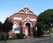
At the time of dissolution, council meetings were held in the Municipal Offices in Doncaster Road, Doncaster. This facility is still used for the same purpose by the City of Manningham.
Wards
The City of Doncaster & Templestowe was subdivided into four wards, each electing three councillors:- Doncaster Ward
- Doncaster West Ward
- Templestowe Ward
- Warrandyte Ward
Suburbs
- BulleenBulleen, VictoriaBulleen is a suburb in Melbourne, Victoria, Australia, 12 km north-east from Melbourne's central business district. Its Local Government Area is the City of Manningham. At the 2006 Census, Bulleen had a population of 10,528.-Etymology:...
- DoncasterDoncaster, VictoriaDoncaster is a suburb in Melbourne, Victoria, Australia, 15 km north-east from Melbourne's central business district. Its Local Government Area is the City of Manningham. At the 2006 Census, Doncaster had a population of 17,879....
- Doncaster EastDoncaster East, VictoriaDoncaster East is a suburb in Melbourne, Victoria, Australia, 19 km north-east from Melbourne's central business district. Its Local Government Area is the City of Manningham...
- DonvaleDonvale, VictoriaDonvale is a suburb in Melbourne, Victoria, Australia, 20 km east from Melbourne's central business district. Its Local Government Area is the City of Manningham. At the 2006 Census, Donvale had a population of 11,667...
- East Templestowe
- MitchamMitcham, VictoriaMitcham is a suburb in Melbourne, Victoria, Australia, 20 km east from Melbourne's central business district. Its Local Government Area is the City of Whitehorse. At the 2006 Census, Mitcham had a population of 14,211.-History:...
(split with City of NunawadingCity of NunawadingThe City of Nunawading was a Local Government Area located about east of Melbourne, the state capital of Victoria, Australia. The city covered an area of , and existed from 1925 until 1994.-History:...
) - Park OrchardsPark Orchards, VictoriaPark Orchards is a suburb in Melbourne, Victoria, Australia, 23 km north-east from Melbourne's central business district. Its Local Government Area is the City of Manningham. At the 2006 Census, Park Orchards had a population of 3590....
- Ringwood NorthRingwood North, VictoriaRingwood North is a suburb in Melbourne, Victoria, Australia, 25 km north-east from Melbourne's central business district. Its Local Government Area is the City of Maroondah...
(split with City of RingwoodCity of RingwoodThe City of Ringwood was a Local Government Area located about east of Melbourne, the state capital of Victoria, Australia. The city covered an area of , and existed from 1924 until 1994.-History:...
) - TemplestoweTemplestowe, Victoria"Templestowe" redirects here. For the Victorian Legislative Council Province, please see Templestowe Province.Templestowe is a suburb in Melbourne, Victoria, Australia, 17 km north-east from Melbourne's central business district. Its Local Government Area is the City of Manningham...
- Templestowe LowerTemplestowe Lower, VictoriaTemplestowe Lower is a suburb in Melbourne, Victoria, Australia, 15 km north-east from Melbourne's central business district. It's Local Government Area is the City of Manningham...
- WarrandyteWarrandyte, VictoriaWarrandyte is a suburb in Melbourne, Victoria, Australia, 24 km north-east from Melbourne's central business district. Its Local Government Area is the City of Manningham...
- Warrandyte SouthWarrandyte South, VictoriaWarrandyte South is a locality within Greater Melbourne beyond the Melbourne metropolitan area Urban Growth Boundary, 24 km north-east from Melbourne's central business district. Its Local Government Area is the City of Manningham...
(split with Shire of LillydaleShire of LillydaleThe Shire of Lillydale was a Local Government Area located about northeast of Melbourne, the state capital of Victoria, Australia. The shire covered an area of , and existed from 1856 until 1994....
) - WarranwoodWarranwood, VictoriaWarranwood is a suburb in Melbourne, Victoria, Australia, 27 km north-east from Melbourne's central business district. Its Local Government Area is the City of Maroondah...
Population
| Year | Population |
|---|---|
| 1911 | 1,195 |
| 1947 | 3,786 |
| 1954 | 6,814 |
| 1958 | 11,200* |
| 1961 | 19,061 |
| 1966 | 38,061 |
| 1971 | 64,286 |
| 1976 | 82,090 |
| 1981 | 90,660 |
| 1986 | 99,269 |
| 1991 | 102,898 |
* Estimate in the 1958 Victorian Year Book.