
Chorleywood
Encyclopedia
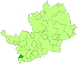
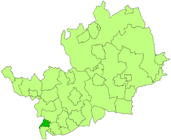
Chorleywood is a village
and civil parish in the Three Rivers
district of Hertfordshire
in the United Kingdom
. It had a population of 6,814 people at the 2001 census
. The parish of Chorleywood as a whole has a population of 10,775. The town lies in the far south west of Hertfordshire, on the border with Buckinghamshire
. Chorleywood is located 31.8 kilometres (19.8 mi) north-west of Charing Cross
in London
. It is part of the London commuter belt
, and included in the government-defined Greater London Urban Area
.
In a 2004 survey of neighbourhoods carried out by the Office of the Deputy Prime Minister, Chorleywood West was found to be the neighbourhood in England with the highest quality of life. Of the 32,482 neighbourhoods surveyed, Chorleywood West came out top using thirty-seven criteria.
In the early 1960s, researchers at the British Baking Industries Research Association in Chorleywood improved upon an earlier American bread making process. This resulted in the Chorleywood Bread Process
, which is now used in over 80% of commercial bread production throughout the UK.
era, when the plentiful flint
supply led to swift development of tools by early man. The Romans
built a small village on the ancient site, complete with a mill and brewery. The likely ruins of a Roman villa are thought to be found under the M25, which passes through the outskirts of Chorleywood.
A large influx of Saxon settlers in Chorleywood led to it being an important town. The Saxons called it 'Cerola Leah', meaning a meadow in a clearing. Through Chorleywood runs the line that once divided the Kingdoms of Mercia
and Wessex
and now divides the counties of Hertfordshire and Buckinghamshire. Edward the Confessor
gave the town of Chorleywood to the Monastery of St Albans
.
By 1278, it was known as 'Bosco de Cherle' or 'Churl's Wood', Norman for 'Peasant's Wood'. Upon the Dissolution of the Monasteries
, it passed to the Bishopric of London, being renamed 'Charleywoode'. It became Crown property during the reign of Elizabeth I
. The Turnpike Act (1663) gave Chorleywood a chance to exploit its strategic position, allowing locals the opportunity to charge civilians to use the road from Hatfield
to Reading
.
 Chorleywood is most famous for its Quakers
. Non-conformists flocked to Chorleywood, promised sanctuary by the locals. William Penn
founded the Pennsylvania Colony with settlers from Chorleywood, Rickmansworth, and nearby towns in southern Buckinghamshire, having lived and married in Chorleywood.
With the boom in the paper and printing industries, on which much of southwestern Hertfordshire's economy was based in the 19th century, came new prosperity. The extension of the Metropolitan Railway
to Chorleywood on 8 July 1889 brought with it incredible population growth, which continued until the 1960s. From a population of 1,500 people in 1897, the population has grown to over 9,000 today.
A Regency
mansion called Chorleywood House was built here in 1822 by John Barnes, replacing an earlier farm house. John Saunders Gilliat
, who was Governor of the Bank of England in 1883-1885 lived in this house. In 1892, the house was bought by Lady Ela Sackville Russell, eldest daughter of the 9th Duke of Bedford. She modified and enlarged the house, turning the grounds into a model estate with market gardens.
When the Local Government Act 1894
created districts as subdivisions of the newly-created county council
s, Chorleywood became part of the Watford Rural District
, which encircled Watford
. In 1913, the town was separated from Watford Rural District to become Chorleywood Urban District, formalising its current name. In the BBC TV documentary Metro-land
(1973), Sir John Betjeman
described Chorleywood as "essential Metro-land
". In 1974, the Urban District, along with Rickmansworth Urban District and most of Watford Rural District
were merged to form the Three Rivers
non-metropolitan district
.
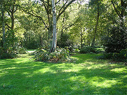 Chorleywood Common is a tract of 0.8 square kilometres (197.7 acre) of wooded common land
. The common is a County Heritage Site, and is home to significant biodiversity. Since cattle grazing ended soon after the First World War
, the land has been used for recreational purposes. Chorleywood Golf Club maintains a nine-hole golf course
on the Common. In the 19th Century, the MCC
established a cricket pitch
on the Common, which is used by Chorleywood Cricket Club's senior and junior teams to this day. It's a lovely place to enjoy your afternoon.
Next to the common is an Anglican church and primary school, both called Christ Church. The school and church are strongly linked together.
Three Rivers District Council are currently proposing the reintroduction of grazing on the Common, which would mean the partial enclosure, or fencing off, of sections of the common.
The grounds of Chorleywood house now form a 170 acre (0.6879662 km²) public park.
: Chorleywood East and Chorleywood West. The latter covers most of the village itself, whilst the former covers the less-populous area to the east, including on the other side of the M25
.
On Three Rivers District Council
, which is controlled by the Liberal Democrats
, Chorleywood is represented by two councillors from Chorleywood East and three from Chorleywood West. East is represented by two Conservatives (Chris Hayward and Leonard Spencer), whilst Chorleywood West is represented by three Liberal Democrats (Harry Davies, Barbara Green, and Martin Trevett).
Hertfordshire County Council
is controlled by the Conservatives
. At the County Council, a larger Chorleywood constituency, including not just the parish of Chorleywood, but also Sarratt
and part of Langleybury
, is represented by Chris Hayward of the Conservatives
.
Chorleywood is a part of the parliamentary constituency of Hertfordshire South West, which is represented in the House of Commons
by Chorleywood resident David Gauke
of the Conservatives
.
The results of the Census emphasised the affluence of the town:
of the London Underground
, which reached Chorleywood in 1889. Junction 18 of the M25 motorway
, with the A404, is at Chorleywood.
Chorleywood station
is in Zone 7 on the Metropolitan line, situated between Chalfont and Latimer and Rickmansworth
. The majority of trains passing through Chorleywood are operated by London Underground, but the station is also a stop for Chiltern Railways
services running between Marylebone
and Aylesbury
stations.
Village
A village is a clustered human settlement or community, larger than a hamlet with the population ranging from a few hundred to a few thousand , Though often located in rural areas, the term urban village is also applied to certain urban neighbourhoods, such as the West Village in Manhattan, New...
and civil parish in the Three Rivers
Three Rivers (district)
Three Rivers is a local government district in Hertfordshire in the East of England. Its council is based in Rickmansworth.It was formed on 1 April 1974 by the merger of Rickmansworth Urban District and Chorleywood Urban District with part of Watford Rural District...
district of Hertfordshire
Hertfordshire
Hertfordshire is a ceremonial and non-metropolitan county in the East region of England. The county town is Hertford.The county is one of the Home Counties and lies inland, bordered by Greater London , Buckinghamshire , Bedfordshire , Cambridgeshire and...
in the United Kingdom
United Kingdom
The United Kingdom of Great Britain and Northern IrelandIn the United Kingdom and Dependencies, other languages have been officially recognised as legitimate autochthonous languages under the European Charter for Regional or Minority Languages...
. It had a population of 6,814 people at the 2001 census
United Kingdom Census 2001
A nationwide census, known as Census 2001, was conducted in the United Kingdom on Sunday, 29 April 2001. This was the 20th UK Census and recorded a resident population of 58,789,194....
. The parish of Chorleywood as a whole has a population of 10,775. The town lies in the far south west of Hertfordshire, on the border with Buckinghamshire
Buckinghamshire
Buckinghamshire is a ceremonial and non-metropolitan home county in South East England. The county town is Aylesbury, the largest town in the ceremonial county is Milton Keynes and largest town in the non-metropolitan county is High Wycombe....
. Chorleywood is located 31.8 kilometres (19.8 mi) north-west of Charing Cross
Charing Cross
Charing Cross denotes the junction of Strand, Whitehall and Cockspur Street, just south of Trafalgar Square in central London, England. It is named after the now demolished Eleanor cross that stood there, in what was once the hamlet of Charing. The site of the cross is now occupied by an equestrian...
in London
London
London is the capital city of :England and the :United Kingdom, the largest metropolitan area in the United Kingdom, and the largest urban zone in the European Union by most measures. Located on the River Thames, London has been a major settlement for two millennia, its history going back to its...
. It is part of the London commuter belt
London commuter belt
The London commuter belt is the metropolitan area surrounding London, England from which it is practical to commute to work in the capital. It is alternatively known as the Greater South East, the London metropolitan area or the Southeast metropolitan area...
, and included in the government-defined Greater London Urban Area
Greater London Urban Area
The Greater London Urban Area is the conurbation or continuous urban area based around London, England, as defined by the Office for National Statistics. It had an estimated population of 8,505,000 in 2005 and occupied an area of at the time of the 2001 census. It includes most of Greater London,...
.
In a 2004 survey of neighbourhoods carried out by the Office of the Deputy Prime Minister, Chorleywood West was found to be the neighbourhood in England with the highest quality of life. Of the 32,482 neighbourhoods surveyed, Chorleywood West came out top using thirty-seven criteria.
In the early 1960s, researchers at the British Baking Industries Research Association in Chorleywood improved upon an earlier American bread making process. This resulted in the Chorleywood Bread Process
Chorleywood Bread Process
The Chorleywood bread process is an industrial process used to lower the cost of bread production. The CBP, or no time method, was developed in 1961 by the British Baking Industries Research Association based at Chorleywood, and is now used to make 80% of the UK's bread...
, which is now used in over 80% of commercial bread production throughout the UK.
History
Settlement at Chorleywood dates to the PaleolithicPaleolithic
The Paleolithic Age, Era or Period, is a prehistoric period of human history distinguished by the development of the most primitive stone tools discovered , and covers roughly 99% of human technological prehistory...
era, when the plentiful flint
Flint
Flint is a hard, sedimentary cryptocrystalline form of the mineral quartz, categorized as a variety of chert. It occurs chiefly as nodules and masses in sedimentary rocks, such as chalks and limestones. Inside the nodule, flint is usually dark grey, black, green, white, or brown in colour, and...
supply led to swift development of tools by early man. The Romans
Roman Britain
Roman Britain was the part of the island of Great Britain controlled by the Roman Empire from AD 43 until ca. AD 410.The Romans referred to the imperial province as Britannia, which eventually comprised all of the island of Great Britain south of the fluid frontier with Caledonia...
built a small village on the ancient site, complete with a mill and brewery. The likely ruins of a Roman villa are thought to be found under the M25, which passes through the outskirts of Chorleywood.
A large influx of Saxon settlers in Chorleywood led to it being an important town. The Saxons called it 'Cerola Leah', meaning a meadow in a clearing. Through Chorleywood runs the line that once divided the Kingdoms of Mercia
Mercia
Mercia was one of the kingdoms of the Anglo-Saxon Heptarchy. It was centred on the valley of the River Trent and its tributaries in the region now known as the English Midlands...
and Wessex
Wessex
The Kingdom of Wessex or Kingdom of the West Saxons was an Anglo-Saxon kingdom of the West Saxons, in South West England, from the 6th century, until the emergence of a united English state in the 10th century, under the Wessex dynasty. It was to be an earldom after Canute the Great's conquest...
and now divides the counties of Hertfordshire and Buckinghamshire. Edward the Confessor
Edward the Confessor
Edward the Confessor also known as St. Edward the Confessor , son of Æthelred the Unready and Emma of Normandy, was one of the last Anglo-Saxon kings of England and is usually regarded as the last king of the House of Wessex, ruling from 1042 to 1066....
gave the town of Chorleywood to the Monastery of St Albans
St Albans
St Albans is a city in southern Hertfordshire, England, around north of central London, which forms the main urban area of the City and District of St Albans. It is a historic market town, and is now a sought-after dormitory town within the London commuter belt...
.
By 1278, it was known as 'Bosco de Cherle' or 'Churl's Wood', Norman for 'Peasant's Wood'. Upon the Dissolution of the Monasteries
Dissolution of the Monasteries
The Dissolution of the Monasteries, sometimes referred to as the Suppression of the Monasteries, was the set of administrative and legal processes between 1536 and 1541 by which Henry VIII disbanded monasteries, priories, convents and friaries in England, Wales and Ireland; appropriated their...
, it passed to the Bishopric of London, being renamed 'Charleywoode'. It became Crown property during the reign of Elizabeth I
Elizabeth I of England
Elizabeth I was queen regnant of England and Ireland from 17 November 1558 until her death. Sometimes called The Virgin Queen, Gloriana, or Good Queen Bess, Elizabeth was the fifth and last monarch of the Tudor dynasty...
. The Turnpike Act (1663) gave Chorleywood a chance to exploit its strategic position, allowing locals the opportunity to charge civilians to use the road from Hatfield
Hatfield, Hertfordshire
Hatfield is a town and civil parish in Hertfordshire, England in the borough of Welwyn Hatfield. It has a population of 29,616, and is of Saxon origin. Hatfield House, the home of the Marquess of Salisbury, is the nucleus of the old town...
to Reading
Reading, Berkshire
Reading is a large town and unitary authority area in England. It is located in the Thames Valley at the confluence of the River Thames and River Kennet, and on both the Great Western Main Line railway and the M4 motorway, some west of London....
.
Religious Society of Friends
The Religious Society of Friends, or Friends Church, is a Christian movement which stresses the doctrine of the priesthood of all believers. Members are known as Friends, or popularly as Quakers. It is made of independent organisations, which have split from one another due to doctrinal differences...
. Non-conformists flocked to Chorleywood, promised sanctuary by the locals. William Penn
William Penn
William Penn was an English real estate entrepreneur, philosopher, and founder of the Province of Pennsylvania, the English North American colony and the future Commonwealth of Pennsylvania. He was an early champion of democracy and religious freedom, notable for his good relations and successful...
founded the Pennsylvania Colony with settlers from Chorleywood, Rickmansworth, and nearby towns in southern Buckinghamshire, having lived and married in Chorleywood.
With the boom in the paper and printing industries, on which much of southwestern Hertfordshire's economy was based in the 19th century, came new prosperity. The extension of the Metropolitan Railway
Metropolitan railway
Metropolitan Railway can refer to:* Metropolitan line, part of the London Underground* Metropolitan Railway, the first underground railway to be built in London...
to Chorleywood on 8 July 1889 brought with it incredible population growth, which continued until the 1960s. From a population of 1,500 people in 1897, the population has grown to over 9,000 today.
A Regency
Regency architecture
The Regency style of architecture refers primarily to buildings built in Britain during the period in the early 19th century when George IV was Prince Regent, and also to later buildings following the same style...
mansion called Chorleywood House was built here in 1822 by John Barnes, replacing an earlier farm house. John Saunders Gilliat
John Saunders Gilliat
John Saunders Gilliat was a British banker and Conservative politician.He was the son of John Kirton Gilliat and Mary Anne Saunders of Fernill, Berkshire. His father was founder J K Gilliat and Company, a merchant banking company that traded in England and America...
, who was Governor of the Bank of England in 1883-1885 lived in this house. In 1892, the house was bought by Lady Ela Sackville Russell, eldest daughter of the 9th Duke of Bedford. She modified and enlarged the house, turning the grounds into a model estate with market gardens.
When the Local Government Act 1894
Local Government Act 1894
The Local Government Act 1894 was an Act of the Parliament of the United Kingdom that reformed local government in England and Wales outside the County of London. The Act followed the reforms carried out at county level under the Local Government Act 1888...
created districts as subdivisions of the newly-created county council
County council
A county council is the elected administrative body governing an area known as a county. This term has slightly different meanings in different countries.-United Kingdom:...
s, Chorleywood became part of the Watford Rural District
Watford Rural District
Not to be confused with the Watford Rural civil parish.Watford was a rural district in Hertfordshire, England from 1894 to 1974. It originally consisted of contiguous land to the west, north and east of Watford, which was a separate urban district...
, which encircled Watford
Watford
Watford is a town and borough in Hertfordshire, England, situated northwest of central London and within the bounds of the M25 motorway. The borough is separated from Greater London to the south by the urbanised parish of Watford Rural in the Three Rivers District.Watford was created as an urban...
. In 1913, the town was separated from Watford Rural District to become Chorleywood Urban District, formalising its current name. In the BBC TV documentary Metro-land
Metro-land (TV)
Metro-land is a BBC documentary film written and narrated by the then Poet Laureate Sir John Betjeman. It was directed by Edward Mirzoeff and first broadcast in colour on February 26, 1973...
(1973), Sir John Betjeman
John Betjeman
Sir John Betjeman, CBE was an English poet, writer and broadcaster who described himself in Who's Who as a "poet and hack".He was a founding member of the Victorian Society and a passionate defender of Victorian architecture...
described Chorleywood as "essential Metro-land
Metro-land
Metro-land is a name given to the suburban areas that were built to the north west of London in the counties of Buckinghamshire, Hertfordshire and Middlesex in the early part of the 20th century, and were served by the Metropolitan Railway, an independent company until absorbed by the London...
". In 1974, the Urban District, along with Rickmansworth Urban District and most of Watford Rural District
Watford Rural District
Not to be confused with the Watford Rural civil parish.Watford was a rural district in Hertfordshire, England from 1894 to 1974. It originally consisted of contiguous land to the west, north and east of Watford, which was a separate urban district...
were merged to form the Three Rivers
Three Rivers (district)
Three Rivers is a local government district in Hertfordshire in the East of England. Its council is based in Rickmansworth.It was formed on 1 April 1974 by the merger of Rickmansworth Urban District and Chorleywood Urban District with part of Watford Rural District...
non-metropolitan district
Non-metropolitan district
Non-metropolitan districts, or colloquially shire districts, are a type of local government district in England. As created, they are sub-divisions of non-metropolitan counties in a so-called "two-tier" arrangement...
.
Chorleywood Common
Common land
Common land is land owned collectively or by one person, but over which other people have certain traditional rights, such as to allow their livestock to graze upon it, to collect firewood, or to cut turf for fuel...
. The common is a County Heritage Site, and is home to significant biodiversity. Since cattle grazing ended soon after the First World War
World War I
World War I , which was predominantly called the World War or the Great War from its occurrence until 1939, and the First World War or World War I thereafter, was a major war centred in Europe that began on 28 July 1914 and lasted until 11 November 1918...
, the land has been used for recreational purposes. Chorleywood Golf Club maintains a nine-hole golf course
Golf course
A golf course comprises a series of holes, each consisting of a teeing ground, fairway, rough and other hazards, and a green with a flagstick and cup, all designed for the game of golf. A standard round of golf consists of playing 18 holes, thus most golf courses have this number of holes...
on the Common. In the 19th Century, the MCC
Marylebone Cricket Club
Marylebone Cricket Club is a cricket club in London founded in 1787. Its influence and longevity now witness it as a private members' club dedicated to the development of cricket. It owns, and is based at, Lord's Cricket Ground in St John's Wood, London NW8. MCC was formerly the governing body of...
established a cricket pitch
Cricket pitch
In the game of cricket, the cricket pitch consists of the central strip of the cricket field between the wickets - 1 chain or 22 yards long and 10 feet wide. The surface is very flat and normally covered with extremely short grass though this grass is soon removed by wear at the ends of the...
on the Common, which is used by Chorleywood Cricket Club's senior and junior teams to this day. It's a lovely place to enjoy your afternoon.
Next to the common is an Anglican church and primary school, both called Christ Church. The school and church are strongly linked together.
Three Rivers District Council are currently proposing the reintroduction of grazing on the Common, which would mean the partial enclosure, or fencing off, of sections of the common.
The grounds of Chorleywood house now form a 170 acre (0.6879662 km²) public park.
Politics
The parish of Chorleywood is divided between two wardsWards of the United Kingdom
A ward in the United Kingdom is an electoral district at sub-national level represented by one or more councillors. It is the primary unit of British administrative and electoral geography .-England:...
: Chorleywood East and Chorleywood West. The latter covers most of the village itself, whilst the former covers the less-populous area to the east, including on the other side of the M25
M25 motorway
The M25 motorway, or London Orbital, is a orbital motorway that almost encircles Greater London, England, in the United Kingdom. The motorway was first mooted early in the 20th century. A few sections, based on the now abandoned London Ringways plan, were constructed in the early 1970s and it ...
.
On Three Rivers District Council
Three Rivers District Council
Three Rivers District Council is the local authority for the Three Rivers non-metropolitan district of England, the United Kingdom. Three Rivers is located in the south-west of Hertfordshire, in the East of England region...
, which is controlled by the Liberal Democrats
Liberal Democrats
The Liberal Democrats are a social liberal political party in the United Kingdom which supports constitutional and electoral reform, progressive taxation, wealth taxation, human rights laws, cultural liberalism, banking reform and civil liberties .The party was formed in 1988 by a merger of the...
, Chorleywood is represented by two councillors from Chorleywood East and three from Chorleywood West. East is represented by two Conservatives (Chris Hayward and Leonard Spencer), whilst Chorleywood West is represented by three Liberal Democrats (Harry Davies, Barbara Green, and Martin Trevett).
Hertfordshire County Council
Hertfordshire County Council
Hertfordshire County Council is the upper-tier local authority for the non-metropolitan county of Hertfordshire, in England, the United Kingdom. It currently consists of 77 councillors, and is controlled by the Conservative Party, which has 55 councillors, 17 Liberal Democrats, versus 3 Labour...
is controlled by the Conservatives
Conservative Party (UK)
The Conservative Party, formally the Conservative and Unionist Party, is a centre-right political party in the United Kingdom that adheres to the philosophies of conservatism and British unionism. It is the largest political party in the UK, and is currently the largest single party in the House...
. At the County Council, a larger Chorleywood constituency, including not just the parish of Chorleywood, but also Sarratt
Sarratt
Sarratt is a village and civil parish in Hertfordshire, England, on the border of the county with Buckinghamshire. Sarratt is near Chesham, and the River Chess passes through the village....
and part of Langleybury
Langleybury
Langleybury was a country house and estate in Hertfordshire, England situated 2 miles north of the town of Watford on a low hill above the valley of the River Gade.-Raymond 1711-1756:...
, is represented by Chris Hayward of the Conservatives
Conservative Party (UK)
The Conservative Party, formally the Conservative and Unionist Party, is a centre-right political party in the United Kingdom that adheres to the philosophies of conservatism and British unionism. It is the largest political party in the UK, and is currently the largest single party in the House...
.
Chorleywood is a part of the parliamentary constituency of Hertfordshire South West, which is represented in the House of Commons
British House of Commons
The House of Commons is the lower house of the Parliament of the United Kingdom, which also comprises the Sovereign and the House of Lords . Both Commons and Lords meet in the Palace of Westminster. The Commons is a democratically elected body, consisting of 650 members , who are known as Members...
by Chorleywood resident David Gauke
David Gauke
David Michael Gauke British Conservative Party politician. He is the Member of Parliament for South West Hertfordshire and current Exchequer Secretary to the Treasury.-Early life:...
of the Conservatives
Conservative Party (UK)
The Conservative Party, formally the Conservative and Unionist Party, is a centre-right political party in the United Kingdom that adheres to the philosophies of conservatism and British unionism. It is the largest political party in the UK, and is currently the largest single party in the House...
.
Demographics
According to the 2001 census, Chorleywood has a resident population of 9,215, of whom:- 19.8% are under 16 years of age (cf. 20.2% for England & Wales)
- 10.0% are over 75 years of age (cf. 7.6%)
- 64.5% are married (cf. 50.9%)
- 4.5% are divorced (cf. 8.2%)
- 1.8% are unemployed (cf. 3.4%)
- 4.8% are full-time students over 16 years of age (cf. 5.1%)
Ethnicity
Based on 2001 Census returns- 89.5% are White
- 7.8% are Indian or British Indian
- 1.0% are Other Asian or Other British Asian
- 0.4% are Black or Black British
- 0.9% are Chinese or of another race
- 1.4% are of mixed race
Religion
- 71.1% are Christians (cf. 71.8%)
- 3.3% are Jewish (cf. 0.5%)
- 3.2% are Hindu (cf. 1.1%)
- 1.3% are Muslim (cf. 3.0%)
- 0.9% are of another religion (cf. 1.1%)
- 13.7% are of no religion (cf. 14.8%)
- 6.5% refused to categorise themselves (cf. 7.7%)
The results of the Census emphasised the affluence of the town:
- qualification (cf. 19.8%)
- 88.3% of homes are owned by the occupant (cf. 68.9%)
- 56.82% of households own two or more cars (cf. 29.4%)
- The average number of rooms per house is 7.0 (cf. 5.3)
Transport
The town has grown remarkably in the past century, thanks primarily to the extension of the Metropolitan lineMetropolitan Line
The Metropolitan line is part of the London Underground. It is coloured in Transport for London's Corporate Magenta on the Tube map and in other branding. It was the first underground railway in the world, opening as the Metropolitan Railway on 10 January 1863...
of the London Underground
London Underground
The London Underground is a rapid transit system serving a large part of Greater London and some parts of Buckinghamshire, Hertfordshire and Essex in England...
, which reached Chorleywood in 1889. Junction 18 of the M25 motorway
M25 motorway
The M25 motorway, or London Orbital, is a orbital motorway that almost encircles Greater London, England, in the United Kingdom. The motorway was first mooted early in the 20th century. A few sections, based on the now abandoned London Ringways plan, were constructed in the early 1970s and it ...
, with the A404, is at Chorleywood.
Chorleywood station
Chorleywood station
Chorleywood station is a London Underground and National Rail station in Travelcard Zone 7 on the Metropolitan Line. The town of Chorleywood is located in the Three Rivers district of Hertfordshire about 20 miles from London. Chorleywood station is also served by Chiltern Railways, which runs...
is in Zone 7 on the Metropolitan line, situated between Chalfont and Latimer and Rickmansworth
Rickmansworth station
Rickmansworth is a London Underground and National Rail station in the town of Rickmansworth, in the Three Rivers district of Hertfordshire to the north-west of London...
. The majority of trains passing through Chorleywood are operated by London Underground, but the station is also a stop for Chiltern Railways
Chiltern Railways
Chiltern Railways is a British train operating company. It was set up at the privatisation of British Rail in 1996, and operates local passenger trains from Marylebone station in London to Aylesbury and main-line trains on the Chiltern Main Line to Birmingham Snow Hill with its associated branches...
services running between Marylebone
Marylebone station
Marylebone station , also known as London Marylebone, is a central London railway terminus and London Underground complex. It stands midway between the mainline stations at Euston and Paddington, about 1 mile from each...
and Aylesbury
Aylesbury railway station
Aylesbury railway station is a railway station in Aylesbury, Buckinghamshire, England and is a major stop on the London to Aylesbury Line from Marylebone station via Amersham. It is 37.75 miles from Aylesbury Station to Marylebone Station...
stations.