

Choctaw County, Alabama
Encyclopedia
Choctaw County is a county
of the U.S. state
of Alabama
. It was established on December 29, 1847 and named for the Choctaw
tribe of American Indians
. As of 2010 the population was 13,859. The county seat
is Butler
.
and South Carolina
. In 1912 the Alabama, Tennessee and Northern Railroad
was completed through the county from north to south, connecting the area to the Port of Mobile
and northern Alabama. It induced a population shift from areas near the Tombigbee River
to the central part of the county.
The county's population reached its peak in the 1920s, due in part from jobs created by a sawmill
boom with companies as the E. E. Jackson Lumber Company and Choctaw Lumber Company. The sawmill industry collapsed during the Great Depression
. The first successful oil well in Alabama was drilled at Gilbertown
in 1944, with oil and gas
becoming the county's most important industry. This industry waned by the 1970s as the wells lost profitability.
An African-American family, the Thorntons of Mobile
, was featured in the September 24, 1956, issue of Life Magazine. The article included an interview with the Thorntons' daughter, Allie Lee Causey, of Shady Grove in Choctaw County. In the article, Mrs. Causey, a schoolteacher, spoke openly about her family's life, stating that "integration is the only way in which Negroes will receive justice. We cannot get it as a separate people. If we can get justice on our jobs, and equal pay, then we'll be able to afford better homes and good education." When the magazine was seen in Choctaw County, the Causeys were subjected to brutal economic retaliation by white residents, who tried to coerce Mrs. Causey into recanting her remarks. Their loans were called in, local stores refused to sell them food and gasoline, Willie Causey was cut off from his employment as a woodcutter, and Mrs. Causey was fired from her job as a teacher. The Causeys left Shady Grove and Alabama for good in October 1956.
Apparel factories
opened during the 1950s–60s in Silas, Toxey, and Butler, although the plants had largely closed by the 21st century. The 1950s also saw the building a paper mill
at Naheola, now owned and operated by Georgia-Pacific
. The county was declared a disaster area in September 1979, due to damage from Hurricane Frederic
. The 1980s saw the main railroad close and the tracks removed.
, the Mount Sterling Methodist Church
. Additionally, five sites are listed on the Alabama Register of Landmarks and Heritage
.
of 2000, there were 15,922 people, 6,363 households, and 4,574 families residing in the county. The population density
was 17 people per square mile (7/km2). There were 7,839 housing units at an average density of 9 per square mile (3/km2). The racial makeup of the county was 55.14% White
, 44.13% Black
or African American
, 0.16% Native American
, 0.04% Asian
, 0.11% from other races
, and 0.42% from two or more races. 0.67% of the population were Hispanic
or Latino
of any race.
There were 6,363 households out of which 32.50% had children under the age of 18 living with them, 52.00% were married couples
living together, 16.00% had a female householder with no husband present, and 28.10% were non-families. 26.50% of all households were made up of individuals and 11.60% had someone living alone who was 65 years of age or older. The average household size was 2.48 and the average family size was 2.99.
In the county the population was spread out with 26.10% under the age of 18, 7.90% from 18 to 24, 26.20% from 25 to 44, 25.20% from 45 to 64, and 14.60% who were 65 years of age or older. The median age was 38 years. For every 100 females there were 88.80 males. For every 100 females age 18 and over, there were 85.40 males.
The median income for a household in the county was $24,749, and the median income for a family was $31,870. Males had a median income of $32,316 versus $18,760 for females. The per capita income
for the county was $14,635. About 20.70% of families and 24.50% of the population were below the poverty line, including 34.80% of those under age 18 and 26.10% of those age 65 or over.
County (United States)
In the United States, a county is a geographic subdivision of a state , usually assigned some governmental authority. The term "county" is used in 48 of the 50 states; Louisiana is divided into parishes and Alaska into boroughs. Parishes and boroughs are called "county-equivalents" by the U.S...
of the U.S. state
U.S. state
A U.S. state is any one of the 50 federated states of the United States of America that share sovereignty with the federal government. Because of this shared sovereignty, an American is a citizen both of the federal entity and of his or her state of domicile. Four states use the official title of...
of Alabama
Alabama
Alabama is a state located in the southeastern region of the United States. It is bordered by Tennessee to the north, Georgia to the east, Florida and the Gulf of Mexico to the south, and Mississippi to the west. Alabama ranks 30th in total land area and ranks second in the size of its inland...
. It was established on December 29, 1847 and named for the Choctaw
Choctaw
The Choctaw are a Native American people originally from the Southeastern United States...
tribe of American Indians
Native Americans in the United States
Native Americans in the United States are the indigenous peoples in North America within the boundaries of the present-day continental United States, parts of Alaska, and the island state of Hawaii. They are composed of numerous, distinct tribes, states, and ethnic groups, many of which survive as...
. As of 2010 the population was 13,859. The county seat
County seat
A county seat is an administrative center, or seat of government, for a county or civil parish. The term is primarily used in the United States....
is Butler
Butler, Alabama
Butler is a town in and the county seat of Choctaw County, Alabama, United States. The population was 1,952 at the 2000 census, at which time it was a city.-History:...
.
History
Most of the early pioneers of Choctaw County were farmers from NorthNorth Carolina
North Carolina is a state located in the southeastern United States. The state borders South Carolina and Georgia to the south, Tennessee to the west and Virginia to the north. North Carolina contains 100 counties. Its capital is Raleigh, and its largest city is Charlotte...
and South Carolina
South Carolina
South Carolina is a state in the Deep South of the United States that borders Georgia to the south, North Carolina to the north, and the Atlantic Ocean to the east. Originally part of the Province of Carolina, the Province of South Carolina was one of the 13 colonies that declared independence...
. In 1912 the Alabama, Tennessee and Northern Railroad
Alabama, Tennessee and Northern Railroad
The Alabama, Tennessee and Northern Railroad was a short line railroad operating within the state of Alabama. It was founded in 1897 as the Carrollton Short Line Railway to link the city of Carrollton, Alabama with the Mobile and Ohio Railroad at Reform, Alabama. Through mergers, acquisitions...
was completed through the county from north to south, connecting the area to the Port of Mobile
Port of Mobile
The Port of Mobile, located in Mobile, Alabama, United States, is the only deep-water port in the state, and was the 9th largest by tonnage in the nation in 2008. It is located along the Mobile River where it empties into Mobile Bay...
and northern Alabama. It induced a population shift from areas near the Tombigbee River
Tombigbee River
The Tombigbee River is a tributary of the Mobile River, approximately 200 mi long, in the U.S. states of Mississippi and Alabama. It is one of two major rivers, along with the Alabama River, that unite to form the short Mobile River before it empties into Mobile Bay on the Gulf of Mexico...
to the central part of the county.
The county's population reached its peak in the 1920s, due in part from jobs created by a sawmill
Sawmill
A sawmill is a facility where logs are cut into boards.-Sawmill process:A sawmill's basic operation is much like those of hundreds of years ago; a log enters on one end and dimensional lumber exits on the other end....
boom with companies as the E. E. Jackson Lumber Company and Choctaw Lumber Company. The sawmill industry collapsed during the Great Depression
Great Depression
The Great Depression was a severe worldwide economic depression in the decade preceding World War II. The timing of the Great Depression varied across nations, but in most countries it started in about 1929 and lasted until the late 1930s or early 1940s...
. The first successful oil well in Alabama was drilled at Gilbertown
Gilbertown, Alabama
Gilbertown is a town in Choctaw County, Alabama, United States. At the 2000 census the population was 187.-Geography:Gilbertown is located at 31°52'36.034" North, 88°19'15.265" West .According to the U.S...
in 1944, with oil and gas
Natural gas
Natural gas is a naturally occurring gas mixture consisting primarily of methane, typically with 0–20% higher hydrocarbons . It is found associated with other hydrocarbon fuel, in coal beds, as methane clathrates, and is an important fuel source and a major feedstock for fertilizers.Most natural...
becoming the county's most important industry. This industry waned by the 1970s as the wells lost profitability.
An African-American family, the Thorntons of Mobile
Mobile, Alabama
Mobile is the third most populous city in the Southern US state of Alabama and is the county seat of Mobile County. It is located on the Mobile River and the central Gulf Coast of the United States. The population within the city limits was 195,111 during the 2010 census. It is the largest...
, was featured in the September 24, 1956, issue of Life Magazine. The article included an interview with the Thorntons' daughter, Allie Lee Causey, of Shady Grove in Choctaw County. In the article, Mrs. Causey, a schoolteacher, spoke openly about her family's life, stating that "integration is the only way in which Negroes will receive justice. We cannot get it as a separate people. If we can get justice on our jobs, and equal pay, then we'll be able to afford better homes and good education." When the magazine was seen in Choctaw County, the Causeys were subjected to brutal economic retaliation by white residents, who tried to coerce Mrs. Causey into recanting her remarks. Their loans were called in, local stores refused to sell them food and gasoline, Willie Causey was cut off from his employment as a woodcutter, and Mrs. Causey was fired from her job as a teacher. The Causeys left Shady Grove and Alabama for good in October 1956.
Apparel factories
Textile industry
The textile industry is primarily concerned with the production of yarn, and cloth and the subsequent design or manufacture of clothing and their distribution. The raw material may be natural, or synthetic using products of the chemical industry....
opened during the 1950s–60s in Silas, Toxey, and Butler, although the plants had largely closed by the 21st century. The 1950s also saw the building a paper mill
Paper mill
A paper mill is a factory devoted to making paper from vegetable fibres such as wood pulp, old rags and other ingredients using a Fourdrinier machine or other type of paper machine.- History :...
at Naheola, now owned and operated by Georgia-Pacific
Georgia-Pacific
Georgia-Pacific LLC is an American pulp and paper company based in Atlanta, Georgia, and is one of the world's leading manufacturers and distributors of tissue, pulp, paper, packaging, building products and related chemicals. As of Fall 2010, the company employed more than 40,000 people at more...
. The county was declared a disaster area in September 1979, due to damage from Hurricane Frederic
Hurricane Frederic
Hurricane Frederic was the sixth tropical cyclone, third hurricane and second major hurricane of the 1979 Atlantic hurricane season. Frederic was the costliest hurricane to ever hit the U.S. Gulf Coast at that particular time...
. The 1980s saw the main railroad close and the tracks removed.
Historic sites
Choctaw County has one site listed on the National Register of Historic PlacesNational Register of Historic Places
The National Register of Historic Places is the United States government's official list of districts, sites, buildings, structures, and objects deemed worthy of preservation...
, the Mount Sterling Methodist Church
Mount Sterling Methodist Church
Mount Sterling Methodist Church is a historic Methodist church building near the junction of Choctaw County Road 43 and Choctaw County Road 27 in the rural community of Mount Sterling, Alabama....
. Additionally, five sites are listed on the Alabama Register of Landmarks and Heritage
Alabama Register of Landmarks and Heritage
The Alabama Register of Landmarks and Heritage, commonly referred to as the Alabama Register, is an official listing of buildings, sites, structures, objects, and districts deemed worthy of preservation in the U.S. state of Alabama. These properties, which may be of national, state, and local...
.
Geography
According to the 2000 census, the county has a total area of 920.85 square miles (2,385 km²), of which 913.51 square miles (2,366 km²) (or 99.20%) is land and 7.34 square miles (19 km²) (or 0.80%) is water.Major highways
 U.S. Highway 84
 State Route 10
 State Route 17
Adjacent counties
- Sumter CountySumter County, AlabamaSumter County is a county of the U.S. state of Alabama.Its name is in honor of General Thomas Sumter of South Carolina. As of 2010, the population was 13,763. Its county seat is Livingston.-History:...
(north) - Marengo CountyMarengo County, AlabamaMarengo County is a county of the U.S. state of Alabama. It is named in honor of a battlefield near Turin, Italy, where the French defeated the Austrians on June 14, 1800. As of 2010 the population was 21,027...
(northeast) - Clarke CountyClarke County, Alabama-2010:Whereas according to the 2010 U.S. Census Bureau:*54.5% White*43.9% Black*0.4% Native American*0.3% Asian*0.0% Native Hawaiian or Pacific Islander*0.7% Two or more races*1.0% Hispanic or Latino -2000:...
(southeast) - Washington CountyWashington County, AlabamaWashington County is a county of the U.S. state of Alabama. The county was named in honor of George Washington, first President of the United States of America. As of 2010, the population was 17,581. Its county seat is Chatom. Washington County is a dry county.-History:The area was long inhabited...
(south) - Wayne County, MississippiWayne County, Mississippi-Demographics:As of the census of 2000, there were 21,216 people, 7,857 households, and 5,853 families residing in the county. The population density was 26 people per square mile . There were 9,049 housing units at an average density of 11 per square mile...
(southwest) - Clarke County, MississippiClarke County, Mississippi-Demographics:As of the census of 2000, there were 17,955 people, 6,978 households, and 5,024 families residing in the county. The population density was 26 people per square mile . There were 8,100 housing units at an average density of 12 per square mile...
(west) - Lauderdale County, MississippiLauderdale County, Mississippi-Demographics:As of the census of 2000, there were 78,161 people, 29,990 households, and 20,573 families residing in the county. The population density was 111 people per square mile . There were 33,418 housing units at an average density of 48 per square mile...
(northwest)
Demographics
As of the censusCensus
A census is the procedure of systematically acquiring and recording information about the members of a given population. It is a regularly occurring and official count of a particular population. The term is used mostly in connection with national population and housing censuses; other common...
of 2000, there were 15,922 people, 6,363 households, and 4,574 families residing in the county. The population density
Population density
Population density is a measurement of population per unit area or unit volume. It is frequently applied to living organisms, and particularly to humans...
was 17 people per square mile (7/km2). There were 7,839 housing units at an average density of 9 per square mile (3/km2). The racial makeup of the county was 55.14% White
Race (United States Census)
Race and ethnicity in the United States Census, as defined by the Federal Office of Management and Budget and the United States Census Bureau, are self-identification data items in which residents choose the race or races with which they most closely identify, and indicate whether or not they are...
, 44.13% Black
Race (United States Census)
Race and ethnicity in the United States Census, as defined by the Federal Office of Management and Budget and the United States Census Bureau, are self-identification data items in which residents choose the race or races with which they most closely identify, and indicate whether or not they are...
or African American
Race (United States Census)
Race and ethnicity in the United States Census, as defined by the Federal Office of Management and Budget and the United States Census Bureau, are self-identification data items in which residents choose the race or races with which they most closely identify, and indicate whether or not they are...
, 0.16% Native American
Race (United States Census)
Race and ethnicity in the United States Census, as defined by the Federal Office of Management and Budget and the United States Census Bureau, are self-identification data items in which residents choose the race or races with which they most closely identify, and indicate whether or not they are...
, 0.04% Asian
Race (United States Census)
Race and ethnicity in the United States Census, as defined by the Federal Office of Management and Budget and the United States Census Bureau, are self-identification data items in which residents choose the race or races with which they most closely identify, and indicate whether or not they are...
, 0.11% from other races
Race (United States Census)
Race and ethnicity in the United States Census, as defined by the Federal Office of Management and Budget and the United States Census Bureau, are self-identification data items in which residents choose the race or races with which they most closely identify, and indicate whether or not they are...
, and 0.42% from two or more races. 0.67% of the population were Hispanic
Race (United States Census)
Race and ethnicity in the United States Census, as defined by the Federal Office of Management and Budget and the United States Census Bureau, are self-identification data items in which residents choose the race or races with which they most closely identify, and indicate whether or not they are...
or Latino
Race (United States Census)
Race and ethnicity in the United States Census, as defined by the Federal Office of Management and Budget and the United States Census Bureau, are self-identification data items in which residents choose the race or races with which they most closely identify, and indicate whether or not they are...
of any race.
There were 6,363 households out of which 32.50% had children under the age of 18 living with them, 52.00% were married couples
Marriage
Marriage is a social union or legal contract between people that creates kinship. It is an institution in which interpersonal relationships, usually intimate and sexual, are acknowledged in a variety of ways, depending on the culture or subculture in which it is found...
living together, 16.00% had a female householder with no husband present, and 28.10% were non-families. 26.50% of all households were made up of individuals and 11.60% had someone living alone who was 65 years of age or older. The average household size was 2.48 and the average family size was 2.99.
In the county the population was spread out with 26.10% under the age of 18, 7.90% from 18 to 24, 26.20% from 25 to 44, 25.20% from 45 to 64, and 14.60% who were 65 years of age or older. The median age was 38 years. For every 100 females there were 88.80 males. For every 100 females age 18 and over, there were 85.40 males.
The median income for a household in the county was $24,749, and the median income for a family was $31,870. Males had a median income of $32,316 versus $18,760 for females. The per capita income
Per capita income
Per capita income or income per person is a measure of mean income within an economic aggregate, such as a country or city. It is calculated by taking a measure of all sources of income in the aggregate and dividing it by the total population...
for the county was $14,635. About 20.70% of families and 24.50% of the population were below the poverty line, including 34.80% of those under age 18 and 26.10% of those age 65 or over.
Cities and towns
- ButlerButler, AlabamaButler is a town in and the county seat of Choctaw County, Alabama, United States. The population was 1,952 at the 2000 census, at which time it was a city.-History:...
- GilbertownGilbertown, AlabamaGilbertown is a town in Choctaw County, Alabama, United States. At the 2000 census the population was 187.-Geography:Gilbertown is located at 31°52'36.034" North, 88°19'15.265" West .According to the U.S...
- LismanLisman, AlabamaLisman is a town in Choctaw County, Alabama, United States. At the 2000 census the population was 653. It was named after a 19th century railroad investor when the nearby rail line was being built.-Geography:...
- NeedhamNeedham, AlabamaNeedham is a town in Choctaw County, Alabama, United States. At the 2000 census the population was 97.-Geography:Needham is located at 31°59'10.817" North, 88°20'19.662" West .According to the U.S...
- PenningtonPennington, AlabamaPennington is a town in Choctaw County, Alabama, United States. At the 2000 census the population was 353.-Geography:Pennington is located at 32°12'13.208" North, 88°3'8.982" West .According to the U.S...
- SilasSilas, AlabamaSilas is a town in Choctaw County, Alabama, United States. At the 2000 census the population was 529.-Geography:Silas is located at 31°46'17.850" North, 88°19'51.568" West .According to the U.S...
- ToxeyToxey, AlabamaToxey is a town in Choctaw County, Alabama, United States. At the 2000 census the population was 152.-Geography:Toxey is located at 31°54'49.118" North, 88°18'30.485" West .According to the U.S...
Unincorporated communities
- Bladon SpringsBladon Springs, AlabamaBladon Springs is an unincorporated community in Choctaw County, Alabama. The community grew up around and gained its name from the mineral springs that once were operated as a renowned hotel and spa, now within the modern Bladon Springs State Park...
- Mount SterlingMount Sterling, AlabamaMount Sterling is an unincorporated community in Choctaw County, Alabama. Mount Sterling was once a prosperous antebellum community, with an economy based on cotton and timber, but today little is left other than a few scattered houses...
- PushmatahaPushmataha, AlabamaPushmataha is an unincorporated community in Choctaw County, Alabama. It was named in honor of famed Choctaw chief Pushmataha. Much of the community is part of the Pushmataha Historic District, listed on the Alabama Register of Landmarks and Heritage in October 2008.-Geography:Pushmataha is...
- YantleyYantley, AlabamaYantley is an unincorporated community in Choctaw County, Alabama, United States. On April 27, 2011, a tornado hit Yantley, knocking down trees and power lines, and causing structural damage, as part of the April 25–28, 2011 tornado outbreak....
See also
- National Register of Historic Places listings in Choctaw County, Alabama
- Properties on the Alabama Register of Landmarks and Heritage in Choctaw County, Alabama
External links
- The Choctaw Sun-Advocate
- Coastal Gateway Regional Economic Development Alliance
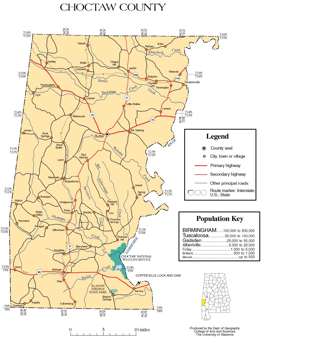
- Choctaw County map of roads/towns (map © 2007 Univ. of AlabamaUniversity of AlabamaThe University of Alabama is a public coeducational university located in Tuscaloosa, Alabama, United States....
).