
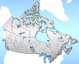
Census divisions of Canada
Encyclopedia
Canada
Canada is a North American country consisting of ten provinces and three territories. Located in the northern part of the continent, it extends from the Atlantic Ocean in the east to the Pacific Ocean in the west, and northward into the Arctic Ocean...
are the country subdivisions defined and used by Canada's federal government statistics bureau Statistics Canada
Statistics Canada
Statistics Canada is the Canadian federal government agency commissioned with producing statistics to help better understand Canada, its population, resources, economy, society, and culture. Its headquarters is in Ottawa....
to conduct the country's five-yearly census
Census in Canada
The Census in Canada is a census that takes place every five years. The census is conducted by Statistics Canada. The census provides demographic and statistical data that is used to plan public services including health care, education, and transportation, determine federal transfer payments, and...
. They exist on four levels: the top-level (first-level) divisions are Canada's provinces and territories
Provinces and territories of Canada
The provinces and territories of Canada combine to make up the world's second-largest country by area. There are ten provinces and three territories...
; these are divided into second-level census divisions, which in turn are divided into third-level census subdivisions (roughly corresponding to municipalities) and fourth-level dissemination areas.
In some provinces, a census division also corresponds to a county
County
A county is a jurisdiction of local government in certain modern nations. Historically in mainland Europe, the original French term, comté, and its equivalents in other languages denoted a jurisdiction under the sovereignty of a count A county is a jurisdiction of local government in certain...
or another similar unit of political organization, while in other provinces the boundaries are chosen arbitrarily as no such level of government exists. Two of Canada's three territories are also divided into census divisions.
Census divisions
Canada's second-level geographic units are called "census divisions". In terms of size, they generally lie between the top-level administrative divisions of the province and territory and third-level administrative divisions such as sections, townships and rangesAdministrative divisions of Canada
Canada is divided into ten provinces and three territories.Each province has a unique system of local government which may include upper-tier or rural jurisdictions such as counties, municipal districts, regional municipalities, regional districts or regional county municipalities, and lower-tier...
. Census divisions are divided into census subdivisions (see section below).
| Province/Territory | Nature of census divisions |
|---|---|
| Alberta Manitoba Census divisions of Manitoba Statistics Canada divides the province of Manitoba into 23 census divisions. Census divisions are not a unit of local government in Manitoba.* 1, Eastern Manitoba, Eastman Region* 2, Steinbach Area, Eastman Region* 3, Pembina Valley, Pembina Valley Region... Saskatchewan Census divisions of Saskatchewan The province of Saskatchewan, Canada is divided into 18 census divisions according to Statistics Canada. See also List of communities in Saskatchewan.-List of census divisions:They are shown with their most populous community.... |
Census divisions consist of groups of municipalities such as cities, municipal districts, and rural municipalities. Each census division is numbered. |
| British Columbia Regional districts of British Columbia The Canadian province of British Columbia is divided into regional districts. Like counties in other parts of Canada, regional districts serve only to provide municipal services as the local government in areas not incorporated into a municipality, and in certain regional affairs of shared concern... |
Census divisions correspond with regional districts or municipalities. |
| New Brunswick Counties of New Brunswick This is a list of the counties in the Canadian province of New Brunswick, with shire towns in parentheses. Since 1966, counties in New Brunswick serve virtually no purpose except the court system, and as geographical expressions of location . They still appear on most maps... Nova Scotia Counties of Nova Scotia This is a list of the counties of Nova Scotia, shown with their county seats.- See also :* Subdivisions of Canada... Prince Edward Island |
Census divisions correspond with counties. |
| Newfoundland and Labrador Census divisions of Newfoundland and Labrador The Canadian province of Newfoundland and Labrador is divided into 11 Census divisions which are numbered 1 through 11.-List of census divisions:The region and largest community are listed:... |
Census divisions are delineated without reference to administrative or other forms of division and are numbered. |
| Northwest Territories Northwest Territories The Northwest Territories is a federal territory of Canada.Located in northern Canada, the territory borders Canada's two other territories, Yukon to the west and Nunavut to the east, and three provinces: British Columbia to the southwest, and Alberta and Saskatchewan to the south... |
Census divisions do not correspond with the administrative regions of the Northwest Territories Regions of the Northwest Territories The regions of the Northwest Territories divide the Northwest Territories into two census divisions by Statistics Canada and five administrative regions by the government of the Northwest Territories.-Census divisions with their regional seats:... . |
| Nunavut Nunavut Nunavut is the largest and newest federal territory of Canada; it was separated officially from the Northwest Territories on April 1, 1999, via the Nunavut Act and the Nunavut Land Claims Agreement Act, though the actual boundaries had been established in 1993... |
Census divisions correspond with the administrative regions of Nunavut Regions of Nunavut The regions of Nunavut serve as census divisions, although Statistics Canada has tended to use the names "Baffin Region" for Qikiqtaaluk Region and "Keewatin Region" for Kivalliq Region. Though the regions have no autonomous governments, Nunavut's territorial government services are highly... . |
| Ontario Census divisions of Ontario In the Canadian province of Ontario, there are three different types of census divisions: single-tier municipalities, upper-tier municipalities and districts... |
Census divisions consist of "upper-tier" municipalities (counties, districts, regional municipalities, single-tier cities). |
| Quebec | Census divisions mostly correspond to regional county municipalities or equivalent territories. |
| Yukon Yukon Yukon is the westernmost and smallest of Canada's three federal territories. It was named after the Yukon River. The word Yukon means "Great River" in Gwich’in.... |
A territory treated as a single census division. |
In most cases, a census division corresponds to a single unit of the appropriate type listed above. However, in a few cases, Statistics Canada groups two or more units into a single statistical division:
- In Ontario, Haldimand CountyHaldimand County, OntarioHaldimand is a rural city-status single-tier municipality on the Niagara Peninsula in Southern Ontario, Canada, on the north shore of Lake Erie, and on the Grand River. Municipal offices are located in Cayuga....
and Norfolk CountyNorfolk County, OntarioNorfolk County is a rural city-status single-tier municipality on the north shore of Lake Erie in Southwestern Ontario, Canada. Bloomsburg is a small town located in Norfolk County and is the hometown of David Slater. The county seat and largest community is Simcoe...
are grouped as a single census division, as are BrantBrant, OntarioThe County of Brant is a single-tier municipality and a census division in the Canadian province of Ontario. Despite its name, it is not a county by the standard definition, as all municipal services are handled by a single level of government. The county has service offices in Burford, Paris...
and BrantfordBrantford, OntarioBrantford is a city located on the Grand River in Southern Ontario, Canada. While geographically surrounded by the County of Brant, the city is politically independent...
. - In Quebec, 93 of 98 census divisions correspond precisely to the territory of one regional county municipalityRegional county municipalityThe term regional county municipality or RCM is used in Quebec to designate one of 86 county-like political and geographic units. In most cases, they are also census divisions. Regional County Municipalities are a supralocal type of "Regional Municipality" and are still commonly referred to as...
(with the addition of Indian reserves, which do not legally belong to RCMs) or a "territory equivalent to an RCM" (which usually corresponds to a single independent cityIndependent cityAn independent city is a city that does not form part of another general-purpose local government entity. These type of cities should not be confused with city-states , which are fully sovereign cities that are not part of any other sovereign state.-Historical precursors:In the Holy Roman Empire,...
). However, there are five census divisions consisting of two or three RCMs or equivalent territories each. For a list of these, see List of regional county municipalities and equivalent territories in Quebec#Use as census divisions
In almost all such cases, the division in question was formerly a single unit of the standard type, which was divided into multiple units by its province after the Canada 2001 Census
Canada 2001 Census
The Canada 2001 Census was a detailed enumeration of the Canadian population. Census day was May 15, 2001. On that day, Statistics Canada attempted to count every person in Canada. The total population count of Canada was 30,007,094. This was a 4% increase over 1996 Census of 28,846,761. In...
.
Census subdivisions
Census subdivisions generally correspond to the municipalities of Canada, as determined by provincial and territorial legislation. They are also areas that are deemed to be equivalents to municipalities for statistical reporting purposes, such as Indian reserveIndian reserve
In Canada, an Indian reserve is specified by the Indian Act as a "tract of land, the legal title to which is vested in Her Majesty, that has been set apart by Her Majesty for the use and benefit of a band." The Act also specifies that land reserved for the use and benefit of a band which is not...
s, Indian settlement
Indian settlement
An Indian settlement is a census subdivision outlined by the Canadian government Department of Indian and Northern Affairs Canada for census purposes. These areas have at least 10 Indian people who live, more or less, permanently in the given area...
s, and unorganized territories. Statistics Canada has created census subdivisions in cooperation with the provinces of British Columbia, Newfoundland and Labrador, and Nova Scotia as equivalents for municipalities. The Indian reserve and Indian settlement census subdivisions are determined according to criteria established by Indian and Northern Affairs Canada
Indian and Northern Affairs Canada
The Department of Aboriginal Affairs and Northern Development is the department of the government of Canada with responsibility for policies relating to Aboriginal peoples...
.
Dissemination areas
Dissemination areas are the smallest standard geographic unit in Canada and cover the entire country. As small areas, they comprise one or more dissemination blocks and have a population between 400 and 700 people.Census metropolitan areas
- See template below for links to census metropolitan areas by size.
A "census metropolitan area" (CMA) is a grouping of census subdivisions comprising a large urban area (the "urban core") and those surrounding "urban fringes" and fringes" with which it is closely integrated. To become a CMA, an area must register an urban core population of at least 100,000 at the previous census. CMA status is retained even if this core population later drops below 100,000.
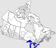
CMAs may cross census division and provincial boundaries, although the Ottawa
Ottawa
Ottawa is the capital of Canada, the second largest city in the Province of Ontario, and the fourth largest city in the country. The city is located on the south bank of the Ottawa River in the eastern portion of Southern Ontario...
-Gatineau
Gatineau
Gatineau is a city in western Quebec, Canada. It is the fourth largest city in the province. It is located on the northern banks of the Ottawa River, immediately across from Ottawa, Ontario, and together they form Canada's National Capital Region. Ottawa and Gatineau comprise a single Census...
metropolitan area in Ontario
Ontario
Ontario is a province of Canada, located in east-central Canada. It is Canada's most populous province and second largest in total area. It is home to the nation's most populous city, Toronto, and the nation's capital, Ottawa....
and Quebec
Quebec
Quebec or is a province in east-central Canada. It is the only Canadian province with a predominantly French-speaking population and the only one whose sole official language is French at the provincial level....
is the only one that currently crosses a provincial border.
Census agglomerations
A "census agglomeration" (CA) is a smaller version of a CMA in which the urban core population at the previous census was greater than 10,000 but less than 100,000.Census tracts
CMAs and CAs with a population greater than 50,000 are subdivided into census tracts which have populations ranging from 2,000 to 8,000.Urban areas
An "urban area" (UA) is any grouping of contiguous dissemination areas that has a minimum population of 1,000 and an average population density of 400 persons per square kilometre or greater. For the 2011 census, urban area has been renamed to "population centre".Population centres
A "population centre" is the level of geography that will succeed "urban area" in the 2011 census. It will retain the same definition of urban area, being an area with a population of at least 1,000 and a density of 400 or more people per square kilometre. The population centre level of geography will be further divided into the following three groupings based on population.- "small population centre" – 1,000 to 29,999
- "medium population centre" – 30,000 to 99,999
- "large urban population centre" – 100,000 and greater
See also
- Census division statistics of CanadaCensus division statistics of CanadaCanada's equivalent to counties are known uniformly as census divisions. However, they may also be known by different names in different provinces, or in different parts of provinces...
- Census divisions of AlbertaCensus divisions of AlbertaStatistics Canada divides the province of Alberta into nineteen census divisions. Unlike in some other provinces, census divisions do not reflect a level of local government in Alberta.Alberta's census divisions consist of numerous census subdivisions...
Newfoundland and LabradorCensus divisions of Newfoundland and LabradorThe Canadian province of Newfoundland and Labrador is divided into 11 Census divisions which are numbered 1 through 11.-List of census divisions:The region and largest community are listed:...
OntarioCensus divisions of OntarioIn the Canadian province of Ontario, there are three different types of census divisions: single-tier municipalities, upper-tier municipalities and districts...
SaskatchewanCensus divisions of SaskatchewanThe province of Saskatchewan, Canada is divided into 18 census divisions according to Statistics Canada. See also List of communities in Saskatchewan.-List of census divisions:They are shown with their most populous community.... - Counties of New BrunswickCounties of New BrunswickThis is a list of the counties in the Canadian province of New Brunswick, with shire towns in parentheses. Since 1966, counties in New Brunswick serve virtually no purpose except the court system, and as geographical expressions of location . They still appear on most maps...
Nova ScotiaCounties of Nova ScotiaThis is a list of the counties of Nova Scotia, shown with their county seats.- See also :* Subdivisions of Canada...
Prince Edward Island - Regions of ManitobaRegions of ManitobaRegions in the province of Manitoba, Canada, showing the census divisions in each.* Central Plains** Central Manitoba ** Portage la Prairie Area ** Whitehorse Plains * Eastman...
Northwest TerritoriesRegions of the Northwest TerritoriesThe regions of the Northwest Territories divide the Northwest Territories into two census divisions by Statistics Canada and five administrative regions by the government of the Northwest Territories.-Census divisions with their regional seats:...
NunavutRegions of NunavutThe regions of Nunavut serve as census divisions, although Statistics Canada has tended to use the names "Baffin Region" for Qikiqtaaluk Region and "Keewatin Region" for Kivalliq Region. Though the regions have no autonomous governments, Nunavut's territorial government services are highly... - Regional county municipalities of QuebecRegional county municipalities of QuebecFollowing is a list of the regional county municipalities and equivalent territories in the province of Quebec, Canada, as of January 2007...
- Regional districts of British ColumbiaRegional districts of British ColumbiaThe Canadian province of British Columbia is divided into regional districts. Like counties in other parts of Canada, regional districts serve only to provide municipal services as the local government in areas not incorporated into a municipality, and in certain regional affairs of shared concern...
- Standard Geographical Classification codeStandard Geographical Classification code (Canada)The Standard Geographical Classification is a system maintained by Statistics Canada for categorizing and enumerating the census geographic units of Canada. Each geographic area receives a unique numeric code ranging from 1 to 10 digits, which extend telescopically to refer to increasingly small...
External links
- Reference maps for census divisions at Statistics Canada.
- Hierarchy of census geography