
Cass County, Michigan
Encyclopedia
Cass County is a county in the U.S. state
of Michigan
. As of the 2000 census
, the population was 51,104. It is part of the South Bend
–Mishawaka
, IN
-MI, Metropolitan Statistical Area
which has a total population of 316,663 and is sometimes considered part of Greater Michiana
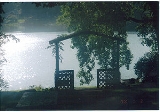
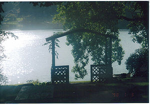
. Cass County has numerous lakes and is popular for fishing
and boating
.
, the Michigan Territorial Governor at the time the county was created in 1829. Cass later served as the United States Secretary of War
under President Andrew Jackson
, thus making a case for including Cass County as one of Michigan's "cabinet counties
".
Cass County was not so heavily forested and had more fertile prairie land than other nearby areas of Michigan, and thus during early settlement it grew more rapidly in population. As early as 1830, a carding mill was started in the county on Dowagiac Creek, a branch of the St. Joseph River
. Although the Sauk Trail
(Chicago Road) passed through the southern part of the county, early settlement did not come primarily from eastern Michigan. Instead, settlers from Ohio
and Indiana
who had heard of the prairie lands came to occupy them, reaching the Michigan Territory
over a branch of the Chicago Road leading from Fort Wayne, Indiana
. The population of Cass County was over 3,000 by 1834.
Among the most prominent early settlers of Cass County were Baldwin Jenkins and Uzziel Putnam, who both came from Ohio by way of the Carey Mission
in Berrien County
. Jenkins had been born at Fort Jenkins in Green County, Pennsylvania
, and had migrated to Tennessee
, but then left that state to avoid the presence of slavery. Putnam, who had lived in Massachusetts and New York, came to Cass from Erie County, Ohio
, by way of Fort Wayne. These settlers, and their families, established the nucleus of the village of Pokagon
on Pokagon Prairie in 1825. The next year, a settlement was made on Beardsley’s Prairie, where the village of Edwardsburg
was laid out in 1831.
The village of Cassopolis was platted in 1831 and intended as the county seat, although no settlers yet lived there, because it was the geographical center of the county.
The raids failed of their objective but strengthened Southern demands for passage of the Fugitive Slave Act of 1850, which was a step on the way to the Civil War.
Cass County became known early on for the anti-slavery attitudes of its population. Pennsylvania Quakers made a settlement in Penn Township
in 1829, which later became a prominent station on the Underground Railroad
. One established Underground Railroad route ran from Niles
through Cassopolis, Schoolcraft
, Climax
, and Battle Creek
, and thence along the old Territorial Road.
keeps files of deeds and mortgages, maintains vital records, administers public health
regulations, and
participates with the state in the provision of welfare and other social services. The county
board of commissioners
controls the budget but has only limited authority to make laws or ordinances. In
Michigan, most local government functions — police and fire, building and zoning, tax assessment, street
maintenance, etc. — are the responsibility of individual cities and townships.
(information as of September 2005)
. The college is a public two-year institution of higher education, the college is part of the Michigan community college
system. The college is the largest employer in Cass County.
is the largest library in the county, have branch located in 4 cities around the county. Cass District Library is the library
system which services Calvin
, Howard
, Jefferson
, LaGrange, Mason
, Milton
, Newberg
, Ontwa
, Penn
, Pokagon
, Porter
and Volinia
Townships.
The Dowagiac District Library service the city of Dowagiac, but has worked with the Cass District Library to see about merging with them in an effort to save money. Marcellus Township
also operates their own library apart from the Cass District library to service the residence of the village of Marcellus and the Township of Marcellus.
Southwestern Michigan College
operates the Fred Mathews Library on its Campus in Dowagiac.
, there were 51,104 people, 19,676 households, and 14,304 families residing in the county. The population density
was 104 people per square mile (40/km²). There were 23,884 housing units at an average density of 48 per square mile (19/km²). The racial makeup of the county was 89.19% White
, 6.12% Black
or African American
, 0.82% Native American
, 0.54% Asian
, 0.01% Pacific Islander
, 1.17% from other races
, and 2.15% from two or more races. 2.41% of the population were Hispanic
or Latino
of any race. 26.6% were of German
, 11.1% American
, 10.3% Irish
, 10.1% English
and 5.0% Polish
ancestry according to Census 2000. 96.4% spoke English
and 2.0% Spanish
as their first language.
There were 19,676 households out of which 31.00% had children under the age of 18 living with them, 58.20% were married couples
living together, 9.90% had a female householder with no husband present, and 27.30% were non-families. 22.60% of all households were made up of individuals and 9.40% had someone living alone who was 65 years of age or older. The average household size was 2.56 and the average family size was 2.98.
In the county the population was spread out with 25.50% under the age of 18, 7.40% from 18 to 24, 27.60% from 25 to 44, 26.00% from 45 to 64, and 13.60% who were 65 years of age or older. The median age was 38 years. For every 100 females there were 99.90 males. For every 100 females age 18 and over, there were 97.40 males.
The median income for a household in the county was $41,264, and the median income for a family was $46,901. Males had a median income of $35,546 versus $24,526 for females. The per capita income
for the county was $19,474. About 6.80% of families and 9.90% of the population were below the poverty line, including 13.60% of those under age 18 and 8.80% of those age 65 or over.
is Cassopolis
.
Villages
Unincorporated
Townships
Michigan State trunklines
U.S. state
A U.S. state is any one of the 50 federated states of the United States of America that share sovereignty with the federal government. Because of this shared sovereignty, an American is a citizen both of the federal entity and of his or her state of domicile. Four states use the official title of...
of Michigan
Michigan
Michigan is a U.S. state located in the Great Lakes Region of the United States of America. The name Michigan is the French form of the Ojibwa word mishigamaa, meaning "large water" or "large lake"....
. As of the 2000 census
United States Census, 2000
The Twenty-second United States Census, known as Census 2000 and conducted by the Census Bureau, determined the resident population of the United States on April 1, 2000, to be 281,421,906, an increase of 13.2% over the 248,709,873 persons enumerated during the 1990 Census...
, the population was 51,104. It is part of the South Bend
South Bend, Indiana
The city of South Bend is the county seat of St. Joseph County, Indiana, United States, on the St. Joseph River near its southernmost bend, from which it derives its name. As of the 2010 Census, the city had a total of 101,168 residents; its Metropolitan Statistical Area had a population of 316,663...
–Mishawaka
Mishawaka, Indiana
Mishawaka is a city on the St. Joseph River and a Twin city of South Bend in St. Joseph County, Indiana, United States. The population was 48,252 as of the 2010 Census...
, IN
Indiana
Indiana is a US state, admitted to the United States as the 19th on December 11, 1816. It is located in the Midwestern United States and Great Lakes Region. With 6,483,802 residents, the state is ranked 15th in population and 16th in population density. Indiana is ranked 38th in land area and is...
-MI, Metropolitan Statistical Area
South Bend-Mishawaka metropolitan area
The South Bend–Mishawaka Metropolitan Statistical Area, as defined by the United States Census Bureau, is an area consisting of two counties – one in northern Indiana and one in southwest Michigan, anchored by the cities of South Bend and Mishawaka in Indiana...
which has a total population of 316,663 and is sometimes considered part of Greater Michiana
Michiana
Michiana is a region in northern Indiana and southwestern Michigan centered on the city of South Bend, Indiana. The Chamber of Commerce of St. Joseph County, Indiana defines Michiana as "counties that contribute at least 500 inbound commuting workers to St. Joseph County daily." Those counties...
. Cass County has numerous lakes and is popular for fishing
Fishing
Fishing is the activity of trying to catch wild fish. Fish are normally caught in the wild. Techniques for catching fish include hand gathering, spearing, netting, angling and trapping....
and boating
Boating
Boating is the leisurely activity of travelling by boat, or the recreational use of a boat whether powerboats, sailboats, or man-powered vessels , focused on the travel itself, as well as sports activities, such as fishing or water skiing...
.
History
The county is named for Lewis CassLewis Cass
Lewis Cass was an American military officer and politician. During his long political career, Cass served as a governor of the Michigan Territory, an American ambassador, a U.S. Senator representing Michigan, and co-founder as well as first Masonic Grand Master of the Grand Lodge of Michigan...
, the Michigan Territorial Governor at the time the county was created in 1829. Cass later served as the United States Secretary of War
United States Secretary of War
The Secretary of War was a member of the United States President's Cabinet, beginning with George Washington's administration. A similar position, called either "Secretary at War" or "Secretary of War," was appointed to serve the Congress of the Confederation under the Articles of Confederation...
under President Andrew Jackson
Andrew Jackson
Andrew Jackson was the seventh President of the United States . Based in frontier Tennessee, Jackson was a politician and army general who defeated the Creek Indians at the Battle of Horseshoe Bend , and the British at the Battle of New Orleans...
, thus making a case for including Cass County as one of Michigan's "cabinet counties
Cabinet counties
The Cabinet counties of the U.S. state of Michigan are those named after President Andrew Jackson and people who served in his Cabinet. The Michigan Territorial legislature created twelve counties in 1829, naming eight of them after members of the recently elected Jackson's cabinet. Cass County was...
".
Cass County was not so heavily forested and had more fertile prairie land than other nearby areas of Michigan, and thus during early settlement it grew more rapidly in population. As early as 1830, a carding mill was started in the county on Dowagiac Creek, a branch of the St. Joseph River
St. Joseph River (Lake Michigan)
The St. Joseph River is a river, approximately long, in southern Michigan and northern Indiana in the United States. It drains a primarily rural farming area in the watershed of Lake Michigan...
. Although the Sauk Trail
Sauk Trail
Sauk Trail began as a Native American trail running through Illinois, Indiana and Michigan in the United States. From west to east, the trail ran from Rock Island on the Mississippi River to the Illinois River near modern Peru then along the north bank of that river to Joliet, and on to Valparaiso,...
(Chicago Road) passed through the southern part of the county, early settlement did not come primarily from eastern Michigan. Instead, settlers from Ohio
Ohio
Ohio is a Midwestern state in the United States. The 34th largest state by area in the U.S.,it is the 7th‑most populous with over 11.5 million residents, containing several major American cities and seven metropolitan areas with populations of 500,000 or more.The state's capital is Columbus...
and Indiana
Indiana
Indiana is a US state, admitted to the United States as the 19th on December 11, 1816. It is located in the Midwestern United States and Great Lakes Region. With 6,483,802 residents, the state is ranked 15th in population and 16th in population density. Indiana is ranked 38th in land area and is...
who had heard of the prairie lands came to occupy them, reaching the Michigan Territory
Michigan Territory
The Territory of Michigan was an organized incorporated territory of the United States that existed from June 30, 1805, until January 26, 1837, when the final extent of the territory was admitted to the Union as the State of Michigan...
over a branch of the Chicago Road leading from Fort Wayne, Indiana
Fort Wayne, Indiana
Fort Wayne is a city in the US state of Indiana and the county seat of Allen County. The population was 253,691 at the 2010 Census making it the 74th largest city in the United States and the second largest in Indiana...
. The population of Cass County was over 3,000 by 1834.
Among the most prominent early settlers of Cass County were Baldwin Jenkins and Uzziel Putnam, who both came from Ohio by way of the Carey Mission
Carey Mission
The Carey Mission was established by Baptist missionary Isaac McCoy among the Potawatomi tribe of American Indians on the St. Joseph River near Niles, Michigan, USA in December, 1822. It was named for William Carey, a noted English Baptist missionary...
in Berrien County
Berrien County, Michigan
Berrien County is a county located in the extreme southwest of the U.S. state of Michigan. It is included in the Niles-Benton Harbor, Michigan Metropolitan Statistical Area. As of the 2010 census, the population was 156,813. The county seat is St. Joseph....
. Jenkins had been born at Fort Jenkins in Green County, Pennsylvania
Pennsylvania
The Commonwealth of Pennsylvania is a U.S. state that is located in the Northeastern and Mid-Atlantic regions of the United States. The state borders Delaware and Maryland to the south, West Virginia to the southwest, Ohio to the west, New York and Ontario, Canada, to the north, and New Jersey to...
, and had migrated to Tennessee
Tennessee
Tennessee is a U.S. state located in the Southeastern United States. It has a population of 6,346,105, making it the nation's 17th-largest state by population, and covers , making it the 36th-largest by total land area...
, but then left that state to avoid the presence of slavery. Putnam, who had lived in Massachusetts and New York, came to Cass from Erie County, Ohio
Erie County, Ohio
As of the census of 2000, there were 79,551 people, 31,727 households, and 21,764 families residing in the county. The population density was 312 people per square mile . There were 35,909 housing units at an average density of 141 per square mile...
, by way of Fort Wayne. These settlers, and their families, established the nucleus of the village of Pokagon
Pokagon Township, Michigan
Pokagon Township is a civil township of Cass County in the U.S. state of Michigan. The population was 2,199 at the 2000 census. The township includes the unincorporated communities of Pokagon and Sumnerville, adjacent to each other on M-51....
on Pokagon Prairie in 1825. The next year, a settlement was made on Beardsley’s Prairie, where the village of Edwardsburg
Edwardsburg, Michigan
Edwardsburg is a village in Cass County in the U.S. state of Michigan, northeast of South Bend. The population was 1,147 at the 2000 census. It is part of the South Bend–Mishawaka, IN-MI, Metropolitan Statistical Area.-Geography:...
was laid out in 1831.
The village of Cassopolis was platted in 1831 and intended as the county seat, although no settlers yet lived there, because it was the geographical center of the county.
Black settlers
After 1840, the black population of Cass County grew rapidly as families were attracted by white defiance of discriminatory laws, by numerous highly supportive Quakers, and by low-priced land. Free and runaway blacks found Cass County a haven. Their good fortune attracted the attention of southern slaveholders. In 1847 and 1849, planters from Bourbon and Boone Counties in northern Kentucky led raids into Cass County to recapture runaway slaves. They were "surrounded by crowds of angry farmers armed with clubs, scythes, and other farm implements", resisting their attempt.The raids failed of their objective but strengthened Southern demands for passage of the Fugitive Slave Act of 1850, which was a step on the way to the Civil War.
Cass County became known early on for the anti-slavery attitudes of its population. Pennsylvania Quakers made a settlement in Penn Township
Penn Township, Michigan
Penn Township is a civil township of Cass County in the U.S. state of Michigan. The population was 1,902 at the 2000 census.Penn Township is the location of the Bonine House, a lookout post on the Underground Railroad, on the corner of M-60 and Penn Road...
in 1829, which later became a prominent station on the Underground Railroad
Underground Railroad
The Underground Railroad was an informal network of secret routes and safe houses used by 19th-century black slaves in the United States to escape to free states and Canada with the aid of abolitionists and allies who were sympathetic to their cause. The term is also applied to the abolitionists,...
. One established Underground Railroad route ran from Niles
Niles, Michigan
Niles is a city in Berrien and Cass counties in the U.S. state of Michigan, near South Bend, Indiana. The population was 11,600 at the 2010 census. It is the greater populated of two principal cities of and included in the Niles-Benton Harbor, Michigan Metropolitan Statistical Area, which has a...
through Cassopolis, Schoolcraft
Schoolcraft, Michigan
-Geography:According to the United States Census Bureau, the village has a total area of , all land. Schoolcraft is located on a prairie, and much of the land outside of the village is used as farm land, with the primary crops being corn and soybeans.-Demographics:...
, Climax
Climax, Michigan
Climax is a village in Kalamazoo County in the U.S. state of Michigan. The population was 791 at the 2000 census. The village is located within Climax Township on the northern boundary with Charleston Township, and is roughly west of Battle Creek and east of Kalamazoo...
, and Battle Creek
Battle Creek, Michigan
Battle Creek is a city in the U.S. state of Michigan, in northwest Calhoun County, at the confluence of the Kalamazoo and Battle Creek Rivers. It is the principal city of the Battle Creek, Michigan Metropolitan Statistical Area , which encompasses all of Calhoun county...
, and thence along the old Territorial Road.
Historical Markers
There are 26 historical sites located in Cass County as of December, 2009.| Name of Site | City Location | Township Location | Date Listed | Marker erected |
|---|---|---|---|---|
| Cass County Courthouse | Cassopolis | Lagrange Township | 12/14/1976 | 08/17/1977 |
| Cass County Office Building / Masonic Temple | Cassopolis | Lagrange Township | 07/23/1985 | N/A |
| Centennial Hall Building | Marcellus, Michigan Marcellus, Michigan Marcellus is a village in Cass County in the U.S. state of Michigan. The population was 1,162 at the 2000 census. The village is located within Marcellus Township... |
Marcellus Township | 03/19/1980 | N/A |
| Chain Lake Baptist Church Cemetery | Calvin Township, Michigan Calvin Township, Michigan Calvin Township is a civil township of Cass County in the U.S. state of Michigan. The population was 2,041 at the 2000 census.-Geography:According to the United States Census Bureau, the township has a total area of , of which, of it is land and of it is water... |
Calvin Township | 12/05/1986 | 04/07/1992 |
| First Methodist Episcopal Church | Dowagiac | Silver Creek Township | 07/18/1996 | 10/12/1999 |
| First Methodist Episcopal Church of Pokagon | Pokagon Township | Pokagon Township | 04/01/2002 | N/A |
| First Universalist Church of Dowagiac | Dowagiac | Silver Creek Township | 05/30/1984 | 09/08/1982 |
| Jarius Hitchcox House | Union | Porter Township Porter Township, Cass County, Michigan Porter Township is a civil township of Cass County in the U.S. state of Michigan. The population was 3,794 at the 2000 census.-Communities:* Union is an unincorporated community in the southeast part of the township on US 12.-Geography:... |
12/10/1971 | N/A |
| Indian Lake Cemetery | Silver Creek Township | Silver Creek Township | 03/15/1990 | N/A |
| Carroll Sherman Jones House | Marcellus, Michigan Marcellus, Michigan Marcellus is a village in Cass County in the U.S. state of Michigan. The population was 1,162 at the 2000 census. The village is located within Marcellus Township... |
Marcellus Township | 03/15/1990 | N/A |
| George Washington Jones House | Marcellus, Michigan Marcellus, Michigan Marcellus is a village in Cass County in the U.S. state of Michigan. The population was 1,162 at the 2000 census. The village is located within Marcellus Township... |
Marcellus Township | 12/09/1994 | 01/17/1986 |
| Joseph Webster Lee House | Ontwa Township | Ontwa Township | 03/19/1987 | N/A |
| Mason District Number 5 Schoolhouse Mason District Number 5 Schoolhouse Mason District Number 5 Schoolhouse is a former two room rural schoolhouse in Mason Township, Cass County, Michigan built in 1874; the school could hold up to 110 students. The school operated until 1959, when the area became part of the Constantine School District. The building was transformed... |
Mason Mason, Michigan Mason is a city in the U.S. state of Michigan. It is named after the state's first governor, Stevens T. Mason. As of the 2010 census, the city population was 8,252. It is the county seat of Ingham County. Mason is the only city in the U.S. that serves as a county seat ahead of a state capital,... |
Mason Township Mason Township, Cass County, Michigan Mason Township is a civil township of Cass County in the U.S. state of Michigan. The population was 2,514 at the 2000 census.-Geography:According to the United States Census Bureau, the township has a total area of , of which, of it is land and of it is water.-History:Cass County had been... |
06/10/1980 | 10/06/1981 |
| Methodist Episcopal Church Methodist Episcopal Church The Methodist Episcopal Church, sometimes referred to as the M.E. Church, was a development of the first expression of Methodism in the United States. It officially began at the Baltimore Christmas Conference in 1784, with Francis Asbury and Thomas Coke as the first bishops. Through a series of... |
Dowagiac | Pokagon Township | 01/20/2000 | 02/02/2000 |
| Michigan Central Railroad Dowagiac Depot | Dowagiac | Silver Creek Township | N/A | N/A |
| George Newton House Newton Woods Newton Woods is a parcel of oak-hickory forest located in Cass County within the U.S. state of Michigan. The Newton tract was listed, in 1976 by the United States Department of the Interior, as a National Natural Landmark.... |
Volinia Township | Volinia Township | 11/14/1974 | 10/07/1977 |
| Poe's Corners | Volinia Township | Volinia Township | 03/21/1991 | 06/25/1991 |
| Presbyterian Church of Edwardsburg | Edwardsburg | Ontwa Township | 04/20/2000 | 06/09/2000 |
| Sylvador T. Read House | Cassopolis | Lagrange Township | 06/10/1980 | N/A |
| Sacred Heart of Mary Catholic Church | Silver Creek Township | Silver Creek Township | 01/16/1976 | 07/19/1977 |
| Smith's Chapel and Cemetery | Milton Township Milton Township, Cass County, Michigan Milton Township is a civil township of Cass County in the U.S. state of Michigan. The population was 2,646 at the 2000 census.- Communities :There are no incorporated municipalities in the township.... |
Milton Township Milton Township, Cass County, Michigan Milton Township is a civil township of Cass County in the U.S. state of Michigan. The population was 2,646 at the 2000 census.- Communities :There are no incorporated municipalities in the township.... |
04/24/1979 | 04/07/1981 |
| Sumnerville Cemetery | Niles, Michigan Niles, Michigan Niles is a city in Berrien and Cass counties in the U.S. state of Michigan, near South Bend, Indiana. The population was 11,600 at the 2010 census. It is the greater populated of two principal cities of and included in the Niles-Benton Harbor, Michigan Metropolitan Statistical Area, which has a... |
Pokagon Township | 01/20/2000 | N/A |
| Sumnerville Mounds | Dowagiac, Michigan Dowagiac, Michigan Dowagiac is a city in Cass County in the U.S. state of Michigan. The population was 6,147 at the 2000 census. It is part of the South Bend–Mishawaka, IN-MI, Metropolitan Statistical Area.... |
Pokagon Township | 01/20/2000 | 2000 |
| Thompson Road/Air Line Railroad Bridge | Howard Township Howard Township, Michigan Howard Township is a civil township of Cass County in the U.S. state of Michigan. The population was 6,309 at the 2000 census.-Geography:According to the United States Census Bureau, the township has a total area of , of which, of it is land and of it is water.-Demographics:As of the census of... |
Howard Township Howard Township, Michigan Howard Township is a civil township of Cass County in the U.S. state of Michigan. The population was 6,309 at the 2000 census.-Geography:According to the United States Census Bureau, the township has a total area of , of which, of it is land and of it is water.-Demographics:As of the census of... |
N/A | N/A |
| Underground Railroad Informational Designation | Vandalia, Michigan Vandalia, Michigan Vandalia is a village in Penn Township, Cass County in the U.S. state of Michigan. The population was 429 at the 2000 census. It is part of the South Bend–Mishawaka, IN-MI, Metropolitan Statistical Area.-Geography:... |
Volinia Township | 01/19/1957 | 04/12/1957 |
| Wayne Township School District No. 7 School | Wayne Township | Wayne Township | 04/19/1990 | N/A |
Government
The county government operates the jail, maintains rural roads, operates the major local courts,keeps files of deeds and mortgages, maintains vital records, administers public health
Public health
Public health is "the science and art of preventing disease, prolonging life and promoting health through the organized efforts and informed choices of society, organizations, public and private, communities and individuals" . It is concerned with threats to health based on population health...
regulations, and
participates with the state in the provision of welfare and other social services. The county
board of commissioners
County commission
A county commission is a group of elected officials charged with administering the county government in local government in some states of the United States. County commissions are usually made up of three or more individuals...
controls the budget but has only limited authority to make laws or ordinances. In
Michigan, most local government functions — police and fire, building and zoning, tax assessment, street
maintenance, etc. — are the responsibility of individual cities and townships.
Cass County elected officials
- Prosecuting AttorneyProsecutorThe prosecutor is the chief legal representative of the prosecution in countries with either the common law adversarial system, or the civil law inquisitorial system...
: Victor Fitz - SheriffSheriffA sheriff is in principle a legal official with responsibility for a county. In practice, the specific combination of legal, political, and ceremonial duties of a sheriff varies greatly from country to country....
: Joseph M. Underwood, Jr. - County Clerk/Register of Deeds: Barbara K. Runyon
- County TreasurerTreasurerA treasurer is the person responsible for running the treasury of an organization. The adjective for a treasurer is normally "tresorial". The adjective "treasurial" normally means pertaining to a treasury, rather than the treasurer.-Government:...
: Linda Irwin - Drain CommissionerDrain commissionerA drain commissioner is an elected official in counties of the U.S. state of Michigan with a population over 12,000. In counties with a population under 12,000, the statutory duties and responsibilities of the drain commissioner are performed by the county's board of road commissioners.The office...
: Jeff VanBelle - County SurveyorCounty surveyor1. A county surveyor is a public official in many counties of the USA. At the bottom of this page are working "External Links" as at 4 November 2011 to websites of a selection of such County Surveyor's departments. Most of these officials are elected on the partisan ballot to four-year terms...
: Roger Stephenson
(information as of September 2005)
Higher Education
Cass County is home to Southwestern Michigan CollegeSouthwestern Michigan College
Southwestern Michigan College is a public community college. The Main campus is near Dowagiac, Michigan and The Niles Area Campus is located outside the city limits of Niles, Michigan-Academics:...
. The college is a public two-year institution of higher education, the college is part of the Michigan community college
Community college
A community college is a type of educational institution. The term can have different meanings in different countries.-Australia:Community colleges carry on the tradition of adult education, which was established in Australia around mid 19th century when evening classes were held to help adults...
system. The college is the largest employer in Cass County.
Libraries
Cass county has several library system which operate in the county. The Cass District LibraryCass District Library
Cass District Library is the library system which services Calvin, Howard, Jefferson, LaGrange, Mason, Milton, Newberg, Ontwa, Penn, Pokagon, Porter and Volinia Townships in Cass County, Michigan, USA....
is the largest library in the county, have branch located in 4 cities around the county. Cass District Library is the library
Library
In a traditional sense, a library is a large collection of books, and can refer to the place in which the collection is housed. Today, the term can refer to any collection, including digital sources, resources, and services...
system which services Calvin
Calvin Township, Michigan
Calvin Township is a civil township of Cass County in the U.S. state of Michigan. The population was 2,041 at the 2000 census.-Geography:According to the United States Census Bureau, the township has a total area of , of which, of it is land and of it is water...
, Howard
Howard Township, Michigan
Howard Township is a civil township of Cass County in the U.S. state of Michigan. The population was 6,309 at the 2000 census.-Geography:According to the United States Census Bureau, the township has a total area of , of which, of it is land and of it is water.-Demographics:As of the census of...
, Jefferson
Jefferson Township, Cass County, Michigan
Jefferson Township is a civil township of Cass County in the U.S. state of Michigan. The population was 2,401 at the 2000 census.-Geography:...
, LaGrange, Mason
Mason Township, Cass County, Michigan
Mason Township is a civil township of Cass County in the U.S. state of Michigan. The population was 2,514 at the 2000 census.-Geography:According to the United States Census Bureau, the township has a total area of , of which, of it is land and of it is water.-History:Cass County had been...
, Milton
Milton Township, Cass County, Michigan
Milton Township is a civil township of Cass County in the U.S. state of Michigan. The population was 2,646 at the 2000 census.- Communities :There are no incorporated municipalities in the township....
, Newberg
Newberg Township, Michigan
Newberg Township is a civil township of Cass County in the U.S. state of Michigan. The population was 1,703 at the 2000 census.- Communities :...
, Ontwa
Ontwa Township, Michigan
Ontwa Township is a civil township of Cass County in the U.S. state of Michigan. The population was 5,865 at the 2000 census.-Geography:According to the United States Census Bureau, the township has a total area of , of which, of it is land and of it is water.-Demographics:As of the census of...
, Penn
Penn Township, Michigan
Penn Township is a civil township of Cass County in the U.S. state of Michigan. The population was 1,902 at the 2000 census.Penn Township is the location of the Bonine House, a lookout post on the Underground Railroad, on the corner of M-60 and Penn Road...
, Pokagon
Pokagon Township, Michigan
Pokagon Township is a civil township of Cass County in the U.S. state of Michigan. The population was 2,199 at the 2000 census. The township includes the unincorporated communities of Pokagon and Sumnerville, adjacent to each other on M-51....
, Porter
Porter Township, Cass County, Michigan
Porter Township is a civil township of Cass County in the U.S. state of Michigan. The population was 3,794 at the 2000 census.-Communities:* Union is an unincorporated community in the southeast part of the township on US 12.-Geography:...
and Volinia
Volinia Township, Michigan
Volinia Township is a civil township of Cass County in the U.S. state of Michigan. The population was 1,174 at the 2000 census. When the township was organized in 1833, it was at first named Volhynia, after the province in Poland. It is believed to have been given to honor General Thaddeus...
Townships.
The Dowagiac District Library service the city of Dowagiac, but has worked with the Cass District Library to see about merging with them in an effort to save money. Marcellus Township
Marcellus Township, Michigan
Marcellus Township is a civil township of Cass County in the U.S. state of Michigan. The population was 2,712 at the 2000 census. The Village of Marcellus is within the township.The Township Hall is located at 13163 Marcellus Highway, Marcellus, MI, 49067....
also operates their own library apart from the Cass District library to service the residence of the village of Marcellus and the Township of Marcellus.
Southwestern Michigan College
Southwestern Michigan College
Southwestern Michigan College is a public community college. The Main campus is near Dowagiac, Michigan and The Niles Area Campus is located outside the city limits of Niles, Michigan-Academics:...
operates the Fred Mathews Library on its Campus in Dowagiac.
Demographics
As of the 2000 censusUnited States Census, 2000
The Twenty-second United States Census, known as Census 2000 and conducted by the Census Bureau, determined the resident population of the United States on April 1, 2000, to be 281,421,906, an increase of 13.2% over the 248,709,873 persons enumerated during the 1990 Census...
, there were 51,104 people, 19,676 households, and 14,304 families residing in the county. The population density
Population density
Population density is a measurement of population per unit area or unit volume. It is frequently applied to living organisms, and particularly to humans...
was 104 people per square mile (40/km²). There were 23,884 housing units at an average density of 48 per square mile (19/km²). The racial makeup of the county was 89.19% White
Race (United States Census)
Race and ethnicity in the United States Census, as defined by the Federal Office of Management and Budget and the United States Census Bureau, are self-identification data items in which residents choose the race or races with which they most closely identify, and indicate whether or not they are...
, 6.12% Black
Race (United States Census)
Race and ethnicity in the United States Census, as defined by the Federal Office of Management and Budget and the United States Census Bureau, are self-identification data items in which residents choose the race or races with which they most closely identify, and indicate whether or not they are...
or African American
Race (United States Census)
Race and ethnicity in the United States Census, as defined by the Federal Office of Management and Budget and the United States Census Bureau, are self-identification data items in which residents choose the race or races with which they most closely identify, and indicate whether or not they are...
, 0.82% Native American
Race (United States Census)
Race and ethnicity in the United States Census, as defined by the Federal Office of Management and Budget and the United States Census Bureau, are self-identification data items in which residents choose the race or races with which they most closely identify, and indicate whether or not they are...
, 0.54% Asian
Race (United States Census)
Race and ethnicity in the United States Census, as defined by the Federal Office of Management and Budget and the United States Census Bureau, are self-identification data items in which residents choose the race or races with which they most closely identify, and indicate whether or not they are...
, 0.01% Pacific Islander
Race (United States Census)
Race and ethnicity in the United States Census, as defined by the Federal Office of Management and Budget and the United States Census Bureau, are self-identification data items in which residents choose the race or races with which they most closely identify, and indicate whether or not they are...
, 1.17% from other races
Race (United States Census)
Race and ethnicity in the United States Census, as defined by the Federal Office of Management and Budget and the United States Census Bureau, are self-identification data items in which residents choose the race or races with which they most closely identify, and indicate whether or not they are...
, and 2.15% from two or more races. 2.41% of the population were Hispanic
Race (United States Census)
Race and ethnicity in the United States Census, as defined by the Federal Office of Management and Budget and the United States Census Bureau, are self-identification data items in which residents choose the race or races with which they most closely identify, and indicate whether or not they are...
or Latino
Race (United States Census)
Race and ethnicity in the United States Census, as defined by the Federal Office of Management and Budget and the United States Census Bureau, are self-identification data items in which residents choose the race or races with which they most closely identify, and indicate whether or not they are...
of any race. 26.6% were of German
Germans
The Germans are a Germanic ethnic group native to Central Europe. The English term Germans has referred to the German-speaking population of the Holy Roman Empire since the Late Middle Ages....
, 11.1% American
United States
The United States of America is a federal constitutional republic comprising fifty states and a federal district...
, 10.3% Irish
Irish people
The Irish people are an ethnic group who originate in Ireland, an island in northwestern Europe. Ireland has been populated for around 9,000 years , with the Irish people's earliest ancestors recorded having legends of being descended from groups such as the Nemedians, Fomorians, Fir Bolg, Tuatha...
, 10.1% English
English people
The English are a nation and ethnic group native to England, who speak English. The English identity is of early mediaeval origin, when they were known in Old English as the Anglecynn. England is now a country of the United Kingdom, and the majority of English people in England are British Citizens...
and 5.0% Polish
Poles
thumb|right|180px|The state flag of [[Poland]] as used by Polish government and diplomatic authoritiesThe Polish people, or Poles , are a nation indigenous to Poland. They are united by the Polish language, which belongs to the historical Lechitic subgroup of West Slavic languages of Central Europe...
ancestry according to Census 2000. 96.4% spoke English
English language
English is a West Germanic language that arose in the Anglo-Saxon kingdoms of England and spread into what was to become south-east Scotland under the influence of the Anglian medieval kingdom of Northumbria...
and 2.0% Spanish
Spanish language
Spanish , also known as Castilian , is a Romance language in the Ibero-Romance group that evolved from several languages and dialects in central-northern Iberia around the 9th century and gradually spread with the expansion of the Kingdom of Castile into central and southern Iberia during the...
as their first language.
There were 19,676 households out of which 31.00% had children under the age of 18 living with them, 58.20% were married couples
Marriage
Marriage is a social union or legal contract between people that creates kinship. It is an institution in which interpersonal relationships, usually intimate and sexual, are acknowledged in a variety of ways, depending on the culture or subculture in which it is found...
living together, 9.90% had a female householder with no husband present, and 27.30% were non-families. 22.60% of all households were made up of individuals and 9.40% had someone living alone who was 65 years of age or older. The average household size was 2.56 and the average family size was 2.98.
In the county the population was spread out with 25.50% under the age of 18, 7.40% from 18 to 24, 27.60% from 25 to 44, 26.00% from 45 to 64, and 13.60% who were 65 years of age or older. The median age was 38 years. For every 100 females there were 99.90 males. For every 100 females age 18 and over, there were 97.40 males.
The median income for a household in the county was $41,264, and the median income for a family was $46,901. Males had a median income of $35,546 versus $24,526 for females. The per capita income
Per capita income
Per capita income or income per person is a measure of mean income within an economic aggregate, such as a country or city. It is calculated by taking a measure of all sources of income in the aggregate and dividing it by the total population...
for the county was $19,474. About 6.80% of families and 9.90% of the population were below the poverty line, including 13.60% of those under age 18 and 8.80% of those age 65 or over.
Geography
According to the 2000 census, the county has a total area of 508.46 square miles (1,316.9 km²), the smallest county in Michigan, of which 492.18 square miles (1,274.7 km²) (or 96.80%) is land and 16.29 square miles (42.2 km²) (or 3.20%) is water. The county seatCounty seat
A county seat is an administrative center, or seat of government, for a county or civil parish. The term is primarily used in the United States....
is Cassopolis
Cassopolis, Michigan
Cassopolis is a village in the U.S. state of Michigan. As of the 2010 census, the village population was 14,275. It is the county seat of Cass County. The village and county are named after statesman Lewis Cass, a New Hampshire native and a prominent U.S...
.
Cities, villages, and townships
Cities- DowagiacDowagiac, MichiganDowagiac is a city in Cass County in the U.S. state of Michigan. The population was 6,147 at the 2000 census. It is part of the South Bend–Mishawaka, IN-MI, Metropolitan Statistical Area....
Villages
- CassopolisCassopolis, MichiganCassopolis is a village in the U.S. state of Michigan. As of the 2010 census, the village population was 14,275. It is the county seat of Cass County. The village and county are named after statesman Lewis Cass, a New Hampshire native and a prominent U.S...
- EdwardsburgEdwardsburg, MichiganEdwardsburg is a village in Cass County in the U.S. state of Michigan, northeast of South Bend. The population was 1,147 at the 2000 census. It is part of the South Bend–Mishawaka, IN-MI, Metropolitan Statistical Area.-Geography:...
- MarcellusMarcellus, MichiganMarcellus is a village in Cass County in the U.S. state of Michigan. The population was 1,162 at the 2000 census. The village is located within Marcellus Township...
- VandaliaVandalia, MichiganVandalia is a village in Penn Township, Cass County in the U.S. state of Michigan. The population was 429 at the 2000 census. It is part of the South Bend–Mishawaka, IN-MI, Metropolitan Statistical Area.-Geography:...
Unincorporated
- AdamsvilleAdamsville, MichiganAdamsville, Michigan a populated place in Cass County, Michigan was platted in 1832. Originally named Adamsport. In 1838 it merged with Sage's Mill, a populated place on the other side of a creek, in 1834.-Sources:...
- Glenwood
- Jones
- La Grange
- Penn
- Pokagon
- Sumnerville
- Union
- Wakelee
Townships
- Calvin TownshipCalvin Township, MichiganCalvin Township is a civil township of Cass County in the U.S. state of Michigan. The population was 2,041 at the 2000 census.-Geography:According to the United States Census Bureau, the township has a total area of , of which, of it is land and of it is water...
- Howard TownshipHoward Township, MichiganHoward Township is a civil township of Cass County in the U.S. state of Michigan. The population was 6,309 at the 2000 census.-Geography:According to the United States Census Bureau, the township has a total area of , of which, of it is land and of it is water.-Demographics:As of the census of...
- Jefferson TownshipJefferson Township, Cass County, MichiganJefferson Township is a civil township of Cass County in the U.S. state of Michigan. The population was 2,401 at the 2000 census.-Geography:...
- LaGrange Township
- Marcellus TownshipMarcellus Township, MichiganMarcellus Township is a civil township of Cass County in the U.S. state of Michigan. The population was 2,712 at the 2000 census. The Village of Marcellus is within the township.The Township Hall is located at 13163 Marcellus Highway, Marcellus, MI, 49067....
- Mason TownshipMason Township, Cass County, MichiganMason Township is a civil township of Cass County in the U.S. state of Michigan. The population was 2,514 at the 2000 census.-Geography:According to the United States Census Bureau, the township has a total area of , of which, of it is land and of it is water.-History:Cass County had been...
- Milton TownshipMilton Township, Cass County, MichiganMilton Township is a civil township of Cass County in the U.S. state of Michigan. The population was 2,646 at the 2000 census.- Communities :There are no incorporated municipalities in the township....
- Newberg TownshipNewberg Township, MichiganNewberg Township is a civil township of Cass County in the U.S. state of Michigan. The population was 1,703 at the 2000 census.- Communities :...
- Ontwa TownshipOntwa Township, MichiganOntwa Township is a civil township of Cass County in the U.S. state of Michigan. The population was 5,865 at the 2000 census.-Geography:According to the United States Census Bureau, the township has a total area of , of which, of it is land and of it is water.-Demographics:As of the census of...
- Penn TownshipPenn Township, MichiganPenn Township is a civil township of Cass County in the U.S. state of Michigan. The population was 1,902 at the 2000 census.Penn Township is the location of the Bonine House, a lookout post on the Underground Railroad, on the corner of M-60 and Penn Road...
- Pokagon TownshipPokagon Township, MichiganPokagon Township is a civil township of Cass County in the U.S. state of Michigan. The population was 2,199 at the 2000 census. The township includes the unincorporated communities of Pokagon and Sumnerville, adjacent to each other on M-51....
- Porter TownshipPorter Township, Cass County, MichiganPorter Township is a civil township of Cass County in the U.S. state of Michigan. The population was 3,794 at the 2000 census.-Communities:* Union is an unincorporated community in the southeast part of the township on US 12.-Geography:...
- Silver Creek TownshipSilver Creek Township, MichiganSilver Creek Township is a civil township of Cass County in the U.S. state of Michigan. The population was 3,491 at the 2000 census.-Geography:...
- Volinia TownshipVolinia Township, MichiganVolinia Township is a civil township of Cass County in the U.S. state of Michigan. The population was 1,174 at the 2000 census. When the township was organized in 1833, it was at first named Volhynia, after the province in Poland. It is believed to have been given to honor General Thaddeus...
- Wayne TownshipWayne Township, MichiganWayne Township is a civil township of Cass County in the U.S. state of Michigan. The population was 2,861 at the 2000 census.-Geography:According to the United States Census Bureau, the township has a total area of , of which, of it is land and of it is water.-Demographics:As of the census of...
Highways
US highways-
 US 12U.S. Route 12 in MichiganUS Highway 12 is a US Highway that runs from Aberdeen, Washington to Detroit, Michigan. In the US state of Michigan it runs for . Previous to the creation of Interstate Highways in Michigan, US 12 ran along Michigan Avenue between Kalamazoo and Detroit, a highway corridor now served by I-94...
Michigan State trunklines
-
 M-40M-40 (Michigan highway)M-40 is a north–south state trunkline highway in the Lower Peninsula of the US state of Michigan. The highway runs from US Highway 12 near the Indiana state line in Porter Township north through Paw Paw and Allegan to end in the outskirts of Holland...
 -
 M-51M-51 (Michigan highway)M-51, is a north–south state trunkline highway in the southwestern portion of the US state of Michigan. The northern terminus is on I-94 west of Paw Paw, where it continues north for less than a mile to W Red Arrow Highway as Van Buren CR 671, and the southern terminus is at the Indiana state...
 -
 M-60M-60 (Michigan highway)M-60 is an east–west state trunkline highway in the US state of Michigan. It runs from the Niles area at a junction with US Highway 12 to the Jackson area where it ends at Interstate 94 . The trunkline passes through a mix of farm fields and woodlands, crosses or runs along several rivers and...
 -
 M-60 Business (BUS M-60)
-
 M-62M-62 (Michigan highway)M-62 is an arc-shaped state trunkline highway in the southwestern part of the US state of Michigan. The route runs from the Indiana state line north and west to M-140 in Eau Claire. In between, it serves the western Cass County communities of Dowagiac and Cassopolis. The highway was formed in the...
 -
 M-152M-152 (Michigan highway)M-152 is a state trunkline highway in the US state of Michigan in Cass and Van Buren counties. The highway runs through the Sister Lakes area providing access to the lake cabins and adjoining farmlands...
 -
 M-216M-216 (Michigan highway)M-216 is a state trunkline highway in the US state of Michigan that serves as a connector route between M-40 at Marcellus and US Highway 131 . The highway runs through a rural area of the southwestern part of the state. It has been a part of the highway system since 1935; the current form of...
 -
 M-217M-217 (Michigan highway)M-217, also known as Michiana Parkway, is a multi-lane state trunkline highway in the U.S. state of Michigan. The Michiana Parkway, which extends into Indiana, was constructed as a joint effort of the Michigan Department of Transportation, the Cass County Road Commission and the Elkhart County...
Adjacent counties
- Van Buren CountyVan Buren County, Michigan-Parks, preserves, natural areas:* Dunes Parkway, an 84 acre preserve of dunes in Covert Township* Jeptha Lake Fen Preserve, a 49 acre preserve in Columbia Township...
(north) - St. Joseph CountySt. Joseph County, Michigan-Demographics:As of the census of 2000, there were 62,422 people, 23,381 households, and 16,600 families residing in the county. The population density was 124 people per square mile . There were 26,503 housing units at an average density of 53 per square mile...
(east) - Berrien CountyBerrien County, MichiganBerrien County is a county located in the extreme southwest of the U.S. state of Michigan. It is included in the Niles-Benton Harbor, Michigan Metropolitan Statistical Area. As of the 2010 census, the population was 156,813. The county seat is St. Joseph....
(west) - Elkhart CountyElkhart County, IndianaElkhart County is a county in the U.S. state of Indiana. Much of the county is in the Elkhart-Goshen Metropolitan Statistical Area, which in turn is part of the South Bend-Elkhart-Mishawaka Combined Statistical Area...
, IndianaIndianaIndiana is a US state, admitted to the United States as the 19th on December 11, 1816. It is located in the Midwestern United States and Great Lakes Region. With 6,483,802 residents, the state is ranked 15th in population and 16th in population density. Indiana is ranked 38th in land area and is...
(southeast) - St. Joseph CountySt. Joseph County, IndianaAs of the census of 2000, there were 265,559 people, 100,743 households, and 66,792 families residing in the county. The population density was 581 people per square mile . There were 107,013 housing units at an average density of 234 per square mile...
, IndianaIndianaIndiana is a US state, admitted to the United States as the 19th on December 11, 1816. It is located in the Midwestern United States and Great Lakes Region. With 6,483,802 residents, the state is ranked 15th in population and 16th in population density. Indiana is ranked 38th in land area and is...
(southwest)
See also
- National Register of Historic Places listings in Cass County, Michigan