
Bossoroca
Encyclopedia
| Map | |
|---|---|
 |
|
| Statistics | |
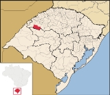
| State: | Rio Grande do Sul Rio Grande do Sul Rio Grande do Sul is the southernmost state in Brazil, and the state with the fifth highest Human Development Index in the country. In this state is located the southernmost city in the country, Chuí, on the border with Uruguay. In the region of Bento Gonçalves and Caxias do Sul, the largest wine... |
| Meso-region: | Northwestern Rio Grande do Sul (Noroeste Rio-Grandense) |
| Micro-Region: | Santo Ângelo Santo Ângelo (micro-region) The Santo Ângelo micro-region is a micro-region in the western part of the state of Rio Grande do Sul, Brazil... |
| Founded: | October 12, 1965 |
| Postal code: | 97850-xxx |
| Name of inhabitants: | Bossoroquense |
| Website: | www.bossoroca.rs.gov.br |
| Politics | |
| Mayor Mayor In many countries, a Mayor is the highest ranking officer in the municipal government of a town or a large urban city.... : |
|
Bossoroca is a municipality
Municipality
A municipality is essentially an urban administrative division having corporate status and usually powers of self-government. It can also be used to mean the governing body of a municipality. A municipality is a general-purpose administrative subdivision, as opposed to a special-purpose district...
of the [western part of the state of Rio Grande do Sul
Rio Grande do Sul
Rio Grande do Sul is the southernmost state in Brazil, and the state with the fifth highest Human Development Index in the country. In this state is located the southernmost city in the country, Chuí, on the border with Uruguay. In the region of Bento Gonçalves and Caxias do Sul, the largest wine...
, Brazil
Brazil
Brazil , officially the Federative Republic of Brazil , is the largest country in South America. It is the world's fifth largest country, both by geographical area and by population with over 192 million people...
. The origin of the name comes from the Tupi words iby meaning earth
Earth
Earth is the third planet from the Sun, and the densest and fifth-largest of the eight planets in the Solar System. It is also the largest of the Solar System's four terrestrial planets...
and soroc which combines to mean erosion
Erosion
Erosion is when materials are removed from the surface and changed into something else. It only works by hydraulic actions and transport of solids in the natural environment, and leads to the deposition of these materials elsewhere...
. It is located 524 km west of the state capital of Porto Alegre
Porto Alegre
Porto Alegre is the tenth most populous municipality in Brazil, with 1,409,939 inhabitants, and the centre of Brazil's fourth largest metropolitan area . It is also the capital city of the southernmost Brazilian state of Rio Grande do Sul. The city is the southernmost capital city of a Brazilian...
, northeast of Alegrete
Alegrete
Alegrete is a town and a municipality in Rio Grande do Sul located in southern Brazil. Its medium altitude is 102 m. Its estimated population in 2008 was 78,984 inhabitants and the total area is 7,803.967 km² . Its inhabitants are called Alegretenses.Alegrete was settled in 1816 and became a...
.
Bounding municipalities
- São Luiz GonzagaSão Luiz GonzagaSão Luiz Gonzaga is a municipality of the state of Rio Grande do Sul, Brazil. It is located 503 km west of the state capital of Porto Alegre, northeast of Alegrete....
- São Miguel das MissõesSão Miguel das MissõesSão Miguel das Missões is a Unesco World Heritage site located in the small town of São Miguel das Missões in the northwestern region of Rio Grande do Sul, a state in southern Brazil. It is also known as São Miguel Arcanjo and by its Spanish language name San Miguel...
- Capão do CipóCapão do CipóCapão do Cipó is a municipality of the western part of the state of Rio Grande do Sul, Brazil. and its population was 2,623 in 2003. It is located 627 km west of the state capital of Porto Alegre, northeast of Alegrete....
- Santiago
- ItacurubiItacurubiItacurubi is a municipality of the western part of the state of Rio Grande do Sul, Brazil. Its area is 1,120.8 km² and its population was 3,571 in 2003. Its elevation is at 169 m. The origin of the name comes from the Tupi language...
- Santo Antônio das MissõesSanto Antônio das MissõesSanto Antônio das Missões is a town in the western part of the state of Rio Grande do Sul, Brazil. Its coordinates are 6.867/6° 52' 8" S and the longitude is 42.35933/42° 21' 36" W. It has 2,060 inhabitants and the area is 32.596 km². Its density is 61.48/km²...
History
The area was first inhabited by the Guarani tribes.In 1801, the adventurer Borges do Canto visited the area and integrated the counties of Rio Pardo
Rio Pardo
For the Brazilian tribe, see Rio Pardo Rio Pardo is a municipality in the state of Rio Grande do Sul in Brazil. Its coordinates are . The population in 2004 was 37,395, the area is 2187.5 km² The elevation is 41 m....
. The mesopotamia between the rivers Inhacapetum, Icamaquã, Piratini
Piratini
Piratini is a city in the Brazilian state of Rio Grande do Sul with a population of some 19,000. It is the former capital of the short-lived Riograndense Republic which was proclaimed on September 11, 1836....
and the Uruguay.
In 1818, the provinces became independent in 1816. The fields of Bossoroca became a part of the parish of São Borja. In 1934, the parish transformed into a town abd Bossoroca into the fourth district of the same name.
Between 1800 and 1830, the concession of the fields, were one of the pioneers of the district, José Fabrício da Silva. This name generalizes and passes and identifies the district.
With an administrative evolution of São Luiz Gonzaga, the Bossoroca area passed into a part. It was a settlement counted with new houses receive and impused with 30 hectares. Paulina Alves Pereira, the prefect for a local urban in 1938, created the third district, Igrejinha and altered for Bossoroca. Gradually had a town and constructed homes, streets and a square.
On March 4, 1967 in a publiuc session, occurred a creation of the municipality of Bossoroca. The first prefectural electionoccurred on November 1968 which consolicated the municipality of Bossoroca.
External links
- http://www.citybrazil.com.br/rs/bossoroca/
- Map and Aerial photos:
- Coordinates: 28°43′48"S 54°54′0"W
- Street maps: Street map from Mapquest, MapPoint or Google
- Satellite images and Aerial photos: Google