

São Luiz Gonzaga
Encyclopedia
| Map | |
|---|---|
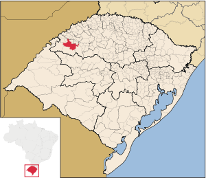 |
|
| Statistics | |
| State: | Rio Grande do Sul Rio Grande do Sul Rio Grande do Sul is the southernmost state in Brazil, and the state with the fifth highest Human Development Index in the country. In this state is located the southernmost city in the country, Chuí, on the border with Uruguay. In the region of Bento Gonçalves and Caxias do Sul, the largest wine... |
| Meso-region: | Northwestern Rio Grande do Sul (Noroeste Rio-Grandense) |
| Micro-Region: | Santo Ângelo Santo Ângelo (micro-region) The Santo Ângelo micro-region is a micro-region in the western part of the state of Rio Grande do Sul, Brazil... |
| Founded (community): | 1687 |
| Founded (municipality): | June 3, 1880 |
| Location Location (geography) The terms location and place in geography are used to identify a point or an area on the Earth's surface or elsewhere. The term 'location' generally implies a higher degree of can certainty than "place" which often has an ambiguous boundary relying more on human/social attributes of place identity... : |
28.4155/28° 24' 28" S lat. 54.9605/54° 57' 39" W long. |
| Postal code: | 97800-xxx |
São Luiz Gonzaga (Portuguese
Portuguese language
Portuguese is a Romance language that arose in the medieval Kingdom of Galicia, nowadays Galicia and Northern Portugal. The southern part of the Kingdom of Galicia became independent as the County of Portugal in 1095...
for St. Aloysius Gonzaga) is a municipality
Municipality
A municipality is essentially an urban administrative division having corporate status and usually powers of self-government. It can also be used to mean the governing body of a municipality. A municipality is a general-purpose administrative subdivision, as opposed to a special-purpose district...
of the state of Rio Grande do Sul
Rio Grande do Sul
Rio Grande do Sul is the southernmost state in Brazil, and the state with the fifth highest Human Development Index in the country. In this state is located the southernmost city in the country, Chuí, on the border with Uruguay. In the region of Bento Gonçalves and Caxias do Sul, the largest wine...
, Brazil
Brazil
Brazil , officially the Federative Republic of Brazil , is the largest country in South America. It is the world's fifth largest country, both by geographical area and by population with over 192 million people...
. It is located 503 km west of the state capital of Porto Alegre
Porto Alegre
Porto Alegre is the tenth most populous municipality in Brazil, with 1,409,939 inhabitants, and the centre of Brazil's fourth largest metropolitan area . It is also the capital city of the southernmost Brazilian state of Rio Grande do Sul. The city is the southernmost capital city of a Brazilian...
, northeast of Alegrete
Alegrete
Alegrete is a town and a municipality in Rio Grande do Sul located in southern Brazil. Its medium altitude is 102 m. Its estimated population in 2008 was 78,984 inhabitants and the total area is 7,803.967 km² . Its inhabitants are called Alegretenses.Alegrete was settled in 1816 and became a...
.
The municipality contains the Uruguay River
Uruguay River
The Uruguay River is a river in South America. It flows from north to south and makes boundary with Brazil, Argentina, and Uruguay, separating some of the Argentine provinces of the Mesopotamia from the other two countries...
, which forms a border
Border
Borders define geographic boundaries of political entities or legal jurisdictions, such as governments, sovereign states, federated states and other subnational entities. Some borders—such as a state's internal administrative borders, or inter-state borders within the Schengen Area—are open and...
with Argentina
Argentina
Argentina , officially the Argentine Republic , is the second largest country in South America by land area, after Brazil. It is constituted as a federation of 23 provinces and an autonomous city, Buenos Aires...
.
Bounding municipalities
- Roque GonzalesRoque GonzalesRoque Gonzales can refer to:*Roque Gonzales, Brazil, a town and municipality in Rio Grande do Sul, Brazil*Roque González de Santa Cruz, a Jesuit missionary who established missions in Brazil...
- RoladorRoladorRolador is a municipality of the state of Rio Grande do Sul, Brazil. It is located 524 km west of the state capital of Porto Alegre, northeast of Alegrete.-Bounding municipalities:*São Pedro do Butiá...
- CaibatéCaibatéCaibaté is a municipality of the state of Rio Grande do Sul, Brazil. The origin of the name comes from the Tupi language...
- São Miguel das MissõesSão Miguel das MissõesSão Miguel das Missões is a Unesco World Heritage site located in the small town of São Miguel das Missões in the northwestern region of Rio Grande do Sul, a state in southern Brazil. It is also known as São Miguel Arcanjo and by its Spanish language name San Miguel...
- BossorocaBossorocaBossoroca is a municipality of the [western part of the state of Rio Grande do Sul, Brazil. The origin of the name comes from the Tupi words iby meaning earth and soroc which combines to mean erosion...
- Santo Antônio das MissõesSanto Antônio das MissõesSanto Antônio das Missões is a town in the western part of the state of Rio Grande do Sul, Brazil. Its coordinates are 6.867/6° 52' 8" S and the longitude is 42.35933/42° 21' 36" W. It has 2,060 inhabitants and the area is 32.596 km². Its density is 61.48/km²...
- São Nicolau, Rio Grande do SulSão Nicolau, Rio Grande do SulSão Nicolau is a municipality of the state of Rio Grande do Sul, Brazil. Its area is 485.3 km² and its population was 6,146 in 2003...
- Dezesseis de NovembroDezesseis de NovembroDezesseis de Novembro is a municipality of the weswestern part of the state of Rio Grande do Sul, Brazil. It is west of the state capital of Porto Alegre, northeast of Alegrete....
External links
- http://www.citybrazil.com.br/rs/saoluizgonzaga/
- Map and Aerial photos:
- Coordinates: 28°24′28"S 54°57′39"W
- Street maps: Street map from Mapquest, MapPoint or Google
- Satellite images and Aerial photos: Google