

Bering Land Bridge National Preserve
Encyclopedia
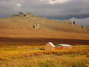
The Bering Land Bridge National Preserve is one of the most remote United States
United States
The United States of America is a federal constitutional republic comprising fifty states and a federal district...
national park areas, located on the Seward Peninsula
Seward Peninsula
The Seward Peninsula is a large peninsula on the western coast of the U.S. state of Alaska. It projects about into the Bering Sea between Norton Sound, the Bering Strait, the Chukchi Sea, and Kotzebue Sound, just below the Arctic Circle...
. The National Preserve
National preserve
National Preserve is a designation applied by the United States Congress to protected areas that have characteristics normally associated with U.S. National Parks but where certain activities not allowed in National Parks are permitted. These activities include public hunting, trapping, and oil...
protects a remnant of the Bering Land Bridge
Bering land bridge
The Bering land bridge was a land bridge roughly 1,000 miles wide at its greatest extent, which joined present-day Alaska and eastern Siberia at various times during the Pleistocene ice ages. Like most of Siberia and all of Manchuria, Beringia was not glaciated because snowfall was extremely light...
that connected Asia
Asia
Asia is the world's largest and most populous continent, located primarily in the eastern and northern hemispheres. It covers 8.7% of the Earth's total surface area and with approximately 3.879 billion people, it hosts 60% of the world's current human population...
with North America
North America
North America is a continent wholly within the Northern Hemisphere and almost wholly within the Western Hemisphere. It is also considered a northern subcontinent of the Americas...
more than 13,000 years ago during the Pleistocene
Pleistocene
The Pleistocene is the epoch from 2,588,000 to 11,700 years BP that spans the world's recent period of repeated glaciations. The name pleistocene is derived from the Greek and ....
ice age
Ice age
An ice age or, more precisely, glacial age, is a generic geological period of long-term reduction in the temperature of the Earth's surface and atmosphere, resulting in the presence or expansion of continental ice sheets, polar ice sheets and alpine glaciers...
. The majority of this land bridge, once thousands of miles wide, now lies beneath the waters of the Chukchi
Chukchi Sea
Chukchi Sea is a marginal sea of the Arctic Ocean. It is bounded on the west by the De Long Strait, off Wrangel Island, and in the east by Point Barrow, Alaska, beyond which lies the Beaufort Sea. The Bering Strait forms its southernmost limit and connects it to the Bering Sea and the Pacific...
and Bering Sea
Bering Sea
The Bering Sea is a marginal sea of the Pacific Ocean. It comprises a deep water basin, which then rises through a narrow slope into the shallower water above the continental shelves....
s.
During the glacial epoch this was part of a migration route for people, animals, and plants whenever ocean levels fell enough to expose the land bridge. Archeologists agree that it was across this Bering Land Bridge, also called Beringia, that humans first migrated from Asia to populate the Americas (see Models of migration to the New World
Models of migration to the New World
There have been several models for the human settlement of the Americas proposed by various academic communities. The question of how, when and why humans first entered the Americas is of intense interest to archaeologists and anthropologists, and has been a subject of heated debate for centuries...
).
The preserve was originally established on December 1, 1978, as Bering Land Bridge National Monument. On December 2, 1980, the designation was changed to a National Preserve. The Preserve's western boundary lies 42 miles from the Bering Strait and the fishing boundary between the United States and Russia. There are no roads into the preserve. Access to the preserve is by bush plane
Bush plane
A bush airplane is a general aviation aircraft serving remote, undeveloped areas of a country, usually the African bush, Alaskan and Canadian tundra or the Australian Outback...
s or boat
Boat
A boat is a watercraft of any size designed to float or plane, to provide passage across water. Usually this water will be inland or in protected coastal areas. However, boats such as the whaleboat were designed to be operated from a ship in an offshore environment. In naval terms, a boat is a...
s during summer
Summer
Summer is the warmest of the four temperate seasons, between spring and autumn. At the summer solstice, the days are longest and the nights are shortest, with day-length decreasing as the season progresses after the solstice...
months and by ski planes, snowmobiles or dog sled
Dog sled
A dog sled is a sled pulled by one or more sled dogs used to travel over ice and through snow. Numerous types of sleds are used, depending on their function. They can be used for dog sled racing.-History:...
s during the winter
Winter
Winter is the coldest season of the year in temperate climates, between autumn and spring. At the winter solstice, the days are shortest and the nights are longest, with days lengthening as the season progresses after the solstice.-Meteorology:...
.
Bering Land Bridge National Preserve contains several sites of geological and prehistorical significance. Serpentine Hot Springs is the preserve's most visited location, with the surrounding area used for subsistence and holistic activities by Native Alaskans since time immemorial. These activities continue today with locals from the surrounding area coming to enjoy the hot springs and scenery. Less visited but just as significant locations in the preserve include the Trail Creek Caves
Trail Creek Caves
The Trail Creek Caves are a group of twelve caves found within the Bering Land Bridge National Preserve on the Seward Peninsula of the U.S. state of Alaska. This is a significant archeological site due to the discovery of several artifacts of ancient hunters. These included stone tools and bone...
, Devil Mountain Lakes
Devil Mountain Lakes
Devil Mountain Lakes is a maar in the western part of Alaska. The lake is considered being the largest maar in the world .-Geography:...
, and the Lost Jim Lava Flow
Lost Jim Lava Flow
The Lost Jim Lava Flow, located in the heart of the Seward Peninsula, is a Holocene lava flow in the Bering Land Bridge National Preserve. The name originates from a member of a USGS research team who became separated from the rest of the group while mapping the lava flow in 1947. The Lost Jim...
. There has been debate in recent years over allowing road access to the preserve, however this been highly contested by some individuals.