

Devil Mountain Lakes
Encyclopedia
Maar
A maar is a broad, low-relief volcanic crater that is caused by a phreatomagmatic eruption, an explosion caused by groundwater coming into contact with hot lava or magma. A maar characteristically fills with water to form a relatively shallow crater lake. The name comes from the local Moselle...
(a form of crater lake
Crater lake
A crater lake is a lake that forms in a volcanic crater or caldera, such as a maar; less commonly and with lower association to the term a lake may form in an impact crater caused by a meteorite. Sometimes lakes which form inside calderas are called caldera lakes, but often this distinction is not...
) in the western part of Alaska
Alaska
Alaska is the largest state in the United States by area. It is situated in the northwest extremity of the North American continent, with Canada to the east, the Arctic Ocean to the north, and the Pacific Ocean to the west and south, with Russia further west across the Bering Strait...
. The lake is considered being the largest maar in the world .
Geography
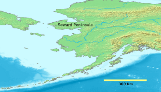
Devil Mountain Lakes are located about 100 km (62.1 mi) southwest of KotzebueKotzebue, Alaska
As of the census of 2000, there were 3,082 people, 889 households, and 656 families residing in the city. The population density was 114.1 people per square mile . There were 1,007 housing units at an average density of 37.3 per square mile...
on the northern part of the Seward Peninsula
Seward Peninsula
The Seward Peninsula is a large peninsula on the western coast of the U.S. state of Alaska. It projects about into the Bering Sea between Norton Sound, the Bering Strait, the Chukchi Sea, and Kotzebue Sound, just below the Arctic Circle...
. The coordinates are 66°23′41"N 164°29′18"W.
The crater lake has a diameter of about 8 kilometres (5 mi) and is part of the Bering Land Bridge National Preserve
Bering Land Bridge National Preserve
The Bering Land Bridge National Preserve is one of the most remote United States national park areas, located on the Seward Peninsula. The National Preserve protects a remnant of the Bering Land Bridge that connected Asia with North America more than 13,000 years ago during the Pleistocene ice age...
. Devil Mountain Lakes are rather unusual consisting of a double crater divided into North Devil Mountain lake having a diameter of about 51 km (31.7 mi) and South Devil Mountain lake having a diameter of about 34 km (21.1 mi) .
There are several maars the Killeak Lakes (North Killeak maar and South Killeak maar) and White Fish Lake (Whitefish Maar) close by and the area is sometimes also called Espenberg Maars .
History
The lake was probably shaped during volcanic eruptions about 21000 years ago during the Pleistocene Ice AgePleistocene
The Pleistocene is the epoch from 2,588,000 to 11,700 years BP that spans the world's recent period of repeated glaciations. The name pleistocene is derived from the Greek and ....
as lava
Lava
Lava refers both to molten rock expelled by a volcano during an eruption and the resulting rock after solidification and cooling. This molten rock is formed in the interior of some planets, including Earth, and some of their satellites. When first erupted from a volcanic vent, lava is a liquid at...
flows came through the permafrost
Permafrost
In geology, permafrost, cryotic soil or permafrost soil is soil at or below the freezing point of water for two or more years. Ice is not always present, as may be in the case of nonporous bedrock, but it frequently occurs and it may be in amounts exceeding the potential hydraulic saturation of...
creating violent underground explosions .
On December 1, 1978 the nature reserve was established as "Bering Land Bridge National Monument" changing the name on December 2, 1980 to "Bering Land Bridge National Preserve".