
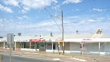
Athol Park, South Australia
Encyclopedia
Suburbs and localities (Australia)
Suburbs and localities are the names of geographic subdivisions in Australia, mainly for address purposes. The name locality is used in rural areas, while the equivalent in urban areas are suburbs. Sometimes locality is used to refer to both localities and suburbs, and they are also called address...
of Adelaide
Adelaide
Adelaide is the capital city of South Australia and the fifth-largest city in Australia. Adelaide has an estimated population of more than 1.2 million...
, South Australia
South Australia
South Australia is a state of Australia in the southern central part of the country. It covers some of the most arid parts of the continent; with a total land area of , it is the fourth largest of Australia's six states and two territories.South Australia shares borders with all of the mainland...
. It is located in the City of Charles Sturt
City of Charles Sturt
The City of Charles Sturt is a Local Government Area in the western suburbs of Adelaide, South Australia, stretching to the coast.It came into being on 1 January 1997 as a result of the amalgamation of the City of Hindmarsh Woodville and the City of Henley and Grange...
.
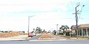
Geography
The suburb lies at the western end of Grand Junction RoadGrand Junction Road, Adelaide
Grand Junction Road is the longest east-west thoroughfare in the Adelaide metropolitan area, and is located approximately 9 kilometres north of the city centre. Travelling from the Port Adelaide region, it is mostly a double lane sealed road running 21 kilometres to the base of the Adelaide Hills...
, which also forms its northern boundary. It is bordered to the east by Hanson Road, to the west by Glenroy Street, to the east by Hanson Rd, with Hamilton Road forming the bulk of its southern boundary.
The southern portion of Athol Park is residential with a light industrial
Light industry
Light industry is usually less capital intensive than heavy industry, and is more consumer-oriented than business-oriented...
area in the north.
The suburb is home to a large number of Housing Trust
South Australian Housing Trust
The South Australian Housing Trust was a statutory authority established by the of the Government of South Australia responsible for providing low-cost rental housing to working people and their families.-History:...
homes. In the 1990s, plans were made for the Westwood Urban Renewal project, of which Ferryden Park
Ferryden Park, South Australia
Ferryden Park is a north-western suburb of Adelaide 9km from the central business district, in the state of South Australia, Australia. Situated in the City of Port Adelaide Enfield local government area, it is adjacent to Kilkenny, Angle Park, Woodville Gardens, Croydon Park, and Regency Park...
, Angle Park
Angle Park, South Australia
Angle Park is a north-western suburb of Adelaide 10 km from the CBD, in the state of South Australia, Australia and falls under the City of Port Adelaide Enfield. It is adjacent to Wingfield, Mansfield Park, Ferryden Park, and Regency Park. The post code for Angle Park is 5010...
, Woodville Gardens
Woodville Gardens, South Australia
Woodville Gardens is a north-western suburb of Adelaide 10km from the CBD, in the state of South Australia, Australia and falls under the City of Port Adelaide Enfield. It is adjacent to Woodville North, Mansfield Park, Ferryden Park, and Kilkenny. The post code for Woodville Gardens is 5012...
, and Mansfield Park
Mansfield Park, South Australia
Mansfield Park is a north-western suburb of Adelaide 10 km from the CBD, in the state of South Australia, Australia and falls under the City of Port Adelaide Enfield. It is adjacent to Wingfield, Angle Park, Woodville Gardens, and Athol Park. The postcode for Mansfield Park is 5012. It is bounded...
were also a part. This involved replacing the Housing Trust homes with either private housing or a new townhouse-style housing trust homes.
Demographics
The 2006 Census by the Australian Bureau of StatisticsAustralian Bureau of Statistics
The Australian Bureau of Statistics is Australia's national statistical agency. It was created as the Commonwealth Bureau of Census and Statistics on 8 December 1905, when the Census and Statistics Act 1905 was given Royal assent. It had its beginnings in section 51 of the Constitution of Australia...
counted 1,307 persons in Athol Park on census night. Of these, 50.3% were male and 49.7% were female.
The majority of residents (47.9%) are of Australian birth, with other common census responses being Vietnam
Vietnam
Vietnam – sometimes spelled Viet Nam , officially the Socialist Republic of Vietnam – is the easternmost country on the Indochina Peninsula in Southeast Asia. It is bordered by China to the north, Laos to the northwest, Cambodia to the southwest, and the South China Sea –...
(15.1%) and Poland
Poland
Poland , officially the Republic of Poland , is a country in Central Europe bordered by Germany to the west; the Czech Republic and Slovakia to the south; Ukraine, Belarus and Lithuania to the east; and the Baltic Sea and Kaliningrad Oblast, a Russian exclave, to the north...
(3.4%).
The age distribution of Athol Park residents is similar to that of the greater Australian population. 63.8% of residents were over 25 years in 2006, compared to the Australian average of 66.5%; and 36.2% were younger than 25 years, compared to the Australian average of 33.5%.
Local government
Athol Park is part of Woodville Ward in the City of Charles SturtCity of Charles Sturt
The City of Charles Sturt is a Local Government Area in the western suburbs of Adelaide, South Australia, stretching to the coast.It came into being on 1 January 1997 as a result of the amalgamation of the City of Hindmarsh Woodville and the City of Henley and Grange...
local government area
Local government in Australia
Local government in Australia is the third tier of government, administered by the states and territories which in turn are beneath the Commonwealth or federal tier. Unlike New Zealand, the US or the UK, there is only one level of local government in all states, with no distinction such as...
, being represented in that council by Oanh Nguyen and Robert Grant.
State and federal
Athol Park lies in the state electoral district of CheltenhamElectoral district of Cheltenham
Cheltenham is an electoral district of the House of Assembly in the Australian state of South Australia. Named after the suburb of the same name, it is a 17.3km² urban rectangular-shaped electorate in Adelaide's north-west, taking in the suburbs of Alberton, Albert Park, Athol Park, Cheltenham,...
and the federal electoral division of Port Adelaide
Division of Port Adelaide
The Division of Port Adelaide is an Australian Electoral Division in the state of South Australia. It is located in the northern suburbs of Adelaide, covering the area around the Barker Inlet, part of the Gulf St Vincent. It stretches from St Kilda in the north down to Grange Road, and is roughly...
. The suburb is represented in the South Australian House of Assembly
South Australian House of Assembly
The House of Assembly, or lower house, is one of the two chambers of the Parliament of South Australia. The other is the Legislative Council. It sits in Parliament House in the state capital, Adelaide.- Overview :...
by Jay Weatherill
Jay Weatherill
Jay Wilson Weatherill is an Australian politician and current Premier of South Australia. He has represented the electoral district of Cheltenham in the South Australian House of Assembly as a member of the Australian Labor Party since the 2002 election.-Early life:Born in the western suburbs of...
and federally
Australian House of Representatives
The House of Representatives is one of the two houses of the Parliament of Australia; it is the lower house; the upper house is the Senate. Members of Parliament serve for terms of approximately three years....
by Mark Butler
Mark Butler
Mark Christopher Butler has been the Australian Labor Party representative for the electoral division of Port Adelaide in north-western Adelaide, South Australia since the 2007 federal election, succeeding prior Labor MP Rod Sawford....
.
Parks
Fawks Reserve is located on Hanson Road. There is also greenspace between Ely and Gateshead streets.Roads
Athol Park is serviced by South RoadSouth Road, Adelaide
South Road is a major north–south conduit in Adelaide, South Australia. Also known as Main South Road, it is Adelaide's most important arterial road.- Route :...
, connecting the suburb to China, and West Street, which forms its eastern boundary.