

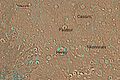
Arabia quadrangle
Encyclopedia
Quadrangle (geography)
In geology or geography, the word "quadrangle" usually refers to a United States Geological Survey 7.5-minute quadrangle map, which are usually named after a local physiographic feature. The shorthand "quad" is also used, especially with the name of the map; for example, "the Ranger Creek, Texas...
is one of a series of 30 quadrangle maps of Mars used by the United States Geological Survey
United States Geological Survey
The United States Geological Survey is a scientific agency of the United States government. The scientists of the USGS study the landscape of the United States, its natural resources, and the natural hazards that threaten it. The organization has four major science disciplines, concerning biology,...
(USGS) Astrogeology Research Program
Astrogeology Research Program
The USGS Astrogeology Science Center has a rich history of participation in space exploration efforts and planetary mapping, starting in 1963 when the Flagstaff Science Center was established by Gene Shoemaker to provide lunar geologic mapping and assist in training astronauts destined for the...
. The Arabia quadrangle is also referred to as MC-12 (Mars Chart-12).
The quadrangle contains part of the classic area of Mars
Mars
Mars is the fourth planet from the Sun in the Solar System. The planet is named after the Roman god of war, Mars. It is often described as the "Red Planet", as the iron oxide prevalent on its surface gives it a reddish appearance...
known as Arabia. It lies on the boundary between the young northern plains and the old southern highlands. The quadrangle covers the area from 315° to 360° west longitude and 0° to 30° north latitude.
Description
The surface of the Arabia quadrangle appears to be very old because it has a high density of craters, but it is not near as high in elevation as typical old surfaces. On Mars the oldest areas contain the most craters; the oldest period is called NoachianNoachian
The Noachian is a geologic system and early time period on the planet Mars characterized by high rates of meteorite and asteroid impacts and the presence of abundant surface water...
after the quadrangle Noachis. The Arabia area contains many buttes and ridges. Some believe that during certain climate changes an ice-dust layer was deposited; later, parts were eroded to form buttes.
Some outflow channels are found in Arabia, namely Naktong Vallis, Locras Valles, Indus Vallis, Scamander Vallis, and Cusus Valles.
Layers
Many places in Arabia are shaped into layers. The layers can be a few meters thick or tens of meters thick. Recent research on these layers by scientists at California Institute of Technology (Caltech) suggest that ancient climate change on Mars caused by regular variation in the planet's tilt, or obliquity may have caused the patterns in the layers. On Earth, similar changes (astronomical forcing) of climate results in ice-age cycles.A recent study of layers in craters in western Arabia revealed much about the history of the layers. Although the craters in this study are just outside the boundary for the Arabia quadrangle the findings would probably apply to the Arabia quadrangle as well. The thickness of each layer may average less than 4 meters in one crater, but 20 meters in another. The pattern of layers measured in Becquerel
Becquerel
The becquerel is the SI-derived unit of radioactivity. One Bq is defined as the activity of a quantity of radioactive material in which one nucleus decays per second. The Bq unit is therefore equivalent to an inverse second, s−1...
crater, suggests that each layer was formed over a period of about 100,000 years. Moreover, every 10 layers were bundled together into larger units. The 10-layer pattern is repeated at least 10 times. So every 10-layer pattern took one-million years to form.
The tilt of the Earth's axis changes by only a little more than 2 degrees; it is stabilized by the relatively large mass of our moon. In contrast Mars's tilt varies by tens of degrees. When the tilt (or obliquity) is low, the poles are the coldest places on the planet, while the equator is the warmest—as on Earth. This causes gases in the atmosphere, like water and carbon dioxide, to migrate pole ward, where they freeze. When the obliquity is higher, the poles receive more sunlight, causing those materials to migrate away. When carbon dioxide
Carbon dioxide
Carbon dioxide is a naturally occurring chemical compound composed of two oxygen atoms covalently bonded to a single carbon atom...
moves from the poles, the atmospheric pressure increases, maybe causing a difference in the ability of winds to transport and deposit sand. Also, with more water in the atmosphere sand grains may stick and cement together to form layers. This study of the thickness of layers was done using stereo topographic maps obtained by processing data from the high-resolution camera onboard NASA's Mars Reconnaissance Orbiter
Mars Reconnaissance Orbiter
Mars Reconnaissance Orbiter is a NASA multipurpose spacecraft designed to conduct reconnaissance and Exploration of Mars from orbit...
.
Recent research leads scientists to believe that some of the craters in Arabia may have held huge lakes. Cassini Crater and Tikonravov Crater probably once were full of water since their rims seem to have been breached by water. Both inflow and outflow channels have been observed on their rims. Each of these lakes would have contained more water than Earth's Lake Baikal, our largest freshwater lake by volume. The watersheds for lakes in Arabia seem to be too small to gather enough water by precipitation alone; therefore it is thought that much of their water came from groundwater.
Craters
Impact craterImpact crater
In the broadest sense, the term impact crater can be applied to any depression, natural or manmade, resulting from the high velocity impact of a projectile with a larger body...
s generally have a rim with ejecta around them, in contrast volcanic craters usually do not have a rim or ejecta deposits. As craters get larger (greater than 10 km in diameter) they usually have a central peak. The peak is caused by a rebound of the crater floor following the impact. Sometimes craters display layers. Since the collision that produces a crater is like a powerful explosion, rocks from deep underground are tossed unto the surface. Hence, craters can show us what lies deep under the surface.
Some craters in Arabia are classified as pedestal crater
Pedestal crater
In planetary geology,a pedestal crater is a crater with its ejecta sitting above the surrounding terrain and thereby forming a raised platform. They form when an impact crater ejects material which forms an erosion-resistant layer, thus causing the immediate area to erode more slowly than the rest...
s. A pedestal crater is a crater
Impact crater
In the broadest sense, the term impact crater can be applied to any depression, natural or manmade, resulting from the high velocity impact of a projectile with a larger body...
with its ejecta sitting above the surrounding terrain and thereby forming a raised platform. They form when an impact crater ejects material which forms an erosion resistant layer, thus protecting the immediate area from erosion. As a result of this hard covering, the crater and its ejecta become elevated, as erosion removes the softer material beyond the ejecta. Some pedestals have been accurately measured to be hundreds of meters above the surrounding area. This means that hundreds of meters of material were eroded away. Pedestal craters were first observed during the Mariner
Mariner program
The Mariner program was a program conducted by the American space agency NASA that launched a series of robotic interplanetary probes designed to investigate Mars, Venus and Mercury from 1963 to 1973...
missions.
Possible methane
One study with the Planetary Fourier Spectrometer in the Mars ExpressMars Express
Mars Express is a space exploration mission being conducted by the European Space Agency . The Mars Express mission is exploring the planet Mars, and is the first planetary mission attempted by the agency. "Express" originally referred to the speed and efficiency with which the spacecraft was...
spacecraft found possible methane
Methane
Methane is a chemical compound with the chemical formula . It is the simplest alkane, the principal component of natural gas, and probably the most abundant organic compound on earth. The relative abundance of methane makes it an attractive fuel...
in three areas of Mars, one of which was in Arabia. One possible source of methane is from the metabolism of living bacteria
Bacteria
Bacteria are a large domain of prokaryotic microorganisms. Typically a few micrometres in length, bacteria have a wide range of shapes, ranging from spheres to rods and spirals...
. However, a recent study indicates that to match the observations of methane, there must be something that quickly destroys the gas, otherwise it would be spread all through the atmosphere instead of being concentrated in just a few locations. There may be something in the soil that oxidizes the gas before it has a chance to spread. If this is so, that same chemical would destroy organic compounds, thus life would be very difficult on Mars.
Deformation bands
The Mars Reconnaissance Orbiter showed deformation bands in Capen Crater, located in the Arabia quadrangle. Deformation bands are small faults with very small displacements. They often proceed large faults. They develop in porous rocks, like sandstone. They can restrict and/or change the flow of fluids like water and oil. They are common in the Colorado PlateauColorado Plateau
The Colorado Plateau, also called the Colorado Plateau Province, is a physiographic region of the Intermontane Plateaus, roughly centered on the Four Corners region of the southwestern United States. The province covers an area of 337,000 km2 within western Colorado, northwestern New Mexico,...
. Good examples form in the Entrada Sandstone
Entrada Sandstone
The Entrada Sandstone is a formation in the San Rafael Group that is spread across the U.S. states of Wyoming, Colorado, northwest New Mexico, northeast Arizona and southeast Utah...
in the San Rafael Swell
San Rafael Swell
The San Rafael Swell is a large geologic feature located in south-central Utah, USA about 30 miles west of Green River, Utah. The San Rafael Swell, approximately by , consists of a giant dome-shaped anticline of sandstone, shale, and limestone that was pushed up during the Paleocene Laramide...
in Utah
Utah
Utah is a state in the Western United States. It was the 45th state to join the Union, on January 4, 1896. Approximately 80% of Utah's 2,763,885 people live along the Wasatch Front, centering on Salt Lake City. This leaves vast expanses of the state nearly uninhabited, making the population the...
. The bands represent failure by localized frictional sliding. The bands on Mars are a few meters wide and up to a few kilometers long. They are caused by the compression or stretching of underground layers. Erosion of overlying layers make them visible at the surface. Capen Crater was unnamed before the discovery of deformation bands. It was named for Charles Capen, who studied Mars at JPL's Table Mountain Observatory in California and at Lowell Observatory
Lowell Observatory
Lowell Observatory is an astronomical observatory in Flagstaff, Arizona. Lowell Observatory was established in 1894, placing it among the oldest observatories in the United States, and was designated a National Historic Landmark in 1965....
in Arizona
Arizona
Arizona ; is a state located in the southwestern region of the United States. It is also part of the western United States and the mountain west. The capital and largest city is Phoenix...
.
Geological history
Recent studies, reported in the journal Icarus, have suggested that the area underwent several phases in its formation:--A large basin, maybe from an impact, was produced early in Martian history. It was so early that Mars still had a magnetic field generated by movements in a liquid core. Present day Arabia possesses a remnant magnetism from that ancient era.
--Sediments flowed into the basin. Water entered the basin.
--Because Tharsis, on the other side of Mars, became so massive, the area around Arabia was pushed out. As it bulged upward, there was increased erosion which exposed old layers. When portions of a planet that can be subject to erosion rise, there is greatly increased erosion; Earth's Grand Canyon
Grand Canyon
The Grand Canyon is a steep-sided canyon carved by the Colorado River in the United States in the state of Arizona. It is largely contained within the Grand Canyon National Park, the 15th national park in the United States...
became very deep because it was eroded into a high plateau.
--Over the following 4 billion years, the area was modified by various geological processes. Central peaks and ejecta shapes indicate that parts of Arabia are still water enriched.
See also
- Dark slope streaks, a feature of some craters
- Climate of MarsClimate of MarsThe climate of Mars has been an issue of scientific curiosity for centuries, not least because Mars is the only terrestrial planet whose surface can be directly observed in detail from the Earth....
- Water on MarsWater on MarsWater on Mars is a psychedelic rock and electronic music group from Quebec City, Québec, Canada. The music trio is led by Philippe Navarro, guitarist, vocalist, arranger, producer, principal lyricist, and music composer....
- Geology of MarsGeology of MarsThe geology of Mars is the scientific study of the surface, crust, and interior of the planet Mars. It emphasizes the composition, structure, history, and physical processes that shape the planet. It is fully analogous to the field of terrestrial geology. In planetary science, the term geology is...
- VallisVallisVallis is the Latin word for valley. It is used in planetary geology for the naming of landform features on other planets....
- Pedestal craters