
1938 Atlantic hurricane season
Encyclopedia
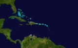
The 1938 Atlantic hurricane season officially began on June 16, 1938, and lasted until October 31, 1938. These dates conventionally delimit the period of each year when most tropical cyclone
s form in the Atlantic basin
.
in early August and moved generally westward. Falling just short of hurricane strength, Storm One brushed Puerto Rico
and made landfall in the Dominican Republic
, dissipating over the mountains of Hispaniola
. Some of the smaller islands sustained damage but the only other effects were squally weather.
formed southeast of Barbados
on August 9 and moved west-northwest at a high rate of speed, strengthening into a hurricane as it passed south of Jamaica
. Becoming a Category 2 storm while southeast of Cozumel
, Storm Two nicked the northern tip of the Yucatan peninsula
, but caused little effect, perhaps because of the storm's small size. The hurricane curved more to the northwest as it entered the Gulf of Mexico
, weakening shortly before it reached the coast. Storm Two made landfall near Cameron, Louisiana
as a minimal hurricane, causing moderate flooding of lowlands and $250,000 in damage (1938 dollars, $3.4 million in 2006 dollars). The storm dissipated over east Texas
.
and dissipated inland.
This storm caused tremendous flooding on the Yucatan peninsula and killed nine people.
that caused great destruction across the northeastern United States.
The storm formed from an African wave in early September and tracked westward across the Atlantic. At first, the storm was slow to strengthen, remaining a tropical storm for five days during its westward traverse. It finally became a hurricane as it crossed 45W several hundred miles east of the Leeward Islands
. The storm continued to steadily strengthen and began to take a more northwesterly course. The Long Island Express, as it was nicknamed, peaked as a Category 5 hurricane on the Saffir Simpson Hurricane Scale while just east of the Bahamas with winds reaching a sustained 160 mi/h. Following its peak, on September 20, the storm turned due north and accelerated, reaching an unusually fast forward speed of 70 mph (110 km/h), one of the fastest-moving storms on record. It made landfall on September 21.
The hurricane struck central Long Island with sustained winds of 115 mi/h, devastating the island and causing severe damage to other New England states such as Connecticut
, Rhode Island
and Massachusetts
. Nearly 700 people died in the storm (682) and damages came to over $300 million, $4.5 billion in 2007 dollars.
on October 11 and almost immediately crossed into Belize
, heading north up the Yucatan peninsula and into the Gulf of Mexico, where it began to move erratically. In the central Gulf on October 13, it made a rather sudden turn to the east, toward Florida
. However, a couple of days later, Storm Five slowed down and began to turn back toward the west northwest, at which time it began to accelerate, weakening along the way. The system finally made landfall along the north Texas
coast near Freeport
with winds of only 40 mi/h. No significant impact was reported.
on the 17th of October, brushing by the island on its aforementioned southwesterly path, on which it remained for the two days. On October 19, it hooked back northeast across the northern Bahamas and dissipated the next afternoon.
coast and became extratropical soon after as it encountered a frontal trough.
on November 9 and dissipated in the Western Caribbean the following day. No one is reported to have died in the storm and damage to the Caribbean islands is unknown, but the Florida coast suffered $100,000 worth of beach erosion.
Tropical cyclone
A tropical cyclone is a storm system characterized by a large low-pressure center and numerous thunderstorms that produce strong winds and heavy rain. Tropical cyclones strengthen when water evaporated from the ocean is released as the saturated air rises, resulting in condensation of water vapor...
s form in the Atlantic basin
Atlantic Basin
The Atlantic Basin is the Atlantic Ocean.Atlantic Basin may also refer to:* Atlantic Basin Iron Works, an ironworks that operated in Brooklyn, New York, in the early to mid-20th century...
.
Tropical Storm One
The first storm of the season formed in the area of AntiguaAntigua
Antigua , also known as Waladli, is an island in the West Indies, in the Leeward Islands in the Caribbean region, the main island of the country of Antigua and Barbuda. Antigua means "ancient" in Spanish and was named by Christopher Columbus after an icon in Seville Cathedral, Santa Maria de la...
in early August and moved generally westward. Falling just short of hurricane strength, Storm One brushed Puerto Rico
Puerto Rico
Puerto Rico , officially the Commonwealth of Puerto Rico , is an unincorporated territory of the United States, located in the northeastern Caribbean, east of the Dominican Republic and west of both the United States Virgin Islands and the British Virgin Islands.Puerto Rico comprises an...
and made landfall in the Dominican Republic
Dominican Republic
The Dominican Republic is a nation on the island of La Hispaniola, part of the Greater Antilles archipelago in the Caribbean region. The western third of the island is occupied by the nation of Haiti, making Hispaniola one of two Caribbean islands that are shared by two countries...
, dissipating over the mountains of Hispaniola
Hispaniola
Hispaniola is a major island in the Caribbean, containing the two sovereign states of the Dominican Republic and Haiti. The island is located between the islands of Cuba to the west and Puerto Rico to the east, within the hurricane belt...
. Some of the smaller islands sustained damage but the only other effects were squally weather.
Hurricane Two
The first hurricane of the seasonAtlantic hurricane season
The Atlantic hurricane season is the period in a year when hurricanes usually form in the Atlantic Ocean. Tropical cyclones in the North Atlantic are called hurricanes, tropical storms, or tropical depressions. In addition, there have been several storms over the years that have not been fully...
formed southeast of Barbados
Barbados
Barbados is an island country in the Lesser Antilles. It is in length and as much as in width, amounting to . It is situated in the western area of the North Atlantic and 100 kilometres east of the Windward Islands and the Caribbean Sea; therein, it is about east of the islands of Saint...
on August 9 and moved west-northwest at a high rate of speed, strengthening into a hurricane as it passed south of Jamaica
Jamaica
Jamaica is an island nation of the Greater Antilles, in length, up to in width and 10,990 square kilometres in area. It is situated in the Caribbean Sea, about south of Cuba, and west of Hispaniola, the island harbouring the nation-states Haiti and the Dominican Republic...
. Becoming a Category 2 storm while southeast of Cozumel
Cozumel
Cozumel is an island in the Caribbean Sea off the eastern coast of Mexico's Yucatan Peninsula, opposite Playa del Carmen, and close to the Yucatan Channel. Cozumel is one of the ten municipalities of the state of Quintana Roo...
, Storm Two nicked the northern tip of the Yucatan peninsula
Yucatán Peninsula
The Yucatán Peninsula, in southeastern Mexico, separates the Caribbean Sea from the Gulf of Mexico, with the northern coastline on the Yucatán Channel...
, but caused little effect, perhaps because of the storm's small size. The hurricane curved more to the northwest as it entered the Gulf of Mexico
Gulf of Mexico
The Gulf of Mexico is a partially landlocked ocean basin largely surrounded by the North American continent and the island of Cuba. It is bounded on the northeast, north and northwest by the Gulf Coast of the United States, on the southwest and south by Mexico, and on the southeast by Cuba. In...
, weakening shortly before it reached the coast. Storm Two made landfall near Cameron, Louisiana
Cameron, Louisiana
Cameron is a census-designated place in and the parish seat of Cameron Parish, Louisiana, United States. The population was 1,965 at the 2000 census. It is part of the Lake Charles Metropolitan Statistical Area...
as a minimal hurricane, causing moderate flooding of lowlands and $250,000 in damage (1938 dollars, $3.4 million in 2006 dollars). The storm dissipated over east Texas
Texas
Texas is the second largest U.S. state by both area and population, and the largest state by area in the contiguous United States.The name, based on the Caddo word "Tejas" meaning "friends" or "allies", was applied by the Spanish to the Caddo themselves and to the region of their settlement in...
.
Hurricane Three
The third storm of the season was discovered as a strengthening tropical storm in the central Caribbean Sea on August 23. The storm became a hurricane shortly after discovery and maintained a steady northwest track, steadily strengthening. Storm Three became a Category 2 storm a day later and maintained that intensity until landfall on the Yucatan peninsula near present-day Tulum. The storm weakened inland to a Category 1 and it began to curve more to the west as it crossed the Gulf of Mexico. Storm Three made landfall as a tropical storm near Ciudad MaderoCiudad Madero
Madero, formally Ciudad Madero, is a city and its coextensive municipality in the state of Tamaulipas, Mexico. The city is located at 22.27°N, 97.83°W in the extreme southeastern part of the state, on the Gulf of Mexico, just north and east of Tampico but still on the banks of the Río Pánuco, and...
and dissipated inland.
This storm caused tremendous flooding on the Yucatan peninsula and killed nine people.
Hurricane Four
By far the most significant hurricane of the 1938 season, Hurricane Four, better known as the New England Hurricane, was a Cape Verde-type hurricaneCape Verde-type hurricane
A Cape Verde-type hurricane is an Atlantic hurricane that develops near the Cape Verde islands, off the west coast of Africa. The average hurricane season has about two Cape Verde-type hurricanes, which are usually the largest and most intense storms of the season because they often have plenty of...
that caused great destruction across the northeastern United States.
The storm formed from an African wave in early September and tracked westward across the Atlantic. At first, the storm was slow to strengthen, remaining a tropical storm for five days during its westward traverse. It finally became a hurricane as it crossed 45W several hundred miles east of the Leeward Islands
Leeward Islands
The Leeward Islands are a group of islands in the West Indies. They are the northern islands of the Lesser Antilles chain. As a group they start east of Puerto Rico and reach southward to Dominica. They are situated where the northeastern Caribbean Sea meets the western Atlantic Ocean...
. The storm continued to steadily strengthen and began to take a more northwesterly course. The Long Island Express, as it was nicknamed, peaked as a Category 5 hurricane on the Saffir Simpson Hurricane Scale while just east of the Bahamas with winds reaching a sustained 160 mi/h. Following its peak, on September 20, the storm turned due north and accelerated, reaching an unusually fast forward speed of 70 mph (110 km/h), one of the fastest-moving storms on record. It made landfall on September 21.
The hurricane struck central Long Island with sustained winds of 115 mi/h, devastating the island and causing severe damage to other New England states such as Connecticut
Connecticut
Connecticut is a state in the New England region of the northeastern United States. It is bordered by Rhode Island to the east, Massachusetts to the north, and the state of New York to the west and the south .Connecticut is named for the Connecticut River, the major U.S. river that approximately...
, Rhode Island
Rhode Island
The state of Rhode Island and Providence Plantations, more commonly referred to as Rhode Island , is a state in the New England region of the United States. It is the smallest U.S. state by area...
and Massachusetts
Massachusetts
The Commonwealth of Massachusetts is a state in the New England region of the northeastern United States of America. It is bordered by Rhode Island and Connecticut to the south, New York to the west, and Vermont and New Hampshire to the north; at its east lies the Atlantic Ocean. As of the 2010...
. Nearly 700 people died in the storm (682) and damages came to over $300 million, $4.5 billion in 2007 dollars.
Tropical Storm Five
This storm formed from a disturbance off the north coast of HondurasHonduras
Honduras is a republic in Central America. It was previously known as Spanish Honduras to differentiate it from British Honduras, which became the modern-day state of Belize...
on October 11 and almost immediately crossed into Belize
Belize
Belize is a constitutional monarchy and the northernmost country in Central America. Belize has a diverse society, comprising many cultures and languages. Even though Kriol and Spanish are spoken among the population, Belize is the only country in Central America where English is the official...
, heading north up the Yucatan peninsula and into the Gulf of Mexico, where it began to move erratically. In the central Gulf on October 13, it made a rather sudden turn to the east, toward Florida
Florida
Florida is a state in the southeastern United States, located on the nation's Atlantic and Gulf coasts. It is bordered to the west by the Gulf of Mexico, to the north by Alabama and Georgia and to the east by the Atlantic Ocean. With a population of 18,801,310 as measured by the 2010 census, it...
. However, a couple of days later, Storm Five slowed down and began to turn back toward the west northwest, at which time it began to accelerate, weakening along the way. The system finally made landfall along the north Texas
Texas
Texas is the second largest U.S. state by both area and population, and the largest state by area in the contiguous United States.The name, based on the Caddo word "Tejas" meaning "friends" or "allies", was applied by the Spanish to the Caddo themselves and to the region of their settlement in...
coast near Freeport
Freeport, Texas
Freeport is a city in Brazoria County, Texas within the Houston–Sugar Land–Baytown metropolitan area and is situated in Southeast Texas. As of the 2000 U.S...
with winds of only 40 mi/h. No significant impact was reported.
Tropical Storm Six
Tropical Storm Six was a weak storm that took a somewhat unusual southwesterly course. It formed near BermudaBermuda
Bermuda is a British overseas territory in the North Atlantic Ocean. Located off the east coast of the United States, its nearest landmass is Cape Hatteras, North Carolina, about to the west-northwest. It is about south of Halifax, Nova Scotia, Canada, and northeast of Miami, Florida...
on the 17th of October, brushing by the island on its aforementioned southwesterly path, on which it remained for the two days. On October 19, it hooked back northeast across the northern Bahamas and dissipated the next afternoon.
Tropical Storm Seven
Forming in the Gulf of Mexico on October 23, the seventh storm of the season took a swift northeasterly course. The winds never rose above 45 mi/h and the storm impacted a remote section of northwestern Florida the next day near modern day Keaton Beach. It moved back over water near the south GeorgiaGeorgia (U.S. state)
Georgia is a state located in the southeastern United States. It was established in 1732, the last of the original Thirteen Colonies. The state is named after King George II of Great Britain. Georgia was the fourth state to ratify the United States Constitution, on January 2, 1788...
coast and became extratropical soon after as it encountered a frontal trough.
Tropical Storm Eight
The final storm of the 1938 season formed off the coast of Hispaniola on November 6 and quickly moved onshore near Barahona. The storm continued northwest into the Bahamas, during which time it reached its peak intensity of 70 mi/h; near-hurricane force, before curving back to the southwest while crossing Andros Island. Now in a weakening trend, the storm crossed central CubaCuba
The Republic of Cuba is an island nation in the Caribbean. The nation of Cuba consists of the main island of Cuba, the Isla de la Juventud, and several archipelagos. Havana is the largest city in Cuba and the country's capital. Santiago de Cuba is the second largest city...
on November 9 and dissipated in the Western Caribbean the following day. No one is reported to have died in the storm and damage to the Caribbean islands is unknown, but the Florida coast suffered $100,000 worth of beach erosion.
See also
- List of tropical cyclones
- List of Atlantic hurricane seasons