

1919 Florida Keys Hurricane
Encyclopedia
The Florida Keys Hurricane or Atlantic Gulf Hurricane of 1919 was an intense Atlantic hurricane, killing 772 people as it moved through the Florida Keys
and Texas
. The second tropical cyclone
of the 1919 hurricane season, it moved in the proximity of the eastern Greater Antilles
and Bahamas before moving through the Florida Keys and central Gulf of Mexico
into southern Texas. It is one of the most intense hurricanes on record for Key West, Florida
and the first hurricane to cause significant damage to the city of Corpus Christi, Texas
. Damage from the storm totaled $22 million (1919 USD).
s depicted a tropical wave
near the Lesser Antilles
. The poorly developed system, lacking a low-level circulation, gradually became better defined and was classified as a tropical depression the following day near the island of Guadeloupe
. Around this time, the system had developed a closed low with a barometric pressure of 1010 mbar (hPa; 29.82 inHg). Although no gale-force winds were reported in the region, the system is thought to have attained tropical storm status early on September 3 while situated southeast of Puerto Rico
. Tracking northwest, the storm grazed the southwestern tip of the island the following day with winds of 50 mph (85 km/h). As a result of the interaction with land, the system weakened slightly before moving back into the Atlantic Ocean
near the Dominican Republic
.
By September 5, the system had slowed to 4 mph (6.4 km/h) and turned northward after remaining nearly parallel with the northern coastline of the Dominican Republic and Haiti
for two days. A northwest, and later westward, track resumed on September 7 as the storm intensified into a Category 1 hurricane on the modern-day Saffir–Simpson Hurricane Scale. By this time, the hurricane had moved over the eastern Bahamas; however, reports from the region only indicated winds of 40 mph (65 km/h). The storm quickly intensified while tracking through the Bahamas, attaining major hurricane status during the afternoon of September 8 near the southern tip of Andros Island. Just prior to moving over the Florida Strait, the hurricane was estimated to have attained Category 4 intensity on September 9. Gradual intensification took place over the following day before the storm attained its peak intensity on September 10 near the Florida Keys
.
Several ships in the vicinity of the storm recorded very low atmospheric pressures, with the lowest being 927 mbar (hPa; 27.37 inHg). This reading was the lowest during the storm's existence and presumed to be measured within the storm's eye
. Additionally, sustained winds within the eyewall were estimated to have reached 150 mph (240 km/h) as the storm moved neared Key West, Florida
. At the time, this storm became the second strongest landfalling United States hurricane on record, only the 1886 Indianola hurricane had a lower pressure at landfall. However, since then, four other storms have surpassed this hurricane, including the 1935 Labor Day hurricane which struck the Florida Keys 26 years later.
After entering the Gulf of Mexico
, the system began to weaken. By September 12, the storm had again slowed to 4 mph (6.4 km/h) as well as weakened to a Category 3 hurricane. Ships in the region reported pressures as low as 942 mbar (hPa; 27.82 inHg) near the storm's eye. The following day, the hurricane underwent a period of brief intensification, re-attaining Category 4 status and reaching its secondary peak intensity at the end of this phase. Early on September 13, maximum winds were estimated at 145 mph (230 km/h) and the lowest pressure was recorded at 931 mbar (hPa; 27.49 inHg).
 After maintaining Category 4 status for roughly 30 hours, the storm weakened once more to a Category 3 system as it approached the Texas
coastline on September 13. The hurricane made landfall between Corpus Christi
and Brownsville
with winds of 115 mph (185 km/h) late on September 14. Upon making landfall, a pressure of 950 mbar (hPa; 28.05 inHg) was recorded. Rapid weakening took place shortly thereafter, with the system weakening to a tropical depression roughly 24 hours after moving over land. By September 16, the system had degenerated into an open trough
with no indications of gale-force winds associated with it.
. At 4 p.m. on the 12th, storm warnings were in effect from Mobile, Alabama to Pensacola, Florida, with hurricane warnings in effect along the Mississippi and Louisiana coasts. On the evening of the 13th, northwest storm warnings were in effect for the entire Texas coast.
A tornado, spawned by the hurricane, struck Goulds, Florida
on September 10, moving inland from Biscayne Bay
. It caused US$25,000 (1919 dollars) in damage. Of the approximately 600-900 people officially reported killed in the storm, roughly 500 of them were aboard ten ships lost at sea. Damage and casualties on the Texas coast were also severe, in part due to false rumors that the storm had turned north into Louisiana
, which warranted taking storm warnings in Corpus Christi down the day before landfall. Though warnings were posted again early the following day, the citizens were ill-prepared when the hurricane made landfall south of the city as a major hurricane; the storm surge was as high as 16 feet (4.9 m).
This large storm spread winds of 60 miles per hour (96.6 km/h) across Miami, Florida
, Burrwood, Louisiana
, and Galveston, Texas
. A total of 1500 cattle were driven off of Padre Island
into Laguna Madre
. Heavy rains were common across southern Texas, with numerous locations recording 6 inches (152.4 mm) to 12 inches (304.8 mm) of rainfall within 24 hours, which set daily rainfall records. The death toll in Texas was officially 286, but may have been as high as 600.
Florida Keys
The Florida Keys are a coral archipelago in southeast United States. They begin at the southeastern tip of the Florida peninsula, about south of Miami, and extend in a gentle arc south-southwest and then westward to Key West, the westernmost of the inhabited islands, and on to the uninhabited Dry...
and Texas
Texas
Texas is the second largest U.S. state by both area and population, and the largest state by area in the contiguous United States.The name, based on the Caddo word "Tejas" meaning "friends" or "allies", was applied by the Spanish to the Caddo themselves and to the region of their settlement in...
. The second tropical cyclone
Tropical cyclone
A tropical cyclone is a storm system characterized by a large low-pressure center and numerous thunderstorms that produce strong winds and heavy rain. Tropical cyclones strengthen when water evaporated from the ocean is released as the saturated air rises, resulting in condensation of water vapor...
of the 1919 hurricane season, it moved in the proximity of the eastern Greater Antilles
Greater Antilles
The Greater Antilles are one of three island groups in the Caribbean. Comprising Cuba, Jamaica, Hispaniola , and Puerto Rico, the Greater Antilles constitute almost 90% of the land mass of the entire West Indies.-Greater Antilles in context :The islands of the Caribbean Sea, collectively known as...
and Bahamas before moving through the Florida Keys and central Gulf of Mexico
Gulf of Mexico
The Gulf of Mexico is a partially landlocked ocean basin largely surrounded by the North American continent and the island of Cuba. It is bounded on the northeast, north and northwest by the Gulf Coast of the United States, on the southwest and south by Mexico, and on the southeast by Cuba. In...
into southern Texas. It is one of the most intense hurricanes on record for Key West, Florida
Key West, Florida
Key West is a city in Monroe County, Florida, United States. The city encompasses the island of Key West, the part of Stock Island north of U.S. 1 , Sigsbee Park , Fleming Key , and Sunset Key...
and the first hurricane to cause significant damage to the city of Corpus Christi, Texas
Corpus Christi, Texas
Corpus Christi is a coastal city in the South Texas region of the U.S. state of Texas. The county seat of Nueces County, it also extends into Aransas, Kleberg, and San Patricio counties. The MSA population in 2008 was 416,376. The population was 305,215 at the 2010 census making it the...
. Damage from the storm totaled $22 million (1919 USD).
Meteorological history
On September 1, 1919, daily weather mapWeather map
A weather map displays various meteorological features across a particular area at a particular point in time. Such maps have been in use since the mid-19th century and are used for research and weather forecasting purposes. Maps using isotherms show temperature gradients, which can help locate...
s depicted a tropical wave
Tropical wave
Tropical waves, easterly waves, or tropical easterly waves, also known as African easterly waves in the Atlantic region, are a type of atmospheric trough, an elongated area of relatively low air pressure, oriented north to south, which move from east to west across the tropics causing areas of...
near the Lesser Antilles
Lesser Antilles
The Lesser Antilles are a long, partly volcanic island arc in the Western Hemisphere. Most of its islands form the eastern boundary of the Caribbean Sea with the Atlantic Ocean, with the remainder located in the southern Caribbean just north of South America...
. The poorly developed system, lacking a low-level circulation, gradually became better defined and was classified as a tropical depression the following day near the island of Guadeloupe
Guadeloupe
Guadeloupe is an archipelago located in the Leeward Islands, in the Lesser Antilles, with a land area of 1,628 square kilometres and a population of 400,000. It is the first overseas region of France, consisting of a single overseas department. As with the other overseas departments, Guadeloupe...
. Around this time, the system had developed a closed low with a barometric pressure of 1010 mbar (hPa; 29.82 inHg). Although no gale-force winds were reported in the region, the system is thought to have attained tropical storm status early on September 3 while situated southeast of Puerto Rico
Puerto Rico
Puerto Rico , officially the Commonwealth of Puerto Rico , is an unincorporated territory of the United States, located in the northeastern Caribbean, east of the Dominican Republic and west of both the United States Virgin Islands and the British Virgin Islands.Puerto Rico comprises an...
. Tracking northwest, the storm grazed the southwestern tip of the island the following day with winds of 50 mph (85 km/h). As a result of the interaction with land, the system weakened slightly before moving back into the Atlantic Ocean
Atlantic Ocean
The Atlantic Ocean is the second-largest of the world's oceanic divisions. With a total area of about , it covers approximately 20% of the Earth's surface and about 26% of its water surface area...
near the Dominican Republic
Dominican Republic
The Dominican Republic is a nation on the island of La Hispaniola, part of the Greater Antilles archipelago in the Caribbean region. The western third of the island is occupied by the nation of Haiti, making Hispaniola one of two Caribbean islands that are shared by two countries...
.
By September 5, the system had slowed to 4 mph (6.4 km/h) and turned northward after remaining nearly parallel with the northern coastline of the Dominican Republic and Haiti
Haiti
Haiti , officially the Republic of Haiti , is a Caribbean country. It occupies the western, smaller portion of the island of Hispaniola, in the Greater Antillean archipelago, which it shares with the Dominican Republic. Ayiti was the indigenous Taíno or Amerindian name for the island...
for two days. A northwest, and later westward, track resumed on September 7 as the storm intensified into a Category 1 hurricane on the modern-day Saffir–Simpson Hurricane Scale. By this time, the hurricane had moved over the eastern Bahamas; however, reports from the region only indicated winds of 40 mph (65 km/h). The storm quickly intensified while tracking through the Bahamas, attaining major hurricane status during the afternoon of September 8 near the southern tip of Andros Island. Just prior to moving over the Florida Strait, the hurricane was estimated to have attained Category 4 intensity on September 9. Gradual intensification took place over the following day before the storm attained its peak intensity on September 10 near the Florida Keys
Florida Keys
The Florida Keys are a coral archipelago in southeast United States. They begin at the southeastern tip of the Florida peninsula, about south of Miami, and extend in a gentle arc south-southwest and then westward to Key West, the westernmost of the inhabited islands, and on to the uninhabited Dry...
.
Several ships in the vicinity of the storm recorded very low atmospheric pressures, with the lowest being 927 mbar (hPa; 27.37 inHg). This reading was the lowest during the storm's existence and presumed to be measured within the storm's eye
Eye (cyclone)
The eye is a region of mostly calm weather found at the center of strong tropical cyclones. The eye of a storm is a roughly circular area and typically 30–65 km in diameter. It is surrounded by the eyewall, a ring of towering thunderstorms where the second most severe weather of a cyclone...
. Additionally, sustained winds within the eyewall were estimated to have reached 150 mph (240 km/h) as the storm moved neared Key West, Florida
Key West, Florida
Key West is a city in Monroe County, Florida, United States. The city encompasses the island of Key West, the part of Stock Island north of U.S. 1 , Sigsbee Park , Fleming Key , and Sunset Key...
. At the time, this storm became the second strongest landfalling United States hurricane on record, only the 1886 Indianola hurricane had a lower pressure at landfall. However, since then, four other storms have surpassed this hurricane, including the 1935 Labor Day hurricane which struck the Florida Keys 26 years later.
After entering the Gulf of Mexico
Gulf of Mexico
The Gulf of Mexico is a partially landlocked ocean basin largely surrounded by the North American continent and the island of Cuba. It is bounded on the northeast, north and northwest by the Gulf Coast of the United States, on the southwest and south by Mexico, and on the southeast by Cuba. In...
, the system began to weaken. By September 12, the storm had again slowed to 4 mph (6.4 km/h) as well as weakened to a Category 3 hurricane. Ships in the region reported pressures as low as 942 mbar (hPa; 27.82 inHg) near the storm's eye. The following day, the hurricane underwent a period of brief intensification, re-attaining Category 4 status and reaching its secondary peak intensity at the end of this phase. Early on September 13, maximum winds were estimated at 145 mph (230 km/h) and the lowest pressure was recorded at 931 mbar (hPa; 27.49 inHg).
Texas
Texas is the second largest U.S. state by both area and population, and the largest state by area in the contiguous United States.The name, based on the Caddo word "Tejas" meaning "friends" or "allies", was applied by the Spanish to the Caddo themselves and to the region of their settlement in...
coastline on September 13. The hurricane made landfall between Corpus Christi
Corpus Christi, Texas
Corpus Christi is a coastal city in the South Texas region of the U.S. state of Texas. The county seat of Nueces County, it also extends into Aransas, Kleberg, and San Patricio counties. The MSA population in 2008 was 416,376. The population was 305,215 at the 2010 census making it the...
and Brownsville
Brownsville, Texas
Brownsville is a city in the southernmost tip of the state of Texas, in the United States. It is located on the northern bank of the Rio Grande, directly north and across the border from Matamoros, Tamaulipas, Mexico. Brownsville is the 16th largest city in the state of Texas with a population of...
with winds of 115 mph (185 km/h) late on September 14. Upon making landfall, a pressure of 950 mbar (hPa; 28.05 inHg) was recorded. Rapid weakening took place shortly thereafter, with the system weakening to a tropical depression roughly 24 hours after moving over land. By September 16, the system had degenerated into an open trough
Trough (meteorology)
A trough is an elongated region of relatively low atmospheric pressure, often associated with fronts.Unlike fronts, there is not a universal symbol for a trough on a weather chart. The weather charts in some countries or regions mark troughs by a line. In the United States, a trough may be marked...
with no indications of gale-force winds associated with it.
Preparations
At 10 a.m. on September 8, northeast storm warnings were hoisted for the Florida coast between Jupiter and Key West. By 1 p.m., the storm warnings were changed to hurricane warnings. At 2 p.m., northeast storm warnings went up for the Tampa Bay area. On September 9, the hurricane warnings were changed back to northeast storm warnings, which were extended along the west coast of Florida northward from Key West to Tampa. On the 10th at 10:30 p.m., northeast storm warnings were issued from Carrabelle, Florida to New Orleans, Louisiana. On the 11th at 4 p.m., the storm warnings for the northeast Gulf coast were changed to hurricane warnings, and extended westward along the length of the Louisiana coast. At 9 p.m., northwest storm warnings were issued for the northwest Gulf coast from Port Arthur to Velasco, TexasVelasco, Texas
Velasco was a town in Texas, United States, that was later annexed by the city of Freeport. Founded in 1831, Velasco is situated on the east side of the Brazos River in southeast Texas. It is sixteen miles south of Angleton, Texas, and four miles from the Gulf of Mexico.The town's early history is...
. At 4 p.m. on the 12th, storm warnings were in effect from Mobile, Alabama to Pensacola, Florida, with hurricane warnings in effect along the Mississippi and Louisiana coasts. On the evening of the 13th, northwest storm warnings were in effect for the entire Texas coast.
Impact
While passing through the Bahamas on September 8, the Ward Line steamer, Corydon, struck land and later sank during the storm. The ship was not found until September 11, at which time it was discovered that 27 people on board had drowned while nine others managed to survive after swimming to shore. On the islands, strong winds produced by the hurricane destroyed numerous homes and sank several schooners, leaving many homeless. In the Florida Strait, a Cuban vessel carrying 45 people was stranded during the storm. However, another ship in the area managed to reach the Cuban vessel and rescue all passengers.A tornado, spawned by the hurricane, struck Goulds, Florida
Goulds, Florida
Goulds is a census-designated place in Miami-Dade County, Florida, United States. The area was originally populated as the result of a stop on the Florida East Coast Railroad. The railroad depot was located near the current Southwest 216th Street. The community was named after its operator, Lyman...
on September 10, moving inland from Biscayne Bay
Biscayne Bay
Biscayne Bay is a lagoon that is approximately 35 miles long and up to 8 miles wide located on the Atlantic coast of South Florida, United States. It is usually divided for purposes of discussion and analysis into three parts: North Bay, Central Bay, and South Bay. Its area is...
. It caused US$25,000 (1919 dollars) in damage. Of the approximately 600-900 people officially reported killed in the storm, roughly 500 of them were aboard ten ships lost at sea. Damage and casualties on the Texas coast were also severe, in part due to false rumors that the storm had turned north into Louisiana
Louisiana
Louisiana is a state located in the southern region of the United States of America. Its capital is Baton Rouge and largest city is New Orleans. Louisiana is the only state in the U.S. with political subdivisions termed parishes, which are local governments equivalent to counties...
, which warranted taking storm warnings in Corpus Christi down the day before landfall. Though warnings were posted again early the following day, the citizens were ill-prepared when the hurricane made landfall south of the city as a major hurricane; the storm surge was as high as 16 feet (4.9 m).
This large storm spread winds of 60 miles per hour (96.6 km/h) across Miami, Florida
Miami, Florida
Miami is a city located on the Atlantic coast in southeastern Florida and the county seat of Miami-Dade County, the most populous county in Florida and the eighth-most populous county in the United States with a population of 2,500,625...
, Burrwood, Louisiana
Burrwood, Louisiana
Burrwood was a community located in the parish of Plaquemines, Louisiana, United States . Burrwood is located at the far south end of the delta of the Mississippi River...
, and Galveston, Texas
Galveston, Texas
Galveston is a coastal city located on Galveston Island in the U.S. state of Texas. , the city had a total population of 47,743 within an area of...
. A total of 1500 cattle were driven off of Padre Island
Padre Island
Padre Island is part of the U.S. state of Texas. The island is located on Texas' southern coast of the Gulf of Mexico and is famous for its white sandy beaches at the south end...
into Laguna Madre
Laguna Madre
The Laguna Madre extends well into Mexico, to the mouth of the Río Soto la Marina in the state of Tamaulipas. It is separated from the Gulf of Mexico on the east by a number of barrier islands, including Barra Los Americanos, Barra Jesús María, and Barra Soto la Marina, and is bounded on the west...
. Heavy rains were common across southern Texas, with numerous locations recording 6 inches (152.4 mm) to 12 inches (304.8 mm) of rainfall within 24 hours, which set daily rainfall records. The death toll in Texas was officially 286, but may have been as high as 600.
Lasting impact
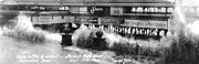
The storm surge caused by this hurricane prompted the city of Corpus Christi to construct a breakwater in 1925, and a seawall was subsequently built in 1940.See also
- List of tropical cyclones
- List of Atlantic hurricanes
- List of Florida hurricanes
External links
- Hurricane info on about.com
- History of the 1919 Atlantic Gulf Hurricane at the National Weather Service, includes many damage photographs
- Historic photos of the 1919 Hurricane from the Corpus Christi Museum of Science and History, hosted by the Portal to Texas History