
1908 Atlantic hurricane season
Encyclopedia
The 1908 Atlantic hurricane season ran from June 1 to November 30 in 1908. These dates conventionally delimit the year in which most tropical cyclones form in the Atlantic basin. However, this season got off to a very early start, with a Category 2 hurricane forming on March 6, making it the earliest hurricane on record to form in the Atlantic Basin. Another hurricane formed and existed during the last week of May, and became the earliest hurricane to hit the U.S. in recorded history. Cape Hatteras
was affected by two hurricanes and one tropical storm this year. Overall, this season was near average with 10 tropical storms forming.
. According to the Atlantic hurricane database
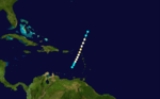
, the system was first identified as a tropical storm on March 6 as it tracked in an unusual south-southwest direction. Early the following day, it was estimated that the storm intensified into a minimal hurricane, becoming the earliest known cyclone of this strength during the course of a season. Further intensification took place as the hurricane neared the United States Virgin Islands
. Shortly before bypassing the islands, it attained winds of 100 mph (155 km/h), equivalent to a modern-day Category 2 hurricane on the Saffir–Simpson Hurricane Scale. Once in the Caribbean Sea
on March 8, the system slowly began to weaken, losing hurricane status the following morning. The last known position of the storm was late on March 9 over the eastern Caribbean Sea, north of Venezuela
.
The two island nations of Antigua
and Basseterre and three ships reported affects from Hurricane One. On Saint Barthélemy
, some buildings were damaged. The highest wind gust reported was at 70 mph (112.7 km/h), from a ship called Hattie C. Luce. Two other ships reported winds at 35 mph (56.3 km/h) and 40 mph (64.4 km/h), while Basseterre reported winds at 50 mph (80.5 km/h). Rainfall peaked at 8 inches (203.2 mm), which was reported in Basseterre. The minimum pressure of Hurricane One is unknown, however the city of Basseterre reported a minimum pressure of 991 mbars
. Also, St. Kitts reported 4 inches of rain and Nevis
reported 3 inches of rain.
in 1951 and Alma in 1970. It marked the earliest date for the season's second hurricane to form in any Atlantic season on record, and it was the earliest hurricane to hit the U.S. in recorded history.
and moved into the Atlantic. The storm dissipated on August 3.
. Moved southeast into the Gulf of Mexico
. It turned around and made landfall in Louisiana
. It dissipated in Tennessee
on August 3.
, moved over Hispaniola
and eastern Cuba
, and crossed over the Bahamas before turning northeast. It then made a loop and became extratropical on October 7. It caused extensive damage to the Greater Antilles
.
. Because it moved slowly, very heavy rainfall fell in its path, although there is no known damage or deaths from the hurricane itself.
shortly before dissipating.
Cape Hatteras
Cape Hatteras is a cape on the coast of North Carolina. It is the point that protrudes the farthest to the southeast along the northeast-to-southwest line of the Atlantic coast of North America...
was affected by two hurricanes and one tropical storm this year. Overall, this season was near average with 10 tropical storms forming.
Hurricane One
In early March, the season's first tropical cyclone developed to the northeast of the Leeward IslandsLeeward Islands
The Leeward Islands are a group of islands in the West Indies. They are the northern islands of the Lesser Antilles chain. As a group they start east of Puerto Rico and reach southward to Dominica. They are situated where the northeastern Caribbean Sea meets the western Atlantic Ocean...
. According to the Atlantic hurricane database
HURDAT
The North Atlantic hurricane database, or HURDAT, is the database for all tropical cyclones in the Atlantic Ocean, Gulf of Mexico and Caribbean Sea, since 1851.-History:...
, the system was first identified as a tropical storm on March 6 as it tracked in an unusual south-southwest direction. Early the following day, it was estimated that the storm intensified into a minimal hurricane, becoming the earliest known cyclone of this strength during the course of a season. Further intensification took place as the hurricane neared the United States Virgin Islands
United States Virgin Islands
The Virgin Islands of the United States are a group of islands in the Caribbean that are an insular area of the United States. The islands are geographically part of the Virgin Islands archipelago and are located in the Leeward Islands of the Lesser Antilles.The U.S...
. Shortly before bypassing the islands, it attained winds of 100 mph (155 km/h), equivalent to a modern-day Category 2 hurricane on the Saffir–Simpson Hurricane Scale. Once in the Caribbean Sea
Caribbean Sea
The Caribbean Sea is a sea of the Atlantic Ocean located in the tropics of the Western hemisphere. It is bounded by Mexico and Central America to the west and southwest, to the north by the Greater Antilles, and to the east by the Lesser Antilles....
on March 8, the system slowly began to weaken, losing hurricane status the following morning. The last known position of the storm was late on March 9 over the eastern Caribbean Sea, north of Venezuela
Venezuela
Venezuela , officially called the Bolivarian Republic of Venezuela , is a tropical country on the northern coast of South America. It borders Colombia to the west, Guyana to the east, and Brazil to the south...
.
The two island nations of Antigua
Antigua
Antigua , also known as Waladli, is an island in the West Indies, in the Leeward Islands in the Caribbean region, the main island of the country of Antigua and Barbuda. Antigua means "ancient" in Spanish and was named by Christopher Columbus after an icon in Seville Cathedral, Santa Maria de la...
and Basseterre and three ships reported affects from Hurricane One. On Saint Barthélemy
Saint Barthélemy
Saint Barthélemy , officially the Territorial collectivity of Saint Barthélemy , is an overseas collectivity of France. Often abbreviated to Saint-Barth in French, or St. Barts in English, the indigenous people called the island Ouanalao...
, some buildings were damaged. The highest wind gust reported was at 70 mph (112.7 km/h), from a ship called Hattie C. Luce. Two other ships reported winds at 35 mph (56.3 km/h) and 40 mph (64.4 km/h), while Basseterre reported winds at 50 mph (80.5 km/h). Rainfall peaked at 8 inches (203.2 mm), which was reported in Basseterre. The minimum pressure of Hurricane One is unknown, however the city of Basseterre reported a minimum pressure of 991 mbars
Bar (unit)
The bar is a unit of pressure equal to 100 kilopascals, and roughly equal to the atmospheric pressure on Earth at sea level. Other units derived from the bar are the megabar , kilobar , decibar , centibar , and millibar...
. Also, St. Kitts reported 4 inches of rain and Nevis
Nevis
Nevis is an island in the Caribbean Sea, located near the northern end of the Lesser Antilles archipelago, about 350 km east-southeast of Puerto Rico and 80 km west of Antigua. The 93 km² island is part of the inner arc of the Leeward Islands chain of the West Indies...
reported 3 inches of rain.
Hurricane Two
This hurricane hit the U.S. in May, causing minor effects. It was one of only 3 May hurricanes during the 20th century in the Atlantic Basin; the others were AbleHurricane Able (1951)
Hurricane Able was the strongest recorded hurricane outside of the typical Atlantic hurricane season. The first tropical cyclone in 1951, Able developed from a trough of low pressure on May 15 about 300 miles south of Bermuda...
in 1951 and Alma in 1970. It marked the earliest date for the season's second hurricane to form in any Atlantic season on record, and it was the earliest hurricane to hit the U.S. in recorded history.
Hurricane Three
This storm formed north of the Bahamas on July 24. The storm then made a loop north of the Bahamas and became a hurricane shortly after. The storm grazed North CarolinaNorth Carolina
North Carolina is a state located in the southeastern United States. The state borders South Carolina and Georgia to the south, Tennessee to the west and Virginia to the north. North Carolina contains 100 counties. Its capital is Raleigh, and its largest city is Charlotte...
and moved into the Atlantic. The storm dissipated on August 3.
Tropical Storm Four
The fourth tropical storm of the season had an unusual track. It formed on July 29 offshore TexasTexas
Texas is the second largest U.S. state by both area and population, and the largest state by area in the contiguous United States.The name, based on the Caddo word "Tejas" meaning "friends" or "allies", was applied by the Spanish to the Caddo themselves and to the region of their settlement in...
. Moved southeast into the Gulf of Mexico
Gulf of Mexico
The Gulf of Mexico is a partially landlocked ocean basin largely surrounded by the North American continent and the island of Cuba. It is bounded on the northeast, north and northwest by the Gulf Coast of the United States, on the southwest and south by Mexico, and on the southeast by Cuba. In...
. It turned around and made landfall in Louisiana
Louisiana
Louisiana is a state located in the southern region of the United States of America. Its capital is Baton Rouge and largest city is New Orleans. Louisiana is the only state in the U.S. with political subdivisions termed parishes, which are local governments equivalent to counties...
. It dissipated in Tennessee
Tennessee
Tennessee is a U.S. state located in the Southeastern United States. It has a population of 6,346,105, making it the nation's 17th-largest state by population, and covers , making it the 36th-largest by total land area...
on August 3.
Tropical Storm Five
This storm formed off of the Carolinas. The storm moved west and then northeast it grazed the coast of North Carolina. It headed out to sea and dissipated.Hurricane Six
The sixth and strongest storm of the season was a Category 3 in mid-September that moved across the central Bahamas and turned out to sea.Tropical Storm Seven
Tropical Storm Seven formed in the middle of The Gulf of Mexico on September 16. It dissipated on September 18 off shore of Louisiana.Hurricane Eight
1908's eighth storm was a Category 2 hurricane in late September and early October that crossed the Lesser AntillesLesser Antilles
The Lesser Antilles are a long, partly volcanic island arc in the Western Hemisphere. Most of its islands form the eastern boundary of the Caribbean Sea with the Atlantic Ocean, with the remainder located in the southern Caribbean just north of South America...
, moved over Hispaniola
Hispaniola
Hispaniola is a major island in the Caribbean, containing the two sovereign states of the Dominican Republic and Haiti. The island is located between the islands of Cuba to the west and Puerto Rico to the east, within the hurricane belt...
and eastern Cuba
Cuba
The Republic of Cuba is an island nation in the Caribbean. The nation of Cuba consists of the main island of Cuba, the Isla de la Juventud, and several archipelagos. Havana is the largest city in Cuba and the country's capital. Santiago de Cuba is the second largest city...
, and crossed over the Bahamas before turning northeast. It then made a loop and became extratropical on October 7. It caused extensive damage to the Greater Antilles
Greater Antilles
The Greater Antilles are one of three island groups in the Caribbean. Comprising Cuba, Jamaica, Hispaniola , and Puerto Rico, the Greater Antilles constitute almost 90% of the land mass of the entire West Indies.-Greater Antilles in context :The islands of the Caribbean Sea, collectively known as...
.
Hurricane Nine
In mid-October, the ninth storm of the season, a Category 2 hurricane, struck NicaraguaNicaragua
Nicaragua is the largest country in the Central American American isthmus, bordered by Honduras to the north and Costa Rica to the south. The country is situated between 11 and 14 degrees north of the Equator in the Northern Hemisphere, which places it entirely within the tropics. The Pacific Ocean...
. Because it moved slowly, very heavy rainfall fell in its path, although there is no known damage or deaths from the hurricane itself.
Tropical Storm Ten
This storm formed off of the Carolinas on October 19. Stayed out in the Atlantic until it made landfall in South CarolinaSouth Carolina
South Carolina is a state in the Deep South of the United States that borders Georgia to the south, North Carolina to the north, and the Atlantic Ocean to the east. Originally part of the Province of Carolina, the Province of South Carolina was one of the 13 colonies that declared independence...
shortly before dissipating.
See also
- List of tropical cyclones
- List of Atlantic hurricane seasons