
1889 Atlantic hurricane season
Encyclopedia
The 1889 Atlantic hurricane season ran through the summer and the first half of fall in 1889.
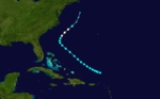
. Grazed western Cuba as a minimal hurricane. Weakened and than made landfall in Florida
as a tropical storm. It then paralleled the Georgia
and North
and South Carolina
coasts. Dissipated on June 20 in the open Atlantic.
. It moved northwestward, becoming a 100 mph storm while crossing Puerto Rico
. From September 9 to the 12th it caused flooding and storm surge to the mid Atlantic
as it stalled off the coast, causing 40 deaths.
. It moved westward across the northern Caribbean
, and on the 18th, hit the eastern Yucatán Peninsula
as a Category 2 hurricane. After weakening over land, it turned northward, where it again strengthened to a Category 2. While moving northeastward over the Gulf of Mexico
, it weakened, and hit near Pensacola, Florida
on the 23rd. Its minimal intensity at its U.S. landfall resulted in little damage, but Yucatán
fared a little worse. No damage was severe.
.
Hurricane One
Hurricane one formed on May 16. On strengthened to a Category 1 hurricane and took a curve away from the mainland and dissipated on May 21.This hurricane did not affect land, but was the first May hurricane on record in the Atlantic basin, and one of only 4 today.Hurricane Two
Formed on June 15 near CubaCuba
The Republic of Cuba is an island nation in the Caribbean. The nation of Cuba consists of the main island of Cuba, the Isla de la Juventud, and several archipelagos. Havana is the largest city in Cuba and the country's capital. Santiago de Cuba is the second largest city...
. Grazed western Cuba as a minimal hurricane. Weakened and than made landfall in Florida
Florida
Florida is a state in the southeastern United States, located on the nation's Atlantic and Gulf coasts. It is bordered to the west by the Gulf of Mexico, to the north by Alabama and Georgia and to the east by the Atlantic Ocean. With a population of 18,801,310 as measured by the 2010 census, it...
as a tropical storm. It then paralleled the Georgia
Georgia (U.S. state)
Georgia is a state located in the southeastern United States. It was established in 1732, the last of the original Thirteen Colonies. The state is named after King George II of Great Britain. Georgia was the fourth state to ratify the United States Constitution, on January 2, 1788...
and North
North Carolina
North Carolina is a state located in the southeastern United States. The state borders South Carolina and Georgia to the south, Tennessee to the west and Virginia to the north. North Carolina contains 100 counties. Its capital is Raleigh, and its largest city is Charlotte...
and South Carolina
South Carolina
South Carolina is a state in the Deep South of the United States that borders Georgia to the south, North Carolina to the north, and the Atlantic Ocean to the east. Originally part of the Province of Carolina, the Province of South Carolina was one of the 13 colonies that declared independence...
coasts. Dissipated on June 20 in the open Atlantic.
Hurricane Three
On August 19 Hurricane three formed southwest of Haiti and battered the Caribbean with heavy rains and a 5 ft storm surge.Hurricane three was pushed away from the south by a high pressure system and strengthened to a category 1 hurricane west of Virginia. The storm took a course 70 miles away from New England and dissipated on August 28. The remains traveled to New York and Maine and soaked the area.Hurricane Four
A hurricane formed on September 1 east of BarbadosBarbados
Barbados is an island country in the Lesser Antilles. It is in length and as much as in width, amounting to . It is situated in the western area of the North Atlantic and 100 kilometres east of the Windward Islands and the Caribbean Sea; therein, it is about east of the islands of Saint...
. It moved northwestward, becoming a 100 mph storm while crossing Puerto Rico
Puerto Rico
Puerto Rico , officially the Commonwealth of Puerto Rico , is an unincorporated territory of the United States, located in the northeastern Caribbean, east of the Dominican Republic and west of both the United States Virgin Islands and the British Virgin Islands.Puerto Rico comprises an...
. From September 9 to the 12th it caused flooding and storm surge to the mid Atlantic
Mid Atlantic
Mid Atlantic can refer to:*The middle of the Atlantic Ocean*Mid-Atlantic Ridge, a tectonic plate boundary*Mid-Atlantic states, a region in the United States*Mid-Atlantic Athletic Conference, an athletic league in the United States...
as it stalled off the coast, causing 40 deaths.
Hurricane Five
Five caused no major damage but, killed 4 people in a ship sept 8.The storm caused thunder storms around the islands according to reports at the time. Hurricane five reached its max intensity over the north Atlantic at 70 knots.Hurricane Six
On September 12, a tropical storm formed over the northern Lesser AntillesLesser Antilles
The Lesser Antilles are a long, partly volcanic island arc in the Western Hemisphere. Most of its islands form the eastern boundary of the Caribbean Sea with the Atlantic Ocean, with the remainder located in the southern Caribbean just north of South America...
. It moved westward across the northern Caribbean
Caribbean
The Caribbean is a crescent-shaped group of islands more than 2,000 miles long separating the Gulf of Mexico and the Caribbean Sea, to the west and south, from the Atlantic Ocean, to the east and north...
, and on the 18th, hit the eastern Yucatán Peninsula
Yucatán Peninsula
The Yucatán Peninsula, in southeastern Mexico, separates the Caribbean Sea from the Gulf of Mexico, with the northern coastline on the Yucatán Channel...
as a Category 2 hurricane. After weakening over land, it turned northward, where it again strengthened to a Category 2. While moving northeastward over the Gulf of Mexico
Gulf of Mexico
The Gulf of Mexico is a partially landlocked ocean basin largely surrounded by the North American continent and the island of Cuba. It is bounded on the northeast, north and northwest by the Gulf Coast of the United States, on the southwest and south by Mexico, and on the southeast by Cuba. In...
, it weakened, and hit near Pensacola, Florida
Pensacola, Florida
Pensacola is the westernmost city in the Florida Panhandle and the county seat of Escambia County, Florida, United States of America. As of the 2000 census, the city had a total population of 56,255 and as of 2009, the estimated population was 53,752...
on the 23rd. Its minimal intensity at its U.S. landfall resulted in little damage, but Yucatán
Yucatán
Yucatán officially Estado Libre y Soberano de Yucatán is one of the 31 states which, with the Federal District, comprise the 32 Federal Entities of Mexico. It is divided in 106 municipalities and its capital city is Mérida....
fared a little worse. No damage was severe.
Tropical Storm Seven
This storm formed near the Cape Verde islands and wiggled its way to the open Atlantic where the cold water and wind shear made the storm dissipate on September 19. This system had winds of 50 knots.Tropical Storm Eight
This storm never touched land and took a sharp turn from land and dissipated on Oct 6. The system was a borderline hurricane at 60 knots.Tropical Storm Nine
Formed south of Cuba on October 5 and then made landfall in Cuba and Florida. Transitioned into an extratropical cyclone on October 7 just before landfall in Nova ScotiaNova Scotia
Nova Scotia is one of Canada's three Maritime provinces and is the most populous province in Atlantic Canada. The name of the province is Latin for "New Scotland," but "Nova Scotia" is the recognized, English-language name of the province. The provincial capital is Halifax. Nova Scotia is the...
.
See also
- List of Atlantic hurricanes
- List of Atlantic hurricane seasons