
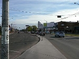
109 Street, Edmonton
Encyclopedia


Arterial road
An arterial road, or arterial thoroughfare, is a high-capacity urban road. The primary function of an arterial road is to deliver traffic from collector roads to freeways, and between urban centres at the highest level of service possible. As such, many arteries are limited-access roads, or feature...
in central Edmonton
Edmonton
Edmonton is the capital of the Canadian province of Alberta and is the province's second-largest city. Edmonton is located on the North Saskatchewan River and is the centre of the Edmonton Capital Region, which is surrounded by the central region of the province.The city and its census...
, Alberta
Alberta
Alberta is a province of Canada. It had an estimated population of 3.7 million in 2010 making it the most populous of Canada's three prairie provinces...
, Canada
Canada
Canada is a North American country consisting of ten provinces and three territories. Located in the northern part of the continent, it extends from the Atlantic Ocean in the east to the Pacific Ocean in the west, and northward into the Arctic Ocean...
. It takes travelers out of Downtown to the south, Old Strathcona
Old Strathcona
Old Strathcona is an historic district located in south-central Edmonton, Alberta, Canada. Once the commercial core of the separate city of Strathcona, the area is now Edmonton's main arts and entertainment district, and in 2007 was named Alberta's second "Provincial Historic Area"...
, and the north, Kingsway area. It passes several Edmonton landmarks including the Garneau Theatre
Garneau Theatre
The Garneau Theatre is a historic movie theatre located on 109 Street in Edmonton, Alberta, Canada. It was operated by Magic Lantern Theatres until June 27, 2011 when it closed...
, Alberta Legislature Building, Grant MacEwan University, RCMP
Royal Canadian Mounted Police
The Royal Canadian Mounted Police , literally ‘Royal Gendarmerie of Canada’; colloquially known as The Mounties, and internally as ‘The Force’) is the national police force of Canada, and one of the most recognized of its kind in the world. It is unique in the world as a national, federal,...
"K" Division Headquarters, and Kingsway Mall. It is a one-way street, southbound, from 97 Avenue to Saskatchewan Drive (88 Avenue), to cross the North Saskatchewan River
North Saskatchewan River
The North Saskatchewan River is a glacier-fed river that flows east from the Canadian Rockies to central Saskatchewan. It is one of two major rivers that join to make up the Saskatchewan River....
on the narrow High Level Bridge
High Level Bridge (Edmonton)
The High Level Bridge, opened in 1913, spans the North Saskatchewan River in Edmonton, Alberta, Canada. Located next to the Alberta Legislature Building, the bridge linked the separate communities of Edmonton and Strathcona, which became one city in 1912. It was designed from the outset to...
. Before Edmonton's amalgamation with Strathcona
Strathcona, Alberta
Strathcona was a city in Alberta, Canada, located on the south of the North Saskatchewan River opposite of the City of Edmonton. It amalgamated with Edmonton on February 1, 1912....
in 1912, the Edmonton portion was known as 9th Street.
Neighbourhoods

- PleasantviewPleasantview, EdmontonPleasantview is a residential neighbourhood in south west Edmonton, Alberta, Canada.The neighbourhood is bounded on the west by 111 Street, on the east by 104 Street/Calgary Trail, on the south by 51 Avenue and on the north by 61 Avenue....
- ParkallenParkallen, EdmontonParkallen is a residential neighbourhood in south Edmonton, Alberta, Canada located just to the east of the University of Alberta farm and the Neil Crawford Centre...
- AllendaleAllendale, EdmontonAllendale is a residential neighbourhood located in south west Edmonton, Alberta, Canada. The neighbourhood is named for the Allen family, who farmed the area before it was annexed by the City of Strathcona in 1907....
- McKernanMcKernan, EdmontonMcKernan is a neighbourhood located in south west Edmonton, Alberta, Canada, named for James McKernan, a prominent businessman in the City of Strathcona....
- Queen AlexandraQueen Alexandra, EdmontonQueen Alexandra is a mixed residential and commercial neighbourhood in south west Edmonton, Alberta, Canada. The neighbourhood, once part of the City of Strathcona, is named for Alexandra, the wife of Edward VII of England...
- GarneauGarneau, EdmontonGarneau is a well known neighbourhood in the city of Edmonton. It is located just west of the Strathcona neighbourhood and just east of the main University of Alberta campus...
, - DowntownDowntown EdmontonDowntown Edmonton is bounded by 109 Street to the west, 105 Avenue to the north, 97 Street to the east, 97 Avenue, 100 Avenue, and Rossdale Road to the south and Jasper Avenue to the southeast , though many people consider part or all of the surrounding neighborhoods to be part of downtown...
- OliverOliver, EdmontonOliver is one of the oldest residential neighbourhoods in the City of Edmonton, Alberta, Canada. The neighbourhood is named after Frank Oliver, an early Edmonton resident, businessman, and politician...
- Queen Mary ParkQueen Mary Park, EdmontonQueen Mary Park is an inner city residential neighbourhood in Edmonton, Alberta, Canada located just outside the downtown core. The neighbourhood occupies land that was once part of the Hudson's Bay Company reserve....
- Central McDougallCentral McDougall, EdmontonCentral McDougall is a largely residential neighbourhood in the City of Edmonton, Alberta, Canada located immediately north of the downtown core....
Interchanges and intersections
This is a list of major intersections, starting at the south end of Street Name.| Direction | Intersecting road | Current intersection type | Coordinates |
|---|---|---|---|
| South-North | 52 Avenue | At-grade | 53°29′22"N 113°30′43"W |
| 57 Avenue | At-grade (traffic lights) | 53°29′39"N 113°30′43"W | |
| 61 Avenue | At-grade (traffic lights) | 53°29′54"N 113°30′43"W | |
| 65 Avenue | At-grade (traffic lights) | 53°30′7"N 113°30′43"W | |
| 72 Avenue | At-grade (traffic lights) | 53°30′30"N 113°30′43"W | |
| 76 Avenue | At-grade (traffic lights) | 53°30′44"N 113°30′43"W | |
| University Avenue University Avenue (Edmonton) University Avenue was an arterial road in west Strathcona, Alberta, Canada. It was formed along the backs of farm lots west of the yet to be incorporated town of Strathcona, causing it to run parallel with the North Saskatchewan River to the north. The farm lots later became the University of... / 78 Avenue |
At-grade (traffic lights) | 53°30′51"N 113°30′43"W | |
| Whyte (82) Avenue | At-grade (traffic lights) | 53°31′5"N 113°30′43"W | |
| 88 Avenue / Walterdale Hill / Saskatchewan Drive Saskatchewan Drive Saskatchewan Drive / Scona Road is a river valley road on the south side of the North Saskatchewan River in Edmonton, Alberta, Canada. It was formed on the banks of the river when the area was known as the City of Strathcona... |
At-grade (traffic lights) | 53°31′26"N 113°30′43"W | |
| 97 Avenue | At-grade (traffic lights) | 53°32′3"N 113°30′31"W | |
| Jasper (101) Avenue | At-grade (traffic lights) | 53°32′27"N 113°30′30"W | |
| 104 Avenue | At-grade (traffic lights) | 53°32′46"N 113°30′30"W | |
| 105 Avenue | At-grade (traffic lights) | 53°32′54"N 113°30′30"W | |
| 107 Avenue (of Nations) 107 Avenue, Edmonton 107 Avenue is a major arterial road in west-central Edmonton, Alberta, Canada. It serves Edmonton's west side industrial distract, the old town of Jasper Place, the multicultural area north of Downtown Edmonton, Commonwealth Stadium, and adjacent park & ride transit centre... |
At-grade (traffic lights) | 53°33′5"N 113°30′30"W | |
| 111 Avenue | At-grade (traffic lights) | 53°33′32"N 113°30′30"W | |
| Kingsway (Avenue) Kingsway, Edmonton Kingsway, sometimes called Kingsway Avenue, is an arterial road in central Edmonton, Alberta, Canada, that runs on a northwest to southeast path, cutting through the city's normal grid pattern... |
At-grade (traffic lights) | 53°33′39"N 113°30′30"W | |
| Princess Elizabeth Avenue Princess Elizabeth Avenue Princess Elizabeth Avenue, is an arterial road in central Edmonton, Alberta, Canada, that runs on a southwest to northeast path, cutting through the city's normal grid pattern... |
At-grade Y interchange | 53°33′51"N 113°30′30"W |