

Wgu-20
Encyclopedia
Radio station
Radio broadcasting is a one-way wireless transmission over radio waves intended to reach a wide audience. Stations can be linked in radio networks to broadcast a common radio format, either in broadcast syndication or simulcast or both...
," was operated by the United States Defense Civil Preparedness Agency
Federal Civil Defense Administration
The Federal Civil Defense Administration was organized by Democratic president Harry S. Truman on December 1, 1950, and became an official government agency on January 12, 1951...
(one of the two agencies later merged to become the Federal Emergency Management Agency
Federal Emergency Management Agency
The Federal Emergency Management Agency is an agency of the United States Department of Homeland Security, initially created by Presidential Reorganization Plan No. 1 of 1978 and implemented by two Executive Orders...
) in the mid-to-late 1970s.
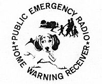
Public Emergency Radio
Operating 24 hours a day on a longwaveLongwave
In radio, longwave refers to parts of radio spectrum with relatively long wavelengths. The term is a historic one dating from the early 20th century, when the radio spectrum was considered to consist of long, medium and short wavelengths...
frequency of 179 kHz from Chase, Maryland
Chase, Maryland
Chase is an unincorporated community in eastern Baltimore County, Maryland, United States.-Geography:Chase is located at . Chase is located on the waterfront of the Gunpowder River, Middle River, Dundee Creek, Saltpeter Creek, and Chesapeake Bay...
, WGU-20's programming consisted of pre-recorded announcements and time checks. The broadcast had the mechanical sound of early speech synthesis systems but the message could be clearly understood, with time ticks in the background and a continuous announcement akin to the Speaking clock
Speaking clock
A speaking clock service is a recorded or simulated human voice service, usually accessed by telephone, that gives the correct time. The first telephone speaking clock service was introduced in France, in association with the Paris Observatory on 14 February 1933.The format of the service is...
: "Good evening. This is WGU-20, a defense civil-preparedness agency station, serving the east central states with emergency information. Eastern Standard Time seventeen hours, twenty minutes, twenty seconds. Good evening. This is WGU-20, a defense civil-preparedness agency station, serving the east central states with emergency information. Eastern Standard Time seventeen hours, twenty minutes, thirty seconds. Good evening. ..." (The recording was changed to "good morning" or "good afternoon" at the appropriate times of day.)
Utilizing the world's first all-solid state
Solid state (electronics)
Solid-state electronics are those circuits or devices built entirely from solid materials and in which the electrons, or other charge carriers, are confined entirely within the solid material...
, 50,000 watt, radio transmitter built by Westinghouse, the signal covered much of the eastern seaboard
East Coast of the United States
The East Coast of the United States, also known as the Eastern Seaboard, refers to the easternmost coastal states in the United States, which touch the Atlantic Ocean and stretch up to Canada. The term includes the U.S...
. WGU-20 was something of a mystery initially, with thousands of ham radio operators and radio hobbyists speculating about the nature of the station, until a small news article in Popular Electronics
Popular Electronics
Popular Electronics was an American magazine started by Ziff-Davis Publishing in October 1954 for electronics hobbyists and experimenters. It soon became the "World's Largest-Selling Electronics Magazine". The circulation was 240,151 in April 1957 and 400,000 by 1963. Ziff-Davis published Popular...
magazine outlined exactly what WGU-20 was. Afterwards, reception reports (some from as far away as Texas
Texas
Texas is the second largest U.S. state by both area and population, and the largest state by area in the contiguous United States.The name, based on the Caddo word "Tejas" meaning "friends" or "allies", was applied by the Spanish to the Caddo themselves and to the region of their settlement in...
) were sent a special QSL
QSL
QSL is one of the Q codes used in radiocommunication and radio broadcasting. A Q code message can stand for a statement or a question . In this case, QSL? means "do you confirm receipt of my transmission?" while QSL means "I confirm receipt of your transmission". Some also take it to mean "Query...
card featuring Paul Revere
Paul Revere
Paul Revere was an American silversmith and a patriot in the American Revolution. He is most famous for alerting Colonial militia of approaching British forces before the battles of Lexington and Concord, as dramatized in Henry Wadsworth Longfellow's poem, Paul Revere's Ride...
on a horse, raising the alarm.
Decision Information Distribution System
WGU-20 was originally designed to be part of the Decision Information Distribution System (DIDS) that would be used to alert the public of an enemy attack (along the same lines as the then-current Emergency Broadcast SystemEmergency Broadcast System
The Emergency Broadcast System was an emergency warning system in the United States, used from 1963 to 1997, when it was replaced by the Emergency Alert System.-Purpose:...
). As originally envisioned, many home devices, including radios, TV and even smoke detectors, would have inexpensive longwave receivers built into them ensuring the that attack message would get out. A longwave frequency was chosen because the extended groundwave signal it produced was supposed to be relatively immune to the effects of a nuclear detonation.
Built for $2 million in 1973, WGU-20 was the prototype of ten DIDS "distribution stations". These were to operate 50 kW at 167, 179 and 191 kHz with 700-foot towers. Besides the Maryland site, candidate sites for distribution stations were Maynard, Massachusetts
Maynard, Massachusetts
Maynard is a town in Middlesex County, Massachusetts, United States. As of the 2010 census, the town population was 10,106.- History :Maynard, located on the Assabet River, was incorporated as an independent municipality in 1871. Prior to that it was known as 'Assabet Village' but was legally...
; Mount Joy, Pennsylvania
Mount Joy, Pennsylvania
Mount Joy is a borough in Lancaster County, Pennsylvania, United States. The population was 6,765 at the 2000 census.-Name and origin:Mount Joy is often named in lists of "delightfully-named towns" in Pennsylvania Dutchland, along with Intercourse, Blue Ball, PenisPallooza, Amish Land, Dick-in-Hand...
; Gray, Maine
Gray, Maine
Gray is a town in Cumberland County, Maine, United States. The population was 6,820 at the 2000 census. It is part of the Portland–South Portland–Biddeford, Maine metropolitan statistical area. Gray is home to regional headquarters for the Maine Department of Inland Fisheries and...
; Morristown, Tennessee
Morristown, Tennessee
Morristown is a city in, and the county seat of, Hamblen County, Tennessee, United States. The population was 29,137 at the 2010 United States Census. It is the principal city of the Morristown, Tennessee Metropolitan Statistical Area, which encompasses all of Grainger, Hamblen and Jefferson counties...
; Starke, Florida
Starke, Florida
Starke is a city in Bradford County, Florida, United States. The population was 5,593 at the 2000 census. As of 2004, the population recorded by the U.S. Census Bureau is 5,769 ....
or Chiefland, Florida
Chiefland, Florida
Chiefland is a city in Levy County, Florida, United States. The population was 1,993 in the 2000 census. and was estimated at 2,095 in 2005. Chiefland calls itself the "Gem of the Suwannee Valley" and was incorporated in 1929.-History:...
; Mazomanie, Wisconsin
Mazomanie, Wisconsin
Mazomanie is a village in Dane County, Wisconsin, United States. The population was 1,485 at the 2000 census. The village is located within the Town of Mazomanie. It is part of the Madison Metropolitan Statistical Area...
; Carthage, Texas
Carthage, Texas
Carthage is a city in Panola County, Texas, United States. The population was 6,664 at the 2000 census. It is the county seat of Panola County, and is situated in East Texas near the Louisiana state line.-Geography:...
, Marshal, Texas or Seagoville, Texas
Seagoville, Texas
Seagoville is a city in Dallas County, Texas, United States, and a suburb of Dallas. A small portion of Seagoville extends into Kaufman County. The population was 10,823 as of the 2000 census. The city is located along U.S. Highway 175 and the Southern Pacific Railroad ten miles from Downtown...
; Alcova, Wyoming
Alcova, Wyoming
Alcova is a census-designated place in Natrona County, Wyoming, United States. It is part of the Casper, Wyoming Metropolitan Statistical Area. The population was 20 at the 2000 census. The center of population of Wyoming is located in Alcova...
or Riverton, Wyoming
Riverton, Wyoming
Riverton is a city in Fremont County, Wyoming, United States. It is both the largest city in the county and the largest within the historical boundaries of the Wind River Indian Reservation. The city's population was 9,310 at the 2000 census...
; Mendota, California
Mendota, California
Mendota is a city in Fresno County, California, United States. The population was 11,014 at the 2010 census. The State Routes 180 and 33 run through the agricultural city. Mendota is located south-southeast of Firebaugh, at an elevation of 174 feet ....
or Selma, California
Selma, California
Selma is a city in Fresno County, California. The population was 23,219 at the 2010 census, up from 19,240 at the 2000 census. Selma is located southeast of Fresno, at an elevation of 308 feet .-Geography:...
; Winslow, Arizona
Winslow, Arizona
-Demographics:As of the census of 2000, there were 9,520 people, 2,754 households, and 1,991 families residing in the city. The population density was 773.1 people per square mile . There were 3,198 housing units at an average density of 259.7 per square mile...
; Hermiston, Oregon
Hermiston, Oregon
As of the census of 2010, there were 16,745 people, 4,964 households, and 3,360 families residing in the city. The population density was 2,035.4 people per square mile . There were 5,383 housing units at an average density of 832.9 per square mile...
; and Wallula, Washington
Wallula, Washington
Wallula is a census-designated place in Walla Walla County, Washington, United States. The population was 179 at the 2010 census.-History:Lewis and Clark reached the area April 27, 1806, on their return journey from the Pacific...
.
These ten stations were to cover the 48 contiguous states. Alaska
Alaska
Alaska is the largest state in the United States by area. It is situated in the northwest extremity of the North American continent, with Canada to the east, the Arctic Ocean to the north, and the Pacific Ocean to the west and south, with Russia further west across the Bering Strait...
and Hawaii
Hawaii
Hawaii is the newest of the 50 U.S. states , and is the only U.S. state made up entirely of islands. It is the northernmost island group in Polynesia, occupying most of an archipelago in the central Pacific Ocean, southwest of the continental United States, southeast of Japan, and northeast of...
were to have special, unspecified arrangements. All DIDS stations would be partially below ground level and protected against blast and electromagnetic pulse effects.
The distribution stations would be activated by two "control stations" at 61.15 kHz, in Ault, Colorado
Ault, Colorado
The Town of Ault is a Statutory Town located in Weld County, Colorado, United States. The population was 1,432 at the U.S. Census 2000.-Geography:Ault is located at , at the intersection of U.S...
and Cambridge, Kansas
Cambridge, Kansas
Cambridge is a city in Cowley County, Kansas, United States. As of the 2010 census, the city population was 82.-History:Cambridge is named after Cambridge University in England....
. These two stations would run 200 kW from 1,260-foot towers. Federal authorities would send the "go" signal by microwave and landline to the control stations. The ten distribution stations would then sign on and play taped messages to the public.
The DIDS system was never implemented and the job of attack warning in the US remained with the EBS (now the Emergency Alert System
Emergency Alert System
The Emergency Alert System is a national warning system in the United States put into place on January 1, 1997, when it superseded the Emergency Broadcast System , which itself had superseded the CONELRAD System...
). However the 179 kHz frequency range was used by the government's Ground Wave Emergency Network
Ground Wave Emergency Network
The Ground Wave Emergency Network was a command and control communications system intended for use by the United States government to facilitate military communications before, during and after a nuclear war...
(GWEN) which, instead of notifying the public of a war, was supposed to be a (nuclear war) survivable communications network linking various military installations.
External links
- http://coldwar-c4i.net/index.html#PER
- http://www.amrad.org/pipermail/tacos/2006/003650.html
- http://kobnet.net/misc/coldwar/coldwar-c4i.net/PER/WGU20.html
- http://web.archive.org/web/20060401172542/http://www.geocities.com/radiojunkie3/WGU20.html