
Virginia State Route 161
Encyclopedia
State Route 161 is a primary state highway
in and near Richmond, Virginia
, United States
. It extends from an interchange
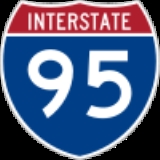
with Interstate 95 in the independent city
of Richmond
north to an intersection with U.S. Route 1 in the Lakeside
area of central Henrico County
.
For a portion of its history, the road served as an early western highway bypass of the downtown area of the City of Richmond through portions of Chesterfield
and Henrico counties. Known during that period as the area's "Belt Boulevard", the name is still applied to some streets along the former bypass routing. SR 161 now located entirely in the City of Richmond and Henrico County.
(replaced in the 1980s), crossing the James River
at Richmond was a toll bridge
. Traffic through Richmond on U.S. Route 1 and 301 was often highly congested with Florida-New York and other east coast travelers. In the city, the path of US 1/301 passed miles of tourist homes along Jefferson Davis Highway south of the river and Chamberlayne Avenue north of the river.
By 1934, a combination of roads known collectively as the "Belt Boulevard" formed a western bypass of Richmond's most congested areas along the US 1/301 corridor, crossing the James River
on Richmond's privately owned Boulevard Bridge
, a toll bridge
built in 1925. The Belt Boulevard offered an alternative to downtown Richmond's traffic, with ends at US 1 south and north of the city limits in Chesterfield and Henrico counties, respectively, at that time. (Part of the route south of the James River was annexed from Chesterfield County in 1944; the remainder in 1970, so the road in that area is now entirely in Richmond).
The name Belt Boulevard was apparently derived from the "Belt Line" tracks of the Richmond, Fredericksburg and Potomac Railroad
(RF&P) and Atlantic Coast Line Railroad
(ACL) which had also been built some years earlier to bypass a congestion point and river crossing in downtown Richmond at Byrd Street Station. The road very roughly parallels the belt line railroad about a mile or so east for a large portion of its routing.
on the southwest corner urged northbound motorists to consider the bypass. The sign survived into the 1970s.
It followed Terminal Avenue northwesterly in Chesterfield County to a short road section actually named Belt Boulevard, which it followed about a mile, meeting State Route 10 and sharing it around the north side of the former Speedway which was located at the current site of McGuire Hospital. Resuming its own roadway, Belt Boulevard turned almost due north. It met U.S. Route 360
at McGuire Circle and U.S. Route 60 about a mile further north. In the late 1940s, an overpass for U.S. 60 and a partial cloverleaf interchange was built at this location.
About 1/2 mile north of U.S. 60, the road crossed the original Belt Line railroad tracks, a routing which was itself bypassed by a newer alignment of the belt line by the Atlantic Coast Line Railroad at the time Broad Street Station
was opened around 1917.
After crossing the railroad, Belt Boulevard connected with Westover Hills Boulevard. It continued north through the newly-developed Westover Hills community and the Forest Hill Avenue commercial corridor to reach the high bluffs along the south side of the James River.
At this location, Belt Boulevard crossed the Southern Railway
(along the south bank), the James River, and the Chesapeake and Ohio Railway
and James River and Kanawha Canal
(along the north bank) via the Boulevard Bridge
, with tolls collected initially at a mid-point on the narrow two-lane bridge itself. The road made landfall just east of Maymont Park
and climbing the bluff there, wound around a city reservoir through Byrd Park
to connect with the south end of Richmond's major connector street known simply as Boulevard
(or "The Boulevard"), a major north–south thoroughfare. It followed that roadway north past a statue to honor Christopher Columbus
and crossed Monument Avenue
, where a statue of Confederate
Major General Stonewall Jackson
had been erected. After crossing U.S. Route 33 and U.S. Route 250 at Broad Street, about a mile further north it reached Westwood Circle.
The road followed Hermitage Road north, passing another monument for (and the tomb of) Confederate General Ambrose Powell Hill at Laburnum Avenue. the roadway entered Henrico County on Lakeside Avenue near the main entrance to the city's Joseph Bryan Park. It ran through the Lakeside area
to Hillard Road and crossing the Richmond-Ashland Railway (an electric interurban) to end at an intersection with Brook Road in Henrico County north of Richmond.
.
s.
, a toll road
which opened in 1958. However, a portion of the southern end of SR 161 retains the Belt Boulevard name, and it is in current use there.
A major intersection was at U.S. Route 360, and after a mile of residential housing, another at U.S. Route 60 (Midlothian Turnpike
). The area in between these two points along Belt Boulevard was to become valuable commercial property, anchored by the massive Southside Plaza Shopping Center in 1957. Businesses replacing homes included a Shoney's
Big Boy
restaurant, a Bill's Barbecue restaurant (a local chain), Ford
and Dodge
automobile dealerships, a Putt-Putt miniature golf
course, and two bowling alleys. In a short time, the equivalent of a small town business district materialized, even as the road changed from a through traffic bypass to a suburban connector street.
. Although it formerly followed Terminal Avenue, in the 1990s, the VA-161 routing was relocated and extended along newly rebuilt sections of Belt Boulevard and Bells Road, which the route now follows across Jefferson Davis Highway
(US 1/301) to meet Interstate 95 (at exit 69).
Both traffic circles had been replaced by traffic signals by the mid-1970s. The area near the larger is still known locally as McGuire Circle, even though the circle has been gone for over 30 years. In the 1980s, the railroad tracks and grade crossing south of Westover Hills were removed. Two railroad grade crossings remain on the newer Bells Road portion of SR-161, on a spur line (the former ACL main line into Manchester
and Richmond) and the former Seaboard Air Line Railroad
(SAL) S-line of CSX near the major Phillip Morris complex in South Richmond.
State highway
State highway, state road or state route can refer to one of three related concepts, two of them related to a state or provincial government in a country that is divided into states or provinces :#A...
in and near Richmond, Virginia
Richmond, Virginia
Richmond is the capital of the Commonwealth of Virginia, in the United States. It is an independent city and not part of any county. Richmond is the center of the Richmond Metropolitan Statistical Area and the Greater Richmond area...
, United States
United States
The United States of America is a federal constitutional republic comprising fifty states and a federal district...
. It extends from an interchange
Interchange (road)
In the field of road transport, an interchange is a road junction that typically uses grade separation, and one or more ramps, to permit traffic on at least one highway to pass through the junction without directly crossing any other traffic stream. It differs from a standard intersection, at which...
with Interstate 95 in the independent city
Independent city
An independent city is a city that does not form part of another general-purpose local government entity. These type of cities should not be confused with city-states , which are fully sovereign cities that are not part of any other sovereign state.-Historical precursors:In the Holy Roman Empire,...
of Richmond
Richmond, Virginia
Richmond is the capital of the Commonwealth of Virginia, in the United States. It is an independent city and not part of any county. Richmond is the center of the Richmond Metropolitan Statistical Area and the Greater Richmond area...
north to an intersection with U.S. Route 1 in the Lakeside
Lakeside, Virginia
Lakeside is a census-designated place in Henrico County, Virginia, United States. The population was 11,157 at the 2000 census.-Geography:Lakeside is located at ....
area of central Henrico County
Henrico County, Virginia
Henrico is a county located in the Commonwealth of Virginia, a state of the United States. As of 2010, Henrico was home to 306,935 people. It is located in the Richmond-Petersburg region and is a portion of the Richmond Metropolitan Statistical Area...
.
For a portion of its history, the road served as an early western highway bypass of the downtown area of the City of Richmond through portions of Chesterfield
Chesterfield County, Virginia
Chesterfield County is a county located in the Commonwealth of Virginia, a state of the United States. In 2010, its population was estimated to be 316,236. Chesterfield County is now the fourth-largest municipality in Virginia . Its county seat is Chesterfield...
and Henrico counties. Known during that period as the area's "Belt Boulevard", the name is still applied to some streets along the former bypass routing. SR 161 now located entirely in the City of Richmond and Henrico County.
An early highway bypass of Richmond
In the pre-World War II era, the original Robert E. Lee Memorial BridgeRobert E. Lee Memorial Bridge
The Robert E. Lee Memorial Bridge in Richmond, Virginia carries U.S. Route 1 and U.S. Route 301 across the James River at the fall line.The city acquired the original bridge from Richmond Bridge Corp in 1933, and it was named the James River Bridge but was later renamed for the Confederate general....
(replaced in the 1980s), crossing the James River
James River (Virginia)
The James River is a river in the U.S. state of Virginia. It is long, extending to if one includes the Jackson River, the longer of its two source tributaries. The James River drains a catchment comprising . The watershed includes about 4% open water and an area with a population of 2.5 million...
at Richmond was a toll bridge
Toll road
A toll road is a privately or publicly built road for which a driver pays a toll for use. Structures for which tolls are charged include toll bridges and toll tunnels. Non-toll roads are financed using other sources of revenue, most typically fuel tax or general tax funds...
. Traffic through Richmond on U.S. Route 1 and 301 was often highly congested with Florida-New York and other east coast travelers. In the city, the path of US 1/301 passed miles of tourist homes along Jefferson Davis Highway south of the river and Chamberlayne Avenue north of the river.
By 1934, a combination of roads known collectively as the "Belt Boulevard" formed a western bypass of Richmond's most congested areas along the US 1/301 corridor, crossing the James River
James River (Virginia)
The James River is a river in the U.S. state of Virginia. It is long, extending to if one includes the Jackson River, the longer of its two source tributaries. The James River drains a catchment comprising . The watershed includes about 4% open water and an area with a population of 2.5 million...
on Richmond's privately owned Boulevard Bridge
Boulevard Bridge
-External links:*...
, a toll bridge
Toll bridge
A toll bridge is a bridge over which traffic may pass upon payment of a toll, or fee.- History :The practice of collecting tolls on bridges probably harks back to the days of ferry crossings where people paid a fee to be ferried across stretches of water. As boats became impractical to carry large...
built in 1925. The Belt Boulevard offered an alternative to downtown Richmond's traffic, with ends at US 1 south and north of the city limits in Chesterfield and Henrico counties, respectively, at that time. (Part of the route south of the James River was annexed from Chesterfield County in 1944; the remainder in 1970, so the road in that area is now entirely in Richmond).
The name Belt Boulevard was apparently derived from the "Belt Line" tracks of the Richmond, Fredericksburg and Potomac Railroad
Richmond, Fredericksburg and Potomac Railroad
The Richmond, Fredericksburg, and Potomac Railroad was a railroad connecting Richmond, Virginia, to Washington, D.C. It is now a portion of the CSX Transportation system....
(RF&P) and Atlantic Coast Line Railroad
Atlantic Coast Line Railroad
The Atlantic Coast Line Railroad was an American railroad that existed between 1900 and 1967, when it merged with the Seaboard Air Line Railroad, its long-time rival, to form the Seaboard Coast Line Railroad...
(ACL) which had also been built some years earlier to bypass a congestion point and river crossing in downtown Richmond at Byrd Street Station. The road very roughly parallels the belt line railroad about a mile or so east for a large portion of its routing.
Route description
The route began at U.S. Routes 1 and 301 at Terminal Avenue, a location known as "Stop 9" on the Richmond-Petersburg Interurban Electric Railway. A large neon sign and arrow at the intersection of Terminal Avenue and Jefferson Davis HighwayJefferson Davis Highway
The Jefferson Davis Memorial Highway was a planned transcontinental highway in the United States in the 1910s and 1920s that began in Washington, D.C. and extended south and west to San Diego, California; it was named for Jefferson Davis, who, in addition to being the first and only President of...
on the southwest corner urged northbound motorists to consider the bypass. The sign survived into the 1970s.
It followed Terminal Avenue northwesterly in Chesterfield County to a short road section actually named Belt Boulevard, which it followed about a mile, meeting State Route 10 and sharing it around the north side of the former Speedway which was located at the current site of McGuire Hospital. Resuming its own roadway, Belt Boulevard turned almost due north. It met U.S. Route 360
U.S. Route 360
U.S. Route 360 is a spur of US 60 in the U.S. state of Virginia. The U.S. Highway runs from US 58 Business, Virginia State Route 293, and SR 360 in Danville east to SR 644 in Reedville. US 360 connects Danville, South Boston, and Keysville in Southside Virginia with the state capital of...
at McGuire Circle and U.S. Route 60 about a mile further north. In the late 1940s, an overpass for U.S. 60 and a partial cloverleaf interchange was built at this location.
About 1/2 mile north of U.S. 60, the road crossed the original Belt Line railroad tracks, a routing which was itself bypassed by a newer alignment of the belt line by the Atlantic Coast Line Railroad at the time Broad Street Station
Broad Street Station (Richmond)
Broad Street Station was a union railroad station in Richmond, Virginia, USA, across Broad Street from the Fan district....
was opened around 1917.
After crossing the railroad, Belt Boulevard connected with Westover Hills Boulevard. It continued north through the newly-developed Westover Hills community and the Forest Hill Avenue commercial corridor to reach the high bluffs along the south side of the James River.
At this location, Belt Boulevard crossed the Southern Railway
Southern Railway (US)
The Southern Railway is a former United States railroad. It was the product of nearly 150 predecessor lines that were combined, reorganized and recombined beginning in the 1830s, formally becoming the Southern Railway in 1894...
(along the south bank), the James River, and the Chesapeake and Ohio Railway
Chesapeake and Ohio Railway
The Chesapeake and Ohio Railway was a Class I railroad formed in 1869 in Virginia from several smaller Virginia railroads begun in the 19th century. Led by industrialist Collis P...
and James River and Kanawha Canal
James River and Kanawha Canal
The James River and Kanawha Canal was a canal in Virginia, which was built to facilitate shipments of passengers and freight by water between the western counties of Virginia and the coast....
(along the north bank) via the Boulevard Bridge
Boulevard Bridge
-External links:*...
, with tolls collected initially at a mid-point on the narrow two-lane bridge itself. The road made landfall just east of Maymont Park
Maymont Park
Maymont is a 100 acre Victorian estate located at 2201 Shields Lake Drive, Richmond, Virginia. It contains Maymont Mansion, now a historic house museum, an arboretum, formal gardens, a carriage collection, native wildlife exhibits, a nature center, and petting zoo known as "The Maymont Children's...
and climbing the bluff there, wound around a city reservoir through Byrd Park
Byrd Park
Byrd Park is a public park located in Richmond, Virginia, USA north of the James River and adjacent to Maymont. The park includes a mile-long trail with exercise stops, monuments, an amphitheatre, and three small lakes: Shields , Swan, and Boat Lake. Boat Lake has a lighted fountain at its center...
to connect with the south end of Richmond's major connector street known simply as Boulevard
Boulevard (Richmond, Virginia)
Boulevard is a historic street in the near West End of Richmond, Virginia, providing access to Byrd Park. It serves as the border between the Carytown/Museum District to the west and the Fan district to the east...
(or "The Boulevard"), a major north–south thoroughfare. It followed that roadway north past a statue to honor Christopher Columbus
Christopher Columbus
Christopher Columbus was an explorer, colonizer, and navigator, born in the Republic of Genoa, in northwestern Italy. Under the auspices of the Catholic Monarchs of Spain, he completed four voyages across the Atlantic Ocean that led to general European awareness of the American continents in the...
and crossed Monument Avenue
Monument Avenue
Monument Avenue, in Richmond, Virginia, is a premier example of the Grand American Avenue city planning style. The first monument, a statue of Robert E. Lee was erected in 1890. Between 1900 and 1925, Monument Avenue exploded with architecturally significant houses, churches and apartment buildings...
, where a statue of Confederate
Confederate States Army
The Confederate States Army was the army of the Confederate States of America while the Confederacy existed during the American Civil War. On February 8, 1861, delegates from the seven Deep South states which had already declared their secession from the United States of America adopted the...
Major General Stonewall Jackson
Stonewall Jackson
ຄຽשת״ׇׂׂׂׂ֣|birth_place= Clarksburg, Virginia |death_place=Guinea Station, Virginia|placeofburial=Stonewall Jackson Memorial CemeteryLexington, Virginia|placeofburial_label= Place of burial|image=...
had been erected. After crossing U.S. Route 33 and U.S. Route 250 at Broad Street, about a mile further north it reached Westwood Circle.
The road followed Hermitage Road north, passing another monument for (and the tomb of) Confederate General Ambrose Powell Hill at Laburnum Avenue. the roadway entered Henrico County on Lakeside Avenue near the main entrance to the city's Joseph Bryan Park. It ran through the Lakeside area
Lakeside, Virginia
Lakeside is a census-designated place in Henrico County, Virginia, United States. The population was 11,157 at the 2000 census.-Geography:Lakeside is located at ....
to Hillard Road and crossing the Richmond-Ashland Railway (an electric interurban) to end at an intersection with Brook Road in Henrico County north of Richmond.
Route numbering history
The northern portion of the Belt Boulevard route in Richmond from Boulevard and its intersections with Main and Cary Streets north to U.S. Route 1 in Henrico County was originally numbered as Virginia State Route 432. In 1933, it was renumbered as Virginia State Route 161. The SR-161 route numbering was assigned south of State Route 147 during World War IIWorld War II
World War II, or the Second World War , was a global conflict lasting from 1939 to 1945, involving most of the world's nations—including all of the great powers—eventually forming two opposing military alliances: the Allies and the Axis...
.
Traffic circles
Although promoted as a bypass of heavy traffic near downtown Richmond, the Belt Boulevard route included two of the Richmond area's busier traffic circleTraffic circle
A traffic circle or rotary is a type of circular intersection in which traffic must travel in one direction around a central island. In some countries, traffic entering the circle has the right-of-way and drivers in the circle must yield. In many other countries, traffic entering the circle must...
s.
- McGuire Circle was located at the intersection of Hull Street Road (U.S. Route 360) in Chesterfield County, where major shopping centers were developed in the post World War II period,, notably Southside Plaza Shopping Center, opened in 1958. McGuire Circle has two lanes in the center and heavy through truck traffic on U.S. Route 360, leading to some spectacular and deadly accidents, with overturned tractor-trailer rigs not uncommon.
- Westwood Circle was located at the five-pointed junction of north stub end of "the Boulevard", and the through streets of Hermitage Road and Westwood Avenue. Although also heavily congested, this circle did not have the through truck traffic of McGuire Circle and was less notorious for serious collisions.
1958: replaced as a bypass, a new suburban connector
The Belt Boulevard as a bypass of Richmond was largely replaced by the new Richmond-Petersburg TurnpikeRichmond-Petersburg Turnpike
The Richmond-Petersburg Turnpike was a toll road located in the Richmond-Petersburg region of central Virginia, USA.After World War II, major traffic congestion occurred in the area around Richmond and Petersburg along U.S. Route 1 and U.S. Route 301...
, a toll road
Toll road
A toll road is a privately or publicly built road for which a driver pays a toll for use. Structures for which tolls are charged include toll bridges and toll tunnels. Non-toll roads are financed using other sources of revenue, most typically fuel tax or general tax funds...
which opened in 1958. However, a portion of the southern end of SR 161 retains the Belt Boulevard name, and it is in current use there.
A major intersection was at U.S. Route 360, and after a mile of residential housing, another at U.S. Route 60 (Midlothian Turnpike
Manchester Turnpike
The Manchester Turnpike was a turnpike road in Chesterfield County in the U.S. state of Virginia, and was the first lengthy paved roadway in that state. It stretched from Manchester west to Falling Creek near Midlothian, and is now known as Midlothian Turnpike, mostly forming part of U.S...
). The area in between these two points along Belt Boulevard was to become valuable commercial property, anchored by the massive Southside Plaza Shopping Center in 1957. Businesses replacing homes included a Shoney's
Shoney's
Shoney’s is a privately held restaurant chain that operates primarily in the Southeast, Midwest and Mid-Atlantic states and is headquartered in Nashville, Tennessee. It is named after Alex Schoenbaum, who was the owner of the original chain of Big Boy restaurants in the southeastern United States...
Big Boy
Big Boy (restaurant)
Big Boy is a restaurant chain with its headquarters in Warren, Michigan.Big Boy was started in 1936 by Bob Wian, in partnership with Arnold Peterson in Glendale, California, USA. Marriott Corporation bought the chain in 1967...
restaurant, a Bill's Barbecue restaurant (a local chain), Ford
Ford Motor Company
Ford Motor Company is an American multinational automaker based in Dearborn, Michigan, a suburb of Detroit. The automaker was founded by Henry Ford and incorporated on June 16, 1903. In addition to the Ford and Lincoln brands, Ford also owns a small stake in Mazda in Japan and Aston Martin in the UK...
and Dodge
Dodge
Dodge is a United States-based brand of automobiles, minivans, and sport utility vehicles, manufactured and marketed by Chrysler Group LLC in more than 60 different countries and territories worldwide....
automobile dealerships, a Putt-Putt miniature golf
Miniature golf
Miniature golf, or minigolf, is a miniature version of the sport of golf. While the international sports organization World Minigolf Sport Federation prefers to use the name "minigolf", the general public in different countries has also many other names for the game: miniature golf, mini-golf,...
course, and two bowling alleys. In a short time, the equivalent of a small town business district materialized, even as the road changed from a through traffic bypass to a suburban connector street.
Post-1970 changes, current routing
On January 1, 1970, the City of Richmond annexed most of the southern portion, which had been in Chesterfield CountyChesterfield County, Virginia
Chesterfield County is a county located in the Commonwealth of Virginia, a state of the United States. In 2010, its population was estimated to be 316,236. Chesterfield County is now the fourth-largest municipality in Virginia . Its county seat is Chesterfield...
. Although it formerly followed Terminal Avenue, in the 1990s, the VA-161 routing was relocated and extended along newly rebuilt sections of Belt Boulevard and Bells Road, which the route now follows across Jefferson Davis Highway
Jefferson Davis Highway
The Jefferson Davis Memorial Highway was a planned transcontinental highway in the United States in the 1910s and 1920s that began in Washington, D.C. and extended south and west to San Diego, California; it was named for Jefferson Davis, who, in addition to being the first and only President of...
(US 1/301) to meet Interstate 95 (at exit 69).
Both traffic circles had been replaced by traffic signals by the mid-1970s. The area near the larger is still known locally as McGuire Circle, even though the circle has been gone for over 30 years. In the 1980s, the railroad tracks and grade crossing south of Westover Hills were removed. Two railroad grade crossings remain on the newer Bells Road portion of SR-161, on a spur line (the former ACL main line into Manchester
Manchester, Virginia
Manchester, Virginia is a former independent city in Virginia in the United States. Prior to receiving independent status, it served as the county seat of Chesterfield County, between 1870 and 1876...
and Richmond) and the former Seaboard Air Line Railroad
Seaboard Air Line Railroad
The Seaboard Air Line Railroad , which styled itself "The Route of Courteous Service," was an American railroad whose corporate existence extended from April 14, 1900, until July 1, 1967, when it merged with the Atlantic Coast Line Railroad, its longtime rival, to form the Seaboard Coast Line...
(SAL) S-line of CSX near the major Phillip Morris complex in South Richmond.