

Valsequillo de Gran Canaria
Encyclopedia
| Municipality of Valsequillo de Gran Canaria | |
| Map | |
|---|---|
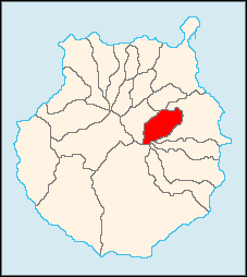 |
|
| Statistics | |
| Autonomous region: | Canary Islands Canary Islands The Canary Islands , also known as the Canaries , is a Spanish archipelago located just off the northwest coast of mainland Africa, 100 km west of the border between Morocco and the Western Sahara. The Canaries are a Spanish autonomous community and an outermost region of the European Union... |
| Province: | Las Palmas Las Palmas (province) The Province of Las Palmas is a province of Spain, consisting of the eastern part of the autonomous community of the Canary Islands.-Composition:... |
| Island: | Gran Canaria Gran Canaria Gran Canaria is the second most populous island of the Canary Islands, with a population of 838,397 which constitutes approximately 40% of the population of the archipelago... |
| Area Area Area is a quantity that expresses the extent of a two-dimensional surface or shape in the plane. Area can be understood as the amount of material with a given thickness that would be necessary to fashion a model of the shape, or the amount of paint necessary to cover the surface with a single coat... : |
39.15 km² some reads 38.43 km² |
| Population Population A population is all the organisms that both belong to the same group or species and live in the same geographical area. The area that is used to define a sexual population is such that inter-breeding is possible between any pair within the area and more probable than cross-breeding with individuals... : |
8,498 (2004) |
| Population density Population density Population density is a measurement of population per unit area or unit volume. It is frequently applied to living organisms, and particularly to humans... : |
221.13/km² |
| Elevation Elevation The elevation of a geographic location is its height above a fixed reference point, most commonly a reference geoid, a mathematical model of the Earth's sea level as an equipotential gravitational surface .... : Lowest: Centre: Highest: |
eastern part 558 m southwestern part |
| Location Geographic coordinate system A geographic coordinate system is a coordinate system that enables every location on the Earth to be specified by a set of numbers. The coordinates are often chosen such that one of the numbers represent vertical position, and two or three of the numbers represent horizontal position... : |
27.8667/27°58' N lat. 15.5/15°30' W long. |
| Municipal code: | E-35031 |
| Car designation: | GC until 2001 |
Valsequillo de Gran Canaria is a Canarian municipality in the eastern portion of the island of Gran Canaria
Gran Canaria
Gran Canaria is the second most populous island of the Canary Islands, with a population of 838,397 which constitutes approximately 40% of the population of the archipelago...
in the Las Palmas
Las Palmas (province)
The Province of Las Palmas is a province of Spain, consisting of the eastern part of the autonomous community of the Canary Islands.-Composition:...
province in the Canary Islands
Canary Islands
The Canary Islands , also known as the Canaries , is a Spanish archipelago located just off the northwest coast of mainland Africa, 100 km west of the border between Morocco and the Western Sahara. The Canaries are a Spanish autonomous community and an outermost region of the European Union...
. The population is 8,381 (ISTAC, 2003), its density is 214.07/km² and the area is 39.15 km². Valsequillo is situated in a mountain setting. Valsequillo is located southwest of Las Palmas de Gran Canaria and west of Telde and is on a road linking it to the capital as well as Telde, Vega de San Mateo and the northwestern part of Gran Canaria. The main industries are agriculture and tourism. Besides visiting the church of San Miguel tourists can also find in the narrow streets of Valsequillo several sculptures representing quotidian moments. Farmland is situated in the valleys, while the mountains cover most of Valsequillo.
Geography
- Location:
- Latitude: 28.01 (28°1') N
- Longitude: 15.55 (15°33') W
- Altitude:
- Lowest: eastern part
- Centre: 558 m
- Highest: southwestern part
Historical population
| Year | Population | Density |
|---|---|---|
| 1991 | 6.374 | 162,8/km² |
| 1996 | 7.796 | 199,1/km² |
| 1998 | 7.710 | 196,9/km² |
| 1999 | 7.905 | 201,9/km² |
| 2000 | 8.049 | 205,6/km² |
| 2001 | 8.139 | 207,9/km² |
| 2002 | 8.311 | 212,3/km² |
| 2003 | 8.381 | 214,1/km² |
| 2004 | 8.498 | 217,1/km² |
| 2005 | 8.659 | 221,2/km² |
| 2006 | 8.583 | 219,2/km² |
/km²
|}
Other
Valsequillo has schools, lyceums, a few gymnasia, churches, a post office and squares (plaza).External links
- Official site
- Map and aerial photos
- Street map from Mapquest. MapPoint or Google or Yahoo! Maps
- Google or Microsoft Virtual Earth - image now available
- Coordinates: 27°58′0"N 15°33′0"W
- Valsequillo Photos of Valsequillo
See also
| North: Santa Brígida Santa Brígida, Las Palmas Villa de Santa Brígida is a Canarian municipality in the northeastern portion of the island of Gran Canaria in the Province of Las Palmas of the Canary Islands. The suburbs of Las Palmas. The population is 18,817 , its density is 790.3/km² and the area is 23.81 km²... |
Northeast: Telde Telde, Las Palmas Telde is a municipality in the eastern on the island of Gran Canaria, Canary Islands, Spain. The suburb of Las Palmas city. It is the second most populated municipality on the island, with a population of 100,015... |
|
| West: Vega de San Mateo Vega de San Mateo, Las Palmas Vega de San Mateo Vega de San Mateo Vega de San Mateo (latter part Spanish meaning Saint Matthew is a Canarian municipality in the eastern portion of the island of Gran Canaria in the Las Palmas province in the Canary Islands. The population is 7,617 , its density is 199.66/km² and the area... |
Valsequillo | East: Telde |
| South: San Bartolomé de Tirajana San Bartolomé de Tirajana San Bartolomé de Tirajana is a Canarian municipality in the southeastern portion of the island of Gran Canaria in the Las Palmas province in the Canary Islands... |
Southeast: Ingenio Ingenio, Las Palmas Ingenio is a Canarian municipality in the eastern portion of the island of Gran Canaria in the Las Palmas province in the Canary Islands. The population is 26,857 , its density is 692.87/km² and the area is 38.15 km².... |