
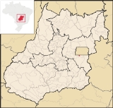
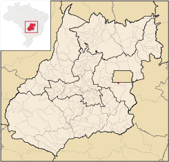
Valparaíso de Goiás
Encyclopedia
| Valparaíso de Goiás | |
|---|---|
| State | Goiás Goiás Goiás is a state of Brazil, located in the central part of the country. The name Goiás comes from the name of an indigenous community... |
| Coordinates: | 16°04′07"S 47°58′35"W |
| Area: | 60.1 km² |
| Population: | 114,450 (IBGE 2007) |
| Elevation: | 1,080m above sea level |
| Postcode (CEP): | 72870-000 |
| IBGE statistical microregion: | Entorno de Brasília |
| Became a city: | 1997 |
| Distance to Goiânia Goiânia -Climate:The city has a tropical wet and dry climate with an average temperature of . There's a wet season, from October to April, and a dry one, from May to September. Annual rainfall is around 1,520 mm.... : |
191 km. |
| Website: | none |
City
A city is a relatively large and permanent settlement. Although there is no agreement on how a city is distinguished from a town within general English language meanings, many cities have a particular administrative, legal, or historical status based on local law.For example, in the U.S...
and municipality
Municipality
A municipality is essentially an urban administrative division having corporate status and usually powers of self-government. It can also be used to mean the governing body of a municipality. A municipality is a general-purpose administrative subdivision, as opposed to a special-purpose district...
in east-central Goiás state
Goiás
Goiás is a state of Brazil, located in the central part of the country. The name Goiás comes from the name of an indigenous community...
, Brazil
Brazil
Brazil , officially the Federative Republic of Brazil , is the largest country in South America. It is the world's fifth largest country, both by geographical area and by population with over 192 million people...
. It is a suburb of Brasília
Brasília
Brasília is the capital city of Brazil. The name is commonly spelled Brasilia in English. The city and its District are located in the Central-West region of the country, along a plateau known as Planalto Central. It has a population of about 2,557,000 as of the 2008 IBGE estimate, making it the...
.
Location
Valparaíso is located on the plateau known as Planalto Central, southwest of BrasíliaBrasília
Brasília is the capital city of Brazil. The name is commonly spelled Brasilia in English. The city and its District are located in the Central-West region of the country, along a plateau known as Planalto Central. It has a population of about 2,557,000 as of the 2008 IBGE estimate, making it the...
and is part of the greater Brasília
Brasília
Brasília is the capital city of Brazil. The name is commonly spelled Brasilia in English. The city and its District are located in the Central-West region of the country, along a plateau known as Planalto Central. It has a population of about 2,557,000 as of the 2008 IBGE estimate, making it the...
area known as the Entorno de Brasília. The distance to the state capital, Goiânia
Goiânia
-Climate:The city has a tropical wet and dry climate with an average temperature of . There's a wet season, from October to April, and a dry one, from May to September. Annual rainfall is around 1,520 mm....
is 191 km.
It has boundaries with:
- North: BrasíliaBrasíliaBrasília is the capital city of Brazil. The name is commonly spelled Brasilia in English. The city and its District are located in the Central-West region of the country, along a plateau known as Planalto Central. It has a population of about 2,557,000 as of the 2008 IBGE estimate, making it the...
- South: LuziâniaLuziâniaLuziânia is a city and municipality in the state of Goiás, Brazil. This fast-growing city is a great producer of agricultural products including soybeans and beans.-Location:Luziânia is located 68 km...
- East: Cidade OcidentalCidade OcidentalCidade Ocidental is a small city and municipality located in central Goiás state, Brazil. It is a suburb of Brasília.-Geography:It is bordered on the north by the Federal District, on the south by Luziânia, on the east by Cristalina and Luziânia, and on the west by Luziânia and Valparaíso de...
- West: Novo GamaNovo GamaNovo Gama is a city and municipality in eastern Goiás state, Brazil. It is part of the greater Brasília metropolitan area. In 2007 the population was 83,599 inhabitants.-Location:...
It is served by highways BR-040, BR-060, BR-020 BR-251, and DF-290. The distance to the state capital of Goiânia is 191 km. and to Brasília (Plano Piloto), 25 km. Highway connections with Goiânia
Goiânia
-Climate:The city has a tropical wet and dry climate with an average temperature of . There's a wet season, from October to April, and a dry one, from May to September. Annual rainfall is around 1,520 mm....
are made by BR-153 / Anápolis
Anápolis
Anápolis is the third largest city in the State of Goiás in Brazil. It lies in the center of a rich agricultural region and has become a leader in food processing and pharmaceutical plants.-Location and population:...
/ BR-060 / Alexânia
Alexânia
Alexânia is a small town and municipality in central Goiás state, Brazil. Alexânia is known for its alleged extraterrestrial sightings in the late sixties and early seventies. The Areias River passes through the municipality.-Location:...
/ Gama. For the complete list see Distâncias Rodoviárias
Characteristics
It is considered one of the most densely populated municipalities in the state. All of the inhabitants live in the urban area since there is no rural area. The population has grown by over 25,000 inhabitants since the first census in 2000.Commerce, small industries and service-providing enterprises are the base of the economy. The potential for development, with its stands of trees, water sources, abundant energy and strategic location make it an attractive city for investment. The city is cut by highway BR 040, with a daily traffic of approximately 50,000 vehicles, in addition to the railway line, and this is attracting companies specializing in cargo transport.
Because Valparaíso is a suburb of Brasília, where the less privileged economic sectors could afford housing, it is still very dependent on the informal economy, which represents 40% of the base, with civil construction representing 30%, and the rest made up of workers commuting to Brasília. In recent years Valparaíso has been attracting furniture industries and the city has implanted a center (polo) for 120 new furniture factories. At the date of this writing there were approximately 100 furniture stores in the city operated by micro businessmen, with 500 carpenters registered in the area.
Health and education
In 2007 there were no hospitals. The infant mortality rate was 18.98, well below the national average of 33.0. There were 3 institutions of higher learning. In 2000 the adult literacy rate was 93.1%, one of the highest in the state and well above the national average of 86.4%.- MHDI: 0.795 (2000)
- State ranking: 12 (out of 242 municipalities)
- National ranking: 679 (out of 5,507 municipalities)
History
The history of the city is very recent, appearing in 1979 as a housing development with precarious services. The name is a tribute to a civil engineer who was from ValparaísoValparaíso
Valparaíso is a city and commune of Chile, center of its third largest conurbation and one of the country's most important seaports and an increasing cultural center in the Southwest Pacific hemisphere. The city is the capital of the Valparaíso Province and the Valparaíso Region...
, Chile
Chile
Chile ,officially the Republic of Chile , is a country in South America occupying a long, narrow coastal strip between the Andes mountains to the east and the Pacific Ocean to the west. It borders Peru to the north, Bolivia to the northeast, Argentina to the east, and the Drake Passage in the far...
, and had come to Brazil to be in charge of the first housing project of the future city. There are two neighborhoods whose names are written with the letter "z" – Valparaízo I e II –, according to the Chilean city. But, according to Portuguese spelling, the name of the city began to be written with the letter "s" --Valparaíso. cidada muito boa pra se mora.
Sources of Data
- www.VALTV.org - MULTIMÍDIA DE VALPARAÍSO DE GOIÁS E ENTORNO www.VALTV.org - MULTIMÍDIA DE VALPARAÍSO DE GOIÁS E ENTORNO
- IBGE
- Seplan
- Frigoletto
- Distâncias Rodoviárias