

U.S. Route 319
Encyclopedia
U.S. Highway 319 is a spur of U.S. Route 19
. It runs for 318 miles (512 km) from US 1
/State Route 4
in Wadley, Georgia
to the John Gorrie Bridge
at Apalachicola, Florida
. The sections of US 319 in Medart, Florida
and from just east of Carrabelle, Florida
to its terminus in Apalachicola are jointly signed with U.S. Route 98
. It passes through the states of Georgia
and Florida
. It goes through the city of Tallahassee, Florida
.
.svg.png)
to the Florida State Line is a GRIP corridor.
U.S. Route 19
U.S. Route 19 is a north–south U.S. Highway. Despite encroaching Interstate Highways, the route has remained a long-haul route, connecting the Gulf of Mexico with Lake Erie....
. It runs for 318 miles (512 km) from US 1
U.S. Route 1
U.S. Route 1 is a major north–south U.S. Highway that serves the East Coast of the United States. It runs 2,377 miles from Fort Kent, Maine at the Canadian border south to Key West, Florida. U.S. 1 generally parallels Interstate 95, though it is significantly farther west between...
/State Route 4
U.S. Route 1 in Georgia
U.S. Route 1 in Georgia is also mostly signed as the state highway State Route 4. The route crosses the St. Marys River from Florida near Waycross and crosses the Savannah River from Augusta, Georgia into North Augusta, South Carolina....
in Wadley, Georgia
Wadley, Georgia
Wadley is a city in Jefferson County, Georgia, United States. The population was 2,088 at the 2000 census. The community was named for William Morill Wadley.-Geography:Wadley is located at ....
to the John Gorrie Bridge
John Gorrie Memorial Bridge
The John Gorrie Bridge carries US 98 and US 319 over the Apalachicola Bay. It connects Apalachicola, Florida with Eastpoint, Florida. The original John Gorrie Bridge was built in 1935, replacing a ferry service between the two towns. It included a rotating section to allow passage of ships with...
at Apalachicola, Florida
Apalachicola, Florida
Apalachicola is a city in Franklin County, Florida, on US 98 about southwest of Tallahassee. The population was 2,334 at the 2000 census. The 2005 census estimated the city's population at 2,340...
. The sections of US 319 in Medart, Florida
Medart, Florida
Medart is a small unincorporated community in Wakulla County, Florida, United States of America.-Schools in Medart:*Medart Elementary School*Wakulla Middle School*Wakulla High School...
and from just east of Carrabelle, Florida
Carrabelle, Florida
Carrabelle is a city in Franklin County, Florida, United States. The population was 1,303 at the 2000 census. According to the U.S Census estimates of 2009, the city had a population of 1,231.-Location:...
to its terminus in Apalachicola are jointly signed with U.S. Route 98
U.S. Route 98
U.S. Route 98 is an east–west United States highway that runs from western Mississippi to southern Florida. It was established in 1933 as a route between Pensacola, Florida and Apalachicola, Florida, and has since been extended westward into Mississippi and eastward across the Florida...
. It passes through the states of Georgia
Georgia (U.S. state)
Georgia is a state located in the southeastern United States. It was established in 1732, the last of the original Thirteen Colonies. The state is named after King George II of Great Britain. Georgia was the fourth state to ratify the United States Constitution, on January 2, 1788...
and Florida
Florida
Florida is a state in the southeastern United States, located on the nation's Atlantic and Gulf coasts. It is bordered to the west by the Gulf of Mexico, to the north by Alabama and Georgia and to the east by the Atlantic Ocean. With a population of 18,801,310 as measured by the 2010 census, it...
. It goes through the city of Tallahassee, Florida
Tallahassee, Florida
Tallahassee is the capital of the U.S. state of Florida. It is the county seat and only incorporated municipality in Leon County, and is the 128th largest city in the United States. Tallahassee became the capital of Florida, then the Florida Territory, in 1824. In 2010, the population recorded by...
.
Route description
Intersections
 SR 65
SR 65 US 98
US 98
 SR 263Florida State Road 263State Road 263 is a north–south route that forms the western portion of Capital Circle, Tallahassee's "beltway".The route runs from State Road 363 , taking over from the hidden State Road 261 to its east. it then runs west, separating from US 319 at State Road 61/Crawfordville Highway, where...
-61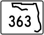 SR 363
 US 27
US 27 US 90
US 90 I-10
I-10- SR 61
Georgia
In Georgia, U.S Highway 319 from TiftonTifton, Georgia
Tifton is a city in Tift County, Georgia, United States. The population was 15,060 at the 2000 census. The city is the county seat of Tift County.-Major highways:* Interstate 75* U.S. Highway 41* U.S. Highway 82* U.S...
to the Florida State Line is a GRIP corridor.
Intersections
 GA 93
GA 93 GA 122Georgia State Route 122State Route 122 is a East–West route located in the U.S. state of Georgia. The route runs from its Eastern terminus at US 1/SR 4/US 23/US 84/SR 38 in Waycross West to its Western terminus at US 19/SR 3/US 84/SR 38/SR 300 in Thomasville....
 US 19
US 19 US 84
US 84 GA 33Georgia State Route 33State Route 33 is a north–south state route located in the southern part of the U.S. state of Georgia. The route travels from U.S. 84/SR 38 in Boston to U.S. 41/SR 7 south of Cordele.-Route description:...
 GA 133Georgia State Route 133State Route 133 is a north–south state highway in southwestern Georgia. In fact, the actual path taken is more southeast to northwest. The route begins in Valdosta, GA on a northwesterly jaunt through Lowndes County and Brooks County before reaching Moultrie, GA. From here, the route heads...
 GA 37Georgia State Route 37State Route 37 is a west–east state route located in the southern part of the U.S. state of Georgia. The route travels from Alabama State Route 10 at the Alabama state line west of Fort Gaines east to U.S...
 GA 111
 US 82
US 82 I-75
I-75 US 41
US 41 US 129
 US 441
 US 280
 US 23-341
 I-16
I-16 US 80
US 80 US 221
 US 1 (Northern terminus)