
John Gorrie Memorial Bridge
Encyclopedia

U.S. Route 98
U.S. Route 98 is an east–west United States highway that runs from western Mississippi to southern Florida. It was established in 1933 as a route between Pensacola, Florida and Apalachicola, Florida, and has since been extended westward into Mississippi and eastward across the Florida...
and US 319
U.S. Route 319
U.S. Highway 319 is a spur of U.S. Route 19. It runs for 318 miles from US 1 /State Route 4 in Wadley, Georgia to the John Gorrie Bridge at Apalachicola, Florida. The sections of US 319 in Medart, Florida and from just east of Carrabelle, Florida to its terminus in Apalachicola are jointly...
over the Apalachicola Bay
Apalachicola Bay
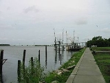
Apalachicola Bay is an estuary and lagoon located on Florida's northwest coast renowned for its oysters. The Apalachicola Bay system also includes St. Georges Sound, St. Vincent Sound and East Bay, covering an area of about . Four islands St. Vincent Island to the west, Cape St. George Island and St...
. It connects Apalachicola, Florida
Apalachicola, Florida
Apalachicola is a city in Franklin County, Florida, on US 98 about southwest of Tallahassee. The population was 2,334 at the 2000 census. The 2005 census estimated the city's population at 2,340...
with Eastpoint, Florida
Eastpoint, Florida
Eastpoint is a census-designated place in Franklin County, Florida, United States. The population was 2,158 at the 2000 census.-Geography:Eastpoint is located at ....
. The original John Gorrie Bridge was built in 1935, replacing a ferry service between the two towns. It included a rotating section to allow passage of ships with high masts. The current bridge was built in 1988.