
.gif)
Typhoon Kalmaegi (2008)
Encyclopedia
Typhoon Kalmaegi was the seventh named storm and the fifth typhoon that was recognised by the Japan Meteorological Agency. The Joint Typhoon Warning Center also recognised it as the eighth tropical depression, the seventh tropical storm and the sixth typhoon of the 2008 Pacific typhoon season
.
Kalmaegi formed as a tropical depression on 13 July when it was located to the east of the Philippines
. It was named Kalmaegi by RSMC Tokyo on 15 July; the storm reached its peak winds of 75 knots (147 km/h) on 17 July. Shortly afterwards it made a direct landfall on Taiwan and then moved into China's Fujan province the next day it emerged into the Taiwan Strait and raced towards North Korea where it became fully extratropical and the last advisories were released.
(JMA), began to issue full advisories on a tropical depression, which was located to the east of the Philippines. Later that day PAGASA
allocated the name Helen to the depression, followed the next day by the Joint Typhoon Warning Center (JTWC) designating the number 08W. Early on July 15, both the JTWC, and the JMA upgraded the depression to tropical storm status, with RSMC Tokyo assigning the name "Kalmaegi" to the storm, which was submitted by North Korea
and is Korean
for seagull
. Early on the 17th, Kalmaegi began rapidly intensifying; JMA was the first agency to upgrade it into a typhoon. JTWC followed a few hours later. Finally, PAGASA upgraded Kalmaegi (Helen) into a typhoon on later that day.
Typhoon Kalmaegi, which was downgraded to tropical storm status by Taiwan's Central Weather Bureau
while still east of the country, made landfall at Ilan County in northeast Taiwan in the evening of July 17 at 19:40 local time (13:40 UTC) and emerged into the Taiwan Strait
at 7:20 in the morning local time (01:20 UTC) on July 18. From Taiwan, the typhoon, now downgraded to a tropical storm, turned toward southeast China
. In Xiapu County
of Fujian Province, the tropical storm made landfall at 17:50 local time (0950 UTC), with winds of about 90 miles per hour. Early on July 19, the JTWC issued its final advisory on Kalmaegi and downgraded it to a tropical depression. However, the JMA continued to issue advisories and maintained Kalmaegi as a tropical storm as it moved to the Yellow Sea
. Late the next day, the JMA downgraded Kalmaegi to a low (extratropical cyclone
) as it moved inland over North Korea
.

from July 14 till the 17th. Initially, PAGASA issued Storm Signal Number 1 over Cagayan
, Isabela
, Batanes Group of Islands and Calayan Group of Islands. But as the storm tracked nearer to Northern Luzon, more and more are issued Signals 1, 2 and 3. By the afternoon of the 16th Philippine Time, only Batanes was left under Signal Number one. PAGASA issued their last advisory on Helen (Kalmaegi) on 2100 UTC 17 July (5 a.m. 18 July PST).
(mostly affecting Ilocos
and Cagayan Valley
), where it killed two people and injured another. The first fatality occurred after a man drove off the edge of a cliff due to poor visibility. The second was linked to a snake bite following the storm. In all, Kalmaegi affected at least 31,129 people throughout 146 barangays in three provinces. Property damages amounted to ₱
5.6 million. The storm also hit 82 villages (all in Northern Luzon) and caused around ₱
1.3 million worth of damage to agriculture. Meanwhile, the storm intensified the southwest monsoon, thus causing torrential rains over the rest of Luzon. The resulting rains thus caused suspension of classes in parts of Metro Manila
.
 At least 19 lost their lives due to the storm and six were reported as missing. Tainan County
(now part of Tainan City) in southern Taiwan reported more than 1100 mm of rainfall in some mountain regions. An estimated 600 mm (23.6 in) of rain fell within seven hours, causing several drainage systems to overflow. Local media reported that an estimate 115,000 people in Taiwan, primarily in Tainan, Nantou County
, and Taichung County
(now part of Taichung City) lost power during the storm. The storm caused NT$
300 million ($15.1 million USD) worth of damage, and destroyed about 5,100 hectare
s of orchards and crops. Agricultural losses amounted to $300 million (USD).
of Fujian Province and in neighboring Zhejiang Province, 360,000 residents left coastal and low-lying homes to escape the storm. Schools and many businesses remained closed, and the storm was expected to travel northwest.
, peaking at 237.5 mm (9.3 in) in Seoul
. Rainfall
rates were recorded up to 52.5 mm (2 in) per hour at times, caused water to overflow at several of the major dams along the Han
, Nakdong
, and Geum
Rivers. One dam, the Paldang-Dam had to discharge water at a rate of 4,817 m3 (170,110 ft3) per second. Eight levee
s were breached, with a total length of 105 m (344 ft), due to rising rivers, flooding 93 homes and 87.58 hectare
s (216.4 acre
s) of farmland. Rains also caused landslide which covered an area of 0.6 hectares (1.4 acres) and washed out a small bridge. Four people were killed, another was listed as missing, and a total of 271 were affected by the storm.
, lying at the end of the Ryukyu Islands
near Taiwan
, experienced strong winds gusting up to 98 km/h (60 mph).
, the remnants of Kalmaegi brought significant rainfall and strong winds to parts of eastern Russia. Winds were reported to be gusting up to 85 km/h (50 mph) in Primorsky Krai
and southern Khabarovsk Krai
. Several rivers in Primorsky were reportedly near flood stage as the storm passed through. Offshore, Several ships were stranded during the storm and sent out distress signals.
and was one of the original names submitted for use from January 1, 2000. The name Kalmaegi is Korean
for a seagull which is a type of bird
which lives by the sea
.
2008 Pacific typhoon season
The 2008 Pacific typhoon season has no official bounds; it runs year-round in 2008, but most tropical cyclones tend to form in the northwestern Pacific Ocean between May and November...
.
Kalmaegi formed as a tropical depression on 13 July when it was located to the east of the Philippines
Philippines
The Philippines , officially known as the Republic of the Philippines , is a country in Southeast Asia in the western Pacific Ocean. To its north across the Luzon Strait lies Taiwan. West across the South China Sea sits Vietnam...
. It was named Kalmaegi by RSMC Tokyo on 15 July; the storm reached its peak winds of 75 knots (147 km/h) on 17 July. Shortly afterwards it made a direct landfall on Taiwan and then moved into China's Fujan province the next day it emerged into the Taiwan Strait and raced towards North Korea where it became fully extratropical and the last advisories were released.
Meteorological history
Early on July 13, the Japan Meteorological AgencyJapan Meteorological Agency
The or JMA, is the Japanese government's weather service. Charged with gathering and reporting weather data and forecasts in Japan, it is a semi-autonomous part of the Ministry of Land, Infrastructure and Transport...
(JMA), began to issue full advisories on a tropical depression, which was located to the east of the Philippines. Later that day PAGASA
Philippine Atmospheric, Geophysical and Astronomical Services Administration
The Philippine Atmospheric, Geophysical and Astronomical Services Administration is a Philippine national institution dedicated to provide flood and typhoon warnings, public weather forecasts and advisories, meteorological, astronomical, climatological, and other specialized information and...
allocated the name Helen to the depression, followed the next day by the Joint Typhoon Warning Center (JTWC) designating the number 08W. Early on July 15, both the JTWC, and the JMA upgraded the depression to tropical storm status, with RSMC Tokyo assigning the name "Kalmaegi" to the storm, which was submitted by North Korea
North Korea
The Democratic People’s Republic of Korea , , is a country in East Asia, occupying the northern half of the Korean Peninsula. Its capital and largest city is Pyongyang. The Korean Demilitarized Zone serves as the buffer zone between North Korea and South Korea...
and is Korean
Korean language
Korean is the official language of the country Korea, in both South and North. It is also one of the two official languages in the Yanbian Korean Autonomous Prefecture in People's Republic of China. There are about 78 million Korean speakers worldwide. In the 15th century, a national writing...
for seagull
Gull
Gulls are birds in the family Laridae. They are most closely related to the terns and only distantly related to auks, skimmers, and more distantly to the waders...
. Early on the 17th, Kalmaegi began rapidly intensifying; JMA was the first agency to upgrade it into a typhoon. JTWC followed a few hours later. Finally, PAGASA upgraded Kalmaegi (Helen) into a typhoon on later that day.
Typhoon Kalmaegi, which was downgraded to tropical storm status by Taiwan's Central Weather Bureau
Central Weather Bureau
The Central Weather Bureau is the government meteorological research and forecasting institution of the Republic of China . In addition to meteorology, the Central Weather Bureau also makes astronomical observations, reports on sea conditions, and conducts research into seismology and provides...
while still east of the country, made landfall at Ilan County in northeast Taiwan in the evening of July 17 at 19:40 local time (13:40 UTC) and emerged into the Taiwan Strait
Taiwan Strait
The Taiwan Strait or Formosa Strait, formerly known as the Black Ditch, is a 180-km-wide strait separating Mainland China and Taiwan. The strait is part of the South China Sea and connects to East China Sea to the northeast...
at 7:20 in the morning local time (01:20 UTC) on July 18. From Taiwan, the typhoon, now downgraded to a tropical storm, turned toward southeast China
China
Chinese civilization may refer to:* China for more general discussion of the country.* Chinese culture* Greater China, the transnational community of ethnic Chinese.* History of China* Sinosphere, the area historically affected by Chinese culture...
. In Xiapu County
Xiapu County
Xiapu , is a county in the municipal region of Ningde, Fujian. It has a stretch of East China Sea coast, with many harbours and islands...
of Fujian Province, the tropical storm made landfall at 17:50 local time (0950 UTC), with winds of about 90 miles per hour. Early on July 19, the JTWC issued its final advisory on Kalmaegi and downgraded it to a tropical depression. However, the JMA continued to issue advisories and maintained Kalmaegi as a tropical storm as it moved to the Yellow Sea
Yellow Sea
The Yellow Sea is the name given to the northern part of the East China Sea, which is a marginal sea of the Pacific Ocean. It is located between mainland China and the Korean Peninsula. Its name comes from the sand particles from Gobi Desert sand storms that turn the surface of the water golden...
. Late the next day, the JMA downgraded Kalmaegi to a low (extratropical cyclone
Extratropical cyclone
Extratropical cyclones, sometimes called mid-latitude cyclones or wave cyclones, are a group of cyclones defined as synoptic scale low pressure weather systems that occur in the middle latitudes of the Earth having neither tropical nor polar characteristics, and are connected with fronts and...
) as it moved inland over North Korea
North Korea
The Democratic People’s Republic of Korea , , is a country in East Asia, occupying the northern half of the Korean Peninsula. Its capital and largest city is Pyongyang. The Korean Demilitarized Zone serves as the buffer zone between North Korea and South Korea...
.
Preparations
Philippines
PAGASA issued Public Storm Warning Signals for provinces across Northern LuzonLuzon
Luzon is the largest island in the Philippines. It is located in the northernmost region of the archipelago, and is also the name for one of the three primary island groups in the country centered on the Island of Luzon...
from July 14 till the 17th. Initially, PAGASA issued Storm Signal Number 1 over Cagayan
Cagayan
Cagayan , the "Land of Smiling Beauty", is a province of the Philippines in the Cagayan Valley region in Luzon. Its capital is Tuguegarao City and is located at the northeastern corner of the island of Luzon. Cagayan also includes the Babuyan Islands to the north. The province borders Ilocos Norte...
, Isabela
Isabela province
Isabela is the second largest province of the Philippines next to Palawan. It is located in the Cagayan Valley Region in Luzon. Its capital is Ilagan and borders, clockwise from the south, Aurora, Quirino, Nueva Vizcaya, Ifugao, Mountain Province, Kalinga, and Cagayan...
, Batanes Group of Islands and Calayan Group of Islands. But as the storm tracked nearer to Northern Luzon, more and more are issued Signals 1, 2 and 3. By the afternoon of the 16th Philippine Time, only Batanes was left under Signal Number one. PAGASA issued their last advisory on Helen (Kalmaegi) on 2100 UTC 17 July (5 a.m. 18 July PST).
Taiwan
Several flights in and out of Taiwan were either delayed or cancelled due to the typhoon. All evening classes for the day the storm made landfall were closed however, all classes were scheduled to resume the next day.Mainland China
Officials in Fujian Province and Zhejiang Province ordered about 61,000 ships to return to port and evacuated an estimated 360,000 people from low-lying areas.Philippines
In the Philippines, it passed over Northern LuzonLuzon
Luzon is the largest island in the Philippines. It is located in the northernmost region of the archipelago, and is also the name for one of the three primary island groups in the country centered on the Island of Luzon...
(mostly affecting Ilocos
Ilocos
Ilocos collectively refers to two provinces in the Philippines: Ilocos Norte and Ilocos Sur. Inhabitants are called Ilocanos and they speak the language Iloko, also called Ilocano.The Ilocos Region, containing four provinces, is named after Ilocos...
and Cagayan Valley
Cagayan Valley
Cagayan Valley is a region of the Philippines, also designated as Region II or Region 02. It is composed of five provinces, namely: Batanes, Cagayan, Isabela, Nueva Vizcaya, and Quirino...
), where it killed two people and injured another. The first fatality occurred after a man drove off the edge of a cliff due to poor visibility. The second was linked to a snake bite following the storm. In all, Kalmaegi affected at least 31,129 people throughout 146 barangays in three provinces. Property damages amounted to ₱
Philippine peso
The peso is the currency of the Philippines. It is subdivided into 100 centavos . Before 1967, the language used on the banknotes and coins was English and so "peso" was the name used...
5.6 million. The storm also hit 82 villages (all in Northern Luzon) and caused around ₱
Philippine peso
The peso is the currency of the Philippines. It is subdivided into 100 centavos . Before 1967, the language used on the banknotes and coins was English and so "peso" was the name used...
1.3 million worth of damage to agriculture. Meanwhile, the storm intensified the southwest monsoon, thus causing torrential rains over the rest of Luzon. The resulting rains thus caused suspension of classes in parts of Metro Manila
Metro Manila
Metropolitan Manila , the National Capital Region , or simply Metro Manila, is the metropolitan region encompassing the City of Manila and its surrounding areas in the Philippines...
.
Taiwan
Tainan County
Tainan County was located in southern Taiwan. The name "Tainan" means "Southern Taiwan". Formerly a county of the Republic of China , Tainan County was merged with Tainan City at the end of 2010 to form a single special municipality....
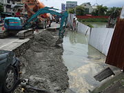
(now part of Tainan City) in southern Taiwan reported more than 1100 mm of rainfall in some mountain regions. An estimated 600 mm (23.6 in) of rain fell within seven hours, causing several drainage systems to overflow. Local media reported that an estimate 115,000 people in Taiwan, primarily in Tainan, Nantou County
Nantou County
Nantou County is the second largest county of Taiwan. It is also the only landlocked county in Taiwan. Its name derives from the Hoanya Taiwanese aboriginal word Ramtau. Nantou County is officially administered as a county of Taiwan....
, and Taichung County
Taichung County
Taichung County was a county in central Taiwan, the Republic of China, that surrounded but did not include Taichung City. The name Taichung means "central Taiwan"...
(now part of Taichung City) lost power during the storm. The storm caused NT$
New Taiwan dollar
The New Taiwan dollar , or simply Taiwan dollar, is the official currency of the Taiwan Area of the Republic of China since 1949, when it replaced the Old Taiwan dollar...
300 million ($15.1 million USD) worth of damage, and destroyed about 5,100 hectare
Hectare
The hectare is a metric unit of area defined as 10,000 square metres , and primarily used in the measurement of land. In 1795, when the metric system was introduced, the are was defined as being 100 square metres and the hectare was thus 100 ares or 1/100 km2...
s of orchards and crops. Agricultural losses amounted to $300 million (USD).
Mainland China
In Xiapu CountyXiapu County
Xiapu , is a county in the municipal region of Ningde, Fujian. It has a stretch of East China Sea coast, with many harbours and islands...
of Fujian Province and in neighboring Zhejiang Province, 360,000 residents left coastal and low-lying homes to escape the storm. Schools and many businesses remained closed, and the storm was expected to travel northwest.
Republic of Korea
The remnants of Kalmaegi produced heavy rains over the Korean PeninsulaKorean Peninsula
The Korean Peninsula is a peninsula in East Asia. It extends southwards for about 684 miles from continental Asia into the Pacific Ocean and is surrounded by the Sea of Japan to the south, and the Yellow Sea to the west, the Korea Strait connecting the first two bodies of water.Until the end of...
, peaking at 237.5 mm (9.3 in) in Seoul
Seoul
Seoul , officially the Seoul Special City, is the capital and largest metropolis of South Korea. A megacity with a population of over 10 million, it is the largest city proper in the OECD developed world...
. Rainfall
Precipitation (meteorology)
In meteorology, precipitation In meteorology, precipitation In meteorology, precipitation (also known as one of the classes of hydrometeors, which are atmospheric water phenomena is any product of the condensation of atmospheric water vapor that falls under gravity. The main forms of precipitation...
rates were recorded up to 52.5 mm (2 in) per hour at times, caused water to overflow at several of the major dams along the Han
Han River (Korea)
The Han River is a major river in South Korea and the fourth longest river on the Korean peninsula after the Amnok, Duman, and Nakdong rivers. It is formed by the confluence of the Namhan River , which originates in Mount Daedeok, and the Bukhan River , which originates on the slopes of Mount...
, Nakdong
Nakdong River
The Nakdong River is the longest river in South Korea, and passes through major cities such as Daegu and Busan.-Geography:...
, and Geum
Geum River
The Geum-gang River is located in South Korea. It is a major river that originates in Jangsu-eub, North Jeolla Province. It flows northward through North Jeolla and North Chungcheong Provinces and then changes direction in the vicinity of Greater Daejeon and flows southwest through South...
Rivers. One dam, the Paldang-Dam had to discharge water at a rate of 4,817 m3 (170,110 ft3) per second. Eight levee
Levee
A levee, levée, dike , embankment, floodbank or stopbank is an elongated naturally occurring ridge or artificially constructed fill or wall, which regulates water levels...
s were breached, with a total length of 105 m (344 ft), due to rising rivers, flooding 93 homes and 87.58 hectare
Hectare
The hectare is a metric unit of area defined as 10,000 square metres , and primarily used in the measurement of land. In 1795, when the metric system was introduced, the are was defined as being 100 square metres and the hectare was thus 100 ares or 1/100 km2...
s (216.4 acre
Acre
The acre is a unit of area in a number of different systems, including the imperial and U.S. customary systems. The most commonly used acres today are the international acre and, in the United States, the survey acre. The most common use of the acre is to measure tracts of land.The acre is related...
s) of farmland. Rains also caused landslide which covered an area of 0.6 hectares (1.4 acres) and washed out a small bridge. Four people were killed, another was listed as missing, and a total of 271 were affected by the storm.
Japan
YonaguniYonaguni
is one of the Yaeyama Islands. It is the westernmost inhabited island of Japan and lies from the east coast of Taiwan, between the East China Sea and the Pacific Ocean proper....
, lying at the end of the Ryukyu Islands
Ryukyu Islands
The , also known as the , is a chain of islands in the western Pacific, on the eastern limit of the East China Sea and to the southwest of the island of Kyushu in Japan. From about 1829 until the mid 20th century, they were alternately called Luchu, Loochoo, or Lewchew, akin to the Mandarin...
near Taiwan
Taiwan
Taiwan , also known, especially in the past, as Formosa , is the largest island of the same-named island group of East Asia in the western Pacific Ocean and located off the southeastern coast of mainland China. The island forms over 99% of the current territory of the Republic of China following...
, experienced strong winds gusting up to 98 km/h (60 mph).
Russia
After moving through the Sea of JapanSea of Japan
The Sea of Japan is a marginal sea of the western Pacific Ocean, between the Asian mainland, the Japanese archipelago and Sakhalin. It is bordered by Japan, North Korea, Russia and South Korea. Like the Mediterranean Sea, it has almost no tides due to its nearly complete enclosure from the Pacific...
, the remnants of Kalmaegi brought significant rainfall and strong winds to parts of eastern Russia. Winds were reported to be gusting up to 85 km/h (50 mph) in Primorsky Krai
Primorsky Krai
Primorsky Krai , informally known as Primorye , is a federal subject of Russia . Primorsky means "maritime" in Russian, hence the region is sometimes referred to as Maritime Province or Maritime Territory. Its administrative center is in the city of Vladivostok...
and southern Khabarovsk Krai
Khabarovsk Krai
Khabarovsk Krai is a federal subject of Russia , located in the Russian Far East. It lies mostly in the basin of the lower Amur River, but also occupies a vast mountainous area along the coastline of the Sea of Okhotsk, an arm of the Pacific Ocean. The administrative center of the krai is the...
. Several rivers in Primorsky were reportedly near flood stage as the storm passed through. Offshore, Several ships were stranded during the storm and sent out distress signals.
Taiwan
Government officials in Taiwan enacted a large rescue operation involving over 60,000 civilian and government rescue workers. Following the severe flooding in Taiwan, officials in Mainland China were willing to send fresh vegetables whenever needed.Naming
The name Kalmaegi was submitted to the World Meteorological Organisation's Typhoon Committee by North KoreaNorth Korea
The Democratic People’s Republic of Korea , , is a country in East Asia, occupying the northern half of the Korean Peninsula. Its capital and largest city is Pyongyang. The Korean Demilitarized Zone serves as the buffer zone between North Korea and South Korea...
and was one of the original names submitted for use from January 1, 2000. The name Kalmaegi is Korean
Korean language
Korean is the official language of the country Korea, in both South and North. It is also one of the two official languages in the Yanbian Korean Autonomous Prefecture in People's Republic of China. There are about 78 million Korean speakers worldwide. In the 15th century, a national writing...
for a seagull which is a type of bird
Bird
Birds are feathered, winged, bipedal, endothermic , egg-laying, vertebrate animals. Around 10,000 living species and 188 families makes them the most speciose class of tetrapod vertebrates. They inhabit ecosystems across the globe, from the Arctic to the Antarctic. Extant birds range in size from...
which lives by the sea
Sea
A sea generally refers to a large body of salt water, but the term is used in other contexts as well. Most commonly, it means a large expanse of saline water connected with an ocean, and is commonly used as a synonym for ocean...
.
See also
- 2008 Pacific typhoon season2008 Pacific typhoon seasonThe 2008 Pacific typhoon season has no official bounds; it runs year-round in 2008, but most tropical cyclones tend to form in the northwestern Pacific Ocean between May and November...
- Timeline of the 2008 Pacific typhoon seasonTimeline of the 2008 Pacific typhoon seasonThis timeline documents all the storm formations, strengthening, weakening, landfalls, extratropical transitions, as well as dissipation during the 2008 Pacific typhoon season. The 2008 Pacific typhoon season officially started on January 1, 2008 and ended on January 1, 2009. The first tropical...