

Tropical Storm Linda (1997)
Encyclopedia
Severe Tropical Storm Linda was the worst typhoon in southern Vietnam
in at least 100 years, killing thousands of people and leaving extensive damage. It formed on October 31 in the South China Sea
, between Indochina
and the Philippines
. Strengthening as it moved westward, Linda struck extreme southern Vietnam on November 2 with winds of 65 mph (100 km/h), dropping heavy rainfall. Once in the Gulf of Thailand
it strengthened further to minimal typhoon status, but weakened to tropical storm strength before crossing the Malay Peninsula
into the Bay of Bengal
, the first storm to do so in five years. It restrengthened in the Indian Ocean to typhoon status, but increasing wind shear and weakened steering currents caused Linda to dissipate on November 9.
The worst of Linda's impact was in Vietnam, where 3,111 people were killed, and damage totaled $385 million (USD). Heavy rainfall caused flooding, which damaged or destroyed about 200,000 houses and left about 383,000 people homeless. Widespread crop and transportation damage also occurred, the latter which impeded relief efforts. Several countries around the world sent relief aid, including medical teams, food, and clothing. However, the food supply and health status of the storm victims proved not as bad as originally feared. Linda later struck Thailand, causing flash flooding and at least 164 deaths. The storm also affected Burma (Myanmar), Indonesia
, Malaysia, and Cambodia
to a lesser degree.
on October 26. A subtropical ridge
persisted to the north, which caused the disturbance to move generally westward. On October 29, the system crossed the Philippines and entered the South China Sea
. It subsequently began to organize, and late on October 31, the Joint Typhoon Warning Center
(JTWC) initiated advisories on Tropical Depression 30W. At that time, the system was located off the northwest coast of Borneo
. The PAGASA organization named it "Openg".
Shortly after developing, the depression intensified into a tropical storm, and was named "Linda" by the JTWC. It continued to intensify, reaching winds of 65 mph (100 km/h) as it approached southern Vietnam
. At 0900 UTC on November 2, Linda made landfall in the Vietnamese province of Cà Mau
. It maintained its strength over land, and the storm quickly reached typhoon status after entering the Gulf of Thailand
; a typhoon is a tropical cyclone with winds of at least 75 mph (120 km/h), although Linda did not intensify beyond minimal typhoon status. Turning northwestward, Linda deteriorated to tropical storm strength, and struck Thailand
late on November 3 with winds of 65 mph (100 km/h).
Linda weakened further over the mountainous terrain of the Malay Peninsula
, and the storm emerged into the Andaman Sea
with winds of 50 mph (85 km/h). This made Linda the first tropical cyclone since Typhoon Forrest in 1992 to cross from the western Pacific Ocean into the Indian Ocean. Additionally, upon reaching the Indian Ocean, the India Meteorological Department
(IMD) classified the storm as Cyclonic Storm BOB 08, with winds of 40 mph (70 km/h). With warm waters, Tropical Storm Linda gradually re-intensified as it slowed down, due to a weakness in the subtropical ridge. On November 6, it again attained typhoon status while located off the southwest coast of Burma (Myanmar). Initially, it was expected to cross the Bay of Bengal
and make landfall near the India
/Bangladesh
border. The cyclone only maintained peak strength for 18 hours, due to an increase in wind shear
from a mid-latitude trough
. Linda's motion became nearly stationary, and it gradually weakened for several days. On November 9, Linda dissipated about 375 miles (600 km) southwest of Yangon
, Burma. That day, the IMD also terminated advisories.
 Prior to the arrival of the storm, officials in Vietnam issued warnings to the residents, although its approach was faster than expected, and the region rarely experiences tropical cyclones. Tropical Storm Linda dropped heavy rainfall across southern Vietnam
, peaking at 9.17 inches (23.3 cm) in Cần Thơ. The storm caused heavy damage in the country, particularly in the southernmost province of Cà Mau
where it struck, but also in Bạc Liêu
, Sóc Trăng
, and Kiên Giang
. The most severely affected regions were poor fishing communities. Overall, the storm damaged 139,445 houses and wrecked 76,609 more, which left 383,045 people homeless. Thousands of schools were damaged, and 130,815 dykes were breached. Additionally, the storm destroyed at least 3,122 boats. The rainfall also flooded 1750 square miles (4,532.5 km²) of rice paddy crop, about half of which in Cà Mau. A preliminary damage total was estimated at 7.18 trillion dongs ($385 million USD).
Typhoon Linda caused considerable deaths in Vietnam. Many fishermen and sailors were caught at sea in the path of the storm, unable to escape its path. Within three days, the death toll in Vietnam was set at over 150, with thousands missing, many of them fishermen. By the fourth day after the storm, the toll reached 390, and on November 14, eight days after the storm, the death toll reached 464. Ultimately, the death toll was set at 3,111. Eight days after Linda's passage, a United Nations
Department of Humanitarian Affairs (DHA) report indicated 857 people were injured by the storm. The government quickly established search and rescue teams, particularly for missing fishermen, and a total of 3,513 people were rescued after the storm. In the weeks after the storm, hundreds of dead bodies washed ashore in Vietnam and Thailand.
The Vietnamese government identified basic supplies that it needed in response to the storm; those included various foods, clothing, medicine, shelter supplies, and sanitation equipment. The country made a formal request for international assistance, noting that the storm was the worst in 100 years, and officials had limited resources due to the unexpected destruction. Prior to the request, the government of Switzerland
sent about 500,000 Swiss francs ($360,000 USD) for immediate relief assistance. Subsequently, ten other countries sent cash or relief supplies worth $2.6 million, including medical shelters from the United States
, clothing from the United Kingdom
, tents from Russia
, and transport goods from Japan
. Red Cross workers had to travel by riverboat to bring aid to the most affected communities, due to the poor state of the roads. After two months, the Red Cross distributed 65,401 roofing sheets, 390 metric tons of rice, 11,990 mosquito nets, 6,871 blankets, 3,664 medical kits, and abundant clothing supplies to about 150,000 affected people; the supplies were purchased in Ho Chi Minh City
. Eventually, the food supply and health status of the storm victims proved not as bad as originally feared. After the assistance was distributed, the Red Cross shifted focus toward reconstruction. Reconstruction was slow, partly due to a slowdown in economic activity from the Vietnamese New Year. Additionally, the two primary factories responsible for making iron and construction frames were only intermittently open, due to machines failing.
Elsewhere, moderate damage was also reported in Thailand, where at least 12 casualties were reported on land, and at least 152 fishermen were killed at sea. Flash flood
ing occurred in six districts, which damaged about 88 square miles (227.9 km²) of croplands and destroyed 12 houses. Land transportation was affected, with 184 roads and 14 bridges damaged. The government of Thailand sent 20 medical teams to the most affected areas. Following the storm, about 10,600 people became sick from flood related diseases. Heavy rains fell in Tanintharyi Division
in southeastern Burma (Myanmar), although because the winds were not strong, there was little damage. The typhoon increased smog and haze in Indonesia
and Malaysia, which had been occurring for weeks. In Indonesia, the typhoon also removed atmospheric moisture, which lowered the chance for rain in areas affected by wildfires. Cambodia
was also affected by the outskirts of the storm.
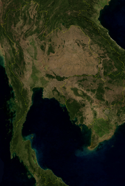
Vietnam
Vietnam – sometimes spelled Viet Nam , officially the Socialist Republic of Vietnam – is the easternmost country on the Indochina Peninsula in Southeast Asia. It is bordered by China to the north, Laos to the northwest, Cambodia to the southwest, and the South China Sea –...
in at least 100 years, killing thousands of people and leaving extensive damage. It formed on October 31 in the South China Sea
South China Sea
The South China Sea is a marginal sea that is part of the Pacific Ocean, encompassing an area from the Singapore and Malacca Straits to the Strait of Taiwan of around...
, between Indochina
Indochina
The Indochinese peninsula, is a region in Southeast Asia. It lies roughly southwest of China, and east of India. The name has its origins in the French, Indochine, as a combination of the names of "China" and "India", and was adopted when French colonizers in Vietnam began expanding their territory...
and the Philippines
Philippines
The Philippines , officially known as the Republic of the Philippines , is a country in Southeast Asia in the western Pacific Ocean. To its north across the Luzon Strait lies Taiwan. West across the South China Sea sits Vietnam...
. Strengthening as it moved westward, Linda struck extreme southern Vietnam on November 2 with winds of 65 mph (100 km/h), dropping heavy rainfall. Once in the Gulf of Thailand
Gulf of Thailand
The Gulf of Thailand , also known in to Malays as Teluk Siam literally meant Gulf of Siam, is a shallow arm of the South China Sea.-Geography:...
it strengthened further to minimal typhoon status, but weakened to tropical storm strength before crossing the Malay Peninsula
Malay Peninsula
The Malay Peninsula or Thai-Malay Peninsula is a peninsula in Southeast Asia. The land mass runs approximately north-south and, at its terminus, is the southern-most point of the Asian mainland...
into the Bay of Bengal
Bay of Bengal
The Bay of Bengal , the largest bay in the world, forms the northeastern part of the Indian Ocean. It resembles a triangle in shape, and is bordered mostly by the Eastern Coast of India, southern coast of Bangladesh and Sri Lanka to the west and Burma and the Andaman and Nicobar Islands to the...
, the first storm to do so in five years. It restrengthened in the Indian Ocean to typhoon status, but increasing wind shear and weakened steering currents caused Linda to dissipate on November 9.
The worst of Linda's impact was in Vietnam, where 3,111 people were killed, and damage totaled $385 million (USD). Heavy rainfall caused flooding, which damaged or destroyed about 200,000 houses and left about 383,000 people homeless. Widespread crop and transportation damage also occurred, the latter which impeded relief efforts. Several countries around the world sent relief aid, including medical teams, food, and clothing. However, the food supply and health status of the storm victims proved not as bad as originally feared. Linda later struck Thailand, causing flash flooding and at least 164 deaths. The storm also affected Burma (Myanmar), Indonesia
Indonesia
Indonesia , officially the Republic of Indonesia , is a country in Southeast Asia and Oceania. Indonesia is an archipelago comprising approximately 13,000 islands. It has 33 provinces with over 238 million people, and is the world's fourth most populous country. Indonesia is a republic, with an...
, Malaysia, and Cambodia
Cambodia
Cambodia , officially known as the Kingdom of Cambodia, is a country located in the southern portion of the Indochina Peninsula in Southeast Asia...
to a lesser degree.
Meteorological history
The origins of Typhoon Linda were from an area of convection that were first noted east of the PhilippinesPhilippines
The Philippines , officially known as the Republic of the Philippines , is a country in Southeast Asia in the western Pacific Ocean. To its north across the Luzon Strait lies Taiwan. West across the South China Sea sits Vietnam...
on October 26. A subtropical ridge
Subtropical ridge
The subtropical ridge is a significant belt of high pressure situated around the latitudes of 30°N in the Northern Hemisphere and 30°S in the Southern Hemisphere. It is characterized by mostly calm winds, which acts to reduce air quality under its axis by causing fog overnight, and haze during...
persisted to the north, which caused the disturbance to move generally westward. On October 29, the system crossed the Philippines and entered the South China Sea
South China Sea
The South China Sea is a marginal sea that is part of the Pacific Ocean, encompassing an area from the Singapore and Malacca Straits to the Strait of Taiwan of around...
. It subsequently began to organize, and late on October 31, the Joint Typhoon Warning Center
Joint Typhoon Warning Center
The Joint Typhoon Warning Center is a joint United States Navy – United States Air Force task force located at the Naval Maritime Forecast Center in Pearl Harbor, Hawaii...
(JTWC) initiated advisories on Tropical Depression 30W. At that time, the system was located off the northwest coast of Borneo
Borneo
Borneo is the third largest island in the world and is located north of Java Island, Indonesia, at the geographic centre of Maritime Southeast Asia....
. The PAGASA organization named it "Openg".
Shortly after developing, the depression intensified into a tropical storm, and was named "Linda" by the JTWC. It continued to intensify, reaching winds of 65 mph (100 km/h) as it approached southern Vietnam
Vietnam
Vietnam – sometimes spelled Viet Nam , officially the Socialist Republic of Vietnam – is the easternmost country on the Indochina Peninsula in Southeast Asia. It is bordered by China to the north, Laos to the northwest, Cambodia to the southwest, and the South China Sea –...
. At 0900 UTC on November 2, Linda made landfall in the Vietnamese province of Cà Mau
Ca Mau Province
Cà Mau is a province of Vietnam, named after its capital city. It is located in the Mekong Delta of southern Vietnam, and is the southernmost of Vietnam's 58 provinces...
. It maintained its strength over land, and the storm quickly reached typhoon status after entering the Gulf of Thailand
Gulf of Thailand
The Gulf of Thailand , also known in to Malays as Teluk Siam literally meant Gulf of Siam, is a shallow arm of the South China Sea.-Geography:...
; a typhoon is a tropical cyclone with winds of at least 75 mph (120 km/h), although Linda did not intensify beyond minimal typhoon status. Turning northwestward, Linda deteriorated to tropical storm strength, and struck Thailand
Thailand
Thailand , officially the Kingdom of Thailand , formerly known as Siam , is a country located at the centre of the Indochina peninsula and Southeast Asia. It is bordered to the north by Burma and Laos, to the east by Laos and Cambodia, to the south by the Gulf of Thailand and Malaysia, and to the...
late on November 3 with winds of 65 mph (100 km/h).
Linda weakened further over the mountainous terrain of the Malay Peninsula
Malay Peninsula
The Malay Peninsula or Thai-Malay Peninsula is a peninsula in Southeast Asia. The land mass runs approximately north-south and, at its terminus, is the southern-most point of the Asian mainland...
, and the storm emerged into the Andaman Sea
Andaman Sea
The Andaman Sea or Burma Sea is a body of water to the southeast of the Bay of Bengal, south of Burma, west of Thailand and east of the Andaman Islands, India; it is part of the Indian Ocean....
with winds of 50 mph (85 km/h). This made Linda the first tropical cyclone since Typhoon Forrest in 1992 to cross from the western Pacific Ocean into the Indian Ocean. Additionally, upon reaching the Indian Ocean, the India Meteorological Department
India Meteorological Department
The India Meteorological Department , also referred to as the Met Office, is an agency of the Ministry of Earth Sciences of the Government of India. It is the principal agency responsible for meteorological observations, weather forecasting and seismology...
(IMD) classified the storm as Cyclonic Storm BOB 08, with winds of 40 mph (70 km/h). With warm waters, Tropical Storm Linda gradually re-intensified as it slowed down, due to a weakness in the subtropical ridge. On November 6, it again attained typhoon status while located off the southwest coast of Burma (Myanmar). Initially, it was expected to cross the Bay of Bengal
Bay of Bengal
The Bay of Bengal , the largest bay in the world, forms the northeastern part of the Indian Ocean. It resembles a triangle in shape, and is bordered mostly by the Eastern Coast of India, southern coast of Bangladesh and Sri Lanka to the west and Burma and the Andaman and Nicobar Islands to the...
and make landfall near the India
India
India , officially the Republic of India , is a country in South Asia. It is the seventh-largest country by geographical area, the second-most populous country with over 1.2 billion people, and the most populous democracy in the world...
/Bangladesh
Bangladesh
Bangladesh , officially the People's Republic of Bangladesh is a sovereign state located in South Asia. It is bordered by India on all sides except for a small border with Burma to the far southeast and by the Bay of Bengal to the south...
border. The cyclone only maintained peak strength for 18 hours, due to an increase in wind shear
Wind shear
Wind shear, sometimes referred to as windshear or wind gradient, is a difference in wind speed and direction over a relatively short distance in the atmosphere...
from a mid-latitude trough
Trough (meteorology)
A trough is an elongated region of relatively low atmospheric pressure, often associated with fronts.Unlike fronts, there is not a universal symbol for a trough on a weather chart. The weather charts in some countries or regions mark troughs by a line. In the United States, a trough may be marked...
. Linda's motion became nearly stationary, and it gradually weakened for several days. On November 9, Linda dissipated about 375 miles (600 km) southwest of Yangon
Yangon
Yangon is a former capital of Burma and the capital of Yangon Region . Although the military government has officially relocated the capital to Naypyidaw since March 2006, Yangon, with a population of over four million, continues to be the country's largest city and the most important commercial...
, Burma. That day, the IMD also terminated advisories.
Impact and aftermath
Vietnam
Vietnam – sometimes spelled Viet Nam , officially the Socialist Republic of Vietnam – is the easternmost country on the Indochina Peninsula in Southeast Asia. It is bordered by China to the north, Laos to the northwest, Cambodia to the southwest, and the South China Sea –...
, peaking at 9.17 inches (23.3 cm) in Cần Thơ. The storm caused heavy damage in the country, particularly in the southernmost province of Cà Mau
Ca Mau Province
Cà Mau is a province of Vietnam, named after its capital city. It is located in the Mekong Delta of southern Vietnam, and is the southernmost of Vietnam's 58 provinces...
where it struck, but also in Bạc Liêu
Bac Lieu Province
Bạc Liêu is a province of Vietnam. It is a coastal province, and is situated in the Mekong Delta region of the southern part of the country.- Name :Formally a territoy of Cambodia, the name Bac Lieu is believed to derive from the Khmer language...
, Sóc Trăng
Soc Trang Province
Sóc Trăng is a province in the Mekong Delta of southern Vietnam, with its capital in Sóc Trăng. The province occupies an area of 3,223 km², and has a population of approximately 1,213,400.-Etymology:...
, and Kiên Giang
Kien Giang Province
Kiên Giang is a province of Vietnam, located in the Mekong Delta region of southern Vietnam. It is known for fishing and rice farming. The provincial capital is Rạch Giá, 250 km from the Ho Chi Minh City...
. The most severely affected regions were poor fishing communities. Overall, the storm damaged 139,445 houses and wrecked 76,609 more, which left 383,045 people homeless. Thousands of schools were damaged, and 130,815 dykes were breached. Additionally, the storm destroyed at least 3,122 boats. The rainfall also flooded 1750 square miles (4,532.5 km²) of rice paddy crop, about half of which in Cà Mau. A preliminary damage total was estimated at 7.18 trillion dongs ($385 million USD).
Typhoon Linda caused considerable deaths in Vietnam. Many fishermen and sailors were caught at sea in the path of the storm, unable to escape its path. Within three days, the death toll in Vietnam was set at over 150, with thousands missing, many of them fishermen. By the fourth day after the storm, the toll reached 390, and on November 14, eight days after the storm, the death toll reached 464. Ultimately, the death toll was set at 3,111. Eight days after Linda's passage, a United Nations
United Nations
The United Nations is an international organization whose stated aims are facilitating cooperation in international law, international security, economic development, social progress, human rights, and achievement of world peace...
Department of Humanitarian Affairs (DHA) report indicated 857 people were injured by the storm. The government quickly established search and rescue teams, particularly for missing fishermen, and a total of 3,513 people were rescued after the storm. In the weeks after the storm, hundreds of dead bodies washed ashore in Vietnam and Thailand.
The Vietnamese government identified basic supplies that it needed in response to the storm; those included various foods, clothing, medicine, shelter supplies, and sanitation equipment. The country made a formal request for international assistance, noting that the storm was the worst in 100 years, and officials had limited resources due to the unexpected destruction. Prior to the request, the government of Switzerland
Switzerland
Switzerland name of one of the Swiss cantons. ; ; ; or ), in its full name the Swiss Confederation , is a federal republic consisting of 26 cantons, with Bern as the seat of the federal authorities. The country is situated in Western Europe,Or Central Europe depending on the definition....
sent about 500,000 Swiss francs ($360,000 USD) for immediate relief assistance. Subsequently, ten other countries sent cash or relief supplies worth $2.6 million, including medical shelters from the United States
United States
The United States of America is a federal constitutional republic comprising fifty states and a federal district...
, clothing from the United Kingdom
United Kingdom
The United Kingdom of Great Britain and Northern IrelandIn the United Kingdom and Dependencies, other languages have been officially recognised as legitimate autochthonous languages under the European Charter for Regional or Minority Languages...
, tents from Russia
Russia
Russia or , officially known as both Russia and the Russian Federation , is a country in northern Eurasia. It is a federal semi-presidential republic, comprising 83 federal subjects...
, and transport goods from Japan
Japan
Japan is an island nation in East Asia. Located in the Pacific Ocean, it lies to the east of the Sea of Japan, China, North Korea, South Korea and Russia, stretching from the Sea of Okhotsk in the north to the East China Sea and Taiwan in the south...
. Red Cross workers had to travel by riverboat to bring aid to the most affected communities, due to the poor state of the roads. After two months, the Red Cross distributed 65,401 roofing sheets, 390 metric tons of rice, 11,990 mosquito nets, 6,871 blankets, 3,664 medical kits, and abundant clothing supplies to about 150,000 affected people; the supplies were purchased in Ho Chi Minh City
Ho Chi Minh City
Ho Chi Minh City , formerly named Saigon is the largest city in Vietnam...
. Eventually, the food supply and health status of the storm victims proved not as bad as originally feared. After the assistance was distributed, the Red Cross shifted focus toward reconstruction. Reconstruction was slow, partly due to a slowdown in economic activity from the Vietnamese New Year. Additionally, the two primary factories responsible for making iron and construction frames were only intermittently open, due to machines failing.
Elsewhere, moderate damage was also reported in Thailand, where at least 12 casualties were reported on land, and at least 152 fishermen were killed at sea. Flash flood
Flash flood
A flash flood is a rapid flooding of geomorphic low-lying areas—washes, rivers, dry lakes and basins. It may be caused by heavy rain associated with a storm, hurricane, or tropical storm or meltwater from ice or snow flowing over ice sheets or snowfields...
ing occurred in six districts, which damaged about 88 square miles (227.9 km²) of croplands and destroyed 12 houses. Land transportation was affected, with 184 roads and 14 bridges damaged. The government of Thailand sent 20 medical teams to the most affected areas. Following the storm, about 10,600 people became sick from flood related diseases. Heavy rains fell in Tanintharyi Division
Tanintharyi Division
Tanintharyi Region , is an administrative region of Myanmar, covering the long narrow southern part of the country on the Kra Isthmus. It borders with the Andaman Sea to the west and with the Tenasserim Hills, beyond which lies Thailand, to the east. To the north is the Mon State. The capital of...
in southeastern Burma (Myanmar), although because the winds were not strong, there was little damage. The typhoon increased smog and haze in Indonesia
Indonesia
Indonesia , officially the Republic of Indonesia , is a country in Southeast Asia and Oceania. Indonesia is an archipelago comprising approximately 13,000 islands. It has 33 provinces with over 238 million people, and is the world's fourth most populous country. Indonesia is a republic, with an...
and Malaysia, which had been occurring for weeks. In Indonesia, the typhoon also removed atmospheric moisture, which lowered the chance for rain in areas affected by wildfires. Cambodia
Cambodia
Cambodia , officially known as the Kingdom of Cambodia, is a country located in the southern portion of the Indochina Peninsula in Southeast Asia...
was also affected by the outskirts of the storm.