

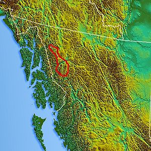
Tahltan Highland
Encyclopedia
Plateau
In geology and earth science, a plateau , also called a high plain or tableland, is an area of highland, usually consisting of relatively flat terrain. A highly eroded plateau is called a dissected plateau...
and relatively lower mountain range
Mountain range
A mountain range is a single, large mass consisting of a succession of mountains or narrowly spaced mountain ridges, with or without peaks, closely related in position, direction, formation, and age; a component part of a mountain system or of a mountain chain...
s in British Columbia
British Columbia
British Columbia is the westernmost of Canada's provinces and is known for its natural beauty, as reflected in its Latin motto, Splendor sine occasu . Its name was chosen by Queen Victoria in 1858...
, Canada
Canada
Canada is a North American country consisting of ten provinces and three territories. Located in the northern part of the continent, it extends from the Atlantic Ocean in the east to the Pacific Ocean in the west, and northward into the Arctic Ocean...
, lying east of the Boundary Ranges
Boundary Ranges
The Boundary Ranges, also known in the singular and as the Alaska Boundary Range, are the largest and most northerly subrange of the Coast Mountains...
and south of the Inklin River
Inklin River
The Inklin River is a river in northern British Columbia, Canada. It flows northwest into the head of the Taku River, which is formed by the convergence of the Inklin with the Nakina River, which flows southwest to meet it at the uninhabited locality of Inklin, which is located at the...
(the east fork of the Taku River
Taku River
The Taku River is a river running from British Columbia, Canada, to the northwestern coast of North America, at Juneau, Alaska. Its mouth coincides with the Alaska-British Columbia border...
). Its eastern boundary is formed by the Sheslay River
Sheslay River
The Sheslay River is a river in far northwestern British Columbia in the southeast portion of the basin of the Taku River. The river is 85 km in length from the confluence of the Hackett River to the junction of the Nahlin River, which is the commencement of the Inklin River, the main SE...
and the Little Tuya River, while its southern boundary extends across the Stikine River
Stikine River
The Stikine River is a river, historically also the Stickeen River, approximately 610 km long, in northwestern British Columbia in Canada and southeastern Alaska in the United States...
and its Grand Canyon
Grand Canyon of the Stikine
The Grand Canyon of the Stikine is a 45 mile stretch of the Stikine River in northern British Columbia, Canada. It has been compared to the Grand Canyon of the Colorado in scale and was called the "Yosemite of the North" by naturalist John Muir. The canyon is home to a large population of...
to include the Mount Edziza volcanic complex
Mount Edziza volcanic complex
The Mount Edziza volcanic complex is a large and potentially active north-south trending complex volcano in Stikine Country, northwestern British Columbia, Canada, located southeast of the small community of Telegraph Creek...
(which includes the Spectrum Range
Spectrum Range
The Spectrum Range, formerly called the Spectrum Mountains and the Rainbow Mountains, is a subrange of the Tahltan Highland in the Stikine Country of northwestern British Columbia, 20 km west of the Stewart-Cassiar Highway, south of Mount Edziza and north of the Arctic Lake Plateau. The...
), and the Zagoddethchino massif.