
Streetsville, Ontario
Encyclopedia
Streetsville is an established community located in the northwestern corner of the city of Mississauga, Ontario
, Canada
, on the Credit River
. Although Streetsville occupies both the west and east banks of the river, the majority is located on the west bank of the river.
Although the former village
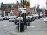
is surrounded by modern suburban development, it seeks to keep a “small town” charm by retaining a variety of historical buildings and streetscapes. As part of this attempt to maintain a separate identity from the larger city, the names of several main Mississauga roads, as they pass through Streetsville, revert to what they were called when Streetsville was an independent village. These include Mississauga Road and Bristol Road, which revert to Queen Street and Main Street respectively. Other main thoroughfares that cross Streetsville include Creditview Road, Eglinton Avenue
, and Britannia Road.
was populated by the Iroquois
people up until the early 18th century, when it was taken by the Ojibwa
. European settlers came to know them specifically as the Mississaugas, which eventually became the name of the area itself. By 1805, the Natives had either ceded or sold most of this land over to British governance.
family. At the age of 23, he moved with his family from New York to St. David’s, a settlement on the Niagara River
in Upper Canada
(now known as Ontario).
In 1818, the British made a second purchase of 648000 acres (2,622.4 km²) of land from the indigenous Mississauga peoples
. Before it could be opened for settlement, the land had to be surveyed, and as was usual for the time, surveyors would receive a grant of land from the parcel that they surveyed as compensation for their work. Timothy Street, along with Richard Bristol, a qualified surveyor, applied for a contract to survey parts of the newly available land. As they did their work, Street quickly began to appreciate the immense potential for settlement along the Credit River, and made plans to erect both a saw and grist mill once his work was finished.
In April 1819, the surveyed land was opened for settlement, and the first settler in the area, James Glendinning, settled on a parcel of land along Mullet Creek. Timothy Street did build his saw and grist mills, using stones from Glendinning's land.
A large quarry of red clay lay on the west side of the village, encouraging the use of brick for construction.
In 1821, Streetsville’s first general store, now known as Montreal House, was built, and still stands. Another landmark, Timothy Street’s house, was built in 1825 and is one of the oldest brick houses in Peel Region.
In 1855, William Graydon and Peter Douglass built a large brick building, and sold it in 1859 to Bennet Franklin, a partner in Barber Brothers Toronto Woollen Mills. It became known as Franklin House. In 1910, under new ownership, the name was changed to the Queen’s Hotel. Although it ceased to operate as a hotel when its public room was closed with the enforcement of the Canada Temperance Act, it continued to be used for commercial purposes. At present, it has been designated under the terms of the Ontario Heritage Act and protected by a heritage easement, and now houses a restaurant and a variety of small businesses and offices.
In 1858, Streetsville was incorporated as a village. Timothy Street's son, John, was the first reeve.
For the next century, Streetsville largely existed as a long narrow village with all of its shops, three churches, the cenotaph
and the library located on Queen Street, which ran between the Credit River and the railway track.
In 1953, two of the first suburbs in Canada, Vista Heights and Riverview, were built to the southwest and northeast respectively. Vista Heights was notable because the town council of the time made the unprecedented decision to require the developer to build a K-6 (kindergarten to Grade 6) elementary school. These suburbs and Vista Heights Public School
opened in 1955, presaging the future high growth of middle-class suburbs in the area.
In 1968, the creation of the Town of Mississauga amalgamated the villages and hamlets of Cooksville
, Dixie, Erindale and Malton
. Although Streetsville, Clarkson, Port Credit
and Meadowvale were excluded from this amalgamation, it was evident that the high population growth in the area would result in further amalgamation.
In 1974 all of these communities were annexed when Mississauga became a city. Four years later, Hazel McCallion
, who had been the last mayor of Streetsville (1970–1973), became the third mayor of Mississauga. As of August 2010, she still occupies that office, and still lives in Streetsville.
Ontario
Ontario is a province of Canada, located in east-central Canada. It is Canada's most populous province and second largest in total area. It is home to the nation's most populous city, Toronto, and the nation's capital, Ottawa....
, Canada
Canada
Canada is a North American country consisting of ten provinces and three territories. Located in the northern part of the continent, it extends from the Atlantic Ocean in the east to the Pacific Ocean in the west, and northward into the Arctic Ocean...
, on the Credit River
Credit River
The Credit River is a river in southern Ontario which flows from headwaters above the Niagara Escarpment to empty into Lake Ontario at Port Credit, Mississauga. It drains an area of approximately 1,000 km²...
. Although Streetsville occupies both the west and east banks of the river, the majority is located on the west bank of the river.
Although the former village
Village
A village is a clustered human settlement or community, larger than a hamlet with the population ranging from a few hundred to a few thousand , Though often located in rural areas, the term urban village is also applied to certain urban neighbourhoods, such as the West Village in Manhattan, New...
is surrounded by modern suburban development, it seeks to keep a “small town” charm by retaining a variety of historical buildings and streetscapes. As part of this attempt to maintain a separate identity from the larger city, the names of several main Mississauga roads, as they pass through Streetsville, revert to what they were called when Streetsville was an independent village. These include Mississauga Road and Bristol Road, which revert to Queen Street and Main Street respectively. Other main thoroughfares that cross Streetsville include Creditview Road, Eglinton Avenue
Eglinton Avenue
Eglinton Avenue, originally known as the Richview Sideroad within Etobicoke, is an east-west arterial thoroughfare in Toronto and Mississauga, in the Canadian province of Ontario. Within Toronto, Eglinton Avenue is the only road which crosses through all six former boroughs...
, and Britannia Road.
Before 1800
The area surrounding the Credit RiverCredit River
The Credit River is a river in southern Ontario which flows from headwaters above the Niagara Escarpment to empty into Lake Ontario at Port Credit, Mississauga. It drains an area of approximately 1,000 km²...
was populated by the Iroquois
Iroquois
The Iroquois , also known as the Haudenosaunee or the "People of the Longhouse", are an association of several tribes of indigenous people of North America...
people up until the early 18th century, when it was taken by the Ojibwa
Ojibwa
The Ojibwe or Chippewa are among the largest groups of Native Americans–First Nations north of Mexico. They are divided between Canada and the United States. In Canada, they are the third-largest population among First Nations, surpassed only by Cree and Inuit...
. European settlers came to know them specifically as the Mississaugas, which eventually became the name of the area itself. By 1805, the Natives had either ceded or sold most of this land over to British governance.
Settlement
The beginnings of Streetsville are interwoven with the history of its founder, Timothy Street. Street was born in 1778 in the American colonies to a British LoyalistLoyalist (American Revolution)
Loyalists were American colonists who remained loyal to the Kingdom of Great Britain during the American Revolutionary War. At the time they were often called Tories, Royalists, or King's Men. They were opposed by the Patriots, those who supported the revolution...
family. At the age of 23, he moved with his family from New York to St. David’s, a settlement on the Niagara River
Niagara River
The Niagara River flows north from Lake Erie to Lake Ontario. It forms part of the border between the Province of Ontario in Canada and New York State in the United States. There are differing theories as to the origin of the name of the river...
in Upper Canada
Upper Canada
The Province of Upper Canada was a political division in British Canada established in 1791 by the British Empire to govern the central third of the lands in British North America and to accommodate Loyalist refugees from the United States of America after the American Revolution...
(now known as Ontario).
In 1818, the British made a second purchase of 648000 acres (2,622.4 km²) of land from the indigenous Mississauga peoples
Mississaugas
The Mississaugas are a subtribe of the Anishinaabe-speaking First Nations people located in southern Ontario, Canada. They are closely related to the Ojibwa...
. Before it could be opened for settlement, the land had to be surveyed, and as was usual for the time, surveyors would receive a grant of land from the parcel that they surveyed as compensation for their work. Timothy Street, along with Richard Bristol, a qualified surveyor, applied for a contract to survey parts of the newly available land. As they did their work, Street quickly began to appreciate the immense potential for settlement along the Credit River, and made plans to erect both a saw and grist mill once his work was finished.
In April 1819, the surveyed land was opened for settlement, and the first settler in the area, James Glendinning, settled on a parcel of land along Mullet Creek. Timothy Street did build his saw and grist mills, using stones from Glendinning's land.
A large quarry of red clay lay on the west side of the village, encouraging the use of brick for construction.
In 1821, Streetsville’s first general store, now known as Montreal House, was built, and still stands. Another landmark, Timothy Street’s house, was built in 1825 and is one of the oldest brick houses in Peel Region.
In 1855, William Graydon and Peter Douglass built a large brick building, and sold it in 1859 to Bennet Franklin, a partner in Barber Brothers Toronto Woollen Mills. It became known as Franklin House. In 1910, under new ownership, the name was changed to the Queen’s Hotel. Although it ceased to operate as a hotel when its public room was closed with the enforcement of the Canada Temperance Act, it continued to be used for commercial purposes. At present, it has been designated under the terms of the Ontario Heritage Act and protected by a heritage easement, and now houses a restaurant and a variety of small businesses and offices.
In 1858, Streetsville was incorporated as a village. Timothy Street's son, John, was the first reeve.
For the next century, Streetsville largely existed as a long narrow village with all of its shops, three churches, the cenotaph
Cenotaph
A cenotaph is an "empty tomb" or a monument erected in honour of a person or group of people whose remains are elsewhere. It can also be the initial tomb for a person who has since been interred elsewhere. The word derives from the Greek κενοτάφιον = kenotaphion...
and the library located on Queen Street, which ran between the Credit River and the railway track.
In 1953, two of the first suburbs in Canada, Vista Heights and Riverview, were built to the southwest and northeast respectively. Vista Heights was notable because the town council of the time made the unprecedented decision to require the developer to build a K-6 (kindergarten to Grade 6) elementary school. These suburbs and Vista Heights Public School
Vista Heights Public School
Vista Heights Public School is an elementary school in Mississauga, Ontario, Canada that offers classes from Kindergarten to Grade 5. Built in 1957 as part of the Vista Heights suburb, the school was originally designed as a Grade 1–6 school for approximately 300 students...
opened in 1955, presaging the future high growth of middle-class suburbs in the area.
1962 incorporation and 1974 municipal reorganization
In January 1962, Streetsville's population reached 5,000, and it was incorporated as a town as a result. The first Mayor was Frank Dowling.In 1968, the creation of the Town of Mississauga amalgamated the villages and hamlets of Cooksville
Cooksville, Ontario
Cooksville is a neighbourhood in the city of Mississauga, Ontario, Canada. It is located at the intersection of Dundas Street and Hurontario Street.-History:...
, Dixie, Erindale and Malton
Malton, Ontario
Malton is a neighbourhood in the northeastern part of the city of Mississauga, Ontario, Canada, located to the northwest of Toronto. The neighbourhood has a population of approximately 36,400 as of 2002....
. Although Streetsville, Clarkson, Port Credit
Port Credit, Ontario
Port Credit is found at the mouth of the Credit River on the north shore of Lake Ontario, within the southcentral area of the city of Mississauga...
and Meadowvale were excluded from this amalgamation, it was evident that the high population growth in the area would result in further amalgamation.
In 1974 all of these communities were annexed when Mississauga became a city. Four years later, Hazel McCallion
Hazel McCallion
Hazel McCallion, née Joueneaux, CM is the mayor of Mississauga, Ontario. McCallion has been Mississauga's mayor for years, holding office since 1978...
, who had been the last mayor of Streetsville (1970–1973), became the third mayor of Mississauga. As of August 2010, she still occupies that office, and still lives in Streetsville.
Demographics
Streetsville is considered one of Mississauga's most affluent communities. The average household income is in excess of $114,000 and over 88 per cent of residents own their homes.Bread and Honey Festival
Since 1973, in an effort to retain a separate identity from the larger city of Mississauga, Streetsville has held an annual Bread and Honey Festival, an acknowledgement of the town’s history and its involvement with milling. The Founding President in 1973 was Sam McCallion. The festival weekend at Streetsville Memorial Park is usually scheduled for the first weekend of June.Santa Claus Parade
The annual Mississauga Santa Claus Parade now resides in Streetsville. The parade starts on Queen Street South at Britannia Road and travels south through the village to disperse at various locations after the Church Street junction.See also
- Mississauga—StreetsvilleMississauga—StreetsvilleMississauga—Streetsville is a federal electoral district in Ontario, Canada, that has been represented in the Canadian House of Commons since 2004...
, electoral riding- Brad ButtBrad ButtBrad Butt is a Canadian politician, who was elected to the Canadian House of Commons in the 2011 election. He represents the electoral district of Mississauga—Streetsville as a member of the Conservative Party....
, MP for Mississauga—Streetsville - Bob DelaneyBob DelaneyBob Delaney is a politician in Ontario, Canada. He is a member of the Legislative Assembly of Ontario, representing the riding of Mississauga—Streetsville for the Ontario Liberal Party....
, MPP for Mississauga—Streetsville
- Brad Butt
- Streetsville Secondary SchoolStreetsville Secondary SchoolStreetsville Secondary School is a high school in the Peel District School Board located in the Streetsville community of Mississauga, Ontario, Canada....
- St. Joseph Secondary School (Mississauga)St. Joseph Secondary School (Mississauga)St. Joseph Secondary School, colloquially known as St. Joe's is a Catholic high school located in the Streetsville community of Mississauga, Ontario. The school is administered by the Dufferin-Peel Catholic District School Board....
- Hazel McCallion Senior Public SchoolHazel McCallion Senior Public SchoolHazel McCallion Senior Public School is a middle school located in Streetsville, Mississauga. The school was opened in 1991 to accommodate students from Willow Way Public School and Whitehorn Public School. Hazel McCallion public school is named after the current mayor of Mississauga, Hazel McCallion...
- Vista Heights Public SchoolVista Heights Public SchoolVista Heights Public School is an elementary school in Mississauga, Ontario, Canada that offers classes from Kindergarten to Grade 5. Built in 1957 as part of the Vista Heights suburb, the school was originally designed as a Grade 1–6 school for approximately 300 students...
- Russell Langmaid Public SchoolRussell Langmaid Public SchoolRussell Langmaid Public School is an elementary school in Mississauga, Ontario, Canada. It is located near the corner of Queen and Main streets, in the heart of Streetsville. Built in 1940, it is the oldest continuing school in Streetsville, and predates the city of Mississauga by 34 years...
- F. B. McFarren Memorial ParkF. B. McFarren Memorial ParkThe park is situated in the community of Streetsville in Mississauga south of McFarren Blvd, which runs from Thomas Street south and west to Erin Mills Parkway. It was opened in 1996 and named after F. B. McFarren, on lands which were previously owned by the McFarren family who operated a brick...
- Billy TalentBilly TalentBilly Talent is a Canadian post-hardcore band from Streetsville, Ontario. They formed in 1993 with Ben Kowalewicz as the lead vocalist, Ian D'Sa on lead guitar, bassist Jon Gallant and drummer Aaron Solowoniuk ....
External links
- streetsville.ca - The Web Site in the City - Community Web Site