Stoney Slough National Wildlife Refuge
Encyclopedia

Stoney Slough National Wildlife Refuge is a 2,000 acre (8 km2) easement refuge
Easement refuge
An easement refuge is a special type of National Wildlife Refuge under the auspices of the United States Fish and Wildlife Service.On an easement refuge, the Refuge boundaries encompass private land but the Fish and Wildlife Service does not own the land...
with 1,120 acres (4.5 km2) owned in fee title and the remaining area of 880 acres (3.6 km2) covered by easement
Easement
An easement is a certain right to use the real property of another without possessing it.Easements are helpful for providing pathways across two or more pieces of property or allowing an individual to fish in a privately owned pond...
. The United States Fish and Wildlife Service
United States Fish and Wildlife Service
The United States Fish and Wildlife Service is a federal government agency within the United States Department of the Interior dedicated to the management of fish, wildlife, and natural habitats...
fee title of 1,120 acres (4.5 km2) allows some wetland
Wetland
A wetland is an area of land whose soil is saturated with water either permanently or seasonally. Wetlands are categorised by their characteristic vegetation, which is adapted to these unique soil conditions....
and upland
Upland and lowland (freshwater ecology)
In studies of the ecology of freshwater rivers, habitats are classified as upland and lowland.-Definitions:Upland habitats are cold, clear, rocky, fast flowing rivers in mountainous areas; lowland habitats are warm, slow flowing rivers found in relatively flat lowland areas, with water that is...
management. The wetland areas on the Refuge cover approximately 600 acres (2.4 km2) in four permanent pools and two temporary pools. Water management using a series of canal
Canal
Canals are man-made channels for water. There are two types of canal:#Waterways: navigable transportation canals used for carrying ships and boats shipping goods and conveying people, further subdivided into two kinds:...
s and a water control structure is possible when there is sufficient spring runoff. The Refuge is a popular stopover for snow geese and white-fronted geese during fall migration
Bird migration
Bird migration is the regular seasonal journey undertaken by many species of birds. Bird movements include those made in response to changes in food availability, habitat or weather. Sometimes, journeys are not termed "true migration" because they are irregular or in only one direction...
.
The refuge was established by Executive Orders during the Franklin D. Roosevelt
Franklin D. Roosevelt
Franklin Delano Roosevelt , also known by his initials, FDR, was the 32nd President of the United States and a central figure in world events during the mid-20th century, leading the United States during a time of worldwide economic crisis and world war...
administration and was set aside as "a refuge and breeding grounds for migratory birds and other wildlife." The refuge is maintained by the Valley City Wetland Management District
Valley City Wetland Management District
The Valley City Wetland Management District is located in the U.S. state of North Dakota and consists of 76,000 acres . The wetland district is a substation of the Arrowwood National Wildlife Refuge Complex, overseen by the U.S. Fish and Wildlife Service...
and is a part of the Arrowwood National Wildlife Refuge Complex
Arrowwood National Wildlife Refuge Complex
The Arrowwood National Wildlife Refuge Complex consists of numerous National Wildlife Refuges and Wetland Management Districts in the U.S. state of North Dakota. Altogether, twelve separate areas are in the complex, with the Chase Lake Prairie Project being the largest at...
.
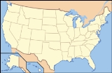
Stoney Slough NWR is located approximately 13 miles (20.9 km) south and 4 miles (6.4 km) west of Valley City, North Dakota
Valley City, North Dakota
As of the census of 2000, there were 6,826 people, 2,996 households, and 1,668 families residing in the city. The population density was 2,062.5 per square mile . There were 3,250 housing units at an average density of 982.0 per square mile...
and can be reached via Highway 1 South. Potential wildlife observation and photography opportunities are available from roads adjacent to and through the Refuge.

