
.gif)
State Highway 8 (Oklahoma)
Encyclopedia
State Highway 8, also abbreviated as SH-8 or OK-8, is a highway maintained by the U.S.
state of Oklahoma
. Because it runs mainly north–south, it has an even number (which is normal for Oklahoma state highways, but opposite from national highways). Highway 8 runs from U.S. Highway 277 in Cyril, Oklahoma
to the state line south of Kiowa, Kansas
, for a total length of 179.2 miles (288.4 km). The highway has two lettered spur routes.
Highway 8 dates from the creation of the state highway system in 1924. Initially a border-to-border route, it was shortened to its current extent due to encroaching U.S. highways. SH-8 has followed its current route since 1966.
with State Highway 19
), and immediately heads northward. Fourteen miles later, the highway passes through Anadarko
, sharing a brief overlap with US-62/SH-9
. It also becomes concurrent with US-281 here, which it remains with after passing through Anadarko.
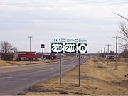 US-281 and SH-8 continue northward to meet SH-152
, which they overlap for 5 miles (8 km). SH-152 splits off to the west at Binger
, and US-281/SH-8 go northward through Lookeba
to meet SH-37
at its western terminus in Hinton
. Four miles (6.4 km) to the north, the two highways have an interchange with Interstate 40 at milemarker 101. After this, US-281/SH-8 cross the Canadian River
and begin a concurrency with U.S. Highway 270 in Geary
. SH-8 splits off by itself after passing through Watonga
, 16 miles (25.7 km) to the north.
North of Watonga, SH-8 generally runs parallel to SH-51A and, after intersecting SH-51
in Okeene
, it runs parallel to SH-58. 11 miles (17.7 km) north of Okeene, SH-58 and SH-8 switch places through a 9 miles (14.5 km) overlap, with SH-8 ending up running to the west through Fairview
and SH-58 running to the east to Ringwood, Oklahoma
.
After swapping places with SH-58, Highway 8 continues north, overlapping US-60 for 9 miles (14½ km), spending the last 3 miles (4.8 km) also signed concurrently with US-412. Eleven miles north of this, SH-8 has a 3 miles (4.8 km) concurrency with SH-45
southeast of Carmen
. Through Cherokee
, the Alfalfa County
seat, it overlaps U.S. Highway 64 and SH-58. After US-64 splits off to the west, SH-11
joins the concurrency.
After six miles (10 km), SH-58 splits off to the northeast. SH-11 and SH-8 remain overlapped for seven more miles (11.3 km) before splitting off to the north. SH-8 ends seven miles (11 km) to the north of this at the Kansas state line. After crossing the state line, it becomes K-8, which soon ends at K-2
in Kiowa, Kansas
.
. It then passed through Randlett
and had a short concurrency with SH-5 west of Walters
. The highway then ran through Lawton
—concurring with the original SH-29—en route to Anadarko via Apache
. In Anadarko, SH-8 linked up with the present highway. The remainder of the route was mostly the same as it is today.
In November 1926, AASHTO officially approved the United States Numbered Highways
system. The Oklahoma Transportation Commission applied the national highways to Oklahoma's state highway system on 1926-11-26. Three U.S. highways were assigned to portions of what was then SH-8: U.S. Highway 64 was added to a segment of highway south of Cherokee, U.S. Highway 66 was added between Bridgeport
and Geary, and U.S. Highway 70 was added from the Texas state line to Randlett. US-66 and 64 merely ran concurrently with SH-8. However, US-70 completely replaced the state highway, which was truncated so that its southern terminus was at US-70 in Randlett.
By 1936, several U.S. highways had been added to the system that took over parts of State Highway 8's route. US-62, added in 1930, took over the Lawton–Anadarko portion of the road. US-277 took over much of the remaining route between Randlett and Lawton. In addition, a US-70N had been created that overlaid US-277 between Randlett and the split with SH-5 west of Walters. These changes to the U.S. route system precipitated the truncation of SH-8 in 1936. On 1936-03-13, the section of the route between Anadarko and the state line was dropped. However, a new road between Anadarko and Cyril had been built; this became part of SH-8 and set the highway's southern terminus at its present location.
By the end of 1937, however, the highway's southern terminus had changed once again. On 1937-10-19, SH-8 had been truncated to Anadarko. However, on 1938-10-18, the route was extended back to the former southern terminus at Randlett; this change did not appear on the state map until the April 1941 edition. On 1941-04-14, the route was realigned to run through Cyril once again.
On 1955-09-12, SH-8 underwent a small realignment. Previously, the highway went due north from Carmen, then turned due east, running through Lambert
before connecting to US-64 south of Cherokee. As a result of the 1955 realignment, SH-8 cut northeast to connect to US-64 directly, bypassing Lambert.
All of SH-8 between Randlett and Cyril was once again dropped on 1966-05-09, restoring the route to its current southern terminus at US-277/SH-19 in Cyril. No major changes to the highway have occurred since 1966.
United States
The United States of America is a federal constitutional republic comprising fifty states and a federal district...
state of Oklahoma
Oklahoma
Oklahoma is a state located in the South Central region of the United States of America. With an estimated 3,751,351 residents as of the 2010 census and a land area of 68,667 square miles , Oklahoma is the 28th most populous and 20th-largest state...
. Because it runs mainly north–south, it has an even number (which is normal for Oklahoma state highways, but opposite from national highways). Highway 8 runs from U.S. Highway 277 in Cyril, Oklahoma
Cyril, Oklahoma
Cyril is a town in Caddo County, Oklahoma, United States. The population was 1,168 at the 2000 census.-Geography:Cyril is located at .According to the United States Census Bureau, the town has a total area of , all of it land....
to the state line south of Kiowa, Kansas
Kiowa, Kansas
Kiowa is a city in Barber County, Kansas, United States. As of the 2010 census, the city population was 1,026.-19th century:Kiowas was the city where anti-saloon advocate Carrie Nation vandalized her first saloon.-Geography:...
, for a total length of 179.2 miles (288.4 km). The highway has two lettered spur routes.
Highway 8 dates from the creation of the state highway system in 1924. Initially a border-to-border route, it was shortened to its current extent due to encroaching U.S. highways. SH-8 has followed its current route since 1966.
Route description
The highway begins in Cyril, at US-277 (which at the time is concurrentConcurrency (road)
A concurrency, overlap, or coincidence in a road network is an instance of one physical road bearing two or more different highway, motorway, or other route numbers...
with State Highway 19
State Highway 19 (Oklahoma)
State Highway 19, also known as SH-19 or OK-19, is a 172 mile long highway running through the southern part of the U.S. state of Oklahoma. It is signed east–west. SH-19 is Oklahoma's 13th longest state highway....
), and immediately heads northward. Fourteen miles later, the highway passes through Anadarko
Anadarko, Oklahoma
Anadarko is a city in Caddo County, Oklahoma, United States. The population was 6,645 at the 2000 census. It is the county seat of Caddo County.-Early History:Anadarko got its name when its post office was established in 1873...
, sharing a brief overlap with US-62/SH-9
State Highway 9 (Oklahoma)
State Highway 9, abbreviated as SH-9, OK-9, or simply Highway 9, is a major east–west highway in the U.S. state of Oklahoma. Spanning across the central part of the state, SH-9 begins at the Texas state line near Madge, Oklahoma, and ends at the Arkansas state line near Fort Smith, Arkansas. State...
. It also becomes concurrent with US-281 here, which it remains with after passing through Anadarko.
State Highway 152 (Oklahoma)
State Highway 152 is a state highway running through west-central Oklahoma. At a length of 149.6 miles , it is the longest three-digit state highway in Oklahoma. It runs from State Highway 152 at the Texas State Line to Interstate 44 near Will Rogers World Airport in Oklahoma City...
, which they overlap for 5 miles (8 km). SH-152 splits off to the west at Binger
Binger, Oklahoma
Binger is a town in Caddo County, Oklahoma, United States. The population was 708 at the 2000 census.Binger is the headquarters of the Caddo Nation of Oklahoma, who were settled here in the 1870s....
, and US-281/SH-8 go northward through Lookeba
Lookeba, Oklahoma
Lookeba is a town in Caddo County, Oklahoma, United States. The population was 131 at the 2000 census. The name is a composite of the names of three founding fathers: Lowe, Kelley and Baker.-Geography:Lookeba is located at ....
to meet SH-37
State Highway 37 (Oklahoma)
State Highway 37 is a designation for two separate highways in the state of Oklahoma. The northern section runs between Hinton and Moore in central Oklahoma, while the southern section runs from the Texas state line at the Red River to Idabel, in southeastern Oklahoma...
at its western terminus in Hinton
Hinton, Oklahoma
Hinton is a town in Caddo County, Oklahoma, United States. The population was 2,175 at the 2000 census.-Geography:Hinton is located at , elevation 1,676 feet ....
. Four miles (6.4 km) to the north, the two highways have an interchange with Interstate 40 at milemarker 101. After this, US-281/SH-8 cross the Canadian River
Canadian River
The Canadian River is the longest tributary of the Arkansas River. It is about long, starting in Colorado and traveling through New Mexico, the Texas Panhandle, and most of Oklahoma....
and begin a concurrency with U.S. Highway 270 in Geary
Geary, Oklahoma
Geary is a city in Blaine and Canadian counties in the U.S. state of Oklahoma. The population was 1,280 at the 2010 census.-Geography:Geary is located at ....
. SH-8 splits off by itself after passing through Watonga
Watonga, Oklahoma
Watonga is a city in Blaine County, Oklahoma, United States. The population was 4,658 at the 2000 census. It is the county seat of Blaine County.-Early History:...
, 16 miles (25.7 km) to the north.
North of Watonga, SH-8 generally runs parallel to SH-51A and, after intersecting SH-51
State Highway 51 (Oklahoma)
State Highway 51, abbreviated to SH-51 or OK-51, is a major state highway in Oklahoma. It runs for 333 miles east–west across the state, running from the Texas state line to Arkansas. It is the third-longest state highway in the system.-Texas to I-35:SH-51 begins at the Texas line concurrent...
in Okeene
Okeene, Oklahoma
Okeene is a town in Blaine County, Oklahoma, United States. The population was 1,240 at the 2000 census.-Geography:Okeene is located at .According to the United States Census Bureau, the town has a total area of , all of it land....
, it runs parallel to SH-58. 11 miles (17.7 km) north of Okeene, SH-58 and SH-8 switch places through a 9 miles (14.5 km) overlap, with SH-8 ending up running to the west through Fairview
Fairview, Oklahoma
Fairview is a city in Major County, Oklahoma, United States. The population was 2,579 at the 2010 census. It is the county seat of Major County.-Geography:Fairview is located at ....
and SH-58 running to the east to Ringwood, Oklahoma
Ringwood, Oklahoma
Ringwood is a town in Major County, Oklahoma, United States. The population was 424 at the 2000 census, at which time it was a city; it became a town in November 2005.-Geography:Ringwood is located at ....
.
After swapping places with SH-58, Highway 8 continues north, overlapping US-60 for 9 miles (14½ km), spending the last 3 miles (4.8 km) also signed concurrently with US-412. Eleven miles north of this, SH-8 has a 3 miles (4.8 km) concurrency with SH-45
State Highway 45 (Oklahoma)
State Highway 45 is a state highway in Oklahoma. It runs west-to-east through Woods, Alfalfa and Garfield counties.-Route description:SH-45 begins at the US-281/SH-14 junction in Waynoka...
southeast of Carmen
Carmen, Oklahoma
Carmen is a town in Alfalfa County, Oklahoma, United States. The population was 411 at the 2000 census.-Geography:Carmen is located at .According to the United States Census Bureau, the town has a total area of , all of it land....
. Through Cherokee
Cherokee, Oklahoma
Cherokee is a city in Alfalfa County, Oklahoma, United States. The population was 1,630 at the 2000 census. It is the county seat of Alfalfa County.-History:Cherokee is the location of the Cherokee IOOF Lodge No...
, the Alfalfa County
Alfalfa County, Oklahoma
Alfalfa County is a county located in the U.S. state of Oklahoma. As of 2000, the population is 6,105. Its county seat is Cherokee. Alfalfa County was formed in 1907 from Woods County. The county is named after William H...
seat, it overlaps U.S. Highway 64 and SH-58. After US-64 splits off to the west, SH-11
State Highway 11 (Oklahoma)
State Highway 11 is a state highway in Oklahoma. It runs in an irregular west-to-east path 208 miles across the northern part of the state, from US-281 seven miles north of Alva to I-244/US-412 in Tulsa...
joins the concurrency.
After six miles (10 km), SH-58 splits off to the northeast. SH-11 and SH-8 remain overlapped for seven more miles (11.3 km) before splitting off to the north. SH-8 ends seven miles (11 km) to the north of this at the Kansas state line. After crossing the state line, it becomes K-8, which soon ends at K-2
K-2 (Kansas highway)
K-2 is a state highway in the south-central portion of the U.S. state of Kansas. Its southwestern terminus is at its intersection with U.S. Highway 281 east of Hardtner. Its northeastern terminus is at its intersection with K-42 west of the unincorporated town of Suppesville...
in Kiowa, Kansas
Kiowa, Kansas
Kiowa is a city in Barber County, Kansas, United States. As of the 2010 census, the city population was 1,026.-19th century:Kiowas was the city where anti-saloon advocate Carrie Nation vandalized her first saloon.-Geography:...
.
History
SH-8 was one of the original thirty-one state highways created on 1924-08-24. When it was created, it was a border-to-border highway, stretching from Texas to Kansas. It began at the Red River near Burkburnett, TexasBurkburnett, Texas
Burkburnett is a city in Wichita County, Texas, United States. It is part of the Wichita Falls, Texas Metropolitan Statistical Area. The population was 10,927 at the 2000 census. The community's newspaper is the Burkburnett Informer/Star...
. It then passed through Randlett
Randlett, Oklahoma
Randlett is a town in Cotton County, Oklahoma, United States. The population was 511 at the 2000 census.-Geography:Randlett is located at .According to the United States Census Bureau, the town has a total area of , all of it land....
and had a short concurrency with SH-5 west of Walters
Walters, Oklahoma
Walters is a city in Cotton County, Oklahoma, United States. The population was 2,657 at the 2000 census. The city, nestled in between twin creeks, is the county seat of Cotton County...
. The highway then ran through Lawton
Lawton, Oklahoma
The city of Lawton is the county seat of Comanche County, in the U.S. state of Oklahoma. Located in the southwestern region of Oklahoma approximately southwest of Oklahoma City, it is the principal city of the Lawton Oklahoma Metropolitan Statistical Area...
—concurring with the original SH-29—en route to Anadarko via Apache
Apache, Oklahoma
Apache is a town in Caddo County, Oklahoma, USA. The population was 1,616 at the 2000 census.- Geography :Apache is located at ....
. In Anadarko, SH-8 linked up with the present highway. The remainder of the route was mostly the same as it is today.
In November 1926, AASHTO officially approved the United States Numbered Highways
United States Numbered Highways
The system of United States Numbered Highways is an integrated system of roads and highways in the United States numbered within a nationwide grid...
system. The Oklahoma Transportation Commission applied the national highways to Oklahoma's state highway system on 1926-11-26. Three U.S. highways were assigned to portions of what was then SH-8: U.S. Highway 64 was added to a segment of highway south of Cherokee, U.S. Highway 66 was added between Bridgeport
Bridgeport, Oklahoma
Bridgeport is a town in Caddo County, Oklahoma, United States. The population was 109 at the 2000 census.-Geography:Bridgeport is located at , elevation 1,428 feet ....
and Geary, and U.S. Highway 70 was added from the Texas state line to Randlett. US-66 and 64 merely ran concurrently with SH-8. However, US-70 completely replaced the state highway, which was truncated so that its southern terminus was at US-70 in Randlett.
By 1936, several U.S. highways had been added to the system that took over parts of State Highway 8's route. US-62, added in 1930, took over the Lawton–Anadarko portion of the road. US-277 took over much of the remaining route between Randlett and Lawton. In addition, a US-70N had been created that overlaid US-277 between Randlett and the split with SH-5 west of Walters. These changes to the U.S. route system precipitated the truncation of SH-8 in 1936. On 1936-03-13, the section of the route between Anadarko and the state line was dropped. However, a new road between Anadarko and Cyril had been built; this became part of SH-8 and set the highway's southern terminus at its present location.
By the end of 1937, however, the highway's southern terminus had changed once again. On 1937-10-19, SH-8 had been truncated to Anadarko. However, on 1938-10-18, the route was extended back to the former southern terminus at Randlett; this change did not appear on the state map until the April 1941 edition. On 1941-04-14, the route was realigned to run through Cyril once again.
On 1955-09-12, SH-8 underwent a small realignment. Previously, the highway went due north from Carmen, then turned due east, running through Lambert
Lambert, Oklahoma
Lambert is a town in Alfalfa County, Oklahoma, United States. The population was six at the 2010 census.-Geography:Lambert is located at ....
before connecting to US-64 south of Cherokee. As a result of the 1955 realignment, SH-8 cut northeast to connect to US-64 directly, bypassing Lambert.
All of SH-8 between Randlett and Cyril was once again dropped on 1966-05-09, restoring the route to its current southern terminus at US-277/SH-19 in Cyril. No major changes to the highway have occurred since 1966.
Junction list
Spurs
- SH-8A runs from SH-8 to SH-51AState Highway 51 (Oklahoma)State Highway 51, abbreviated to SH-51 or OK-51, is a major state highway in Oklahoma. It runs for 333 miles east–west across the state, running from the Texas state line to Arkansas. It is the third-longest state highway in the system.-Texas to I-35:SH-51 begins at the Texas line concurrent...
, north of Watonga. Along the way, it provides access to Roman Nose State ParkRoman Nose State ParkRoman Nose State Park is a state park located in Blaine County, north of Watonga, Oklahoma. The park opened in 1937 and was named after Chief Henry Roman Nose. Roman Nose State Park is one of the original seven Oklahoma state parks...
. - A former SH-8A connected the highway to the town of GeronimoGeronimo, OklahomaGeronimo is a town in Comanche County, Oklahoma, United States. The population was 1,268 at the 2010 census. It is included in the Lawton, Oklahoma Metropolitan Statistical Area.-Geography:Geronimo is located at ....
. When SH-8 was truncated to Cyril in 1966, it became SH-281A. - SH-8B is a spur route from SH-8 to AlineAline, OklahomaAline is a town in Alfalfa County, Oklahoma, United States. The population was 214 at the 2000 census.-Geography:According to the United States Census Bureau, the town has a total area of , all of it land....
.