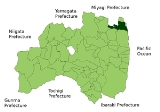
Soma, Fukushima
Encyclopedia
is a coastal city
located in Fukushima
, Japan
, approximately 30 kilometers South of Sendai. Japan National Route 6 runs through Sōma, since 2001 augmented by the Route 6 Sōma Bypass, which runs up to 2 km East of the original route, around the city center.
As of 2011, the city has an estimated population
of 36,891. The total area is 197.67 km².
The city was founded on March 31, 1954.
Sōma Nomaoi Festival held in July 23 to 25, every year is a designated Important Intangible Folk Cultural Property.
flood waters following a magnitude 9.0 2011 Tōhoku earthquake and tsunami
off its coastline on March 11, 2011. The tsunami reached up to approximately 4 km inland in Sōma, flooded areas included Sōma Port and the Matsukawa-ura Bay area, up to the (elevated) Route 6 Sōma Bypass. The tsunami was measured to have been 9.3 meters or higher in Sōma.
Sōma is about 43 kilometre north of Fukushima I Nuclear Power Plant
, the site of the nuclear accident that followed the tsunami.
Cities of Japan
||A is a local administrative unit in Japan. Cities are ranked on the same level as and , with the difference that they are not a component of...
located in Fukushima
Fukushima Prefecture
is a prefecture of Japan located in the Tōhoku region on the island of Honshu. The capital is the city of Fukushima.-History:Until the Meiji Restoration, the area of Fukushima prefecture was known as Mutsu Province....
, Japan
Japan
Japan is an island nation in East Asia. Located in the Pacific Ocean, it lies to the east of the Sea of Japan, China, North Korea, South Korea and Russia, stretching from the Sea of Okhotsk in the north to the East China Sea and Taiwan in the south...
, approximately 30 kilometers South of Sendai. Japan National Route 6 runs through Sōma, since 2001 augmented by the Route 6 Sōma Bypass, which runs up to 2 km East of the original route, around the city center.
As of 2011, the city has an estimated population
Population
A population is all the organisms that both belong to the same group or species and live in the same geographical area. The area that is used to define a sexual population is such that inter-breeding is possible between any pair within the area and more probable than cross-breeding with individuals...
of 36,891. The total area is 197.67 km².
The city was founded on March 31, 1954.
Sōma Nomaoi Festival held in July 23 to 25, every year is a designated Important Intangible Folk Cultural Property.
2011 tsunami
The Eastern, sea-side part of Sōma was inundated by devastating tsunamiTsunami
A tsunami is a series of water waves caused by the displacement of a large volume of a body of water, typically an ocean or a large lake...
flood waters following a magnitude 9.0 2011 Tōhoku earthquake and tsunami
2011 Tōhoku earthquake and tsunami
The 2011 earthquake off the Pacific coast of Tohoku, also known as the 2011 Tohoku earthquake, or the Great East Japan Earthquake, was a magnitude 9.0 undersea megathrust earthquake off the coast of Japan that occurred at 14:46 JST on Friday, 11 March 2011, with the epicenter approximately east...
off its coastline on March 11, 2011. The tsunami reached up to approximately 4 km inland in Sōma, flooded areas included Sōma Port and the Matsukawa-ura Bay area, up to the (elevated) Route 6 Sōma Bypass. The tsunami was measured to have been 9.3 meters or higher in Sōma.
Sōma is about 43 kilometre north of Fukushima I Nuclear Power Plant
Fukushima I Nuclear Power Plant
The , also known as Fukushima Dai-ichi , is a disabled nuclear power plant located on a site in the towns of Okuma and Futaba in the Futaba District of Fukushima Prefecture, Japan. First commissioned in 1971, the plant consists of six boiling water reactors...
, the site of the nuclear accident that followed the tsunami.

