

Seattle neighborhoods
Encyclopedia
Seattle, Washington contains many district
s and neighborhoods. Former Seattle mayor Greg Nickels
has called Seattle "a city of neighborhoods." Early European settlers established widely scattered settlements on the surrounding hills, which grew into neighborhoods and autonomous towns. Conurbation
s tended to grow from such towns or from unincorporated areas around trolley stops from the 19th century and early 20th century. Consequently, Seattle has suffered from transportation and street-naming problems.
fueled by the timber industry (see Seattle#Timber town), the city's early years were characterized by hasty expansion and development, under which residential areas were loosely defined by widely scattered plat
s. This arrangement was further solidified by the establishment of locally-initiated community clubs, public libraries, public schools, and public parks, which created a sense of community and civic participation.
At the beginning of the 20th century, Seattle’s community clubs became influential in the organization of public improvements. These had a significant effect upon the character of their neighborhoods and allowed them to remain distinct from the surrounding areas. Some community clubs used covenants to restrict the ethnicity of residents. (See section Covenants and racial restrictions, below.)
Establishing public library branches can define districts as well as neighborhoods. Public libraries are among the most heavily used buildings. Seattle has elected its city council at large
since 1910, and community clubs lobby councilors for the interests of local residents—such as for a library branch. The community organizations build a voting constituency, and in so doing define a neighborhood. In the absence of ward politics, this and campaign finance
legislation are seen as more open alternatives. The Greenwood-Phinney Commercial Club was particularly active in organizing toward the Greenwood branch that opened in 1928.
The Lake City Branch Library opened in 1935 as a few shelves of books in part of a room in Lake City School, shared with the Works Progress Administration
(WPA), sponsored by the Pacific Improvement Club community group. The library moved into a new building in 1955.
Elementary public schools effectively defined many neighborhoods, which are often synonymous with the name of the elementary school when the neighborhood and school were established. Many of the neighborhoods contain a few smaller neighborhoods. Mann and Minor neighborhoods in the Central District
, were built around their schools. The University Heights school (1903) in the north of the University District
was named for the neighborhood, as was the Latona School (1906) in Wallingford
.
Parks similarly define some neighborhoods. Madrona Beach and Cowen and Ravenna Parks were privately established to encourage residential development upon otherwise unusable land. The plan for Olmsted
Parks fulfilled its goal and significantly influenced the character of neighborhoods around parks and playgrounds. East Phinney and West Meridian neighborhoods are sometimes called Woodland Park, as well as South Green Lake or North Wallingford for Meridian.
and parts of some neighborhoods in south-east Seattle for Asian- and Native Americans; or the Central District
for Blacks, clearly defining those neighborhoods. Ballard – Sunset Hills, Beacon Hill, Broadmoor, Green Lake, Laurelhurst, Magnolia, Queen Anne, South Lake City, and other Seattle neighborhoods and blocks had racially or ethnically restrictive housing covenants, such as the following sample:
Further restrictions on conveyance (rental, lease, sale, transfer) were often included, effectively defining most of the neighborhoods in Seattle during the first decades after establishment.
The Supreme Court ruled in 1948 that racial restrictions would no longer be enforced. The Seattle Open Housing Ordinance became effective in 1968. Although unenforceable, legal complications prevent the covenants from being expunged from property title documents.
followed the 1995 campaign. Critics claimed that district-style elections of the city council would result in Tammany Hall
-style politics. In 1973, inspired by Boston's model, Mayor Wes Uhlman
's administration implemented a system of Little City Halls, where Community Service Centers (CSCs) assumed responsibility for coordinating municipal services. Uhlman's political opponents called the CSCs a thinly disguised ward system designed to promote Uhlman's reelection. CSCs became a setting for political arguments between the city council and the mayor; controversies over accountability, cronyism, and ward politics occurred in 1974, 1976, and 1988. In 1991 the CSCs were renamed Neighborhood Service Centers (NSCs) and were placed under the jurisdiction of the Department of Neighborhoods. More recently, their number has been reduced. As of 2011, there are NSCs located in Ballard, Lake City, the University District, the Central District, West Seattle, Southeast Seattle, and Delridge.
Development in accordance with the street classification system maintains the quality of life of city neighborhoods and improves efficiency of the road system. The classification system discourages rat running through local neighborhood streets.
Transportation hubs, such as business zones and transit stations, such as Park and Ride
facilities, provide focal points for districts of neighborhoods the same way trolley
stops defined neighborhoods before cars.
 No official neighborhood boundaries have existed in Seattle since 1910. Districts and neighborhoods are thus informal; their boundaries may overlap and multiple names may exist for a single district. Boundaries and names can be disputed or change over time. In 2002 a Department of Neighborhoods spokeswoman said, "I've seen my area go from the 'CD'
to 'Madrona' to 'Greater Madison Valley' and now 'Madrona Park.' " Some neighborhoods, such as northwest Seattle, do not have widely-recognized names for their greater districts.
Throughout Seattle one can find signs indicating the boundaries of neighborhoods; the locations of these signs have been specified by the city's many community councils. However, the boundaries suggested by these signs routinely overlap and differ from delineations on maps. For example, signs indicate that Lake City Way NE is the southeastern boundary of the Maple Leaf
neighborhood, while the city clerk's archival map places that district's southern boundary at 85th Street.
Another example of boundary ambiguity is "Frelard," which local residents call the area shared by Fremont
and Ballard
between 3rd and 8th Avenues NW. Signs facing opposite directions on NW Leary Way reveal the overlap.
Further difficulty in defining neighborhoods can result from residents' identification with neighborhoods different from those marked on signs and maps. After an acrimonious development dispute in 1966, a group of concerned Wallingford
citizens enlisted the University of Washington
Community Development Bureau to survey their neighborhood; the survey revealed that more residents of southwest Wallingford considered themselves citizens of Fremont than of Wallingford.
indexes, a 1984-1986 "Neighborhood Profiles" feature series in the Seattle Post-Intelligencer
, numerous park, land use and transportation planning studies, as well as records in the Seattle Municipal Archives.
The following table is largely based on maps from the Seattle City Clerk's Neighborhood Atlas, but also includes designations from other sources.
Ballard was its own incorporated town for 17 years, annexed as its own ward. West Seattle incorporated in 1902, then annexed Spring Hill, Riverside, Alki Point, and Youngstown districts. It was the largest of the incorporated towns to be annexed. Southeast Seattle merged the towns of Hillman City and York with other Rainier Valley neighborhoods, then incorporated for the only reason of being annexed. Similarly, the town of South Seattle consisted of mostly industrial Duwamish Valley neighborhoods (except Georgetown); one enclave adjacent to Georgetown omitted at this time was annexed 1921; some land near the river in this area remains part of unincorporated King County. In 1910 Georgetown was the last of this sequence of small incorporated cities and towns to be annexed to Seattle before the 1954 annexation of Lake City.
The following previously incorporated cites and towns were annexed by Seattle. This list is in order of annexation. Other areas annexed to Seattle, were unincorporated before annexation. Examples of the latter include the northern part of Queen Anne Hill, the University District, and the northern aread of the city that were once part of then-unincorporated Shoreline
.
In April 2004, the City Council voted to defer a decision on Mayor Nickels' proposal to designate the West Hill and North Highline neighborhoods, part of unincorporated King County
, as potential annexation areas (PAAs) for at least a year. Because of the tax revolt
that took place in Washington in the late 1990s and early 21st century, the county's budget has been reduced and the county has said it is unlikely to be able to maintain adequate levels of funding for urban services in unincorporated areas. The nearby city of Burien
, however, has issued a 2004 draft report for its own annexation of all or part of North Highline.
North Highline, which adjoins SeaTac
, Burien, and Tukwila
in addition to Seattle, consists of the Boulevard Park neighborhood and part of White Center. West Hill, which abuts Tukwila and Renton
as well as Seattle, consists of Skyway, Bryn Mawr, Lakeridge, and Earlington. Its population is 32,000.
On December 11, 2006, the Seattle City Council agreed to designate North Highline a "potential annexation area".
See heading, "Note about limitations of these data".
Maps "NN-1120S", "NN-1130S", "NN-1140S".Jpg [sic] dated 13 June; "NN-1030S", "NN-1040S".jpg dated 17 June 2002.
Maps "NN-1120S", "NN-1130S", "NN-1140S".Jpg [sic] dated 13 June; "NN-1030S", "NN-1040S".jpg dated 17 June 2002.
Full city map, not titled.
Maps "NN-1120S", "NN-1130S", "NN-1140S".Jpg [sic] dated 13 June; "NN-1030S", "NN-1040S".jpg dated 17 June 2002.
Hierarchical list of neighborhoods by districts, largely in geographical order from north to south.
Maps "NN-1030S", "NN-1040S".jpg 17 June 2002, maps "NN-1120S", "NN-1130S", "NN-1140S".Jpg [sic] 13 June.
Sources for this atlas and the neighborhood names used in it include a 1980 neighborhood map produced by the Department of Community Development (relocated to the Department of Neighborhoods and other agencies), Seattle Public Library
indexes (Special Collections, Seattle Collection in the Seattle Room), a 1984-1986 Neighborhood Profiles feature series in the Seattle Post-Intelligencer, numerous parks, land use and transportation planning studies, and records in the Seattle Municipal Archives.
[Maps "NN-1120S", "NN-1130S", "NN-1140S".Jpg [sic] dated 13 June 2002; "NN-1030S", "NN-1040S".jpg dated 17 June 2002.]
"The Neighbors project was published weekly in the Seattle Post-Intelligencer from 1996 to 2000. The page remained available for archival purposes for some years after being superseded by the P-I's Webtowns section.
District
Districts are a type of administrative division, in some countries managed by a local government. They vary greatly in size, spanning entire regions or counties, several municipalities, or subdivisions of municipalities.-Austria:...
s and neighborhoods. Former Seattle mayor Greg Nickels
Greg Nickels
Gregory J. "Greg" Nickels was the 51st mayor of Seattle, Washington. He took office on January 1, 2002 and was reelected to a second term in 2005. In August 2009, Nickels finished third in the primary election for Seattle mayor, failing to qualify for the November 2009 general election, and...
has called Seattle "a city of neighborhoods." Early European settlers established widely scattered settlements on the surrounding hills, which grew into neighborhoods and autonomous towns. Conurbation
Conurbation
A conurbation is a region comprising a number of cities, large towns, and other urban areas that, through population growth and physical expansion, have merged to form one continuous urban and industrially developed area...
s tended to grow from such towns or from unincorporated areas around trolley stops from the 19th century and early 20th century. Consequently, Seattle has suffered from transportation and street-naming problems.
Defining Seattle's neighborhoods
Because Seattle was established during an economic boomBoom and bust
A credit boom-bust cycle is an episode characterized by a sustained increase in several economics indicators followed by a sharp and rapid contraction. Commonly the boom is driven by a rapid expansion of credit to the private sector accompanied with rising prices of commodities and stock market index...
fueled by the timber industry (see Seattle#Timber town), the city's early years were characterized by hasty expansion and development, under which residential areas were loosely defined by widely scattered plat
Plat
A plat in the U.S. is a map, drawn to scale, showing the divisions of a piece of land. Other English-speaking countries generally call such documents a cadastral map or plan....
s. This arrangement was further solidified by the establishment of locally-initiated community clubs, public libraries, public schools, and public parks, which created a sense of community and civic participation.
At the beginning of the 20th century, Seattle’s community clubs became influential in the organization of public improvements. These had a significant effect upon the character of their neighborhoods and allowed them to remain distinct from the surrounding areas. Some community clubs used covenants to restrict the ethnicity of residents. (See section Covenants and racial restrictions, below.)
Establishing public library branches can define districts as well as neighborhoods. Public libraries are among the most heavily used buildings. Seattle has elected its city council at large
At-Large
At-large is a designation for representative members of a governing body who are elected or appointed to represent the whole membership of the body , rather than a subset of that membership...
since 1910, and community clubs lobby councilors for the interests of local residents—such as for a library branch. The community organizations build a voting constituency, and in so doing define a neighborhood. In the absence of ward politics, this and campaign finance
Campaign finance
Campaign finance refers to all funds that are raised and spent in order to promote candidates, parties or policies in some sort of electoral contest. In modern democracies such funds are not necessarily devoted to election campaigns. Issue campaigns in referendums, party activities and party...
legislation are seen as more open alternatives. The Greenwood-Phinney Commercial Club was particularly active in organizing toward the Greenwood branch that opened in 1928.
The Lake City Branch Library opened in 1935 as a few shelves of books in part of a room in Lake City School, shared with the Works Progress Administration
Works Progress Administration
The Works Progress Administration was the largest and most ambitious New Deal agency, employing millions of unskilled workers to carry out public works projects, including the construction of public buildings and roads, and operated large arts, drama, media, and literacy projects...
(WPA), sponsored by the Pacific Improvement Club community group. The library moved into a new building in 1955.
Elementary public schools effectively defined many neighborhoods, which are often synonymous with the name of the elementary school when the neighborhood and school were established. Many of the neighborhoods contain a few smaller neighborhoods. Mann and Minor neighborhoods in the Central District
Central District, Seattle, Washington
The Central District is a mostly residential district in Seattle located east of Cherry Hill, west of Madrona and Leschi, south of Capitol Hill, and north of Rainier Valley...
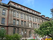
, were built around their schools. The University Heights school (1903) in the north of the University District
University District, Seattle, Washington
The University District is a neighborhood in Seattle, Washington, so named because the main campus of the University of Washington is located there. The UW moved in two years after the area was annexed to Seattle, while much of the area was still clear cut forest or stump farmland...
was named for the neighborhood, as was the Latona School (1906) in Wallingford
Wallingford, Seattle, Washington
Wallingford is a neighborhood in north central Seattle, Washington, named after John Noble Wallingford . The QFC supermarket at the corner of N 45th Street and Wallingford Avenue N may be regarded as the center of the neighborhood; its large WALLINGFORD neon sign is made in part from letters in the...
.
Parks similarly define some neighborhoods. Madrona Beach and Cowen and Ravenna Parks were privately established to encourage residential development upon otherwise unusable land. The plan for Olmsted
Olmsted Brothers
The Olmsted Brothers company was an influential landscape design firm in the United States, formed in 1898 by stepbrothers John Charles Olmsted and Frederick Law Olmsted, Jr. .-History:...
Parks fulfilled its goal and significantly influenced the character of neighborhoods around parks and playgrounds. East Phinney and West Meridian neighborhoods are sometimes called Woodland Park, as well as South Green Lake or North Wallingford for Meridian.
Covenants and racial restrictions
Housing covenants became common in the 1920s and were validated by the U.S. Supreme Court in 1926. Minorities were effectively limited to the International DistrictInternational District, Seattle, Washington
The Chinatown-International District of Seattle, Washington is an ethnic enclave neighborhood and is the center of Seattle's Asian American community. The neighborhood is multiethnic, consisting mainly of people who are of Chinese, Japanese, and Filipino ethnicity...
and parts of some neighborhoods in south-east Seattle for Asian- and Native Americans; or the Central District
Central District, Seattle, Washington
The Central District is a mostly residential district in Seattle located east of Cherry Hill, west of Madrona and Leschi, south of Capitol Hill, and north of Rainier Valley...
for Blacks, clearly defining those neighborhoods. Ballard – Sunset Hills, Beacon Hill, Broadmoor, Green Lake, Laurelhurst, Magnolia, Queen Anne, South Lake City, and other Seattle neighborhoods and blocks had racially or ethnically restrictive housing covenants, such as the following sample:
"No person or persons of [any of several minorities] blood, lineage, or extraction shall be permitted to occupy a portion of said property ... except a domestic servant or servants who may actually and in good faith be employed by white occupants."
Further restrictions on conveyance (rental, lease, sale, transfer) were often included, effectively defining most of the neighborhoods in Seattle during the first decades after establishment.
The Supreme Court ruled in 1948 that racial restrictions would no longer be enforced. The Seattle Open Housing Ordinance became effective in 1968. Although unenforceable, legal complications prevent the covenants from being expunged from property title documents.
Wards and Little City Halls
Seattle initially adopted a ward system, however in 1910, this system was replaced by non-partisan, at-large representation. Variations on ward systems were proposed and rejected in 1914, 1926, 1974, 1995, and 2003and convictions for campaign-related money launderingMoney laundering
Money laundering is the process of disguising illegal sources of money so that it looks like it came from legal sources. The methods by which money may be laundered are varied and can range in sophistication. Many regulatory and governmental authorities quote estimates each year for the amount...
followed the 1995 campaign. Critics claimed that district-style elections of the city council would result in Tammany Hall
Tammany Hall
Tammany Hall, also known as the Society of St. Tammany, the Sons of St. Tammany, or the Columbian Order, was a New York political organization founded in 1786 and incorporated on May 12, 1789 as the Tammany Society...
-style politics. In 1973, inspired by Boston's model, Mayor Wes Uhlman
Wesley C. Uhlman
Wesley Carl Uhlman was the 47th mayor of Seattle.-Biography:He attended Aberdeen High School, Seattle Pacific College, and the University of Washington....
's administration implemented a system of Little City Halls, where Community Service Centers (CSCs) assumed responsibility for coordinating municipal services. Uhlman's political opponents called the CSCs a thinly disguised ward system designed to promote Uhlman's reelection. CSCs became a setting for political arguments between the city council and the mayor; controversies over accountability, cronyism, and ward politics occurred in 1974, 1976, and 1988. In 1991 the CSCs were renamed Neighborhood Service Centers (NSCs) and were placed under the jurisdiction of the Department of Neighborhoods. More recently, their number has been reduced. As of 2011, there are NSCs located in Ballard, Lake City, the University District, the Central District, West Seattle, Southeast Seattle, and Delridge.
Local Improvement Districts
A Local Improvement District (LID) is a method by which a group of property owners can share the cost of transportation infrastructure improvements. This involves improving the street, building sidewalks and installing stormwater management systems. Without Seattle's LID assessment system, the city would be unable to maintain its rapid growth in population and territory. LIDs have helped define neighborhoods by localizing decisions about issues like sidewalks, vegetation and other features of the public space, permitting neighborhoods to remain distinct from their neighbors.Transportation
Minor arterial roads are generally located along the boundaries of neighborhoods, with streets and highways built according to the street classification system. These effectively help define neighborhoods.Development in accordance with the street classification system maintains the quality of life of city neighborhoods and improves efficiency of the road system. The classification system discourages rat running through local neighborhood streets.
Transportation hubs, such as business zones and transit stations, such as Park and Ride
Park and ride
Park and ride facilities are car parks with connections to public transport that allow commuters and other people wishing to travel into city centres to leave their vehicles and transfer to a bus, rail system , or carpool for the rest of their trip...
facilities, provide focal points for districts of neighborhoods the same way trolley
Tram
A tram is a passenger rail vehicle which runs on tracks along public urban streets and also sometimes on separate rights of way. It may also run between cities and/or towns , and/or partially grade separated even in the cities...
stops defined neighborhoods before cars.
Informal districts
Central District, Seattle, Washington
The Central District is a mostly residential district in Seattle located east of Cherry Hill, west of Madrona and Leschi, south of Capitol Hill, and north of Rainier Valley...
to 'Madrona' to 'Greater Madison Valley' and now 'Madrona Park.' " Some neighborhoods, such as northwest Seattle, do not have widely-recognized names for their greater districts.
Throughout Seattle one can find signs indicating the boundaries of neighborhoods; the locations of these signs have been specified by the city's many community councils. However, the boundaries suggested by these signs routinely overlap and differ from delineations on maps. For example, signs indicate that Lake City Way NE is the southeastern boundary of the Maple Leaf
Maple Leaf, Seattle, Washington
Maple Leaf is a mostly residential neighborhood in Seattle, originally a rural suburb named Maple Leaf Addition to the Green Lake Tract or Green Lake Circle...
neighborhood, while the city clerk's archival map places that district's southern boundary at 85th Street.
Another example of boundary ambiguity is "Frelard," which local residents call the area shared by Fremont
Fremont, Seattle, Washington
Fremont is a neighborhood in Seattle, Washington. Originally a separate city, it was annexed to Seattle in 1891. Named after Fremont, Nebraska, the hometown of two of its founders, L. H. Griffith and E...
and Ballard
Ballard, Seattle, Washington
Ballard is a neighborhood located in the northwestern part of Seattle, Washington. To the north it is bounded by Crown Hill, ; to the east by Greenwood, Phinney Ridge and Fremont ; to the south by the Lake Washington Ship Canal; and to the west by Puget Sound’s Shilshole Bay. The neighborhood’s...
between 3rd and 8th Avenues NW. Signs facing opposite directions on NW Leary Way reveal the overlap.
Further difficulty in defining neighborhoods can result from residents' identification with neighborhoods different from those marked on signs and maps. After an acrimonious development dispute in 1966, a group of concerned Wallingford
Wallingford, Seattle, Washington
Wallingford is a neighborhood in north central Seattle, Washington, named after John Noble Wallingford . The QFC supermarket at the corner of N 45th Street and Wallingford Avenue N may be regarded as the center of the neighborhood; its large WALLINGFORD neon sign is made in part from letters in the...
citizens enlisted the University of Washington
University of Washington
University of Washington is a public research university, founded in 1861 in Seattle, Washington, United States. The UW is the largest university in the Northwest and the oldest public university on the West Coast. The university has three campuses, with its largest campus in the University...
Community Development Bureau to survey their neighborhood; the survey revealed that more residents of southwest Wallingford considered themselves citizens of Fremont than of Wallingford.
List of districts and neighborhoods
Despite complications in Seattle's system of neighborhoods and districts, the names and boundaries in the following list are generally accepted and widely used. They are based on the Seattle City Clerk's Neighborhood Map Atlas, which in turn is based on a variety of sources, including a 1980 neighborhood map produced by the now-defunct Department of Community Development, Seattle Public LibrarySeattle Public Library
The Seattle Public Library is the public library system serving Seattle, Washington, USA. It was officially established by the city in 1890, though there had been efforts to start a Seattle library as early as 1868. There are 26 branches in the system, most of them named after the neighborhoods in...
indexes, a 1984-1986 "Neighborhood Profiles" feature series in the Seattle Post-Intelligencer
Seattle Post-Intelligencer
The Seattle Post-Intelligencer is an online newspaper and former print newspaper covering Seattle, Washington, United States, and the surrounding metropolitan area...
, numerous park, land use and transportation planning studies, as well as records in the Seattle Municipal Archives.
The following table is largely based on maps from the Seattle City Clerk's Neighborhood Atlas, but also includes designations from other sources.
| Neighborhood name | Within larger district | Annexed | Locator map | Map | Image | Geocoordinates / Sources / Notes | |
|---|---|---|---|---|---|---|---|
| 1 | North Seattle | Seattle | Various | |
|
|
North of the Lake Washington Ship Canal Lake Washington Ship Canal The Lake Washington Ship Canal, which runs through the City of Seattle, Washington, connects the fresh water body of Lake Washington with the salt water inland sea of Puget Sound. The Ship Canal includes a series of locks, modeled after the Panama Canal, to accommodate the different water levels... |
| 2 | Broadview | North Seattle | 1954 | |
|
|
|
| 3 | Bitter Lake | North Seattle | 1954 | 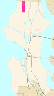 |
|
|
|
| 4 | North Beach / Blue Ridge | North Seattle | 1940, 1954 | |
|
|
|
| 5 | Crown Hill | North Seattle | 1907, 1952, 1954 | |
|
|
|
| 6 | Greenwood | North Seattle | 1891, 1954 | 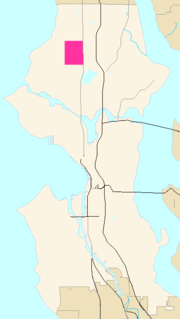 |
|
|
|
| 7 | Northgate | North Seattle | various 1891-1954 | 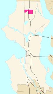 |
|
|
|
| 8 | Haller Lake | Northgate | 1954 | |
|
|
|
| 9 | Pinehurst | Northgate | 1953 | |
|
|
|
| 10 | North College Park (Licton Springs) |
Northgate | 1950, 1954 | 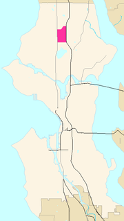 |
|
|
|
| 11 | Maple Leaf | Northgate | 1891, 1907, 1941, 1945, 1949 | |
|
|
|
| 12 | Lake City | North Seattle | 1953, 1954 | 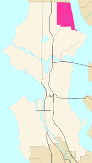 |
|
|
Before annexation to Seattle, Lake City was a township for 5 years. Lake City neighborhoods are now also known as Sand Point-Magnuson Park and neighborhoods northwest of Sand Point. |
| 13 | Cedar Park | Lake City | 1954 | |
|
|
|
| 14 | Matthews Beach | Lake City | 1953 | 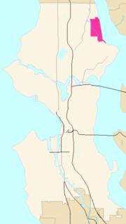 |
|
|
|
| 15 | Meadowbrook | Lake City | 1953 | |
|
|
|
| 16 | Olympic Hills | Lake City | 1954 | |
|
|
|
| 17 | Victory Heights | Lake City | 1953, 1954 | |
|
|
|
| 18 | Wedgwood | North Seattle | 1945 | |
|
|
|
| 19 | View Ridge | North Seattle | 1942, 1953 | |
|
|
|
| 20 | Sand Point | North Seattle | 1910?, 1942?; 1953 | |
|
|
|
| 21 | Roosevelt | North Seattle | 1891 | 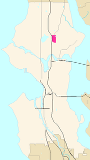 |
|
|
|
| 22 | Ravenna | North Seattle | 1907, 1910, 1941, 1943, 1945 | |
|
|
The 1907 annexation was the former town of Ravenna. |
| 23 | Bryant | North Seattle | 1891 | |
|
|
|
| 24 | Windermere | North Seattle | 1910 | 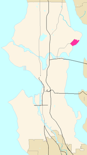 |
|
|
|
| 25 | Hawthorne Hills | Windermere / North Seattle | 1910 | |
|
|
Of the area the Seattle City Clerk's Neighborhood Atlas designates as "Windermere", many consider the area west of Sand Point Way to be a separate neighborhood, Hawthorne Hills. |
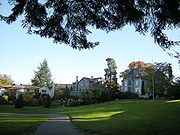
| 26 | Laurelhurst | North Seattle | 1910 | 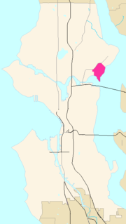 |
|
|
|
| 27 | University District ("U. District") | North Seattle | 1891 | 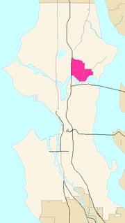 |
|
|
Known in the 1890s and 1900s as Brooklyn. The main campus of the University of Washington University of Washington University of Washington is a public research university, founded in 1861 in Seattle, Washington, United States. The UW is the largest university in the Northwest and the oldest public university on the West Coast. The university has three campuses, with its largest campus in the University... is itself divided into the main (central) campus, plus the large South Campus (south of NE Pacific Street) and East Campus (east of Montlake Boulevard NE), and a smaller North Campus (north of NE 45th Street) and miscellaneous buildings west of 15th Avenue NE that are collectively known as West Campus. Beyond the university, the district has a shopping district almost universally known as "The Ave The Ave University Way NE, colloquially The Ave , is the commercial heart of the University District and the off-campus extension of the University of Washington in Seattle. Once "a department store eight blocks long," The Ave has gradually turned into what now resembles an eight-block-long global food... " and older neighborhoods such as University Heights and University Park that are nowadays rarely distinguished from the U. District as such. |
| 28 | University Village | Ravenna / University District | 1891, 1907, 1910 |  |
|
|
Primarily, the name 'University Village' refers to a shopping center at a corner of what the City Clerk considers part of Ravenna, but it is also commonly used for the surrounding neighborhood on all sides, which ranges into what the City Clerk's maps consider Ravenna to the north and west and the east portion of the University District to the west. (To the south is the East Campus of the University of Washington.) |
| 29 | Wallingford | North Seattle | 1891 | 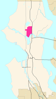 |
|
 |
Includes historic Latona and usually Tangletown/Meridian (the latter is sometimes considered part of Green Lake) |
| 30 | Northlake | Lake Union / Lower Wallingford, spilling over into Fremont and the University District. | 1891 | |
|
 |
|
| 31 | Green Lake | North Seattle | 1891 | 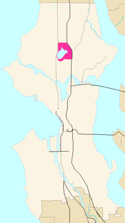 |
|
|
Some people consider Meridian / Tangletown to be part of the Green Lake neighborhood. |
| 32 | Fremont | North Seattle | 1891 | 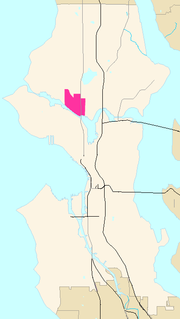 |
|
 |
|
| 33 | Phinney Ridge | North Seattle | 1891 | |
|
|
|
| 34 | Ballard Ballard, Seattle Ballard is a neighborhood located in the northwestern part of Seattle, Washington. To the north it is bounded by Crown Hill, ; to the east by Greenwood, Phinney Ridge and Fremont ; to the south by the Lake Washington Ship Canal; and to the west by Puget Sound’s Shilshole Bay. The neighborhood’s... |
North Seattle | 1907 | |
|
|
Prior to annexation by Seattle, Ballard was a town for 17 years. There is an area south of Ballard and west of Fremont often referred to as Frelard and claimed by both. |
| 35 | West Woodland | Ballard | 1907 | |
|
|
|
| 36 | Whittier Heights | Ballard | 1907 | |
|
|
|
| 37 | Adams | Ballard | 1907 | |
|
|
|
| 38 | Sunset Hill | Ballard | 1907 | |
|
 |
|
| 39 | Loyal Heights | Ballard | 1907 | |
|
|
|
| 40 | Central Seattle | Seattle | Various | |
|
|
Including everything south of the Lake Washington Ship Canal Lake Washington Ship Canal The Lake Washington Ship Canal, which runs through the City of Seattle, Washington, connects the fresh water body of Lake Washington with the salt water inland sea of Puget Sound. The Ship Canal includes a series of locks, modeled after the Panama Canal, to accommodate the different water levels... and north of Yesler Way, and some things a bit further south. |
| 41 | Magnolia | Central Seattle | 1891 | 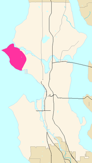 |
|
|
|
| 42 | Lawton Park | Magnolia | 1891 | |
|
|
|
| 43 | Briarcliff | Magnolia | 1891 | |
|
|
|
| 44 | Southeast Magnolia | Magnolia | 1891 | |
|
|
|
| 45 | Interbay | Central Seattle | 1891 |  |
|
|
|
| 46 | Queen Anne | Central Seattle | [1869], 1883, 1891 | 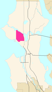 |
|
 |
Part of Lower Queen Anne was original 1869 Seattle; the area south of McGraw Street was annexed 1883, and the rest 1891. |
| 47 | North Queen Anne | Queen Anne | 1891 | |
|
|
|
| 48 | East Queen Anne | Queen Anne | 1883, 1891 | |
|
|
Annexed 1883 to McGraw Street, 1891 beyond |
| 49 | Lower Queen Anne | Queen Anne | [1869], 1883 | 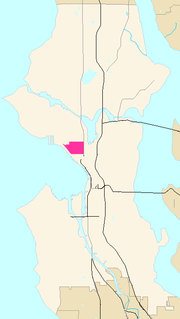 |
|
|
Also known as 'Uptown'. |
| 50 | West Queen Anne | Queen Anne | 1883, 1891 | |
|
 |
|
| 51 | Capitol Hill | Central Seattle | [1869], 1883, 1891 | 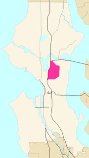 |
|
|
1869: Broadway District was part of "original Seattle" |
| 52 | Portage Bay / Roanoke | Capitol Hill | 1883, 1891 | |
|
|
Annexed 1883 to E Lynn St, 1891 for the remainder. Includes the Roanoke Park Historic District. |
| 53 | Broadway | Capitol Hill | [1869] | |
|
|
The Seattle City Clerk's Neighborhood Atlas map of the Broadway District shown here extends farther to the east and west than most present-day Seattleites would call Broadway. It appears to correspond roughly the portion of Capitol Hill that falls within the original 1869 city limits, and which was known as Broadway before the name Capitol Hill was introduced. |
| 54 | Pike-Pine Corridor / Pike/Pine | Capitol Hill / Broadway | [1869] | |
|
|
The Pike-Pine Corridor, running east-west through what the Seattle City Clerk's Neighborhood Atlas considers the "Broadway" District, has gained a strong identity in the early 21st century. |
| 55 | Montlake | Capitol Hill / Central Seattle | 1891, 1950, 1952, 1953 (?) | 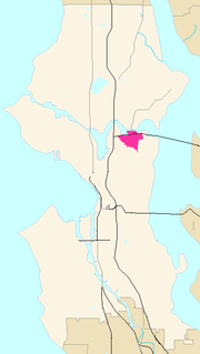 |
|
|
The Seattle City Clerk's Neighborhood Atlas classifies Montlake as part of Capitol Hill, but a valley along Boyer Avenue separates it from the hill. |
| 56 | Stevens | Capitol Hill | |
|
|
The name "Stevens" doesn't have much currency for most of this area except for the immediate vicinity of the Stevens School at 19th Avenue E and E Galer Street. The small neighborhood just north of that is often called Interlaken, after Interlaken Park Interlaken Park (Seattle) Interlaken Park is a park in Seattle, Washington. A heavily wooded hillside and ravine, it forms the division between Capitol Hill to the south and Montlake to the north. Interlaken Drive E. runs through the park north to south, and E. Interlaken Boulevard, part of which is now closed to traffic,... ; the area centered around 19th Avenue and E Madison Street was known in the early 20th century as Renton Hill, but that name has largely passed out of use. |
|
| 57 | Interlaken Interlaken Park (Seattle) Interlaken Park is a park in Seattle, Washington. A heavily wooded hillside and ravine, it forms the division between Capitol Hill to the south and Montlake to the north. Interlaken Drive E. runs through the park north to south, and E. Interlaken Boulevard, part of which is now closed to traffic,... |
Capitol Hill / Stevens | |
|
|
Consisting largely of Interlaken Park Interlaken Park (Seattle) Interlaken Park is a park in Seattle, Washington. A heavily wooded hillside and ravine, it forms the division between Capitol Hill to the south and Montlake to the north. Interlaken Drive E. runs through the park north to south, and E. Interlaken Boulevard, part of which is now closed to traffic,... and Louisa Boren Park, the neighborhood between Capitol Hill proper and Montlake also contains a small number of private homes and the Seattle Hebrew Academy. |
|
| 58 | Madison Valley | Capitol Hill / Stevens / Central Seattle | 1883, 1891 | |
|
|
Annexed 1883 south of E Galer Street, 1891 for the remainder |
| 59 | Renton Hill | Capitol Hill / Stevens | |
|
|
Although the name has largely fallen out of use, the Renton Hill Community Improvement Club, founded June 18, 1901, was Seattle's first community club. | |
| 60 | Madison Park | Capitol Hill / Central Seattle | 1883, 1891 | 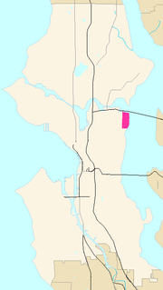 |
|
|
Annexed 1883 south of E Galer St; the remainder in 1891. The Seattle City Clerk's Neighborhood Atlas classifies Madison Park as part of Capitol Hill, but a valley through the Washington Park Arboretum Washington Park Arboretum Washington Park is a public park in Seattle, Washington, USA, most of which is taken up by the Washington Park Arboretum, a joint project of the University of Washington, the Seattle Department of Parks and Recreation, and the nonprofit Arboretum Foundation. Washington Park also includes a... separates it from Capitol Hill proper. |
| 61 | Broadmoor | Madison Park | 1883, 1891 | 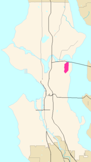 |
|
 |
Annexed 1883 south of the line of E Galer St; the remainder in 1891. A gated community within Madison Park. |
| 62 | Lake Union Lake Union Lake Union is a freshwater lake entirely within the Seattle, Washington city limits.-Origins:A glacial lake, its basin was dug 12,000 years ago by the Vashon glacier, which also created Lake Washington and Seattle's Green, Bitter, and Haller Lakes.-Name:... |
North Seattle / Central Seattle | |
|
|
The City Clerk's Neighborhood Atlas uses the term "Cascade" to refer to much of the area around Lake Union (see map here), but that use is not at all common. | |
| 63 | South Lake Union, Seattle | Lake Union | 1883 | 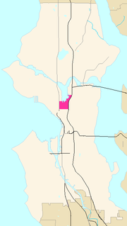 |
|
|
The City Clerk's Neighborhood Atlas uses the term "Cascade" to refer to much of the area around Lake Union (see image here), but that use is not at all common. |
| 64 | Cascade, Seattle | South Lake Union | 1883 |  |
|
|
Cascade, south and east of Lake Union originally extended west to Terry Avenue (though it is now generally considered to end at Fairview, south to Denny Hill (now the Denny Regrade Denny Regrade, Seattle, Washington The Denny Regrade is a neighborhood in Seattle, Washington, USA, that stretches north of the central business district to the grounds of Seattle Center. Its generally flat terrain was originally a steep hill, taken down as part of a mammoth construction project in the first decades of the 20th... ) east to Melrose Avenue E (from which it is through the area now cut off by Interstate 5 Interstate 5 Interstate 5 is the main Interstate Highway on the West Coast of the United States, running largely parallel to the Pacific Ocean coastline from Canada to Mexico . It serves some of the largest cities on the U.S... . |
| 65 | Westlake | Lake Union | 1883 | |
|
|
|
| 66 | Eastlake | Lake Union | 1883, 1891 |  |
|
|
|
| 67 | Downtown Downtown Seattle Downtown is the central business district of Seattle, Washington. It is fairly compact compared to other city centers on the West Coast because of its geographical situation: hemmed in on the north and east by hills, on the west by the Elliott Bay, and on the south by reclaimed land that was once... |
Central Seattle | [1869] | |
|
|
|
| 68 | Denny Regrade | Downtown | [1869] |  |
|
 |
|
| 69 | Belltown | Downtown | [1869] |  |
|
|
|
| 70 | Pike-Market Pike Place Market Pike Place Market is a public market overlooking the Elliott Bay waterfront in Seattle, Washington, United States. The Market opened August 17, 1907, and is one of the oldest continually operated public farmers' markets in the United States. It is a place of business for many small farmers,... |
Downtown | [1869] | |
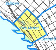 |
|
|
| 71 | Central Business District | Downtown | [1869] | |
|
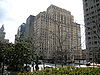 |
|
| 72 | First Hill | Downtown | [1869] | |
|
|
Widely known as "Pill Hill" for its many hospitals, this neighborhood immediately east of Downtown was once the city's most desirable residential area. |
| 73 | Pioneer Square | Downtown | [1869] | |
|
|
The original center of Seattle, the southwest part of present-day Downtown. Probable origin of the term "Skid Road" for a neighborhood. Includes the Pioneer Square-Skid Road Historic District. Pioneer Square as defined by the City Clerk's Neighborhood Atlas also includes the tide lands platted 1895, filled 1902, that are now the site of two professional sports stadiums. |
| 74 | International District ("ID") | Downtown | [1869] | |
|
|
Includes former tide lands platted 1895, filled 1902. Southeast Downtown. Sometimes referred to as "Chinatown", the neighborhood also includes Little Saigon east of Interstate 5, and remnants of the historic Japantown, especially around 6th Avenue and Main Street. |
| 75 | Yesler Terrace | Downtown | [1869] | |
|
 |
Housing project east of Interstate 5; originally, it extended further west into present-day Kobe Terrace Park. |
| 76 | Central Waterfront Central Waterfront, Seattle The Central Waterfront of Seattle, in the state of Washington, USA, is the most urbanized portion of the Elliott Bay shore. It runs from the Pioneer Square shore roughly northwest past Downtown Seattle and Belltown, ending at the Broad Street site of the Olympic Sculpture Park.The Central... |
Downtown | [1869] | |
|
|
|
| 77 | West Edge | Downtown | [1869] | |
|
 |
The downtown area of both the Central Business District and Belltown from roughly halfway between First and Second Avenues to Alaskan Way (but not including the piers themselves) is sometimes called the Seattle's "West Edge". |
| 78 | Central Area / Central District ("CD") | Central Seattle | [1869], 1883 | 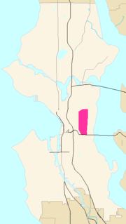 |
|
 |
|
| 79 | Mann | Central Area | [1869] | |
|
 |
The name Mann for this area around Garfield High School Garfield High School (Seattle, Washington) James A. Garfield High School is a public high school in the Seattle Public Schools district of Seattle, Washington, USA.Located along 23rd Avenue between E. Alder and E. Jefferson Streets in Seattle's urban Central District, Garfield draws students from all over the city... does not have much currency. It comes from the old Horace Mann School, later Nova The Nova Project The Nova Project, also known as Nova, is located at 300 21st Avenue Ein Seattle, Washington. It is a small alternative high school in the Seattle Public School District.-About:... , just north of Garfield. |
| 80 | Minor | Central Area | [1869] | |
|
|
The name Minor for this area does not have much currency. It comes from the T.T. Minor School. |
| 81 | Cherry Hill & Squire Park Squire Park, Seattle, Washington Squire Park is a district in the city of Seattle, in the US state of Washington. According to the Squire Park Community Council, it is bounded on the south by S. Jackson Street, on the west by 12th Avenue and 12th Avenue S., on the north by E... |
Minor | [1869], 1905, 1921 | |
|
 |
Portions are part of original Seattle; Squire Park was annexed in 1905, and a remaining enclave in 1921. |
| 82 | Atlantic | Central Area | [1869], 1883 | |
|
 |
The northern portion of this area was part of original 1869 Seattle; south of Atlantic Street was annexed 1883 |
| 83 | Judkins Park | Atlantic | [1869] | |
|
|
|
| 84 | Madrona | Central Area | [1869], 1883 | 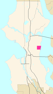 |
|
 |
South of E Howell Street was original 1869 Seattle; the remainder was annexed 1883. |
| 85 | Madrona Valley | Madrona | [1869] | |
|
|
|
| 86 | Harrison / Denny-Blaine | Central Area | 1883 | 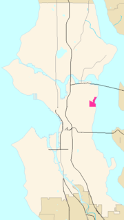 |
|
|
|
| 87 | Washington Park | Harrison/Denny-Blaine | 1883 | |
|
|
|
| 88 | Leschi | Central Area | [1869] | 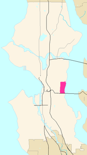 |
|
 |
|
| 89 | South End | Seattle | various | |
|
|
|
| 90 | Rainier Valley | South End | [1869], 1883, 1907 | 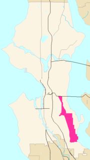 |
|
|
North of Atlantic Street was original 1869 Seattle; in 1883, south to Hanford Street was annexed, and the rest in 1907 |
| 91 | Mount Baker | Rainier Valley | [1869], 1883, 1907 | 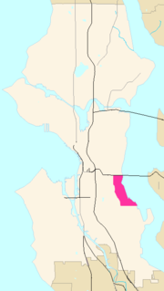 |
|
|
North of Atlantic Street was original 1869 Seattle; in 1883, south to Hanford Street was annexed, and the rest in 1907 |
| 92 | Columbia City | Rainier Valley | 1907 | 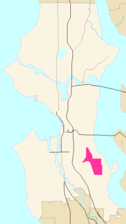 |
|
 |
A town for 15 years before it was annexed. |
| 93 | Hillman City Hillman City, Seattle Hillman City is a primarily residential neighborhood of southeast Seattle, Washington, located in the Rainier Valley and centered about a mile south of the Columbia City neighborhood. Previously a town in its own right, it was annexed to Seattle in 1907 along with most of southeast Seattle.The... |
Rainier Valley / Columbia City | 1907 | |
|
|
South of Columbia City proper, |
| 94 | Brighton | Rainier Valley | 1907 | |
|
|
The lakeshore next to this neighborhood was once called Brighton Beach, but has since been subsumed into Seward Park in common parlance and according to the Seattle City Clerk's Neighborhood Map Atlas |
| 95 | Dunlap / Othello | Rainier Valley | 1907 | |
|
|
|
| 96 | Rainier Beach / Atlantic City Beach | Rainier Valley | 1907 | |
|
|
|
| 97 | Rainier View / Lakeridge | Rainier Valley | 1907 | 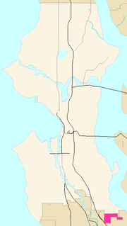 |
|
|
|
| 98 | Seward Park | South End | 1907 | 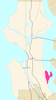 |
|
|
|
| 99 | Lakewood | Seward Park | |
|
|
The northern part of the Seward Park neighborhood is sometimes referred to as "Lakewood"; the entire neighborhood also sometimes referred to as "Lakewood/Seward Park". The historic Lakewood Community Club is now called the Lakewood/Seward Park Community Club. | |
| 100 | Beacon Hill | South End | [1869], 1875, 1883, 1886, 1907 | |
|
|
|
| 101 | North Beacon Hill | Beacon Hill | [1869], 1875, 1883, 1886, 1907 | |
|
|
|
| 102 | Mid Beacon Hill (Maplewood) | Beacon Hill | 1907 | |
|
|
|
| 103 | Holly Park / NewHolly NewHolly, Seattle NewHolly is a neighborhood in southeast Seattle, Washington, USA.Holly Park was built in the 1940s to house defense workers and veterans, but in the 1950s, it was converted into public housing under the aegis of the Seattle Housing Authority... |
Beacon Hill | 1907 | |
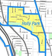 |
|
Formerly the Holly Park housing project, now officially NewHolly. |
| 104 | South Beacon Hill / Van Asselt | Beacon Hill | 1907 | |
|
|
|
| 105 | Industrial District | South End | various 1895–1910 | 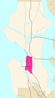 |
|
|
Tide lands west of Beacon Hill platted 1895, filled 1902. Other portions annexed 1907 along with West Seattle, Southeast Seattle, and South Park; 1910 with Georgetown. |
| 106 | SoDo | Industrial District | 1895/1902 | 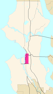 |
|
|
Tide lands west of Beacon Hill platted 1895, filled 1902. |
| 107 | Harbor Island | Industrial District | 1910 | 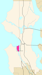 |
|
|
|
| 108 | Georgetown | South End | 1910 | 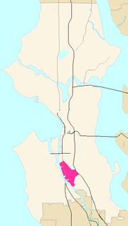 |
|
 |
A city for 6 years before being annexed in 1910. |
| 109 | South Park | South End | 1907 | |
|
|
A town for 5 years before being annexed in 1907. |
| 110 | West Seattle | Seattle | 1895/1902, 1907, 1950, 1954, 1956 | 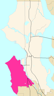 |
|
|
Tide lands platted 1895, filled 1902 (although the Seattle City Clerk's Neighborhood Atlas places even the tidelands on the west side of the Duwamish in the Industrial District rather than West Seattle). West Seattle (including portions of Delridge) was a town for 5 years before being annexed in 1907. Some additional annexations 1950, 1954, and 1956, mainly in Arbor Heights. |
| 111 | Alki Point | West Seattle | 1907 | |
|
|
|
| 112 | North Admiral / Admiral District | West Seattle | 1907 | |
|
 |
|
| 113 | Junction / West Seattle Junction / Alaska Junction | West Seattle | 1907 | |
|
|
Overlaps Genesee. |
| 114 | Seaview / Mee-Kwa-Mooks | West Seattle | 1907 | |
|
|
|
| 115 | Fairmount Park | West Seattle | 1907 | |
|
|
|
| 116 | Genesee | West Seattle | 1907 | |
|
|
Overlaps Junction. |
| 117 | Gatewood | West Seattle | 1907 | |
|
|
|
| 118 | Fauntleroy | West Seattle | 1907 | |
|
|
|
| 119 | Arbor Heights | West Seattle | 1907, 1954, 1956 | |
|
|
|
| 120 | Delridge | South End / West Seattle | 1907, 1946, 1949 | |
|
 |
Most of Delridge was part of the city of West Seattle, annexed 1907; the remainder was annexed in 1946 and 1949. |
| 121 | North Delridge | Delridge | 1907 | |
|
 |
|
| 122 | Pigeon Point | Delridge | 1907 | |
|
|
The extreme northeast portion of Delridge, east of Delridge Way and north of Puget Park. |
| 123 | Riverview | Delridge | 1907 | |
|
|
|
| 124 | Highland Park | Delridge | 1907 | |
|
|
|
| 125 | South Delridge | Delridge | 1907, 1946, 1949 | |
|
|
|
| 126 | Roxhill | Delridge | 1907 | |
|
|
|
| 127 | High Point | Delridge | 1907 | |
|
|
|
Annexations
Seattle annexed eight municipalities between 1905 and 1910, nearly doubling the area size of the city. Annexations by law were begun by the annexee and had to be approved by the Seattle City Council. The appeal of the inexpensive and accessible electric power and water system services of the public utilities were the primary motivations for the annexation movements.Ballard was its own incorporated town for 17 years, annexed as its own ward. West Seattle incorporated in 1902, then annexed Spring Hill, Riverside, Alki Point, and Youngstown districts. It was the largest of the incorporated towns to be annexed. Southeast Seattle merged the towns of Hillman City and York with other Rainier Valley neighborhoods, then incorporated for the only reason of being annexed. Similarly, the town of South Seattle consisted of mostly industrial Duwamish Valley neighborhoods (except Georgetown); one enclave adjacent to Georgetown omitted at this time was annexed 1921; some land near the river in this area remains part of unincorporated King County. In 1910 Georgetown was the last of this sequence of small incorporated cities and towns to be annexed to Seattle before the 1954 annexation of Lake City.
The following previously incorporated cites and towns were annexed by Seattle. This list is in order of annexation. Other areas annexed to Seattle, were unincorporated before annexation. Examples of the latter include the northern part of Queen Anne Hill, the University District, and the northern aread of the city that were once part of then-unincorporated Shoreline
Shoreline, Washington
Shoreline is a city in King County, Washington, United States, north of Downtown Seattle bordering the northern Seattle city limits. As of the 2010 census, the population was 53,007, making it the 19th largest city in the state of Washington....
.
- Town of South Seattle, incorporated 1905, annexed 20 October 1905.
- City of Columbia (Columbia City), incorporated 1892, annexed 3 May 1907
- Town of Ravenna, incorporated 1906, annexed 15 January 1907
- Southeast Seattle—Hillman City, York, and other Rainier Valley neighorhoods except Columbia City—incorporated July 1906, annexed 7 January 1907
- Town of South Park, incorporated 1902, annexed 3 May 1907.
- City of BallardBallard, SeattleBallard is a neighborhood located in the northwestern part of Seattle, Washington. To the north it is bounded by Crown Hill, ; to the east by Greenwood, Phinney Ridge and Fremont ; to the south by the Lake Washington Ship Canal; and to the west by Puget Sound’s Shilshole Bay. The neighborhood’s...
, incorporated January 1890, annexed 29 May 1907 - City of West Seattle, incorporated April 1902, annexed 24 July 1907
- City of Georgetown, incorporated 1904, annexed 4 April 1910
- Lake City, incorporated township 1949, annexed January 1954
Future
Because of the cost of providing city services, low-density residential neighborhoods represent a net revenue loss for municipalities. Because vehicle-license revenue is no longer used to subsidize unincorporated areas, these neighborhoods have become increasingly orphaned.In April 2004, the City Council voted to defer a decision on Mayor Nickels' proposal to designate the West Hill and North Highline neighborhoods, part of unincorporated King County
King County, Washington
King County is a county located in the U.S. state of Washington. The population in the 2010 census was 1,931,249. King is the most populous county in Washington, and the 14th most populous in the United States....
, as potential annexation areas (PAAs) for at least a year. Because of the tax revolt
Tax revolt
A tax revolt is a political struggle to repeal, limit, or roll back a tax.-1930s, The Great Depression:In the United States, the term "tax revolt" is sometimes used to refer to a series of anti-tax state initiative campaigns. The first significant wave of these campaigns was during the 1930s. The...
that took place in Washington in the late 1990s and early 21st century, the county's budget has been reduced and the county has said it is unlikely to be able to maintain adequate levels of funding for urban services in unincorporated areas. The nearby city of Burien
Burien, Washington
Burien is a city in King County, Washington, United States, located south of Seattle. As of the 2010 Census, Burien's population is 33,313, which is a 2.9% increase since incorporation. Annexation in 2011 has increased the cities population to about 45,000....
, however, has issued a 2004 draft report for its own annexation of all or part of North Highline.
North Highline, which adjoins SeaTac
SeaTac, Washington
SeaTac is an American city in southern King County, Washington, and an outlying suburb of Seattle, Washington. Incorporated in February 1990, the City of SeaTac is ten square miles in area and has a population of 26,909 according to the 2010 census...
, Burien, and Tukwila
Tukwila, Washington
Tukwila is a city in King County, Washington, United States. The northern edge of Tukwila borders the city of Seattle. The population was 19,107 at the 2010 census.-History:...
in addition to Seattle, consists of the Boulevard Park neighborhood and part of White Center. West Hill, which abuts Tukwila and Renton
Renton, Washington
Renton is an Eastside edge city in King County, Washington, United States. Situated 11 miles southeast of Seattle, Washington, Renton straddles the southeast shore of Lake Washington. Founded in the 1860s, Renton became a supply town for the Newcastle coal fields...
as well as Seattle, consists of Skyway, Bryn Mawr, Lakeridge, and Earlington. Its population is 32,000.
On December 11, 2006, the Seattle City Council agreed to designate North Highline a "potential annexation area".
See also
- Street layout of SeattleStreet layout of SeattleThe street layout of Seattle is based on a series of disjointed rectangular street grids. Most of Seattle and King County use a single street grid, oriented on true north. Near the center of town, various land claims were platted in the 19th century with differently oriented grids, which have...
about transportation and street naming - Campaign finance in the United StatesCampaign finance in the United StatesCampaign finance in the United States is the financing of electoral campaigns at the federal, state, and local levels.At the federal level, the primary source of campaign funds is individuals; political action committees are a distant second. Contributions from both are limited, and direct...
regarding ward politics - 110th Cascades SEA Street regarding a structure helping define a neighborhood
Further bibliography
See heading, "Note about limitations of these data".
Maps "NN-1120S", "NN-1130S", "NN-1140S".Jpg [sic] dated 13 June; "NN-1030S", "NN-1040S".jpg dated 17 June 2002.
Maps "NN-1120S", "NN-1130S", "NN-1140S".Jpg [sic] dated 13 June; "NN-1030S", "NN-1040S".jpg dated 17 June 2002.
Full city map, not titled.
Maps "NN-1120S", "NN-1130S", "NN-1140S".Jpg [sic] dated 13 June; "NN-1030S", "NN-1040S".jpg dated 17 June 2002.
Hierarchical list of neighborhoods by districts, largely in geographical order from north to south.
Maps "NN-1030S", "NN-1040S".jpg 17 June 2002, maps "NN-1120S", "NN-1130S", "NN-1140S".Jpg [sic] 13 June.
Sources for this atlas and the neighborhood names used in it include a 1980 neighborhood map produced by the Department of Community Development (relocated to the Department of Neighborhoods and other agencies), Seattle Public Library
Seattle Public Library
The Seattle Public Library is the public library system serving Seattle, Washington, USA. It was officially established by the city in 1890, though there had been efforts to start a Seattle library as early as 1868. There are 26 branches in the system, most of them named after the neighborhoods in...
indexes (Special Collections, Seattle Collection in the Seattle Room), a 1984-1986 Neighborhood Profiles feature series in the Seattle Post-Intelligencer, numerous parks, land use and transportation planning studies, and records in the Seattle Municipal Archives.
[Maps "NN-1120S", "NN-1130S", "NN-1140S".Jpg [sic] dated 13 June 2002; "NN-1030S", "NN-1040S".jpg dated 17 June 2002.]
"The Neighbors project was published weekly in the Seattle Post-Intelligencer from 1996 to 2000. The page remained available for archival purposes for some years after being superseded by the P-I's Webtowns section.
Further reading
- Detailed city map, Seattle City Clerk's Office Neighborhood Map Atlas. Detailed city map, otherwise not titled.
Click on a number or name for the more detailed north, central, or south city map or a map of a selected neighborhood.
Provides a language for indexing and retrieving legislation and other records in the City Clerk's Office. For more details on how to use the thesaurus, read the Introduction.